Terry's Wood
Wood, Forest in Kent Canterbury
England
Terry's Wood

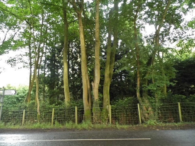
Terry's Wood is a picturesque forest located in the county of Kent, England. Covering an area of approximately 100 acres, this wood is renowned for its natural beauty and diverse flora and fauna. Situated near the village of Terry's Green, the wood offers a tranquil escape from the bustling city life.
The wood is predominantly composed of deciduous trees, including oak, beech, and ash, which provide a stunning canopy during the summer months. The forest floor is adorned with a variety of wildflowers, creating a vibrant and colorful landscape. Terry's Wood is also home to several small streams and a pond, adding to its charm.
This woodland is a haven for wildlife enthusiasts and nature lovers alike. It supports a wide range of animal species, including deer, foxes, rabbits, and a plethora of bird species. Birdwatchers can spot woodpeckers, owls, and various songbirds in this natural habitat.
Historically, Terry's Wood has been a popular location for outdoor activities such as hiking, jogging, and picnicking. The forest boasts a network of well-maintained trails that allow visitors to explore its captivating surroundings. These trails offer stunning views of the wood and its surroundings, making it an ideal spot for photography enthusiasts.
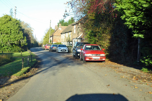
Terry's Wood is easily accessible, with ample parking facilities available nearby. The wood is open to the public throughout the year, allowing visitors to experience the changing seasons and witness the beauty of nature in every month. Whether it's a peaceful stroll or an adventurous hike, Terry's Wood offers a delightful escape into the heart of nature.
If you have any feedback on the listing, please let us know in the comments section below.
Terry's Wood Images
Images are sourced within 2km of 51.196795/1.0054084 or Grid Reference TR1048. Thanks to Geograph Open Source API. All images are credited.


Terry's Wood is located at Grid Ref: TR1048 (Lat: 51.196795, Lng: 1.0054084)
Administrative County: Kent
District: Canterbury
Police Authority: Kent
What 3 Words
///films.join.remarking. Near Wye, Kent
Nearby Locations
Related Wikis

Waltham, Kent
Waltham is a village and civil parish 7 miles (11 km) southwest of Canterbury in Kent, England. == History == The village was once associated with the...

Anvil Green
Anvil Green is a small settlement located near Waltham in Kent, England, about nine miles (14.4 km) north east of Ashford. == External links == Media...
Crundale, Kent
Crundale is a mostly rural village and civil parish in the Ashford District of Kent in southeast England. The village covers a section of one of the dual...

Shrub's Wood Long Barrow
Shrub's Wood Long Barrow is an unchambered long barrow located near to the village of Elmsted in the south-eastern English county of Kent. It was probably...

Yockletts Bank
Yockletts Bank is a 25.4-hectare (63-acre) biological Site of Special Scientific Interest west of Stelling Minnis in Kent. It is managed by KWT and is...

Stour Valley Walk
The Stour Valley Walk is a recreational walking route that follows the River Stour, through the Low Weald and Kent Downs, from its source at Lenham to...

Park Gate Down
Park Gate Down or Parkgate Down is a 7-hectare (17-acre) biological Site of Special Scientific Interest south-east of Stelling Minnis in Kent. It is also...

Denge Wood
Denge Wood is a wood located 8 miles southwest of Canterbury in Kent, England. The wood is owned by the Forestry Commission and the Woodland Trust. Part...
Nearby Amenities
Located within 500m of 51.196795,1.0054084Have you been to Terry's Wood?
Leave your review of Terry's Wood below (or comments, questions and feedback).