Boysack

Settlement in Angus

Scotland

Boysack

Former Kinnell Parish Church In a charter dated 2 June 1509, Master Geo. Sterling of Esterbrekky and Patrick Sterling, his brother-german, with the consent of Lord Ogilvie of Airlie, and of David Sterling, give to St Mary the Virgin, to St Peter and Paul the Apostles and to St Malrubius the Confessor, and to a chaplain serving in the Parish Church of Kynnell at the altar of the blessed Virgin, an annual rent of L.10 from the lands of Esterbrekky.   Charter confirmed by James IV 12 March 1512-13.

Wm Reeves, Saint Maelrubha: His History and Churches
Former Kinnell Parish Church Credit: Alpin Stewart

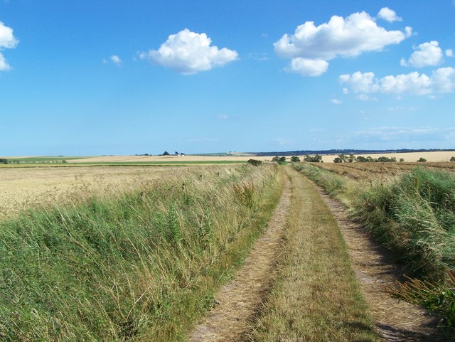
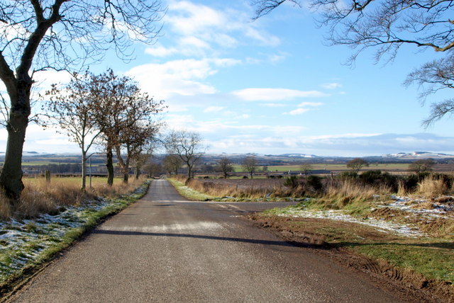
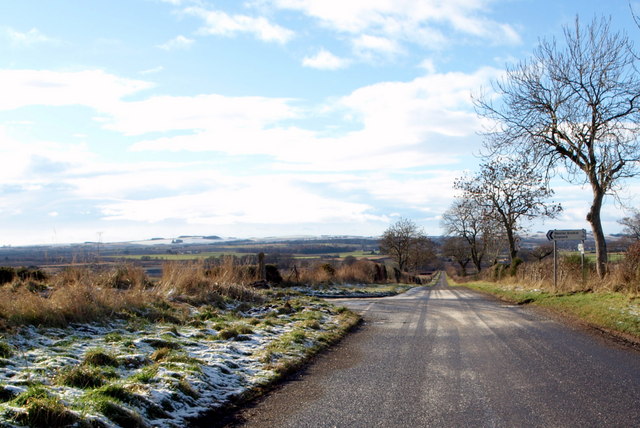
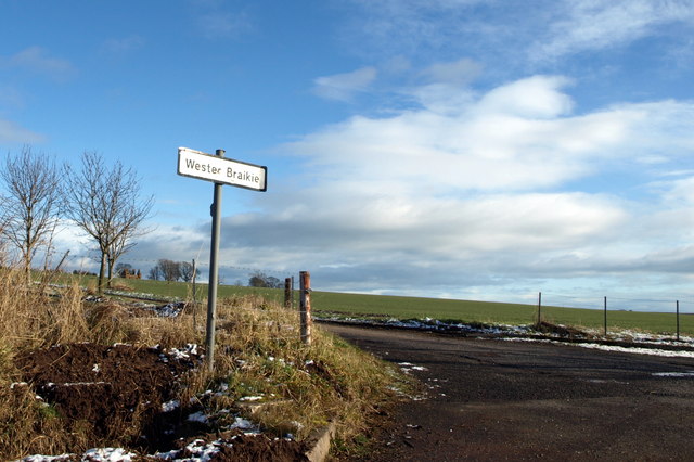
Boysack is a small rural village located in the county of Angus, Scotland. Situated approximately 8 miles southwest of the town of Forfar, Boysack is nestled amidst picturesque countryside and rolling hills.

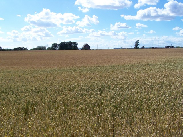
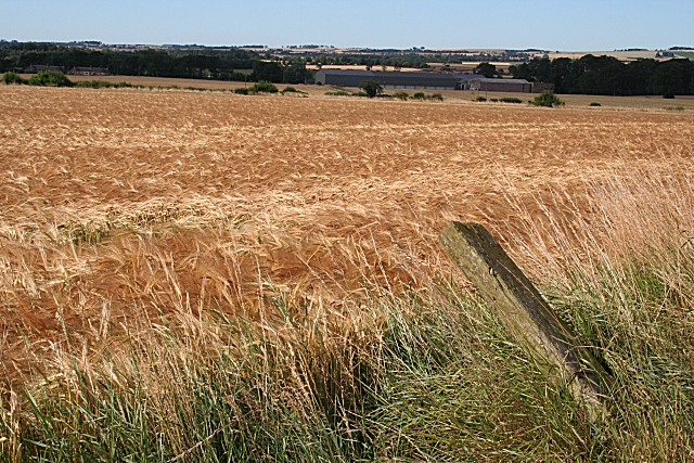
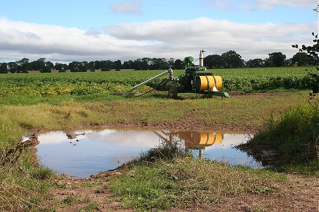
With a population of around 150 residents, Boysack is known for its tight-knit community and tranquil atmosphere. The village primarily consists of traditional stone-built houses, giving it a charming and idyllic appearance. The surrounding landscape is mainly agricultural, with vast fields and farmlands dotting the area.

Despite its small size, Boysack boasts a strong sense of community spirit, evident through various local events and initiatives. The village hall serves as a hub for gathering and hosting social activities, including community meetings, fundraisers, and celebrations. Additionally, a local primary school caters to the educational needs of the village's children.

Boysack offers its residents a peaceful and rural lifestyle, away from the hustle and bustle of larger towns and cities. The village provides easy access to outdoor activities, with numerous walking trails and nature spots nearby. Additionally, the nearby town of Forfar offers a range of amenities, including shops, restaurants, and leisure facilities.

Overall, Boysack is a charming and close-knit village in Angus, Scotland, offering a serene countryside living experience while being within reach of essential services in nearby towns.

If you have any feedback on the listing, please let us know in the comments section below.
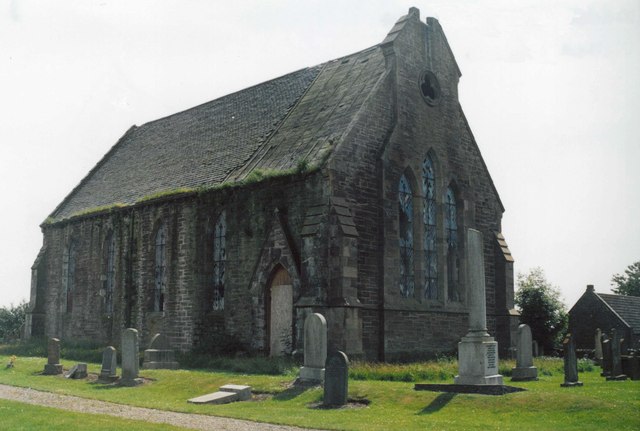
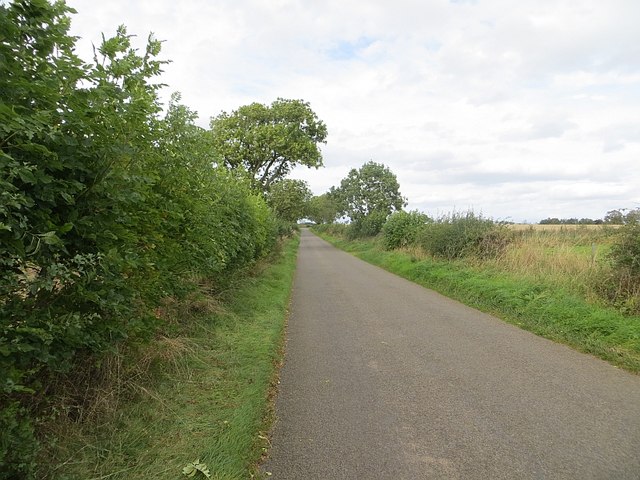
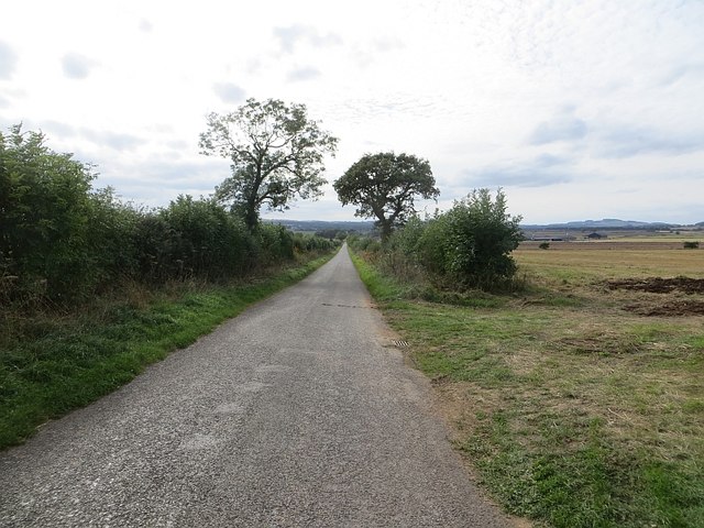
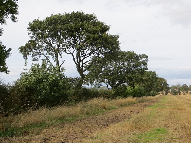
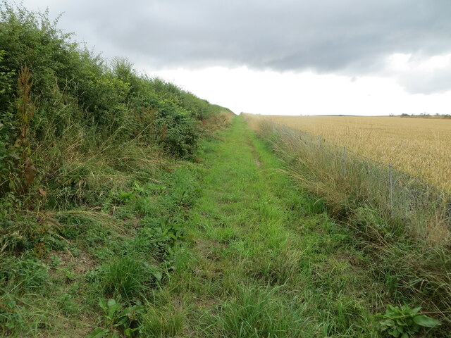
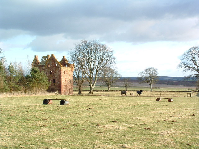
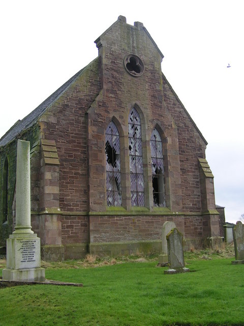
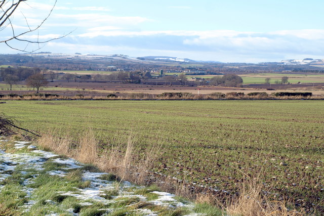
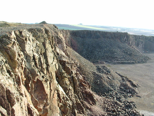
Boysack Images

Images are sourced within 2km of 56.632896/-2.6139059 or Grid Reference NO6249. Thanks to Geograph Open Source API. All images are credited.

Former Kinnell Parish Church In a charter dated 2 June 1509, Master Geo. Sterling of Esterbrekky and Patrick Sterling, his brother-german, with the consent of Lord Ogilvie of Airlie, and of David Sterling, give to St Mary the Virgin, to St Peter and Paul the Apostles and to St Malrubius the Confessor, and to a chaplain serving in the Parish Church of Kynnell at the altar of the blessed Virgin, an annual rent of L.10 from the lands of Esterbrekky.   Charter confirmed by James IV 12 March 1512-13.

Wm Reeves, Saint Maelrubha: His History and Churches
Former Kinnell Parish Church
In a charter dated 2 June 1509, Master Geo. Sterling of Esterbrekky and Patrick Sterling, his brother-german, with the consent of Lord Ogilvie of Airlie, and of David Sterling, give to St Mary the Virgin, to St Peter and Paul the Apostles and to St Malrubius the Confessor, and to a chaplain serving in the Parish Church of Kynnell at the altar of the blessed Virgin, an annual rent of L.10 from the lands of Esterbrekky. Charter confirmed by James IV 12 March 1512-13. Wm Reeves, Saint Maelrubha: His History and Churches
Road, Gightyburn A road climbs away from Gightyburn.
Road, Gightyburn
A road climbs away from Gightyburn.
Kinnell It's a long downhill straight.
Kinnell
It's a long downhill straight.
Hedge by Kinnell Ploughing had just started on the other side.
Hedge by Kinnell
Ploughing had just started on the other side.
Field edge track  near to Gightyburn Looking north-eastward.
Field edge track near to Gightyburn
Looking north-eastward.
Wester Braikie This castle stands on an elevated position overlooking a large area of the Angus countryside
Wester Braikie
This castle stands on an elevated position overlooking a large area of the Angus countryside
Kinnell Kirk The rotting remains of Kinnell kirk.
Kinnell Kirk
The rotting remains of Kinnell kirk.
Barley Fields Looking Towards Kinnell Church This was taken from  the road to Hatton Mill
Barley Fields Looking Towards Kinnell Church
This was taken from the road to Hatton Mill
Track From Wester Braikie The track gives access to fields south-east of the farm.
Track From Wester Braikie
The track gives access to fields south-east of the farm.
Hatton Mill The farm buildings are in the shade, almost invisible, beyond the fields of barley.
Hatton Mill
The farm buildings are in the shade, almost invisible, beyond the fields of barley.
Ruin at Kinnell This looks as if it was part of the WWII airfield buildings at Kinnell. The tree is actually growing in the main room of the blockhouse.
Ruin at Kinnell
This looks as if it was part of the WWII airfield buildings at Kinnell. The tree is actually growing in the main room of the blockhouse.
Kinnell This part of Scotland has a low rainfall, so irrigation is regularly required, especially for potatoes.
Kinnell
This part of Scotland has a low rainfall, so irrigation is regularly required, especially for potatoes.
Disused Airfield at Kinnell After use as a wartime airfield and before its current use, local motor clubs used the airfield runways and perimeter tracks for speed events. This photo was taken in 1968 during a 750 Scotland MC sprint. The driver me in my much younger days!!
Disused Airfield at Kinnell
After use as a wartime airfield and before its current use, local motor clubs used the airfield runways and perimeter tracks for speed events. This photo was taken in 1968 during a 750 Scotland MC sprint. The driver me in my much younger days!!
Fithie / Kinnell Road at its junction with Bolshan Road
Fithie / Kinnell Road at its junction with Boysack Road
Wester Braikie Farm Road Picture taken from the Bolshan / Bolysack Road.
Wester Braikie Farm Road
Picture taken from the Bolshan / Bolysack Road.
Braikie Castle This is a derelict 16th century tower house. It was built in 1581 and is on four storeys. Still relatively complete.
Braikie Castle
This is a derelict 16th century tower house. It was built in 1581 and is on four storeys. Still relatively complete.
Open Farmland to the West of  Wester Braikie Friockheim Village can be seen in the distance.
Open Farmland to the West of Wester Braikie
Friockheim Village can be seen in the distance.
Show me another place!

Boysack is located at Grid Ref: NO6249 (Lat: 56.632896, Lng: -2.6139059)

Unitary Authority: Angus

Police Authority: Tayside

What 3 Words

///lavender.trespass.dime. Near Friockheim, Angus

Nearby Locations

Compass Hill Boysack

Related Wikis

Boysack

Boysack is a village in Angus, Scotland, four miles north of Arbroath. == Notable residents == John Carnegie (c. 1679/80 – by May 1750), lawyer, politician...
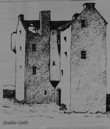
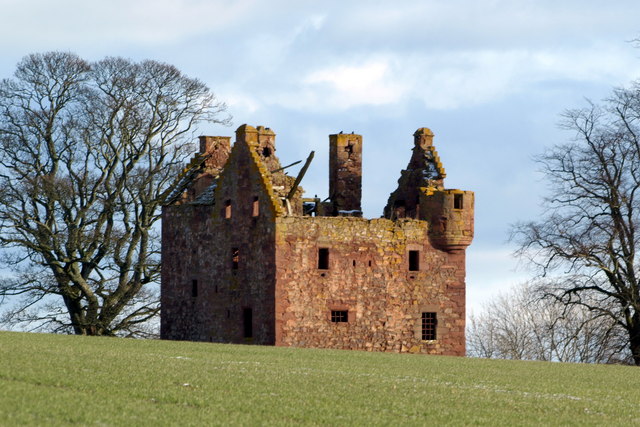
Braikie Castle

Braikie Castle is a late 16th century Scottish tower house, midway between Arbroath and Brechin, east of the village of Friockheim in the parish of Kinnell...
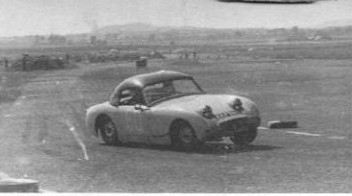
RAF Kinnell

Royal Air Force Kinnell or more simply RAF Kinnell is a former Royal Air Force satellite station located near to Friockheim, Angus, Scotland. == History... ==

Leysmill railway station

Leysmill railway station served the village of Leysmill, Angus, Scotland from 1838 to 1955 on the Arbroath and Forfar Railway. == History == The station...

Nearby Amenities

Located within 500m of 56.632896,-2.6139059
Waterway: dam
Lat/Long: 56.6345928/-2.6197598
Boysack Mills
Place: hamlet
Lat/Long: 56.6324017/-2.6119909
Boysack
Name Pronunciation: 'bəizək
Place: hamlet
Lat/Long: 56.630681/-2.615581
Power: pole
Lat/Long: 56.6292187/-2.610772
Power: pole
Lat/Long: 56.6316729/-2.6177667
Power: pole
Lat/Long: 56.6318742/-2.617601
Power: pole
Lat/Long: 56.6323781/-2.6166601
Power: pole
Lat/Long: 56.6328723/-2.6157138
Power: pole
Lat/Long: 56.6331689/-2.6151399
Power: pole
Lat/Long: 56.6335512/-2.6144079
Power: pole
Lat/Long: 56.6339407/-2.6136652
Power: pole
Lat/Long: 56.6339655/-2.6122619
Power: pole
Lat/Long: 56.6339916/-2.6107915
Power: pole
Lat/Long: 56.6340169/-2.6093601
Power: pole
Lat/Long: 56.6340455/-2.6078984
Power: pole
Lat/Long: 56.6340669/-2.606545
Power: pole
Lat/Long: 56.6332582/-2.6122706
Power: pole
Lat/Long: 56.6325281/-2.6123031
Power: pole
Lat/Long: 56.6346565/-2.6107157
Power: pole
Lat/Long: 56.6353294/-2.6106335
Power: pole
Lat/Long: 56.6359499/-2.6105403
Power: pole
Lat/Long: 56.6367001/-2.6101462
Power: pole
Lat/Long: 56.6371427/-2.6156591
Power: pole
Lat/Long: 56.6368205/-2.6145844
Power: pole
Lat/Long: 56.6364724/-2.6134246
Power: pole
Lat/Long: 56.6361256/-2.6122767
Power: pole
Lat/Long: 56.6360333/-2.6108146
Power: tower
Lat/Long: 56.6359697/-2.6094624
The data included in this document is from www.openstreetmap.org. The data is made available under ODbL.

Have you been to Boysack?

Leave your review of Boysack below (or comments, questions and feedback).