Compass Hill

Hill, Mountain in Angus

Scotland

Compass Hill

Road, Gightyburn A road climbs away from Gightyburn.
Road, Gightyburn Credit: Richard Webb

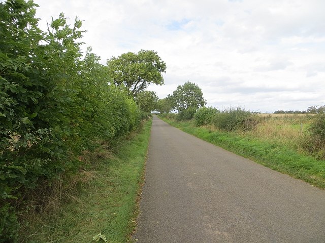
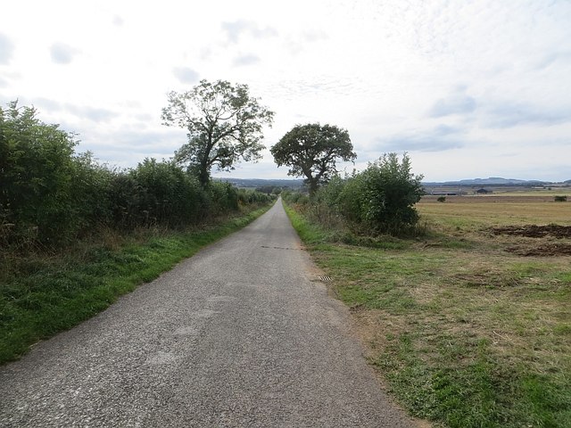
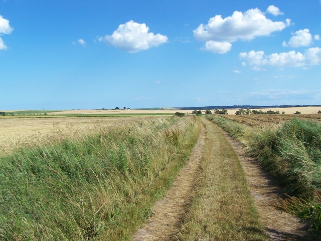
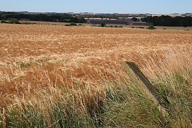
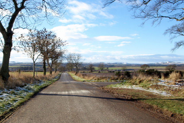
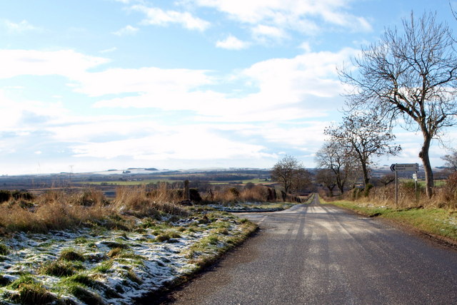
Compass Hill is a prominent hill located in the Angus region of Scotland. It sits within the picturesque countryside, approximately 5 miles southeast of the town of Forfar. Standing at an elevation of 455 meters (1,493 feet), Compass Hill offers breathtaking panoramic views of the surrounding landscapes.

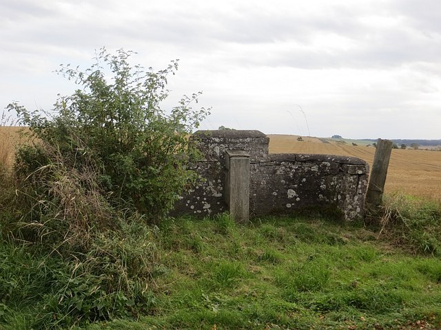
The hill derives its name from an ancient stone compass rose that is engraved on a large rock at its summit. This unique feature has become a popular attraction for visitors and hikers alike. The compass rose is believed to date back to the 19th century and serves as a navigational landmark.

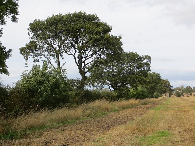
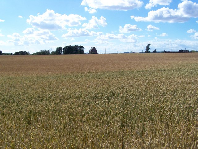
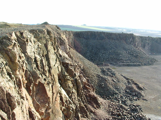
Compass Hill is known for its diverse flora and fauna, making it a haven for nature enthusiasts. The hillside is covered in a patchwork of heather, grasses, and wildflowers, creating a beautiful tapestry of colors throughout the seasons. The area is also home to a variety of wildlife, including red deer, rabbits, and various bird species.

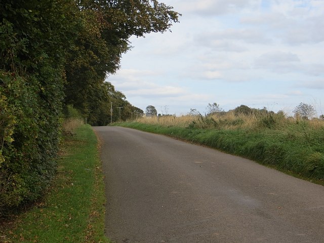
Hiking trails wind their way up Compass Hill, providing both challenging and leisurely options for walkers of all abilities. These paths offer an opportunity to explore the hill's stunning landscapes up close, with breathtaking views awaiting those who reach the summit.

With its natural beauty and historical significance, Compass Hill is a must-visit destination for those seeking a tranquil escape in the Angus countryside. Whether it's for a leisurely stroll, a challenging hike, or simply to enjoy the breathtaking vistas, Compass Hill offers a captivating experience for all who venture to its summit.

If you have any feedback on the listing, please let us know in the comments section below.

Compass Hill Images

Images are sourced within 2km of 56.637728/-2.6068109 or Grid Reference NO6249. Thanks to Geograph Open Source API. All images are credited.

Road, Gightyburn A road climbs away from Gightyburn.
Road, Gightyburn
A road climbs away from Gightyburn.
Kinnell It's a long downhill straight.
Kinnell
It's a long downhill straight.
Hedge by Kinnell Ploughing had just started on the other side.
Hedge by Kinnell
Ploughing had just started on the other side.
Pump, Mainsbank Opposite the cottage by Mainsbank.
Pump, Mainsbank
Opposite the cottage by Mainsbank.
Road, Mainsbank A road climbs Wuddy Law past Mainsbank.
Road, Mainsbank
A road climbs Wuddy Law past Mainsbank.
Field and Mainsbank Hidden in the Trees
Wester Braikie This castle stands on an elevated position overlooking a large area of the Angus countryside
Wester Braikie
This castle stands on an elevated position overlooking a large area of the Angus countryside
Newbigging An old water tower at Newbigging on Hodgeton Farm. Behind the tower and amongst
the trees is the ruins of a cottage
Newbigging
An old water tower at Newbigging on Hodgeton Farm. Behind the tower and amongst the trees is the ruins of a cottage
Barley Fields Looking Towards Kinnell Church This was taken from  the road to Hatton Mill
Barley Fields Looking Towards Kinnell Church
This was taken from the road to Hatton Mill
Track From Wester Braikie The track gives access to fields south-east of the farm.
Track From Wester Braikie
The track gives access to fields south-east of the farm.
Hatton Mill The farm buildings are in the shade, almost invisible, beyond the fields of barley.
Hatton Mill
The farm buildings are in the shade, almost invisible, beyond the fields of barley.
Ruin at Kinnell This looks as if it was part of the WWII airfield buildings at Kinnell. The tree is actually growing in the main room of the blockhouse.
Ruin at Kinnell
This looks as if it was part of the WWII airfield buildings at Kinnell. The tree is actually growing in the main room of the blockhouse.
Kinnell This part of Scotland has a low rainfall, so irrigation is regularly required, especially for potatoes.
Kinnell
This part of Scotland has a low rainfall, so irrigation is regularly required, especially for potatoes.
Disused Airfield at Kinnell After use as a wartime airfield and before its current use, local motor clubs used the airfield runways and perimeter tracks for speed events. This photo was taken in 1968 during a 750 Scotland MC sprint. The driver me in my much younger days!!
Disused Airfield at Kinnell
After use as a wartime airfield and before its current use, local motor clubs used the airfield runways and perimeter tracks for speed events. This photo was taken in 1968 during a 750 Scotland MC sprint. The driver me in my much younger days!!
Hand Pump This hand pump used to be the water supply for what was the shepherd's cottage and bothy at Mainsbank near Wester Braikie. The cottage has JW 1884 ED engraved on the lintel above the door. This was possibly John Watson who was the 9th Earl of Dalhousie (although he predeceased this date by some 20 years), landowners at that time.
Hand Pump
This hand pump used to be the water supply for what was the shepherd's cottage and bothy at Mainsbank near Wester Braikie. The cottage has JW 1884 ED engraved on the lintel above the door. This was possibly John Watson who was the 9th Earl of Dalhousie (although he predeceased this date by some 20 years), landowners at that time.
Fithie / Kinnell Road at its junction with Wester Braikie Farm road
Fithie / Kinnell Road at its junction with Bolshan Road
Fithie / Kinnell Road at its junction with Boysack Road
Show me another place!

Compass Hill is located at Grid Ref: NO6249 (Lat: 56.637728, Lng: -2.6068109)

Unitary Authority: Angus

Police Authority: Tayside

What 3 Words

///arming.duet.closet. Near Friockheim, Angus

Nearby Locations

Compass Hill Boysack

Related Wikis

Boysack

Boysack is a village in Angus, Scotland, four miles north of Arbroath. == Notable residents == John Carnegie (c. 1679/80 – by May 1750), lawyer, politician...
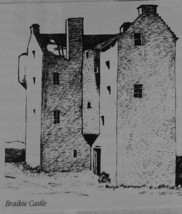
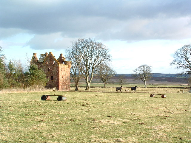
Braikie Castle

Braikie Castle is a late 16th century Scottish tower house, midway between Arbroath and Brechin, east of the village of Friockheim in the parish of Kinnell...

RAF Kinnell

Royal Air Force Kinnell or more simply RAF Kinnell is a former Royal Air Force satellite station located near to Friockheim, Angus, Scotland. == History... ==

Leysmill railway station

Leysmill railway station served the village of Leysmill, Angus, Scotland from 1838 to 1955 on the Arbroath and Forfar Railway. == History == The station...

Glasterlaw railway station

Glasterlaw railway station served the area of Glasterlaw, Angus, Scotland from 1848 to 1956 on the Aberdeen Railway. == History == The station opened on...

Inverkeilor

Inverkeilor is a village and parish in Angus, Scotland. It lies near the North Sea coast, midway between Arbroath and Montrose. The A92 road now bypasses...
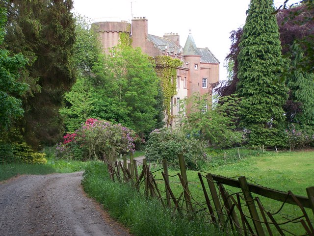
Colliston Castle

Colliston Castle is a 16th-century Z-plan tower house, altered and extended in the 18th and 19th centuries. It is located 6 kilometres (3.7 mi) north of...
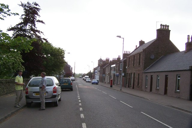
Friockheim

Friockheim is a village in Angus, Scotland dating from 1814. It lies between the towns of Arbroath, Brechin, Forfar and Montrose. == History == The name...

Nearby Amenities

Located within 500m of 56.637728,-2.6068109
Compass Hill
Ele: 88
Natural: peak
Lat/Long: 56.6378764/-2.6071308
Power: pole
Lat/Long: 56.6333791/-2.6052868
Power: pole
Lat/Long: 56.6340949/-2.6052088
Power: pole
Lat/Long: 56.6339916/-2.6107915
Power: pole
Lat/Long: 56.6340169/-2.6093601
Power: pole
Lat/Long: 56.6340455/-2.6078984
Power: pole
Lat/Long: 56.6340669/-2.606545
Power: pole
Lat/Long: 56.634117/-2.6039658
Power: pole
Lat/Long: 56.6341384/-2.6027531
Power: pole
Lat/Long: 56.6346565/-2.6107157
Power: pole
Lat/Long: 56.6353294/-2.6106335
Power: pole
Lat/Long: 56.6359499/-2.6105403
Power: pole
Lat/Long: 56.6367001/-2.6101462
Power: pole
Lat/Long: 56.6374635/-2.6097044
Power: pole
Lat/Long: 56.637866/-2.6094359
Power: pole
Lat/Long: 56.6385198/-2.6098539
Power: pole
Lat/Long: 56.6391676/-2.6102567
Power: pole
Lat/Long: 56.6398297/-2.6106248
Power: pole
Lat/Long: 56.6404763/-2.6110254
Power: pole
Lat/Long: 56.6411229/-2.611413
Power: pole
Lat/Long: 56.6368205/-2.6145844
Power: pole
Lat/Long: 56.6364724/-2.6134246
Power: pole
Lat/Long: 56.6361256/-2.6122767
Power: pole
Lat/Long: 56.6360333/-2.6108146
Power: tower
Lat/Long: 56.6359697/-2.6094624
The data included in this document is from www.openstreetmap.org. The data is made available under ODbL.

Have you been to Compass Hill?

Leave your review of Compass Hill below (or comments, questions and feedback).