Boylestone

Settlement in Derbyshire Derbyshire Dales

England

Boylestone

Road sign on Ashbourne Road
Road sign on Ashbourne Road Credit: Ian S

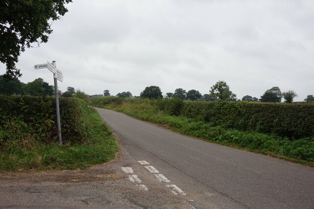
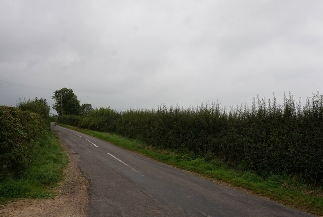
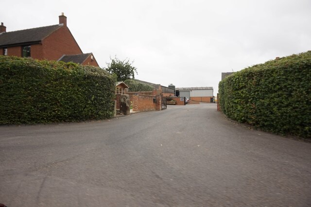
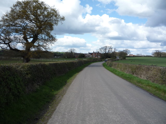
Boylestone is a small village located in the southern part of Derbyshire, England. Situated about 8 miles southwest of Derby city, it falls within the administrative district of South Derbyshire. The village is nestled amidst beautiful rural surroundings, surrounded by picturesque countryside and farmland.

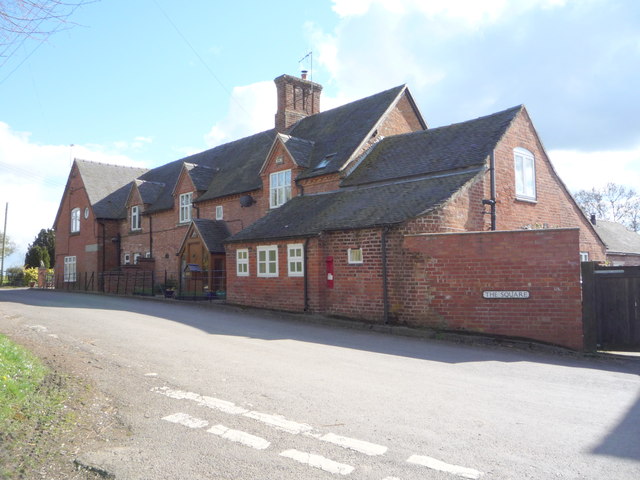
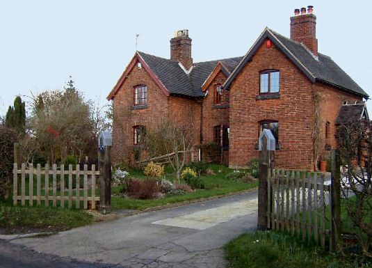
Boylestone is known for its peaceful atmosphere and tight-knit community. The village is home to a relatively small population, with only a few hundred residents. The houses in Boylestone primarily consist of traditional English cottages, giving the village a charming and quaint appearance.

The heart of Boylestone is its village green, a well-maintained open space where locals often gather for community events and activities. The green is also home to a children's playground, providing a safe and enjoyable space for families.

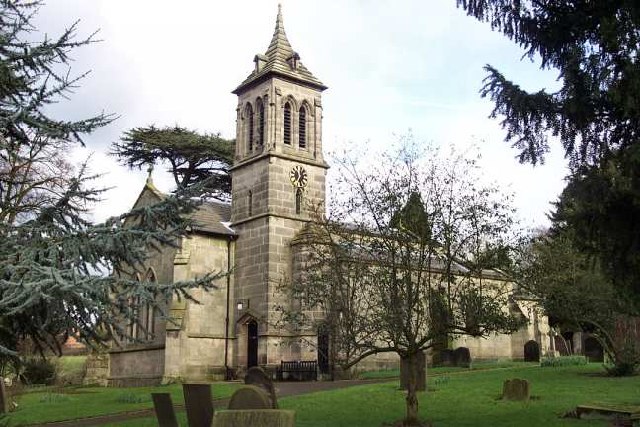
Despite its small size, Boylestone boasts a rich history. The village is mentioned in the Domesday Book, indicating its existence in the 11th century. There are several historic buildings in the area, including the St. John the Baptist Church, a Grade II listed building that dates back to the 13th century.

Although Boylestone is predominantly residential, it benefits from its close proximity to larger towns and cities. The nearby city of Derby offers a wide range of amenities, including shopping centers, restaurants, and leisure facilities. Additionally, the village is well-connected by road, with major highways providing easy access to surrounding areas.

In conclusion, Boylestone is a charming and historic village in Derbyshire, offering a tranquil and close-knit community within beautiful rural surroundings.

If you have any feedback on the listing, please let us know in the comments section below.

Boylestone Images

Images are sourced within 2km of 52.920631/-1.730431 or Grid Reference SK1835. Thanks to Geograph Open Source API. All images are credited.

Road sign on Ashbourne Road
Boylestone Road off Ashbourne Road
Alkmonton Old Hall Farm, Alkmonton
Covert Farm In front of Covert Farm is Potters Covert Wood.
Covert Farm
In front of Covert Farm is Potters Covert Wood.
New Road, Boylestone Boylestone is a hamlet and civil parish in the Derbyshire Dales, about eight miles east of Uttoxeter. According to the 2001 census it had a population of 165.
New Road, Boylestone
Boylestone is a hamlet and civil parish in the Derbyshire Dales, about eight miles east of Uttoxeter. According to the 2001 census it had a population of 165.
Boylestone Methodist Church This chapel also known today as Bourne Methodist Church was built in 1846 and opened in January 1847, replacing an earlier one which had been built in 1811. 2014 marked the bi-centenary of the first Sunday School within Primitive Methodism, which was established at Boylestone in 1814 (<span class="nowrap"><a title="http://www.methodistheritage.org.uk/boylestone.htm" rel="nofollow ugc noopener" href="http://www.methodistheritage.org.uk/boylestone.htm">Link</a><img style="margin-left:2px;" alt="External link" title="External link - shift click to open in new window" src="https://s1.geograph.org.uk/img/external.png" width="10" height="10"/></span>  Methodist Heritage).
Boylestone Methodist Church
This chapel also known today as Bourne Methodist Church was built in 1846 and opened in January 1847, replacing an earlier one which had been built in 1811. 2014 marked the bi-centenary of the first Sunday School within Primitive Methodism, which was established at Boylestone in 1814 (LinkExternal link Methodist Heritage).
Bourne Methodist Church, Boylestone The present chapel was built in 1846 and opened in January 1847, replacing an earlier one which had been built in 1811. 2014 marked the bi-centenary of the first Sunday School within Primitive Methodism, which was established at Boylestone in 1814 (<span class="nowrap"><a title="http://www.methodistheritage.org.uk/boylestone.htm" rel="nofollow ugc noopener" href="http://www.methodistheritage.org.uk/boylestone.htm">Link</a><img style="margin-left:2px;" alt="External link" title="External link - shift click to open in new window" src="https://s1.geograph.org.uk/img/external.png" width="10" height="10"/></span>  Methodist Heritage).
Bourne Methodist Church, Boylestone
The present chapel was built in 1846 and opened in January 1847, replacing an earlier one which had been built in 1811. 2014 marked the bi-centenary of the first Sunday School within Primitive Methodism, which was established at Boylestone in 1814 (LinkExternal link Methodist Heritage).
Boylestone Primitive Methodist Chapel (1846) The present chapel was built in 1846 and opened in January 1847, replacing an earlier one which had been built in 1811. 2014 marked the bi-centenary of the first Sunday School within Primitive Methodism, which was established at Boylestone in 1814 (<span class="nowrap"><a title="http://www.methodistheritage.org.uk/boylestone.htm" rel="nofollow ugc noopener" href="http://www.methodistheritage.org.uk/boylestone.htm">Link</a><img style="margin-left:2px;" alt="External link" title="External link - shift click to open in new window" src="https://s1.geograph.org.uk/img/external.png" width="10" height="10"/></span>  Methodist Heritage).
Boylestone Primitive Methodist Chapel (1846)
The present chapel was built in 1846 and opened in January 1847, replacing an earlier one which had been built in 1811. 2014 marked the bi-centenary of the first Sunday School within Primitive Methodism, which was established at Boylestone in 1814 (LinkExternal link Methodist Heritage).
Boylestone, Chapel Lane Boylestone is a hamlet and civil parish in the Derbyshire Dales, about eight miles east of Uttoxeter. According to the 2001 census it had a population of 165.
Boylestone, Chapel Lane
Boylestone is a hamlet and civil parish in the Derbyshire Dales, about eight miles east of Uttoxeter. According to the 2001 census it had a population of 165.
Gate to Field Behind Boylestone Methodist Church
Boylestone, Muse lane Boylestone is a hamlet and civil parish in the Derbyshire Dales, about eight miles east of Uttoxeter. According to the 2001 census it had a population of 165.
Boylestone, Muse lane
Boylestone is a hamlet and civil parish in the Derbyshire Dales, about eight miles east of Uttoxeter. According to the 2001 census it had a population of 165.
New Road near Harehill Park Farm
New Road approaching Boylestone Boylestone is a hamlet and civil parish in the Derbyshire Dales, about eight miles east of Uttoxeter. According to the 2001 census it had a population of 165.
New Road approaching Boylestone
Boylestone is a hamlet and civil parish in the Derbyshire Dales, about eight miles east of Uttoxeter. According to the 2001 census it had a population of 165.
Victorian postbox on The Square,  Boylestone Postbox No. DE6 41.

See <a href="https://www.geograph.org.uk/photo/4913596">SK1835 : Cottages, The Square, Boylestone</a> for context.
Victorian postbox on The Square, Boylestone
Postbox No. DE6 41. See SK1835 : Cottages, The Square, Boylestone for context.
Cottages, The Square, Boylestone Showing position of Victorian Postbox No. DE6 41.

See <a href="https://www.geograph.org.uk/photo/4913594">SK1835 : Victorian postbox on The Square,  Boylestone</a> for close up.
Cottages, The Square, Boylestone
Showing position of Victorian Postbox No. DE6 41. See SK1835 : Victorian postbox on The Square, Boylestone for close up.
Heading north west on Ashbourne Road
Grazing west of Ashbourne Road
Ashbourne Road Heading north.
Ashbourne Road
Heading north.
Show me another place!

Boylestone is located at Grid Ref: SK1835 (Lat: 52.920631, Lng: -1.730431)

Administrative County: Derbyshire

District: Derbyshire Dales

Police Authority: Derbyshire

What 3 Words

///pasting.sapping.ballpoint. Near Doveridge, Derbyshire

Nearby Locations

Boylestone Boylestone

Related Wikis

Boylestone

Boylestone is a village and civil parish in the Derbyshire Dales district of Derbyshire, England. At the 2011 census, it had a population of 318. The village...

St John the Baptist's Church, Boylestone

St John the Baptist's Church, Boylestone is a Grade II* listed parish church in the Church of England in Boylestone, Derbyshire. == History == The church...

Harehill

Harehill is a village in the civil parish of Boylestone, in the Derbyshire Dales district, in the county of Derbyshire, England. == Nearby settlements... ==

Alkmonton

Alkmonton is a village and civil parish in the Derbyshire Dales district of Derbyshire, England, roughly between Uttoxeter and Derby. The parish had a...

Alkmonton medieval settlement

Alkmonton medieval settlement is an archaeological site, a deserted medieval village near the present-day village of Alkmonton, about 5 miles (8 km) south...

St Andrew's Church, Cubley

St Andrew's Church, Cubley is a Grade I listed parish church in the Church of England in Cubley, Derbyshire. == History == The church dates from the mid...

Hungry Bentley

Hungry Bentley is a deserted medieval village and civil parish in the Derbyshire Dales district of Derbyshire, England, between Uttoxeter and Derby. The...

Barton Blount

Barton Blount is a village and civil parish in the South Derbyshire district of Derbyshire, England, between Derby and Uttoxeter. According to the 2001...

Nearby Amenities

Located within 500m of 52.920631,-1.730431
Post Box
Operator: Royal Mail
Ref: DE6 41
Lat/Long: 52.9187165/-1.7328781
Boylestone
Is In: Derbyshire
Place: village
Wikidata: Q1872937
Wikipedia: en:Boylestone
Lat/Long: 52.9200978/-1.730415
Addr Housename: Brook Cottage
Lat/Long: 52.9231846/-1.7334733
Addr Housename: Brook Farm
Lat/Long: 52.9192034/-1.7334126
Barrier: stile
Lat/Long: 52.9228681/-1.7338974
Passing Place
Lat/Long: 52.9181248/-1.7356626
Direction: SSW
Generator Method: photovoltaic
Generator Output Electricity: yes
Generator Solar Modules: 22
Generator Source: solar
Generator Type: solar_photovoltaic_panel
Location: roof
Power: generator
Lat/Long: 52.9207275/-1.7273507
Direction: SW
Generator Method: photovoltaic
Generator Output Electricity: yes
Generator Source: solar
Generator Type: solar_photovoltaic_panel
Location: roof
Power: generator
Lat/Long: 52.9206224/-1.7311299
Direction: SW
Generator Method: photovoltaic
Generator Output Electricity: yes
Generator Source: solar
Generator Type: solar_photovoltaic_panel
Location: roof
Power: generator
Lat/Long: 52.9209159/-1.7315657
Direction: SW
Generator Method: photovoltaic
Generator Output Electricity: yes
Generator Source: solar
Generator Type: solar_photovoltaic_panel
Location: roof
Power: generator
Lat/Long: 52.9207716/-1.7280185
Direction: S
Generator Method: photovoltaic
Generator Output Electricity: yes
Generator Solar Modules: 12
Generator Source: solar
Generator Type: solar_photovoltaic_panel
Location: roof
Power: generator
Lat/Long: 52.918778/-1.7334205
The data included in this document is from www.openstreetmap.org. The data is made available under ODbL.

Have you been to Boylestone?

Leave your review of Boylestone below (or comments, questions and feedback).