Wadebridge

Settlement in Cornwall

England

Wadebridge

Sustrans milepost by Camel Trail The National Cycle Network is a network of cycle routes. It was created by the charity Sustrans <span class="nowrap"><a title="http://www.sustrans.org.uk/what-we-do/national-cycle-network" rel="nofollow ugc noopener" href="http://www.sustrans.org.uk/what-we-do/national-cycle-network">Link</a><img style="margin-left:2px;" alt="External link" title="External link - shift click to open in new window" src="https://s1.geograph.org.uk/img/external.png" width="10" height="10"/></span>  (Sustainable Transport), aided by a National Lottery grant.

Many routes aim to minimise contact with motor traffic, though 70% of them are on roads. In some cases the NCN uses pedestrian routes, disused railways, minor roads, canal towpaths, or traffic-calmed routes in towns and cities.
Sustrans milepost by Camel Trail Credit: David Smith

Wadebridge is a small town located in the county of Cornwall, southwestern England. Situated on the banks of the River Camel, it lies approximately 6 miles inland from the popular coastal town of Padstow. With a population of around 7,000 residents, Wadebridge is a vibrant and welcoming community.

The town has a rich history, dating back to the medieval period when it served as a crossing point over the river. Today, Wadebridge is known for its picturesque setting and charming character. It boasts a mix of traditional Cornish architecture and modern amenities, making it an appealing destination for residents and visitors alike.

Wadebridge offers a range of amenities and services to cater to the needs of its residents. The town center is home to a variety of independent shops, boutiques, cafes, and restaurants, providing a pleasant shopping and dining experience. Additionally, there are supermarkets, banks, a post office, and other essential facilities conveniently located within the town.

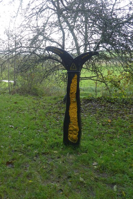
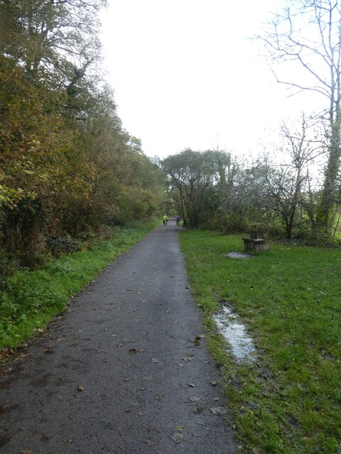
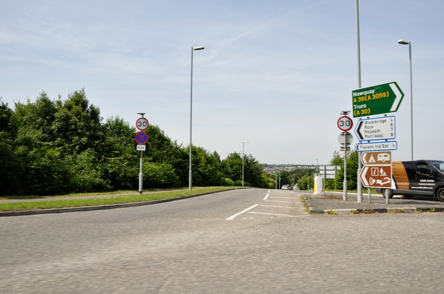
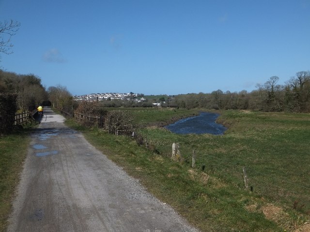
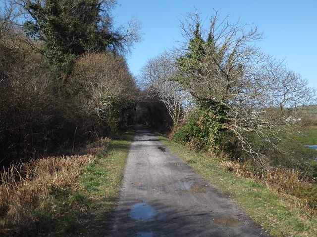
Nature enthusiasts will appreciate the scenic beauty of Wadebridge. The Camel Trail, a popular recreational path, runs through the town, attracting walkers, cyclists, and joggers. The trail follows the route of a disused railway line, offering stunning views of the river and surrounding countryside.

The town also hosts several annual events and festivals, including the Royal Cornwall Show and the Wadebridge Carnival. These events bring the community together and attract visitors from near and far.

In summary, Wadebridge is a charming town in Cornwall, known for its riverside location, historic charm, and range of amenities. With its strong sense of community and beautiful surroundings, it is a delightful place to live or visit.

If you have any feedback on the listing, please let us know in the comments section below.
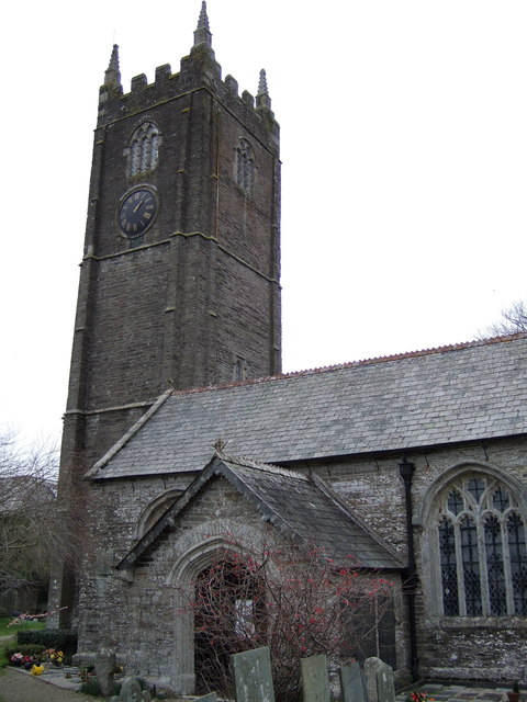
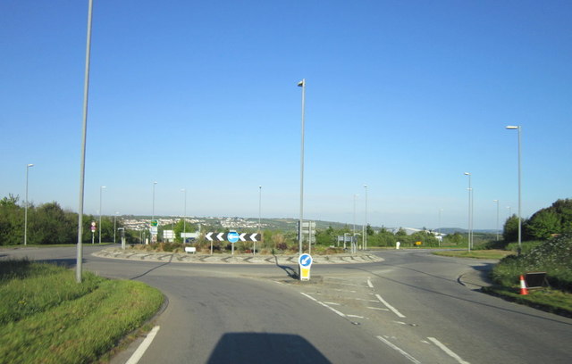
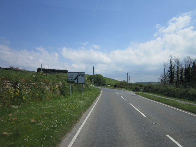
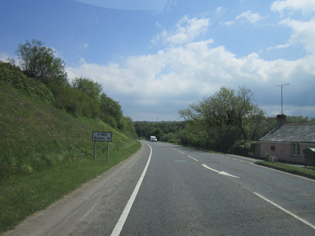
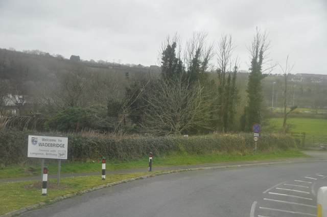
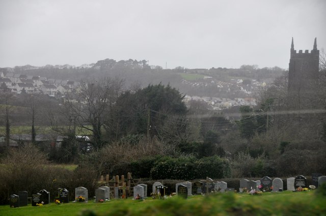
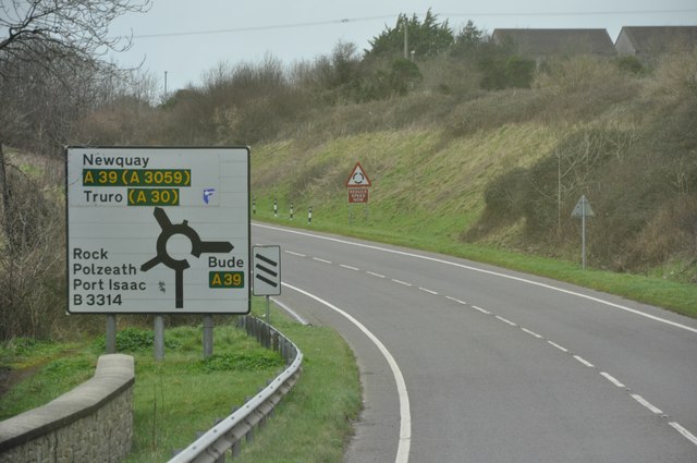
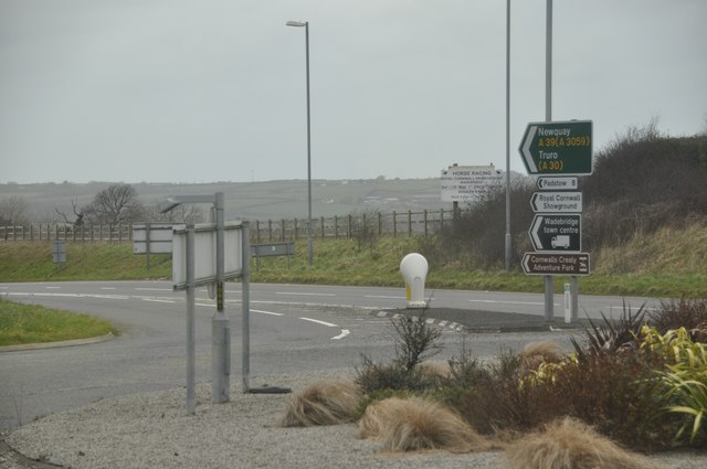
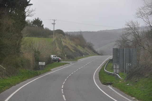
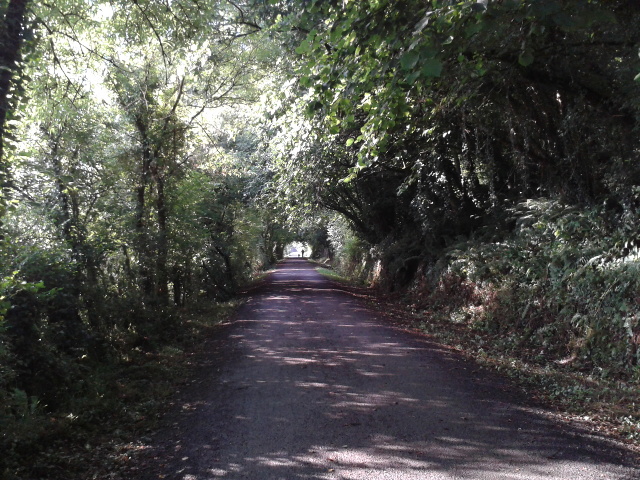
Wadebridge Images

Images are sourced within 2km of 50.516196/-4.836316 or Grid Reference SW9972. Thanks to Geograph Open Source API. All images are credited.

Sustrans milepost by Camel Trail The National Cycle Network is a network of cycle routes. It was created by the charity Sustrans <span class="nowrap"><a title="http://www.sustrans.org.uk/what-we-do/national-cycle-network" rel="nofollow ugc noopener" href="http://www.sustrans.org.uk/what-we-do/national-cycle-network">Link</a><img style="margin-left:2px;" alt="External link" title="External link - shift click to open in new window" src="https://s1.geograph.org.uk/img/external.png" width="10" height="10"/></span>  (Sustainable Transport), aided by a National Lottery grant.

Many routes aim to minimise contact with motor traffic, though 70% of them are on roads. In some cases the NCN uses pedestrian routes, disused railways, minor roads, canal towpaths, or traffic-calmed routes in towns and cities.
Sustrans milepost by Camel Trail
The National Cycle Network is a network of cycle routes. It was created by the charity Sustrans LinkExternal link (Sustainable Transport), aided by a National Lottery grant. Many routes aim to minimise contact with motor traffic, though 70% of them are on roads. In some cases the NCN uses pedestrian routes, disused railways, minor roads, canal towpaths, or traffic-calmed routes in towns and cities.
Camel Trail south of Wadebridge The National Cycle Network is a network of cycle routes. It was created by the charity Sustrans <span class="nowrap"><a title="http://www.sustrans.org.uk/what-we-do/national-cycle-network" rel="nofollow ugc noopener" href="http://www.sustrans.org.uk/what-we-do/national-cycle-network">Link</a><img style="margin-left:2px;" alt="External link" title="External link - shift click to open in new window" src="https://s1.geograph.org.uk/img/external.png" width="10" height="10"/></span>  (Sustainable Transport), aided by a National Lottery grant.

Many routes aim to minimise contact with motor traffic, though 70% of them are on roads. In some cases the NCN uses pedestrian routes, disused railways, minor roads, canal towpaths, or traffic-calmed routes in towns and cities.
Camel Trail south of Wadebridge
The National Cycle Network is a network of cycle routes. It was created by the charity Sustrans LinkExternal link (Sustainable Transport), aided by a National Lottery grant. Many routes aim to minimise contact with motor traffic, though 70% of them are on roads. In some cases the NCN uses pedestrian routes, disused railways, minor roads, canal towpaths, or traffic-calmed routes in towns and cities.
Wadebridge : The A389 The A389 taken from the roundabout. This road heads towards Bodmin.
Wadebridge : The A389
The A389 taken from the roundabout. This road heads towards Bodmin.
Wadebridge : Gonvena Hill From the roundabout looking down the road known as Gonvena Hill which is also the B3314.
Wadebridge : Gonvena Hill
From the roundabout looking down the road known as Gonvena Hill which is also the B3314.
Wadebridge : Gonvena Hill Looking down Gonvena Hill from a roundabout on the A39.
Wadebridge : Gonvena Hill
Looking down Gonvena Hill from a roundabout on the A39.
Camel Trail bridge over River Camel near Pendavey Nearly all the bridge (and all the track leading to it) is in <a href="https://www.geograph.org.uk/gridref/SX0070">SX0070</a> but the stretch of river beyond is in <a href="https://www.geograph.org.uk/gridref/SX0071">SX0071</a>
Camel Trail bridge over River Camel near Pendavey
Nearly all the bridge (and all the track leading to it) is in SX0070 but the stretch of river beyond is in SX0071
Marshy land by the River Camel  The river flows beyond the dike, and under the former railway bridge towards the left of the photo.
Marshy land by the River Camel
The river flows beyond the dike, and under the former railway bridge towards the left of the photo.
Camel Trail in Treraven Woods
St Petrock's church, Egloshayle
The A39 at the A389 and B3314 roundabout
Egloshayle Road joins the A389
The A389 towards Bodmin
Wadebridge : A389 & Sign A sign welcoming people into the town of Wadebridge.
Wadebridge : A389 & Sign
A sign welcoming people into the town of Wadebridge.
Wadebridge : Cemetery & Scenery Looking over the cemetery and surrounding scenery of Wadebridge.
Wadebridge : Cemetery & Scenery
Looking over the cemetery and surrounding scenery of Wadebridge.
Wadebridge : The A389 The A389 heading around Wadebridge.
Wadebridge : The A389
The A389 heading around Wadebridge.
Wadebridge : A389 Roundabout From the roundabout looking towards the exit which heads to Newquay and Truro.
Wadebridge : A389 Roundabout
From the roundabout looking towards the exit which heads to Newquay and Truro.
Wadebridge : The A389 The A389 heading out of Wadebridge.
Wadebridge : The A389
The A389 heading out of Wadebridge.
The Camel Trail cycle and walking route
Show me another place!

Wadebridge is located at Grid Ref: SW9972 (Lat: 50.516196, Lng: -4.836316)

Unitary Authority: Cornwall

Police Authority: Devon and Cornwall

What 3 Words

///turkey.oldest.overused. Near Wadebridge, Cornwall

Related Wikis

Wadebridge Town Hall

Wadebridge Town Hall is a municipal building in The Platt, Wadebridge, Cornwall, England. The town hall is currently used as the meeting place of Wadebridge...

North Cornwall

North Cornwall (Cornish: An Tiredh Uhel) is an area of Cornwall, England, United Kingdom. It is also the name of a former local government district, which...

Wadebridge

Wadebridge (; Cornish: Ponswad) is a town and civil parish in north Cornwall, England, United Kingdom. The town straddles the River Camel five miles (eight...

Wadebridge railway station

Wadebridge railway station (Cornish: Ponswad) was a railway station that served the town of Wadebridge in Cornwall, England. It was on the Bodmin and Wadebridge...

Nearby Amenities

Located within 500m of 50.516196,-4.836316
Crossing
Crossing: traffic_signals
Crossing Ref: pelican
Kerb: lowered
Lat/Long: 50.5169996/-4.836798
Mini Roundabout
Direction: clockwise
Lat/Long: 50.5166646/-4.8364141
Wadebridge
Is In: Cornwall, England, UK
Name Br: Ponswad
Name En: Wadebridge
Name Kw: Ponswad
Place: town
Source Name Br: proper translation
Wikidata: Q261619
Wikipedia: en:Wadebridge
Lat/Long: 50.5171441/-4.8340186
Wadebridge
Historic Railway: station
Railway: site
Source: npe
Lat/Long: 50.5151308/-4.8342467
Mini Roundabout
Direction: clockwise
Lat/Long: 50.5151645/-4.8359797
Post Box
Mapillary: 817061928999792
Operator: Royal Mail
Operator Wikidata: Q638098
Post Box Mounting: pier
Post Box Type: lamp
Ref: PL27 220
Survey Date: 2021-07-06
Lat/Long: 50.5132138/-4.8314653
Bicycle Parking
Bicycle Parking: stands
Capacity: 12
Covered: no
Lat/Long: 50.5149974/-4.835798
Crossing
Crossing: traffic_signals
Crossing Ref: pelican
Lat/Long: 50.5159695/-4.8361627
Bicycle Parking
Bicycle Parking: stands
Capacity: 8
Covered: no
Lat/Long: 50.5173327/-4.8371428
Litter Bin
Lat/Long: 50.5173841/-4.8370834
Bicycle Parking
Bicycle Parking: stands
Capacity: 8
Covered: no
Lat/Long: 50.517491/-4.8372774
Bicycle Parking
Bicycle Parking: stands
Capacity: 8
Covered: no
Lat/Long: 50.5177007/-4.8374594
Bicycle Parking
Bicycle Parking: stands
Capacity: 32
Covered: no
Lat/Long: 50.5192048/-4.8386031
Bus Stop
Wadebridge Bus Station
Bus: yes
Naptan AtcoCode: 0800COA10215
Naptan Bearing: NE
Naptan CommonName: Wadebridge Bus Station
Naptan Crossing: Southern Way
Naptan NaptanCode: cordgtmj
Naptan Street: Guineaport Road
Naptan Verified: no
Public Transport: platform
Source: naptan_import
Lat/Long: 50.5146939/-4.8340061
Bus Stop
The Platt
Bus: yes
Naptan AtcoCode: 0800COA10216
Naptan Bearing: N
Naptan CommonName: The Platt
Naptan Crossing: The Platt
Naptan Indicator: N-bound
Naptan NaptanCode: cordgtjp
Naptan Street: The Platt
Naptan Verified: no
Public Transport: platform
Source: naptan;bing
Lat/Long: 50.5157178/-4.8361089
Bus Stop
Methodist Church
Bus: yes
Naptan AtcoCode: 0800COA10408
Naptan Bearing: SE
Naptan CommonName: Methodist Church
Naptan Crossing: Egloshayle Road
Naptan NaptanCode: cordgtpj
Naptan Street: Bridge View
Naptan Verified: no
Public Transport: platform
Source: naptan_import
Lat/Long: 50.5170332/-4.8333024
Bus Stop
Lidl Superstore
Bus: yes
Naptan AtcoCode: 0800COA10469
Naptan Bearing: N
Naptan CommonName: Lidl Superstore
Naptan Crossing: Trevanson Street
Naptan NaptanCode: cordgtag
Naptan Street: Goldsworthy Way
Naptan Verified: no
Public Transport: platform
Source: naptan_import
Lat/Long: 50.5177248/-4.8395632
Bus Stop
Lidl Superstore
Bus: yes
Naptan AtcoCode: 0800COA10470
Naptan Bearing: SW
Naptan CommonName: Lidl Superstore
Naptan Crossing: Trevanson Street
Naptan Indicator: Opp
Naptan NaptanCode: cordgtdg
Naptan Street: Goldsworthy Way
Naptan Verified: no
Public Transport: platform
Source: naptan_import
Lat/Long: 50.5181237/-4.8390651
Bus Stop
Bridge View
Bus: yes
Naptan AtcoCode: 0800COA10471
Naptan Bearing: E
Naptan CommonName: Bridge View
Naptan Crossing: Gonvena Hill
Naptan NaptanCode: cordgtpw
Naptan Street: Bridge View
Naptan Verified: no
Public Transport: platform
Source: naptan_import
Lat/Long: 50.5190313/-4.8320933
Bus Stop
The Platt
Bus: yes
Naptan AtcoCode: 0800FWX38615
Naptan Bearing: S
Naptan CommonName: The Platt
Naptan Crossing: Polmorla Road
Naptan Indicator: S-bound
Naptan NaptanCode: cordgtjt
Naptan Street: The Platt
Naptan Verified: no
Public Transport: platform
Source: naptan;bing
Lat/Long: 50.5161076/-4.8361648
Pub
The Ship Inn
Addr Postcode: PL27 6DF
Addr Street: Gonvena Hill
Phone: +44 1208 813845
Website: http://shipinnwadebridge.co.uk
Lat/Long: 50.5192678/-4.8339884
Mini Roundabout
Lat/Long: 50.5168381/-4.8415279
Noexit: yes
Lat/Long: 50.5127526/-4.8321814
Post Box
Brand: Royal Mail
Brand Wikidata: Q638098
Mapillary: 1330625377489203
Operator: Royal Mail
Operator Wikidata: Q638098
Post Box Type: pillar
Ref: PL27 230
Lat/Long: 50.5159674/-4.8361079
Post Box
Brand: Royal Mail
Brand Wikidata: Q638098
Operator: Royal Mail
Operator Wikidata: Q638098
Post Box Type: pillar
Ref: PL27 37
Lat/Long: 50.516265/-4.8382177
Cinema
Regal
Addr City: Wadebridge
Addr Street: The Platt
Website: https://wtwcinemas.co.uk/wadebridge/whats-on/
Wikidata: Q41407458
Lat/Long: 50.5152411/-4.8361756
Pharmacy
Day Lewis Pharmacy
Addr City: The Platt
Addr Street: Jubilee Road
Brand: Day Lewis Pharmacy
Brand Wikidata: Q62563772
Healthcare: pharmacy
Survey Date: 2021-07-06
Lat/Long: 50.5153725/-4.8356941
Police
Lat/Long: 50.5162943/-4.8393795
Bicycle Rental
Bridge Bike Hire
Url: http://www.bridgebikehire.co.uk/
Lat/Long: 50.519013/-4.8382849
Addr City: Wadebridge
Addr Postcode: PL27 7AG
Addr Street: The Platt
Disused Amenity: post_office
Old Name: Wadebridge Post Office
Survey Date: 2021-07-06
Lat/Long: 50.5159968/-4.8364116
Toilets
Lat/Long: 50.519028/-4.8386877
Malcolm Barnecutt
Addr City: Wadebridge
Addr Country: GB
Addr Housename: Malcolm Barnecutt Bakery
Addr Housenumber: 18
Addr Postcode: PL27 7DG
Addr Street: Molesworth Street
Brand: Malcolm Barnecutt
Brand Wikidata: Q120865030
Fhrs Id: 502487
Opening Hours: Mo-Sa 08:00-15:30
Shop: bakery
Source Addr: FHRS Open Data
Takeaway: yes
Website: https://barnecutt.co.uk/
Lat/Long: 50.5165925/-4.8368205
Shop: butcher
Lat/Long: 50.5152558/-4.8354599
Mini Roundabout
Direction: clockwise
Lat/Long: 50.5177549/-4.8341293
Mini Roundabout
Lat/Long: 50.51644/-4.8395891
Place Of Worship
Denomination: methodist
Religion: christian
Lat/Long: 50.5172129/-4.8329125
Bicycle Parking
Bicycle Parking: stands
Capacity: 10
Covered: no
Lat/Long: 50.5188284/-4.8389086
Toilets
Lat/Long: 50.5163192/-4.8356152
Restaurant
The Raj
Addr City: Wadebridge
Addr Country: GB
Addr Housenumber: 1
Addr Postcode: PL27 7AL
Addr Street: Eddystone Road
Cuisine: indian
Fhrs Id: 402406
Source Addr: FHRS Open Data
Website: https://www.therajwadebridge.co.uk/
Lat/Long: 50.5183561/-4.8375174
Baker Tom's Bread
Addr City: Wadebridge
Addr Street: The Platt
Shop: bakery
Survey Date: 2023-05-31
Lat/Long: 50.5163783/-4.8361858
Toilets
Fixme: Check location
Lat/Long: 50.5162802/-4.8364188
Generator Method: photovoltaic
Generator Output Electricity: yes
Generator Source: solar
Generator Type: solar_photovoltaic_panel
Location: roof
Power: generator
Lat/Long: 50.5126692/-4.8406765
Generator Method: photovoltaic
Generator Output Electricity: yes
Generator Source: solar
Generator Type: solar_photovoltaic_panel
Location: roof
Power: generator
Lat/Long: 50.5128347/-4.8403332
Generator Method: photovoltaic
Generator Output Electricity: yes
Generator Source: solar
Generator Type: solar_photovoltaic_panel
Location: roof
Power: generator
Lat/Long: 50.5153675/-4.8427981
Generator Method: photovoltaic
Generator Output Electricity: yes
Generator Source: solar
Generator Type: solar_photovoltaic_panel
Location: roof
Power: generator
Lat/Long: 50.5192457/-4.8314685
Generator Method: photovoltaic
Generator Output Electricity: yes
Generator Source: solar
Generator Type: solar_photovoltaic_panel
Location: roof
Power: generator
Lat/Long: 50.5161418/-4.8295909
Generator Method: photovoltaic
Generator Output Electricity: yes
Generator Source: solar
Generator Type: solar_photovoltaic_panel
Location: roof
Power: generator
Lat/Long: 50.5161298/-4.8296633
Generator Method: photovoltaic
Generator Output Electricity: yes
Generator Source: solar
Generator Type: solar_photovoltaic_panel
Location: roof
Power: generator
Lat/Long: 50.5159115/-4.8295614
Generator Method: photovoltaic
Generator Output Electricity: yes
Generator Source: solar
Generator Type: solar_photovoltaic_panel
Location: roof
Power: generator
Lat/Long: 50.5171685/-4.8319057
Generator Method: photovoltaic
Generator Output Electricity: yes
Generator Source: solar
Generator Type: solar_photovoltaic_panel
Location: roof
Power: generator
Lat/Long: 50.5172214/-4.8319861
Generator Method: photovoltaic
Generator Output Electricity: yes
Generator Source: solar
Generator Type: solar_photovoltaic_panel
Location: roof
Power: generator
Lat/Long: 50.5174652/-4.832536
Generator Method: photovoltaic
Generator Output Electricity: yes
Generator Source: solar
Generator Type: solar_photovoltaic_panel
Location: roof
Power: generator
Lat/Long: 50.5182327/-4.8320103
Generator Method: photovoltaic
Generator Output Electricity: yes
Generator Source: solar
Generator Type: solar_photovoltaic_panel
Location: roof
Power: generator
Lat/Long: 50.5185687/-4.835363
Generator Method: photovoltaic
Generator Output Electricity: yes
Generator Source: solar
Generator Type: solar_photovoltaic_panel
Location: roof
Power: generator
Lat/Long: 50.5184595/-4.8398879
Generator Method: photovoltaic
Generator Output Electricity: yes
Generator Source: solar
Generator Type: solar_photovoltaic_panel
Location: roof
Power: generator
Lat/Long: 50.5156676/-4.8373103
Generator Method: photovoltaic
Generator Output Electricity: yes
Generator Source: solar
Generator Type: solar_photovoltaic_panel
Location: roof
Power: generator
Lat/Long: 50.5158331/-4.8383591
Generator Method: photovoltaic
Generator Output Electricity: yes
Generator Source: solar
Generator Type: solar_photovoltaic_panel
Location: roof
Power: generator
Lat/Long: 50.5158314/-4.8382518
Generator Method: photovoltaic
Generator Output Electricity: yes
Generator Source: solar
Generator Type: solar_photovoltaic_panel
Location: roof
Power: generator
Lat/Long: 50.5148695/-4.8345074
Generator Method: photovoltaic
Generator Output Electricity: yes
Generator Source: solar
Generator Type: solar_photovoltaic_panel
Location: roof
Power: generator
Lat/Long: 50.5150639/-4.8347917
Generator Method: photovoltaic
Generator Output Electricity: yes
Generator Source: solar
Generator Type: solar_photovoltaic_panel
Location: roof
Power: generator
Lat/Long: 50.5139109/-4.8342633
Generator Method: photovoltaic
Generator Output Electricity: yes
Generator Source: solar
Generator Type: solar_photovoltaic_panel
Location: roof
Power: generator
Lat/Long: 50.5131434/-4.832941
Generator Method: photovoltaic
Generator Output Electricity: yes
Generator Source: solar
Generator Type: solar_photovoltaic_panel
Location: roof
Power: generator
Lat/Long: 50.5131246/-4.8329973
Generator Method: photovoltaic
Generator Output Electricity: yes
Generator Source: solar
Generator Type: solar_photovoltaic_panel
Location: roof
Power: generator
Lat/Long: 50.5132696/-4.8343009
Generator Method: photovoltaic
Generator Output Electricity: yes
Generator Source: solar
Generator Type: solar_photovoltaic_panel
Location: roof
Power: generator
Lat/Long: 50.5133583/-4.8345235
Generator Method: photovoltaic
Generator Output Electricity: yes
Generator Source: solar
Generator Type: solar_photovoltaic_panel
Location: roof
Power: generator
Lat/Long: 50.5136107/-4.835127
Generator Method: photovoltaic
Generator Output Electricity: yes
Generator Source: solar
Generator Type: solar_photovoltaic_panel
Location: roof
Power: generator
Lat/Long: 50.5130257/-4.8374981
Generator Method: photovoltaic
Generator Output Electricity: yes
Generator Source: solar
Generator Type: solar_photovoltaic_panel
Location: roof
Power: generator
Lat/Long: 50.5127665/-4.8339334
Generator Method: photovoltaic
Generator Output Electricity: yes
Generator Source: solar
Generator Type: solar_photovoltaic_panel
Location: roof
Power: generator
Lat/Long: 50.5127733/-4.8336598
Generator Method: photovoltaic
Generator Output Electricity: yes
Generator Source: solar
Generator Type: solar_photovoltaic_panel
Location: roof
Power: generator
Lat/Long: 50.5127784/-4.8367873
Generator Method: photovoltaic
Generator Output Electricity: yes
Generator Source: solar
Generator Type: solar_photovoltaic_panel
Location: roof
Power: generator
Lat/Long: 50.5129831/-4.8365459
Traffic Calming: yes
Lat/Long: 50.5155406/-4.8306209
Noexit: yes
Lat/Long: 50.5146203/-4.8359149
Give Way
Lat/Long: 50.5187792/-4.8384199
Noexit: yes
Lat/Long: 50.5127059/-4.8319821
Bar
The Salt Box
Lat/Long: 50.5180972/-4.8394353
WW2 Roadblock (site of)
Historic: yes
Lat/Long: 50.517894/-4.8342152
WW2 Roadblock (site of)
Historic: yes
Lat/Long: 50.5164985/-4.8369427
Traffic Calming: yes
Lat/Long: 50.5153133/-4.8298042
Traffic Calming: yes
Lat/Long: 50.516141/-4.8319496
Traffic Calming: yes
Lat/Long: 50.5168187/-4.8329091
Post Box
Operator: Royal Mail
Operator Wikidata: Q638098
Post Box Type: wall
Lat/Long: 50.517795/-4.8339877
Photo Shop
Addr City: Wadebridge
Addr Housenumber: 1
Addr Postcode: PL27 7DJ
Addr Street: Orchard Walk
Shop: photo
Website: https://www.photoshopcornwall.com/wadebridge
Lat/Long: 50.5169229/-4.836857
Barrier: bollard
Lat/Long: 50.5166713/-4.8372534
Addr City: Wadebridge
Addr Country: GB
Addr County: Cornwall
Addr Housenumber: 12
Addr Postcode: PL27 7DB
Addr Street: Molesworth Street
Building: yes
Disused Amenity: bank
Old Name: HSBC UK
Operational Status: closed
Lat/Long: 50.516685/-4.8365794
Restaurant
Barny’s
Addr City: Wadebridge
Addr Housenumber: 10
Addr Postcode: PL27 7DA
Addr Street: Molesworth Street
Air Conditioning: yes
Bar: no
Cuisine: fish_and_chips
Delivery: no
Fhrs Id: 1538033
Indoor Seating: yes
Note: Alternatively could be tagged as amenity=fast_food?
Takeaway: yes
Lat/Long: 50.5167882/-4.836385
Bank
Lloyds Bank
Addr City: Wadebridge
Addr Street: Molesworth Street
Brand: Lloyds Bank
Brand Wikidata: Q1152847
Website: https://branches.lloydsbank.com/cornwall/14-molesworth-street
Lat/Long: 50.5166458/-4.8367068
Cafe
Tims Place
Addr Housename: Foundry Court
Addr Postcode: PL27 7QN
Addr Street: Foundry Street
Addr Unit: 6 - 8
Fhrs Id: 1594240
Internet Access: wlan
Internet Access Fee: no
Smoking: no
Source Addr: FHRS Open Data
Lat/Long: 50.5161217/-4.8370998
Telephone
Booth: KX100
Mapillary: 1330625377489203
Lat/Long: 50.5161769/-4.8362016
Crossing
Bicycle: yes
Crossing: unmarked
Crossing Island: yes
Crossing Markings: no
Lat/Long: 50.5185342/-4.838329
Crossing
Bicycle: yes
Crossing: unmarked
Crossing Markings: no
Lat/Long: 50.5186047/-4.8382632
Give Way
Lat/Long: 50.5185846/-4.8382813
Street Lamp
Lat/Long: 50.5184235/-4.8382653
Street Lamp
Lat/Long: 50.5187412/-4.8383264
Bench
Backrest: yes
Material: wood
Lat/Long: 50.5187587/-4.8383274
Crossing
Bicycle: yes
Crossing: unmarked
Crossing Island: yes
Crossing Markings: no
Lat/Long: 50.5185727/-4.838292
Give Way
Lat/Long: 50.5188476/-4.8383593
Street Lamp
Lat/Long: 50.5178074/-4.837573
Street Lamp
Lat/Long: 50.518003/-4.8379253
Give Way
Lat/Long: 50.5179131/-4.8378181
Street Lamp
Lat/Long: 50.5185249/-4.8384898
Camera Mount: street_lamp
Camera Type: dome
Man Made: surveillance
Surveillance: public
Surveillance Type: camera
Lat/Long: 50.5187405/-4.8383241
Fixme: Path continues - survey required
Lat/Long: 50.5171945/-4.8357282
Cornish Traditional Cottages
Addr City: Wadebridge
Addr Street: Eddystone Road
Office: estate_agent
Survey Date: 2021-07-06
Lat/Long: 50.5170121/-4.8369693
Mish
Addr City: Wadebridge
Addr Street: Eddystone Road
Shop: clothes
Survey Date: 2021-07-06
Lat/Long: 50.5170475/-4.8370311
Bench
Backrest: yes
Lat/Long: 50.5173755/-4.8370561
Bench
Backrest: yes
Lat/Long: 50.5173868/-4.8370242
Bench
Backrest: no
Material: metal
Lat/Long: 50.517474/-4.8372168
Bench
Backrest: no
Material: metal
Lat/Long: 50.5174962/-4.8372385
Defibrillator
Access: yes
Defibrillator Location: On outside wall of Churchill Bars pub
Emergency: defibrillator
Indoor: no
Lat/Long: 50.5163779/-4.8387518
Sanders Opticians
Addr City: Wadebridge
Addr Street: Molesworth Street
Shop: optician
Lat/Long: 50.5162433/-4.8389263
Bench
Backrest: no
Lat/Long: 50.5162887/-4.8385559
Wadebridge Osteopaths
Addr City: Wadebridge
Addr Street: Molesworth Street
Healthcare: alternative
Healthcare Speciality: osteopathy
Lat/Long: 50.5163737/-4.83841
Cornwall Web Let
Addr City: Wadebridge
Addr Street: Molesworth Street
Estate Agent: letting
Office: estate_agent
Lat/Long: 50.5163733/-4.8382846
Bench
Backrest: yes
Material: wood
Lat/Long: 50.516349/-4.8381391
Bench
Backrest: yes
Material: wood
Lat/Long: 50.5163422/-4.8381941
Ocean Blue
Addr City: Wadebridge
Addr Street: Molesworth Street
Shop: clothes
Lat/Long: 50.5162727/-4.8377274
Winifred Mabel
Addr City: Wadebridge
Addr Street: Molesworth Street
Shop: yes
Lat/Long: 50.5162543/-4.837828
Cafe
Dollies
Addr City: Wadebridge
Addr Housenumber: 33
Addr Postcode: PL27 7DH
Addr Street: Molesworth Street
Fhrs Id: 1408738
Phone: +44 1208 368191
Source Addr: FHRS Open Data
Lat/Long: 50.5162475/-4.8378977
Bench
Backrest: yes
Material: wood
Lat/Long: 50.5163895/-4.8377153
Bench
Backrest: yes
Material: wood
Lat/Long: 50.516384/-4.8377737
Addr City: Wadebridge
Addr Housenumber: 32A
Addr Street: Molesworth Street
Lat/Long: 50.5164624/-4.8375618
Telephone
Booth: KX100
Covered: booth
Operator: BT
Operator Wikidata: Q593786
Lat/Long: 50.5163788/-4.837492
Barrier: bollard
Lat/Long: 50.5163711/-4.8373177
Bicycle Parking
Bicycle Parking: stands
Capacity: 6
Lat/Long: 50.5165426/-4.8372158
Barrier: bollard
Lat/Long: 50.5165003/-4.8371783
Atm
Brand: Barclays
Brand Wikidata: Q245343
Operator: Barclays
Operator Wikidata: Q245343
Lat/Long: 50.5164502/-4.8373778
Wadebridge Wines
Addr City: Wadebridge
Addr Street: Eddystone Road
Shop: wine
Lat/Long: 50.5170832/-4.8366485
Bond Oxborough Phillips
Addr City: Wadebridge
Addr Street: Molesworth Street
Office: estate_agent
Website: https://www.bopproperty.com/
Lat/Long: 50.516717/-4.8361241
Continuum
Addr City: Wadebridge
Addr Street: Molesworth Street
Level: 1
Office: financial_advisor
Website: https://mycontinuum.co.uk/
Lat/Long: 50.5166973/-4.8360986
Pub
Bridge on Wool
Addr City: Wadebridge
Addr Street: The Platt
Survey Date: 2021-07-06
Lat/Long: 50.516094/-4.836448
VHQ
Addr City: Wadebridge
Addr Street: The Platt
Alt Name: Vitality, Health, Quality of Life
Fixme: What is this?
Office: yes
Survey Date: 2021-07-06
Lat/Long: 50.5157525/-4.8362247
Addr City: Wadebridge
Fixme: name?
Shop: gift
Survey Date: 2021-07-06
Lat/Long: 50.5156097/-4.836161
Cornwall Air Ambulance
Addr City: Wadebridge
Shop: charity
Survey Date: 2021-07-06
Lat/Long: 50.515524/-4.8361295
Restaurant
The Dancing Taipan
Addr City: Wadebridge
Addr Postcode: PL27 7AD
Addr Street: The Platt
Fhrs Id: 402388
Source Addr: FHRS Open Data
Survey Date: 2021-07-06
Lat/Long: 50.515434/-4.8361181
TechGuy
Addr City: Wadebridge
Addr Street: The Platt
Shop: computer
Survey Date: 2021-07-06
Lat/Long: 50.5153828/-4.836106
Addr City: The Platt
Addr Street: Jubilee Road
Shop: antiques
Survey Date: 2021-07-06
Lat/Long: 50.5154928/-4.8354167
Addr City: Wadebridge
Addr Street: The Platt
Fixme: Name and type?
Shop: yes
Survey Date: 2021-07-06
Lat/Long: 50.5154016/-4.8358924
The Art of Fishing
Addr City: Wadebridge
Addr Street: The Platt
Shop: fishing
Survey Date: 2021-07-06
Lat/Long: 50.5154647/-4.8358995
The Little Beauty Room
Addr City: Wadebridge
Addr Street: The Platt
Shop: beauty
Survey Date: 2021-07-06
Lat/Long: 50.5155116/-4.8358988
Aruba
Addr City: Wadebridge
Addr Street: The Platt
Shop: hairdresser
Survey Date: 2021-07-06
Lat/Long: 50.5155751/-4.8359028
Paper Envy
Addr City: Wadebridge
Addr Street: The Platt
Fixme: What is this?
Shop: yes
Survey Date: 2021-07-06
Lat/Long: 50.5156446/-4.8359055
Astons
Addr City: Wadebridge
Addr Street: The Platt
Fixme: What is this?
Shop: yes
Survey Date: 2021-07-06
Lat/Long: 50.5156762/-4.8359015
Cafe
Addr City: Wadebridge
Addr Street: The Platt
Fixme: Name?
Survey Date: 2021-07-06
Lat/Long: 50.5157632/-4.8359296
Impress
Addr City: Wadebridge
Addr Street: The Platt
Office: computer
Survey Date: 2021-07-06
Lat/Long: 50.5158113/-4.8359498
Post Office
Addr City: Wadebridge
Addr Street: The Platt
Brand: Post Office
Brand Wikidata: Q1783168
Note: Inside Spar shop
Survey Date: 2023-05-31
Website: https://www.postoffice.co.uk/branch-finder/0085014/wadebridge
Lat/Long: 50.5159004/-4.8359873
Spar
Addr City: Wadebridge
Addr Street: The Platt
Brand: Spar
Brand Wikidata: Q610492
Contact Facebook: https://www.facebook.com/p/SPAR-Wadebridge-100022272843126/
Shop: convenience
Survey Date: 2023-05-31
Lat/Long: 50.5158791/-4.8359672
Pharmacy
Boots
Addr City: Wadebridge
Addr Street: The Platt
Brand: Boots
Brand Wikidata: Q6123139
Healthcare: pharmacy
Survey Date: 2023-05-31
Website: https://www.boots.com/stores/5343-wadebridge-platt-pl27-7ag
Lat/Long: 50.516019/-4.8360148
Malcolm Barnecutt
Addr City: Wadebridge
Addr Housename: Newcourt House
Addr Postcode: PL27 7AQ
Addr Street: The Platt
Addr Unit: 2
Brand: Malcolm Barnecutt
Brand Wikidata: Q120865030
Fhrs Id: 502475
Shop: bakery
Source Addr: FHRS Open Data
Survey Date: 2023-05-31
Lat/Long: 50.516129/-4.8360631
Betfred
Addr City: Wadebridge
Addr Street: The Platt
Brand: Betfred
Brand Wikidata: Q4897425
Shop: bookmaker
Survey Date: 2023-05-31
Lat/Long: 50.5161895/-4.836106
Addr City: Wadebridge
Addr Street: The Platt
Disused Shop: yes
Old Name: The Vine
Survey Date: 2023-05-31
Lat/Long: 50.5162398/-4.8361328
New Style Barber
Addr City: Wadebridge
Addr Street: The Platt
Old Name: Shooting Star
Shop: hairdresser
Survey Date: 2023-05-31
Lat/Long: 50.5162893/-4.8361637
Granny Wobbly's Fudge Pantry
Addr City: Wadebridge
Addr Postcode: PL27 7AD
Addr Street: The Platt
Addr Unit: 2
Fhrs Id: 1638544
Shop: confectionery
Source Addr: FHRS Open Data
Survey Date: 2023-05-31
Lat/Long: 50.5163362/-4.8361744
Glanvilles
Addr City: Wadebridge
Addr Street: Polmorla Road
Fixme: What is this?
Shop: yes
Survey Date: 2023-05-31
Lat/Long: 50.5159167/-4.8369683
The Stepping Stone
Addr City: Wadebridge
Addr Street: Polmorla Road
Fixme: What is this?
Survey Date: 2023-05-31
Lat/Long: 50.5160804/-4.8370622
The ___ & Beauty Lounge
Addr City: Wadebridge
Addr Street: Polmorla Road
Fixme: Check name
Shop: beauty
Survey Date: 2023-05-31
Lat/Long: 50.5161401/-4.8368771
Fast Food
Spice Guru
Addr City: Wadebridge
Addr Housenumber: 3
Addr Postcode: PL27 7ND
Addr Street: Polmorla Road
Fhrs Id: 1336879
Fixme: Check name
Source Addr: FHRS Open Data
Survey Date: 2023-05-31
Lat/Long: 50.5161622/-4.8367994
Krazy Kards
Addr City: Wadebridge
Addr Street: Polmorla Road
Shop: gift
Survey Date: 2023-05-31
Lat/Long: 50.5162279/-4.8365968
Fast Food
Pizza Shop
Addr City: Wadebridge
Addr Housenumber: 2
Addr Postcode: PL27 7NB
Addr Street: Polmorla Road
Cuisine: pizza
Fhrs Id: 1076160
Source Addr: FHRS Open Data
Survey Date: 2023-05-31
Lat/Long: 50.5162109/-4.8366612
Kernow Artisan
Addr City: Wadebridge
Addr Street: The Platt
Shop: gift
Survey Date: 2023-05-31
Lat/Long: 50.5160898/-4.836047
Bricknells
Addr City: Wadebridge
Addr Street: Molesworth Street
Shop: stationery;toys
Website: https://bricknells.net/
Lat/Long: 50.5164505/-4.8367712
Williams & Son
Addr City: Wadebridge
Addr Housenumber: 13
Addr Postcode: PL27 7DD
Addr Street: Molesworth Street
Fhrs Id: 517266
Shop: butcher
Source Addr: FHRS Open Data
Website: https://www.williamsbutchers.co.uk/
Lat/Long: 50.5164232/-4.8368678
Kiln Craft
Addr City: Wadebridge
Addr Street: Molesworth Street
Shop: yes
Lat/Long: 50.5164044/-4.8369294
Stags
Addr City: Wadebridge
Addr Street: Eddystone Road
Brand: Stags
Brand Wikidata: Q91028631
Office: estate_agent
Survey Date: 2021-07-06
Lat/Long: 50.5170704/-4.837085
The data included in this document is from www.openstreetmap.org. The data is made available under ODbL.

Have you been to Wadebridge?

Leave your review of Wadebridge below (or comments, questions and feedback).