Trenant

Settlement in Cornwall

England

Trenant

Sustrans milepost by Camel Trail The National Cycle Network is a network of cycle routes. It was created by the charity Sustrans <span class="nowrap"><a title="http://www.sustrans.org.uk/what-we-do/national-cycle-network" rel="nofollow ugc noopener" href="http://www.sustrans.org.uk/what-we-do/national-cycle-network">Link</a><img style="margin-left:2px;" alt="External link" title="External link - shift click to open in new window" src="https://s1.geograph.org.uk/img/external.png" width="10" height="10"/></span>  (Sustainable Transport), aided by a National Lottery grant.

Many routes aim to minimise contact with motor traffic, though 70% of them are on roads. In some cases the NCN uses pedestrian routes, disused railways, minor roads, canal towpaths, or traffic-calmed routes in towns and cities.
Sustrans milepost by Camel Trail Credit: David Smith

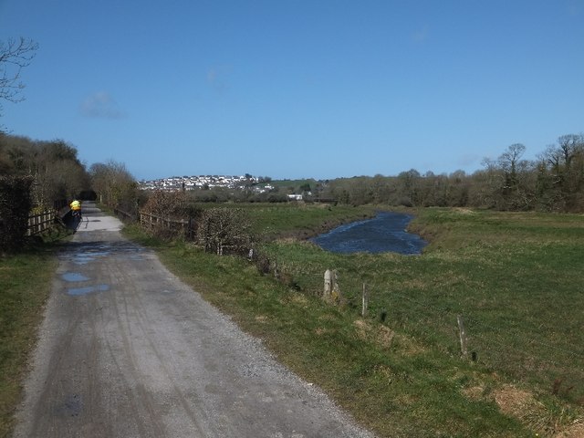
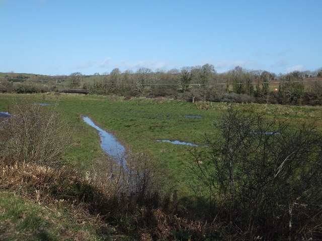
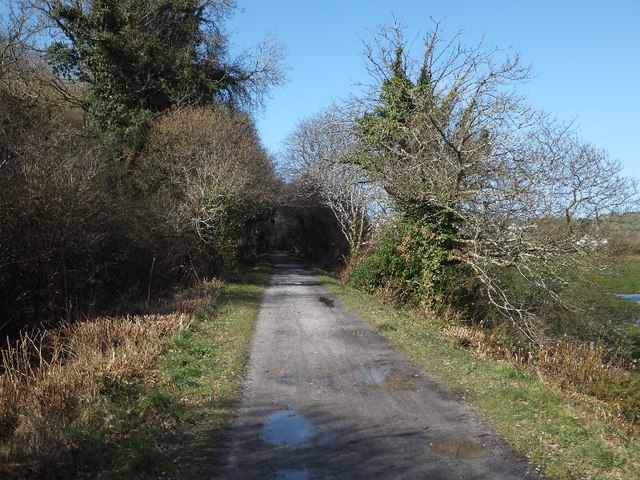
Trenant is a picturesque village located in the county of Cornwall, in southwestern England. Situated near the town of Wadebridge, Trenant is known for its charming rural setting and peaceful atmosphere. The village is surrounded by rolling hills, lush green fields, and meandering streams, offering residents and visitors a serene escape from the bustling city life.

Trenant is home to a small community of residents, who enjoy a close-knit and friendly environment. The village consists of a collection of traditional stone houses and cottages, which add to its idyllic charm. Many of these properties date back several centuries, showcasing the area's rich history and heritage.

Nature lovers will find plenty to explore in Trenant, as the village is located in close proximity to the beautiful Camel Estuary and the stunning North Cornwall coastline. These natural wonders offer opportunities for scenic walks, bird watching, and water activities like kayaking and sailing.

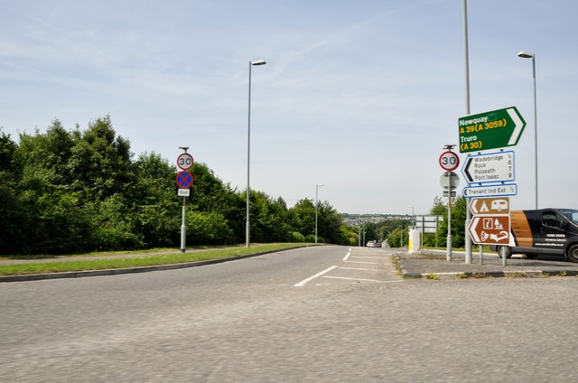
The village also benefits from its proximity to the nearby town of Wadebridge, where residents can access a range of amenities and services, including shops, restaurants, and schools. Additionally, Trenant is well-connected to the rest of Cornwall through a reliable transportation network, making it easily accessible for both residents and tourists.

Overall, Trenant offers a tranquil and picturesque setting, making it an ideal place for those seeking a peaceful escape in the heart of Cornwall's stunning countryside.

If you have any feedback on the listing, please let us know in the comments section below.
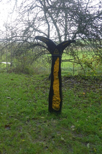
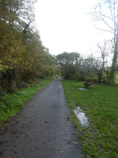
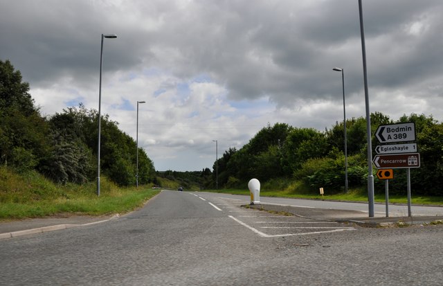
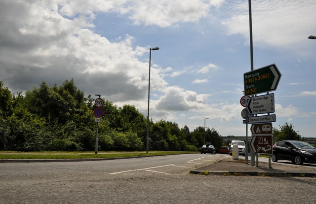
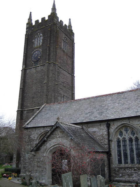
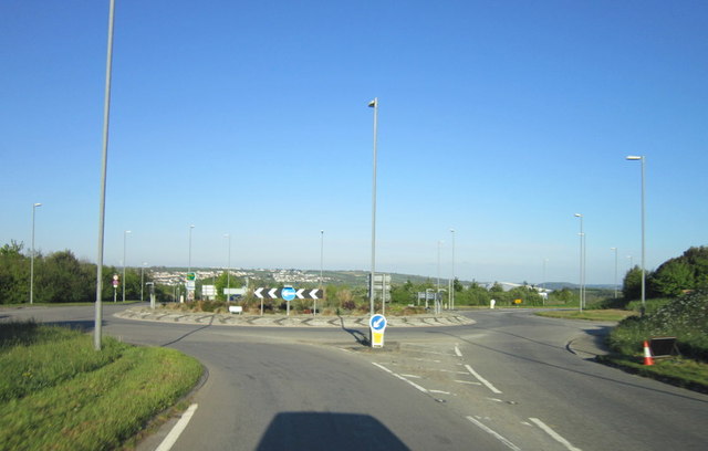
Trenant Images

Images are sourced within 2km of 50.517795/-4.829724 or Grid Reference SW9972. Thanks to Geograph Open Source API. All images are credited.

Sustrans milepost by Camel Trail The National Cycle Network is a network of cycle routes. It was created by the charity Sustrans <span class="nowrap"><a title="http://www.sustrans.org.uk/what-we-do/national-cycle-network" rel="nofollow ugc noopener" href="http://www.sustrans.org.uk/what-we-do/national-cycle-network">Link</a><img style="margin-left:2px;" alt="External link" title="External link - shift click to open in new window" src="https://s1.geograph.org.uk/img/external.png" width="10" height="10"/></span>  (Sustainable Transport), aided by a National Lottery grant.

Many routes aim to minimise contact with motor traffic, though 70% of them are on roads. In some cases the NCN uses pedestrian routes, disused railways, minor roads, canal towpaths, or traffic-calmed routes in towns and cities.
Sustrans milepost by Camel Trail
The National Cycle Network is a network of cycle routes. It was created by the charity Sustrans LinkExternal link (Sustainable Transport), aided by a National Lottery grant. Many routes aim to minimise contact with motor traffic, though 70% of them are on roads. In some cases the NCN uses pedestrian routes, disused railways, minor roads, canal towpaths, or traffic-calmed routes in towns and cities.
Camel Trail south of Wadebridge The National Cycle Network is a network of cycle routes. It was created by the charity Sustrans <span class="nowrap"><a title="http://www.sustrans.org.uk/what-we-do/national-cycle-network" rel="nofollow ugc noopener" href="http://www.sustrans.org.uk/what-we-do/national-cycle-network">Link</a><img style="margin-left:2px;" alt="External link" title="External link - shift click to open in new window" src="https://s1.geograph.org.uk/img/external.png" width="10" height="10"/></span>  (Sustainable Transport), aided by a National Lottery grant.

Many routes aim to minimise contact with motor traffic, though 70% of them are on roads. In some cases the NCN uses pedestrian routes, disused railways, minor roads, canal towpaths, or traffic-calmed routes in towns and cities.
Camel Trail south of Wadebridge
The National Cycle Network is a network of cycle routes. It was created by the charity Sustrans LinkExternal link (Sustainable Transport), aided by a National Lottery grant. Many routes aim to minimise contact with motor traffic, though 70% of them are on roads. In some cases the NCN uses pedestrian routes, disused railways, minor roads, canal towpaths, or traffic-calmed routes in towns and cities.
The Withered Arm - The Allen Valley This view is taken just above Sladesbridge in the Allen Valley, where the line descended the valley on the north side, terraced into the steep valley side. The gradient along this stretch was falling at 1:75 towards the Camel Valley.
The Withered Arm - The Allen Valley
This view is taken just above Sladesbridge in the Allen Valley, where the line descended the valley on the north side, terraced into the steep valley side. The gradient along this stretch was falling at 1:75 towards the Camel Valley.
Trelawney's Garden Centre in Sladebridge
Car wash at the garden centre
Wadebridge : The A389 The A389 taken from the roundabout. This road heads towards Bodmin.
Wadebridge : The A389
The A389 taken from the roundabout. This road heads towards Bodmin.
Wadebridge : Gonvena Hill From the roundabout looking down the road known as Gonvena Hill which is also the B3314.
Wadebridge : Gonvena Hill
From the roundabout looking down the road known as Gonvena Hill which is also the B3314.
Wadebridge : Gonvena Hill Looking down Gonvena Hill from a roundabout on the A39.
Wadebridge : Gonvena Hill
Looking down Gonvena Hill from a roundabout on the A39.
Looking across the valley of the River Allen at Sladesbridge The large building in the centre of the photo is the Trelawney Garden Centre <a href="https://www.geograph.org.uk/photo/1288606">SX0071 : Garden centre, Sladesbridge</a>.
Looking across the valley of the River Allen at Sladesbridge
The large building in the centre of the photo is the Trelawney Garden Centre SX0071 : Garden centre, Sladesbridge.
Minor road from Pendavey to Sladesbridge Note the crash barrier along the side of the road, where there is a steep drop into Lane Wood on the side of the River Allen valley.
Minor road from Pendavey to Sladesbridge
Note the crash barrier along the side of the road, where there is a steep drop into Lane Wood on the side of the River Allen valley.
The River Allen at Sladesbridge Looking upstream from the A389 bridge. Note the large growths of the invasive Himalayan Balsam on both banks.
The River Allen at Sladesbridge
Looking upstream from the A389 bridge. Note the large growths of the invasive Himalayan Balsam on both banks.
Commemorative seat beside the A389 at Sladesbridge According to the plaque on the back of this elaborate seat it was erected by Egloshayle Parish Council to commemorate the Silver Jubilee of Her Majesty Queen Elizabeth II 1952-1977.
Commemorative seat beside the A389 at Sladesbridge
According to the plaque on the back of this elaborate seat it was erected by Egloshayle Parish Council to commemorate the Silver Jubilee of Her Majesty Queen Elizabeth II 1952-1977.
Camel Trail bridge over River Camel near Pendavey Nearly all the bridge (and all the track leading to it) is in <a href="https://www.geograph.org.uk/gridref/SX0070">SX0070</a> but the stretch of river beyond is in <a href="https://www.geograph.org.uk/gridref/SX0071">SX0071</a>
Camel Trail bridge over River Camel near Pendavey
Nearly all the bridge (and all the track leading to it) is in SX0070 but the stretch of river beyond is in SX0071
Marshy land by the River Camel  The river flows beyond the dike, and under the former railway bridge towards the left of the photo.
Marshy land by the River Camel
The river flows beyond the dike, and under the former railway bridge towards the left of the photo.
Camel Trail in Treraven Woods
St Petrock's church, Egloshayle
The A39 at the A389 and B3314 roundabout
The A39 towards Wadebridge
Show me another place!

Trenant is located at Grid Ref: SW9972 (Lat: 50.517795, Lng: -4.829724)

Unitary Authority: Cornwall

Police Authority: Devon and Cornwall

What 3 Words

///remodel.inherits.armful. Near Wadebridge, Cornwall

Related Wikis

Wadebridge

Wadebridge (; Cornish: Ponswad) is a town and civil parish in north Cornwall, England, United Kingdom. The town straddles the River Camel five miles (eight...

North Cornwall

North Cornwall (Cornish: An Tiredh Uhel) is an area of Cornwall, England, United Kingdom. It is also the name of a former local government district, which...

Wadebridge railway station

Wadebridge railway station (Cornish: Ponswad) was a railway station that served the town of Wadebridge in Cornwall, England. It was on the Bodmin and Wadebridge...

Wadebridge School

Wadebridge School is a coeducational secondary school with academy status, located in the town of Wadebridge, Cornwall, England. It has 1,235 pupils. The...

Nearby Amenities

Located within 500m of 50.517795,-4.829724
Mini Roundabout
Source: Bing
Lat/Long: 50.5216865/-4.8271503
Mini Roundabout
Direction: clockwise
Lat/Long: 50.5166646/-4.8364141
Wadebridge
Is In: Cornwall, England, UK
Name Br: Ponswad
Name En: Wadebridge
Name Kw: Ponswad
Place: town
Source Name Br: proper translation
Wikidata: Q261619
Wikipedia: en:Wadebridge
Lat/Long: 50.5171441/-4.8340186
Wadebridge
Historic Railway: station
Railway: site
Source: npe
Lat/Long: 50.5151308/-4.8342467
Crossing
Crossing: traffic_signals
Crossing Ref: pelican
Lat/Long: 50.5159695/-4.8361627
Bus Stop
Wadebridge Bus Station
Bus: yes
Naptan AtcoCode: 0800COA10215
Naptan Bearing: NE
Naptan CommonName: Wadebridge Bus Station
Naptan Crossing: Southern Way
Naptan NaptanCode: cordgtmj
Naptan Street: Guineaport Road
Naptan Verified: no
Public Transport: platform
Source: naptan_import
Lat/Long: 50.5146939/-4.8340061
Bus Stop
Methodist Church
Bus: yes
Naptan AtcoCode: 0800COA10408
Naptan Bearing: SE
Naptan CommonName: Methodist Church
Naptan Crossing: Egloshayle Road
Naptan NaptanCode: cordgtpj
Naptan Street: Bridge View
Naptan Verified: no
Public Transport: platform
Source: naptan_import
Lat/Long: 50.5170332/-4.8333024
Bus Stop
Bridge View
Bus: yes
Naptan AtcoCode: 0800COA10471
Naptan Bearing: E
Naptan CommonName: Bridge View
Naptan Crossing: Gonvena Hill
Naptan NaptanCode: cordgtpw
Naptan Street: Bridge View
Naptan Verified: no
Public Transport: platform
Source: naptan_import
Lat/Long: 50.5190313/-4.8320933
Bus Stop
Foxdown
Bus: yes
Naptan AtcoCode: 0800COA10474
Naptan Bearing: SW
Naptan CommonName: Foxdown
Naptan Crossing: Marshall Avenue
Naptan NaptanCode: cordgwpj
Naptan Street: Foxdown
Naptan Verified: no
Public Transport: platform
Source: naptan_import
Lat/Long: 50.5176497/-4.8237993
Bus Stop
Franklin Close
Bus: yes
Naptan AtcoCode: 0800COA10475
Naptan Bearing: W
Naptan CommonName: Franklin Close
Naptan Crossing: St Matthews Hill
Naptan NaptanCode: cordgwgj
Naptan Street: Franklin Close
Naptan Verified: no
Public Transport: platform
Source: naptan_import
Lat/Long: 50.5191618/-4.828207
Bus Stop
Wadebridge Comprehensive School
Bus: yes
Naptan AtcoCode: 0800SCH15921
Naptan Bearing: NE
Naptan BusStopType: CUS
Naptan CommonName: Wadebridge Sch Gonvena Hill Ent
Naptan Indicator: NE-bound
Naptan NaptanCode: corgmdpj
Naptan Street: Gonvena Hill
Naptan Verified: no
Public Transport: platform
Source: naptan;bing
Lat/Long: 50.5213637/-4.8293969
Bus Stop
The Platt
Bus: yes
Naptan AtcoCode: 0800FWX38615
Naptan Bearing: S
Naptan CommonName: The Platt
Naptan Crossing: Polmorla Road
Naptan Indicator: S-bound
Naptan NaptanCode: cordgtjt
Naptan Street: The Platt
Naptan Verified: no
Public Transport: platform
Source: naptan;bing
Lat/Long: 50.5161076/-4.8361648
Pub
The Ship Inn
Addr Postcode: PL27 6DF
Addr Street: Gonvena Hill
Phone: +44 1208 813845
Website: http://shipinnwadebridge.co.uk
Lat/Long: 50.5192678/-4.8339884
Mini Roundabout
Lat/Long: 50.5203231/-4.8275636
Mini Roundabout
Lat/Long: 50.5179926/-4.8276653
Mini Roundabout
Lat/Long: 50.5194286/-4.8284834
Mini Roundabout
Lat/Long: 50.517451/-4.8279748
Mini Roundabout
Lat/Long: 50.5165642/-4.8288967
Mini Roundabout
Lat/Long: 50.5192388/-4.8282074
Mini Roundabout
Lat/Long: 50.5206118/-4.8267854
Turning Circle
Lat/Long: 50.5177375/-4.8293717
Post Box
Brand: Royal Mail
Brand Wikidata: Q638098
Mapillary: 1330625377489203
Operator: Royal Mail
Operator Wikidata: Q638098
Post Box Type: pillar
Ref: PL27 230
Lat/Long: 50.5159674/-4.8361079
Gonvena
Name Kw: Gwynnvena
Place: suburb
Lat/Long: 50.5208827/-4.8309961
Shop: butcher
Lat/Long: 50.5152558/-4.8354599
Mini Roundabout
Direction: clockwise
Lat/Long: 50.5177549/-4.8341293
Crossing
Crossing: uncontrolled
Lat/Long: 50.5218977/-4.8323543
Place Of Worship
Denomination: methodist
Religion: christian
Lat/Long: 50.5172129/-4.8329125
Toilets
Lat/Long: 50.5163192/-4.8356152
Baker Tom's Bread
Addr City: Wadebridge
Addr Street: The Platt
Shop: bakery
Survey Date: 2023-05-31
Lat/Long: 50.5163783/-4.8361858
Generator Method: photovoltaic
Generator Output Electricity: yes
Generator Source: solar
Generator Type: solar_photovoltaic_panel
Location: roof
Power: generator
Lat/Long: 50.517032/-4.8282203
Generator Method: photovoltaic
Generator Output Electricity: yes
Generator Source: solar
Generator Type: solar_photovoltaic_panel
Location: roof
Power: generator
Lat/Long: 50.5171122/-4.8280567
Generator Method: photovoltaic
Generator Output Electricity: yes
Generator Source: solar
Generator Type: solar_photovoltaic_panel
Location: roof
Power: generator
Lat/Long: 50.5178575/-4.8238698
Generator Method: photovoltaic
Generator Output Electricity: yes
Generator Source: solar
Generator Type: solar_photovoltaic_panel
Location: roof
Power: generator
Lat/Long: 50.5174226/-4.8235238
Generator Method: photovoltaic
Generator Output Electricity: yes
Generator Source: solar
Generator Type: solar_photovoltaic_panel
Location: roof
Power: generator
Lat/Long: 50.5174686/-4.8230678
Generator Method: photovoltaic
Generator Output Electricity: yes
Generator Source: solar
Generator Type: solar_photovoltaic_panel
Location: roof
Power: generator
Lat/Long: 50.5171855/-4.8229015
Generator Method: photovoltaic
Generator Output Electricity: yes
Generator Source: solar
Generator Type: solar_photovoltaic_panel
Location: roof
Power: generator
Lat/Long: 50.5171736/-4.82299
Generator Method: photovoltaic
Generator Output Electricity: yes
Generator Source: solar
Generator Type: solar_photovoltaic_panel
Location: roof
Power: generator
Lat/Long: 50.51665/-4.8245859
Generator Method: photovoltaic
Generator Output Electricity: yes
Generator Source: solar
Generator Type: solar_photovoltaic_panel
Location: roof
Power: generator
Lat/Long: 50.5164726/-4.8238778
Generator Method: photovoltaic
Generator Output Electricity: yes
Generator Source: solar
Generator Type: solar_photovoltaic_panel
Location: roof
Power: generator
Lat/Long: 50.5166756/-4.8233306
Generator Method: photovoltaic
Generator Output Electricity: yes
Generator Source: solar
Generator Type: solar_photovoltaic_panel
Location: roof
Power: generator
Lat/Long: 50.5167745/-4.823159
Generator Method: photovoltaic
Generator Output Electricity: yes
Generator Source: solar
Generator Type: solar_photovoltaic_panel
Location: roof
Power: generator
Lat/Long: 50.5163413/-4.8259351
Generator Method: photovoltaic
Generator Output Electricity: yes
Generator Source: solar
Generator Type: solar_photovoltaic_panel
Location: roof
Power: generator
Lat/Long: 50.5162953/-4.8259565
Generator Method: photovoltaic
Generator Output Electricity: yes
Generator Source: solar
Generator Type: solar_photovoltaic_panel
Location: roof
Power: generator
Lat/Long: 50.5159098/-4.8258224
Generator Method: photovoltaic
Generator Output Electricity: yes
Generator Source: solar
Generator Type: solar_photovoltaic_panel
Location: roof
Power: generator
Lat/Long: 50.5151628/-4.826206
Generator Method: photovoltaic
Generator Output Electricity: yes
Generator Source: solar
Generator Type: solar_photovoltaic_panel
Location: roof
Power: generator
Lat/Long: 50.5221414/-4.828687
Generator Method: photovoltaic
Generator Output Electricity: yes
Generator Source: solar
Generator Type: solar_photovoltaic_panel
Location: roof
Power: generator
Lat/Long: 50.5214695/-4.8310688
Generator Method: photovoltaic
Generator Output Electricity: yes
Generator Source: solar
Generator Type: solar_photovoltaic_panel
Location: roof
Power: generator
Lat/Long: 50.5216486/-4.8320746
Generator Method: photovoltaic
Generator Output Electricity: yes
Generator Source: solar
Generator Type: solar_photovoltaic_panel
Location: roof
Power: generator
Lat/Long: 50.5192457/-4.8314685
Generator Method: photovoltaic
Generator Output Electricity: yes
Generator Source: solar
Generator Type: solar_photovoltaic_panel
Location: roof
Power: generator
Lat/Long: 50.5198307/-4.831726
Generator Method: photovoltaic
Generator Output Electricity: yes
Generator Source: solar
Generator Type: solar_photovoltaic_panel
Location: roof
Power: generator
Lat/Long: 50.5197471/-4.8307791
Generator Method: photovoltaic
Generator Output Electricity: yes
Generator Source: solar
Generator Type: solar_photovoltaic_panel
Location: roof
Power: generator
Lat/Long: 50.5200779/-4.8302132
Generator Method: photovoltaic
Generator Output Electricity: yes
Generator Source: solar
Generator Type: solar_photovoltaic_panel
Location: roof
Power: generator
Lat/Long: 50.5198085/-4.8307014
Generator Method: photovoltaic
Generator Output Electricity: yes
Generator Source: solar
Generator Type: solar_photovoltaic_panel
Location: roof
Power: generator
Lat/Long: 50.5193907/-4.8309964
Generator Method: photovoltaic
Generator Output Electricity: yes
Generator Source: solar
Generator Type: solar_photovoltaic_panel
Location: roof
Power: generator
Lat/Long: 50.519169/-4.8308945
Generator Method: photovoltaic
Generator Output Electricity: yes
Generator Source: solar
Generator Type: solar_photovoltaic_panel
Location: roof
Power: generator
Lat/Long: 50.5192781/-4.8296848
Generator Method: photovoltaic
Generator Output Electricity: yes
Generator Source: solar
Generator Type: solar_photovoltaic_panel
Location: roof
Power: generator
Lat/Long: 50.5190632/-4.8290947
Generator Method: photovoltaic
Generator Output Electricity: yes
Generator Source: solar
Generator Type: solar_photovoltaic_panel
Location: roof
Power: generator
Lat/Long: 50.5191127/-4.8288882
Generator Method: photovoltaic
Generator Output Electricity: yes
Generator Source: solar
Generator Type: solar_photovoltaic_panel
Location: roof
Power: generator
Lat/Long: 50.5179905/-4.8267853
Generator Method: photovoltaic
Generator Output Electricity: yes
Generator Source: solar
Generator Type: solar_photovoltaic_panel
Location: roof
Power: generator
Lat/Long: 50.5186369/-4.8273405
Generator Method: photovoltaic
Generator Output Electricity: yes
Generator Source: solar
Generator Type: solar_photovoltaic_panel
Location: roof
Power: generator
Lat/Long: 50.5187085/-4.8269489
Generator Method: photovoltaic
Generator Output Electricity: yes
Generator Source: solar
Generator Type: solar_photovoltaic_panel
Location: roof
Power: generator
Lat/Long: 50.518422/-4.826493
Generator Method: photovoltaic
Generator Output Electricity: yes
Generator Source: solar
Generator Type: solar_photovoltaic_panel
Location: roof
Power: generator
Lat/Long: 50.5187563/-4.8260772
Generator Method: photovoltaic
Generator Output Electricity: yes
Generator Source: solar
Generator Type: solar_photovoltaic_panel
Location: roof
Power: generator
Lat/Long: 50.518439/-4.8266539
Generator Method: photovoltaic
Generator Output Electricity: yes
Generator Source: solar
Generator Type: solar_photovoltaic_panel
Location: roof
Power: generator
Lat/Long: 50.5184101/-4.826847
Generator Method: photovoltaic
Generator Output Electricity: yes
Generator Source: solar
Generator Type: solar_photovoltaic_panel
Location: roof
Power: generator
Lat/Long: 50.5184322/-4.8270857
Generator Method: photovoltaic
Generator Output Electricity: yes
Generator Source: solar
Generator Type: solar_photovoltaic_panel
Location: roof
Power: generator
Lat/Long: 50.5183026/-4.8271984
Generator Method: photovoltaic
Generator Output Electricity: yes
Generator Source: solar
Generator Type: solar_photovoltaic_panel
Location: roof
Power: generator
Lat/Long: 50.5183504/-4.827598
Generator Method: photovoltaic
Generator Output Electricity: yes
Generator Source: solar
Generator Type: solar_photovoltaic_panel
Location: roof
Power: generator
Lat/Long: 50.5175011/-4.8288479
Generator Method: photovoltaic
Generator Output Electricity: yes
Generator Source: solar
Generator Type: solar_photovoltaic_panel
Location: roof
Power: generator
Lat/Long: 50.5161418/-4.8295909
Generator Method: photovoltaic
Generator Output Electricity: yes
Generator Source: solar
Generator Type: solar_photovoltaic_panel
Location: roof
Power: generator
Lat/Long: 50.5161298/-4.8296633
Generator Method: photovoltaic
Generator Output Electricity: yes
Generator Source: solar
Generator Type: solar_photovoltaic_panel
Location: roof
Power: generator
Lat/Long: 50.5159115/-4.8295614
Generator Method: photovoltaic
Generator Output Electricity: yes
Generator Source: solar
Generator Type: solar_photovoltaic_panel
Location: roof
Power: generator
Lat/Long: 50.5171685/-4.8319057
Generator Method: photovoltaic
Generator Output Electricity: yes
Generator Source: solar
Generator Type: solar_photovoltaic_panel
Location: roof
Power: generator
Lat/Long: 50.5172214/-4.8319861
Generator Method: photovoltaic
Generator Output Electricity: yes
Generator Source: solar
Generator Type: solar_photovoltaic_panel
Location: roof
Power: generator
Lat/Long: 50.5174652/-4.832536
Generator Method: photovoltaic
Generator Output Electricity: yes
Generator Source: solar
Generator Type: solar_photovoltaic_panel
Location: roof
Power: generator
Lat/Long: 50.5182327/-4.8320103
Generator Method: photovoltaic
Generator Output Electricity: yes
Generator Source: solar
Generator Type: solar_photovoltaic_panel
Location: roof
Power: generator
Lat/Long: 50.5185687/-4.835363
Generator Method: photovoltaic
Generator Output Electricity: yes
Generator Source: solar
Generator Type: solar_photovoltaic_panel
Location: roof
Power: generator
Lat/Long: 50.5148695/-4.8345074
Generator Method: photovoltaic
Generator Output Electricity: yes
Generator Source: solar
Generator Type: solar_photovoltaic_panel
Location: roof
Power: generator
Lat/Long: 50.5150639/-4.8347917
Traffic Calming: yes
Lat/Long: 50.5155406/-4.8306209
WW2 Roadblock (site of)
Historic: yes
Lat/Long: 50.517894/-4.8342152
Post Box
Mapillary: 1088959098357491
Operator: Royal Mail
Operator Wikidata: Q638098
Post Box Type: pillar
Lat/Long: 50.5151786/-4.828592
Traffic Calming: yes
Lat/Long: 50.515107/-4.8286686
Traffic Calming: yes
Lat/Long: 50.5153133/-4.8298042
Traffic Calming: yes
Lat/Long: 50.516141/-4.8319496
Traffic Calming: yes
Lat/Long: 50.5168187/-4.8329091
Post Box
Operator: Royal Mail
Operator Wikidata: Q638098
Post Box Type: wall
Lat/Long: 50.517795/-4.8339877
Post Box
Mapillary: 871279747016997
Operator: Royal Mail
Operator Wikidata: Q638098
Post Box Type: wall
Lat/Long: 50.5205267/-4.8309284
Addr City: Wadebridge
Addr Country: GB
Addr County: Cornwall
Addr Housenumber: 12
Addr Postcode: PL27 7DB
Addr Street: Molesworth Street
Building: yes
Disused Amenity: bank
Old Name: HSBC UK
Operational Status: closed
Lat/Long: 50.516685/-4.8365794
Restaurant
Barny’s
Addr City: Wadebridge
Addr Street: Molesworth Street
Air Conditioning: yes
Bar: no
Cuisine: fish_and_chips
Delivery: no
Indoor Seating: yes
Note: Alternatively could be tagged as amenity=fast_food?
Takeaway: yes
Lat/Long: 50.5167882/-4.836385
Telephone
Booth: KX100
Mapillary: 1330625377489203
Lat/Long: 50.5161769/-4.8362016
Fixme: Path continues - survey required
Lat/Long: 50.5171945/-4.8357282
Wadebridge Wines
Addr City: Wadebridge
Addr Street: Eddystone Road
Shop: wine
Lat/Long: 50.5170832/-4.8366485
Bond Oxborough Phillips
Addr City: Wadebridge
Addr Street: Molesworth Street
Office: estate_agent
Website: https://www.bopproperty.com/
Lat/Long: 50.516717/-4.8361241
Continuum
Addr City: Wadebridge
Addr Street: Molesworth Street
Level: 1
Office: financial_adviser
Website: https://mycontinuum.co.uk/
Lat/Long: 50.5166973/-4.8360986
Addr City: The Platt
Addr Street: Jubilee Road
Shop: antiques
Survey Date: 2021-07-06
Lat/Long: 50.5154928/-4.8354167
Paper Envy
Addr City: Wadebridge
Addr Street: The Platt
Fixme: What is this?
Shop: yes
Survey Date: 2021-07-06
Lat/Long: 50.5156446/-4.8359055
Astons
Addr City: Wadebridge
Addr Street: The Platt
Fixme: What is this?
Shop: yes
Survey Date: 2021-07-06
Lat/Long: 50.5156762/-4.8359015
Cafe
Addr City: Wadebridge
Addr Street: The Platt
Fixme: Name?
Survey Date: 2021-07-06
Lat/Long: 50.5157632/-4.8359296
Impress
Addr City: Wadebridge
Addr Street: The Platt
Office: computer
Survey Date: 2021-07-06
Lat/Long: 50.5158113/-4.8359498
Post Office
Addr City: Wadebridge
Addr Street: The Platt
Brand: Post Office
Brand Wikidata: Q1783168
Note: Inside Spar shop
Survey Date: 2023-05-31
Website: https://www.postoffice.co.uk/branch-finder/0085014/wadebridge
Lat/Long: 50.5159004/-4.8359873
Spar
Addr City: Wadebridge
Addr Street: The Platt
Brand: Spar
Brand Wikidata: Q610492
Contact Facebook: https://www.facebook.com/p/SPAR-Wadebridge-100022272843126/
Shop: convenience
Survey Date: 2023-05-31
Lat/Long: 50.5158791/-4.8359672
Pharmacy
Boots
Addr City: Wadebridge
Addr Street: The Platt
Brand: Boots
Brand Wikidata: Q6123139
Healthcare: pharmacy
Survey Date: 2023-05-31
Lat/Long: 50.516019/-4.8360148
Malcolm Barnecutt
Addr City: Wadebridge
Addr Housename: Newcourt House
Addr Postcode: PL27 7AQ
Addr Street: The Platt
Addr Unit: 2
Fhrs Id: 502475
Shop: bakery
Source Addr: FHRS Open Data
Survey Date: 2023-05-31
Lat/Long: 50.516129/-4.8360631
Betfred
Addr City: Wadebridge
Addr Street: The Platt
Brand: Betfred
Brand Wikidata: Q4897425
Shop: bookmaker
Survey Date: 2023-05-31
Lat/Long: 50.5161895/-4.836106
Addr City: Wadebridge
Addr Street: The Platt
Disused Shop: yes
Old Name: The Vine
Survey Date: 2023-05-31
Lat/Long: 50.5162398/-4.8361328
New Style Barber
Addr City: Wadebridge
Addr Street: The Platt
Old Name: Shooting Star
Shop: hairdresser
Survey Date: 2023-05-31
Lat/Long: 50.5162893/-4.8361637
Granny Wobbly's Fudge Pantry
Addr City: Wadebridge
Addr Postcode: PL27 7AD
Addr Street: The Platt
Addr Unit: 2
Fhrs Id: 1638544
Shop: confectionery
Source Addr: FHRS Open Data
Survey Date: 2023-05-31
Lat/Long: 50.5163362/-4.8361744
Kernow Artisan
Addr City: Wadebridge
Addr Street: The Platt
Shop: gift
Survey Date: 2023-05-31
Lat/Long: 50.5160898/-4.836047
The data included in this document is from www.openstreetmap.org. The data is made available under ODbL.

Have you been to Trenant?

Leave your review of Trenant below (or comments, questions and feedback).