Virginia Water

Settlement in Surrey Runnymede

England

Virginia Water

Totem Pole, Windsor Great Park The 100-foot pole bears traditional First Nations carvings and was a gift from the Canadian province of British Columbia to the Queen in 1958.
Totem Pole, Windsor Great Park Credit: Mark Percy

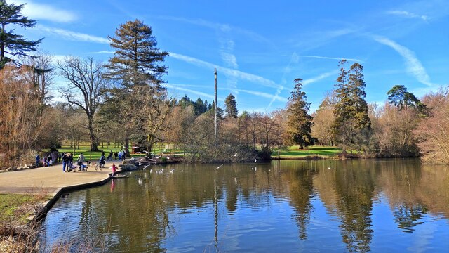
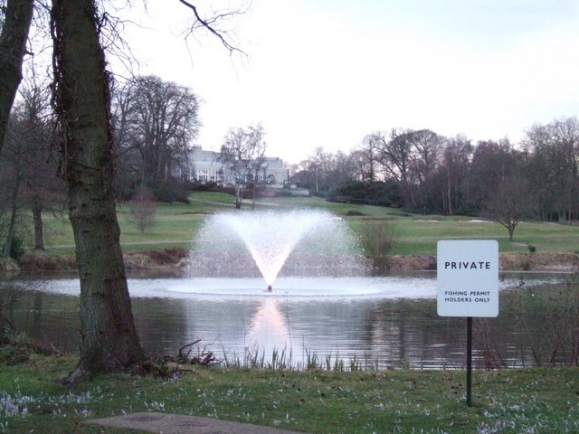
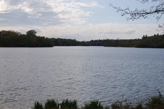
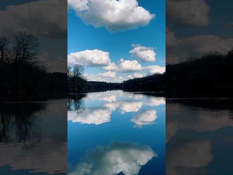
Virginia Water is a small village located in the Runnymede borough of Surrey, England. Situated approximately 23 miles southwest of central London, it is nestled within the picturesque Surrey Hills Area of Outstanding Natural Beauty. The village is known for its prominent attraction, Virginia Water Lake, which spans over 200 acres and is one of the largest man-made lakes in the country.

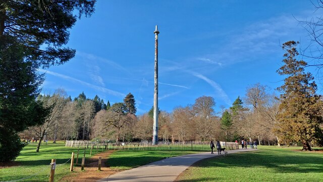
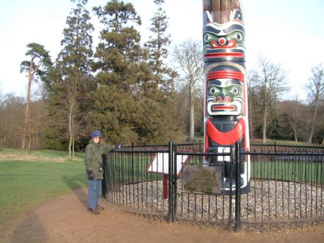
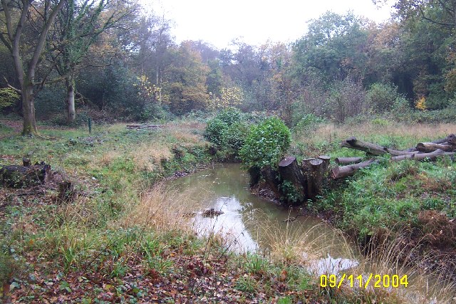
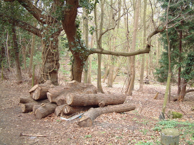
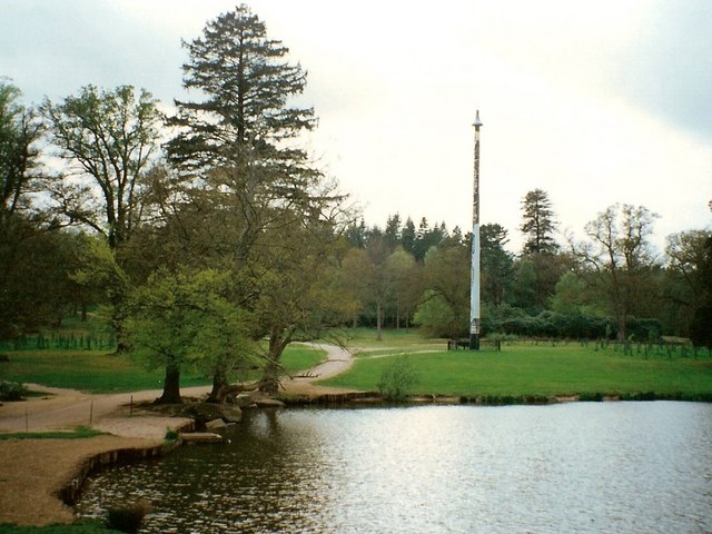
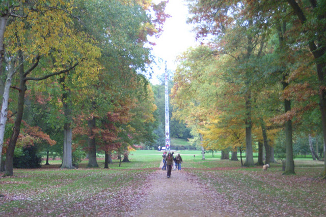
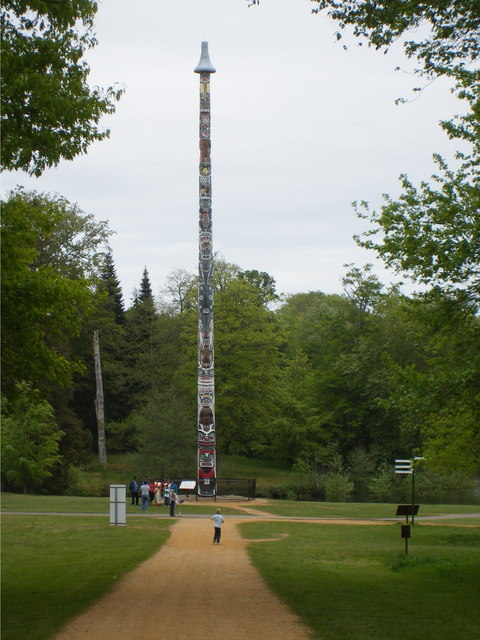
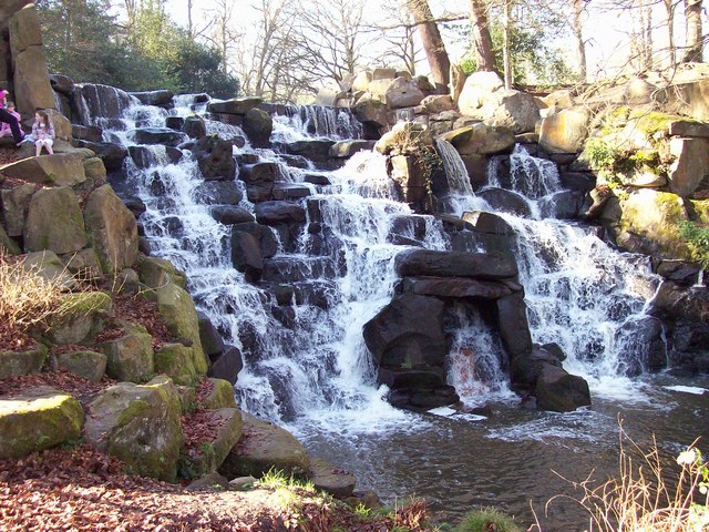
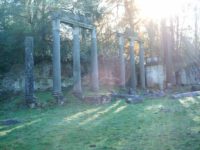
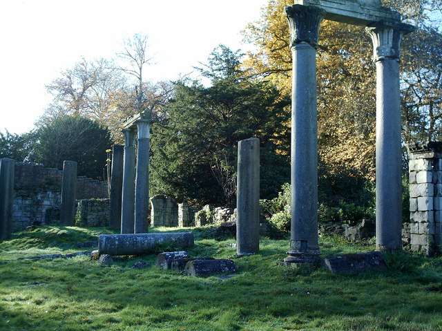
The area surrounding Virginia Water offers a peaceful and serene environment, attracting nature enthusiasts and outdoor lovers. The lake itself is surrounded by lush woodlands, charming gardens, and scenic walking trails, making it a popular spot for leisurely strolls and picnics. Additionally, the village is home to the renowned Windsor Great Park, an expansive royal parkland that encompasses vast open spaces, ancient forests, and historic landmarks such as the Copper Horse statue and the Ruins of Leptis Magna.

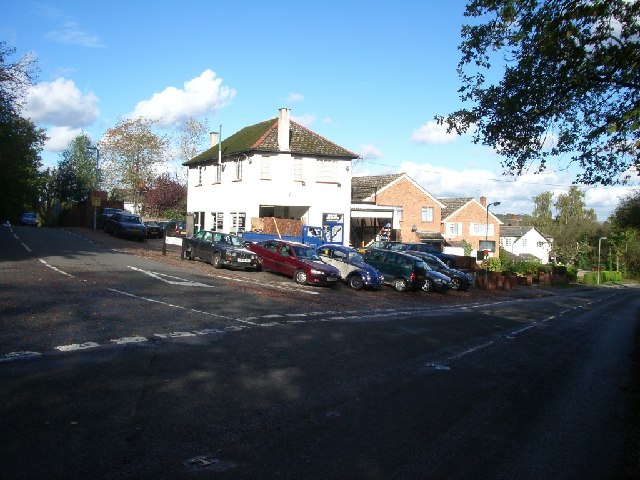
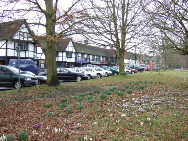
Virginia Water boasts a small but thriving community, with a range of amenities available to residents and visitors. The village center features a selection of shops, cafes, and restaurants, providing essential services and opportunities for socializing. The area is also well-connected, with a nearby railway station providing access to London and other major towns in the region.

Overall, Virginia Water offers a charming countryside retreat with a rich natural landscape and a close-knit community. Its proximity to London, coupled with its tranquil surroundings, makes it an attractive destination for both residents and tourists looking for a peaceful escape from the bustling city.

If you have any feedback on the listing, please let us know in the comments section below.

Virginia Water Images

Images are sourced within 2km of 51.407669/-0.572258 or Grid Reference SU9968. Thanks to Geograph Open Source API. All images are credited.

Totem Pole, Windsor Great Park The 100-foot pole bears traditional First Nations carvings and was a gift from the Canadian province of British Columbia to the Queen in 1958.
Totem Pole, Windsor Great Park
The 100-foot pole bears traditional First Nations carvings and was a gift from the Canadian province of British Columbia to the Queen in 1958.
Wick Pond, Windsor Great Park Looking across Wick Pond to the totem pole.
Wick Pond, Windsor Great Park
Looking across Wick Pond to the totem pole.
Virginia Water This Totem Pole is located on the extreme western edge of the square in Virginia Water.
Virginia Water
This Totem Pole is located on the extreme western edge of the square in Virginia Water.
Wentworth The entrance to the world famous championship golf course.
Wentworth
The entrance to the world famous championship golf course.
The Bourne, Virginia Water Recent clearance of trees has opened up this scene of The Bourne in the woodland between Virginia Water and Trumps Green. This view is taken looking westwards and upstream.
The Bourne, Virginia Water
Recent clearance of trees has opened up this scene of The Bourne in the woodland between Virginia Water and Trumps Green. This view is taken looking westwards and upstream.
Garage at the junction of Wellington Avenue and Trumpsgreen Road looking north
Garage at the junction of Wellington Avenue and Trumpsgreen Road
looking north
Christ Church, Virginia Water
Station Approach Local shops near Virginia Water station.
Station Approach
Local shops near Virginia Water station.
Wentworth Golf Course
Callow Hill Wood As seen from the track that leads east from the Rose and Olive Branch public house.
Callow Hill Wood
As seen from the track that leads east from the Rose and Olive Branch public house.
Totem pole at Virginia Water The totem pole is situated at the northern end of Virginia Water lake in Windsor Great Park
Totem pole at Virginia Water
The totem pole is situated at the northern end of Virginia Water lake in Windsor Great Park
Totem pole, Virginia Water, Surrey Autumn in the park
Totem pole, Virginia Water, Surrey
Autumn in the park
Totem Pole, Virginia Water Given to The Queen in 1958.
Totem Pole, Virginia Water
Given to The Queen in 1958.
The Cascade, Virginia Water The Cascade was constructed in the 18ct, reputedly using stones taken from the site of a Saxon settlement on Bagshot Heath. For a view of the Cascade taken in Nov 2013 refer to picture <a href="https://www.geograph.org.uk/photo/3734030">SU9768 : The Cascade, Virginia Water</a>.
The Cascade, Virginia Water
The Cascade was constructed in the 18ct, reputedly using stones taken from the site of a Saxon settlement on Bagshot Heath. For a view of the Cascade taken in Nov 2013 refer to picture SU9768 : The Cascade, Virginia Water.
Leptis Magna, Virginia Water, (left view) The remains of a Roman Temple from Leptis Magna, near Tripoli, Libya, were given to the Prince Regent, (later King George IV), in 1816. After languishing at the British Museum for 10 years they were erected, not necessarily correctly, in Virginia Water by Sir Jeffery Wyatville. Refer to picture <a href="https://www.geograph.org.uk/photo/2660610">SU9768 : Leptis Magna</a> for a view of Leptis Magna taken in Oct 2011.
Leptis Magna, Virginia Water, (left view)
The remains of a Roman Temple from Leptis Magna, near Tripoli, Libya, were given to the Prince Regent, (later King George IV), in 1816. After languishing at the British Museum for 10 years they were erected, not necessarily correctly, in Virginia Water by Sir Jeffery Wyatville. Refer to picture SU9768 : Leptis Magna for a view of Leptis Magna taken in Oct 2011.
Leptis Magna, Virginia Water, (right view) The remains of a Roman Temple from Leptis Magna, near Tripoli, were given to the Prince Regent, (later King George IV), in 1816. After languishing at the British Museum for 10 years they were erected, not necessarily correctly, in Virginia Water by Sir Jeffery Wyatville. Refer to picture <a href="https://www.geograph.org.uk/photo/705840">SU9768 : Leptis Magna, Virginia Water, (left view)</a> for a view of the LH columns.
Leptis Magna, Virginia Water, (right view)
The remains of a Roman Temple from Leptis Magna, near Tripoli, were given to the Prince Regent, (later King George IV), in 1816. After languishing at the British Museum for 10 years they were erected, not necessarily correctly, in Virginia Water by Sir Jeffery Wyatville. Refer to picture SU9768 : Leptis Magna, Virginia Water, (left view) for a view of the LH columns.
Virginia Water
Virginia Water
The Cascade, Virginia Water
Show me another place!

Virginia Water is located at Grid Ref: SU9968 (Lat: 51.407669, Lng: -0.572258)

Administrative County: Surrey

District: Runnymede

Police Authority: Surrey

What 3 Words

///oath.tricky.spin. Near Virginia Water, Surrey

Nearby Locations

Virginia Water Callow Hill

Related Wikis

Holloway Sanatorium

Holloway Sanatorium was an institution for the treatment of those suffering temporary mental illness, situated on 22 acres (9 ha) of aesthetically landscaped...

Virginia Water railway station

Virginia Water railway station serves the village of Virginia Water, in Surrey, England. It is 23 miles 15 chains (37.3 km) down the line from London Waterloo...

Riverside Walk, Virginia Water

Riverside Walk is a 21.2-hectare (52-acre) local nature reserve in Virginia Water, Surrey. It is owned by Runnymede Borough Council and managed by The...

Virginia Water

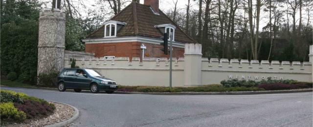
Virginia Water is a commuter village in the Borough of Runnymede in northern Surrey, England. It is home to the Wentworth Estate and the Wentworth Club...

Related Videos

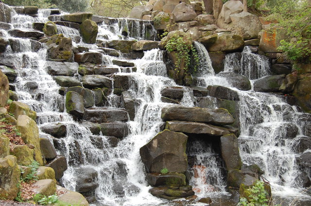
Photos: Virginia Water Cascades and Windsor Castle | Day Hike Saturday | 🇬🇧 Hiking UK | England

Virginia Water, Windsor Great Park, the Long Walk, and Windsor Castle Distance: 17.08 km (10.9 miles) Grading: Easy Rating: 2 ...

4K Windsor Great Park Time Lapse Walking Tour

Windsor Great Park walking tour shot on Pixel 5 in 4K time lapse at 10x.

Nearby Amenities

Located within 500m of 51.407669,-0.572258
Barrier: bollard
Lat/Long: 51.4105186/-0.568095
Crossing
Crossing: uncontrolled
Crossing Island: yes
Kerb: lowered
Lat/Long: 51.4062532/-0.5788651
Crossing
Bicycle: yes
Crossing: unmarked
Kerb: lowered
Sloped Curb: yes
Lat/Long: 51.4055907/-0.576209
Crossing
Bicycle: yes
Crossing: unmarked
Kerb: lowered
Sloped Curb: yes
Lat/Long: 51.404809/-0.5735537
Crossing
Crossing Island: yes
Kerb: lowered
Sloped Curb: yes
Source: Surrey-Air_Survey
Lat/Long: 51.4058977/-0.5785261
Crossing
Crossing Island: yes
Kerb: lowered
Sloped Curb: yes
Source: Surrey-Air_Survey
Lat/Long: 51.4060329/-0.5788193
Glenridge Lodge
Building: residential
Source: OS-OpenData_StreetView
Lat/Long: 51.410891/-0.5747496
Crossing
Crossing: uncontrolled
Crossing Island: yes
Kerb: lowered
Lat/Long: 51.4062992/-0.5788047
Crossing
Crossing: uncontrolled
Crossing Island: yes
Kerb: lowered
Lat/Long: 51.406087/-0.5779913
Crossing
Bicycle: yes
Crossing: uncontrolled
Crossing Island: yes
Kerb: lowered
Lat/Long: 51.4063033/-0.5782327
Crossing
Crossing: uncontrolled
Crossing Island: yes
Kerb: lowered
Lat/Long: 51.406004/-0.5787724
Crossing
Bicycle: yes
Crossing: uncontrolled
Crossing Island: yes
Kerb: lowered
Lat/Long: 51.4063282/-0.5783211
Crossing
Crossing: uncontrolled
Crossing Island: yes
Kerb: lowered
Lat/Long: 51.4060141/-0.5780216
Crossing
Crossing: uncontrolled
Crossing Island: yes
Kerb: lowered
Lat/Long: 51.4060561/-0.5788173
The data included in this document is from www.openstreetmap.org. The data is made available under ODbL.

Have you been to Virginia Water?

Leave your review of Virginia Water below (or comments, questions and feedback).