Vinney Green

Settlement in Gloucestershire

England

Vinney Green

Downend (Glos) St Augustine of Canterbury RC Church Really a suburb of Bristol, but South Glos people  are fiercely independent. This Catholic Church is a notable feature in this sea of 1950s and 1960s housing.
Downend (Glos) St Augustine of Canterbury RC Church Credit: ChurchCrawler

Vinney Green is a small village located in the county of Gloucestershire, in southwestern England. It is situated approximately 4 miles to the south of the town of Thornbury and 15 miles north of Bristol. The village is nestled in a picturesque countryside setting, surrounded by rolling hills and fields.

Vinney Green is primarily a residential area, with a population of around 500 residents. The village is known for its tranquil and peaceful atmosphere, making it an ideal place for those seeking a quiet and idyllic rural lifestyle. The properties in Vinney Green mainly consist of traditional cottages and farmhouses, adding to the village's charm.

Despite its small size, Vinney Green benefits from its proximity to nearby towns and cities. Residents have easy access to amenities and services in Thornbury, including shops, supermarkets, schools, and healthcare facilities. The city of Bristol is also within a short driving distance, offering a wider range of amenities, entertainment options, and employment opportunities.

Nature enthusiasts will appreciate the abundance of scenic walking trails and cycling routes surrounding Vinney Green. The nearby Cotswolds Area of Outstanding Natural Beauty is also easily accessible, providing an array of outdoor activities for residents to enjoy.

Overall, Vinney Green offers a peaceful and picturesque countryside lifestyle, with convenient access to nearby towns and cities. Its quaint charm and beautiful surroundings make it an appealing place to reside.

If you have any feedback on the listing, please let us know in the comments section below.
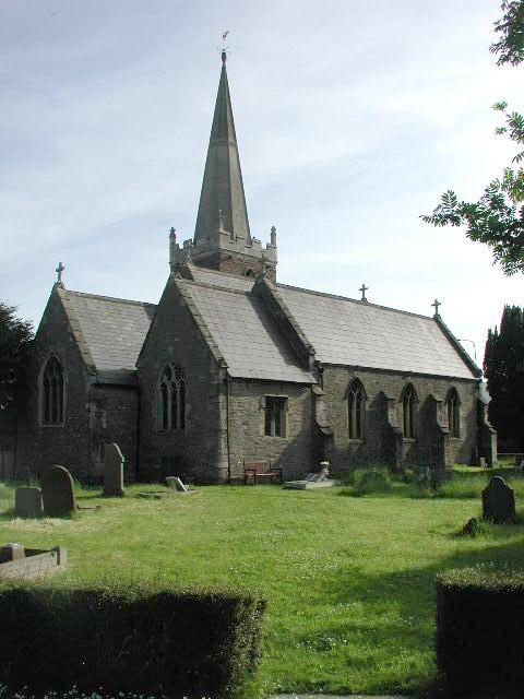
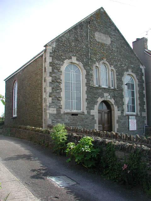
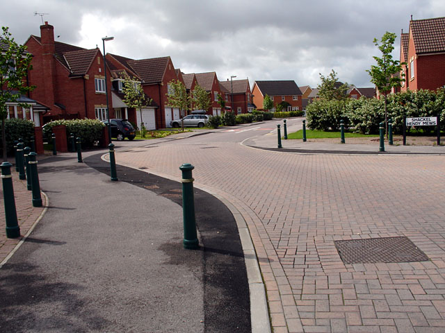
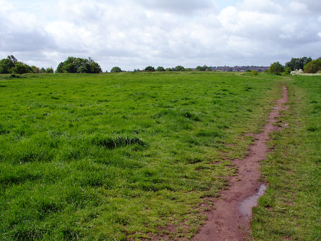
Vinney Green Images

Images are sourced within 2km of 51.490916/-2.491105 or Grid Reference ST6677. Thanks to Geograph Open Source API. All images are credited.

Downend (Glos) St Augustine of Canterbury RC Church Really a suburb of Bristol, but South Glos people  are fiercely independent. This Catholic Church is a notable feature in this sea of 1950s and 1960s housing.
Downend (Glos) St Augustine of Canterbury RC Church
Really a suburb of Bristol, but South Glos people are fiercely independent. This Catholic Church is a notable feature in this sea of 1950s and 1960s housing.
Mangotsfield (Glos) St James Church
Shortwood (Glos) Primitive Methodist Chapel
Emersons Green Emersons Green shopping complex
Emersons Green
Emersons Green shopping complex
Bromley Heath Park summer fete 2003 Always get sunshine each year!
Bromley Heath Park summer fete 2003
Always get sunshine each year!
M4 looking East from footbridge The old road between Downend and Winterbourne not open for cars, now provides a good vantage point for police speed cameras
M4 looking East from footbridge
The old road between Downend and Winterbourne not open for cars, now provides a good vantage point for police speed cameras
Can you spot the speed camera? Footbridge over both the Bristol northern ring road [A4174] and the M4
Can you spot the speed camera?
Footbridge over both the Bristol northern ring road [A4174] and the M4
A sad spot for a family From the footbridge over the A4174 Bristol Ring road at Downend. Note the flowers by the first lamp post
A sad spot for a family
From the footbridge over the A4174 Bristol Ring road at Downend. Note the flowers by the first lamp post
Rather overgrown Folly Bridge over Folly Brook At the back of a pub car park
Rather overgrown Folly Bridge over Folly Brook
At the back of a pub car park
Dragonfly On the new roundabout at the entrance to Emerald Park Industrial Estate
Dragonfly
On the new roundabout at the entrance to Emerald Park Industrial Estate
Cycle Path in Vinny Green This area is predominantly new housing, and the developers seemed to have installed plenty of cycle paths, however some of the junctions with roads could have been designed better.
Cycle Path in Vinny Green
This area is predominantly new housing, and the developers seemed to have installed plenty of cycle paths, however some of the junctions with roads could have been designed better.
The Owl and the Pussy Cat There were two of these 3-piece panels which told the story of the Owl and the Pussy Cat's vogage.
The Owl and the Pussy Cat
There were two of these 3-piece panels which told the story of the Owl and the Pussy Cat's vogage.
The 2nd Part of the Owl and Pussy Cat Poem The 2nd half of the Owl and Pussy Cat Poem showing its position on a very small green in front of housing in Vinny Green. See <a href="https://www.geograph.org.uk/photo/174265">ST6677 : The Owl and the Pussy Cat</a> for a closer view.
The 2nd Part of the Owl and Pussy Cat Poem
The 2nd half of the Owl and Pussy Cat Poem showing its position on a very small green in front of housing in Vinny Green. See ST6677 : The Owl and the Pussy Cat for a closer view.
Ring Road A4174 looking north-west On the pedestrian bridge/cycle route looking down onto the ring-road.
Ring Road A4174 looking north-west
On the pedestrian bridge/cycle route looking down onto the ring-road.
Emerson's Green Looking down Shackel Hendy Mews.

Very quiet roads, hardly met a single pedestrian along my journey.
Emerson's Green
Looking down Shackel Hendy Mews. Very quiet roads, hardly met a single pedestrian along my journey.
Rodway Hill Rodway Hill covers an area of around 34.5 acres. The name Rodway comes from the Celtic words 'rod' which means feed and 'way' which means watery. The land originally belonged to the King, and in Saxon times deer, hare, rabbit, wolf, fox and boar were all found here.
Information from a notice board near the road-side.
Rodway Hill
Rodway Hill covers an area of around 34.5 acres. The name Rodway comes from the Celtic words 'rod' which means feed and 'way' which means watery. The land originally belonged to the King, and in Saxon times deer, hare, rabbit, wolf, fox and boar were all found here. Information from a notice board near the road-side.
Stile on Rodway Road This stile is at the end of a path joining Rodway Hill Road and Cossham Street.
Stile on Rodway Road
This stile is at the end of a path joining Rodway Hill Road and Cossham Street.
Burley Grove Road junction where Burley Grove joins Mangotsfield Road, looking west. The small road which borders the grassy area is Broad St.
Burley Grove
Road junction where Burley Grove joins Mangotsfield Road, looking west. The small road which borders the grassy area is Broad St.
Show me another place!

Vinney Green is located at Grid Ref: ST6677 (Lat: 51.490916, Lng: -2.491105)

Unitary Authority: South Gloucestershire

Police Authority: Avon and Somerset

What 3 Words

///starts.nodded.rally. Near Mangotsfield, Gloucestershire

Related Wikis

Downend School

Downend School is a coeducational secondary school and sixth form with academy status, situated on Westerleigh Road in the suburban village of Downend...

Downend, South Gloucestershire

Downend is an affluent residential suburb of Greater Bristol, England, the housing stock is typically terraced Victorian, 1930s and 1950s semi-detached...

Emersons Green

Emersons Green is a suburb of Greater Bristol and parish in the unitary authority of South Gloucestershire. Sitting 7 miles northeast of Bristol, England...

Page Park, Staple Hill

Page Park is a park in the Staple Hill area of South Gloucestershire.In 1910, the park was donated to the people of Staple Hill by Arthur William Page...

Nearby Amenities

Located within 500m of 51.490916,-2.491105
Bus Stop
Bus: yes
Public Transport: platform
Lat/Long: 51.4878351/-2.4952322
Post Box
Post Box Type: pillar
Ref: BS16 537D
Royal Cypher: EIIR
Royal Cypher Wikidata: Q33102113
Lat/Long: 51.4911302/-2.4940372
Traffic Signals
Crossing: traffic_signals
Crossing Ref: pelican
Lat/Long: 51.4907047/-2.4953549
Bus Stop
Bus: yes
Public Transport: platform
Lat/Long: 51.4880623/-2.4947141
Bus Stop
Stockwell Drive
Naptan AtcoCode: 0170SGA01531
Naptan Bearing: N
Naptan CommonName: Stockwell Drive
Naptan Crossing: Stockwell Drive
Naptan NaptanCode: sglpmpd
Naptan PlusbusZoneRef: BRSTLTM
Naptan Street: Blackhorse Road
Naptan Verified: no
Source: naptan_import
Lat/Long: 51.4900762/-2.4859731
Bus Stop
Peache Road
Bus: yes
Naptan AtcoCode: 0170SGA01596
Naptan Bearing: N
Naptan CommonName: Peache Road
Naptan NaptanCode: sglpmwt
Naptan Street: Peache Road
Naptan Verified: no
Public Transport: platform
Source: naptan_import
Lat/Long: 51.4881777/-2.4959318
Bus Stop
Beaufort Road
Naptan AtcoCode: 0170SGA10031
Naptan Bearing: SW
Naptan CommonName: Beaufort Road
Naptan Crossing: Walker Close
Naptan NaptanCode: sglgjtm
Naptan PlusbusZoneRef: BRSTLTM
Naptan Street: Beaufort Road
Naptan Verified: no
Source: naptan_import
Lat/Long: 51.495202/-2.4901907
Bus Stop
Springfield Road
Naptan AtcoCode: 0170SGA10032
Naptan Bearing: SW
Naptan CommonName: Springfield Road
Naptan Crossing: Elm Tree Avenue
Naptan NaptanCode: sglgmap
Naptan PlusbusZoneRef: BRSTLTM
Naptan Street: Westerleigh Road
Naptan Verified: no
Source: naptan_import
Lat/Long: 51.4939195/-2.4893846
Bus Stop
Westerleigh Road
Bus: yes
Naptan AtcoCode: 0170SGA10033
Naptan Bearing: NE
Naptan CommonName: Westerleigh Road
Naptan Crossing: Dibden Road
Naptan NaptanCode: sglgmgw
Naptan PlusbusZoneRef: BRSTLTM
Naptan Street: Westerleigh Road
Naptan Verified: no
Public Transport: platform
Source: naptan_import
Lat/Long: 51.4943643/-2.4883667
Bus Stop
Westerleigh Road
Bus: yes
Naptan AtcoCode: 0170SGA10034
Naptan Bearing: SW
Naptan CommonName: Westerleigh Road
Naptan Crossing: Dibden Road
Naptan NaptanCode: sglgmta
Naptan PlusbusZoneRef: BRSTLTM
Naptan Street: Westerleigh Road
Naptan Verified: no
Public Transport: platform
Source: naptan_import
Lat/Long: 51.4946837/-2.4872465
Bus Stop
Jubilee Crescent
Bus: yes
Naptan AtcoCode: 0170SGA10043
Naptan Bearing: N
Naptan CommonName: Jubilee Crescent
Naptan Crossing: Springleaze
Naptan NaptanCode: sglgpda
Naptan PlusbusZoneRef: BRSTLTM
Naptan Street: Blackhorse Road
Naptan Verified: no
Public Transport: platform
Source: naptan_import
Lat/Long: 51.4925584/-2.4858698
Bus Stop
Peache Road
Bus: yes
Naptan AtcoCode: 0170SGA10418
Naptan Bearing: E
Naptan CommonName: Peache Road
Naptan Crossing: Stanbridge Road
Naptan NaptanCode: sglgdjw
Naptan PlusbusZoneRef: BRSTLTM
Naptan Street: Peache Road
Naptan Verified: no
Public Transport: platform
Source: naptan_import
Lat/Long: 51.4881333/-2.4946638
Bus Stop
Northcote Road
Naptan AtcoCode: 0170SGA10419
Naptan Bearing: E
Naptan CommonName: Northcote Road
Naptan Crossing: Royal Road
Naptan NaptanCode: sglgjpa
Naptan PlusbusZoneRef: BRSTLTM
Naptan Street: Northcote Road
Naptan Verified: no
Source: naptan_import
Lat/Long: 51.4865944/-2.4907753
Bus Stop
Jubilee Crescent
Naptan AtcoCode: 0170SGB20005
Naptan Bearing: S
Naptan CommonName: Jubilee Crescent
Naptan Crossing: Springfield Road
Naptan NaptanCode: sglgpdt
Naptan PlusbusZoneRef: BRSTLTM
Naptan Street: Blackhorse Road
Naptan Verified: no
Source: naptan_import
Lat/Long: 51.4919749/-2.4856187
Bus Stop
Streamside
Naptan AtcoCode: 0170SGB20371
Naptan Bearing: S
Naptan CommonName: Streamside
Naptan Crossing: Northcote Road
Naptan NaptanCode: sglgjmw
Naptan PlusbusZoneRef: BRSTLTM
Naptan Street: Royal Road
Naptan Verified: no
Source: naptan_import
Lat/Long: 51.4879609/-2.4908332
Bus Stop
Streamside
Naptan AtcoCode: 0170SGB20372
Naptan Bearing: N
Naptan CommonName: Streamside
Naptan Crossing: Barley Close
Naptan NaptanCode: sglgjmd
Naptan PlusbusZoneRef: BRSTLTM
Naptan Street: Royal Road
Naptan Verified: no
Source: naptan_import
Lat/Long: 51.487978/-2.4910494
Bus Stop
Northcote Road
Naptan AtcoCode: 0170SGB20385
Naptan Bearing: NW
Naptan CommonName: Northcote Road
Naptan Crossing: Green Side
Naptan NaptanCode: sglgjgp
Naptan PlusbusZoneRef: BRSTLTM
Naptan Street: Northcote Road
Naptan Verified: no
Source: naptan_import
Lat/Long: 51.4866731/-2.491309
Bus Stop
Peache Road
Bus: yes
Naptan AtcoCode: 0170SGB20387
Naptan Bearing: W
Naptan CommonName: Peache Road
Naptan Crossing: Burley Grove
Naptan NaptanCode: sglgdgd
Naptan PlusbusZoneRef: BRSTLTM
Naptan Street: Salisbury Road
Naptan Verified: no
Public Transport: platform
Source: naptan_import
Lat/Long: 51.4878051/-2.4953475
Bus Stop
Westbourne Road
Naptan AtcoCode: 0170SGB20431
Naptan Bearing: SW
Naptan CommonName: Westbourne Road
Naptan Crossing: Westbourne Road
Naptan NaptanCode: sglgjgw
Naptan PlusbusZoneRef: BRSTLTM
Naptan Street: Westerleigh Road
Naptan Verified: no
Source: naptan_import
Lat/Long: 51.4930124/-2.4912763
Bus Stop
Westbourne Road
Naptan AtcoCode: 0170SGB20432
Naptan Bearing: NE
Naptan CommonName: Westbourne Road
Naptan Crossing: Stockwell Close
Naptan NaptanCode: sglgjdg
Naptan PlusbusZoneRef: BRSTLTM
Naptan Street: Westerleigh Road
Naptan Verified: no
Source: naptan_import
Lat/Long: 51.4925774/-2.4920927
Bus Stop
Mangotsfield Cemetery
Naptan AtcoCode: 0170SGB20433
Naptan Bearing: SW
Naptan CommonName: Mangotsfield Cemetery
Naptan Crossing: Stanbridge Road
Naptan NaptanCode: sglgdgp
Naptan PlusbusZoneRef: BRSTLTM
Naptan Street: Westerleigh Road
Naptan Verified: no
Shelter: yes
Source: naptan_import
Lat/Long: 51.490557/-2.4957007
Bus Stop
Mangotsfield Cemetery
Naptan AtcoCode: 0170SGB20434
Naptan Bearing: E
Naptan CommonName: Mangotsfield Cemetery
Naptan Crossing: Stanbridge Road
Naptan NaptanCode: sglgdat
Naptan PlusbusZoneRef: BRSTLTM
Naptan Street: Westerleigh Road
Naptan Verified: no
Shelter: yes
Source: naptan_import
Lat/Long: 51.4905258/-2.4960752
Bus Stop
Beaufort Road
Naptan AtcoCode: 0170SGY43270
Naptan Bearing: N
Naptan CommonName: Beaufort Road
Naptan Crossing: The Folly
Naptan NaptanCode: sglpgdw
Naptan PlusbusZoneRef: BRSTLTM
Naptan Street: Westbourne Road
Naptan Verified: no
Source: naptan_import
Lat/Long: 51.4947385/-2.4913669
Bicycle Parking
Capacity: 20
Lat/Long: 51.4935651/-2.4944975
Crossing
Crossing: unmarked
Crossing Island: yes
Tactile Paving: yes
Lat/Long: 51.4915999/-2.4930853
Barrier: bollard
Lat/Long: 51.4874966/-2.4869232
Post Box
Collection Times: Mo-Fr 17:15; Sa 12:15; Su off
Post Box Type: pillar
Ref: BS16 515
Royal Cypher: EIIR
Royal Cypher Wikidata: Q33102113
Lat/Long: 51.4902893/-2.4899422
Post Box
Collection Times: Mo-Fr 09:00; Sa 07:00; Su off
Post Box Type: wall
Royal Cypher: GR
Royal Cypher Wikidata: Q33102273
Lat/Long: 51.4883135/-2.4960831
Waste Basket
Lat/Long: 51.4922567/-2.4976395
DOWNEND SEC MOD SCHOOL I.D. S/S
Brand: National Grid
Brand Wikidata: Q1465461
Operator: National Grid Electricity Distribution Plc
Operator Old: Western Power Distribution
Operator Wikidata: Q7988183
Owner: National Grid Electricity Distribution (South West) Plc
Owner Wikidata: Q114397866
Power: substation
Ref: 1160
Lat/Long: 51.4916396/-2.4933735
Grit Bin
Colour: yellow
Material: plastic
Lat/Long: 51.4914046/-2.4930134
Waste Basket
Lat/Long: 51.4910092/-2.4946904
Waste Basket
Lat/Long: 51.4903395/-2.4963105
Bench
Lat/Long: 51.4903178/-2.4961227
Booth: K6
Removed Amenity: telephone
Lat/Long: 51.4903804/-2.4899744
Barrier: bollard
Lat/Long: 51.4904953/-2.4912658
Waste Basket
Lat/Long: 51.4864994/-2.4909043
Power: substation
Lat/Long: 51.4885626/-2.4932372
Waste Basket
Waste: dog_excrement
Lat/Long: 51.4949946/-2.4903259
Waste Basket
Lat/Long: 51.4947653/-2.4901039
Grit Bin
Colour: yellow
Material: plastic
Lat/Long: 51.4949327/-2.491515
Man Made: street_cabinet
Street Cabinet: telecom
Lat/Long: 51.4953183/-2.490555
Man Made: street_cabinet
Lat/Long: 51.489795/-2.4980153
Man Made: street_cabinet
Street Cabinet: telecom
Lat/Long: 51.4904303/-2.4963851
Man Made: street_cabinet
Lat/Long: 51.4903582/-2.4961086
Man Made: street_cabinet
Lat/Long: 51.4915479/-2.4932872
Waste Basket
Lat/Long: 51.491491/-2.4929132
Waste Basket
Lat/Long: 51.4917922/-2.4929599
STOCKWELL HILL P
Power: substation
Ref: 0189
Lat/Long: 51.4934273/-2.4901669
Man Made: street_cabinet
Street Cabinet: telecom
Lat/Long: 51.4939295/-2.4888589
Man Made: street_cabinet
Street Cabinet: telecom
Lat/Long: 51.4939418/-2.4889418
Man Made: street_cabinet
Street Cabinet: telecom
Lat/Long: 51.4939375/-2.4889068
Power: substation
Lat/Long: 51.4876882/-2.4863122
SPRINGLEAZE OD
Brand: National Grid
Brand Wikidata: Q1465461
Operator: National Grid Electricity Distribution Plc
Operator Old: Western Power Distribution
Operator Wikidata: Q7988183
Owner: National Grid Electricity Distribution (South West) Plc
Owner Wikidata: Q114397866
Power: substation
Ref: 111115
Lat/Long: 51.4910463/-2.4892139
BLACKHORSE RD P. S/S
Brand: National Grid
Brand Wikidata: Q1465461
Operator: National Grid Electricity Distribution Plc
Operator Old: Western Power Distribution
Operator Wikidata: Q7988183
Owner: National Grid Electricity Distribution (South West) Plc
Owner Wikidata: Q114397866
Power: substation
Ref: 1173
Lat/Long: 51.4890464/-2.4864526
Power: substation
Lat/Long: 51.4891207/-2.4912991
Power: pole
Lat/Long: 51.4946757/-2.4874314
Power: pole
Lat/Long: 51.4944536/-2.4880534
Power: pole
Lat/Long: 51.4942644/-2.4885839
Power: pole
Lat/Long: 51.4940644/-2.489147
Power: pole
Lat/Long: 51.4938796/-2.4886002
Power: pole
Lat/Long: 51.4938625/-2.487969
Power: pole
Lat/Long: 51.4940245/-2.4873541
Power: pole
Lat/Long: 51.4940941/-2.4867423
Power: pole
Lat/Long: 51.49406/-2.486101
Power: pole
Lat/Long: 51.4943087/-2.4869811
Power: pole
Lat/Long: 51.4938586/-2.4897269
Power: pole
Lat/Long: 51.4936549/-2.4903063
Power: pole
Lat/Long: 51.4933852/-2.4909747
Power: pole
Lat/Long: 51.4928124/-2.4917793
Power: pole
Lat/Long: 51.4932934/-2.4908044
Power: pole
Lat/Long: 51.4931235/-2.4913423
Power: pole
Lat/Long: 51.4927361/-2.4916624
Power: pole
Lat/Long: 51.4930116/-2.4912468
Power: pole
Lat/Long: 51.4924519/-2.492238
Power: pole
Lat/Long: 51.4921626/-2.49251
Power: pole
Lat/Long: 51.4934687/-2.4856272
Power: pole
Lat/Long: 51.4930017/-2.4856394
BOSCOMBE CRES O/D
Brand: National Grid
Brand Wikidata: Q1465461
Operator: National Grid Electricity Distribution Plc
Operator Old: Western Power Distribution
Operator Wikidata: Q7988183
Owner: National Grid Electricity Distribution (South West) Plc
Owner Wikidata: Q114397866
Power: substation
Ref: 1181
Lat/Long: 51.4946725/-2.4937443
Crossing
Crossing: zebra
Crossing Island: no
Tactile Paving: yes
Traffic Calming: table
Lat/Long: 51.4936991/-2.4900529
Charging Station
Fee: yes
Motorcar: yes
Lat/Long: 51.4940724/-2.4886711
Entrance: yes
Lat/Long: 51.4935326/-2.4867739
Entrance: yes
Lat/Long: 51.4934692/-2.4866826
Power: substation
Lat/Long: 51.4918339/-2.4921967
The data included in this document is from www.openstreetmap.org. The data is made available under ODbL.

Have you been to Vinney Green?

Leave your review of Vinney Green below (or comments, questions and feedback).