Virginstow

Settlement in Devon Torridge

England

Virginstow

Ordnance Survey Cut Mark This can be found on the wall of St Bridget's Church at Virginstow.
For more detail see : <span class="nowrap"><a title="http://www.bench-marks.org.uk/bm71361" rel="nofollow ugc noopener" href="http://www.bench-marks.org.uk/bm71361">Link</a><img style="margin-left:2px;" alt="External link" title="External link - shift click to open in new window" src="https://s1.geograph.org.uk/img/external.png" width="10" height="10"/></span>
Ordnance Survey Cut Mark Credit: Peter Wood

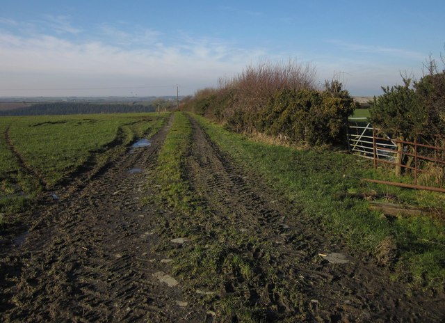
Virginstow is a small village located in the county of Devon, South West England. Situated near the border with Cornwall, it lies within the Torridge district and is surrounded by picturesque countryside. The village is nestled amidst rolling hills and farmland, providing a tranquil and idyllic setting for residents and visitors alike.

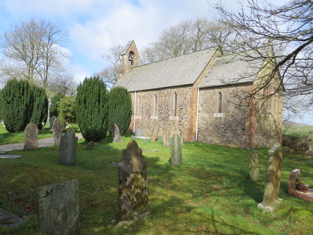
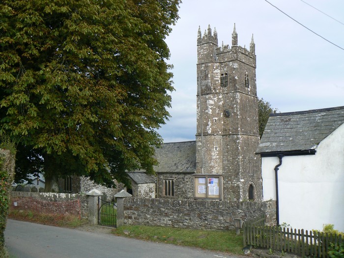
With a population of around 300 people, Virginstow maintains a close-knit community atmosphere. The village consists of a scattering of traditional stone cottages, a charming parish church, and a village hall. The local economy is predominantly based on agriculture, with farming playing a significant role in the area.

Nature enthusiasts will find plenty to appreciate in Virginstow and its surroundings. The village is located in close proximity to the Tamar Valley Area of Outstanding Natural Beauty, offering breathtaking landscapes and diverse wildlife. Additionally, the nearby Dartmoor National Park provides opportunities for outdoor activities such as hiking, cycling, and horseback riding.

While Virginstow may be a quiet and peaceful village, it benefits from its proximity to larger towns and cities. The market town of Holsworthy is approximately 6 miles away, offering a range of amenities including shops, schools, and healthcare facilities. The coastal town of Bude is also within easy reach, providing sandy beaches, water sports, and a vibrant tourist scene.

Overall, Virginstow is a charming rural village that offers a slower pace of life, picturesque surroundings, and easy access to both natural beauty and nearby amenities.

If you have any feedback on the listing, please let us know in the comments section below.

Virginstow Images

Images are sourced within 2km of 50.710867/-4.2978061 or Grid Reference SX3792. Thanks to Geograph Open Source API. All images are credited.

Ordnance Survey Cut Mark This can be found on the wall of St Bridget's Church at Virginstow.
For more detail see : <span class="nowrap"><a title="http://www.bench-marks.org.uk/bm71361" rel="nofollow ugc noopener" href="http://www.bench-marks.org.uk/bm71361">Link</a><img style="margin-left:2px;" alt="External link" title="External link - shift click to open in new window" src="https://s1.geograph.org.uk/img/external.png" width="10" height="10"/></span>
Ordnance Survey Cut Mark
This can be found on the wall of St Bridget's Church at Virginstow. For more detail see : LinkExternal link
The Church of St Bridget at Virginstow Viewed from the south-east.
The Church of St Bridget at Virginstow
Viewed from the south-east.
St Bridget the Virgin, Virginstow The west end of the church illustrated in <a href="https://www.geograph.org.uk/photo/457015">SX3792 : Virginstow: St Bridget the Virgin</a>, with its bellcote.
St Bridget the Virgin, Virginstow
The west end of the church illustrated in SX3792 : Virginstow: St Bridget the Virgin, with its bellcote.
St Bridget the Virgin, Virginstow Taken on the north side of <a href="https://www.geograph.org.uk/photo/2804534">SX3792 : St Bridget the Virgin, Virginstow</a>. In the background next to the churchyard is Churchtown House.
St Bridget the Virgin, Virginstow
Taken on the north side of SX3792 : St Bridget the Virgin, Virginstow. In the background next to the churchyard is Churchtown House.
St Bridget the Virgin, Virginstow The west end of <a href="https://www.geograph.org.uk/photo/2804534">SX3792 : St Bridget the Virgin, Virginstow</a>, with its bellcote. See <span class="nowrap"><a title="http://www.britishlistedbuildings.co.uk/en-435427-church-of-st-bridget-virginstow" rel="nofollow ugc noopener" href="http://www.britishlistedbuildings.co.uk/en-435427-church-of-st-bridget-virginstow">Link</a><img style="margin-left:2px;" alt="External link" title="External link - shift click to open in new window" src="https://s1.geograph.org.uk/img/external.png" width="10" height="10"/></span> . Cherry & Pevsner call the church "modest and old-fashioned"; at least the late sunshine gives the stonework an attractive hue.
St Bridget the Virgin, Virginstow
The west end of SX3792 : St Bridget the Virgin, Virginstow, with its bellcote. See LinkExternal link . Cherry & Pevsner call the church "modest and old-fashioned"; at least the late sunshine gives the stonework an attractive hue.
Track towards the Carey valley Not dissimilar to <a href="https://www.geograph.org.uk/photo/425996">SX3894 : Ashwater Wood</a> (the distant field to the left can be seen on the right of that image), this view is from Virginstow Footpath 2, although that runs at right angles to the track shown. Ashwater Wood lies on the other side of the River Carey.
Track towards the Carey valley
Not dissimilar to SX3894 : Ashwater Wood (the distant field to the left can be seen on the right of that image), this view is from Virginstow Footpath 2, although that runs at right angles to the track shown. Ashwater Wood lies on the other side of the River Carey.
Woodland edge near Bradaford From Virginstow Footpath 2 as it approaches the wooded side valley of the Carey, where it crosses the footbridge shown in <a href="https://www.geograph.org.uk/photo/426015">SX3893 : Footbridge</a>.
Woodland edge near Bradaford
From Virginstow Footpath 2 as it approaches the wooded side valley of the Carey, where it crosses the footbridge shown in SX3893 : Footbridge.
Woodland near Bradaford In the wooded valley containing <a href="https://www.geograph.org.uk/photo/426015">SX3893 : Footbridge</a> and crossed by Virginstow Footpath 2.
Woodland near Bradaford
In the wooded valley containing SX3893 : Footbridge and crossed by Virginstow Footpath 2.
Path across the shadows near Bradaford Virginstow Footpath 2 climbs away from the woodland shown in <a href="https://www.geograph.org.uk/photo/2805247">SX3893 : Woodland edge near Bradaford</a>. The shadows extend almost to the northing gridline.
Path across the shadows near Bradaford
Virginstow Footpath 2 climbs away from the woodland shown in SX3893 : Woodland edge near Bradaford. The shadows extend almost to the northing gridline.
Lane at Higher Bradaford The lane runs between banks towards a line of beeches and Bradaford Cottage.
Lane at Higher Bradaford
The lane runs between banks towards a line of beeches and Bradaford Cottage.
Field track near Higher Bradaford From the lane shown in <a href="https://www.geograph.org.uk/photo/2805645">SX3993 : Lane at Higher Bradaford</a>. The track and adjacent field boundary are heading towards the distant Carey valley.
Field track near Higher Bradaford
From the lane shown in SX3993 : Lane at Higher Bradaford. The track and adjacent field boundary are heading towards the distant Carey valley.
Road passing Cross Park Cottage A winter version of the scene in <a href="https://www.geograph.org.uk/photo/426035">SX3993 : Road passing Cross Park Cottage</a>, taken a little further back near Middlecott Cross. The beech hedges retain their beauty through the seasons, the dead leaves remaining on the twigs.
Road passing Cross Park Cottage
A winter version of the scene in SX3993 : Road passing Cross Park Cottage, taken a little further back near Middlecott Cross. The beech hedges retain their beauty through the seasons, the dead leaves remaining on the twigs.
Middlecott Cross A fork in the road northeast of Dubbs Cross, with the lane to Bradaford heading left from the road to Ivyhouse Cross. Visible in the background is the scene in <a href="https://www.geograph.org.uk/photo/2805684">SX3993 : Road passing Cross Park Cottage</a>. Visible in the foreground is the photographer's shadow.
Middlecott Cross
A fork in the road northeast of Dubbs Cross, with the lane to Bradaford heading left from the road to Ivyhouse Cross. Visible in the background is the scene in SX3993 : Road passing Cross Park Cottage. Visible in the foreground is the photographer's shadow.
Field near Middlecott Cross Icy puddles in tracks entering this large field, seen from a belt of trees between Dubbs Cross and Middlecott Cross.
Field near Middlecott Cross
Icy puddles in tracks entering this large field, seen from a belt of trees between Dubbs Cross and Middlecott Cross.
Approaching Higher Combeshead The lane from Virginstow seen from its last corner heading west before meeting the road from St Giles on the Heath at a T-junction at Higher Combeshead.
Approaching Higher Combeshead
The lane from Virginstow seen from its last corner heading west before meeting the road from St Giles on the Heath at a T-junction at Higher Combeshead.
Field near Dubbs Cross On the right is the former United Methodist Free Chapel, dating from 1862, with a Sunday School addition; it is now a private house <span class="nowrap"><a title="http://www.virginstowe.org.uk/index.aspx?articleid=6099" rel="nofollow ugc noopener" href="http://www.virginstowe.org.uk/index.aspx?articleid=6099">Link</a><img style="margin-left:2px;" alt="External link" title="External link - shift click to open in new window" src="https://s1.geograph.org.uk/img/external.png" width="10" height="10"/></span> . View from the same spot as <a href="https://www.geograph.org.uk/photo/2805750">SX3892 : Approaching Higher Combeshead</a>.
Field near Dubbs Cross
On the right is the former United Methodist Free Chapel, dating from 1862, with a Sunday School addition; it is now a private house LinkExternal link . View from the same spot as SX3892 : Approaching Higher Combeshead.
Lane through Virginstow Seen from the gate into the churchyard, looking past Rosedene.
Lane through Virginstow
Seen from the gate into the churchyard, looking past Rosedene.
Trees in the churchyard, Virginstow Trees at the eastern side of the churchyard of <a href="https://www.geograph.org.uk/photo/457015">SX3792 : Virginstow: St Bridget the Virgin</a>.
Trees in the churchyard, Virginstow
Trees at the eastern side of the churchyard of SX3792 : Virginstow: St Bridget the Virgin.
Show me another place!

Virginstow is located at Grid Ref: SX3792 (Lat: 50.710867, Lng: -4.2978061)

Administrative County: Devon

District: Torridge

Police Authority: Devon and Cornwall

What 3 Words

///albatross.cascade.transmitted. Near Boyton, Cornwall

Nearby Locations

Virginstow

Related Wikis

Virginstow

Virginstow is a village and civil parish in the Torridge district of Devon, England. It is situated about 7 miles north of Launceston in Cornwall. According...

Bradaford

Bradaford is a village in Devon, England.

Ashwater

Ashwater is a village and civil parish in the Torridge district of Devon, England. According to the 2001 census it had a population of 651 that had risen...

Tower Hill railway station (Devon)

Tower Hill railway station was a railway station that served a rural district being named after a local farm, near the River Carey, Devon, England. It...

Nearby Amenities

Located within 500m of 50.710867,-4.2978061
Virginstow
Created By: Potlatch 0.10f
Place: village
Lat/Long: 50.7113109/-4.2963252
The data included in this document is from www.openstreetmap.org. The data is made available under ODbL.

Have you been to Virginstow?

Leave your review of Virginstow below (or comments, questions and feedback).