Bouthwaite

Settlement in Yorkshire Harrogate

England

Bouthwaite

Ramsgill Right on the edge of the gridsquare. The Yorke Arms, Ramsgill.
Ramsgill Credit: DS Pugh

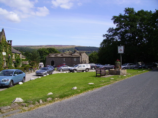
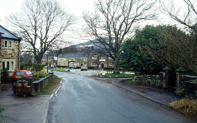
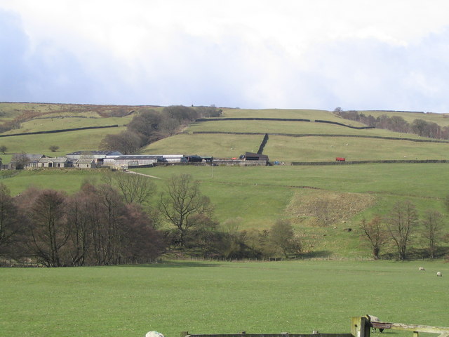
Bouthwaite is a small village located in the Nidderdale area of Yorkshire, England. Situated in the Harrogate district, it is nestled within the picturesque Nidderdale Area of Outstanding Natural Beauty.

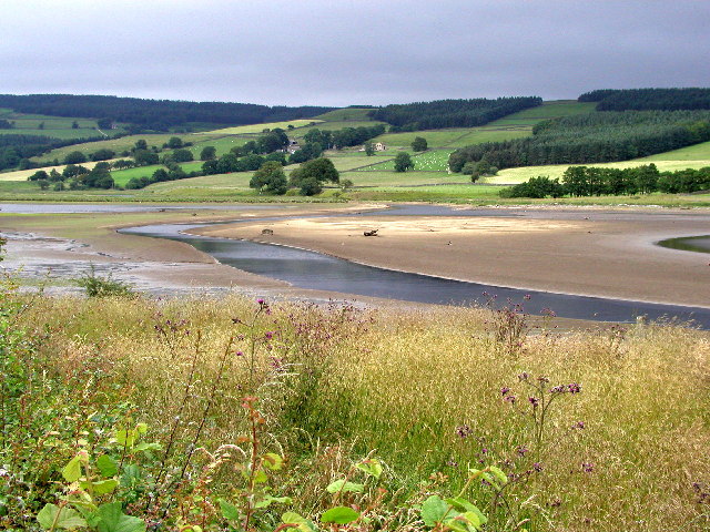
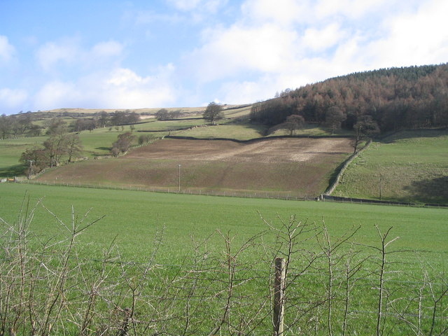
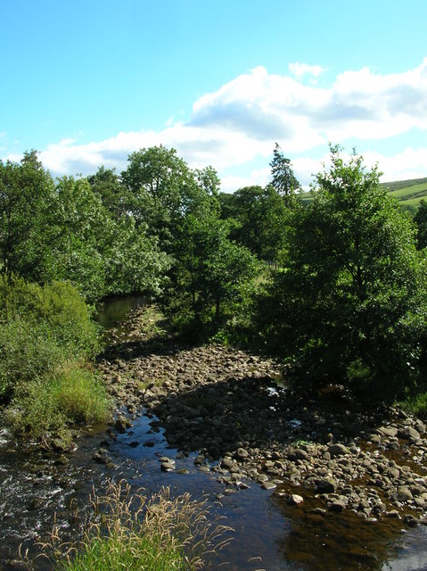
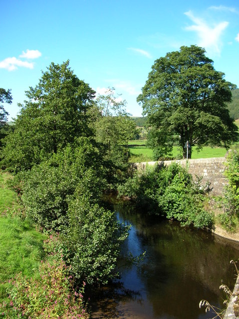
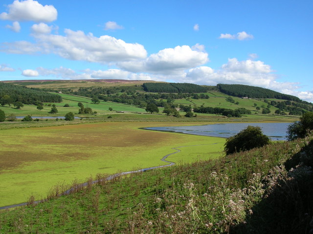
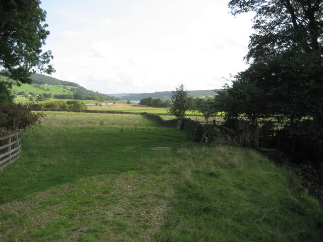
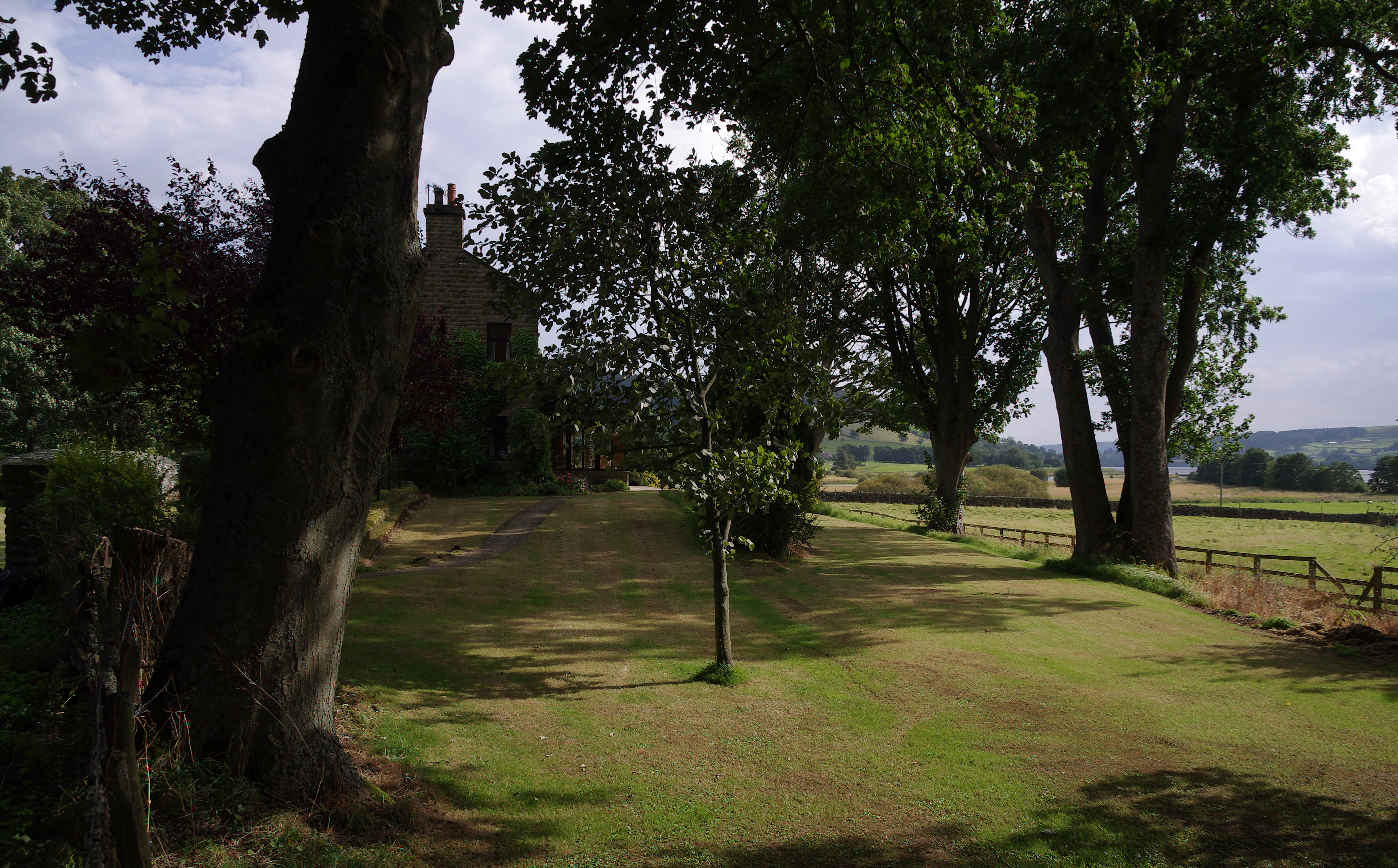
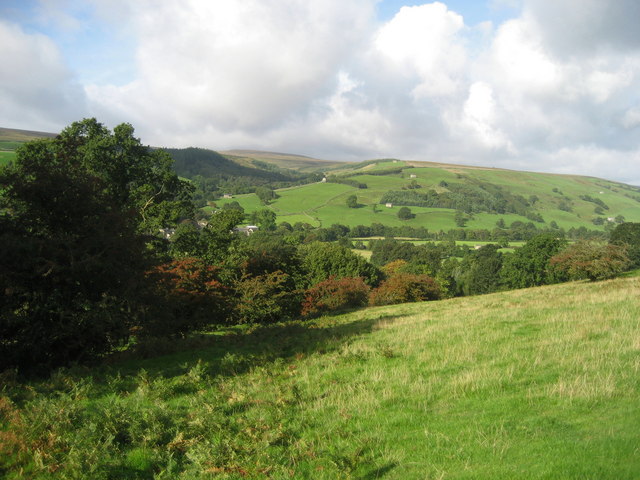
The village is surrounded by stunning countryside, with rolling hills, meandering rivers, and lush green fields. Bouthwaite is particularly known for its proximity to the River Nidd, which flows through the village, offering scenic views and recreational opportunities for residents and visitors alike.

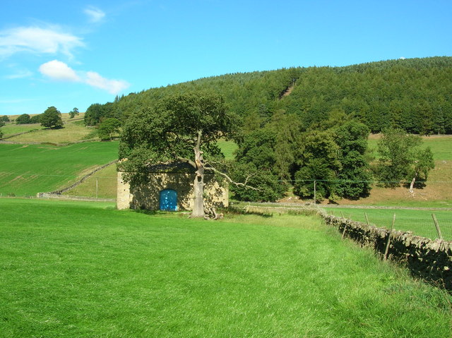
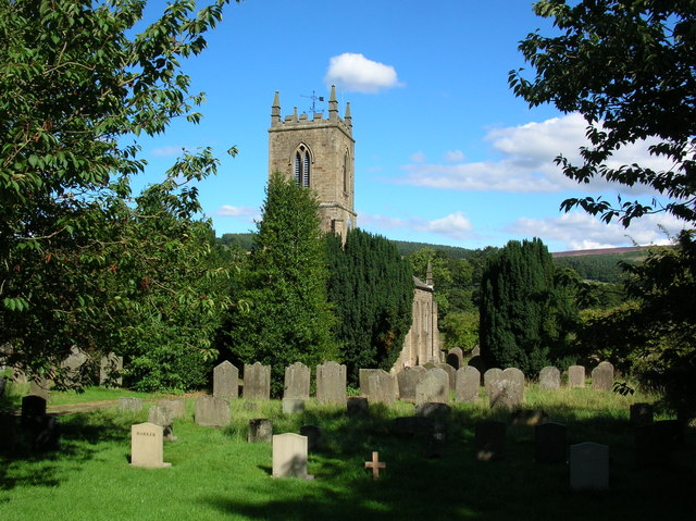
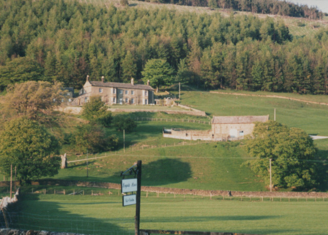
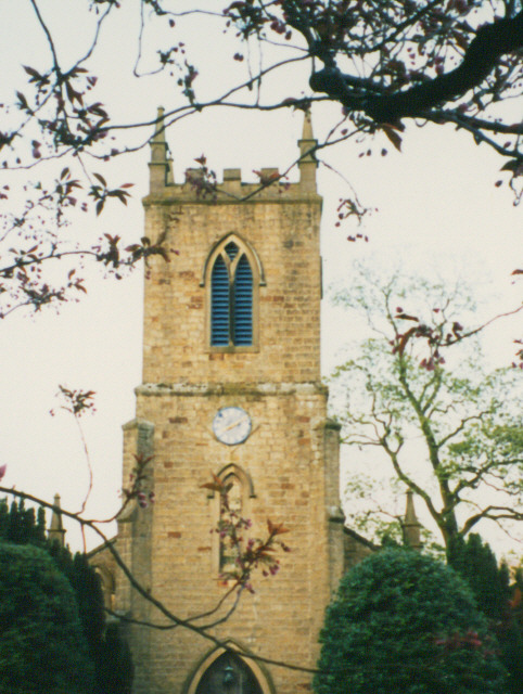
The village itself is characterized by its quaint and charming atmosphere, with a small population of friendly locals. It has a rich history, dating back to medieval times, and is home to several historic buildings, including a beautiful 17th-century church.

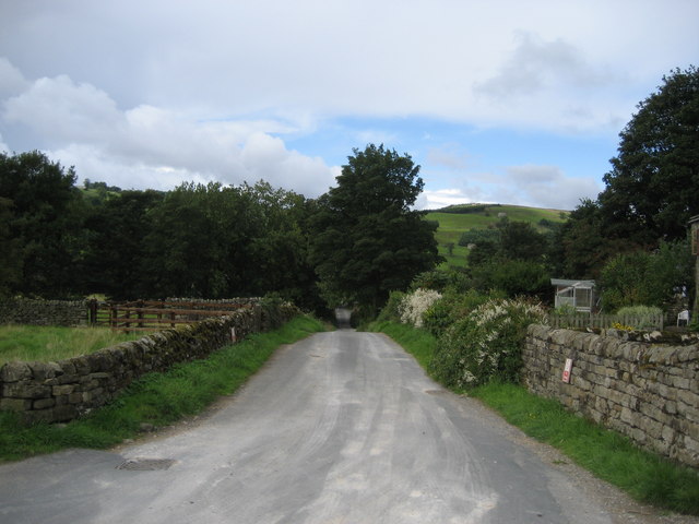
Due to its rural location, Bouthwaite is popular among nature enthusiasts and outdoor lovers. The area offers a plethora of activities, such as hiking, cycling, fishing, and birdwatching. The nearby Nidderdale Way, a long-distance footpath, provides ample opportunities for exploring the stunning landscape.

While Bouthwaite is a quiet village, it is within easy reach of larger towns and cities. Harrogate, renowned for its spa heritage and elegant architecture, is just a short drive away. Additionally, the vibrant city of Leeds and the historic city of York are both within an hour's drive, offering a range of cultural, shopping, and dining experiences.

Overall, Bouthwaite is a hidden gem in the heart of Yorkshire, offering a peaceful and idyllic setting for those seeking a rural escape amidst natural beauty.

If you have any feedback on the listing, please let us know in the comments section below.

Bouthwaite Images

Images are sourced within 2km of 54.135513/-1.813089 or Grid Reference SE1271. Thanks to Geograph Open Source API. All images are credited.

Ramsgill Right on the edge of the gridsquare. The Yorke Arms, Ramsgill.
Ramsgill
Right on the edge of the gridsquare. The Yorke Arms, Ramsgill.
Ramsgill Looking north into the centre of the village.
Ramsgill
Looking north into the centre of the village.
The head of Gouthwaite Reservoir A much depleted reservoir in July 2002.
The head of Gouthwaite Reservoir
A much depleted reservoir in July 2002.
Nidderdale Looking North East from road between Ramsgill and Lofthouse
Nidderdale
Looking North East from road between Ramsgill and Lofthouse
West House Farm Fields and Land belonging to the farm taken from entrance to farm
West House Farm
Fields and Land belonging to the farm taken from entrance to farm
River Nidd Taken from next to the entrance to West House Farm. The Nidd runs from Scar House reservoir along the Nidd Valley through Patley Bridge and Knaresborough and joins with the River Ouse at Nun Monkton. The confluence is seen here: <a href="https://www.geograph.org.uk/photo/184550">SE5157 : Nun Monkton Priory</a>.
River Nidd
Taken from next to the entrance to West House Farm. The Nidd runs from Scar House reservoir along the Nidd Valley through Patley Bridge and Knaresborough and joins with the River Ouse at Nun Monkton. The confluence is seen here: SE5157 : Nun Monkton Priory.
Barn at Longside Halfway between Ramsgill and Lofthouse.
Barn at Longside
Halfway between Ramsgill and Lofthouse.
Nidd at Ramsgill From the road bridge over the Nidd.
Nidd at Ramsgill
From the road bridge over the Nidd.
Ramsgill Church Standing at the edge of Gouthwaite reservoir.
Ramsgill Church
Standing at the edge of Gouthwaite reservoir.
Marshland at Gouthwaite The amount of visible marsh varies a lot throughout the year with the reservoir. Taken in the middle of summer the reservoir at this end is fairly low, and much land is exposed.
Marshland at Gouthwaite
The amount of visible marsh varies a lot throughout the year with the reservoir. Taken in the middle of summer the reservoir at this end is fairly low, and much land is exposed.
Bouthwaite From the end of the cul-de-sac lane looking down its length towards Ramsgill
Bouthwaite
From the end of the cul-de-sac lane looking down its length towards Ramsgill
Ramsgill/Dallowgill Highway (1) At this juncture the track is about to plunge deeply into Nidderdale from Covill House Moor
Ramsgill/Dallowgill Highway (1)
At this juncture the track is about to plunge deeply into Nidderdale from Covill House Moor
Ramsgill/Dallowgill Highway (2) At this juncture crossing Covill House Moor
Ramsgill/Dallowgill Highway (2)
At this juncture crossing Covill House Moor
Helks Wood Just passing this plantation below Fountains Earth Moor
Helks Wood
Just passing this plantation below Fountains Earth Moor
Countryside just north of Gouthwaite Reservoir Tranquil fields in Upper Nidderdale. What is interesting about this photograph is that a railway from Scar House once ran down on the left-hand side of the landscape pictured here - little evidence remains today.
Countryside just north of Gouthwaite Reservoir
Tranquil fields in Upper Nidderdale. What is interesting about this photograph is that a railway from Scar House once ran down on the left-hand side of the landscape pictured here - little evidence remains today.
Longside House Formerly the Ramsgill Youth Hostel (closed circa 1990?)
Longside House
Formerly the Ramsgill Youth Hostel (closed circa 1990?)
Tower of St Mary's church St Mary's, Ramsgill
Tower of St Mary's church
St Mary's, Ramsgill
Part of Upper Nidderdale View of this famous Yorkshire Dale from above Bouthwaite.
Part of Upper Nidderdale
View of this famous Yorkshire Dale from above Bouthwaite.
Show me another place!

Bouthwaite is located at Grid Ref: SE1271 (Lat: 54.135513, Lng: -1.813089)

Division: West Riding

Administrative County: North Yorkshire

District: Harrogate

Police Authority: North Yorkshire

What 3 Words

///bunk.alpha.spare. Near Pateley Bridge, North Yorkshire

Related Wikis

Ramsgill railway station

Ramsgill railway station was a station on the Nidd Valley Light Railway in Nidderdale in Yorkshire, England. It opened in 1907 and closed in 1930. It was...

Ramsgill

Ramsgill is a small village in Nidderdale, North Yorkshire, England, about 2 miles (3.2 km) south-east of Lofthouse, located near Gouthwaite Reservoir...

Yorke Arms

The Yorke Arms is a luxury events venue in Ramsgill, Nidderdale, in the Yorkshire Dales in northern England. The building began life as a shooting lodge...

Bouthwaite

Bouthwaite is a hamlet in the Harrogate district of North Yorkshire, England. It is situated in Nidderdale, to the north of Pateley Bridge, close to the...

Nearby Amenities

Located within 500m of 54.135513,-1.813089
Ramsgill
Alt Name: Ramsgill-in-Nidderdale
Is In Country: UK
Place: hamlet
Wikidata: Q7290282
Lat/Long: 54.1350145/-1.8191884
Telephone
Booth: K6
Covered: booth
Fee: yes
Phone: +44 1423 755241
Source: survey
Lat/Long: 54.1346787/-1.8199921
Hollin House
Place: farm
Lat/Long: 54.1350807/-1.8064957
Historic: memorial
Lat/Long: 54.1343232/-1.8192626
Post Box
Collection Times: Mo-Fr 16:45; Sa 10:30
Post Box Type: wall
Ref: HG3 154
Royal Cypher: GR
Royal Cypher Wikidata: Q33102273
Lat/Long: 54.1346897/-1.8198752
Bench
Backrest: yes
Lat/Long: 54.1345024/-1.819619
Ford: yes
Lat/Long: 54.1378448/-1.813735
Fountain
Historic: fountain
Lat/Long: 54.1344721/-1.8195909
Bus Stop
Ramsgill (The Yorkie Arms)
Bus: yes
Departures Board: timetable
Note: A timetable is attached to the telephone pole at this location for both directions. However, buses actually stop opposite the fountain about 50m SE
Public Transport: platform
Shelter: no
Lat/Long: 54.1346951/-1.8199952
Bus: yes
Note: Southbound
Public Transport: stop_position
Lat/Long: 54.1343441/-1.8195726
Bus: yes
Note: Northbound
Public Transport: stop_position
Lat/Long: 54.1345275/-1.819778
Waste Basket
Lat/Long: 54.1346507/-1.8200488
Bench
Backrest: yes
Lat/Long: 54.1345042/-1.8200997
Bench
Backrest: yes
Lat/Long: 54.1344412/-1.820058
Bench
Backrest: yes
Historic: memorial
Inscription: In loving memory of Kathleen Brown 1935-1999 from Alan and all the family
Memorial: plaque
Lat/Long: 54.1345828/-1.8200793
Generator Method: photovoltaic
Generator Output Electricity: yes
Generator Source: solar
Generator Type: solar_photovoltaic_panel
Power: generator
Lat/Long: 54.1343211/-1.8183172
Power: pole
Lat/Long: 54.1324235/-1.8095667
Power: pole
Lat/Long: 54.133048/-1.8102791
Power: pole
Lat/Long: 54.1335897/-1.8109626
Power: pole
Lat/Long: 54.1341006/-1.8115676
Power: pole
Lat/Long: 54.1346423/-1.8122144
Power: pole
Lat/Long: 54.1324128/-1.8184055
Power: pole
Lat/Long: 54.1329897/-1.8185102
Power: pole
Lat/Long: 54.1335268/-1.8182221
Power: pole
Lat/Long: 54.1342218/-1.8178948
Power: pole
Lat/Long: 54.1350351/-1.8178764
Power: pole
Lat/Long: 54.1354938/-1.8179183
Power: pole
Lat/Long: 54.1358881/-1.8181619
Power: pole
Lat/Long: 54.1361398/-1.8183164
Power: pole
Lat/Long: 54.1368425/-1.8187747
Power: pole
Lat/Long: 54.1370051/-1.8197149
Power: pole
Lat/Long: 54.134696/-1.8076995
Power: pole
Lat/Long: 54.1340991/-1.8090979
Power: pole
Lat/Long: 54.1344167/-1.8108578
Power: pole
Lat/Long: 54.1348724/-1.8136077
Power: pole
Lat/Long: 54.134831/-1.814904
Power: pole
Lat/Long: 54.134811/-1.8161873
Power: pole
Lat/Long: 54.1354908/-1.8171615
Power: pole
Lat/Long: 54.1361735/-1.8167948
Power: pole
Lat/Long: 54.136933/-1.8163811
Power: pole
Lat/Long: 54.137628/-1.8159935
Power: pole
Lat/Long: 54.1369898/-1.8150297
Power: pole
Lat/Long: 54.137605/-1.8159542
Power: pole
Lat/Long: 54.1381164/-1.8166347
Power: pole
Lat/Long: 54.1385654/-1.8172243
Power: pole
Lat/Long: 54.1380637/-1.815674
Power: pole
Lat/Long: 54.138432/-1.8148412
Power: pole
Lat/Long: 54.1388032/-1.8139638
Power: pole
Lat/Long: 54.1393049/-1.8132934
Power: pole
Lat/Long: 54.1397636/-1.8126832
Entrance: yes
Lat/Long: 54.1342805/-1.8196293
Defibrillator
Access: yes
Defibrillator Location: in open porch of Ramsgill Village Hall
Emergency: defibrillator
Indoor: no
Lat/Long: 54.1342908/-1.819641
The data included in this document is from www.openstreetmap.org. The data is made available under ODbL.

Have you been to Bouthwaite?

Leave your review of Bouthwaite below (or comments, questions and feedback).