Trefin

Settlement in Pembrokeshire

Wales

Trefin

Carreg Sampson A Neolithic burial chamber or cromlech. The capstone lies on three of the six uprights and is approximately 6m by 3m in size.
Carreg Sampson Credit: E Gammie

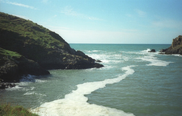
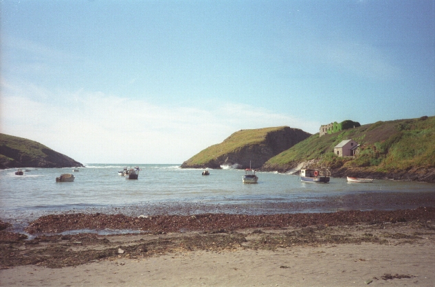
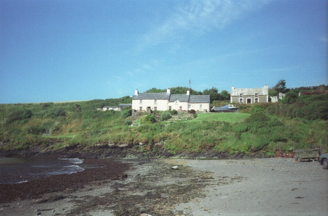
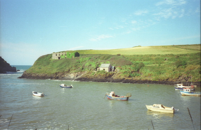
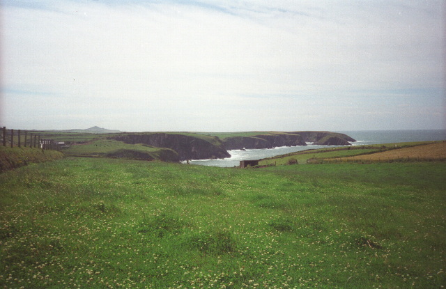
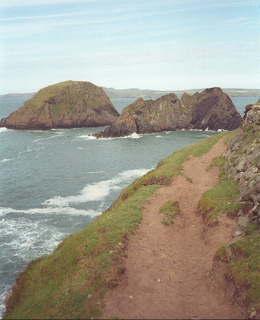
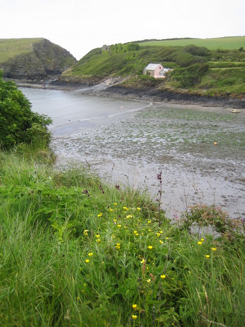
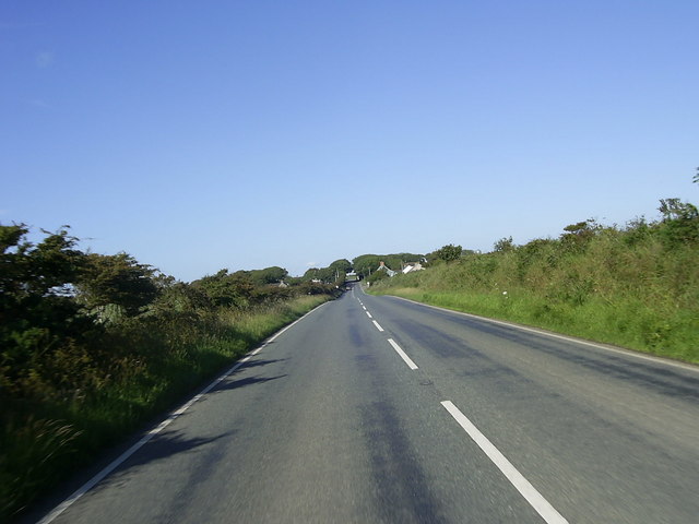
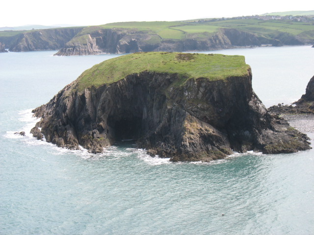
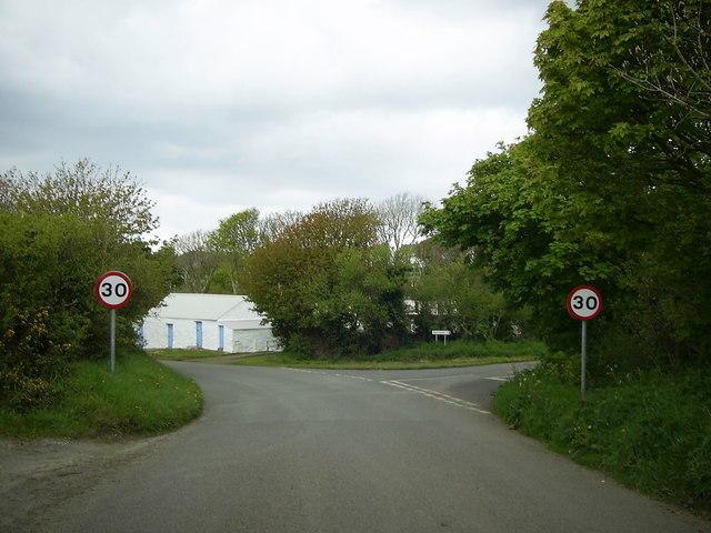
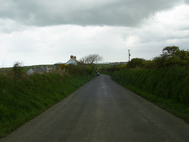
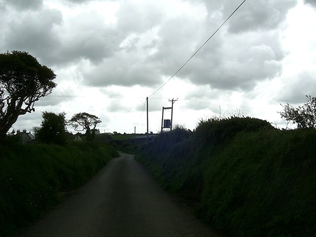
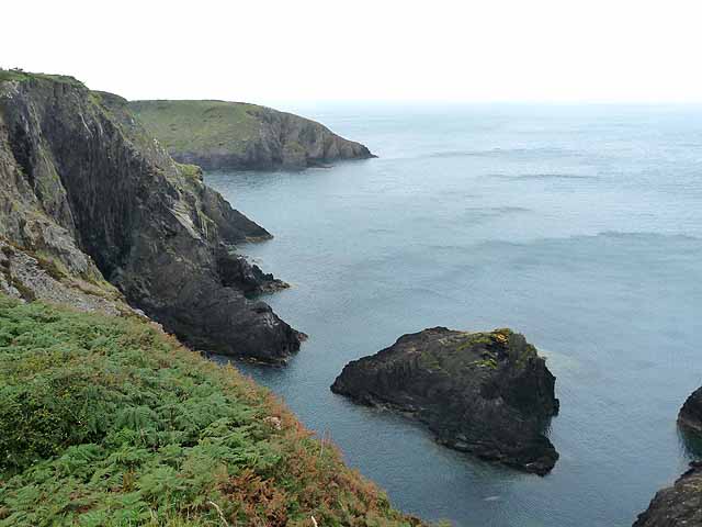
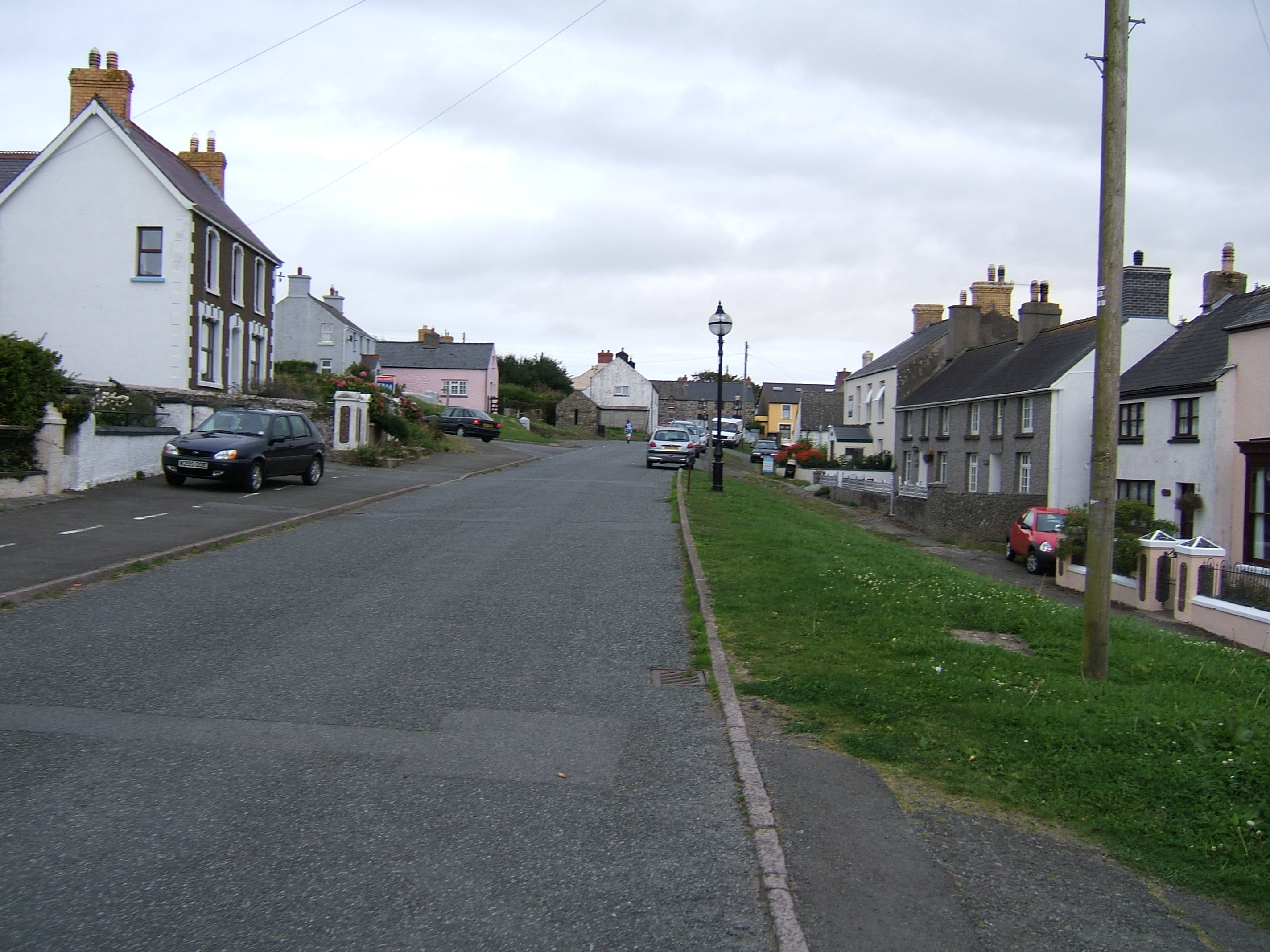
Trefin is a small coastal village located in Pembrokeshire, Wales. Situated along the rugged coastline of St. Davids Peninsula, Trefin is known for its stunning views of the Irish Sea and its picturesque landscape. The village is surrounded by rolling green hills and cliffs, making it a popular destination for hikers and outdoor enthusiasts.

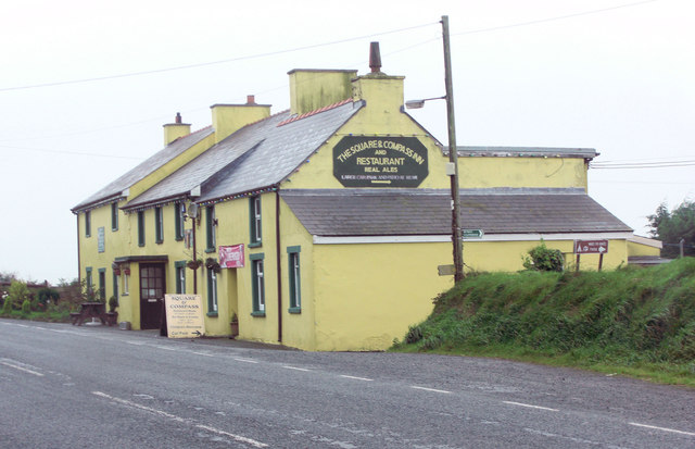
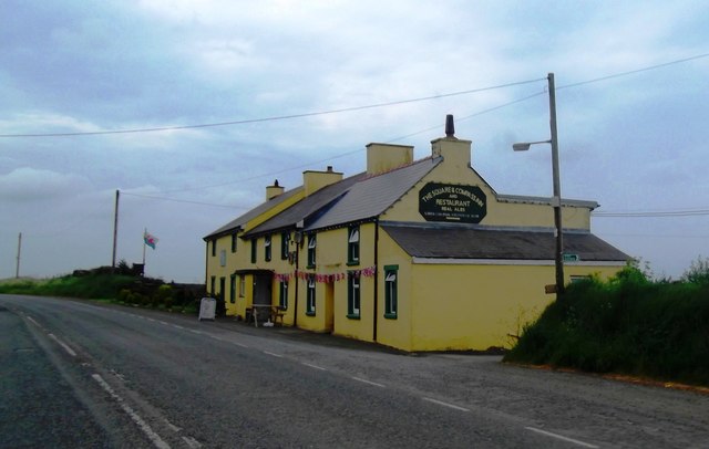
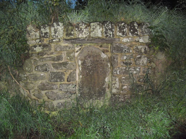
Trefin has a population of around 300 residents and is a tight-knit community with a strong sense of local pride. The village is home to a few amenities, including a traditional pub, a café, and a small art gallery. Trefin also has a rich history, with remnants of ancient settlements and prehistoric sites scattered throughout the area.

The village is a popular spot for tourists looking to explore the nearby Pembrokeshire Coast National Park, which offers a variety of walking trails and opportunities to spot wildlife such as seals and seabirds. Trefin is also known for its sandy beaches and clear waters, making it a great spot for swimming, surfing, and other water activities. Overall, Trefin is a charming coastal village that offers a peaceful retreat for visitors looking to experience the beauty of the Welsh countryside.

If you have any feedback on the listing, please let us know in the comments section below.

Trefin Images

Images are sourced within 2km of 51.948011/-5.147852 or Grid Reference SM8332. Thanks to Geograph Open Source API. All images are credited.

Carreg Sampson A Neolithic burial chamber or cromlech. The capstone lies on three of the six uprights and is approximately 6m by 3m in size.
Carreg Sampson
A Neolithic burial chamber or cromlech. The capstone lies on three of the six uprights and is approximately 6m by 3m in size.
Entrance to the bay Choppy waters at the entrance to the narrow sheltered bay of Abercastle.

See <a title="https://www.geograph.org.uk/photo/2018024" href="https://www.geograph.org.uk/photo/2018024">Link</a> for a comparative view (2010) at a lower tide level.
Entrance to the bay
Choppy waters at the entrance to the narrow sheltered bay of Abercastle. See Link for a comparative view (2010) at a lower tide level.
Aber Castle Boats moored in the narrow bay of Aber Castle with Ynys y Castell on the right, at the mouth of the bay.
Aber Castle
Boats moored in the narrow bay of Aber Castle with Ynys y Castell on the right, at the mouth of the bay.
Cottages by the bay Cottages on the north side of the head of the bay at Abercastle.
Cottages by the bay
Cottages on the north side of the head of the bay at Abercastle.
Boats in the bay Boats moored in Aber Castle with Ynys y Castell to the left, viewed from the Pembrokeshire Coast path.
Boats in the bay
Boats moored in Aber Castle with Ynys y Castell to the left, viewed from the Pembrokeshire Coast path.
Fields near Trefin Looking westward across Aber Draw from the footpath joining Trefin with the coast path.
Fields near Trefin
Looking westward across Aber Draw from the footpath joining Trefin with the coast path.
Ynys Deullyn Ynys Deullyn from the Pembrokeshire Coast path, a short section of which can be seen in the foreground.
Ynys Deullyn
Ynys Deullyn from the Pembrokeshire Coast path, a short section of which can be seen in the foreground.
Abercastle
Abercastle
Carreg Samson
Carreg Samson
A487 near Croes-Goch Looking towards Mesur-y-dorth.
A487 near Croes-Goch
Looking towards Mesur-y-dorth.
Ynys-fach from the west A small tidal island well seen from the Pembrokeshire Coast Path.
Ynys-fach from the west
A small tidal island well seen from the Pembrokeshire Coast Path.
The Square and Compass
The Square & Compass Inn
Mesur y Dorth / Measure of the Loaf Stone Cross An early Christian marker stone inscribed with a cross inside a circle. Tradition has it that St David decreed that in times of poverty the maximum size of a loaf of bread should not exceed the circumference of the circle. Another legend has this as the final refreshment stop for pilgrims heading to the cathedral 6 miles further on.
Mesur y Dorth / Measure of the Loaf Stone Cross
An early Christian marker stone inscribed with a cross inside a circle. Tradition has it that St David decreed that in times of poverty the maximum size of a loaf of bread should not exceed the circumference of the circle. Another legend has this as the final refreshment stop for pilgrims heading to the cathedral 6 miles further on.
Minor road junction near Trefin The road to the right goes to Abercastle. The road straight ahead leads to Trefin.
Minor road junction near Trefin
The road to the right goes to Abercastle. The road straight ahead leads to Trefin.
Minor road to Trefin This short stretch of road near Awel-For heading for Trefin, is just within the relevant grid square.
Minor road to Trefin
This short stretch of road near Awel-For heading for Trefin, is just within the relevant grid square.
Bend in the road  near Llanon A view of a bend in the country road heading for Llanon Farm from Llanrhian, taken under a gloomy overcast sky.
Bend in the road near Llanon
A view of a bend in the country road heading for Llanon Farm from Llanrhian, taken under a gloomy overcast sky.
Sea cliffs and stacks On the Pembrokeshire coast, between Porthgain and Trefin.
Sea cliffs and stacks
On the Pembrokeshire coast, between Porthgain and Trefin.
Show me another place!

Trefin is located at Grid Ref: SM8332 (Lat: 51.948011, Lng: -5.147852)

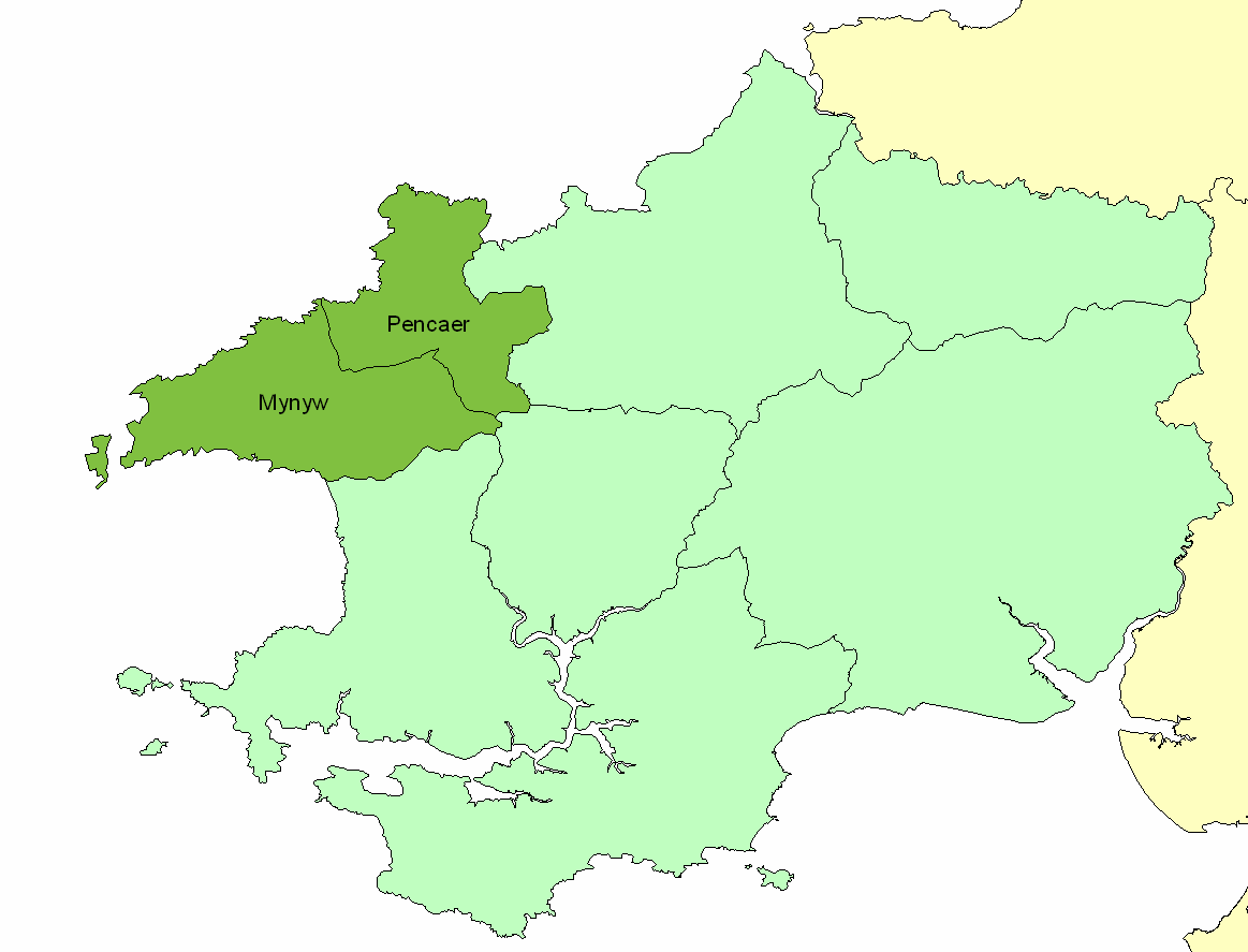
Unitary Authority: Pembrokeshire

Police Authority: Dyfed Powys

Also known as: Tre-fin, Trevine

What 3 Words

///strike.blunders.skips. Near Llanrhian, Pembrokeshire

Related Wikis

Trefin

Trefin (Welsh standardised:Tre-fin), formerly anglicised as Trevine, is a village in North Pembrokeshire, south-west Wales. The village lies within the...

Dewisland

The Hundred of Dewisland (often written "Dewsland") was a hundred in northwest Pembrokeshire, Wales. Formerly the pre-Norman cantref of Pebidiog, it included...

Penparc, Pembrokeshire

Penparc is a village in the community of Llanrhian, Pembrokeshire, Wales. Located near Trefin and Croesgoch, the village also includes the settlement of...
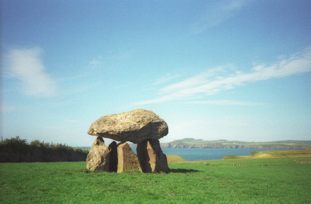
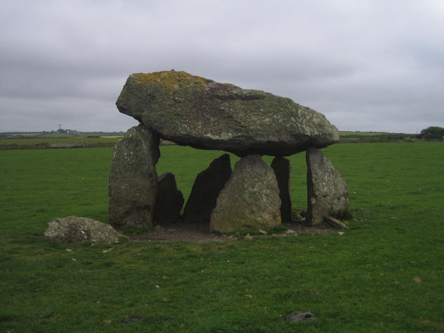
Carreg Samson

Carreg Samson (also known as Carreg Sampson, Samson's Stone, or the Longhouse) is a 5000-year-old Neolithic dolmen located half a mile west of Abercastle...

Nearby Amenities

Located within 500m of 51.948011,-5.147852
Trefin
Name En: Trevine
Place: village
Wikidata: Q7837785
Lat/Long: 51.9490256/-5.1448468
The Old School Hostel
Addr City: Trefin
Addr Postcode: SA62 5AU
Phone: +44 1348 831 800
Tourism: hostel
Website: https://www.oldschoolhostel.com/
Lat/Long: 51.9487975/-5.1442165
Barrier: stile
Foot: yes
Lat/Long: 51.9458296/-5.1469092
Barrier: stile
Foot: yes
Lat/Long: 51.9476235/-5.1465005
Barrier: stile
Foot: yes
Lat/Long: 51.9465127/-5.1529311
Power: pole
Source: Bing
Lat/Long: 51.9468243/-5.1541193
Power: pole
Source: Bing
Lat/Long: 51.9473065/-5.1507907
Power: pole
Source: Bing
Lat/Long: 51.9472031/-5.151426
Power: pole
Source: Bing
Lat/Long: 51.9477005/-5.1483716
Post Box
Post Box Type: lamp
Lat/Long: 51.9489575/-5.1454979
Recycling
Lat/Long: 51.9485676/-5.1486768
Public Bookcase
Booth: KX300
Disused Amenity: telephone
Man Made: telephone_box
Public Bookcase Type: phone_box
Lat/Long: 51.9489554/-5.1455536
Bus Stop
Trefin Square
Bench: yes
Bin: yes
Lit: no
Shelter: yes
Tactile Paving: no
Lat/Long: 51.9490518/-5.1456171
Melin Trefin Mill
Historic: ruins
Lat/Long: 51.9482416/-5.1528472
Direction: SSE
Generator Method: photovoltaic
Generator Output Electricity: yes
Generator Solar Modules: 1
Generator Source: solar
Generator Type: solar_photovoltaic_panel
Location: roof
Power: generator
Lat/Long: 51.9488726/-5.1444253
Direction: SSE
Generator Method: photovoltaic
Generator Output Electricity: yes
Generator Solar Modules: 3
Generator Source: solar
Generator Type: solar_photovoltaic_panel
Location: roof
Power: generator
Lat/Long: 51.9489144/-5.1442804
Direction: SSE
Generator Method: photovoltaic
Generator Output Electricity: yes
Generator Solar Modules: 1
Generator Source: solar
Generator Type: solar_photovoltaic_panel
Location: roof
Power: generator
Lat/Long: 51.9488952/-5.1443498
Direction: 165
Generator Method: photovoltaic
Generator Output Electricity: yes
Generator Solar Modules: 10
Generator Source: solar
Generator Type: solar_photovoltaic_panel
Location: roof
Power: generator
Lat/Long: 51.9502117/-5.1445279
Parking
Lat/Long: 51.9480904/-5.1522164
Power: pole
Transformer: distribution
Lat/Long: 51.9473087/-5.1490045
Power: pole
Lat/Long: 51.9483386/-5.1474917
Power: pole
Lat/Long: 51.9482122/-5.1462995
Power: pole
Transformer: distribution
Lat/Long: 51.9480849/-5.1451032
Power: pole
Lat/Long: 51.9477079/-5.144147
Power: pole
Transformer: distribution
Lat/Long: 51.947026/-5.1431438
Power: pole
Lat/Long: 51.9467085/-5.1416928
Power: pole
Transformer: distribution
Lat/Long: 51.9476575/-5.1545379
Power: pole
Lat/Long: 51.9459348/-5.1537251
The data included in this document is from www.openstreetmap.org. The data is made available under ODbL.

Have you been to Trefin?

Leave your review of Trefin below (or comments, questions and feedback).