Totley Brook

Settlement in Derbyshire

England

Totley Brook

Looking towards Owler Bar From top of Totley Lane, Bradway
Looking towards Owler Bar Credit: Chris Morgan

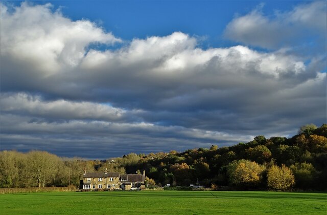
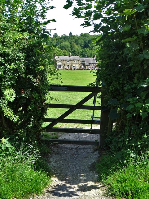
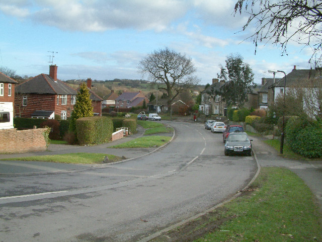
Totley Brook is a small village located in the county of Derbyshire, England. Situated on the outskirts of Sheffield, it lies within the district of the Peak District National Park, making it an ideal destination for nature enthusiasts and outdoor activities.

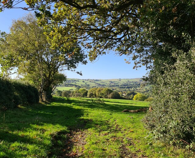
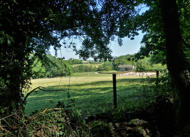
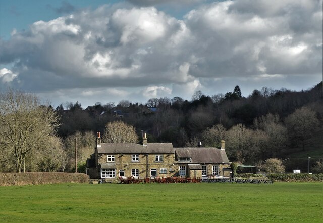
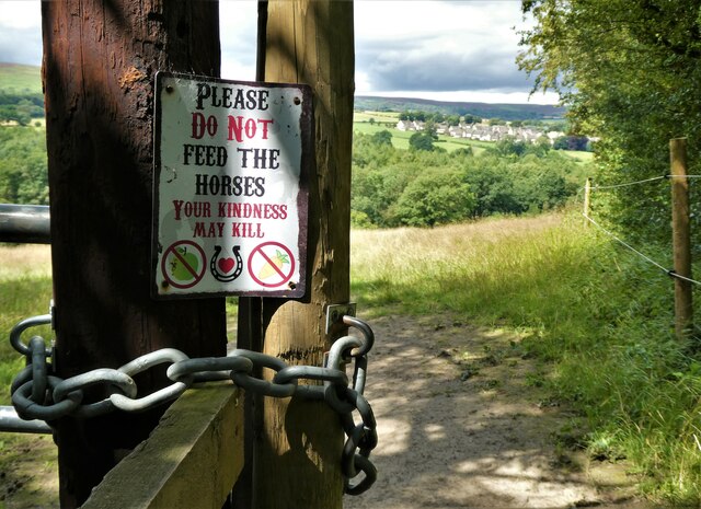
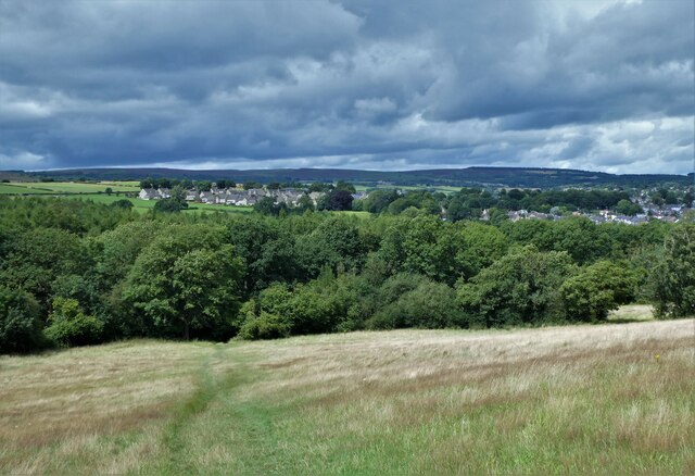
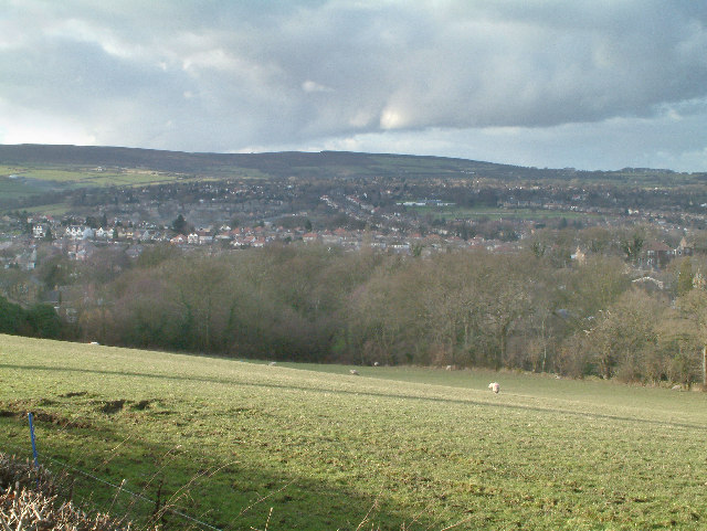
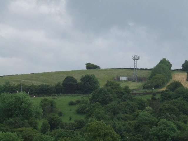
The village is nestled in a picturesque valley, surrounded by rolling hills and lush green countryside. Totley Brook itself is a small stream that flows through the village, adding to its charm and tranquility. The brook is known for its crystal-clear waters and is a popular spot for fishing and picnicking.

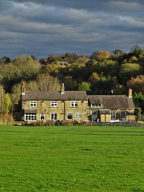
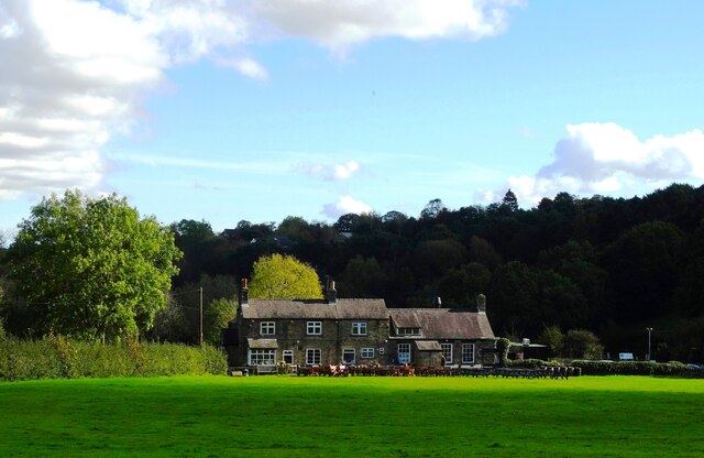
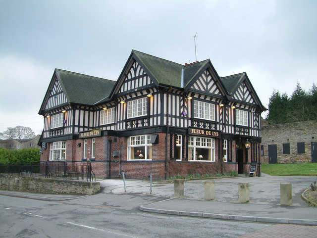
Totley Brook offers a range of amenities for its residents and visitors. There is a small local shop that caters to daily needs, as well as a village hall that hosts community events and gatherings. The village is also home to a primary school, providing education for the local children.

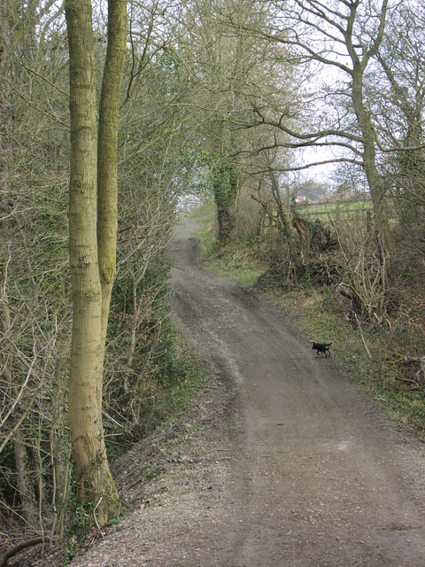
For those seeking outdoor adventure, Totley Brook is a gateway to the stunning natural beauty of the Peak District. The surrounding area offers numerous walking and cycling trails, providing opportunities to explore the countryside and enjoy breathtaking views. The nearby moorland and woodland areas are also popular for birdwatching and wildlife spotting.

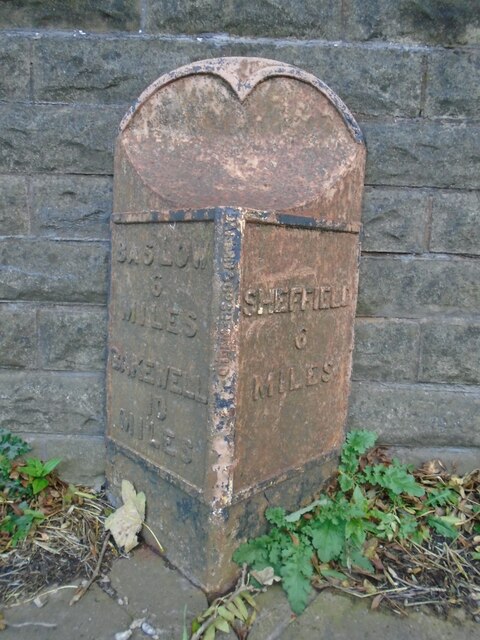
In terms of transportation, Totley Brook is well-connected to the rest of the region. The village has regular bus services, and the nearby Sheffield train station provides easy access to other major cities in the UK.

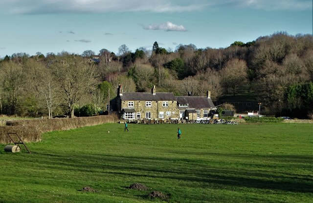
Overall, Totley Brook is a charming village that offers a peaceful retreat amidst the stunning landscapes of Derbyshire. Whether you are seeking outdoor activities or simply looking to relax and enjoy the natural beauty, Totley Brook has something to offer for everyone.

If you have any feedback on the listing, please let us know in the comments section below.

Totley Brook Images

Images are sourced within 2km of 53.319241/-1.533103 or Grid Reference SK3180. Thanks to Geograph Open Source API. All images are credited.

Looking towards Owler Bar From top of Totley Lane, Bradway
Looking towards Owler Bar
From top of Totley Lane, Bradway
Beneath November clouds at Totley Bents Another view of "The Cricket Inn".
Beneath November clouds at Totley Bents
Another view of "The Cricket Inn".
"The Cricket Inn"  in  Totley Bents On the edge of the city of Sheffield.
"The Cricket Inn" in Totley Bents
On the edge of the city of Sheffield.
"The Cricket Inn", Totley Bents in early springtime Two brothers, still in school uniform, are playing football on the playing-field.
"The Cricket Inn", Totley Bents in early springtime
Two brothers, still in school uniform, are playing football on the playing-field.
Gate to Totley Bents Recreation Ground With "The Cricket Inn" at the other side of the field.
Gate to Totley Bents Recreation Ground
With "The Cricket Inn" at the other side of the field.
A view of Owler Lee Farm Seen from Fanshawe Gate Lane
A view of Owler Lee Farm
Seen from Fanshawe Gate Lane
"The Cricket Inn" at Totley Bents
Old milepost On the A621, Baslow Road, Totley this milepost becomes more and more neglected.   It is in a very vulnerable position opposite houses that often have parked cars making the road narrower.   The foundry name is down the front spine DARWIN & CO SHEFFIELD.   Their name is also seen on gully grates and doubtless they cast other products.   There was a Sheffield, Baslow, Owler Bar turnpike that lasted from 1803 to 1880 so this post may date from the middle to late 19C.
Old milepost
On the A621, Baslow Road, Totley this milepost becomes more and more neglected. It is in a very vulnerable position opposite houses that often have parked cars making the road narrower. The foundry name is down the front spine DARWIN & CO SHEFFIELD. Their name is also seen on gully grates and doubtless they cast other products. There was a Sheffield, Baslow, Owler Bar turnpike that lasted from 1803 to 1880 so this post may date from the middle to late 19C.
Looking back to Gillifield Wood and Totley From the edge of Woodthorpe Hall grounds
Looking back to Gillifield Wood and Totley
From the edge of Woodthorpe Hall grounds
Gillifield Wood and Totley In the southern suburbs of Sheffield
Gillifield Wood and Totley
In the southern suburbs of Sheffield
Yet another image of "The Cricket Inn" Viewed across the recreation ground at Totley Bents
Yet another image of "The Cricket Inn"
Viewed across the recreation ground at Totley Bents
Mickley Lane. This shows the New Totley end of the road which runs through to Mickley.
Mickley Lane.
This shows the New Totley end of the road which runs through to Mickley.
View from Mickley Lane. A view looking out to Totley Rise and beyond from the road running between New Totley and Mickley.
View from Mickley Lane.
A view looking out to Totley Rise and beyond from the road running between New Totley and Mickley.
Fleur De Lys public house. Located on Totley Hall Lane in the Totley area of Sheffield.
Fleur De Lys public house.
Located on Totley Hall Lane in the Totley area of Sheffield.
Woodthorpe Hall.
Woodthorpe Hall.
Phone Mast at Totley
The White Lane, Totley This track runs from Woodthorpe Hall to Mickley Lane in Totley. Here a tributary of the Totley Brook is culverted and marks the boundary between Derbyshire and Yorkshire.
The White Lane, Totley
This track runs from Woodthorpe Hall to Mickley Lane in Totley. Here a tributary of the Totley Brook is culverted and marks the boundary between Derbyshire and Yorkshire.
Holmesfield Park Wood - Easy Access Trail
Show me another place!

Totley Brook is located at Grid Ref: SK3180 (Lat: 53.319241, Lng: -1.533103)

Unitary Authority: Sheffield

Police Authority: South Yorkshire

What 3 Words

///code.icon.export. Near Dronfield, Derbyshire

Related Wikis

Old Hay Brook

The Old Hay Brook is a small river in Sheffield, South Yorkshire, England. It is formed from the Redcar Brook, Blacka Dike and another stream, which rise...

Totley Brook

The Totley Brook is a stream in Sheffield, South Yorkshire, England. It rises on a millstone grit ridge some 7 miles (11 km) to the south-west of the centre...

King Ecgbert School

King Ecgbert School is a co-educational secondary school with academy status (age range 11–18) in the village of Dore in the south-west of Sheffield, South...

Dore and Totley

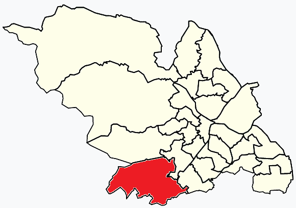
Dore and Totley ward—which includes the districts of Bradway , Dore, Totley, and Whirlow—is one of the 28 electoral wards in City of Sheffield, England...

Dore, South Yorkshire

Dore is a large village in South Yorkshire, England. The village lies on a hill above the River Sheaf which gave Sheffield its name and, until 1934, was...

Totley

Totley is a suburb on the extreme southwest of the City of Sheffield, in South Yorkshire, England. Lying in the historic county boundaries of Derbyshire...

Abbeydale Park

Abbeydale Park is a sports venue in Dore, South Yorkshire, England. It is unusual in having hosted home games for two different county cricket teams....

Dore & Totley railway station

Dore & Totley railway station serves the south-western Sheffield suburbs of Dore and Totley in South Yorkshire, England 4+3⁄4 miles (7.6 km) south of Sheffield...

Nearby Amenities

Located within 500m of 53.319241,-1.533103
Turning Circle
Lat/Long: 53.323312/-1.5321162
Turning Circle
Lat/Long: 53.3219147/-1.530201
Totley Tunnel East
Railway: junction
Lat/Long: 53.3190113/-1.529875
Totley Brook Road/Totley Brook
Bus: yes
Public Transport: stop_position
Lat/Long: 53.3186654/-1.5336561
Turning Circle
Lat/Long: 53.3198014/-1.5342301
Turning Circle
Lat/Long: 53.3211363/-1.5387952
Turning Circle
Lat/Long: 53.3204442/-1.540213
Turning Circle
Lat/Long: 53.3199631/-1.5389463
Turning Circle
Lat/Long: 53.31945/-1.5381675
Turning Circle
Lat/Long: 53.3187986/-1.5395106
Bus Stop
Totley Brook Road (adj)
Bus: yes
Public Transport: platform
Lat/Long: 53.3226041/-1.5374674
Post Box
Collection Times: Mo-Fr 09:00; Sa 07:00
Post Box Type: pillar
Postal Code: S17
Ref: S17 671
Royal Cypher: GVIR
Royal Cypher Wikidata: Q33102169
Lat/Long: 53.3226711/-1.537366
Power: substation
Lat/Long: 53.3186877/-1.5332461
Post Box
Collection Times: Mo-Fr 09:00; Sa 07:00
Post Box Type: wall
Ref: S17 185D
Royal Cypher: GR
Royal Cypher Wikidata: Q33102273
Lat/Long: 53.3192407/-1.5297634
Power: substation
Lat/Long: 53.3197647/-1.5276414
Place Of Worship
Dore & Totley United Reformed Church
Religion: christian
Lat/Long: 53.3204348/-1.526332
Barrier: bollard
Lat/Long: 53.3161575/-1.528684
Turning Circle
Lat/Long: 53.3172785/-1.5346156
Bus Stop
Baslow Road/Grove Road
Bus: yes
Naptan AtcoCode: 370020450
Naptan Bearing: N
Naptan CommonName: Baslow Road/Grove Road
Naptan Indicator: 20450
Naptan Landmark: 20450
Naptan PlusbusZoneRef: ROTHCEN
Naptan Street: Baslow Road
Naptan Verified: no
Public Transport: platform
Source: naptan_import
Lat/Long: 53.3190902/-1.5256545
Bus Stop
Baslow Road/Marstone Crescent
Bus: yes
Naptan AtcoCode: 370020453
Naptan Bearing: NE
Naptan CommonName: Baslow Road/Marstone Crescent
Naptan Indicator: 20453
Naptan Landmark: 20453
Naptan PlusbusZoneRef: ROTHCEN
Naptan Street: Baslow Road
Naptan Verified: no
Public Transport: platform
Source: naptan_import
Lat/Long: 53.3164574/-1.5282141
Bus Stop
Totley Brook Road/King Ecgbert Road
Bus: yes
Covered: yes
Naptan AtcoCode: 370020456
Naptan Bearing: N
Naptan CommonName: Totley Brook Road/King Ecgbert Road
Naptan Indicator: 20456
Naptan Landmark: Outside Sherwood Chase/Flats
Naptan PlusbusZoneRef: ROTHCEN
Naptan Street: Totley Brook Road
Naptan Verified: no
Public Transport: platform
Shelter: yes
Source: naptan_import
Lat/Long: 53.3195954/-1.5287399
Bus Stop
Totley Brook Road/Totley Brook
Alt Name: Totley Brook Road/Totley Brook
Bus: yes
Naptan AltCommonName: Totley Brook Road/Totley Brook
Naptan AtcoCode: 370020457
Naptan Bearing: E
Naptan CommonName: Totley Brook Road/Totley Brook
Naptan Indicator: 20457
Naptan Landmark: TOTLEY BROOK
Naptan PlusbusZoneRef: ROTHCEN
Naptan Street: Totley Brook Road
Naptan Verified: no
Public Transport: platform
Source: naptan_import
Lat/Long: 53.3187183/-1.5336474
Bus Stop
King Ecgbert Road/Totley Brook Road
Bus: yes
Naptan AtcoCode: 370020458
Naptan Bearing: W
Naptan CommonName: King Ecgbert Road/Totley Brook Road
Naptan Indicator: 20458
Naptan Landmark: 20458
Naptan PlusbusZoneRef: ROTHCEN
Naptan Street: King Ecbert Road
Naptan Verified: no
Public Transport: platform
Source: naptan_import
Lat/Long: 53.3199627/-1.5288038
Bus Stop
Furniss Avenue/Durvale Court
Alt Name: Furniss Avenue/Durvale Court
Bus: yes
Naptan AltCommonName: Furniss Avenue/Durvale Court
Naptan AtcoCode: 370020459
Naptan Bearing: N
Naptan CommonName: Furniss Avenue/Durvale Court
Naptan Indicator: 20459
Naptan Landmark: 20459
Naptan PlusbusZoneRef: ROTHCEN
Naptan Street: Furniss Avenue
Naptan Verified: no
Public Transport: platform
Source: naptan_import
Lat/Long: 53.3209809/-1.5339092
Bus Stop
Totley Brook, nr King Ecgbert Road
Alt Name: Furniss Avenue/Totley Brook Road
Bus: yes
Naptan AltCommonName: Furniss Avenue/Totley Brook Road
Naptan AtcoCode: 370020461
Naptan Bearing: NW
Naptan CommonName: Furniss Avenue/Totley Brook Road
Naptan Indicator: 20461
Naptan Landmark: Opposite School
Naptan PlusbusZoneRef: ROTHCEN
Naptan Street: Furniss Avenue
Naptan Verified: no
Public Transport: platform
Source: naptan_import
Lat/Long: 53.3219149/-1.5360008
Bus Stop
Baslow Road/The Crescent
Alt Name: Baslow Road/The Crescent
Bus: yes
Naptan AltCommonName: Baslow Road/The Crescent
Naptan AtcoCode: 370020462
Naptan Bearing: NE
Naptan CommonName: Baslow Road/The Crescent
Naptan Indicator: 20462
Naptan Landmark: 20462
Naptan PlusbusZoneRef: ROTHCEN
Naptan Street: Baslow Road
Naptan Verified: no
Public Transport: platform
Source: naptan_import
Lat/Long: 53.3159855/-1.5323002
Bus Stop
Totley Brook Road/King Ecgbert School
Bus: yes
Naptan AtcoCode: 370020464
Naptan Bearing: SW
Naptan CommonName: Totley Brook Road/King Ecgbert School
Naptan Indicator: 20464
Naptan Landmark: BUS LAYBY/SCHOOL
Naptan PlusbusZoneRef: ROTHCEN
Naptan Street: Totley Brook Road
Naptan Verified: no
Public Transport: platform
Source: naptan_import
Lat/Long: 53.3215149/-1.5394731
Bus Stop
Totley Brook Road/Wessex Gardens
Bus: yes
Naptan AtcoCode: 370020465
Naptan Bearing: N
Naptan CommonName: Totley Brook Road/Wessex Gardens
Naptan Indicator: 20465
Naptan Landmark: POLICE SUB STATION
Naptan PlusbusZoneRef: ROTHCEN
Naptan Street: Totley Brook Road
Naptan Verified: no
Public Transport: platform
Source: naptan_import
Lat/Long: 53.319206/-1.5390296
Bus Stop
Baslow Road/Laverdene Road
Alt Name: Baslow Road/Laverdene Road
Bus: yes
Naptan AltCommonName: Baslow Road/Laverdene Road
Naptan AtcoCode: 370023681
Naptan Bearing: SW
Naptan CommonName: Baslow Road/Laverdene Road
Naptan Indicator: 23681
Naptan Landmark: 23681
Naptan PlusbusZoneRef: ROTHCEN
Naptan Street: Baslow Road
Naptan Verified: no
Public Transport: platform
Source: naptan_import
Lat/Long: 53.3162891/-1.5281782
Bus Stop
Baslow Road/Main Avenue
Bench: yes
Bus: yes
Naptan AtcoCode: 370021981
Naptan Bearing: NE
Naptan CommonName: Baslow Road/Main Avenue
Naptan Indicator: 21981
Naptan Landmark: 21981
Naptan PlusbusZoneRef: ROTHCEN
Naptan Street: Baslow Road
Naptan Verified: no
Public Transport: platform
Shelter: yes
Source: naptan_import
Tactile Paving: yes
Lat/Long: 53.3149482/-1.5353447
Bus Stop
Baslow Road/Mickley Lane
Bus: yes
Naptan AtcoCode: 370021983
Naptan Bearing: SW
Naptan CommonName: Baslow Road/Mickley Lane
Naptan Indicator: 21983
Naptan Landmark: Parade of Shops
Naptan PlusbusZoneRef: ROTHCEN
Naptan Street: Baslow Road
Naptan Verified: no
Public Transport: platform
Source: naptan_import
Lat/Long: 53.3158038/-1.5320925
Railway: buffer_stop
Lat/Long: 53.3200435/-1.5257104
Baslow Road/The Crescent
Bus: yes
Public Transport: stop_position
Lat/Long: 53.3159287/-1.532262
Baslow Road/Marstone Crescent
Bus: yes
Public Transport: stop_position
Lat/Long: 53.3164164/-1.5281989
Baslow Road/Laverdene Road
Bus: yes
Public Transport: stop_position
Lat/Long: 53.316329/-1.5281968
Baslow Road/Mickley Lane
Bus: yes
Public Transport: stop_position
Lat/Long: 53.3158613/-1.5321228
Turning Circle
Lat/Long: 53.322035/-1.5339688
New Totley
Place: neighbourhood
Lat/Long: 53.3158454/-1.531771
Turning Circle
Lat/Long: 53.3227119/-1.5306475
Turning Circle
Lat/Long: 53.3224579/-1.5296505
Telephone
Booth: KXPlus
Covered: booth
Operator: British Telecom
Lat/Long: 53.3157894/-1.5320409
Totley Brook
Place: neighbourhood
Lat/Long: 53.321363/-1.5334446
Turning Circle
Lat/Long: 53.3221646/-1.5353701
Totley Tunnel East
Railway: junction
Lat/Long: 53.3190411/-1.5298985
Turning Circle
Lat/Long: 53.318917/-1.535303
Turning Circle
Lat/Long: 53.320226/-1.5344259
Turning Circle
Lat/Long: 53.3191956/-1.540378
Turning Circle
Lat/Long: 53.3217964/-1.5391305
Turning Circle
Lat/Long: 53.3218717/-1.5336641
Turning Circle
Lat/Long: 53.3229458/-1.5300341
Turning Circle
Lat/Long: 53.3228657/-1.5314763
Post Box
Collection Times: Mo-Fr 09:00; Sa 07:00
Post Box Design: type_g
Post Box Type: pillar
Ref: S17 317
Royal Cypher: EIIR
Royal Cypher Wikidata: Q33102113
Lat/Long: 53.3196646/-1.5397148
Post Box
Collection Times: Mo-Fr 16:15; Sa 10:30
Post Box Design: type_g
Post Box Type: pillar
Ref: S17 490
Royal Cypher: EIIR
Royal Cypher Wikidata: Q33102113
Lat/Long: 53.315987/-1.5326137
Defibrillator
Access: yes
Check Date: 2023-03-09
Defibrillator Location: On outside wall. Available 24/7.
Emergency: defibrillator
Indoor: no
Opening Hours: 24/7
Lat/Long: 53.3204123/-1.5260954
Defibrillator
Access: yes
Check Date: 2023-03-09
Defibrillator Location: On outside wall. Available 24/7.
Emergency: defibrillator
Indoor: no
Opening Hours: 24/7
Lat/Long: 53.3190413/-1.5259503
Totley Brook Road (adj)
Bus: yes
Public Transport: stop_position
Lat/Long: 53.3226336/-1.5374469
Totley Brook, nr King Ecgbert Road
Bus: yes
Public Transport: stop_position
Lat/Long: 53.3219611/-1.5359359
Totley Brook Road/Wessex Gardens
Bus: yes
Public Transport: stop_position
Lat/Long: 53.3192074/-1.5391058
King Ecgbert Road/Totley Brook Road
Bus: yes
Public Transport: stop_position
Lat/Long: 53.3199962/-1.5288036
Totley Brook Road/King Ecgbert Road
Bus: yes
Public Transport: stop_position
Lat/Long: 53.3195598/-1.5287038
Furniss Avenue/Durvale Court
Bus: yes
Public Transport: stop_position
Lat/Long: 53.3210505/-1.5338255
Railway: switch
Lat/Long: 53.3190625/-1.5296784
Railway: switch
Lat/Long: 53.3201261/-1.5257574
Railway: switch
Lat/Long: 53.3199501/-1.5265679
Crossing
Crossing: unmarked
Crossing Island: no
Tactile Paving: yes
Lat/Long: 53.3159663/-1.5319725
Crossing
Crossing: unmarked
Crossing Island: no
Tactile Paving: yes
Lat/Long: 53.3158801/-1.5319406
Crossing
Crossing: unmarked
Crossing Island: no
Tactile Paving: yes
Lat/Long: 53.3192155/-1.5255938
Grit Bin
Operator: Sheffield City Council
Operator Type: government
Operator Wikidata: Q7492609
Seasonal: no
Lat/Long: 53.3156612/-1.5315082
Grit Bin
Operator: Sheffield City Council
Operator Type: government
Operator Wikidata: Q7492609
Seasonal: no
Lat/Long: 53.3233009/-1.5313045
Grit Bin
Operator: Sheffield City Council
Operator Type: government
Operator Wikidata: Q7492609
Seasonal: no
Lat/Long: 53.3166778/-1.5294407
Grit Bin
Operator: Sheffield City Council
Operator Type: government
Operator Wikidata: Q7492609
Seasonal: no
Lat/Long: 53.3222297/-1.5332078
Grit Bin
Operator: Sheffield City Council
Operator Type: government
Operator Wikidata: Q7492609
Seasonal: no
Lat/Long: 53.3161886/-1.5330485
Grit Bin
Operator: Sheffield City Council
Operator Type: government
Operator Wikidata: Q7492609
Seasonal: no
Lat/Long: 53.322407/-1.5371992
Grit Bin
Operator: Sheffield City Council
Operator Type: government
Operator Wikidata: Q7492609
Seasonal: no
Lat/Long: 53.3153357/-1.533313
Grit Bin
Operator: Sheffield City Council
Operator Type: government
Operator Wikidata: Q7492609
Seasonal: no
Lat/Long: 53.3156838/-1.5373019
Grit Bin
Operator: Sheffield City Council
Operator Type: government
Operator Wikidata: Q7492609
Seasonal: no
Lat/Long: 53.3202624/-1.5312477
Grit Bin
Operator: Sheffield City Council
Operator Type: government
Operator Wikidata: Q7492609
Seasonal: no
Lat/Long: 53.3189399/-1.5286652
Grit Bin
Operator: Sheffield City Council
Operator Type: government
Operator Wikidata: Q7492609
Seasonal: no
Lat/Long: 53.322393/-1.5290175
Grit Bin
Operator: Sheffield City Council
Operator Type: government
Operator Wikidata: Q7492609
Seasonal: no
Lat/Long: 53.3209703/-1.539932
Grit Bin
Operator: Sheffield City Council
Operator Type: government
Operator Wikidata: Q7492609
Seasonal: no
Lat/Long: 53.3174563/-1.5262648
Grit Bin
Operator: Sheffield City Council
Operator Type: government
Operator Wikidata: Q7492609
Seasonal: no
Lat/Long: 53.3193416/-1.5394841
Grit Bin
Operator: Sheffield City Council
Operator Type: government
Operator Wikidata: Q7492609
Seasonal: no
Lat/Long: 53.3197385/-1.5398401
Bench
Lat/Long: 53.3198123/-1.5396531
Defibrillator
Access: yes
Defibrillator Location: On the outside wall by the entrance of the library.
Emergency: defibrillator
Indoor: no
Lat/Long: 53.3149059/-1.533807
The data included in this document is from www.openstreetmap.org. The data is made available under ODbL.

Have you been to Totley Brook?

Leave your review of Totley Brook below (or comments, questions and feedback).