Totley

Settlement in Derbyshire

England

Totley

Looking towards Owler Bar From top of Totley Lane, Bradway
Looking towards Owler Bar Credit: Chris Morgan

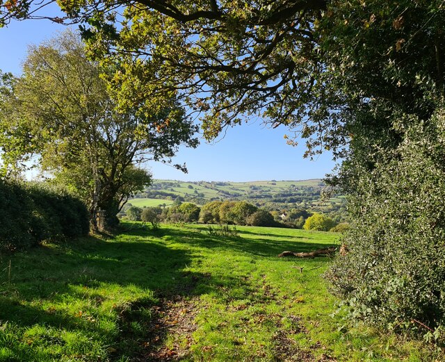
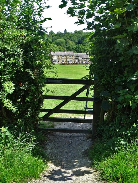
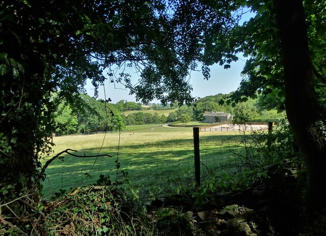
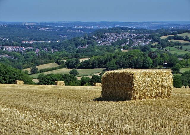
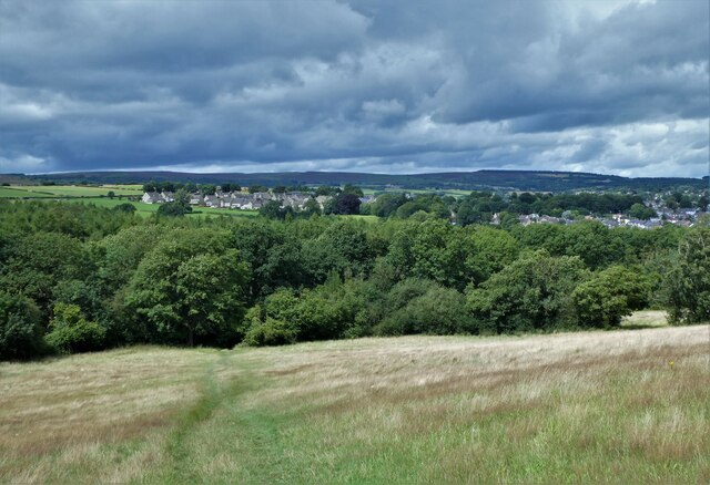
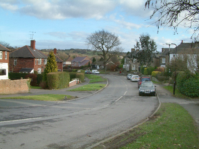
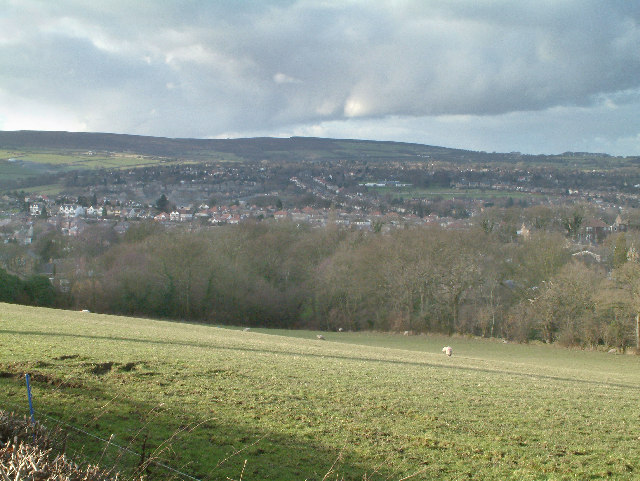
Totley is a small village located in the county of Derbyshire, England. Situated on the outskirts of the Peak District National Park, it is approximately 6 miles southwest of the city of Sheffield. Totley is surrounded by picturesque countryside, with rolling hills and scenic landscapes.

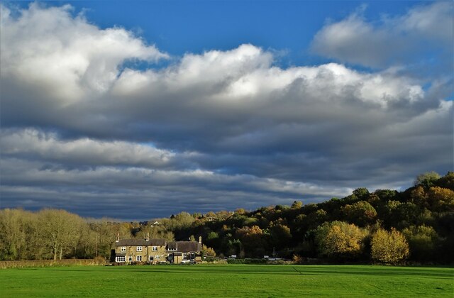
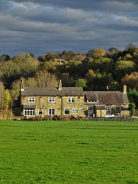
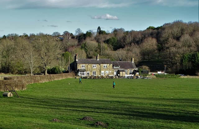
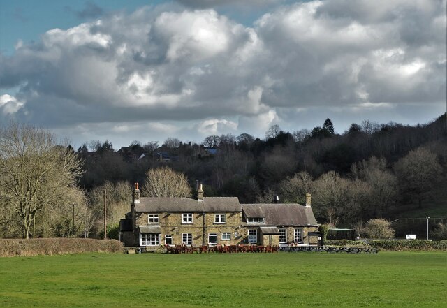
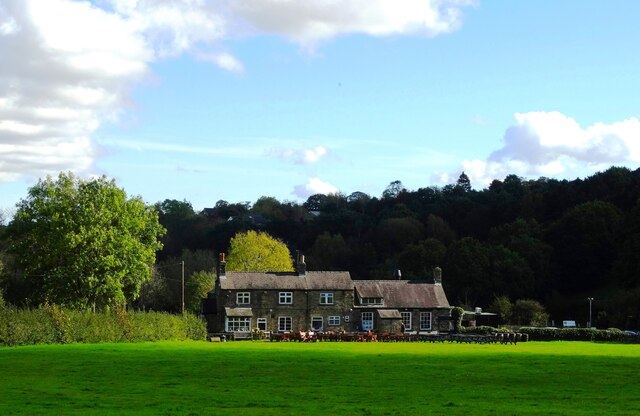
The village itself is known for its charming and quaint atmosphere. It has a population of around 2,000 residents and offers a peaceful and rural lifestyle. Totley has a close-knit community, with a range of amenities and facilities that cater to the needs of its residents.

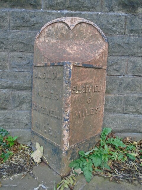
One of Totley's notable landmarks is the Totley Tunnel, which was constructed in the 19th century as part of the railway line connecting Sheffield to Manchester. The tunnel is approximately 6 miles long and remains an important transportation route to this day.

In terms of education, Totley is home to a primary school, which provides education for children aged 4 to 11. The village also has several churches, a post office, and a few local shops and businesses that serve the community.

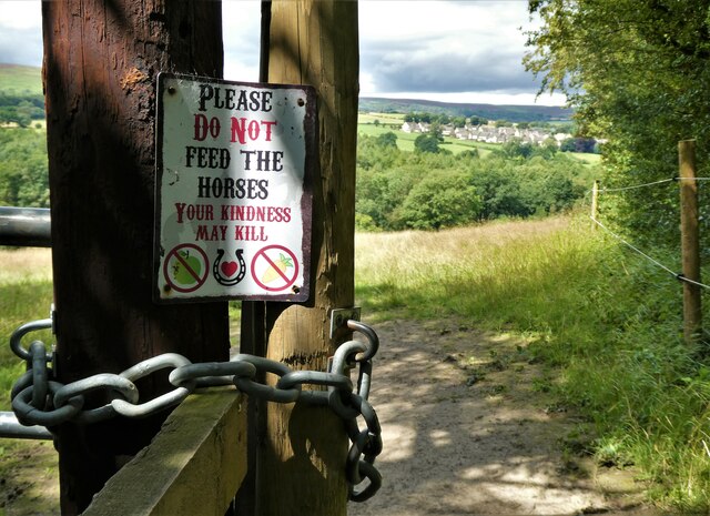
For outdoor enthusiasts, Totley offers easy access to the Peak District, with its abundance of nature trails, hiking routes, and stunning scenery. This makes Totley an attractive location for those who enjoy outdoor activities such as walking, cycling, and birdwatching.

Overall, Totley is a peaceful and picturesque village that combines the beauty of the countryside with the convenience of nearby urban areas. It provides a tranquil and idyllic setting for residents and visitors alike.

If you have any feedback on the listing, please let us know in the comments section below.

Totley Images

Images are sourced within 2km of 53.312804/-1.542179 or Grid Reference SK3079. Thanks to Geograph Open Source API. All images are credited.

Looking towards Owler Bar From top of Totley Lane, Bradway
Looking towards Owler Bar
From top of Totley Lane, Bradway
Beneath November clouds at Totley Bents Another view of "The Cricket Inn".
Beneath November clouds at Totley Bents
Another view of "The Cricket Inn".
"The Cricket Inn"  in  Totley Bents On the edge of the city of Sheffield.
"The Cricket Inn" in Totley Bents
On the edge of the city of Sheffield.
"The Cricket Inn", Totley Bents in early springtime Two brothers, still in school uniform, are playing football on the playing-field.
"The Cricket Inn", Totley Bents in early springtime
Two brothers, still in school uniform, are playing football on the playing-field.
Gate to Totley Bents Recreation Ground With "The Cricket Inn" at the other side of the field.
Gate to Totley Bents Recreation Ground
With "The Cricket Inn" at the other side of the field.
A view of Owler Lee Farm Seen from Fanshawe Gate Lane
A view of Owler Lee Farm
Seen from Fanshawe Gate Lane
After the Harvest Harvested field at Lydgate, Holmesfield with a view of Sheffield's southern  suburbs.
After the Harvest
Harvested field at Lydgate, Holmesfield with a view of Sheffield's southern suburbs.
"The Cricket Inn" at Totley Bents
Old milepost On the A621, Baslow Road, Totley this milepost becomes more and more neglected.   It is in a very vulnerable position opposite houses that often have parked cars making the road narrower.   The foundry name is down the front spine DARWIN & CO SHEFFIELD.   Their name is also seen on gully grates and doubtless they cast other products.   There was a Sheffield, Baslow, Owler Bar turnpike that lasted from 1803 to 1880 so this post may date from the middle to late 19C.
Old milepost
On the A621, Baslow Road, Totley this milepost becomes more and more neglected. It is in a very vulnerable position opposite houses that often have parked cars making the road narrower. The foundry name is down the front spine DARWIN & CO SHEFFIELD. Their name is also seen on gully grates and doubtless they cast other products. There was a Sheffield, Baslow, Owler Bar turnpike that lasted from 1803 to 1880 so this post may date from the middle to late 19C.
Looking back to Gillifield Wood and Totley From the edge of Woodthorpe Hall grounds
Looking back to Gillifield Wood and Totley
From the edge of Woodthorpe Hall grounds
Gillifield Wood and Totley In the southern suburbs of Sheffield
Gillifield Wood and Totley
In the southern suburbs of Sheffield
Yet another image of "The Cricket Inn" Viewed across the recreation ground at Totley Bents
Yet another image of "The Cricket Inn"
Viewed across the recreation ground at Totley Bents
Mickley Lane. This shows the New Totley end of the road which runs through to Mickley.
Mickley Lane.
This shows the New Totley end of the road which runs through to Mickley.
View from Mickley Lane. A view looking out to Totley Rise and beyond from the road running between New Totley and Mickley.
View from Mickley Lane.
A view looking out to Totley Rise and beyond from the road running between New Totley and Mickley.
Near Lidgate. An easterly view in the direction of Lidgate. The B6054 road can be seen in the distance.
Near Lidgate.
An easterly view in the direction of Lidgate. The B6054 road can be seen in the distance.
Fleur De Lys public house. Located on Totley Hall Lane in the Totley area of Sheffield.
Fleur De Lys public house.
Located on Totley Hall Lane in the Totley area of Sheffield.
Near Moorwoods Hall Farm. Typical countryside near Totley on the outskirts of Sheffield.
Near Moorwoods Hall Farm.
Typical countryside near Totley on the outskirts of Sheffield.
Woodthorpe Hall.
Woodthorpe Hall.
Show me another place!

Totley is located at Grid Ref: SK3079 (Lat: 53.312804, Lng: -1.542179)

Unitary Authority: Sheffield

Police Authority: South Yorkshire

What 3 Words

///cape.holly.impose. Near Dronfield, Derbyshire

Nearby Locations

Little Wood Totley

Related Wikis

Totley

Totley is a suburb on the extreme southwest of the City of Sheffield, in South Yorkshire, England. Lying in the historic county boundaries of Derbyshire...

Old Hay Brook

The Old Hay Brook is a small river in Sheffield, South Yorkshire, England. It is formed from the Redcar Brook, Blacka Dike and another stream, which rise...

King Ecgbert School

King Ecgbert School is a co-educational secondary school with academy status (age range 11–18) in the village of Dore in the south-west of Sheffield, South...

Totley Brook

The Totley Brook is a stream in Sheffield, South Yorkshire, England. It rises on a millstone grit ridge some 7 miles (11 km) to the south-west of the centre...

Dore, South Yorkshire

Dore is a large village in South Yorkshire, England. The village lies on a hill above the River Sheaf which gave Sheffield its name and, until 1934, was...
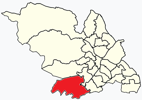
Dore and Totley

Dore and Totley ward—which includes the districts of Bradway , Dore, Totley, and Whirlow—is one of the 28 electoral wards in City of Sheffield, England...

Owler Bar

Owler Bar is a small area of settlement and locally important road junction in the parish of Holmesfield, Derbyshire, England. It lies at an altitude of...

Blacka Moor Nature Reserve

Blacka Moor Nature Reserve is a nature reserve located on Hathersage Road between Sheffield and Hathersage in the Peak District National Park in the United...

Nearby Amenities

Located within 500m of 53.312804,-1.542179
Totley
Place: suburb
Wikidata: Q946011
Lat/Long: 53.3140025/-1.541144
Post Box
Collection Times: Mo-Fr 09:00, Sa 07:00
Postal Code: S17
Ref: S17 373
Royal Cypher: EIIR
Royal Cypher Wikidata: Q33102113
Lat/Long: 53.3146053/-1.5360528
Turning Circle
Lat/Long: 53.310627/-1.535867
Turning Circle
Lat/Long: 53.3155371/-1.538559
Turning Circle
Lat/Long: 53.3152897/-1.5395831
Turning Circle
Lat/Long: 53.3123813/-1.5354035
Turning Circle
Lat/Long: 53.313816/-1.5368624
Turning Circle
Lat/Long: 53.3134488/-1.5379065
Barrier: kissing_gate
Lat/Long: 53.3102483/-1.5375003
Barrier: block
Lat/Long: 53.3157126/-1.5424378
Bus Stop
Baslow Road/Cross Scythes
Alt Name: Baslow Road/Cross Scythes
Bus: yes
Departures Board: timetable
Naptan AltCommonName: Baslow Road/Cross Scythes
Naptan AtcoCode: 370021978
Naptan Bearing: NE
Naptan CommonName: Baslow Road/Cross Scythes
Naptan Indicator: 21978
Naptan Landmark: Cross Scythes Pub
Naptan PlusbusZoneRef: ROTHCEN
Naptan Street: Baslow Road
Naptan Verified: no
Public Transport: platform
Shelter: no
Source: naptan_import
Lat/Long: 53.3142407/-1.5400768
Bus Stop
Baslow Road/Totley Hall Lane
Alt Name: Baslow Road/Totley Hall Lane
Bus: yes
Naptan AltCommonName: Baslow Road/Totley Hall Lane
Naptan AtcoCode: 370021979
Naptan Bearing: W
Naptan CommonName: Baslow Road/Totley Hall Lane
Naptan Indicator: 21979
Naptan Landmark: Cross Scythes Pub
Naptan PlusbusZoneRef: ROTHCEN
Naptan Street: Baslow Road
Naptan Verified: no
Public Transport: platform
Source: naptan_import
Lat/Long: 53.3141446/-1.5401062
Barrier: stile
Lat/Long: 53.3088412/-1.5389442
Barrier: stile
Lat/Long: 53.3120658/-1.5413098
Barrier: stile
Lat/Long: 53.3159528/-1.5474826
Totley War Memorial
Historic: memorial
Lat/Long: 53.3142078/-1.5435282
Parking
Parking: surface
Lat/Long: 53.31486/-1.5424526
Barrier: stile
Lat/Long: 53.3089226/-1.54038
Barrier: stile
Lat/Long: 53.3103752/-1.5388566
Barrier: stile
Lat/Long: 53.3104797/-1.5385045
Drinking Water
Lat/Long: 53.313042/-1.541538
Man Made: tower
Lat/Long: 53.3129042/-1.5466395
Power: pole
Lat/Long: 53.3127023/-1.5400741
Post Box
Collection Times: Mo-Fr 09:00; Sa 07:00
Post Box Type: lamp
Ref: S17 534D
Royal Cypher: EIIR
Royal Cypher Wikidata: Q33102113
Lat/Long: 53.3139338/-1.5412751
Bus Stop
Totley Cross Sythes
Bus: yes
Public Transport: platform
Lat/Long: 53.3142052/-1.5405579
Hillfoot
Place: locality
Lat/Long: 53.3167167/-1.5412416
Traffic Signals
Lat/Long: 53.3141001/-1.5410464
Turning Circle
Lat/Long: 53.3114845/-1.5355911
Street Lamp
Lat/Long: 53.3121461/-1.5392933
Grit Bin
Operator: Sheffield City Council
Operator Type: government
Operator Wikidata: Q7492609
Seasonal: no
Lat/Long: 53.3135229/-1.5410326
Totley Cross Sythes
Bus: yes
Public Transport: stop_position
Lat/Long: 53.3142739/-1.54056
Cafe
Coffee on the Corner
Addr City: Sheffield
Addr Country: GB
Addr Housenumber: 249
Addr Postcode: S17 4DU
Addr Street: Baslow Road
Fhrs Id: 907596
Lat/Long: 53.314589/-1.5356367
Public Footpath
Hiking: yes
Information: guidepost
Tourism: information
Lat/Long: 53.3133269/-1.5413019
Public Footpath
Hiking: yes
Information: guidepost
Tourism: information
Lat/Long: 53.3138926/-1.5412617
Parking
Capacity: 3
Lat/Long: 53.316585/-1.5439921
Baslow Road/Cross Scythes
Bus: yes
Public Transport: stop_position
Lat/Long: 53.3142172/-1.5400661
Baslow Road/Totley Hall Lane
Bus: yes
Public Transport: stop_position
Lat/Long: 53.3142091/-1.540133
Parking
Capacity: 5
Fee: no
Lat/Long: 53.3108656/-1.5376201
Bench
Backrest: yes
Lat/Long: 53.3150535/-1.542244
Bench
Backrest: yes
Lat/Long: 53.3150029/-1.5423093
Generator Method: photovoltaic
Generator Output Electricity: yes
Generator Source: solar
Generator Type: solar_photovoltaic_panel
Power: generator
Lat/Long: 53.3144106/-1.5396971
Generator Method: photovoltaic
Generator Output Electricity: yes
Generator Source: solar
Generator Type: solar_photovoltaic_panel
Power: generator
Lat/Long: 53.3141107/-1.5384846
Grit Bin
Operator: Sheffield City Council
Operator Type: government
Operator Wikidata: Q7492609
Seasonal: no
Lat/Long: 53.3137198/-1.5478899
Grit Bin
Operator: Sheffield City Council
Operator Type: government
Operator Wikidata: Q7492609
Seasonal: no
Lat/Long: 53.312893/-1.5362064
Grit Bin
Operator: Sheffield City Council
Operator Type: government
Operator Wikidata: Q7492609
Seasonal: no
Lat/Long: 53.3111386/-1.5381165
Grit Bin
Operator: Sheffield City Council
Operator Type: government
Operator Wikidata: Q7492609
Seasonal: no
Lat/Long: 53.3147523/-1.5381676
Grit Bin
Operator: Sheffield City Council
Operator Type: government
Operator Wikidata: Q7492609
Seasonal: no
Lat/Long: 53.3135892/-1.5419175
Grit Bin
Operator: Sheffield City Council
Operator Type: government
Operator Wikidata: Q7492609
Seasonal: no
Lat/Long: 53.3135288/-1.5379106
Grit Bin
Operator: Sheffield City Council
Operator Type: government
Operator Wikidata: Q7492609
Seasonal: no
Lat/Long: 53.3131806/-1.5361883
Grit Bin
Operator: Sheffield City Council
Operator Type: government
Operator Wikidata: Q7492609
Seasonal: no
Lat/Long: 53.3123123/-1.5417961
Grit Bin
Operator: Sheffield City Council
Operator Type: government
Operator Wikidata: Q7492609
Seasonal: no
Lat/Long: 53.3113592/-1.5417162
Grit Bin
Operator: Sheffield City Council
Operator Type: government
Operator Wikidata: Q7492609
Seasonal: no
Lat/Long: 53.3156838/-1.5373019
Grit Bin
Operator: Sheffield City Council
Operator Type: government
Operator Wikidata: Q7492609
Seasonal: no
Lat/Long: 53.3115015/-1.5389831
Grit Bin
Operator: Sheffield City Council
Operator Type: government
Operator Wikidata: Q7492609
Seasonal: no
Lat/Long: 53.3110411/-1.5408041
Grit Bin
Operator: Sheffield City Council
Operator Type: government
Operator Wikidata: Q7492609
Seasonal: no
Lat/Long: 53.31375/-1.5463736
Grit Bin
Operator: Sheffield City Council
Operator Type: government
Operator Wikidata: Q7492609
Seasonal: no
Lat/Long: 53.3148206/-1.5419043
Grit Bin
Operator: Sheffield City Council
Operator Type: government
Operator Wikidata: Q7492609
Seasonal: no
Lat/Long: 53.3145821/-1.536008
Grit Bin
Operator: Sheffield City Council
Operator Type: government
Operator Wikidata: Q7492609
Seasonal: no
Lat/Long: 53.3159279/-1.547071
Grit Bin
Operator: Sheffield City Council
Operator Type: government
Operator Wikidata: Q7492609
Seasonal: no
Lat/Long: 53.3127712/-1.5419112
Grit Bin
Operator: Sheffield City Council
Operator Type: government
Operator Wikidata: Q7492609
Seasonal: no
Lat/Long: 53.3167513/-1.5414183
Defibrillator
Access: yes
Defibrillator Location: On the outside wall of the school near to the entrance.
Emergency: defibrillator
Indoor: no
Lat/Long: 53.3135781/-1.5390985
The data included in this document is from www.openstreetmap.org. The data is made available under ODbL.

Have you been to Totley?

Leave your review of Totley below (or comments, questions and feedback).