Clay Wood

Wood, Forest in Derbyshire

England

Clay Wood

Upper Birchitt farm and wind turbines. Along the Dronfield 2000 rotary walk.
Upper Birchitt farm and wind turbines. Credit: steven ruffles

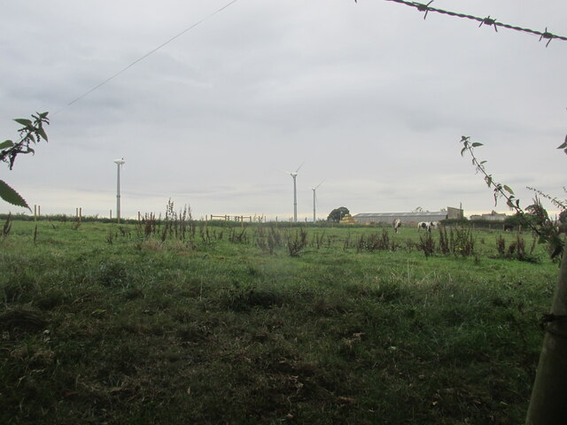
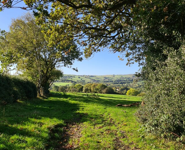
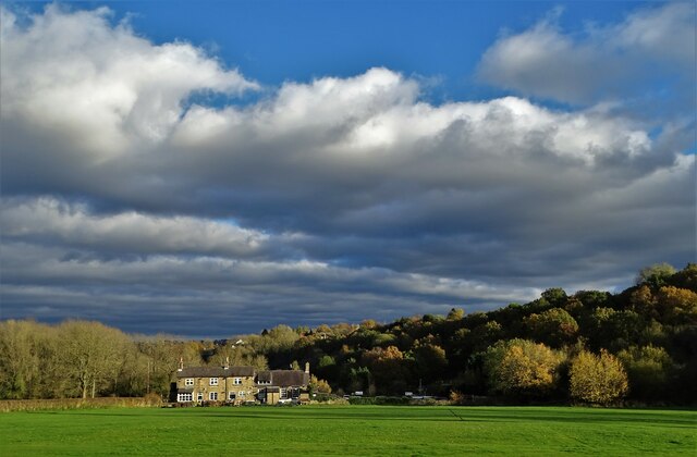
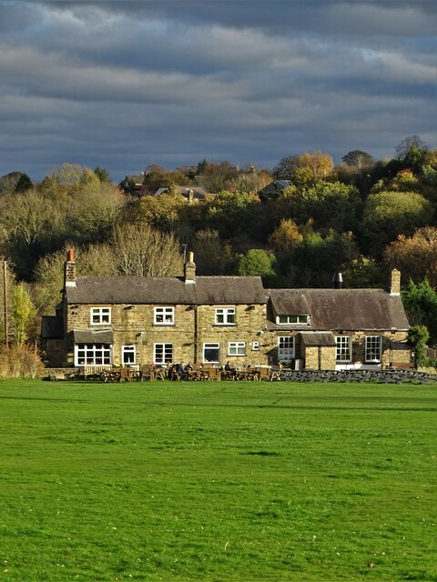
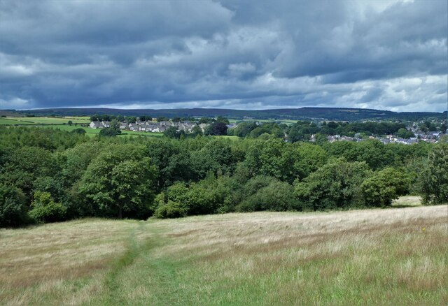
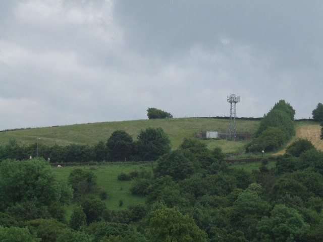
Clay Wood is a dense forest located in Derbyshire, England. Covering an area of approximately 500 acres, it is known for its rich biodiversity and stunning natural beauty. The forest is situated within the Derbyshire Dales National Nature Reserve, making it a popular destination for nature enthusiasts and hikers.

The woodland is primarily composed of broadleaf trees, including oak, birch, and beech. These towering trees provide a lush canopy that filters sunlight, creating a serene and peaceful atmosphere within the forest. The forest floor is covered in a thick layer of moss and ferns, adding to its enchanting appeal.

Clay Wood is home to a wide range of wildlife, including deer, badgers, foxes, and numerous bird species. It is also a haven for various plant species, including bluebells, wild garlic, and orchids. The forest's diverse ecosystem offers a unique opportunity for visitors to observe and appreciate the natural world.

Several trails wind their way through Clay Wood, providing visitors with the opportunity to explore its beauty. These paths are well-maintained and suitable for walking, jogging, or cycling. Along the trails, there are informative signposts that provide interesting facts about the forest's flora and fauna.

Overall, Clay Wood is a picturesque forest in Derbyshire that offers a peaceful retreat from the hustle and bustle of everyday life. Its natural beauty, diverse wildlife, and well-maintained trails make it an ideal destination for outdoor enthusiasts and nature lovers alike.

If you have any feedback on the listing, please let us know in the comments section below.
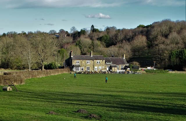
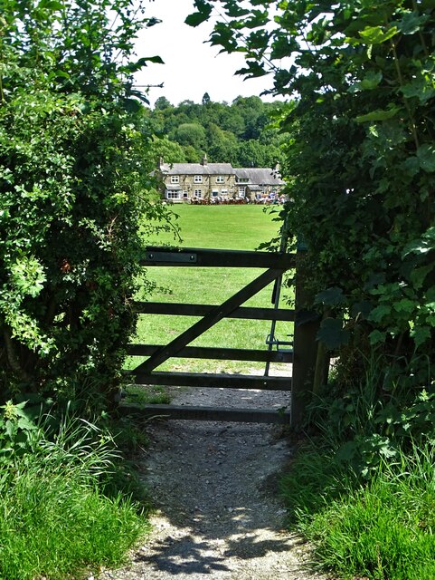
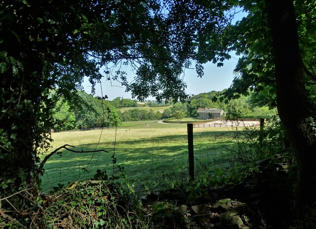
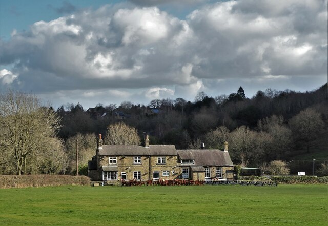
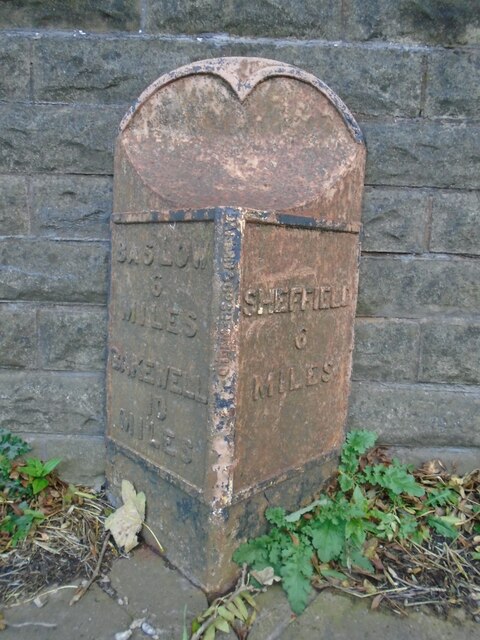
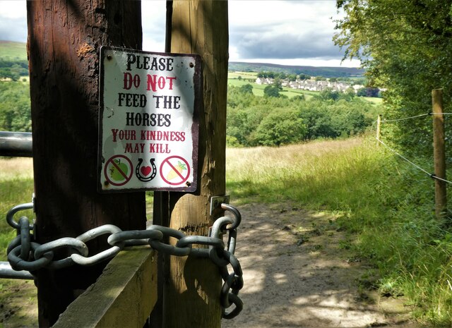
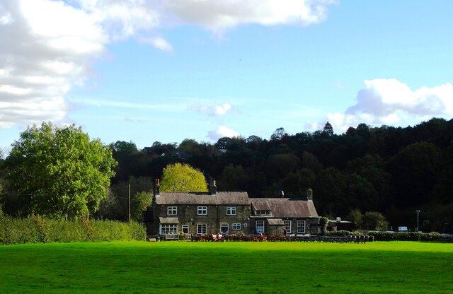
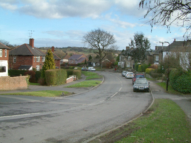
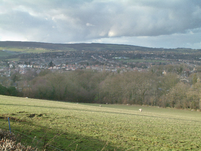
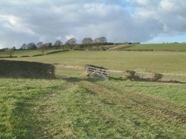
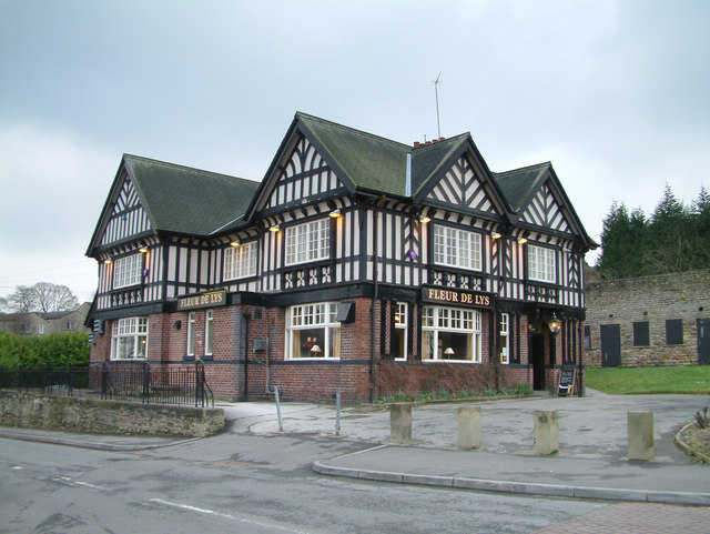
Clay Wood Images

Images are sourced within 2km of 53.317767/-1.523095 or Grid Reference SK3180. Thanks to Geograph Open Source API. All images are credited.

Upper Birchitt farm and wind turbines. Along the Dronfield 2000 rotary walk.
Upper Birchitt farm and wind turbines.
Along the Dronfield 2000 rotary walk.
Looking towards Owler Bar From top of Totley Lane, Bradway
Looking towards Owler Bar
From top of Totley Lane, Bradway
Beneath November clouds at Totley Bents Another view of "The Cricket Inn".
Beneath November clouds at Totley Bents
Another view of "The Cricket Inn".
"The Cricket Inn"  in  Totley Bents On the edge of the city of Sheffield.
"The Cricket Inn" in Totley Bents
On the edge of the city of Sheffield.
"The Cricket Inn", Totley Bents in early springtime Two brothers, still in school uniform, are playing football on the playing-field.
"The Cricket Inn", Totley Bents in early springtime
Two brothers, still in school uniform, are playing football on the playing-field.
Gate to Totley Bents Recreation Ground With "The Cricket Inn" at the other side of the field.
Gate to Totley Bents Recreation Ground
With "The Cricket Inn" at the other side of the field.
A view of Owler Lee Farm Seen from Fanshawe Gate Lane
A view of Owler Lee Farm
Seen from Fanshawe Gate Lane
"The Cricket Inn" at Totley Bents
Old milepost On the A621, Baslow Road, Totley this milepost becomes more and more neglected.   It is in a very vulnerable position opposite houses that often have parked cars making the road narrower.   The foundry name is down the front spine DARWIN & CO SHEFFIELD.   Their name is also seen on gully grates and doubtless they cast other products.   There was a Sheffield, Baslow, Owler Bar turnpike that lasted from 1803 to 1880 so this post may date from the middle to late 19C.
Old milepost
On the A621, Baslow Road, Totley this milepost becomes more and more neglected. It is in a very vulnerable position opposite houses that often have parked cars making the road narrower. The foundry name is down the front spine DARWIN & CO SHEFFIELD. Their name is also seen on gully grates and doubtless they cast other products. There was a Sheffield, Baslow, Owler Bar turnpike that lasted from 1803 to 1880 so this post may date from the middle to late 19C.
Looking back to Gillifield Wood and Totley From the edge of Woodthorpe Hall grounds
Looking back to Gillifield Wood and Totley
From the edge of Woodthorpe Hall grounds
Gillifield Wood and Totley In the southern suburbs of Sheffield
Gillifield Wood and Totley
In the southern suburbs of Sheffield
Yet another image of "The Cricket Inn" Viewed across the recreation ground at Totley Bents
Yet another image of "The Cricket Inn"
Viewed across the recreation ground at Totley Bents
Mickley Lane. This shows the New Totley end of the road which runs through to Mickley.
Mickley Lane.
This shows the New Totley end of the road which runs through to Mickley.
View from Mickley Lane. A view looking out to Totley Rise and beyond from the road running between New Totley and Mickley.
View from Mickley Lane.
A view looking out to Totley Rise and beyond from the road running between New Totley and Mickley.
Near Dronfield Woodhouse. A view looking north west from the Dronfield Woodhouse to Holmsfield road.
Near Dronfield Woodhouse.
A view looking north west from the Dronfield Woodhouse to Holmsfield road.
Fleur De Lys public house. Located on Totley Hall Lane in the Totley area of Sheffield.
Fleur De Lys public house.
Located on Totley Hall Lane in the Totley area of Sheffield.
Woodthorpe Hall.
Woodthorpe Hall.
Phone Mast at Totley
Show me another place!

Clay Wood is located at Grid Ref: SK3180 (Lat: 53.317767, Lng: -1.523095)

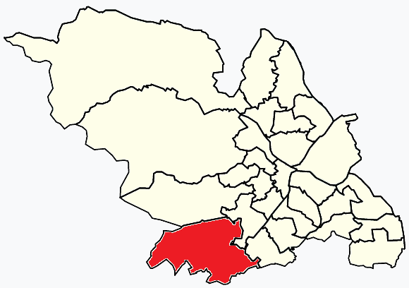
Unitary Authority: Sheffield

Police Authority: South Yorkshire

What 3 Words

///parks.takes.runs. Near Dronfield, Derbyshire

Related Wikis

Old Hay Brook

The Old Hay Brook is a small river in Sheffield, South Yorkshire, England. It is formed from the Redcar Brook, Blacka Dike and another stream, which rise...

Dore and Totley

Dore and Totley ward—which includes the districts of Bradway , Dore, Totley, and Whirlow—is one of the 28 electoral wards in City of Sheffield, England...

Totley Brook

The Totley Brook is a stream in Sheffield, South Yorkshire, England. It rises on a millstone grit ridge some 7 miles (11 km) to the south-west of the centre...

King Ecgbert School

King Ecgbert School is a co-educational secondary school with academy status (age range 11–18) in the village of Dore in the south-west of Sheffield, South...

Abbeydale Park

Abbeydale Park is a sports venue in Dore, South Yorkshire, England. It is unusual in having hosted home games for two different county cricket teams....

Dore & Totley railway station

Dore & Totley railway station serves the south-western Sheffield suburbs of Dore and Totley in South Yorkshire, England 4+3⁄4 miles (7.6 km) south of Sheffield...

Totley

Totley is a suburb on the extreme southwest of the City of Sheffield, in South Yorkshire, England. Lying in the historic county boundaries of Derbyshire...

Dore, South Yorkshire

Dore is a large village in South Yorkshire, England. The village lies on a hill above the River Sheaf which gave Sheffield its name and, until 1934, was...

Nearby Amenities

Located within 500m of 53.317767,-1.523095
Baslow Road/Mill Lane
Bus: yes
Public Transport: stop_position
Lat/Long: 53.319045/-1.5253888
Totley Tunnel East
Railway: junction
Lat/Long: 53.3190113/-1.529875
Baslow Road/Grove Road
Bus: yes
Public Transport: stop_position
Lat/Long: 53.3191189/-1.525567
Post Office
Totley Rise Post Office
Addr City: Sheffield
Addr Country: GB
Addr Housenumber: 71
Addr Postcode: S17 4DL
Addr Street: Baslow Road
Addr Village: Totley
Brand: Post Office
Brand Wikidata: Q1783168
Opening Hours: Mo-Sa 05:30-20:00; Su 05:30-18:00
Ref Pol Id: 146948
Website: https://www.postoffice.co.uk/branch-finder/642340x/totley-rise
Lat/Long: 53.3175531/-1.5247782
Turning Circle
Lat/Long: 53.3210407/-1.5237576
Post Box
Collection Times: Mo-Fr 09:00; Sa 07:00
Post Box Type: wall
Ref: S17 185D
Royal Cypher: GR
Royal Cypher Wikidata: Q33102273
Lat/Long: 53.3192407/-1.5297634
Power: substation
Lat/Long: 53.3197647/-1.5276414
Place Of Worship
Dore & Totley United Reformed Church
Religion: christian
Lat/Long: 53.3204348/-1.526332
Booth: K6
Removed Amenity: telephone
Lat/Long: 53.3209554/-1.5246025
Post Box
Collection Times: Mo-Fr 16:15; Sa 10:30
Post Box Type: pillar
Postal Code: S17
Ref: S17 300
Royal Cypher: EIIR
Royal Cypher Wikidata: Q33102113
Lat/Long: 53.3214269/-1.5242766
Atm
Lat/Long: 53.3218415/-1.5240634
Recycling
Lat/Long: 53.3217381/-1.52055
Power: substation
Ref GB Uprn: 10013644335
Lat/Long: 53.3209664/-1.5220864
Turning Circle
Lat/Long: 53.3220237/-1.5219579
Barrier: bollard
Lat/Long: 53.3161575/-1.528684
Crossing: uncontrolled
Lat/Long: 53.3160115/-1.52029
Turning Circle
Lat/Long: 53.3135105/-1.5216149
Bus Stop
Abbeydale Road Sth/Devonshire Road
Alt Name: Abbeydale Road Sth/Devonshire Road
Bench: yes
Bus: yes
Covered: yes
Naptan AltCommonName: Abbeydale Road Sth/Devonshire Road
Naptan AtcoCode: 370020445
Naptan Bearing: NE
Naptan CommonName: Abbeydale Road Sth/Devonshire Road
Naptan Indicator: 20445
Naptan Landmark: Outside Woods Market/Mobile Ga
Naptan PlusbusZoneRef: ROTHCEN
Naptan Street: Abbeydale Road South
Naptan Verified: no
Public Transport: platform
Shelter: yes
Source: naptan_import
Lat/Long: 53.3215797/-1.5239609
Bus Stop
Abbeydale Road Sth/West View Close
Alt Name: Abbeydale Road Sth/West View Close
Bus: yes
Naptan AltCommonName: Abbeydale Road Sth/West View Close
Naptan AtcoCode: 370020448
Naptan Bearing: SW
Naptan CommonName: Abbeydale Road Sth/West View Close
Naptan Indicator: 20448
Naptan Landmark: 20448
Naptan PlusbusZoneRef: ROTHCEN
Naptan Street: Abbeydale Road South
Naptan Verified: no
Public Transport: platform
Source: naptan_import
Lat/Long: 53.3211209/-1.5240137
Bus Stop
Baslow Road/Mill Lane
Alt Name: Baslow Road/Mill Lane
Bus: yes
Naptan AltCommonName: Baslow Road/Mill Lane
Naptan AtcoCode: 370020449
Naptan Bearing: S
Naptan CommonName: Baslow Road/Mill Lane
Naptan Indicator: 20449
Naptan Landmark: Methodist Church
Naptan PlusbusZoneRef: ROTHCEN
Naptan Street: Baslow Road
Naptan Verified: no
Public Transport: platform
Source: naptan_import
Lat/Long: 53.3190516/-1.5253169
Bus Stop
Baslow Road/Grove Road
Bus: yes
Naptan AtcoCode: 370020450
Naptan Bearing: N
Naptan CommonName: Baslow Road/Grove Road
Naptan Indicator: 20450
Naptan Landmark: 20450
Naptan PlusbusZoneRef: ROTHCEN
Naptan Street: Baslow Road
Naptan Verified: no
Public Transport: platform
Source: naptan_import
Lat/Long: 53.3190902/-1.5256545
Bus Stop
Baslow Road/Glover Road
Bus: yes
Naptan AtcoCode: 370020452
Naptan Bearing: N
Naptan CommonName: Baslow Road/Glover Road
Naptan Indicator: 20452
Naptan Landmark: 20452
Naptan PlusbusZoneRef: ROTHCEN
Naptan Street: Baslow Road
Naptan Verified: no
Public Transport: platform
Source: naptan_import
Lat/Long: 53.3172989/-1.5253094
Bus Stop
Baslow Road/Marstone Crescent
Bus: yes
Naptan AtcoCode: 370020453
Naptan Bearing: NE
Naptan CommonName: Baslow Road/Marstone Crescent
Naptan Indicator: 20453
Naptan Landmark: 20453
Naptan PlusbusZoneRef: ROTHCEN
Naptan Street: Baslow Road
Naptan Verified: no
Public Transport: platform
Source: naptan_import
Lat/Long: 53.3164574/-1.5282141
Bus Stop
Totley Brook Road/Abbeydale Road Sth
Bus: yes
Naptan AtcoCode: 370020455
Naptan Bearing: N
Naptan CommonName: Totley Brook Road/Abbeydale Road Sth
Naptan Indicator: 20455
Naptan Landmark: Opposite No. 18
Naptan PlusbusZoneRef: ROTHCEN
Naptan Street: Totley Brook Road
Naptan Verified: no
Public Transport: platform
Source: naptan_import
Lat/Long: 53.3205149/-1.525147
Bus Stop
Totley Brook Road/King Ecgbert Road
Bus: yes
Covered: yes
Naptan AtcoCode: 370020456
Naptan Bearing: N
Naptan CommonName: Totley Brook Road/King Ecgbert Road
Naptan Indicator: 20456
Naptan Landmark: Outside Sherwood Chase/Flats
Naptan PlusbusZoneRef: ROTHCEN
Naptan Street: Totley Brook Road
Naptan Verified: no
Public Transport: platform
Shelter: yes
Source: naptan_import
Lat/Long: 53.3195954/-1.5287399
Bus Stop
King Ecgbert Road/Totley Brook Road
Bus: yes
Naptan AtcoCode: 370020458
Naptan Bearing: W
Naptan CommonName: King Ecgbert Road/Totley Brook Road
Naptan Indicator: 20458
Naptan Landmark: 20458
Naptan PlusbusZoneRef: ROTHCEN
Naptan Street: King Ecbert Road
Naptan Verified: no
Public Transport: platform
Source: naptan_import
Lat/Long: 53.3199627/-1.5288038
Bus Stop
Baslow Road/Laverdene Road
Alt Name: Baslow Road/Laverdene Road
Bus: yes
Naptan AltCommonName: Baslow Road/Laverdene Road
Naptan AtcoCode: 370023681
Naptan Bearing: SW
Naptan CommonName: Baslow Road/Laverdene Road
Naptan Indicator: 23681
Naptan Landmark: 23681
Naptan PlusbusZoneRef: ROTHCEN
Naptan Street: Baslow Road
Naptan Verified: no
Public Transport: platform
Source: naptan_import
Lat/Long: 53.3162891/-1.5281782
Bus Stop
Prospect Road/Everard Avenue
Alt Name: Prospect Road/Everard Avenue
Bus: yes
Naptan AltCommonName: Prospect Road/Everard Avenue
Naptan AtcoCode: 370025442
Naptan Bearing: SE
Naptan CommonName: Prospect Road/Everard Avenue
Naptan Indicator: 25442
Naptan Landmark: 25442
Naptan PlusbusZoneRef: ROTHCEN
Naptan Street: Prospect Road
Naptan Verified: no
Public Transport: platform
Source: naptan_import
Lat/Long: 53.3183404/-1.5163909
Bus Stop
Baslow Road/Marstone Crescent
Alt Name: Baslow Road/Marstone Crescent
Bus: yes
Naptan AltCommonName: Baslow Road/Marstone Crescent
Naptan AtcoCode: 370025454
Naptan Bearing: N
Naptan CommonName: Baslow Road/Marstone Crescent
Naptan Indicator: 25454
Naptan Landmark: Total Petrol Station
Naptan PlusbusZoneRef: ROTHCEN
Naptan Street: Baslow Road
Naptan Verified: no
Public Transport: platform
Source: naptan_import
Lat/Long: 53.317286/-1.5257505
Bus Stop
Longford Road/Longford Drive
Bus: yes
Naptan AtcoCode: 370026764
Naptan Bearing: NW
Naptan BusStopType: CUS
Naptan CommonName: Longford Road/Longford Drive
Naptan Indicator: 26764
Naptan Landmark: POST BOX
Naptan PlusbusZoneRef: ROTHCEN
Naptan Street: Longford Road
Naptan Verified: no
Public Transport: platform
Source: naptan_import
Lat/Long: 53.3161271/-1.5204204
Bicycle Parking
Bicycle Parking: stands
Capacity: 13
Covered: no
Lat/Long: 53.3219537/-1.5239204
Railway: buffer_stop
Lat/Long: 53.3200435/-1.5257104
Traffic Signals
Crossing: no
Lat/Long: 53.3175901/-1.5251152
Baslow Road/Marstone Crescent
Bus: yes
Public Transport: stop_position
Lat/Long: 53.3164164/-1.5281989
Baslow Road/Laverdene Road
Bus: yes
Public Transport: stop_position
Lat/Long: 53.316329/-1.5281968
Cycleway: asl
Lat/Long: 53.3174474/-1.5254185
Traffic Signals
Crossing: no
Traffic Signals Direction: forward
Lat/Long: 53.3173743/-1.5250987
Railway: switch
Lat/Long: 53.3212585/-1.5220368
Turning Circle
Lat/Long: 53.3193233/-1.5240875
Barrier: bollard
Lat/Long: 53.3214956/-1.5243003
Barrier: bollard
Lat/Long: 53.3214872/-1.5242801
Barrier: bollard
Lat/Long: 53.3215126/-1.5243417
Barrier: bollard
Lat/Long: 53.3214776/-1.5242569
Barrier: bollard
Lat/Long: 53.3215044/-1.5243218
Longford Road/Longford Drive
Bus: yes
Public Transport: stop_position
Lat/Long: 53.3161529/-1.5203559
Totley Rise
Place: neighbourhood
Lat/Long: 53.3178787/-1.5251547
Totley Tunnel East
Railway: junction
Lat/Long: 53.3190411/-1.5298985
Barrier: bollard
Motor Vehicle: no
Lat/Long: 53.3169903/-1.5241512
Addr City: Sheffield
Addr Country: GB
Addr Street: Baslow Road
Addr Village: Totley
Shop: optician
Lat/Long: 53.317648/-1.5247176
Grit Bin
Operator: Sheffield City Council
Operator Type: government
Operator Wikidata: Q7492609
Seasonal: no
Lat/Long: 53.3188173/-1.5249438
Crossing: uncontrolled
Lat/Long: 53.3143237/-1.5229243
Post Box
Collection Times: Mo-Fr 09:00; Sa 07:00
Post Box Type: pillar
Ref: S17 843D
Royal Cypher: EIIR
Royal Cypher Wikidata: Q33102113
Lat/Long: 53.3186055/-1.5169236
Post Box
Collection Times: Mo-Fr 09:00; Sa 07:00
Post Box Type: pillar
Ref: S17 893
Royal Cypher: EIIR
Royal Cypher Wikidata: Q33102113
Lat/Long: 53.3160569/-1.5203654
Post Box
Collection Times: Mo-Fr 17:00; Sa 11:45
Post Box Type: pillar
Ref: S17 464
Royal Cypher: EIIR
Royal Cypher Wikidata: Q33102113
Lat/Long: 53.3175578/-1.5248309
Baslow Road News & Off-License
Addr City: Sheffield
Addr Country: GB
Addr Housenumber: 71
Addr Postcode: S17 4DL
Addr Street: Baslow Road
Addr Village: Totley
Fhrs Id: 696803
Shop: newsagent
Lat/Long: 53.3174957/-1.5248401
Defibrillator
Access: yes
Check Date: 2023-03-09
Defibrillator Location: On outside wall. Available 24/7.
Emergency: defibrillator
Indoor: no
Opening Hours: 24/7
Lat/Long: 53.3204123/-1.5260954
Defibrillator
Access: yes
Check Date: 2023-03-09
Defibrillator Location: On outside wall. Available 24/7.
Emergency: defibrillator
Indoor: no
Opening Hours: 24/7
Lat/Long: 53.3190413/-1.5259503
King Ecgbert Road/Totley Brook Road
Bus: yes
Public Transport: stop_position
Lat/Long: 53.3199962/-1.5288036
Totley Brook Road/King Ecgbert Road
Bus: yes
Public Transport: stop_position
Lat/Long: 53.3195598/-1.5287038
Totley Brook Road/Abbeydale Road Sth
Bus: yes
Public Transport: stop_position
Lat/Long: 53.3205518/-1.5252004
Abbeydale Road Sth/Devonshire Road
Bus: yes
Public Transport: stop_position
Lat/Long: 53.3215447/-1.5238732
Abbeydale Road Sth/West View Close
Bus: yes
Public Transport: stop_position
Lat/Long: 53.3211446/-1.5240837
Baslow Road/Glover Road
Bus: yes
Public Transport: stop_position
Lat/Long: 53.317325/-1.5253974
Baslow Road/Marstone Crescent
Bus: yes
Public Transport: stop_position
Lat/Long: 53.3172595/-1.5256695
Prospect Road/Everard Avenue
Bus: yes
Public Transport: stop_position
Lat/Long: 53.3183599/-1.5165028
Bae hair
Addr City: Sheffield
Addr Country: GB
Addr Postcode: S17 4DL
Addr Street: Baslow Road
Addr Village: Totley
Shop: hairdresser
Lat/Long: 53.3184498/-1.5247847
Martin Scriven
Addr City: Sheffield
Addr Country: GB
Addr Street: Baslow Road
Addr Village: Totley
Shop: greengrocer
Lat/Long: 53.3181048/-1.5246564
Shoe repairs
Addr City: Sheffield
Addr Country: GB
Addr Street: Baslow Road
Addr Village: Totley
Shop: shoe_repair
Lat/Long: 53.3181486/-1.5246597
Fast Food
Balti Ghar
Addr City: Sheffield
Addr Country: GB
Addr Housenumber: 39
Addr Postcode: S17 4DL
Addr Street: Baslow Road
Addr Village: Totley
Cuisine: indian
Fhrs Id: 436663
Phone: +44 1142362223
Lat/Long: 53.3180527/-1.5246581
The Foot Hut
Addr City: Sheffield
Addr Country: GB
Addr Street: Baslow Road
Addr Village: Totley
Healthcare: alternative
Healthcare Speciality: chiropractic
Website: https://www.thefoothut.co.uk/
Lat/Long: 53.3180077/-1.5246636
Restaurant
The Mohul
Addr City: Sheffield
Addr Country: GB
Addr Housenumber: 47
Addr Postcode: S17 4DL
Addr Street: Baslow Road
Addr Village: Totley
Cuisine: indian
Fhrs Id: 435518
Phone: +441142620192
Website: https://www.themohul.com/index
Lat/Long: 53.3179159/-1.5246678
Totley Deli and Cafe
Addr City: Sheffield
Addr Country: GB
Addr Housenumber: 51-53
Addr Postcode: S17 4DL
Addr Street: Baslow Road
Addr Village: Totley
Fhrs Id: 437670
Phone: +441142620192
Shop: deli
Lat/Long: 53.317853/-1.5246769
Pharmacy
Well Totley -Baslow Road
Addr City: Sheffield
Addr Country: GB
Addr Housenumber: 45
Addr Postcode: S17 4DL
Addr Street: Baslow Road
Addr Village: Totley
Brand: Well Pharmacy
Brand Wikidata: Q7726524
Brand Wikipedia: en:Well Pharmacy
Contact Phone: +441142361181
Contact Website: https://finder.well.co.uk/store/totley-baslow-road
Dispensing: yes
Healthcare: pharmacy
Opening Hours: Mo-Fr 09:00-18:00; Sa 09:00-12:00
Lat/Long: 53.3179766/-1.5246641
Fast Food
PONTUS
Addr City: Sheffield
Addr Country: GB
Addr Housenumber: 65
Addr Postcode: S17 4DL
Addr Street: Baslow Road
Addr Village: Totley
Cuisine: fish_and_chips
Fhrs Id: 591089
Phone: +441142360394
Lat/Long: 53.3176162/-1.524752
Railway: switch
Lat/Long: 53.3190625/-1.5296784
Railway: switch
Lat/Long: 53.3201261/-1.5257574
Railway: switch
Lat/Long: 53.3199501/-1.5265679
Crossing
Crossing: unmarked
Crossing Island: no
Tactile Paving: yes
Lat/Long: 53.3145556/-1.5257331
Traffic Signals
Crossing: no
Lat/Long: 53.3174182/-1.5254541
Crossing
Crossing: unmarked
Crossing Island: no
Tactile Paving: yes
Lat/Long: 53.3192287/-1.5254558
Crossing
Crossing: unmarked
Crossing Island: no
Tactile Paving: yes
Lat/Long: 53.3192155/-1.5255938
Crossing
Crossing: unmarked
Crossing Island: no
Crossing Markings: no
Tactile Paving: yes
Lat/Long: 53.3213924/-1.5238589
Crossing
Crossing: unmarked
Crossing Island: no
Crossing Markings: no
Tactile Paving: yes
Lat/Long: 53.3214372/-1.5239803
Pub
Tunnel Tap
Addr City: Sheffield
Addr Housenumber: 57
Addr Postcode: S17 4DL
Addr Street: Baslow Road
Fhrs Id: 1388154
Lat/Long: 53.3177844/-1.5247007
Grit Bin
Operator: Sheffield City Council
Operator Type: government
Operator Wikidata: Q7492609
Seasonal: no
Lat/Long: 53.3210967/-1.5217359
Grit Bin
Operator: Sheffield City Council
Operator Type: government
Operator Wikidata: Q7492609
Seasonal: no
Lat/Long: 53.3162763/-1.5188928
Grit Bin
Operator: Sheffield City Council
Operator Type: government
Operator Wikidata: Q7492609
Seasonal: no
Lat/Long: 53.3188285/-1.5209807
Grit Bin
Operator: Sheffield City Council
Operator Type: government
Operator Wikidata: Q7492609
Seasonal: no
Lat/Long: 53.317949/-1.5213358
Grit Bin
Operator: Sheffield City Council
Operator Type: government
Operator Wikidata: Q7492609
Seasonal: no
Lat/Long: 53.3205342/-1.5204512
Grit Bin
Operator: Sheffield City Council
Operator Type: government
Operator Wikidata: Q7492609
Seasonal: no
Lat/Long: 53.3166778/-1.5294407
Grit Bin
Operator: Sheffield City Council
Operator Type: government
Operator Wikidata: Q7492609
Seasonal: no
Lat/Long: 53.3173441/-1.5251853
Grit Bin
Operator: Sheffield City Council
Operator Type: government
Operator Wikidata: Q7492609
Seasonal: no
Lat/Long: 53.3178017/-1.5182151
Grit Bin
Operator: Sheffield City Council
Operator Type: government
Operator Wikidata: Q7492609
Seasonal: no
Lat/Long: 53.3145501/-1.52328
Grit Bin
Operator: Sheffield City Council
Operator Type: government
Operator Wikidata: Q7492609
Seasonal: no
Lat/Long: 53.3157156/-1.520295
Grit Bin
Operator: Sheffield City Council
Operator Type: government
Operator Wikidata: Q7492609
Seasonal: no
Lat/Long: 53.314727/-1.5271056
Grit Bin
Operator: Sheffield City Council
Operator Type: government
Operator Wikidata: Q7492609
Seasonal: no
Lat/Long: 53.3211056/-1.5217208
Grit Bin
Operator: Sheffield City Council
Operator Type: government
Operator Wikidata: Q7492609
Seasonal: no
Lat/Long: 53.3145522/-1.5260868
Grit Bin
Operator: Sheffield City Council
Operator Type: government
Operator Wikidata: Q7492609
Seasonal: no
Lat/Long: 53.3189399/-1.5286652
Grit Bin
Operator: Sheffield City Council
Operator Type: government
Operator Wikidata: Q7492609
Seasonal: no
Lat/Long: 53.3208053/-1.5185716
Grit Bin
Operator: Sheffield City Council
Operator Type: government
Operator Wikidata: Q7492609
Seasonal: no
Lat/Long: 53.3174563/-1.5262648
Grit Bin
Operator: Sheffield City Council
Operator Type: government
Operator Wikidata: Q7492609
Seasonal: no
Lat/Long: 53.3186604/-1.5171697
Grit Bin
Operator: Sheffield City Council
Operator Type: government
Operator Wikidata: Q7492609
Seasonal: no
Lat/Long: 53.3205696/-1.5203007
Defibrillator
Access: yes
Defibrillator Location: On the outside wall of the shops.
Emergency: defibrillator
Indoor: no
Lat/Long: 53.3163727/-1.5200514
Defibrillator
Access: yes
Defibrillator Location: On outside wall of pub.
Emergency: defibrillator
Indoor: no
Lat/Long: 53.3143177/-1.5262618
Kinetic
Healthcare: alternative
Healthcare Speciality: chiropractic
Lat/Long: 53.3215803/-1.5242124
The data included in this document is from www.openstreetmap.org. The data is made available under ODbL.

Have you been to Clay Wood?

Leave your review of Clay Wood below (or comments, questions and feedback).