Abbeydale Park

Settlement in Derbyshire

England

Abbeydale Park

Upper Birchitt farm and wind turbines. Along the Dronfield 2000 rotary walk.
Upper Birchitt farm and wind turbines. Credit: steven ruffles

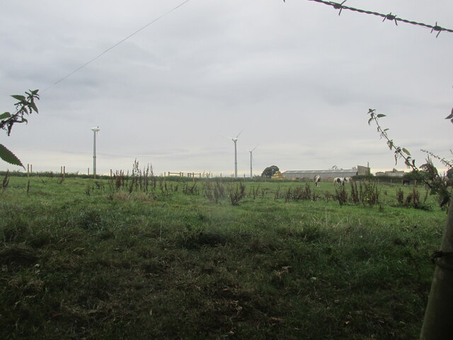
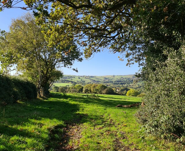
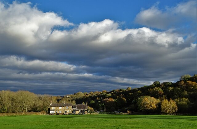
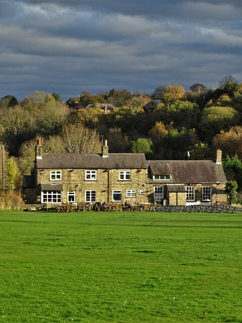
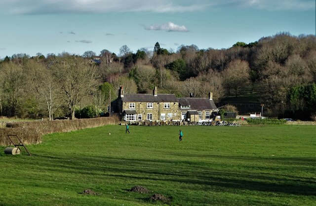
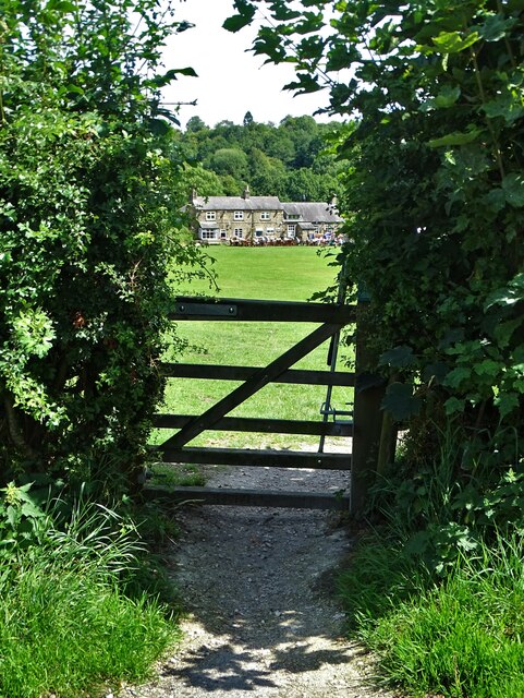
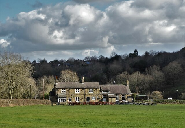
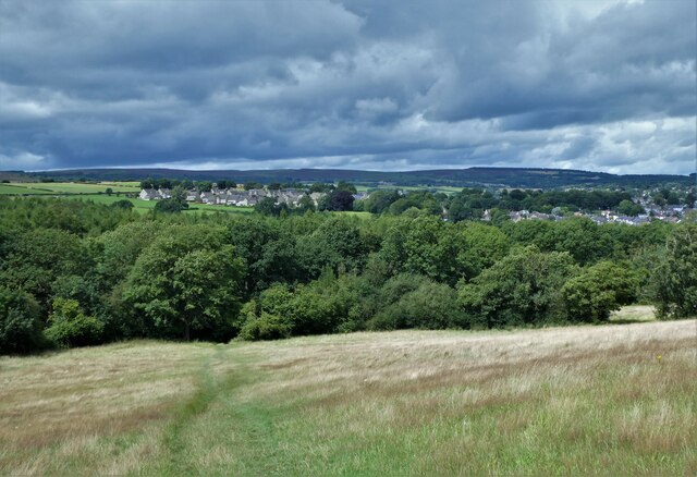
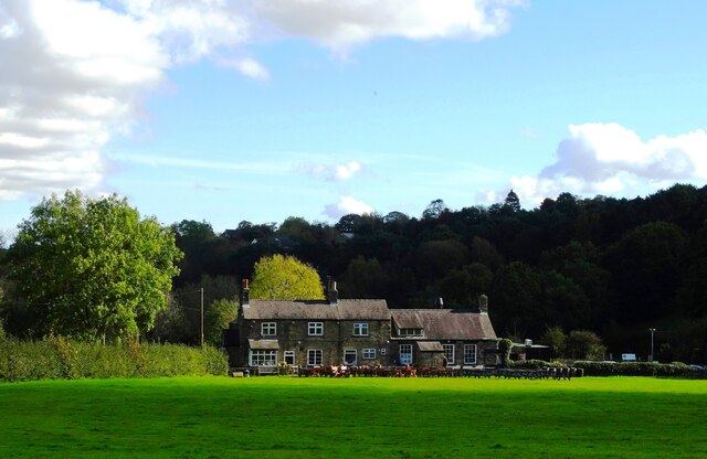
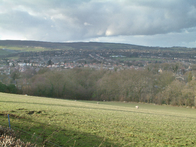
Abbeydale Park is a historic estate located in the county of Derbyshire, England. Situated near the town of Dore, it covers an expansive area of approximately 100 acres. The park is surrounded by picturesque countryside and offers visitors a serene and tranquil environment to explore.

The history of Abbeydale Park dates back to the 12th century when it was established as part of the Beauchief Abbey estate. Over the years, it has undergone various changes and developments, but it still retains its rustic charm and natural beauty.

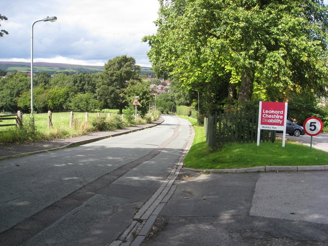
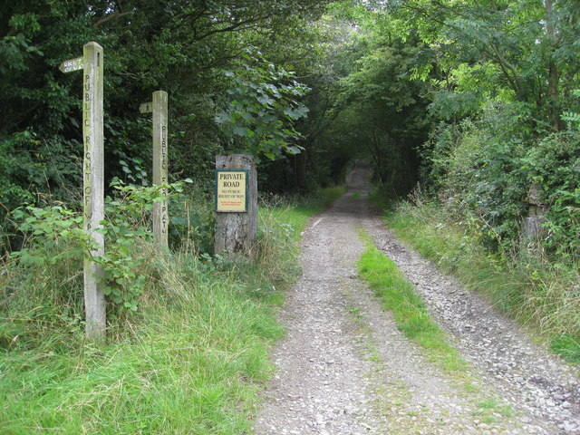
One of the main attractions of Abbeydale Park is its stunning gardens. The park boasts meticulously manicured lawns, vibrant flower beds, and a variety of trees and shrubs. Visitors can take leisurely strolls along the winding paths, enjoying the sights and sounds of nature. The park also features a beautiful lake, where visitors can relax and watch the ducks and swans that inhabit its waters.

In addition to its natural beauty, Abbeydale Park offers a range of recreational activities. There are ample opportunities for walking, jogging, and cycling, with designated paths and trails throughout the park. The estate also has a playground for children, making it a popular destination for families.

Abbeydale Park is not only a place for leisure and relaxation but also serves as a venue for various events and activities. It regularly hosts community gatherings, concerts, and outdoor theater performances, attracting visitors from near and far.

Overall, Abbeydale Park is a charming and idyllic destination, offering a perfect blend of natural beauty and recreational opportunities. Whether for a peaceful walk, a family outing, or attending an event, visitors are sure to enjoy the serene ambiance and scenic surroundings that Abbeydale Park has to offer.

If you have any feedback on the listing, please let us know in the comments section below.

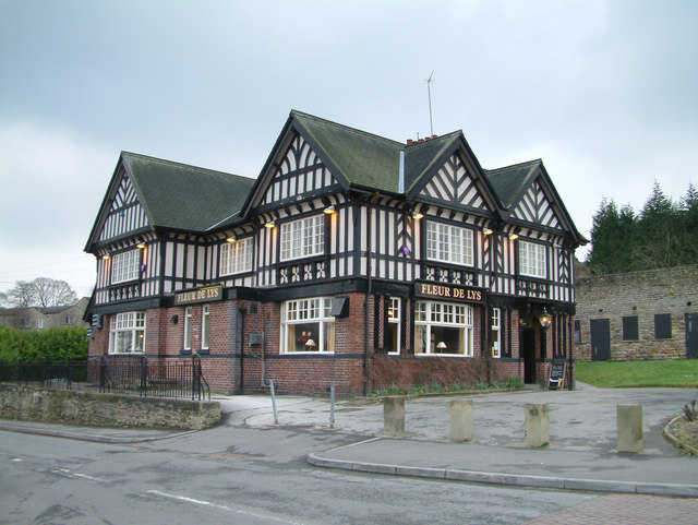
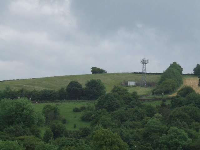
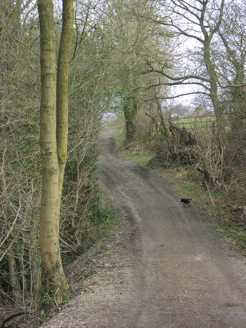
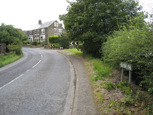
Abbeydale Park Images

Images are sourced within 2km of 53.323524/-1.525099 or Grid Reference SK3180. Thanks to Geograph Open Source API. All images are credited.

Upper Birchitt farm and wind turbines. Along the Dronfield 2000 rotary walk.
Upper Birchitt farm and wind turbines.
Along the Dronfield 2000 rotary walk.
Looking towards Owler Bar From top of Totley Lane, Bradway
Looking towards Owler Bar
From top of Totley Lane, Bradway
Beneath November clouds at Totley Bents Another view of "The Cricket Inn".
Beneath November clouds at Totley Bents
Another view of "The Cricket Inn".
"The Cricket Inn"  in  Totley Bents On the edge of the city of Sheffield.
"The Cricket Inn" in Totley Bents
On the edge of the city of Sheffield.
"The Cricket Inn", Totley Bents in early springtime Two brothers, still in school uniform, are playing football on the playing-field.
"The Cricket Inn", Totley Bents in early springtime
Two brothers, still in school uniform, are playing football on the playing-field.
Gate to Totley Bents Recreation Ground With "The Cricket Inn" at the other side of the field.
Gate to Totley Bents Recreation Ground
With "The Cricket Inn" at the other side of the field.
"The Cricket Inn" at Totley Bents
Old milepost On the A621, Baslow Road, Totley this milepost becomes more and more neglected.   It is in a very vulnerable position opposite houses that often have parked cars making the road narrower.   The foundry name is down the front spine DARWIN & CO SHEFFIELD.   Their name is also seen on gully grates and doubtless they cast other products.   There was a Sheffield, Baslow, Owler Bar turnpike that lasted from 1803 to 1880 so this post may date from the middle to late 19C.
Old milepost
On the A621, Baslow Road, Totley this milepost becomes more and more neglected. It is in a very vulnerable position opposite houses that often have parked cars making the road narrower. The foundry name is down the front spine DARWIN & CO SHEFFIELD. Their name is also seen on gully grates and doubtless they cast other products. There was a Sheffield, Baslow, Owler Bar turnpike that lasted from 1803 to 1880 so this post may date from the middle to late 19C.
Gillifield Wood and Totley In the southern suburbs of Sheffield
Gillifield Wood and Totley
In the southern suburbs of Sheffield
Yet another image of "The Cricket Inn" Viewed across the recreation ground at Totley Bents
Yet another image of "The Cricket Inn"
Viewed across the recreation ground at Totley Bents
Mickley Lane. This shows the New Totley end of the road which runs through to Mickley.
Mickley Lane.
This shows the New Totley end of the road which runs through to Mickley.
View from Mickley Lane. A view looking out to Totley Rise and beyond from the road running between New Totley and Mickley.
View from Mickley Lane.
A view looking out to Totley Rise and beyond from the road running between New Totley and Mickley.
Fleur De Lys public house. Located on Totley Hall Lane in the Totley area of Sheffield.
Fleur De Lys public house.
Located on Totley Hall Lane in the Totley area of Sheffield.
Phone Mast at Totley
The White Lane, Totley This track runs from Woodthorpe Hall to Mickley Lane in Totley. Here a tributary of the Totley Brook is culverted and marks the boundary between Derbyshire and Yorkshire.
The White Lane, Totley
This track runs from Woodthorpe Hall to Mickley Lane in Totley. Here a tributary of the Totley Brook is culverted and marks the boundary between Derbyshire and Yorkshire.
Mickley - Rod Moor Road Approaching junction with Mickley Lane.
Mickley - Rod Moor Road
Approaching junction with Mickley Lane.
Mickley Lane approaching New Totley
Private Road - Footpath to the left please The sign reads :-
Private Road
No public right of way
Some OS Maps have an Admitted Error
Private Road - Footpath to the left please
The sign reads :- Private Road No public right of way Some OS Maps have an Admitted Error
Show me another place!

Abbeydale Park is located at Grid Ref: SK3180 (Lat: 53.323524, Lng: -1.525099)

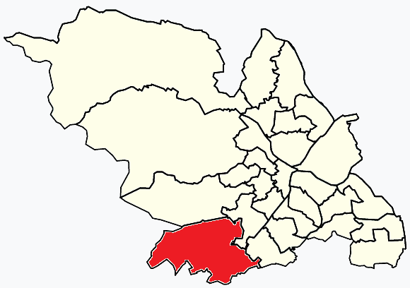
Unitary Authority: Sheffield

Police Authority: South Yorkshire

What 3 Words

///else.deck.battle. Near Dronfield, Derbyshire

Related Wikis

Dore and Totley

Dore and Totley ward—which includes the districts of Bradway , Dore, Totley, and Whirlow—is one of the 28 electoral wards in City of Sheffield, England...

Abbeydale Park

Abbeydale Park is a sports venue in Dore, South Yorkshire, England. It is unusual in having hosted home games for two different county cricket teams....

Totley Brook

The Totley Brook is a stream in Sheffield, South Yorkshire, England. It rises on a millstone grit ridge some 7 miles (11 km) to the south-west of the centre...

Dore & Totley railway station

Dore & Totley railway station serves the south-western Sheffield suburbs of Dore and Totley in South Yorkshire, England 4+3⁄4 miles (7.6 km) south of Sheffield...

Old Hay Brook

The Old Hay Brook is a small river in Sheffield, South Yorkshire, England. It is formed from the Redcar Brook, Blacka Dike and another stream, which rise...

King Ecgbert School

King Ecgbert School is a co-educational secondary school with academy status (age range 11–18) in the village of Dore in the south-west of Sheffield, South...

Dore, South Yorkshire

Dore is a large village in South Yorkshire, England. The village lies on a hill above the River Sheaf which gave Sheffield its name and, until 1934, was...
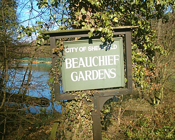
Beauchief Gardens

Beauchief Gardens is a small area of formal parkland in south-west Sheffield. The gardens lie between Abbeydale Road South to the north-west, the River...

Nearby Amenities

Located within 500m of 53.323524,-1.525099
Turning Circle
Lat/Long: 53.323312/-1.5321162
Turning Circle
Lat/Long: 53.3239109/-1.527605
Turning Circle
Lat/Long: 53.324395/-1.5282809
Turning Circle
Lat/Long: 53.324996/-1.5216801
Post Box
Collection Times: Mo-Fr 09:00; Sa 07:00
Post Box Type: pillar
Ref: S17 647
Royal Cypher: GR
Royal Cypher Wikidata: Q33102273
Lat/Long: 53.3238754/-1.5226097
Turning Circle
Lat/Long: 53.3219147/-1.530201
Baslow Road/Mill Lane
Bus: yes
Public Transport: stop_position
Lat/Long: 53.319045/-1.5253888
Baslow Road/Grove Road
Bus: yes
Public Transport: stop_position
Lat/Long: 53.3191189/-1.525567
Turning Circle
Lat/Long: 53.3210407/-1.5237576
Turning Circle
Lat/Long: 53.3243341/-1.5188769
Turning Circle
Lat/Long: 53.3229554/-1.5198453
Power: substation
Lat/Long: 53.3197647/-1.5276414
Place Of Worship
Dore & Totley United Reformed Church
Religion: christian
Lat/Long: 53.3204348/-1.526332
Booth: K6
Removed Amenity: telephone
Lat/Long: 53.3209554/-1.5246025
Post Box
Collection Times: Mo-Fr 16:15; Sa 10:30
Post Box Type: pillar
Postal Code: S17
Ref: S17 300
Royal Cypher: EIIR
Royal Cypher Wikidata: Q33102113
Lat/Long: 53.3214269/-1.5242766
Atm
Lat/Long: 53.3218415/-1.5240634
Recycling
Lat/Long: 53.3217381/-1.52055
Power: substation
Ref GB Uprn: 10013644335
Lat/Long: 53.3209664/-1.5220864
Turning Circle
Lat/Long: 53.3220237/-1.5219579
Waterway: water_level_monitor
Lat/Long: 53.3227064/-1.5209444
Abbeydale Sports Club
Leisure: sports_centre
Lat/Long: 53.3253149/-1.5204245
Bus Stop
Abbeydale Rd South/Five Trees Dr
Alt Name: Abbeydale Rd South/Five Trees Dr
Bus: yes
Naptan AltCommonName: Abbeydale Rd South/Five Trees Dr
Naptan AtcoCode: 370020443
Naptan Bearing: NE
Naptan CommonName: Abbeydale Rd South/Five Trees Dr
Naptan Indicator: 20443
Naptan Landmark: Outside Abbeydale Hall
Naptan PlusbusZoneRef: ROTHCEN
Naptan Street: Abbeydale Road South
Naptan Verified: no
Public Transport: platform
Source: naptan_import
Lat/Long: 53.3246183/-1.5195163
Bus Stop
Abbeydale Rd South/Five Trees Dr
Alt Name: Abbeydale Rd South/Five Trees Dr
Bus: yes
Naptan AltCommonName: Abbeydale Rd South/Five Trees Dr
Naptan AtcoCode: 370020444
Naptan Bearing: SW
Naptan CommonName: Abbeydale Rd South/Five Trees Dr
Naptan Indicator: 20444
Naptan Landmark: Abbeydale Hall
Naptan PlusbusZoneRef: ROTHCEN
Naptan Street: Abbeydale Road South
Naptan Verified: no
Public Transport: platform
Source: naptan_import
Lat/Long: 53.3242692/-1.5198956
Bus Stop
Abbeydale Road Sth/Devonshire Road
Alt Name: Abbeydale Road Sth/Devonshire Road
Bench: yes
Bus: yes
Covered: yes
Naptan AltCommonName: Abbeydale Road Sth/Devonshire Road
Naptan AtcoCode: 370020445
Naptan Bearing: NE
Naptan CommonName: Abbeydale Road Sth/Devonshire Road
Naptan Indicator: 20445
Naptan Landmark: Outside Woods Market/Mobile Ga
Naptan PlusbusZoneRef: ROTHCEN
Naptan Street: Abbeydale Road South
Naptan Verified: no
Public Transport: platform
Shelter: yes
Source: naptan_import
Lat/Long: 53.3215797/-1.5239609
Bus Stop
Abbeydale Road Sth/Brinkburn Drive
Bus: yes
Naptan AtcoCode: 370020446
Naptan Bearing: SW
Naptan CommonName: Abbeydale Road Sth/Brinkburn Drive
Naptan Indicator: 20446
Naptan Landmark: 20446
Naptan PlusbusZoneRef: ROTHCEN
Naptan Street: Abbeydale Road South
Naptan Verified: no
Public Transport: platform
Source: naptan_import
Lat/Long: 53.3229655/-1.5220571
Bus Stop
Abbeydale Road Sth/Abbeydale Park Rise
Alt Name: Abbeydale Road Sth/Abbeydale Park Rise
Bus: yes
Naptan AltCommonName: Abbeydale Road Sth/Abbeydale Park Rise
Naptan AtcoCode: 370020447
Naptan Bearing: NE
Naptan CommonName: Abbeydale Road Sth/Abbeydale Park Rise
Naptan Indicator: 20447
Naptan Landmark: Outside No. 264
Naptan PlusbusZoneRef: ROTHCEN
Naptan Street: Abbeydale Road South
Naptan Verified: no
Public Transport: platform
Source: naptan_import
Lat/Long: 53.3231808/-1.5219496
Bus Stop
Abbeydale Road Sth/West View Close
Alt Name: Abbeydale Road Sth/West View Close
Bus: yes
Naptan AltCommonName: Abbeydale Road Sth/West View Close
Naptan AtcoCode: 370020448
Naptan Bearing: SW
Naptan CommonName: Abbeydale Road Sth/West View Close
Naptan Indicator: 20448
Naptan Landmark: 20448
Naptan PlusbusZoneRef: ROTHCEN
Naptan Street: Abbeydale Road South
Naptan Verified: no
Public Transport: platform
Source: naptan_import
Lat/Long: 53.3211209/-1.5240137
Bus Stop
Baslow Road/Mill Lane
Alt Name: Baslow Road/Mill Lane
Bus: yes
Naptan AltCommonName: Baslow Road/Mill Lane
Naptan AtcoCode: 370020449
Naptan Bearing: S
Naptan CommonName: Baslow Road/Mill Lane
Naptan Indicator: 20449
Naptan Landmark: Methodist Church
Naptan PlusbusZoneRef: ROTHCEN
Naptan Street: Baslow Road
Naptan Verified: no
Public Transport: platform
Source: naptan_import
Lat/Long: 53.3190516/-1.5253169
Bus Stop
Baslow Road/Grove Road
Bus: yes
Naptan AtcoCode: 370020450
Naptan Bearing: N
Naptan CommonName: Baslow Road/Grove Road
Naptan Indicator: 20450
Naptan Landmark: 20450
Naptan PlusbusZoneRef: ROTHCEN
Naptan Street: Baslow Road
Naptan Verified: no
Public Transport: platform
Source: naptan_import
Lat/Long: 53.3190902/-1.5256545
Bus Stop
Totley Brook Road/Abbeydale Road Sth
Bus: yes
Naptan AtcoCode: 370020455
Naptan Bearing: N
Naptan CommonName: Totley Brook Road/Abbeydale Road Sth
Naptan Indicator: 20455
Naptan Landmark: Opposite No. 18
Naptan PlusbusZoneRef: ROTHCEN
Naptan Street: Totley Brook Road
Naptan Verified: no
Public Transport: platform
Source: naptan_import
Lat/Long: 53.3205149/-1.525147
Bus Stop
Totley Brook Road/King Ecgbert Road
Bus: yes
Covered: yes
Naptan AtcoCode: 370020456
Naptan Bearing: N
Naptan CommonName: Totley Brook Road/King Ecgbert Road
Naptan Indicator: 20456
Naptan Landmark: Outside Sherwood Chase/Flats
Naptan PlusbusZoneRef: ROTHCEN
Naptan Street: Totley Brook Road
Naptan Verified: no
Public Transport: platform
Shelter: yes
Source: naptan_import
Lat/Long: 53.3195954/-1.5287399
Bus Stop
King Ecgbert Road/Totley Brook Road
Bus: yes
Naptan AtcoCode: 370020458
Naptan Bearing: W
Naptan CommonName: King Ecgbert Road/Totley Brook Road
Naptan Indicator: 20458
Naptan Landmark: 20458
Naptan PlusbusZoneRef: ROTHCEN
Naptan Street: King Ecbert Road
Naptan Verified: no
Public Transport: platform
Source: naptan_import
Lat/Long: 53.3199627/-1.5288038
Bicycle Parking
Bicycle Parking: stands
Capacity: 13
Covered: no
Lat/Long: 53.3219537/-1.5239204
Turning Circle
Lat/Long: 53.3248472/-1.5205415
Railway: buffer_stop
Lat/Long: 53.3200435/-1.5257104
Power: substation
Substation: minor_distribution
Lat/Long: 53.326141/-1.5304469
Railway: switch
Lat/Long: 53.3212585/-1.5220368
Turning Circle
Lat/Long: 53.3227119/-1.5306475
Turning Circle
Lat/Long: 53.3224579/-1.5296505
Turning Circle
Lat/Long: 53.3193233/-1.5240875
Barrier: bollard
Lat/Long: 53.3214956/-1.5243003
Barrier: bollard
Lat/Long: 53.3214872/-1.5242801
Barrier: bollard
Lat/Long: 53.3215126/-1.5243417
Barrier: bollard
Lat/Long: 53.3214776/-1.5242569
Barrier: bollard
Lat/Long: 53.3215044/-1.5243218
Abbeydale Park
Place: neighbourhood
Lat/Long: 53.3251759/-1.527415
Entrance: yes
Lat/Long: 53.3257283/-1.5206622
Turning Circle
Lat/Long: 53.3263006/-1.5273237
Turning Circle
Lat/Long: 53.3244859/-1.5266755
Turning Circle
Lat/Long: 53.3247186/-1.5293672
Turning Circle
Lat/Long: 53.3259585/-1.5311476
Turning Circle
Lat/Long: 53.3229458/-1.5300341
Turning Circle
Lat/Long: 53.3228657/-1.5314763
Turning Circle
Lat/Long: 53.327477/-1.5226611
Defibrillator
Access: yes
Check Date: 2023-03-09
Defibrillator Location: On outside wall. Available 24/7.
Emergency: defibrillator
Indoor: no
Opening Hours: 24/7
Lat/Long: 53.3204123/-1.5260954
King Ecgbert Road/Totley Brook Road
Bus: yes
Public Transport: stop_position
Lat/Long: 53.3199962/-1.5288036
Totley Brook Road/Abbeydale Road Sth
Bus: yes
Public Transport: stop_position
Lat/Long: 53.3205518/-1.5252004
Abbeydale Road Sth/Devonshire Road
Bus: yes
Public Transport: stop_position
Lat/Long: 53.3215447/-1.5238732
Abbeydale Road Sth/West View Close
Bus: yes
Public Transport: stop_position
Lat/Long: 53.3211446/-1.5240837
Abbeydale Road Sth/Brinkburn Drive
Bus: yes
Public Transport: stop_position
Lat/Long: 53.3229971/-1.5221087
Abbeydale Road Sth/Abbeydale Park Rise
Bus: yes
Public Transport: stop_position
Lat/Long: 53.3231519/-1.5218887
Abbeydale Rd South/Five Trees Dr
Bus: yes
Public Transport: stop_position
Lat/Long: 53.324306/-1.5199216
Abbeydale Rd South/Five Trees Dr
Bus: yes
Public Transport: stop_position
Lat/Long: 53.3245534/-1.5194419
Railway: switch
Lat/Long: 53.3201261/-1.5257574
Railway: switch
Lat/Long: 53.3199501/-1.5265679
Crossing
Crossing: unmarked
Crossing Island: no
Tactile Paving: yes
Lat/Long: 53.3192287/-1.5254558
Crossing
Crossing: unmarked
Crossing Island: no
Tactile Paving: yes
Lat/Long: 53.3192155/-1.5255938
Crossing
Crossing: unmarked
Crossing Island: no
Crossing Markings: no
Tactile Paving: yes
Lat/Long: 53.3213924/-1.5238589
Crossing
Crossing: unmarked
Crossing Island: no
Crossing Markings: no
Tactile Paving: yes
Lat/Long: 53.3214372/-1.5239803
Grit Bin
Operator: Sheffield City Council
Operator Type: government
Operator Wikidata: Q7492609
Seasonal: no
Lat/Long: 53.3210967/-1.5217359
Grit Bin
Operator: Sheffield City Council
Operator Type: government
Operator Wikidata: Q7492609
Seasonal: no
Lat/Long: 53.3205342/-1.5204512
Grit Bin
Operator: Sheffield City Council
Operator Type: government
Operator Wikidata: Q7492609
Seasonal: no
Lat/Long: 53.3233009/-1.5313045
Grit Bin
Operator: Sheffield City Council
Operator Type: government
Operator Wikidata: Q7492609
Seasonal: no
Lat/Long: 53.3238687/-1.5226207
Grit Bin
Operator: Sheffield City Council
Operator Type: government
Operator Wikidata: Q7492609
Seasonal: no
Lat/Long: 53.3267232/-1.5284294
Grit Bin
Operator: Sheffield City Council
Operator Type: government
Operator Wikidata: Q7492609
Seasonal: no
Lat/Long: 53.3211056/-1.5217208
Grit Bin
Operator: Sheffield City Council
Operator Type: government
Operator Wikidata: Q7492609
Seasonal: no
Lat/Long: 53.322393/-1.5290175
Grit Bin
Operator: Sheffield City Council
Operator Type: government
Operator Wikidata: Q7492609
Seasonal: no
Lat/Long: 53.3242801/-1.5311737
Grit Bin
Operator: Sheffield City Council
Operator Type: government
Operator Wikidata: Q7492609
Seasonal: no
Lat/Long: 53.3205696/-1.5203007
Defibrillator
Access: customers
Defibrillator Location: Inside the clubhouse next to the lift.
Emergency: defibrillator
Indoor: yes
Lat/Long: 53.3256777/-1.5206967
Kinetic
Healthcare: alternative
Healthcare Speciality: chiropractic
Lat/Long: 53.3215803/-1.5242124
Defibrillator
Access: yes
Defibrillator Location: On the outside wall of the tennis club clubhouse. Accessible by the public.
Emergency: defibrillator
Indoor: no
Lat/Long: 53.324604/-1.5271547
The data included in this document is from www.openstreetmap.org. The data is made available under ODbL.

Have you been to Abbeydale Park?

Leave your review of Abbeydale Park below (or comments, questions and feedback).