Abbeydale

Settlement in Gloucestershire Gloucester

England

Abbeydale

Barnwood The Church of St Lawrence
Barnwood Credit: David Stowell

Abbeydale is a small village located in the county of Gloucestershire, England. Situated in the South West region of the country, it lies approximately three miles east of the city of Gloucester. The village is nestled amidst picturesque countryside, with rolling hills and lush green fields surrounding it.

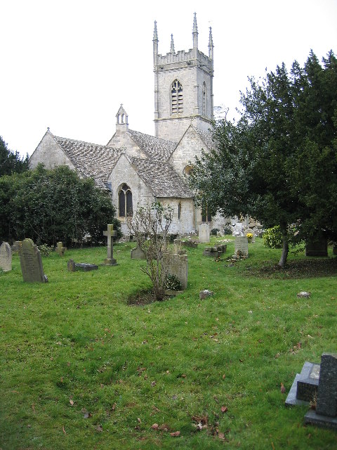
Abbeydale is renowned for its historical significance, as it was once home to a Cistercian Abbey, which was founded in the 12th century. The remains of this abbey still exist today, serving as a reminder of the village's rich heritage. Visitors can explore the ruins and marvel at the architectural remnants that have withstood the test of time.

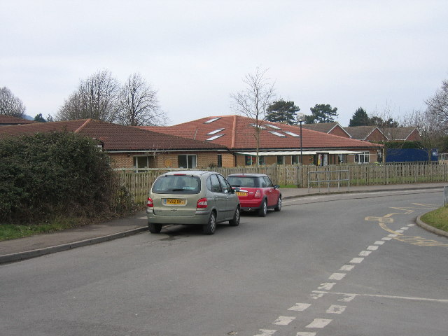
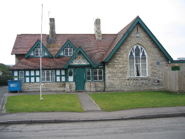
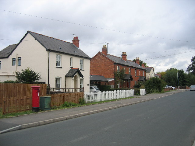
The village itself is quaint and charming, with a population of around 1,200 residents. It boasts a close-knit community, where locals take pride in maintaining the village's beauty and preserving its historical landmarks. The streets are lined with traditional stone houses, giving Abbeydale an authentic and timeless feel.

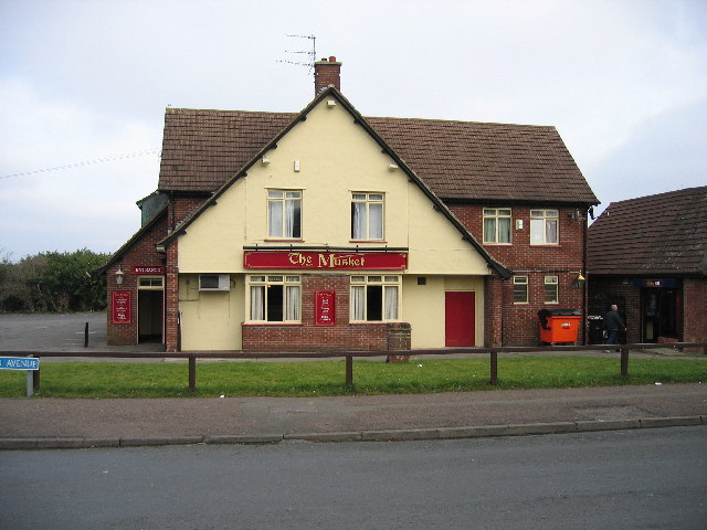
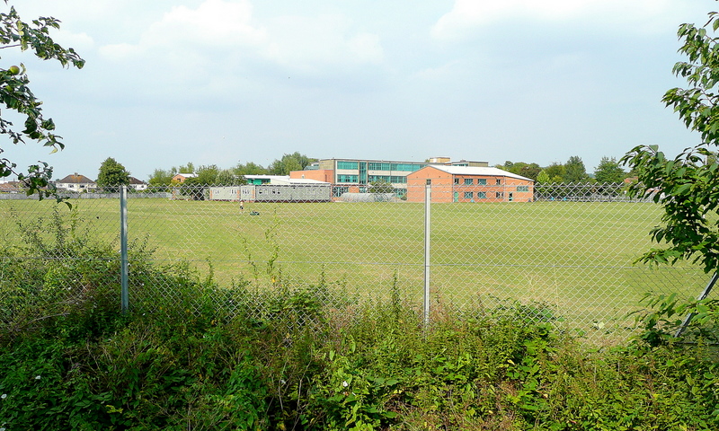
Despite its small size, Abbeydale offers a range of amenities to its residents. There is a local primary school, a village hall, and a small selection of shops and pubs. The nearby city of Gloucester provides additional services and facilities, such as supermarkets, healthcare centers, and leisure activities.

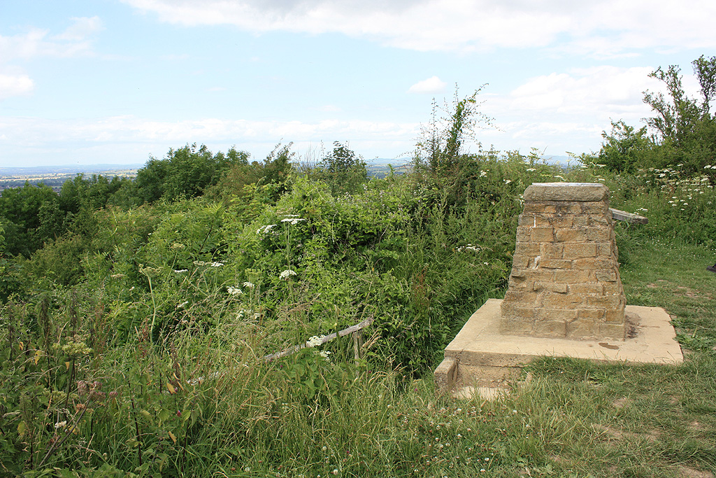
Surrounded by nature, Abbeydale is a haven for outdoor enthusiasts. The village is located close to the Cotswolds, a designated Area of Outstanding Natural Beauty. This allows residents and visitors to enjoy breathtaking countryside walks, cycling trails, and picnics in the idyllic surroundings.

Overall, Abbeydale is a charming village that combines rich history, natural beauty, and a strong sense of community, making it an appealing place to live or visit.

If you have any feedback on the listing, please let us know in the comments section below.

Abbeydale Images

Images are sourced within 2km of 51.846147/-2.1992196 or Grid Reference SO8616. Thanks to Geograph Open Source API. All images are credited.

Barnwood The Church of St Lawrence
Barnwood
The Church of St Lawrence
Barnwood Barnwood Avenue, complete with May Blossom
Barnwood
Barnwood Avenue, complete with May Blossom
Gloucester Business Park - Montpellier Court Built on the site of the wartime Gloster Aircraft factory the Gloucester Business Park sprawls over four grid squares.  This section of the park contains modern office buildings.
Gloucester Business Park - Montpellier Court
Built on the site of the wartime Gloster Aircraft factory the Gloucester Business Park sprawls over four grid squares. This section of the park contains modern office buildings.
Plaque Commemorating Gloster Aircraft Factory The Gloster B28/39

First British Jet Aircraft

Designed and constructed by Gloster Aircraft Company Ltd. a member of the Hawker Siddeley Group on this site during 1940-41 and powered by the first jet engine invented by Sir Frank Whittle

This plaque is also a tribute to all GAC personnel who contributed so much to the 1939-45 war effort

Commemorative plaque designed by Gloster Design Services (e&b) ltd.
Plaque Commemorating Gloster Aircraft Factory
The Gloster B28/39 First British Jet Aircraft Designed and constructed by Gloster Aircraft Company Ltd. a member of the Hawker Siddeley Group on this site during 1940-41 and powered by the first jet engine invented by Sir Frank Whittle This plaque is also a tribute to all GAC personnel who contributed so much to the 1939-45 war effort Commemorative plaque designed by Gloster Design Services (e&b) ltd.
Kingscroft Road, Hucclecote Some of the older houses on this road. Hucclecote was at one time a village on the   road from Gloucester to Cirencester but has now been absorbed as the suburbs of Gloucester.
Kingscroft Road, Hucclecote
Some of the older houses on this road. Hucclecote was at one time a village on the road from Gloucester to Cirencester but has now been absorbed as the suburbs of Gloucester.
Kingscroft Road, Hucclecote Looking west along Kingscroft Road.
Kingscroft Road, Hucclecote
Looking west along Kingscroft Road.
Royal Oak, Hucclecote This public house was in the centre of the village of Hucclecote and was extended in the 1960s to serve the housing developments that accompanied the growth of the boundaries of Gloucester to engulf the village.
Royal Oak, Hucclecote
This public house was in the centre of the village of Hucclecote and was extended in the 1960s to serve the housing developments that accompanied the growth of the boundaries of Gloucester to engulf the village.
Hucclecote Millennium Garden Located in the corner of Hucclecote Road and Porchester Road, with Hucclecote Court on the right.
Hucclecote Millennium Garden
Located in the corner of Hucclecote Road and Porchester Road, with Hucclecote Court on the right.
Hucclecote Court Once a country house, this building right on the eastern edge of the square is now home to a firm of solicitors.
Hucclecote Court
Once a country house, this building right on the eastern edge of the square is now home to a firm of solicitors.
Zoons Court Roundabout A417 from overbridge A very awkward roundabout joining the Brockworth bypass to the older Hucclecote bypass
Zoons Court Roundabout A417 from overbridge
A very awkward roundabout joining the Brockworth bypass to the older Hucclecote bypass
The Turmut Hoer Abbeymead A turmut hoer hoes turnips!
The Turmut Hoer Abbeymead
A turmut hoer hoes turnips!
Abbeymead Primary School
Curlew Road Gloucester The houses in this part of town all face onto the wrong road, the address being the vehicle access at the back, very confusing for visitors and deliverymen.
Curlew Road Gloucester
The houses in this part of town all face onto the wrong road, the address being the vehicle access at the back, very confusing for visitors and deliverymen.
The Musket Matson
The Musket Matson
Primary  School Upton St Leonards
Primary School Upton St Leonards
Bowden Hall Hotel Upton St Leonards Once a country house
Bowden Hall Hotel Upton St Leonards
Once a country house
The Village Institute Upton St Leonards
Parish Church Upton St Leonards
Show me another place!

Abbeydale is located at Grid Ref: SO8616 (Lat: 51.846147, Lng: -2.1992196)

Administrative County: Gloucestershire

District: Gloucester

Police Authority: Gloucestershire

What 3 Words

///radio.stages.rival. Near Barnwood, Gloucestershire

Nearby Locations

Abbeydale

Related Wikis

Nearby Amenities

Located within 500m of 51.846147,-2.1992196
Traffic Calming: table
Lat/Long: 51.846419/-2.1984941
Mini Roundabout
Lat/Long: 51.8443793/-2.1952744
Mini Roundabout
Lat/Long: 51.8461721/-2.1925224
Crossing
Crossing: traffic_signals
Crossing Ref: toucan
Lat/Long: 51.8458126/-2.1983425
Lobleys Drive
Power: substation
Ref: 62286
Lat/Long: 51.8458332/-2.1928213
Bus Stop
The Turmut-Hoer
Bus: yes
Departures Board: timetable
Naptan AtcoCode: 1600GL10
Naptan Bearing: NW
Naptan CommonName: The Termut-hoer
Naptan Indicator: Opp
Naptan NaptanCode: glodjdgd
Naptan PlusbusZoneRef: GLOSTER
Naptan Street: Abbeymead Ave
Naptan Verified: no
Public Transport: platform
Shelter: yes
Source: naptan_import
Lat/Long: 51.8464793/-2.199919
Bus Stop
Upton Lane
Bus: yes
Departures Board: timetable
Naptan AtcoCode: 1600GL11
Naptan Bearing: SW
Naptan CommonName: Upton Lane
Naptan NaptanCode: glodjdtj
Naptan PlusbusZoneRef: GLOSTER
Naptan Street: Abbeymead Ave
Naptan Verified: no
Public Transport: platform
Shelter: no
Source: naptan_import
Lat/Long: 51.8432792/-2.1976228
Bus Stop
Upton Lane
Bus: yes
Departures Board: timetable
Naptan AtcoCode: 1600GL12
Naptan Bearing: NE
Naptan CommonName: Upton Lane
Naptan Indicator: Opp
Naptan NaptanCode: glodjdpw
Naptan PlusbusZoneRef: GLOSTER
Naptan Street: Abbeymead Ave
Naptan Verified: no
Public Transport: platform
Shelter: yes
Source: naptan_import
Lat/Long: 51.8433576/-2.1976994
Bus Stop
Bishops Road
Bus: yes
Departures Board: no
Naptan AtcoCode: 1600GL19
Naptan Bearing: S
Naptan CommonName: Bishops Rd
Naptan NaptanCode: glodjatw
Naptan PlusbusZoneRef: GLOSTER
Naptan Street: Abbeymead Ave
Naptan Verified: no
Public Transport: platform
Shelter: no
Source: naptan_import
Lat/Long: 51.8495407/-2.2007342
Bus Stop
Longborough Drive
Bus: yes
Departures Board: timetable
Naptan AtcoCode: 1600GL28
Naptan Bearing: NE
Naptan CommonName: Longborough Drive
Naptan NaptanCode: glodjatm
Naptan PlusbusZoneRef: GLOSTER
Naptan Street: Abbeymead Ave
Naptan Verified: no
Public Transport: platform
Shelter: yes
Source: naptan_import
Lat/Long: 51.8419639/-2.2004604
Bus Stop
The Turmut-Hoer
Bus: yes
Departures Board: timetable
Naptan AtcoCode: 1600GL9
Naptan Bearing: SE
Naptan CommonName: The Termut-hoer
Naptan NaptanCode: glodjdjd
Naptan PlusbusZoneRef: GLOSTER
Naptan Street: Abbeymead Ave
Naptan Verified: no
Public Transport: platform
Shelter: yes
Source: naptan_import
Lat/Long: 51.8462118/-2.1992144
Bus Stop
Palmer Avenue
Bus: yes
Departures Board: timetable
Naptan AtcoCode: 1600GLA26335
Naptan Bearing: SW
Naptan CommonName: Palmer Avenue
Naptan NaptanCode: glogpjmj
Naptan PlusbusZoneRef: GLOSTER
Naptan Street: Lobleys Drive
Naptan Verified: no
Public Transport: platform
Shelter: yes
Source: naptan_import
Lat/Long: 51.8445068/-2.194745
Bus Stop
Brome Rd
Bus: yes
Departures Board: timetable
Naptan AtcoCode: 1600GLA26337
Naptan Bearing: SW
Naptan CommonName: Brome Road
Naptan Indicator: Opp
Naptan NaptanCode: glogpjmt
Naptan PlusbusZoneRef: GLOSTER
Naptan Street: Lobleys Drive
Naptan Verified: no
Public Transport: platform
Shelter: yes
Source: naptan_import
Lat/Long: 51.845806/-2.1929509
Bus Stop
Brome Rd
Bus: yes
Departures Board: no
Naptan AtcoCode: 1600GLA26338
Naptan Bearing: NE
Naptan CommonName: Brome Road
Naptan NaptanCode: glogpjmw
Naptan PlusbusZoneRef: GLOSTER
Naptan Street: Lobleys Drive
Naptan Verified: no
Public Transport: platform
Shelter: no
Source: naptan_import
Lat/Long: 51.8452005/-2.1938072
Abbeymead Boulevard
Power: substation
Ref: 62114
Source: survey
Lat/Long: 51.8420047/-2.2000163
Post Box
Collection Times: Mo-Fr 17:30; Sa 12:30
Ref: GL4 156
Source: survey
Lat/Long: 51.8459613/-2.2007103
Post Box
Ref: GL4 154
Source: survey
Lat/Long: 51.8488152/-2.1995548
Post Box
Collection Times: Mo-Fr 17:30; Sa 12:30
Ref: GL4 409
Source: survey
Lat/Long: 51.8466839/-2.1991871
Bodenham Field
Note: No ref present
Power: substation
Source: survey
Lat/Long: 51.8477706/-2.2023414
Milton Green
Power: substation
Ref: 62297
Source: survey
Lat/Long: 51.848736/-2.199678
Power: substation
Ref: 62145
Source: survey
Lat/Long: 51.8458318/-2.2008205
Telephone
Booth: KX100
Covered: booth
Lat/Long: 51.8460994/-2.1988704
Tactile Paving: yes
Lat/Long: 51.8442437/-2.1967999
Tactile Paving: yes
Lat/Long: 51.8461808/-2.1923931
Tactile Paving: yes
Lat/Long: 51.8462719/-2.1924655
Tactile Paving: yes
Lat/Long: 51.8444128/-2.1968107
Tactile Paving: yes
Lat/Long: 51.8462139/-2.192377
Traffic Signals
Cycleway: asl
Direction: backward
Lat/Long: 51.8443398/-2.1967545
Traffic Signals
Crossing Ref: toucan
Cycleway: asl
Direction: forward
Lat/Long: 51.8445431/-2.1970184
Traffic Signals
Cycleway: asl
Direction: backward
Lat/Long: 51.8442064/-2.1970052
Crossing
Bicycle: designated
Crossing: traffic_signals
Foot: designated
Lat/Long: 51.8443415/-2.1968054
Crossing
Bicycle: designated
Crossing: traffic_signals
Crossing Ref: toucan
Foot: designated
Lat/Long: 51.8437484/-2.1969824
Tactile Paving: yes
Lat/Long: 51.8437814/-2.1969582
Crossing
Crossing: traffic_signals
Crossing Ref: puffin
Lat/Long: 51.8490139/-2.2009098
Source: Bing
Tactile Paving: yes
Lat/Long: 51.8500355/-2.2008045
Source: Bing
Tactile Paving: yes
Lat/Long: 51.8500177/-2.2006703
Crossing
Crossing: traffic_signals
Crossing Ref: puffin
Lat/Long: 51.8489871/-2.2010389
Tactile Paving: yes
Lat/Long: 51.8487836/-2.2007914
Tactile Paving: yes
Lat/Long: 51.8488781/-2.1996622
Tactile Paving: yes
Lat/Long: 51.8488532/-2.2007753
Crossing
Lat/Long: 51.8488257/-2.2007838
Tactile Paving: yes
Lat/Long: 51.848888/-2.1995335
Traffic Signals
Lat/Long: 51.8487122/-2.2011067
Traffic Signals
Lat/Long: 51.8488873/-2.2012488
Traffic Signals
Cycleway: asl
Lat/Long: 51.8486635/-2.2010377
Traffic Signals
Cycleway: asl
Lat/Long: 51.8490813/-2.2009061
Crossing
Crossing: uncontrolled
Crossing Island: yes
Lat/Long: 51.8475496/-2.2008233
Generator Method: photovoltaic
Generator Output Electricity: yes
Generator Source: solar
Generator Type: solar_photovoltaic_panel
Location: roof
Power: generator
Lat/Long: 51.8456296/-2.2062805
Parking
Lobleys Drive Park car park
Dog: yes
Sport: Abbeymead Rovers FC
Lat/Long: 51.8451898/-2.194915
Crossing
Crossing: uncontrolled
Crossing Island: yes
Lat/Long: 51.8463322/-2.1995683
Traffic Signals
Direction: backward
Lat/Long: 51.8488211/-2.2007321
Traffic Signals
Cycleway: asl
Direction: backward
Lat/Long: 51.8437273/-2.196919
Traffic Signals
Cycleway: asl
Direction: backward
Lat/Long: 51.8436794/-2.1972728
Traffic Signals
Cycleway: asl
Direction: forward
Lat/Long: 51.8439228/-2.1971154
Turning Circle
Lat/Long: 51.8498005/-2.2027746
Crossing
Lat/Long: 51.844545/-2.2042971
Crossing
Lat/Long: 51.8444898/-2.2042971
Artwork Type: sculpture
Material: wood
Tourism: artwork
Lat/Long: 51.842728/-2.2039538
Turning Circle
Lat/Long: 51.8470165/-2.1933764
Turning Circle
Lat/Long: 51.8469287/-2.193469
Man Made: street_cabinet
Lat/Long: 51.8460881/-2.1988291
Bus Stop
Charlwood House
Bus: yes
Departures Board: timetable
Naptan AtcoCode: 1600GLA90883
Naptan Bearing: N
Naptan CommonName: Charlwood House
Naptan Indicator: Stop
Naptan NaptanCode: glogptma
Naptan PlusbusZoneRef: GLOSTER
Naptan Street: Abbeymead Avenue
Naptan Verified: no
Public Transport: platform
Shelter: yes
Lat/Long: 51.8473117/-2.2007695
Bus Stop
The Oaks
Bus: yes
Departures Board: timetable
Public Transport: platform
Shelter: yes
Lat/Long: 51.8502449/-2.2007543
Bus Stop
Primary School stop
Bus: yes
Public Transport: platform
Lat/Long: 51.8447508/-2.1969932
The data included in this document is from www.openstreetmap.org. The data is made available under ODbL.

Have you been to Abbeydale?

Leave your review of Abbeydale below (or comments, questions and feedback).