Straits, The

Settlement in Staffordshire

England

Straits, The

Woodland in Baggeridge Country Park, near Sedgley These woods are by the road north of the visitor centre near Gospel End. 
Baggeridge Country Park is an attractive area of countryside near Dudley and Wolverhampton. It was formerly the Baggeridge Colliery. Together with part of the original Himley Estate of the Earls of Dudley, the whole site has been transformed into 150 acres of attractive country park, including woodland, lakes, and open grassed areas.
Woodland in Baggeridge Country Park, near Sedgley Credit: Roger Kidd

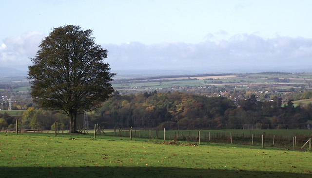
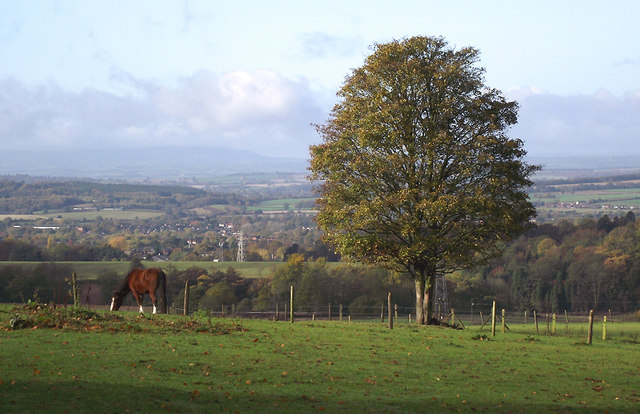
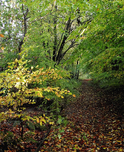
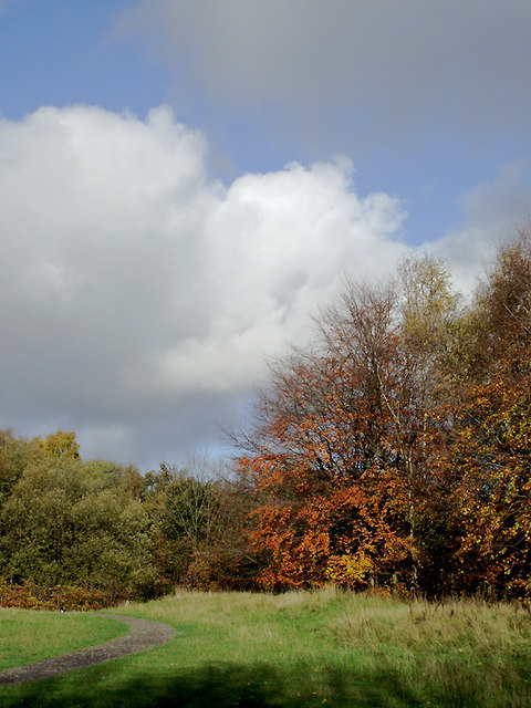
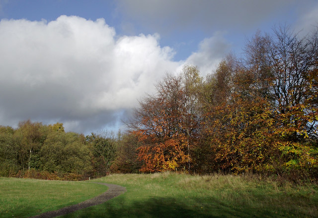
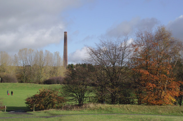
The Straits is a charming Staffordshire village located in the West Midlands region of England. Situated near the town of Dudley, The Straits offers a peaceful and idyllic setting for residents and visitors alike. The village is known for its picturesque countryside, rolling hills, and stunning views.

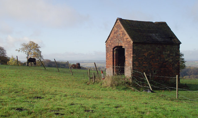
The Straits is home to a close-knit community that takes pride in its heritage and traditions. The village has a rich history, with many of its buildings dating back to the 18th and 19th centuries. The architecture in The Straits is a blend of traditional English styles, featuring quaint cottages and Georgian-style houses.

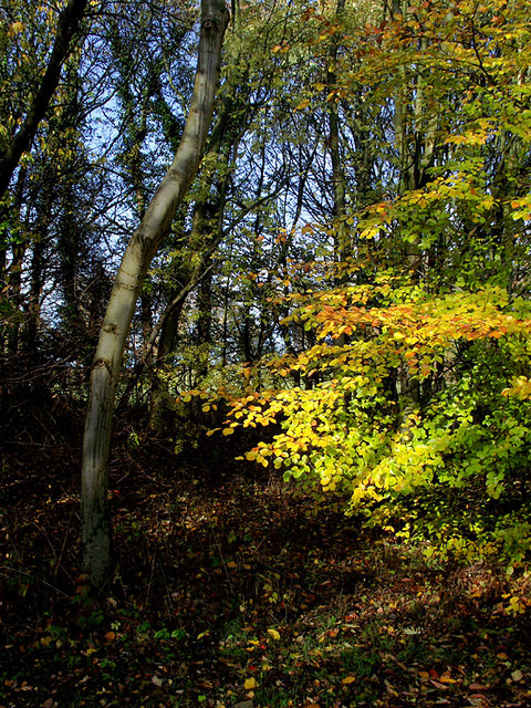
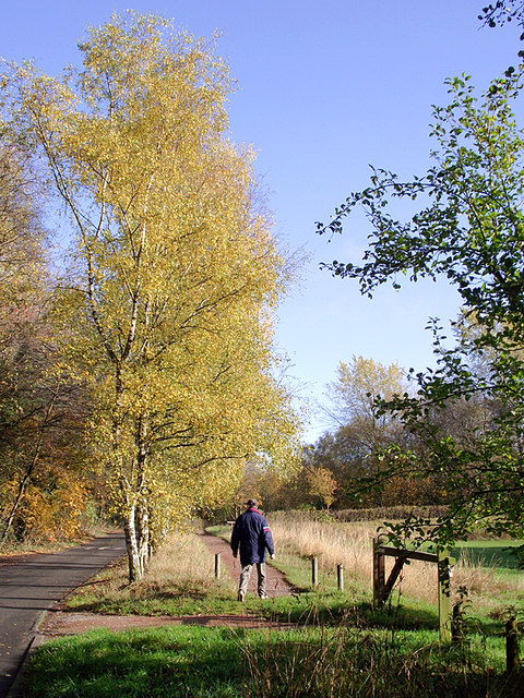
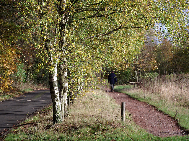
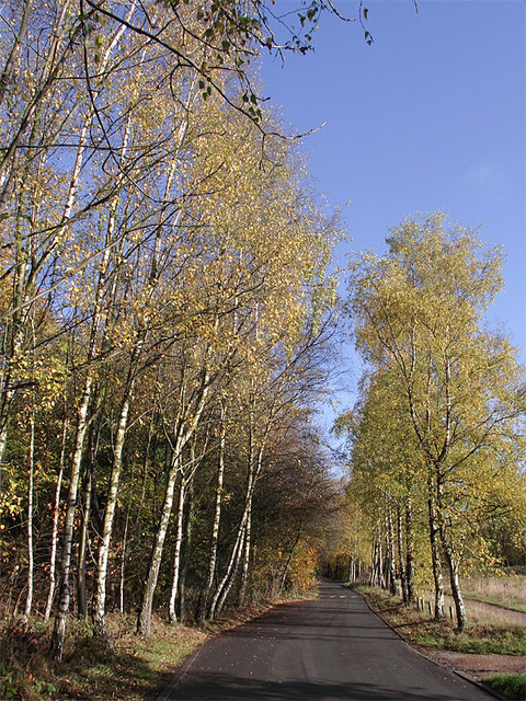
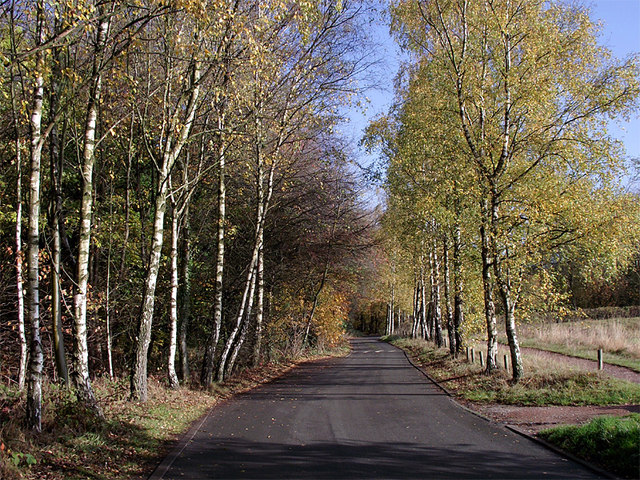
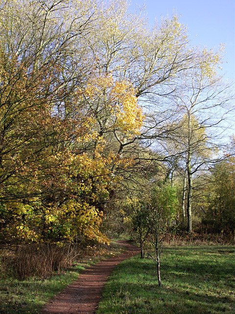
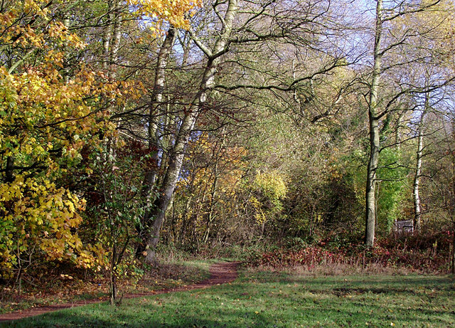
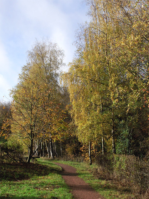
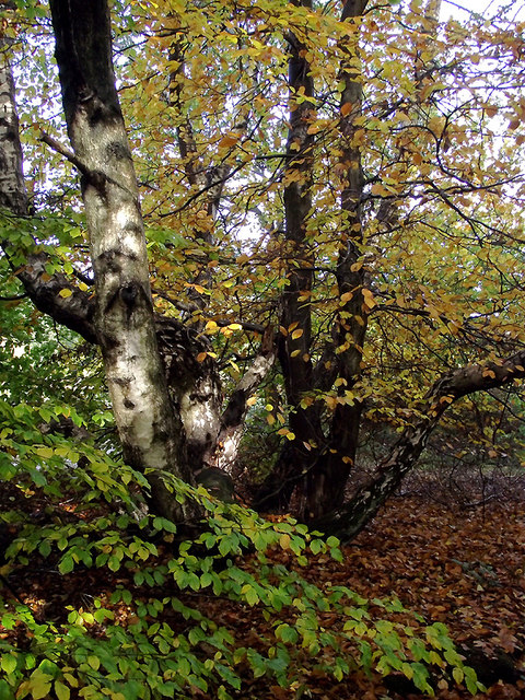
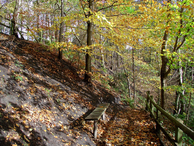
Nature enthusiasts will find plenty to explore in The Straits, as the village is surrounded by beautiful countryside and green spaces. The nearby Kinver Edge and Rock Houses, a National Trust property, is a popular attraction and offers stunning walks and panoramic views of the surrounding area.

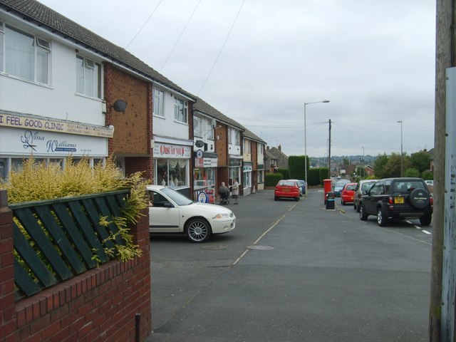
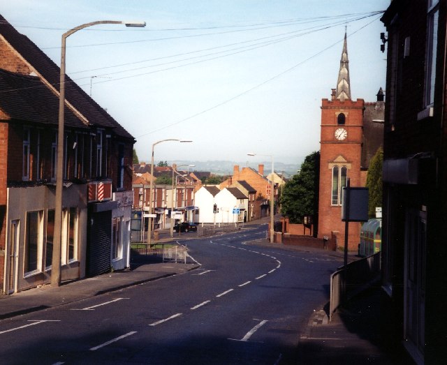
In terms of amenities, The Straits offers a range of services to its residents. The village has a primary school, a local pub, and a few small shops for everyday needs. For a wider range of facilities, the nearby towns of Dudley and Stourbridge provide a variety of shopping, dining, and entertainment options.

Overall, The Straits is a tranquil and picturesque village that provides a peaceful escape from the hustle and bustle of city life. Its natural beauty, historic charm, and strong sense of community make it a desirable place to live or visit.

If you have any feedback on the listing, please let us know in the comments section below.

Straits, The Images

Images are sourced within 2km of 52.526657/-2.143683 or Grid Reference SO9092. Thanks to Geograph Open Source API. All images are credited.

Woodland in Baggeridge Country Park, near Sedgley These woods are by the road north of the visitor centre near Gospel End. 
Baggeridge Country Park is an attractive area of countryside near Dudley and Wolverhampton. It was formerly the Baggeridge Colliery. Together with part of the original Himley Estate of the Earls of Dudley, the whole site has been transformed into 150 acres of attractive country park, including woodland, lakes, and open grassed areas.
Woodland in Baggeridge Country Park, near Sedgley
These woods are by the road north of the visitor centre near Gospel End. Baggeridge Country Park is an attractive area of countryside near Dudley and Wolverhampton. It was formerly the Baggeridge Colliery. Together with part of the original Himley Estate of the Earls of Dudley, the whole site has been transformed into 150 acres of attractive country park, including woodland, lakes, and open grassed areas.
 Baggeridge Country Park, near Sedgley The road links the car parks to Woodhouse Lane (A463) near Gospel End. The Upper Meadow is on the right.

Baggeridge Country Park is an attractive area of countryside near Dudley and Wolverhampton. It was formerly the Baggeridge Colliery. Together with part of the original Himley Estate of the Earls of Dudley, the whole site has been transformed into 150 acres of attractive country park, including woodland, lakes, and open grassed areas. <span class="nowrap"><a title="http://www.sstaffs.gov.uk/default.aspx?page=12695" rel="nofollow ugc noopener" href="http://www.sstaffs.gov.uk/default.aspx?page=12695">Link</a><img style="margin-left:2px;" alt="External link" title="External link - shift click to open in new window" src="https://s1.geograph.org.uk/img/external.png" width="10" height="10"/></span>
Baggeridge Country Park, near Sedgley
The road links the car parks to Woodhouse Lane (A463) near Gospel End. The Upper Meadow is on the right. Baggeridge Country Park is an attractive area of countryside near Dudley and Wolverhampton. It was formerly the Baggeridge Colliery. Together with part of the original Himley Estate of the Earls of Dudley, the whole site has been transformed into 150 acres of attractive country park, including woodland, lakes, and open grassed areas. LinkExternal link
 Baggeridge Country Park, near Sedgley The road links the car parks to Woodhouse Lane (A463) near Gospel End. The Upper Meadow is off to the right.
Baggeridge Country Park, near Sedgley
The road links the car parks to Woodhouse Lane (A463) near Gospel End. The Upper Meadow is off to the right.
The Road to Gospel End near Sedgley The private road is in Baggeridge Country Park and links the car parks to Woodhouse Lane (A463) near Gospel End.
The Road to Gospel End near Sedgley
The private road is in Baggeridge Country Park and links the car parks to Woodhouse Lane (A463) near Gospel End.
The Road to Gospel End near Sedgley The private road is in Baggeridge Country Park and links the car parks to Woodhouse Lane (A463) near Gospel End.
The Road to Gospel End near Sedgley
The private road is in Baggeridge Country Park and links the car parks to Woodhouse Lane (A463) near Gospel End.
Pathway in Baggeridge Country Park near Sedgley This is at the north end of Upper Meadow, looking towards Gospel End.
Pathway in Baggeridge Country Park near Sedgley
This is at the north end of Upper Meadow, looking towards Gospel End.
Pathway in Baggeridge Country Park near Sedgley This is at the north end of Upper Meadow, looking towards Gospel End.
Pathway in Baggeridge Country Park near Sedgley
This is at the north end of Upper Meadow, looking towards Gospel End.
Pathway in Baggeridge Country Park near Sedgley This is at the north end of Upper Meadow, looking away from Gospel End. The driveway from the A453 Wodehouse Road passes through the birch trees on the right.
Pathway in Baggeridge Country Park near Sedgley
This is at the north end of Upper Meadow, looking away from Gospel End. The driveway from the A453 Wodehouse Road passes through the birch trees on the right.
Farmland and woodland near Gospel End, Staffordshire Looking towards Wombourne past deciduous woodland at The Foxhills. Beyond the nearby fields is the wide valley occupied by the Smestow Brook.
Farmland and woodland near Gospel End, Staffordshire
Looking towards Wombourne past deciduous woodland at The Foxhills. Beyond the nearby fields is the wide valley occupied by the Smestow Brook.
Pasture and woodland near Gospel End, Staffordshire Looking towards Wombourne past deciduous woodland at The Foxhills. Beyond the nearby fields is the wide valley occupied by the Smestow Brook.
Pasture and woodland near Gospel End, Staffordshire
Looking towards Wombourne past deciduous woodland at The Foxhills. Beyond the nearby fields is the wide valley occupied by the Smestow Brook.
Farm outhouse in pasture near Gospel End, Staffordshire Beyond the nearby fields is the wide valley occupied by the Smestow Brook.
Farm outhouse in pasture near Gospel End, Staffordshire
Beyond the nearby fields is the wide valley occupied by the Smestow Brook.
Woodland in Baggeridge Country Park near Sedgley This is by a partly overgrown track north-east of Heather Cottage.
Woodland in Baggeridge Country Park near Sedgley
This is by a partly overgrown track north-east of Heather Cottage.
Woodland track in Baggeridge Country Path The track north-east from Heather Cottage is not all as well defined as this.
Woodland track in Baggeridge Country Path
The track north-east from Heather Cottage is not all as well defined as this.
Woodland in Baggeridge Country Park near Sedgley This is by the Events Field south of the tea rooms.
Woodland in Baggeridge Country Park near Sedgley
This is by the Events Field south of the tea rooms.
Woodland in Baggeridge Country Park near Sedgley This is by the Events Field south of the tea rooms.
Woodland in Baggeridge Country Park near Sedgley
This is by the Events Field south of the tea rooms.
Baggeridge Country Park near Sedgley Looking across the Events Field towards the chimney of the Baggeridge Brickworks.
Baggeridge Country Park near Sedgley
Looking across the Events Field towards the chimney of the Baggeridge Brickworks.
Woodland bench in Baggeridge Country Park near Sedgley This is on the waymarked route down Jake's Ladder, a very steep (and precarious in wet autumn weather) stepped route down to the pools. That this land was formerly a coal mine is evident from the high amount of coal dust in the soil on the bank.
Woodland bench in Baggeridge Country Park near Sedgley
This is on the waymarked route down Jake's Ladder, a very steep (and precarious in wet autumn weather) stepped route down to the pools. That this land was formerly a coal mine is evident from the high amount of coal dust in the soil on the bank.
Woodland bench in Baggeridge Country Park near Sedgley This is on the waymarked route down Jake's Ladder, a very steep (and precarious in wet autumn weather, never mind ice and snow!) stepped route down to the pools. That this land was formerly a coal mine is evident from the high amount of coal dust in the soil on the bank. It is much steeper behind the camera. :-)
Woodland bench in Baggeridge Country Park near Sedgley
This is on the waymarked route down Jake's Ladder, a very steep (and precarious in wet autumn weather, never mind ice and snow!) stepped route down to the pools. That this land was formerly a coal mine is evident from the high amount of coal dust in the soil on the bank. It is much steeper behind the camera. :-)
Show me another place!

Straits, The is located at Grid Ref: SO9092 (Lat: 52.526657, Lng: -2.143683)

Unitary Authority: Dudley

Police Authority: West Midlands

What 3 Words

///finely.strike.hero. Near Wombourn, Staffordshire

Related Wikis

Straits Estate

Straits Estate is a housing estate located near Sedgley, West Midlands, England, to the north-west of Gornal Ward, and was built for homeowners during...

Baggeridge Colliery

Baggeridge Colliery was a colliery located in Sedgley, West Midlands England. == Colliery History == The Baggeridge Colliery was an enterprise of the Earls...

Baggeridge Country Park

Baggeridge Country Park is located within the South Staffordshire district of Staffordshire, England. Its entrance is on the A463 just west of Gospel End...

Ellowes Hall Sports College

Ellowes Hall Sports College (formerly Ellowes Hall School) is a comprehensive secondary school and sixth form situated on Stickley Lane in Lower Gornal...

Ellowes Hall

Ellowes Hall was a stately home located in Sedgley, Staffordshire (now West Midlands). It was built in 1821 in parkland near Lower Gornal village as the...

Cotwall End Valley

Cotwall End Valley is a local nature reserve in West Midlands, England. It is about a mile south of Sedgley, in the Metropolitan Borough of Dudley. It...

Gornal, West Midlands

Gornal is a village and electoral ward in the Dudley Metropolitan Borough, in the West Midlands of England. It encompasses the three historical villages...
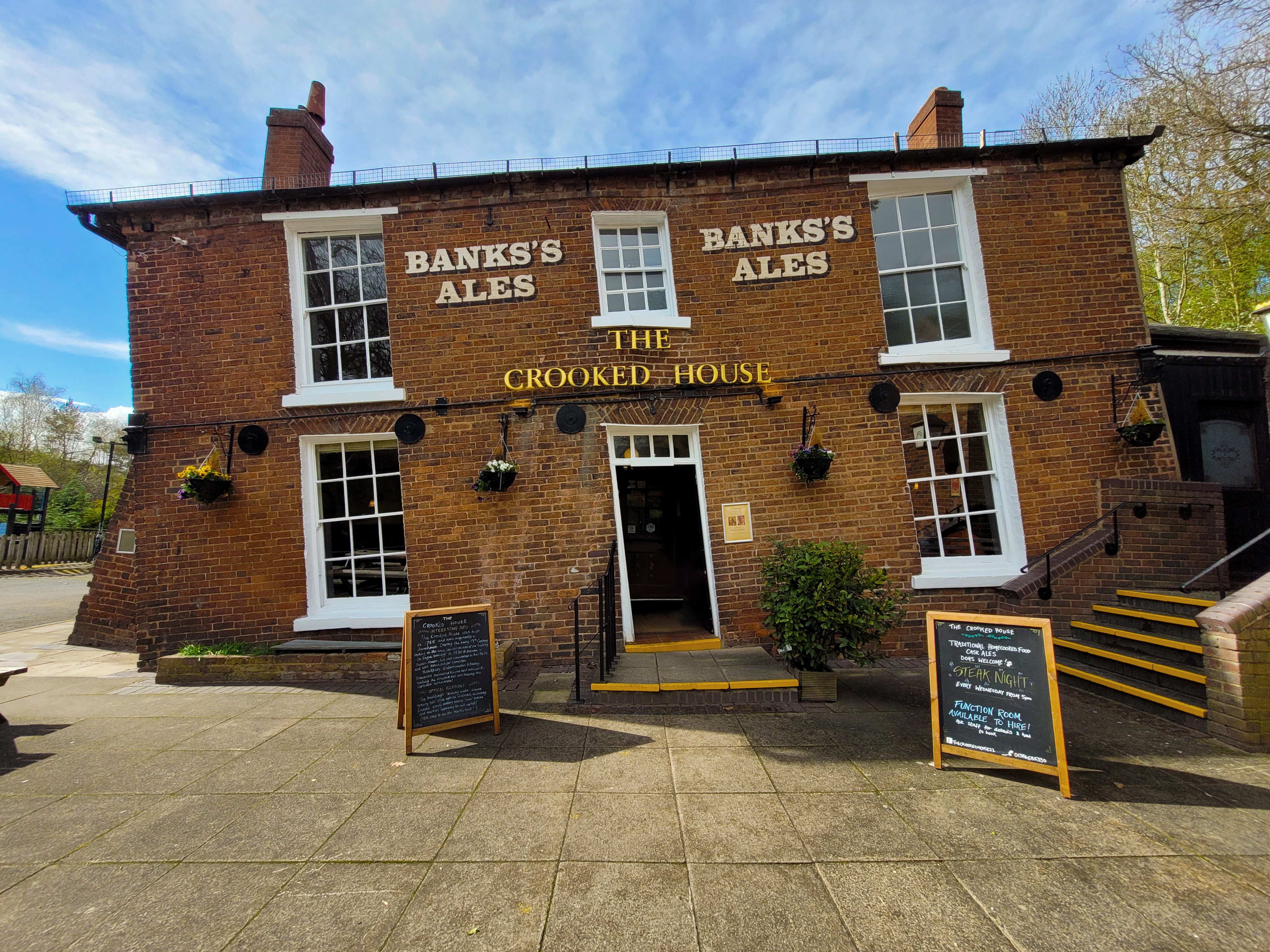
The Crooked House

The Crooked House was a pub in South Staffordshire, England. Its name and distinctive appearance were the result of 19th-century mining subsidence which...

Nearby Amenities

Located within 500m of 52.526657,-2.143683
Bus Stop
Sandyfields Rd / Ruskin Avenue
Bus: yes
Naptan AtcoCode: 43000853401
Naptan Bearing: SW
Naptan BusStopType: MKD
Naptan CommonName: Ruskin Avenue
Naptan Indicator: adj
Naptan NaptanCode: nwmjwjtm
Naptan Status: ACT
Naptan StopType: BCT
Naptan Street: SANDYFIELDS RD
Naptan Towards: Gornal Wood
Naptan Verified: no
Public Transport: platform
Route Ref: 27;27A
Source: WMCA
Lat/Long: 52.531041/-2.1427132
Bus Stop
Sandyfields Rd / Ruskin Avenue
Bus: yes
Naptan AtcoCode: 43000853402
Naptan Bearing: NE
Naptan BusStopType: MKD
Naptan CommonName: Ruskin Avenue
Naptan Indicator: opp
Naptan NaptanCode: nwmjwjtp
Naptan Status: ACT
Naptan StopType: BCT
Naptan Street: SANDYFIELDS RD
Naptan Towards: Sedgley
Naptan Verified: no
Public Transport: platform
Route Ref: 27;27A
Source: WMCA
Lat/Long: 52.5309685/-2.1430455
Bus Stop
Sandyfields Rd / Longfellow Rd
NaPTANAreaCode: 43000853501
Bus: yes
Naptan AtcoCode: 43000853501
Naptan Bearing: NE
Naptan BusStopType: MKD
Naptan CommonName: Longfellow Rd
Naptan Indicator: opp
Naptan NaptanCode: nwmjwjtw
Naptan Status: ACT
Naptan StopType: BCT
Naptan Street: SANDYFIELDS RD
Naptan Towards: Sedgley
Naptan Verified: no
Public Transport: platform
Route Ref: 27;27A
Shelter: yes
Shelter Ref: 404105
Source: WMCA
Lat/Long: 52.5291044/-2.1457584
Bus Stop
Sandyfields Rd / Longfellow Rd
NaPTANAreaCode: 43000853502
Bus: yes
Naptan AtcoCode: 43000853502
Naptan Bearing: SW
Naptan BusStopType: MKD
Naptan CommonName: Longfellow Rd
Naptan Indicator: adj
Naptan NaptanCode: nwmjwjwa
Naptan PlusbusZoneRef: BHAMNWS
Naptan Status: ACT
Naptan StopType: BCT
Naptan Street: SANDYFIELDS RD
Naptan Towards: Gornal Wood
Naptan Verified: no
Public Transport: platform
Route Ref: 27
Shelter: yes
Shelter Ref: 405320
Source: WMCA
Lat/Long: 52.5284116/-2.146213
Bus Stop
The Straits / High Arcal Rd
Bus: yes
Naptan AtcoCode: 43000853601
Naptan Bearing: NW
Naptan BusStopType: MKD
Naptan CommonName: High Arcal Rd
Naptan Indicator: adj
Naptan NaptanCode: nwmjwjwd
Naptan PlusbusZoneRef: BHAMNWS
Naptan Status: ACT
Naptan StopType: BCT
Naptan Street: THE STRAITS
Naptan Towards: Sedgley
Naptan Verified: no
Public Transport: platform
Route Ref: 27
Source: WMCA
Lat/Long: 52.5253161/-2.1485906
Bus Stop
The Straits / High Arcal Rd
NaPTANAreaCode: 43000853602
Bus: yes
Naptan AtcoCode: 43000853602
Naptan Bearing: SE
Naptan BusStopType: MKD
Naptan CommonName: High Arcal Rd
Naptan Indicator: opp
Naptan NaptanCode: nwmjwjwg
Naptan PlusbusZoneRef: BHAMNWS
Naptan Status: ACT
Naptan StopType: BCT
Naptan Street: THE STRAITS
Naptan Towards: Gornal Wood
Naptan Verified: no
Public Transport: platform
Route Ref: 27
Shelter: yes
Shelter Ref: 405319
Source: WMCA
Lat/Long: 52.525119/-2.1480446
Bus Stop
The Straits / Masefield Rd
Bus: yes
Naptan AtcoCode: 43000853701
Naptan Bearing: NW
Naptan BusStopType: MKD
Naptan CommonName: Masefield Rd
Naptan Indicator: opp
Naptan NaptanCode: nwmjwjwj
Naptan PlusbusZoneRef: BHAMNWS
Naptan Status: ACT
Naptan StopType: BCT
Naptan Street: THE STRAITS
Naptan Towards: Sedgley
Naptan Verified: no
Public Transport: platform
Route Ref: 27
Source: WMCA
Lat/Long: 52.5240424/-2.1462133
Bus Stop
The Straits / Coleridge Rise
NaPTANAreaCode: 43000853801
Bus: yes
Naptan AtcoCode: 43000853801
Naptan Bearing: SE
Naptan BusStopType: MKD
Naptan CommonName: Coleridge Rise
Naptan Indicator: adj
Naptan NaptanCode: nwmjwjwp
Naptan PlusbusZoneRef: BHAMNWS
Naptan Status: ACT
Naptan StopType: BCT
Naptan Street: THE STRAITS
Naptan Towards: Gornal Wood
Naptan Verified: no
Public Transport: platform
Route Ref: 27
Shelter: yes
Shelter Ref: 405318
Source: WMCA
Lat/Long: 52.5231639/-2.1441322
Bus Stop
The Straits / Coleridge Rise
Bus: yes
Naptan AtcoCode: 43000853802
Naptan Bearing: NW
Naptan BusStopType: MKD
Naptan CommonName: Coleridge Rise
Naptan Indicator: opp
Naptan NaptanCode: nwmjwjwt
Naptan PlusbusZoneRef: BHAMNWS
Naptan Status: ACT
Naptan StopType: BCT
Naptan Street: THE STRAITS
Naptan Towards: Sedgley
Naptan Verified: no
Public Transport: platform
Route Ref: 27
Source: WMCA
Lat/Long: 52.5225963/-2.1437591
The Straits
Place: suburb
Source: os
Lat/Long: 52.526275/-2.1436065
Barrier: bollard
Lat/Long: 52.5268543/-2.1500077
Barrier: kissing_gate
Lat/Long: 52.5265731/-2.1509663
Bus Stop
Longfellow Rd / Tennyson Road
Bus: yes
Naptan AtcoCode: 43008301601
Naptan Bearing: N
Naptan BusStopType: MKD
Naptan CommonName: Tennyson Road
Naptan Indicator: adj
Naptan NaptanCode: nwmwgatd
Naptan Status: ACT
Naptan StopType: BCT
Naptan Street: LONGFELLOW RD
Naptan Towards: Sedgley
Public Transport: platform
Route Ref: 27A
Source: WMCA
Lat/Long: 52.5255756/-2.1407908
Bus Stop
Longfellow Rd / Milton Crescent
Bus: yes
Naptan AtcoCode: 43008301501
Naptan Bearing: SE
Naptan BusStopType: MKD
Naptan CommonName: Milton Crescent
Naptan Indicator: adj
Naptan NaptanCode: nwmwgata
Naptan Status: ACT
Naptan StopType: BCT
Naptan Street: LONGFELLOW RD
Naptan Towards: Gornal Wood
Public Transport: platform
Route Ref: 27A
Source: WMCA
Lat/Long: 52.5275875/-2.1423155
Post Office
The Straits Post Office
Addr Postcode: DY3 3BA
Brand: Post Office
Brand Wikidata: Q1783168
Fixme: verify by survey
Fixme Addr 1: 114 The Straits
Fixme Addr City: Dudley
Opening Hours: Mo-Fr 09:00-17:30; Sa 09:00-12:00
Ref Pol Id: 5434
Source: pol_branch_list_2018-02
Website: https://www.postoffice.co.uk/branch-finder/182208x/the-straits
Lat/Long: 52.52506/-2.14764
Generator Method: photovoltaic
Generator Output Electricity: yes
Generator Source: solar
Generator Type: solar_photovoltaic_panel
Location: roof
Power: generator
Lat/Long: 52.5230185/-2.1414113
Generator Method: photovoltaic
Generator Output Electricity: yes
Generator Source: solar
Generator Type: solar_photovoltaic_panel
Location: roof
Power: generator
Lat/Long: 52.5252151/-2.1396169
The data included in this document is from www.openstreetmap.org. The data is made available under ODbL.

Have you been to Straits, The?

Leave your review of Straits, The below (or comments, questions and feedback).