Bag Pool

Lake, Pool, Pond, Freshwater Marsh in Staffordshire South Staffordshire

England

Bag Pool

New Year on Northway The Northway Estate in Sedgley on New Year's Day.
New Year on Northway Credit: Gordon Griffiths

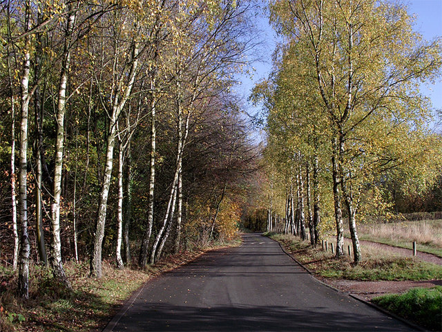
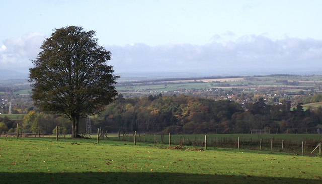
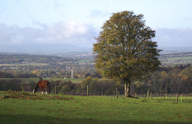
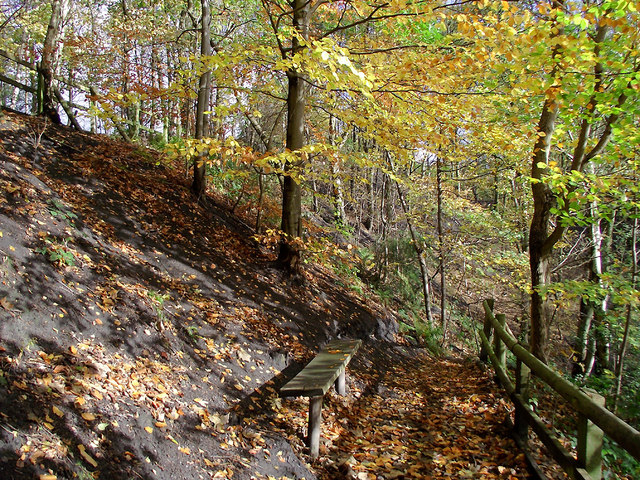
Bag Pool is a freshwater lake located in Staffordshire, England. It is situated in the heart of the county, near the village of Baginton. Covering an area of approximately 10 acres, Bag Pool is a popular destination for nature enthusiasts and anglers.

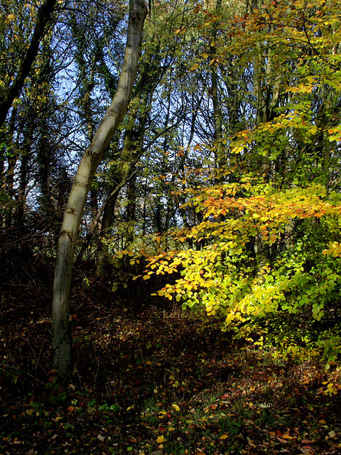
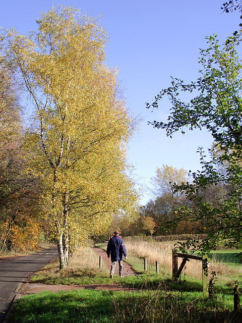
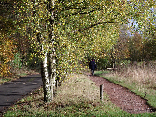
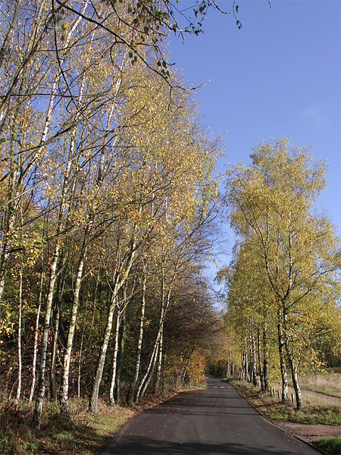
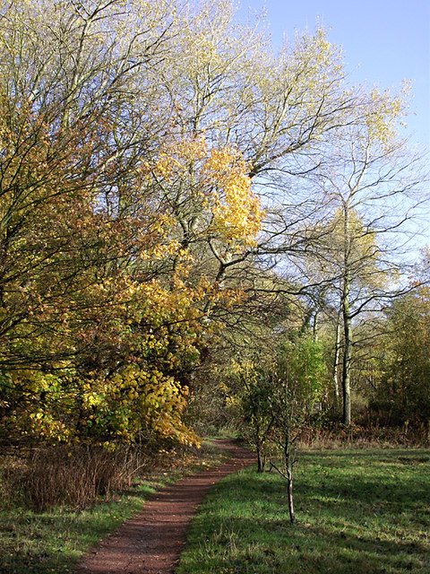
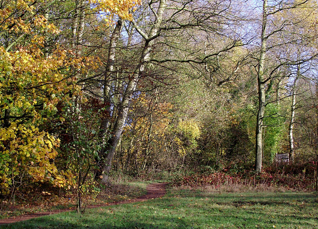
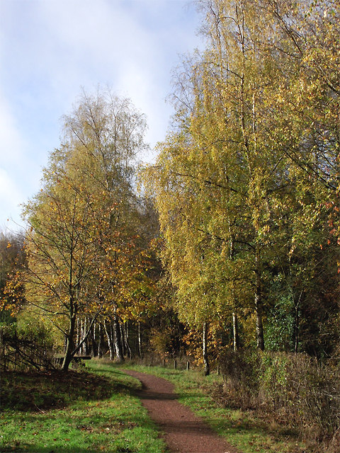
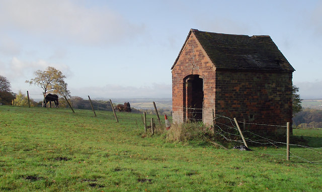
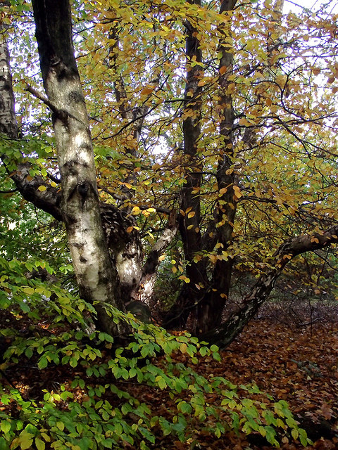
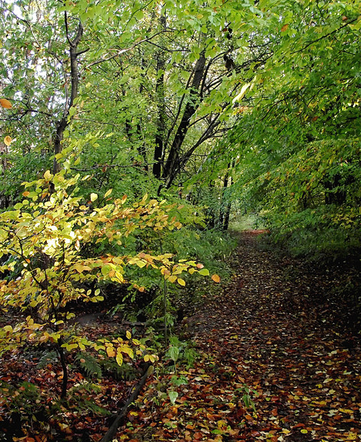
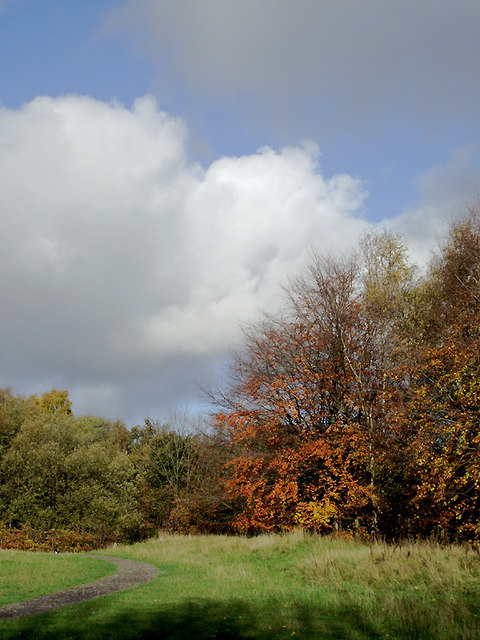
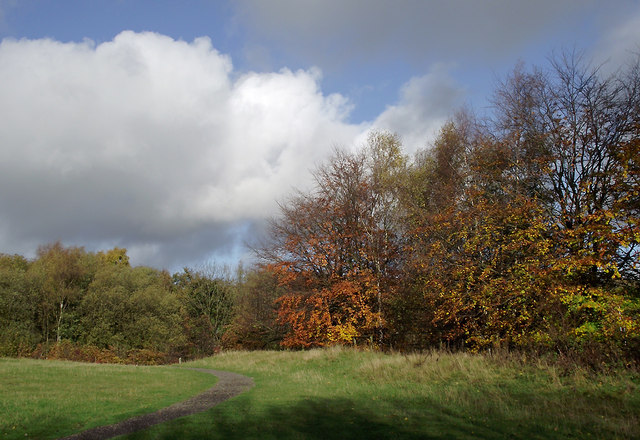
The lake is surrounded by a picturesque landscape, with lush greenery and mature trees providing a tranquil setting. It offers a diverse range of habitats, including open water, marshy areas, and reed beds, making it a haven for a variety of wildlife.

Bag Pool is home to a wide range of bird species, including herons, ducks, and swans, making it a popular spot for birdwatching. The reed beds provide a nesting ground for several species, including reed warblers and sedge warblers.

Angling is a popular activity at Bag Pool, with the lake boasting a healthy population of fish, including carp, pike, and bream. Fishing platforms and pegs are available along the banks, providing anglers with convenient spots to cast their lines.

The lake is also a designated Site of Special Scientific Interest (SSSI), due to its importance as a habitat for various flora and fauna. The freshwater marsh surrounding the lake supports a rich variety of plant species, including water lilies, sedges, and rushes.

Bag Pool offers visitors a peaceful and picturesque environment to enjoy the beauty of nature. Whether it is birdwatching, fishing, or simply taking a leisurely stroll along its banks, this Staffordshire gem offers a serene escape from the hustle and bustle of everyday life.

If you have any feedback on the listing, please let us know in the comments section below.

Bag Pool Images

Images are sourced within 2km of 52.533988/-2.14841 or Grid Reference SO9092. Thanks to Geograph Open Source API. All images are credited.

New Year on Northway The Northway Estate in Sedgley on New Year's Day.
New Year on Northway
The Northway Estate in Sedgley on New Year's Day.
Woodland in Baggeridge Country Park, near Sedgley These woods are by the road north of the visitor centre near Gospel End. 
Baggeridge Country Park is an attractive area of countryside near Dudley and Wolverhampton. It was formerly the Baggeridge Colliery. Together with part of the original Himley Estate of the Earls of Dudley, the whole site has been transformed into 150 acres of attractive country park, including woodland, lakes, and open grassed areas.
Woodland in Baggeridge Country Park, near Sedgley
These woods are by the road north of the visitor centre near Gospel End. Baggeridge Country Park is an attractive area of countryside near Dudley and Wolverhampton. It was formerly the Baggeridge Colliery. Together with part of the original Himley Estate of the Earls of Dudley, the whole site has been transformed into 150 acres of attractive country park, including woodland, lakes, and open grassed areas.
 Baggeridge Country Park, near Sedgley The road links the car parks to Woodhouse Lane (A463) near Gospel End. The Upper Meadow is on the right.

Baggeridge Country Park is an attractive area of countryside near Dudley and Wolverhampton. It was formerly the Baggeridge Colliery. Together with part of the original Himley Estate of the Earls of Dudley, the whole site has been transformed into 150 acres of attractive country park, including woodland, lakes, and open grassed areas. <span class="nowrap"><a title="http://www.sstaffs.gov.uk/default.aspx?page=12695" rel="nofollow ugc noopener" href="http://www.sstaffs.gov.uk/default.aspx?page=12695">Link</a><img style="margin-left:2px;" alt="External link" title="External link - shift click to open in new window" src="https://s1.geograph.org.uk/img/external.png" width="10" height="10"/></span>
Baggeridge Country Park, near Sedgley
The road links the car parks to Woodhouse Lane (A463) near Gospel End. The Upper Meadow is on the right. Baggeridge Country Park is an attractive area of countryside near Dudley and Wolverhampton. It was formerly the Baggeridge Colliery. Together with part of the original Himley Estate of the Earls of Dudley, the whole site has been transformed into 150 acres of attractive country park, including woodland, lakes, and open grassed areas. LinkExternal link
 Baggeridge Country Park, near Sedgley The road links the car parks to Woodhouse Lane (A463) near Gospel End. The Upper Meadow is off to the right.
Baggeridge Country Park, near Sedgley
The road links the car parks to Woodhouse Lane (A463) near Gospel End. The Upper Meadow is off to the right.
The Road to Gospel End near Sedgley The private road is in Baggeridge Country Park and links the car parks to Woodhouse Lane (A463) near Gospel End.
The Road to Gospel End near Sedgley
The private road is in Baggeridge Country Park and links the car parks to Woodhouse Lane (A463) near Gospel End.
The Road to Gospel End near Sedgley The private road is in Baggeridge Country Park and links the car parks to Woodhouse Lane (A463) near Gospel End.
The Road to Gospel End near Sedgley
The private road is in Baggeridge Country Park and links the car parks to Woodhouse Lane (A463) near Gospel End.
Pathway in Baggeridge Country Park near Sedgley This is at the north end of Upper Meadow, looking towards Gospel End.
Pathway in Baggeridge Country Park near Sedgley
This is at the north end of Upper Meadow, looking towards Gospel End.
Pathway in Baggeridge Country Park near Sedgley This is at the north end of Upper Meadow, looking towards Gospel End.
Pathway in Baggeridge Country Park near Sedgley
This is at the north end of Upper Meadow, looking towards Gospel End.
Pathway in Baggeridge Country Park near Sedgley This is at the north end of Upper Meadow, looking away from Gospel End. The driveway from the A453 Wodehouse Road passes through the birch trees on the right.
Pathway in Baggeridge Country Park near Sedgley
This is at the north end of Upper Meadow, looking away from Gospel End. The driveway from the A453 Wodehouse Road passes through the birch trees on the right.
Farmland and woodland near Gospel End, Staffordshire Looking towards Wombourne past deciduous woodland at The Foxhills. Beyond the nearby fields is the wide valley occupied by the Smestow Brook.
Farmland and woodland near Gospel End, Staffordshire
Looking towards Wombourne past deciduous woodland at The Foxhills. Beyond the nearby fields is the wide valley occupied by the Smestow Brook.
Pasture and woodland near Gospel End, Staffordshire Looking towards Wombourne past deciduous woodland at The Foxhills. Beyond the nearby fields is the wide valley occupied by the Smestow Brook.
Pasture and woodland near Gospel End, Staffordshire
Looking towards Wombourne past deciduous woodland at The Foxhills. Beyond the nearby fields is the wide valley occupied by the Smestow Brook.
Farm outhouse in pasture near Gospel End, Staffordshire Beyond the nearby fields is the wide valley occupied by the Smestow Brook.
Farm outhouse in pasture near Gospel End, Staffordshire
Beyond the nearby fields is the wide valley occupied by the Smestow Brook.
Woodland in Baggeridge Country Park near Sedgley This is by a partly overgrown track north-east of Heather Cottage.
Woodland in Baggeridge Country Park near Sedgley
This is by a partly overgrown track north-east of Heather Cottage.
Woodland track in Baggeridge Country Path The track north-east from Heather Cottage is not all as well defined as this.
Woodland track in Baggeridge Country Path
The track north-east from Heather Cottage is not all as well defined as this.
Woodland in Baggeridge Country Park near Sedgley This is by the Events Field south of the tea rooms.
Woodland in Baggeridge Country Park near Sedgley
This is by the Events Field south of the tea rooms.
Woodland in Baggeridge Country Park near Sedgley This is by the Events Field south of the tea rooms.
Woodland in Baggeridge Country Park near Sedgley
This is by the Events Field south of the tea rooms.
Baggeridge Country Park near Sedgley Looking across the Events Field towards the chimney of the Baggeridge Brickworks.
Baggeridge Country Park near Sedgley
Looking across the Events Field towards the chimney of the Baggeridge Brickworks.
Woodland bench in Baggeridge Country Park near Sedgley This is on the waymarked route down Jake's Ladder, a very steep (and precarious in wet autumn weather) stepped route down to the pools. That this land was formerly a coal mine is evident from the high amount of coal dust in the soil on the bank.
Woodland bench in Baggeridge Country Park near Sedgley
This is on the waymarked route down Jake's Ladder, a very steep (and precarious in wet autumn weather) stepped route down to the pools. That this land was formerly a coal mine is evident from the high amount of coal dust in the soil on the bank.
Show me another place!

Bag Pool is located at Grid Ref: SO9092 (Lat: 52.533988, Lng: -2.14841)

Administrative County: Staffordshire

District: South Staffordshire

Police Authority: Staffordshire

What 3 Words

///chief.mock.loyal. Near Wombourn, Staffordshire

Related Wikis

Baggeridge Colliery

Baggeridge Colliery was a colliery located in Sedgley, West Midlands England. == Colliery History == The Baggeridge Colliery was an enterprise of the Earls...

Baggeridge Country Park

Baggeridge Country Park is located within the South Staffordshire district of Staffordshire, England. Its entrance is on the A463 just west of Gospel End...

Gospel End

Gospel End is a village in the South Staffordshire district of Staffordshire, England. Population details taken at the 2011 census can be found under...

Straits Estate

Straits Estate is a housing estate located near Sedgley, West Midlands, England, to the north-west of Gornal Ward, and was built for homeowners during...

Cotwall End Valley

Cotwall End Valley is a local nature reserve in West Midlands, England. It is about a mile south of Sedgley, in the Metropolitan Borough of Dudley. It...

Ellowes Hall

Ellowes Hall was a stately home located in Sedgley, Staffordshire (now West Midlands). It was built in 1821 in parkland near Lower Gornal village as the...

Ellowes Hall Sports College

Ellowes Hall Sports College (formerly Ellowes Hall School) is a comprehensive secondary school and sixth form situated on Stickley Lane in Lower Gornal...

The Wodehouse

The Wodehouse is a Grade II* listed English country house near Wombourne, Staffordshire, notable as the family seat of the Georgian landscape designer...

Nearby Amenities

Located within 500m of 52.533988,-2.14841
Bus Stop
Sandyfields Rd / Ruskin Avenue
Bus: yes
Naptan AtcoCode: 43000853402
Naptan Bearing: NE
Naptan BusStopType: MKD
Naptan CommonName: Ruskin Avenue
Naptan Indicator: opp
Naptan NaptanCode: nwmjwjtp
Naptan Status: ACT
Naptan StopType: BCT
Naptan Street: SANDYFIELDS RD
Naptan Towards: Sedgley
Naptan Verified: no
Public Transport: platform
Route Ref: 27;27A
Source: WMCA
Lat/Long: 52.5309685/-2.1430455
Cafe
Lat/Long: 52.5353243/-2.1524371
Baggeridge Toposcope
Tourism: viewpoint
Lat/Long: 52.5319773/-2.1480189
Barrier: stile
Foot: yes
Lat/Long: 52.5310078/-2.1480117
Barrier: stile
Lat/Long: 52.5334553/-2.1457184
Bench
Bob's Bench
Lat/Long: 52.5311006/-2.1535987
Turning Circle
Lat/Long: 52.5377761/-2.1484951
Barrier: kissing_gate
Bicycle: no
Foot: yes
Lat/Long: 52.5376927/-2.1498136
Barrier: lift_gate
Bicycle: yes
Foot: yes
Lat/Long: 52.5377401/-2.1500189
Turning Circle
Lat/Long: 52.5374348/-2.1456688
Barrier: swing_gate
Foot: yes
Lat/Long: 52.5321936/-2.1492637
Bench
Material: wood
Lat/Long: 52.5323479/-2.1496101
Railway: level_crossing
Lat/Long: 52.5348724/-2.1499452
The data included in this document is from www.openstreetmap.org. The data is made available under ODbL.

Have you been to Bag Pool?

Leave your review of Bag Pool below (or comments, questions and feedback).