Sandyfields

Settlement in Staffordshire

England

Sandyfields

Woodland in Baggeridge Country Park, near Sedgley These woods are by the road north of the visitor centre near Gospel End. 
Baggeridge Country Park is an attractive area of countryside near Dudley and Wolverhampton. It was formerly the Baggeridge Colliery. Together with part of the original Himley Estate of the Earls of Dudley, the whole site has been transformed into 150 acres of attractive country park, including woodland, lakes, and open grassed areas.
Woodland in Baggeridge Country Park, near Sedgley Credit: Roger Kidd

Sandyfields is a small village located in the county of Staffordshire, England. Situated in the heart of the West Midlands, Sandyfields is nestled amidst picturesque countryside and rolling hills, providing its residents with a tranquil and idyllic setting.

The village itself is relatively small, with a population of around 500 people. Sandyfields is known for its close-knit community and friendly atmosphere, making it a desirable place to live for families and individuals seeking a peaceful lifestyle. The village is characterized by its charming cottages and well-maintained gardens, reflecting the pride that residents take in their homes.

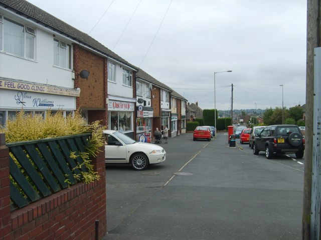
Despite its rural setting, Sandyfields benefits from its proximity to larger towns and cities. The bustling market town of Stafford is located just a short drive away, offering a wide range of amenities, including shops, restaurants, and leisure facilities. The village is also well-connected in terms of transportation, with good road links to nearby towns and access to major motorways such as the M6.

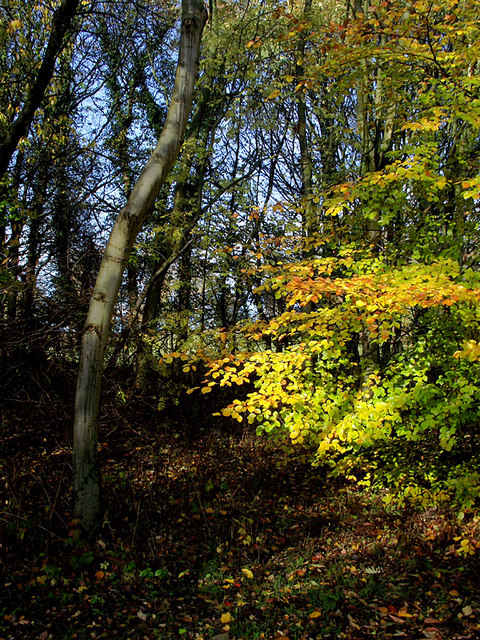
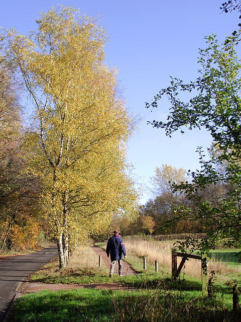
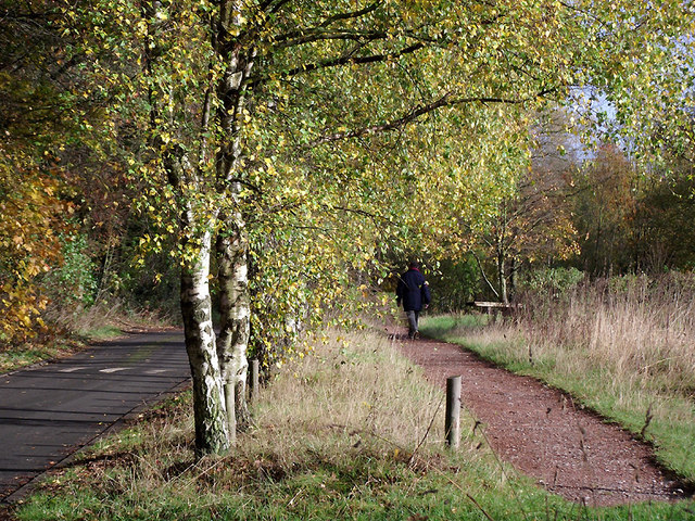
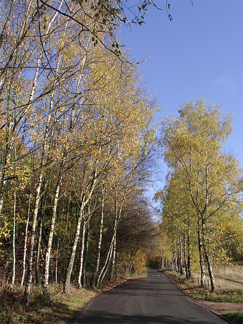
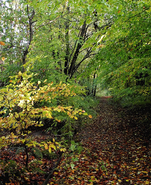
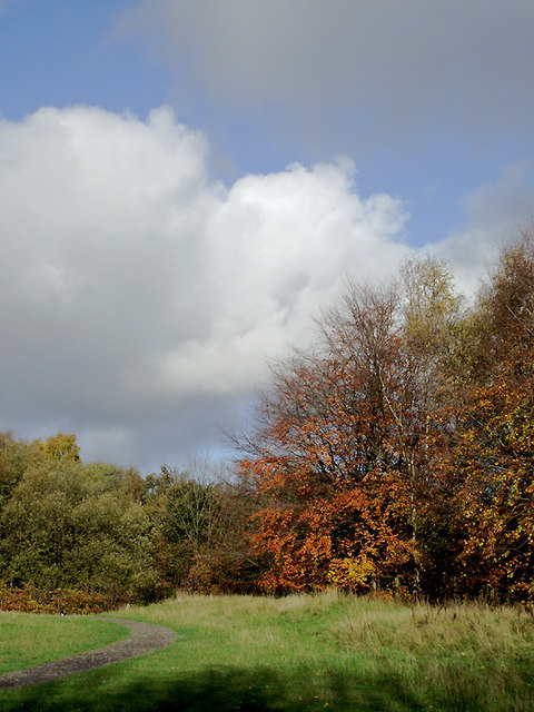
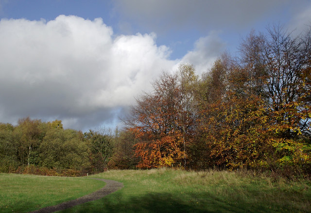
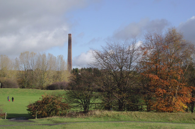
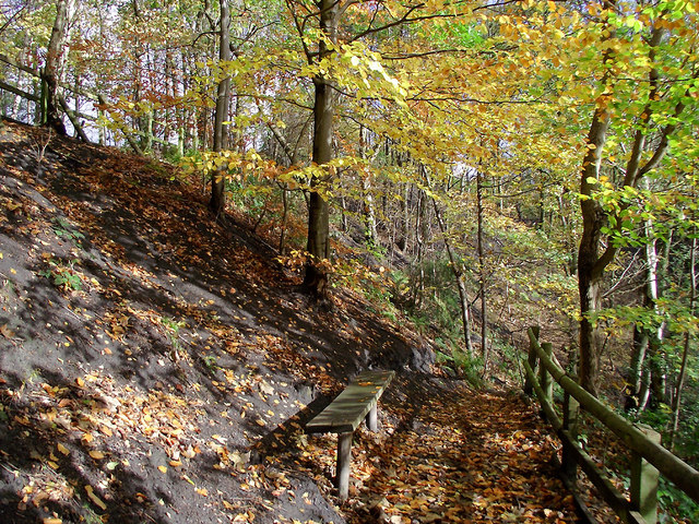
For outdoor enthusiasts, Sandyfields offers plenty of opportunities to enjoy the surrounding natural beauty. The village is surrounded by extensive green spaces and woodland, providing ample opportunities for walking, hiking, and cycling. The nearby Cannock Chase Area of Outstanding Natural Beauty is also within easy reach, offering a wealth of outdoor activities and stunning scenery.

Overall, Sandyfields is a charming village that offers a peaceful and close-knit community, beautiful surroundings, and convenient access to nearby amenities.

If you have any feedback on the listing, please let us know in the comments section below.
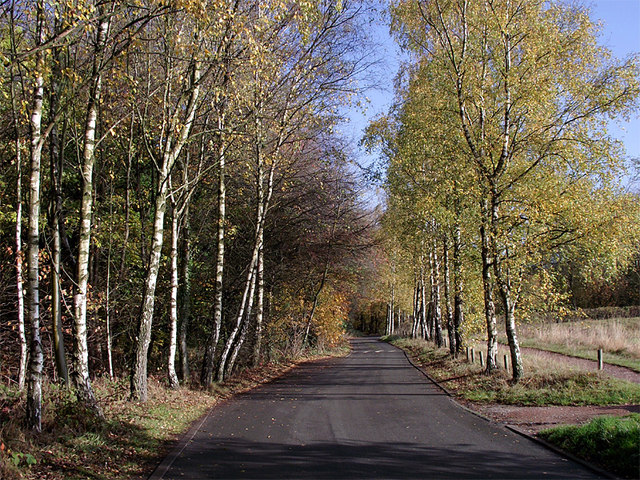
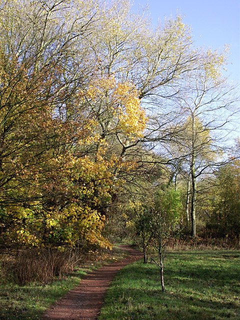
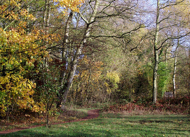
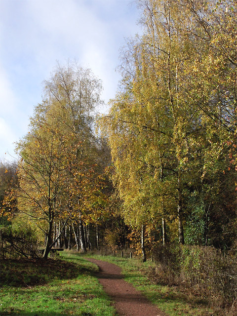
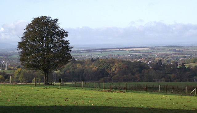
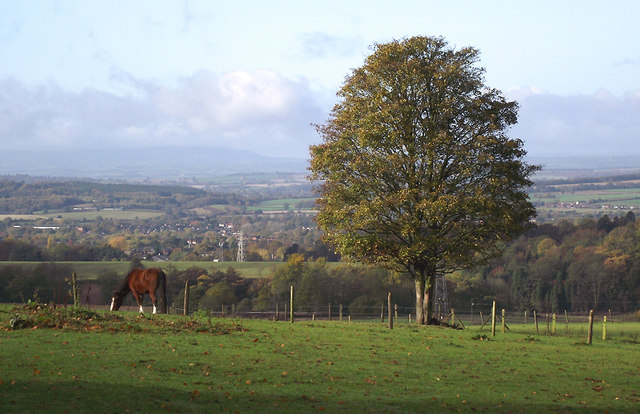
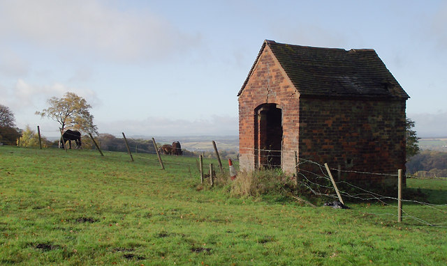
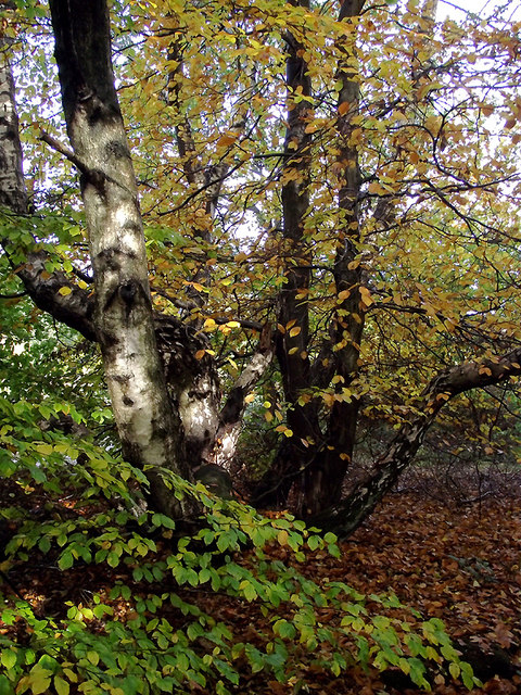
Sandyfields Images

Images are sourced within 2km of 52.533946/-2.137957 or Grid Reference SO9092. Thanks to Geograph Open Source API. All images are credited.

Woodland in Baggeridge Country Park, near Sedgley These woods are by the road north of the visitor centre near Gospel End. 
Baggeridge Country Park is an attractive area of countryside near Dudley and Wolverhampton. It was formerly the Baggeridge Colliery. Together with part of the original Himley Estate of the Earls of Dudley, the whole site has been transformed into 150 acres of attractive country park, including woodland, lakes, and open grassed areas.
Woodland in Baggeridge Country Park, near Sedgley
These woods are by the road north of the visitor centre near Gospel End. Baggeridge Country Park is an attractive area of countryside near Dudley and Wolverhampton. It was formerly the Baggeridge Colliery. Together with part of the original Himley Estate of the Earls of Dudley, the whole site has been transformed into 150 acres of attractive country park, including woodland, lakes, and open grassed areas.
 Baggeridge Country Park, near Sedgley The road links the car parks to Woodhouse Lane (A463) near Gospel End. The Upper Meadow is on the right.

Baggeridge Country Park is an attractive area of countryside near Dudley and Wolverhampton. It was formerly the Baggeridge Colliery. Together with part of the original Himley Estate of the Earls of Dudley, the whole site has been transformed into 150 acres of attractive country park, including woodland, lakes, and open grassed areas. <span class="nowrap"><a title="http://www.sstaffs.gov.uk/default.aspx?page=12695" rel="nofollow ugc noopener" href="http://www.sstaffs.gov.uk/default.aspx?page=12695">Link</a><img style="margin-left:2px;" alt="External link" title="External link - shift click to open in new window" src="https://s1.geograph.org.uk/img/external.png" width="10" height="10"/></span>
Baggeridge Country Park, near Sedgley
The road links the car parks to Woodhouse Lane (A463) near Gospel End. The Upper Meadow is on the right. Baggeridge Country Park is an attractive area of countryside near Dudley and Wolverhampton. It was formerly the Baggeridge Colliery. Together with part of the original Himley Estate of the Earls of Dudley, the whole site has been transformed into 150 acres of attractive country park, including woodland, lakes, and open grassed areas. LinkExternal link
 Baggeridge Country Park, near Sedgley The road links the car parks to Woodhouse Lane (A463) near Gospel End. The Upper Meadow is off to the right.
Baggeridge Country Park, near Sedgley
The road links the car parks to Woodhouse Lane (A463) near Gospel End. The Upper Meadow is off to the right.
The Road to Gospel End near Sedgley The private road is in Baggeridge Country Park and links the car parks to Woodhouse Lane (A463) near Gospel End.
The Road to Gospel End near Sedgley
The private road is in Baggeridge Country Park and links the car parks to Woodhouse Lane (A463) near Gospel End.
The Road to Gospel End near Sedgley The private road is in Baggeridge Country Park and links the car parks to Woodhouse Lane (A463) near Gospel End.
The Road to Gospel End near Sedgley
The private road is in Baggeridge Country Park and links the car parks to Woodhouse Lane (A463) near Gospel End.
Pathway in Baggeridge Country Park near Sedgley This is at the north end of Upper Meadow, looking towards Gospel End.
Pathway in Baggeridge Country Park near Sedgley
This is at the north end of Upper Meadow, looking towards Gospel End.
Pathway in Baggeridge Country Park near Sedgley This is at the north end of Upper Meadow, looking towards Gospel End.
Pathway in Baggeridge Country Park near Sedgley
This is at the north end of Upper Meadow, looking towards Gospel End.
Pathway in Baggeridge Country Park near Sedgley This is at the north end of Upper Meadow, looking away from Gospel End. The driveway from the A453 Wodehouse Road passes through the birch trees on the right.
Pathway in Baggeridge Country Park near Sedgley
This is at the north end of Upper Meadow, looking away from Gospel End. The driveway from the A453 Wodehouse Road passes through the birch trees on the right.
Farmland and woodland near Gospel End, Staffordshire Looking towards Wombourne past deciduous woodland at The Foxhills. Beyond the nearby fields is the wide valley occupied by the Smestow Brook.
Farmland and woodland near Gospel End, Staffordshire
Looking towards Wombourne past deciduous woodland at The Foxhills. Beyond the nearby fields is the wide valley occupied by the Smestow Brook.
Pasture and woodland near Gospel End, Staffordshire Looking towards Wombourne past deciduous woodland at The Foxhills. Beyond the nearby fields is the wide valley occupied by the Smestow Brook.
Pasture and woodland near Gospel End, Staffordshire
Looking towards Wombourne past deciduous woodland at The Foxhills. Beyond the nearby fields is the wide valley occupied by the Smestow Brook.
Farm outhouse in pasture near Gospel End, Staffordshire Beyond the nearby fields is the wide valley occupied by the Smestow Brook.
Farm outhouse in pasture near Gospel End, Staffordshire
Beyond the nearby fields is the wide valley occupied by the Smestow Brook.
Woodland in Baggeridge Country Park near Sedgley This is by a partly overgrown track north-east of Heather Cottage.
Woodland in Baggeridge Country Park near Sedgley
This is by a partly overgrown track north-east of Heather Cottage.
Woodland track in Baggeridge Country Path The track north-east from Heather Cottage is not all as well defined as this.
Woodland track in Baggeridge Country Path
The track north-east from Heather Cottage is not all as well defined as this.
Woodland in Baggeridge Country Park near Sedgley This is by the Events Field south of the tea rooms.
Woodland in Baggeridge Country Park near Sedgley
This is by the Events Field south of the tea rooms.
Woodland in Baggeridge Country Park near Sedgley This is by the Events Field south of the tea rooms.
Woodland in Baggeridge Country Park near Sedgley
This is by the Events Field south of the tea rooms.
Baggeridge Country Park near Sedgley Looking across the Events Field towards the chimney of the Baggeridge Brickworks.
Baggeridge Country Park near Sedgley
Looking across the Events Field towards the chimney of the Baggeridge Brickworks.
Woodland bench in Baggeridge Country Park near Sedgley This is on the waymarked route down Jake's Ladder, a very steep (and precarious in wet autumn weather) stepped route down to the pools. That this land was formerly a coal mine is evident from the high amount of coal dust in the soil on the bank.
Woodland bench in Baggeridge Country Park near Sedgley
This is on the waymarked route down Jake's Ladder, a very steep (and precarious in wet autumn weather) stepped route down to the pools. That this land was formerly a coal mine is evident from the high amount of coal dust in the soil on the bank.
Woodland bench in Baggeridge Country Park near Sedgley This is on the waymarked route down Jake's Ladder, a very steep (and precarious in wet autumn weather, never mind ice and snow!) stepped route down to the pools. That this land was formerly a coal mine is evident from the high amount of coal dust in the soil on the bank. It is much steeper behind the camera. :-)
Woodland bench in Baggeridge Country Park near Sedgley
This is on the waymarked route down Jake's Ladder, a very steep (and precarious in wet autumn weather, never mind ice and snow!) stepped route down to the pools. That this land was formerly a coal mine is evident from the high amount of coal dust in the soil on the bank. It is much steeper behind the camera. :-)
Show me another place!

Sandyfields is located at Grid Ref: SO9092 (Lat: 52.533946, Lng: -2.137957)

Unitary Authority: Dudley

Police Authority: West Midlands

What 3 Words

///tips.being.gravel. Near Wombourn, Staffordshire

Related Wikis

Baggeridge Colliery

Baggeridge Colliery was a colliery located in Sedgley, West Midlands England. == Colliery History == The Baggeridge Colliery was an enterprise of the Earls...

Cotwall End Valley

Cotwall End Valley is a local nature reserve in West Midlands, England. It is about a mile south of Sedgley, in the Metropolitan Borough of Dudley. It...

Baggeridge Country Park

Baggeridge Country Park is located within the South Staffordshire district of Staffordshire, England. Its entrance is on the A463 just west of Gospel End...

Gospel End

Gospel End is a village in the South Staffordshire district of Staffordshire, England. Population details taken at the 2011 census can be found under...

Straits Estate

Straits Estate is a housing estate located near Sedgley, West Midlands, England, to the north-west of Gornal Ward, and was built for homeowners during...

Ellowes Hall

Ellowes Hall was a stately home located in Sedgley, Staffordshire (now West Midlands). It was built in 1821 in parkland near Lower Gornal village as the...

Ellowes Hall Sports College

Ellowes Hall Sports College (formerly Ellowes Hall School) is a comprehensive secondary school and sixth form situated on Stickley Lane in Lower Gornal...

Sedgley

Sedgley is a town in the north of the Metropolitan Borough of Dudley, in the West Midlands, England.Historically part of Staffordshire, Sedgley is on the...

Nearby Amenities

Located within 500m of 52.533946,-2.137957
Bus Stop
Sandyfields Rd / Dingle View
Bus: yes
Naptan AtcoCode: 43000853201
Naptan Bearing: SW
Naptan BusStopType: MKD
Naptan CommonName: Dingle View
Naptan Indicator: adj
Naptan NaptanCode: nwmjwjta
Naptan PlusbusZoneRef: BHAMNWS
Naptan Status: ACT
Naptan StopType: BCT
Naptan Street: SANDYFIELDS RD
Naptan Towards: Gornal Wood
Public Transport: platform
Route Ref: 27;27A
Shelter: no
Source: WMCA
Towards: Dudley
Lat/Long: 52.5353901/-2.1329122
Bus Stop
Sandyfields Rd / Dingle View
NaPTANAreaCode: 43000853202
Bus: yes
Naptan AtcoCode: 43000853202
Naptan Bearing: NE
Naptan BusStopType: MKD
Naptan CommonName: Dingle View
Naptan Indicator: opp
Naptan NaptanCode: nwmjwjtd
Naptan PlusbusZoneRef: BHAMNWS
Naptan Status: ACT
Naptan StopType: BCT
Naptan Street: SANDYFIELDS RD
Naptan Towards: Sedgley
Naptan Verified: no
Public Transport: platform
Route Ref: 27;27A
Shelter: yes
Shelter Ref: 404103
Source: WMCA
Lat/Long: 52.5350158/-2.1340131
Bus Stop
Sandyfields Rd / The Croft
Bus: yes
Naptan AtcoCode: 43000853301
Naptan Bearing: NE
Naptan BusStopType: MKD
Naptan CommonName: The Croft
Naptan Indicator: opp
Naptan NaptanCode: nwmjwjtg
Naptan PlusbusZoneRef: BHAMNWS
Naptan Status: ACT
Naptan StopType: BCT
Naptan Street: SANDYFIELDS RD
Naptan Towards: Sedgley
Naptan Verified: no
Public Transport: platform
Route Ref: 27;27A
Source: WMCA
Lat/Long: 52.5338444/-2.1363978
Bus Stop
Sandyfields Rd / The Croft
Bus: yes
Naptan AtcoCode: 43000853302
Naptan Bearing: SW
Naptan BusStopType: MKD
Naptan CommonName: The Croft
Naptan Indicator: adj
Naptan NaptanCode: nwmjwjtj
Naptan PlusbusZoneRef: BHAMNWS
Naptan Status: ACT
Naptan StopType: BCT
Naptan Street: SANDYFIELDS RD
Naptan Towards: Gornal Wood
Naptan Verified: no
Public Transport: platform
Route Ref: 27;27A
Source: WMCA
Lat/Long: 52.5337277/-2.13625
Bus Stop
Sandyfields Rd / Ruskin Avenue
Bus: yes
Naptan AtcoCode: 43000853401
Naptan Bearing: SW
Naptan BusStopType: MKD
Naptan CommonName: Ruskin Avenue
Naptan Indicator: adj
Naptan NaptanCode: nwmjwjtm
Naptan Status: ACT
Naptan StopType: BCT
Naptan Street: SANDYFIELDS RD
Naptan Towards: Gornal Wood
Naptan Verified: no
Public Transport: platform
Route Ref: 27;27A
Source: WMCA
Lat/Long: 52.531041/-2.1427132
Bus Stop
Sandyfields Rd / Ruskin Avenue
Bus: yes
Naptan AtcoCode: 43000853402
Naptan Bearing: NE
Naptan BusStopType: MKD
Naptan CommonName: Ruskin Avenue
Naptan Indicator: opp
Naptan NaptanCode: nwmjwjtp
Naptan Status: ACT
Naptan StopType: BCT
Naptan Street: SANDYFIELDS RD
Naptan Towards: Sedgley
Naptan Verified: no
Public Transport: platform
Route Ref: 27;27A
Source: WMCA
Lat/Long: 52.5309685/-2.1430455
Post Box
Brand: Royal Mail
Brand Wikidata: Q638098
Brand Wikipedia: en:Royal Mail
Collection Times: Mo-Fr 17:15; Sa 11:00
Operator: Royal Mail
Operator Wikidata: Q638098
Ref: DY3 63
Source: survey
Lat/Long: 52.5354429/-2.1328636
Addr Country: GB
Addr Housenumber: 2
Addr Street: Ferndown Avenue
Source: survey
Lat/Long: 52.535574/-2.1321336
Generator Method: photovoltaic
Generator Output Electricity: yes
Generator Source: solar
Generator Type: solar_photovoltaic_panel
Location: roof
Power: generator
Lat/Long: 52.5356058/-2.1314845
Generator Method: photovoltaic
Generator Output Electricity: yes
Generator Source: solar
Generator Type: solar_photovoltaic_panel
Location: roof
Power: generator
Lat/Long: 52.5381443/-2.1363312
Natural: spring
Source: OS
Lat/Long: 52.5375628/-2.1389041
The data included in this document is from www.openstreetmap.org. The data is made available under ODbL.

Have you been to Sandyfields?

Leave your review of Sandyfields below (or comments, questions and feedback).