Boquhan

Settlement in Stirlingshire

Scotland

Boquhan

River Endrick A walk along the Endrick on a Sunday Afternoon
River Endrick Credit: richard newall

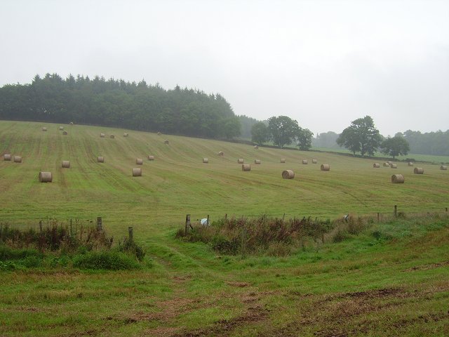
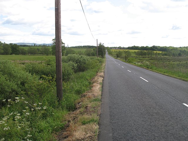
Boquhan is a small rural village located in Stirlingshire, Scotland. Situated approximately 5 miles northwest of the town of Dunblane, Boquhan is nestled amidst picturesque rolling hills and lush countryside. The village is known for its tranquil and idyllic setting, making it a popular destination for those seeking a peaceful retreat.

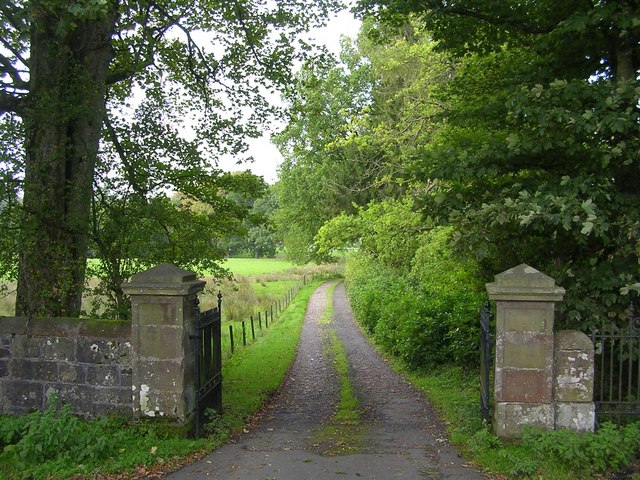
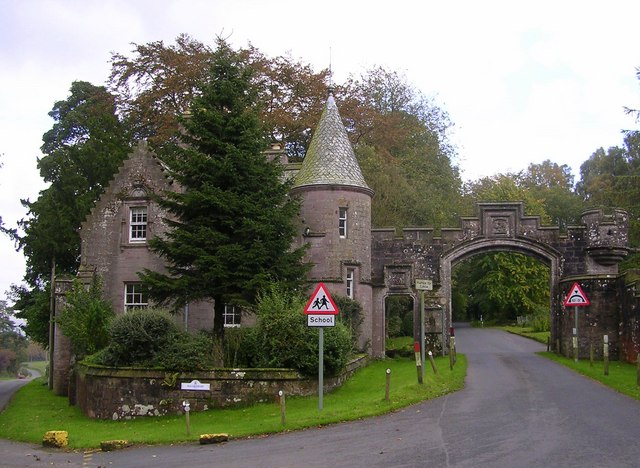
Boquhan is a historic village with a rich heritage. It is home to several traditional stone-built cottages and farmhouses, some of which date back to the 18th century. The village exudes a charming and timeless atmosphere, with its well-preserved architecture and quaint streets.

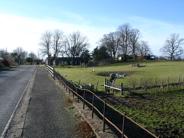
Although small in size, Boquhan offers a range of amenities to its residents and visitors. There is a local community hall that serves as a hub for social gatherings and events, fostering a strong sense of community spirit. The village is also surrounded by vast green spaces, making it an ideal location for outdoor activities such as walking, cycling, and horse riding.

For those interested in exploring the wider area, Boquhan provides easy access to the stunning Trossachs National Park. This renowned national park is known for its breathtaking landscapes, including sparkling lochs, towering mountains, and dense forests. Visitors can partake in various outdoor pursuits such as hiking, fishing, and wildlife spotting.

With its peaceful ambiance, beautiful surroundings, and close proximity to natural attractions, Boquhan offers a charming escape from the hustle and bustle of city life. Whether for a relaxing retreat or as a base for exploring the Scottish countryside, Boquhan is a delightful destination to visit.

If you have any feedback on the listing, please let us know in the comments section below.
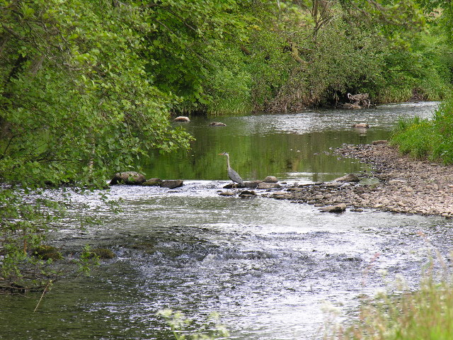
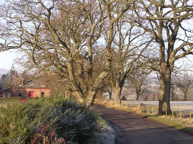
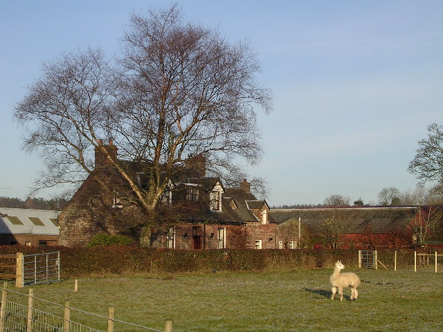
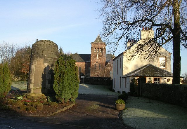
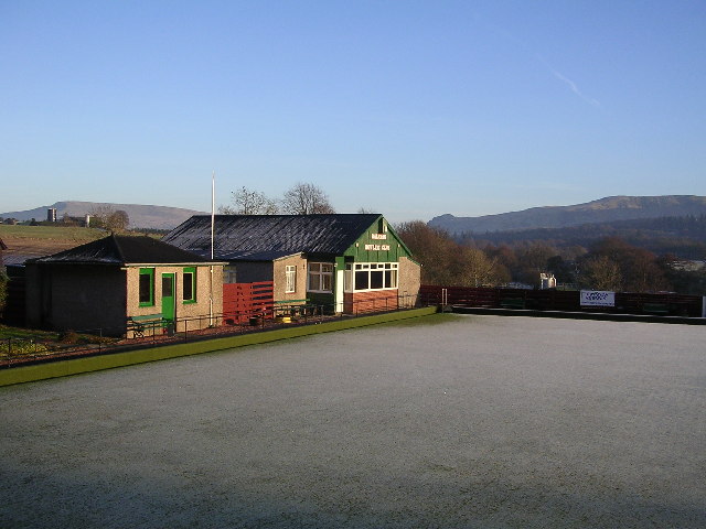
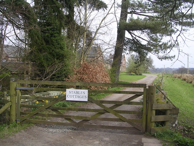
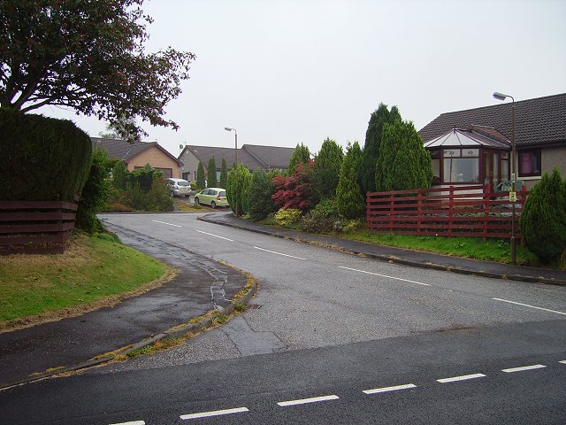
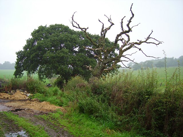
Boquhan Images

Images are sourced within 2km of 56.059552/-4.353181 or Grid Reference NS5387. Thanks to Geograph Open Source API. All images are credited.

River Endrick A walk along the Endrick on a Sunday Afternoon
River Endrick
A walk along the Endrick on a Sunday Afternoon
Killearn church This church was built in 1882.
Killearn church
This church was built in 1882.
Home Farm Cottage, near Boquhan
Ballochruin Farm plus Llama
Balfron Church and War Memorial
Balfron Bowling Club
Footbridge across the Endrick Water A very secluded stretch of river
Footbridge across the Endrick Water
A very secluded stretch of river
Gateway to Carbeth House Private Grounds I didn't feel comfortable to walk through the grounds of Carbeth House, so this was my point of closest approach.
Gateway to Carbeth House Private Grounds
I didn't feel comfortable to walk through the grounds of Carbeth House, so this was my point of closest approach.
Bend in the Endrick Water Sharp bend on secluded stretch of river
Bend in the Endrick Water
Sharp bend on secluded stretch of river
Balfron Bungaloid close on the eastern side of Balfron.
Balfron
Bungaloid close on the eastern side of Balfron.
Dead oak, Balfron Dead tree by a cut off road loop between Balfron and Balfron Station, Stirlingshire.
Dead oak, Balfron
Dead tree by a cut off road loop between Balfron and Balfron Station, Stirlingshire.
Camoquill Round bales left out for a while, near Camoquill Douglas, Balfron.
Camoquill
Round bales left out for a while, near Camoquill Douglas, Balfron.
Driveway to Boquhan Old House
Entrance to Ballikinrain Castle School
Balfron Church and war memorial
Heron's Court
Heron's Court
Katrine Aqueduct at Killearn These four nondescript trapdoors near the main road contain a secret, one that doesn't even appear on the OS map. These service hatches provide access to the underground aqueduct that provides Glasgow's water supply - from Loch Katrine, to Milngavie Water Works. The aqueduct was opened by Queen Victoria at the turn of the century, and was a major engineering feat with most of the work (and route) being invisible (unless you knew where to look).  The next access to the aqueduct southwards is within the village of Blanefield.
Katrine Aqueduct at Killearn
These four nondescript trapdoors near the main road contain a secret, one that doesn't even appear on the OS map. These service hatches provide access to the underground aqueduct that provides Glasgow's water supply - from Loch Katrine, to Milngavie Water Works. The aqueduct was opened by Queen Victoria at the turn of the century, and was a major engineering feat with most of the work (and route) being invisible (unless you knew where to look). The next access to the aqueduct southwards is within the village of Blanefield.
Auchenibert Lane Looking northwest
Auchenibert Lane
Looking northwest
Show me another place!

Boquhan is located at Grid Ref: NS5387 (Lat: 56.059552, Lng: -4.353181)

Unitary Authority: Stirling

Police Authority: Forth Valley

What 3 Words

///prune.broth.provider. Near Balfron, Stirling

Related Wikis

Boquhan

Boquhan (pronounced Bowhan) is a hamlet in Stirling, Scotland, sometimes known as Wester Boquhan to distinguish it from the other nearby Boquhan, near...

Balfron

Balfron (Scottish Gaelic: Both Fron) is a village in the Stirling council area of Scotland. It is situated near Endrick Water on the A875 road, 18 miles...

Balfron High School

Balfron High School is a secondary school situated in the village of Balfron, approximately 18 miles (29 km) west of Stirling and 16 miles (26 km) north...

Balfron railway station

Balfron railway station was a railway station that served the village of Balfron in Scotland. The station was served by trains on the Strathendrick and...

Killearn

Killearn (Scottish Gaelic: Cill Fhearann, from orig. Ceann Fhearann, "Head/End of (the) Land/Territory" – until the 15th century when Ceann was replaced...

A81 road

The A81 road is a major road in Scotland. It runs from Glasgow to Callander via Woodside and Maryhill within the city, as well as Bearsden, Milngavie and...

Ballikinrain

Ballikinrain is an independent residential school in Stirling, central Scotland. It is run by CrossReach, a social care outreach arm of the Church of Scotland...

Gartness

Gartness is a hamlet in Stirling, Scotland. It is located 1.8 miles/2.9 km from Killearn and 3.1 miles/5 km from Drymen. Most pupils attend Killearn Primary...

Nearby Amenities

Located within 500m of 56.059552,-4.353181
Boqhuan
Place: hamlet
Lat/Long: 56.0574215/-4.3542742
Power: pole
Lat/Long: 56.0576069/-4.3461444
Power: pole
Lat/Long: 56.0636797/-4.3500402
Power: pole
Lat/Long: 56.0631963/-4.34958
Power: pole
Lat/Long: 56.0623111/-4.3484735
Power: pole
Lat/Long: 56.0619526/-4.3480217
Power: pole
Lat/Long: 56.0601459/-4.3524206
Power: pole
Lat/Long: 56.0607976/-4.3516634
Power: pole
Lat/Long: 56.0612028/-4.350377
Power: pole
Lat/Long: 56.061587/-4.3491889
Power: pole
Lat/Long: 56.0596881/-4.3514291
Power: pole
Lat/Long: 56.0604227/-4.3532594
Power: pole
Lat/Long: 56.0607228/-4.3541882
Power: pole
Lat/Long: 56.0609996/-4.3550771
Power: pole
Lat/Long: 56.0612927/-4.3559536
Power: pole
Lat/Long: 56.0619117/-4.3578675
Power: pole
Lat/Long: 56.0621709/-4.3588632
Power: pole
Lat/Long: 56.0558853/-4.3556064
Power: pole
Lat/Long: 56.0560173/-4.3566627
Power: pole
Lat/Long: 56.0561855/-4.3579407
Power: pole
Lat/Long: 56.0602125/-4.3611306
Power: pole
Lat/Long: 56.0605453/-4.3600764
Power: pole
Lat/Long: 56.0608922/-4.3589929
Power: pole
Lat/Long: 56.0612332/-4.3579094
The data included in this document is from www.openstreetmap.org. The data is made available under ODbL.

Have you been to Boquhan?

Leave your review of Boquhan below (or comments, questions and feedback).