Boquhapple

Settlement in Perthshire

Scotland

Boquhapple

Flanders Moss seen from Thornhill Carse land along the Forth: this was once bogland until cleared by stripping away the peat to reclaim it as arable land.
Flanders Moss seen from Thornhill Credit: Richard Webb

Boquhapple is a small village located in Perthshire, Scotland. Situated just 2 miles north of Dunblane, it is nestled amidst the picturesque countryside, offering breathtaking views of the surrounding landscape. The village is home to a close-knit community and boasts a rich history that dates back centuries.

One of the notable features of Boquhapple is its stunning natural beauty. The village is surrounded by lush greenery, rolling hills, and enchanting woodlands, making it a haven for nature enthusiasts and outdoor lovers. The tranquil atmosphere and idyllic setting make Boquhapple a popular destination for those seeking a peaceful retreat.

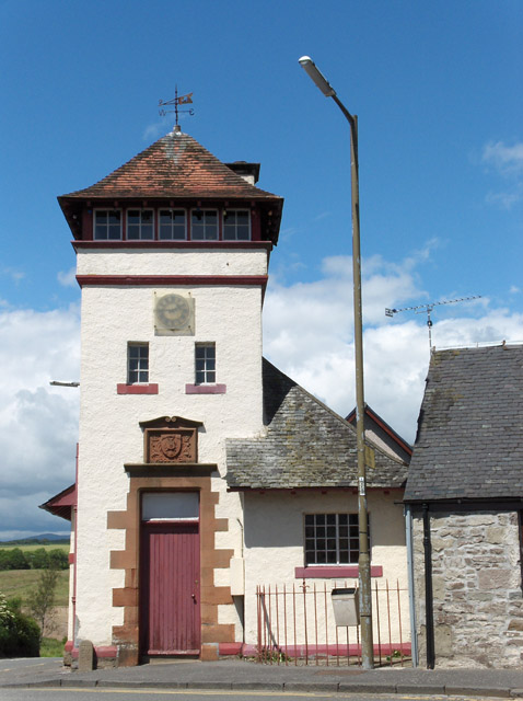
Boquhapple is also known for its historic landmarks and heritage sites. The village is home to Boquhapple House, a magnificent mansion that stands as a testament to the architectural brilliance of bygone eras. This grand residence has a rich history and is often admired for its intricate detailing and beautiful gardens.

Despite its small size, Boquhapple has a strong sense of community spirit. The village hosts various events and activities throughout the year, bringing locals together and fostering a sense of belonging. The residents take pride in their village and work together to maintain its charm and character.

In terms of amenities, Boquhapple offers a range of facilities to cater to the needs of its residents. There are local shops, schools, and community centers, ensuring that residents have easy access to essential services.

Overall, Boquhapple is a charming village that combines natural beauty, rich history, and a strong community spirit. It is a place where residents and visitors can enjoy the best of rural Scotland.

If you have any feedback on the listing, please let us know in the comments section below.

Boquhapple Images

Images are sourced within 2km of 56.173463/-4.1760483 or Grid Reference NN6500. Thanks to Geograph Open Source API. All images are credited.

Flanders Moss seen from Thornhill Carse land along the Forth: this was once bogland until cleared by stripping away the peat to reclaim it as arable land.
Flanders Moss seen from Thornhill
Carse land along the Forth: this was once bogland until cleared by stripping away the peat to reclaim it as arable land.
Carse land near Thornhill Farmland won from the bogs of Flanders Moss.
Carse land near Thornhill
Farmland won from the bogs of Flanders Moss.
Crown Hotel, Thornhill Closed and for sale. There is another pub in the village.
Crown Hotel, Thornhill
Closed and for sale. There is another pub in the village.
Main Street, Thornhill (Perthshire)
Impressive gates Belonging to an equally impressive 8-bedroom mansion, Moss-side Hall of Boquhapple.
Impressive gates
Belonging to an equally impressive 8-bedroom mansion, Moss-side Hall of Boquhapple.
Flanders Moss General view north from the top of the Scottish Natural Heritage Flanders Moss observation tower. SNH have provided paths and boardwalks enabling visitors to walk dryshod around this vast expanse of peat and moss (which forms part of the largest raised bog in Britain) and in places to feel it gently tremble under ones footfall.
Flanders Moss
General view north from the top of the Scottish Natural Heritage Flanders Moss observation tower. SNH have provided paths and boardwalks enabling visitors to walk dryshod around this vast expanse of peat and moss (which forms part of the largest raised bog in Britain) and in places to feel it gently tremble under ones footfall.
Visitors to Flanders Moss Ducks and gulls frequenting a pond in the SNH nature reserve of Flanders Moss, a vast expanse of peat and moss which forms part of the largest raised bog in Britain.
Visitors to Flanders Moss
Ducks and gulls frequenting a pond in the SNH nature reserve of Flanders Moss, a vast expanse of peat and moss which forms part of the largest raised bog in Britain.
Stirlingshire, Thornhill [2] View west of the Main Street, pub on the right.
Stirlingshire, Thornhill [2]
View west of the Main Street, pub on the right.
Road through Thornhill village
Flanders Moss: More Than Moss! A view of the vegetation in the Moss from the boardwalk.
Flanders Moss: More Than Moss!
A view of the vegetation in the Moss from the boardwalk.
Common Lizard (Zootoca vivipara) At Flanders Moss Flanders Moss is a superb site for observing Common Lizards.  On my visit, I encountered about half a dozen basking on the edge of the boardwalk in the Moss; upon speaking to another visitor, he reported approximately 30 on a recent visit.
Common Lizard (Zootoca vivipara) At Flanders Moss
Flanders Moss is a superb site for observing Common Lizards. On my visit, I encountered about half a dozen basking on the edge of the boardwalk in the Moss; upon speaking to another visitor, he reported approximately 30 on a recent visit.
Goodie Water Looking upstream from Netherton Bridge, south of Thornhill village.
Goodie Water
Looking upstream from Netherton Bridge, south of Thornhill village.
Old milepost This Grangemouth Ironworks milepost on the A873 at Easter Borland has been painted in the last 2 years.
Old milepost
This Grangemouth Ironworks milepost on the A873 at Easter Borland has been painted in the last 2 years.
Solitary birch tree This birch tree has been left standing beside the point where the boardwalk changes direction. Most of the other birch trees on the raised bog here at Flanders Moss National Nature Reserve are removed to ensure that they do not get established and start to dry out the bog.
Solitary birch tree
This birch tree has been left standing beside the point where the boardwalk changes direction. Most of the other birch trees on the raised bog here at Flanders Moss National Nature Reserve are removed to ensure that they do not get established and start to dry out the bog.
Cutting heather on Flanders Moss Flanders Moss is a lowland raised bog and an area of conservation.  The heather is being removed to encourage the regeneration of a bog habitat
Cutting heather on Flanders Moss
Flanders Moss is a lowland raised bog and an area of conservation. The heather is being removed to encourage the regeneration of a bog habitat
Cottages, Thornhill On Main Street, the A873.
Cottages, Thornhill
On Main Street, the A873.
Netherton Bridge Underwater vegetation in Goodie Water.
Netherton Bridge
Underwater vegetation in Goodie Water.
Wood and farmland, Poldar Moss With Ben Ledi behind.
Wood and farmland, Poldar Moss
With Ben Ledi behind.
Show me another place!

Boquhapple is located at Grid Ref: NN6500 (Lat: 56.173463, Lng: -4.1760483)

Unitary Authority: Stirling

Police Authority: Forth Valley

What 3 Words

///neatly.tolls.screeches. Near Kippen, Stirling

Nearby Locations

Boquhapple

Related Wikis

Boquhapple

Boquhapple is an area in Stirling council area, Scotland near Thornhill. == References ==

Thornhill, Stirling

Thornhill (Scottish Gaelic: Cnoc na Driseig) is a village in the Scottish council area of Stirling. It lies 14 miles north west of Stirling itself, south...

Flanders Moss

Flanders Moss (Scottish Gaelic: A’ Mhòine Fhlànrasach) is an area of raised bog lying in the Carse of Forth in west Stirlingshire, Scotland. The villages...

Ruskie

Ruskie is a hamlet in Stirling, Scotland. It is located 4.5 kilometres (2+3⁄4 mi) from Thornhill. It lies within the FK postcode area. == About the... ==

Kippen railway station

Kippen railway station co-served the village of Kippen, Stirling, Scotland, from 1856 to 1934 on the Forth and Clyde Junction Railway. == History == The...

Fairfield Siding railway station

Fairfield Siding railway station co-served the village of Kippen, Stirling, Scotland, from 1861 to 1866 on the Forth and Clyde Junction Railway. ��2�...

Ladylands Platform railway station

Ladylands Platform railway station co-served the village of Kippen, Stirling, Scotland, from 1861 to 1934 on the Forth and Clyde Junction Railway. ��2...

Loch Rusky

Loch Rusky is a small freshwater loch near Callander in the Stirling council area in Scottish Highlands. == Geography == The lake lies in the Registration...

Nearby Amenities

Located within 500m of 56.173463,-4.1760483
Wards of Goodie
Place: hamlet
Lat/Long: 56.1691079/-4.1779983
Power: pole
Lat/Long: 56.1758347/-4.17707
Power: pole
Lat/Long: 56.1763796/-4.1772478
Power: pole
Lat/Long: 56.1771702/-4.1775009
Power: pole
Lat/Long: 56.1761363/-4.1820149
Power: pole
Lat/Long: 56.1760734/-4.1810129
Power: pole
Lat/Long: 56.1760152/-4.180034
Power: pole
Lat/Long: 56.1759593/-4.1790363
Power: pole
Lat/Long: 56.1758964/-4.1780761
Power: pole
Lat/Long: 56.1757765/-4.1760806
Power: pole
Lat/Long: 56.1757066/-4.1749636
Power: pole
Lat/Long: 56.1756472/-4.1738676
Power: pole
Lat/Long: 56.1755913/-4.1729388
Power: pole
Lat/Long: 56.1755285/-4.1719892
Power: pole
Lat/Long: 56.1754633/-4.1710479
Power: pole
Lat/Long: 56.1752874/-4.1703702
Power: pole
Lat/Long: 56.1750883/-4.1696046
Power: pole
Lat/Long: 56.1748799/-4.1687846
Power: pole
Lat/Long: 56.1758626/-4.1702489
Power: pole
Lat/Long: 56.1701883/-4.1782937
Power: pole
Lat/Long: 56.1707158/-4.1778607
Power: pole
Lat/Long: 56.171234/-4.1774214
Power: pole
Lat/Long: 56.1719479/-4.1768295
Power: pole
Lat/Long: 56.1725359/-4.1763337
Power: pole
Lat/Long: 56.1733708/-4.1762647
Power: pole
Lat/Long: 56.1741731/-4.1761978
Power: pole
Lat/Long: 56.1749812/-4.1761392
The data included in this document is from www.openstreetmap.org. The data is made available under ODbL.

Have you been to Boquhapple?

Leave your review of Boquhapple below (or comments, questions and feedback).