Booze

Settlement in Yorkshire Richmondshire

England

Booze

Old Mine Shafts on Booze Moor The mining up here wasn't the best, and may have only been mined when the price of lead was high in the 1760s. 
You can tell the shafts are old as they are quite low, very close to the hush and have greened over. 
It takes several hundred years for the heavy metals in the soil to wash away significantly to allow grasses to grow.
Old Mine Shafts on Booze Moor Credit: Matthew Hatton

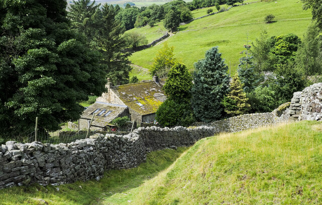
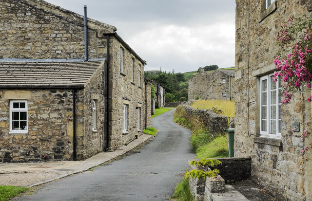
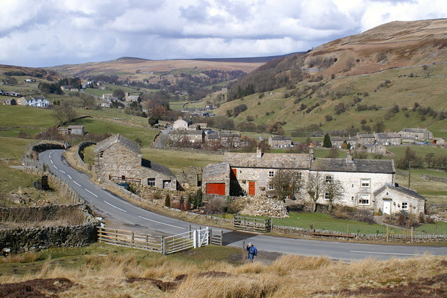
Booze is a small village located in the county of Yorkshire, England. Situated in the scenic Yorkshire Dales National Park, Booze is known for its picturesque countryside, charming stone cottages, and tranquil atmosphere.

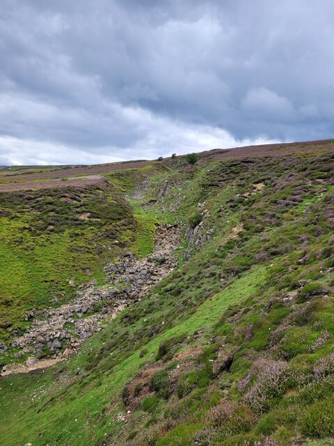
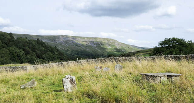
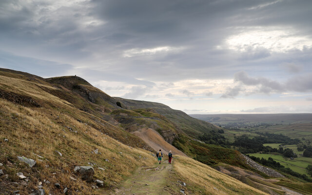
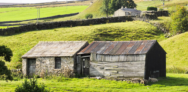
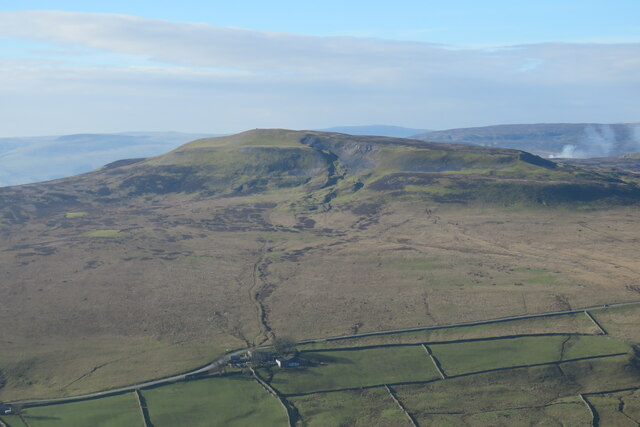
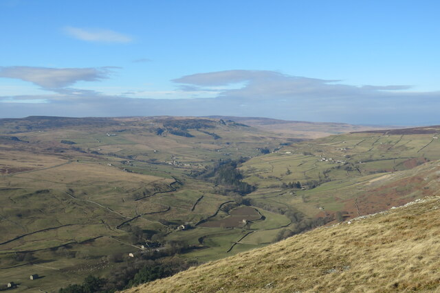
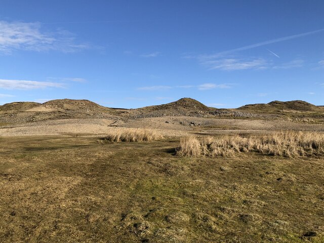
The village is nestled in a valley, surrounded by rolling hills and meandering streams. It offers breathtaking views of the surrounding moors and is a popular destination for nature lovers and hikers. The area is rich in wildlife, with many species of birds, mammals, and plant life thriving in the diverse ecosystem.

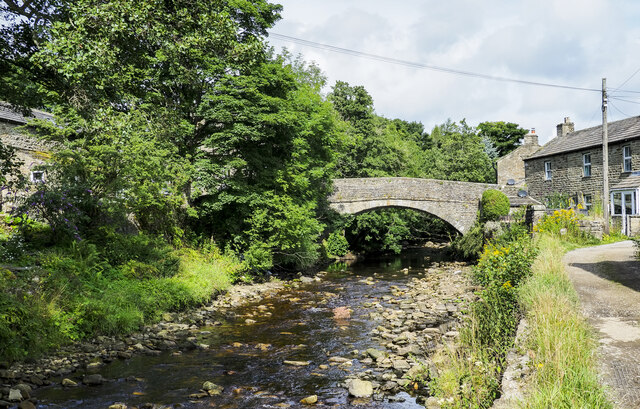
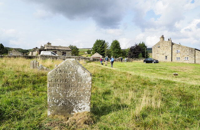
Booze is a close-knit community, with a population of around 200 residents. The village has a strong sense of community spirit, and locals take great pride in their surroundings. The village is well-maintained, with neatly manicured gardens and well-preserved historical buildings.

Although small in size, Booze is not lacking in amenities. The village has a local pub, The Booze Inn, which is a popular spot for locals and visitors alike to gather and enjoy a drink or a meal. There are also some small shops and businesses catering to the needs of residents and tourists.

Booze is surrounded by several other charming villages, including Grassington and Kettlewell, which offer additional amenities and attractions. The area is also known for its annual festivals and events, including the Grassington Dickensian Festival and the Kettlewell Scarecrow Festival, which attract visitors from far and wide.

In summary, Booze is a quaint and idyllic village in Yorkshire, offering a peaceful retreat for those seeking a break from the hustle and bustle of city life. Its natural beauty, friendly community, and proximity to other attractions make it a desirable destination for tourists and a beloved home for its residents.

If you have any feedback on the listing, please let us know in the comments section below.

Booze Images

Images are sourced within 2km of 54.417143/-1.980704 or Grid Reference NZ0102. Thanks to Geograph Open Source API. All images are credited.

Old Mine Shafts on Booze Moor The mining up here wasn't the best, and may have only been mined when the price of lead was high in the 1760s. 
You can tell the shafts are old as they are quite low, very close to the hush and have greened over. 
It takes several hundred years for the heavy metals in the soil to wash away significantly to allow grasses to grow.
Old Mine Shafts on Booze Moor
The mining up here wasn't the best, and may have only been mined when the price of lead was high in the 1760s. You can tell the shafts are old as they are quite low, very close to the hush and have greened over. It takes several hundred years for the heavy metals in the soil to wash away significantly to allow grasses to grow.
Mine shaft at the NW end of the White Gang Mines The White Gang Mines run across Booze Moor for a good half a mile, from the Windegg Scar to the Shooting Hut above Slack Wife Gill.
Mine shaft at the NW end of the White Gang Mines
The White Gang Mines run across Booze Moor for a good half a mile, from the Windegg Scar to the Shooting Hut above Slack Wife Gill.
Old Levels from White Gang Mine The White Gang Lead Vein has extensive workings via shafts and hushes atop of Booze Moor, where the vein was easily reached on the edge of the slope adits where used instead.
Old Levels from White Gang Mine
The White Gang Lead Vein has extensive workings via shafts and hushes atop of Booze Moor, where the vein was easily reached on the edge of the slope adits where used instead.
Looking up North Rake Hush The new official diversion footpath up Slei Gill now passes within 50yds of the hush, so I thought it was worth a quick skip over the moor to take a photo.
Looking up North Rake Hush
The new official diversion footpath up Slei Gill now passes within 50yds of the hush, so I thought it was worth a quick skip over the moor to take a photo.
Lane descending to Storthwaite Hall Storthwaite Hall is a farm in Arkengarthdale close to the stream's confluence with Slei Gill. The walled lane, a bridleway, climbs from the farm on to the open hillside above.
Lane descending to Storthwaite Hall
Storthwaite Hall is a farm in Arkengarthdale close to the stream's confluence with Slei Gill. The walled lane, a bridleway, climbs from the farm on to the open hillside above.
Arkle Beck at Langthwaite Arkle Beck is the river draining Arkengarthdale which is a tributary valley of Swaledale. Here it's passing the small settlement at Langthwaite which is accessed by the bridge from the main road through the valley.
Arkle Beck at Langthwaite
Arkle Beck is the river draining Arkengarthdale which is a tributary valley of Swaledale. Here it's passing the small settlement at Langthwaite which is accessed by the bridge from the main road through the valley.
Fell End Boulders Fell End Boulders are at Fell End, a location overlooking the valley of Slei Gill which is in the distance beyond the rocks.
Fell End Boulders
Fell End Boulders are at Fell End, a location overlooking the valley of Slei Gill which is in the distance beyond the rocks.
Blooming heather with dry stone wall Heather in flower in mid-August along the ridge crest at the north side of Arkengarthdale which is the obvious gulf beyond the wall. The green dome at the right side of the image is a feature of the old lead mining industry.
Calver Hill is at the left side of the image.
Blooming heather with dry stone wall
Heather in flower in mid-August along the ridge crest at the north side of Arkengarthdale which is the obvious gulf beyond the wall. The green dome at the right side of the image is a feature of the old lead mining industry. Calver Hill is at the left side of the image.
Gravestones at Arkle Town Arkle Town is a small settlement of Arkengarthdale. There's no longer a church in Arkle Town and the graveyard has just a few gravestones; it appears to have been virtually abandoned.
The chapel at Arkle Town was replaced by the present parish church of St Mary, Arkengarthdale in 1820. (Thanks to Stephen Craven for that additional information.)
Gravestones at Arkle Town
Arkle Town is a small settlement of Arkengarthdale. There's no longer a church in Arkle Town and the graveyard has just a few gravestones; it appears to have been virtually abandoned. The chapel at Arkle Town was replaced by the present parish church of St Mary, Arkengarthdale in 1820. (Thanks to Stephen Craven for that additional information.)
Arkle Town A minor road in the small settlement of Arkle Town in Arkengarthdale. The road is heading towards the main thoroughfare through the valley which itself is just a minor road.
Arkle Town
A minor road in the small settlement of Arkle Town in Arkengarthdale. The road is heading towards the main thoroughfare through the valley which itself is just a minor road.
Reconstructed bridleway in Arkengarthdale The path is on the steep slope of the valley below Fremington Edge. In July 2019 there was flash flooding in the area due to a spell of intense rainfall which led to significant damage in the valley bottom and the closure of this route. Clearly, repair work has been done since.
Reconstructed bridleway in Arkengarthdale
The path is on the steep slope of the valley below Fremington Edge. In July 2019 there was flash flooding in the area due to a spell of intense rainfall which led to significant damage in the valley bottom and the closure of this route. Clearly, repair work has been done since.
Descending Fell End Lead workings Taken from a little higher on the bridleway than last year's <a href="https://www.geograph.org.uk/photo/6653457">NZ0202 : Descending Fell End Lead workings</a> and a month earlier so that the bracken has not yet turned. The workings on Fell End Moor have been severely hushed and eroded, with the waste rock quite hostile to new vegetation, leaving an ugly scar. The violent storm of summer 2019 also added to the erosion, but the bridleway still picks its way successfully down by a zig zag route. The cairn seen on the horizon marks the Northwest end of Fremington Edge, a splendid five kilometre romp once you're up there - though almost all routes to reach it from Arkengarthdate are steep. The views are excellent on a clear day, but it is invariably windier than you'd expected.
Descending Fell End Lead workings
Taken from a little higher on the bridleway than last year's NZ0202 : Descending Fell End Lead workings and a month earlier so that the bracken has not yet turned. The workings on Fell End Moor have been severely hushed and eroded, with the waste rock quite hostile to new vegetation, leaving an ugly scar. The violent storm of summer 2019 also added to the erosion, but the bridleway still picks its way successfully down by a zig zag route. The cairn seen on the horizon marks the Northwest end of Fremington Edge, a splendid five kilometre romp once you're up there - though almost all routes to reach it from Arkengarthdate are steep. The views are excellent on a clear day, but it is invariably windier than you'd expected.
Two barns in Arkengarthdale The small barns are on the south-western side of the road through the valley. The one in stone appears to be surviving better than that in wood and in fact its roof seems to have been replaced fairly recently.
Two barns in Arkengarthdale
The small barns are on the south-western side of the road through the valley. The one in stone appears to be surviving better than that in wood and in fact its roof seems to have been replaced fairly recently.
Graveyard at Arkle Town Arkle Town is a small settlement in Arkengarthdale.
The gravestone in the foreground is that of Ann Harker, wife of John, who died on the 6th. of May 1809 aged 42.
There's now no church at Arkle Town, the chapel there was replaced by the present parish church of St Mary, Arkengarthdale in 1820. (That information was provided by Stephen Craven in relation to another image.)
Graveyard at Arkle Town
Arkle Town is a small settlement in Arkengarthdale. The gravestone in the foreground is that of Ann Harker, wife of John, who died on the 6th. of May 1809 aged 42. There's now no church at Arkle Town, the chapel there was replaced by the present parish church of St Mary, Arkengarthdale in 1820. (That information was provided by Stephen Craven in relation to another image.)
Calver Hill Prominent hill between Swaledale and Arkengarthdale reaching 1598 ft. high with evidence of mining and quarrying on the summit plateau.
Calver Hill
Prominent hill between Swaledale and Arkengarthdale reaching 1598 ft. high with evidence of mining and quarrying on the summit plateau.
View up Arkengarthdale The northernmost of the Yorkshire dales, the valley of the Arkle Beck is a tributary of the river Swale which it joins at Reeth.
View up Arkengarthdale
The northernmost of the Yorkshire dales, the valley of the Arkle Beck is a tributary of the river Swale which it joins at Reeth.
Mining waste from Fell End lead mine Tips on the moor at the edge of Fell End lead mine. The mine cut a scar down the side of the valley as it followed the mineral vein.
Mining waste from Fell End lead mine
Tips on the moor at the edge of Fell End lead mine. The mine cut a scar down the side of the valley as it followed the mineral vein.
Pile of stones above Arkengarthdale
Show me another place!

Booze is located at Grid Ref: NZ0102 (Lat: 54.417143, Lng: -1.980704)

Division: North Riding

Administrative County: North Yorkshire

District: Richmondshire

Police Authority: North Yorkshire

What 3 Words

///invisible.conquest.courier. Near Barningham, Co. Durham

Related Wikis

Booze, North Yorkshire

Booze is a hamlet in Arkengarthdale, in the Richmondshire district of North Yorkshire, England. It is about 1 mile (1.6 km) east of Langthwaite. There...

Arkle Town

Arkle Town is a hamlet in Arkengarthdale in the Richmondshire district of North Yorkshire, England. It is situated 0.4 miles (0.64 km) to the south of...

Langthwaite

Langthwaite is one of the few villages in Arkengarthdale, North Yorkshire, England. It is 3.5 miles (5.6 km) north of Reeth and sits 870 feet (270 m) above...

Calver Hill

Calver Hill is a fell in the Yorkshire Dales National Park in North Yorkshire, England. It is composed of limestone and is situated at grid reference NZ012003...

Eskeleth

Eskeleth is a hamlet in Arkengarthdale in North Yorkshire, England. It is in the Yorkshire Dales National Park. Eskeleth sits 4 miles (6.4 km) from the...

Fremington Edge

Fremington Edge is a 3-mile (5 km) long wall of crags and scree slopes that is situated to the north of the village of Reeth in Swaledale in the Yorkshire...

Healaugh, Richmondshire

Healaugh (pronounced "hee-law") is a small village in the civil parish of Reeth, Fremington and Healaugh, in Swaledale in the Yorkshire Dales. It is in...

Arkle Beck Meadows, Whaw

Arkle Beck Meadows, Whaw (grid reference NY984041) is a 8.4 hectares (21 acres) biological Site of Special Scientific Interest (SSSI) at Whaw in Arkengarthdale...

Nearby Amenities

Located within 500m of 54.417143,-1.980704
Booze
Is In Historic County: Yorkshire
Place: hamlet
Source: NPE
Wikidata: Q4944140
Wikipedia: en:Booze, North Yorkshire
Lat/Long: 54.4176184/-1.9788303
Ford: yes
Image: https://www.geograph.org.uk/photo/4460459
Lat/Long: 54.4149496/-1.9747834
Passing Place
Lat/Long: 54.4175075/-1.9883149
Barrier: stile
Foot: designated
Lat/Long: 54.4150187/-1.9787784
Ford: yes
Lat/Long: 54.4139145/-1.9854889
Power: pole
Lat/Long: 54.4143859/-1.9865124
Power: pole
Lat/Long: 54.4140714/-1.9852196
Power: pole
Lat/Long: 54.4137561/-1.983908
Power: pole
Lat/Long: 54.4134291/-1.9825226
Power: pole
Lat/Long: 54.4130911/-1.9811131
Barrier: entrance
Lat/Long: 54.4193943/-1.9836735
Barrier: entrance
Lat/Long: 54.4168886/-1.9751682
Geordie Coates
Place: locality
Source Name: OS_OpenData_StreetView
Lat/Long: 54.4204016/-1.9812325
The data included in this document is from www.openstreetmap.org. The data is made available under ODbL.

Have you been to Booze?

Leave your review of Booze below (or comments, questions and feedback).