Ainsdale

Settlement in Lancashire

England

Ainsdale

Ex Toad Hall nightclub Sefton Council commissioned street artist Paul Curtis to create a mural featuring the local sand lizard
Ex Toad Hall nightclub Credit: Norman Caesar

Ainsdale is a small village located on the Sefton coast in the county of Lancashire, England. Situated approximately 12 miles north of the city of Liverpool, Ainsdale offers a tranquil and scenic setting with its proximity to both the sandy beach and the nearby nature reserve.

The village is mainly residential, characterized by a mix of housing styles including detached houses, semi-detached properties, and bungalows. The community is known for its friendly and welcoming atmosphere, making it an appealing place to live for families and retirees alike.

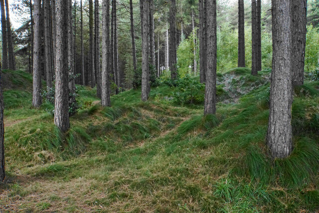
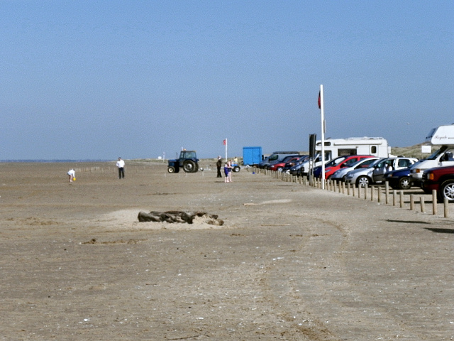
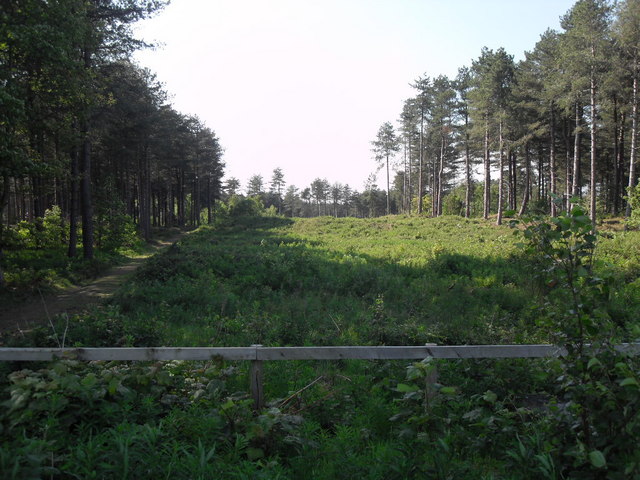
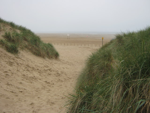
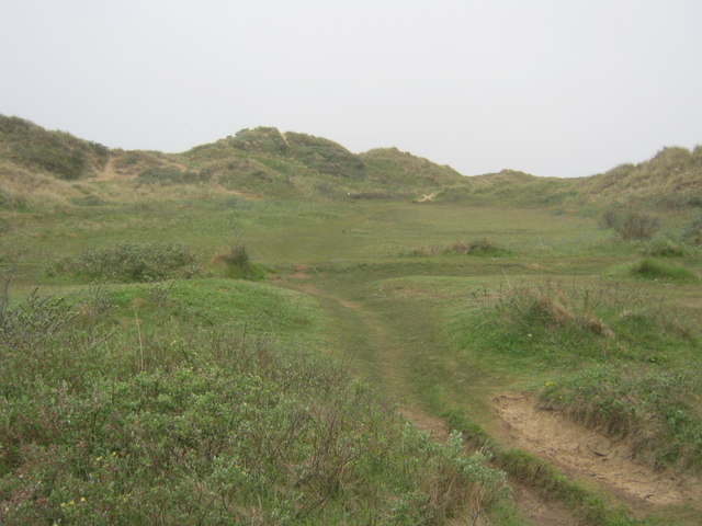
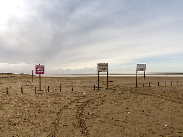
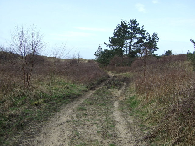
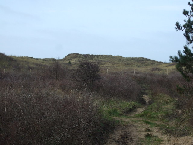
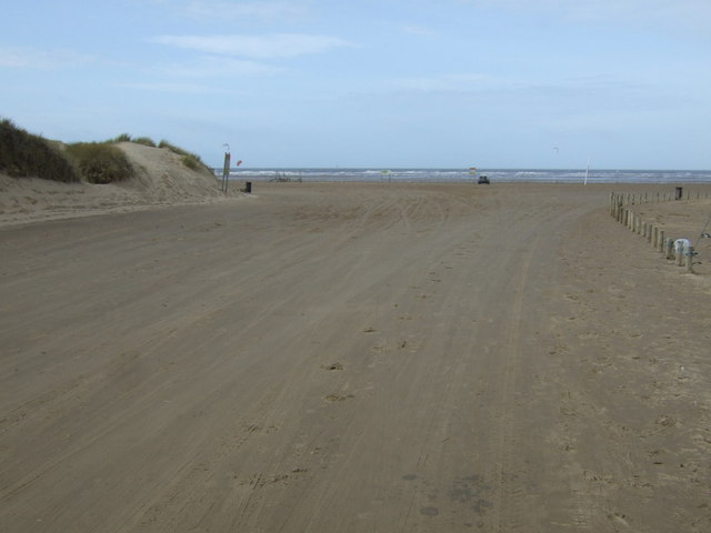
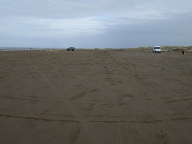
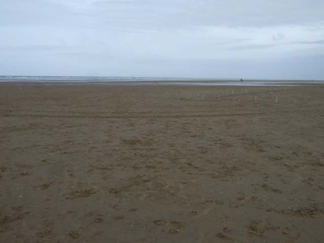
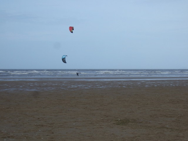
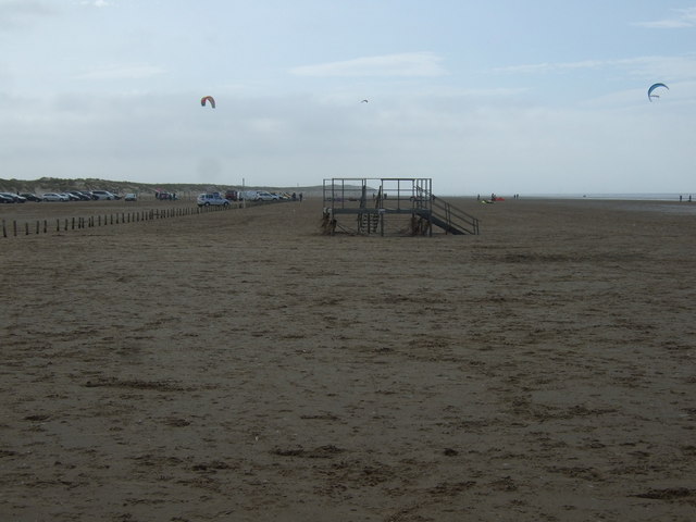
Ainsdale Beach is a popular attraction, stretching for miles along the coast and offering stunning views of the Irish Sea. The beach is well-maintained and has been awarded the Blue Flag status, ensuring cleanliness and safety for visitors. It is a haven for nature lovers, with unique sand dunes and a diverse range of flora and fauna.

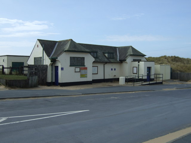
Ainsdale also boasts Ainsdale Village Park, a green space that provides recreational facilities such as tennis courts, a children's playground, and open fields for various outdoor activities. The village has a small number of local shops, cafes, and restaurants, providing residents with convenient amenities.

Transport links in Ainsdale are excellent, with regular train services connecting the village to Liverpool and other nearby towns. The village is also well-connected by road, with the A565 providing easy access to the wider region.

Overall, Ainsdale offers a picturesque coastal location with a strong sense of community, making it an attractive place to live or visit for those seeking a peaceful and scenic environment.

If you have any feedback on the listing, please let us know in the comments section below.
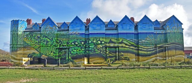
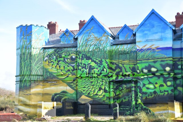
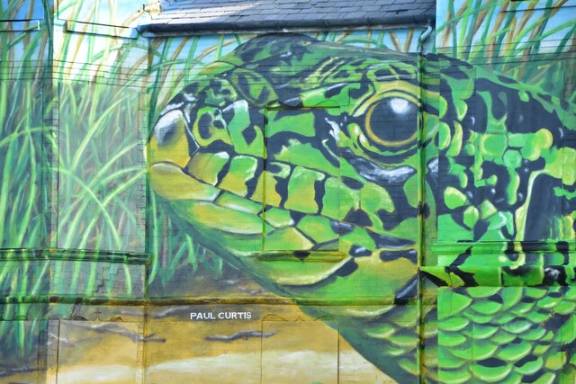
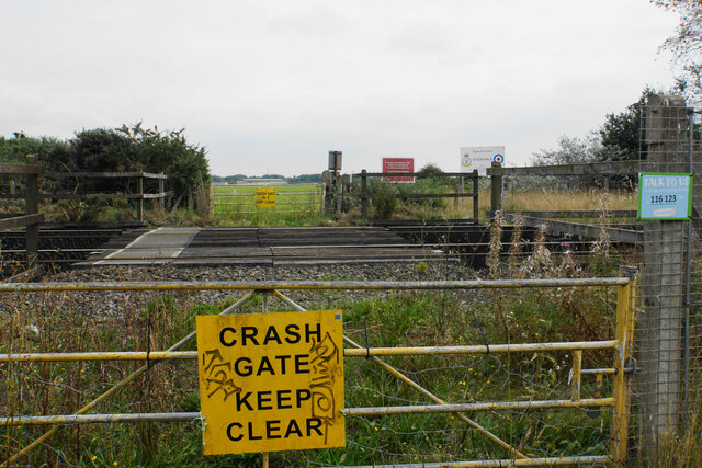
Ainsdale Images

Images are sourced within 2km of 53.598046/-3.041538 or Grid Reference SD3111. Thanks to Geograph Open Source API. All images are credited.

Ex Toad Hall nightclub Sefton Council commissioned street artist Paul Curtis to create a mural featuring the local sand lizard
Ex Toad Hall nightclub
Sefton Council commissioned street artist Paul Curtis to create a mural featuring the local sand lizard
Ex Toad Hall nightclub detail Sefton Council commissioned street artist Paul Curtis to create a mural featuring the local sand lizard
Ex Toad Hall nightclub detail
Sefton Council commissioned street artist Paul Curtis to create a mural featuring the local sand lizard
Ex Toad Hall nightclub detail Sefton Council commissioned street artist Paul Curtis to create a mural featuring the local sand lizard
Ex Toad Hall nightclub detail
Sefton Council commissioned street artist Paul Curtis to create a mural featuring the local sand lizard
Crash Gate No. 5 Access in case of emergency to RAF Woodvale across the railway.
Crash Gate No. 5
Access in case of emergency to RAF Woodvale across the railway.
Pine-covered dunes Part of the Ainsdale Sand Dunes National Nature Reserve.
Pine-covered dunes
Part of the Ainsdale Sand Dunes National Nature Reserve.
Ainsdale Beach Car Park
Ainsdale Nature Reserve
Path to Beach from Ainsdale Discovery Centre
Path in Ainsdale Hills
Beach signage Information signs on the beach at Ainsdale on Sea.
Beach signage
Information signs on the beach at Ainsdale on Sea.
Coastal track Ainsdale Hills
Dunes, Ainsdale Hills
Toilets on Shore Road, Ainsdale-on-Sea
Beach road, Ainsdale-on-Sea To car parking on the beach.
Beach road, Ainsdale-on-Sea
To car parking on the beach.
Parking on the beach, Ainsdale-on-Sea
Beach, Ainsdale-on-Sea
Kites, Ainsdale-on-Sea
Beach, Ainsdale-on-Sea
Show me another place!

Ainsdale is located at Grid Ref: SD3111 (Lat: 53.598046, Lng: -3.041538)

Unitary Authority: Sefton

Police Authority: Merseyside

What 3 Words

///grad.fruity.smiling. Near Formby, Merseyside

Nearby Locations

Woodvale Ainsdale

Related Wikis

Ainsdale railway station

Ainsdale railway station serves the village of Ainsdale near Southport, England. The station is located on the Southport branch of the Merseyrail network...

Ainsdale (ward)

Ainsdale is a Metropolitan Borough of Sefton ward in the Southport Parliamentary constituency that covers the localities of Ainsdale and Woodvale in the...

Ainsdale

Ainsdale is an area of Southport in Merseyside, England, situated three miles south of the centre of Southport. Originally in the historic county of Lancashire...

1937 Ryder Cup

The 6th Ryder Cup Matches were held 29–30 June 1937 at the Southport and Ainsdale Golf Club in Southport, England. The United States team won the competition...

Nearby Amenities

Located within 500m of 53.598046,-3.041538
Ainsdale
Alt Name: Ainsdale-on-Sea
Place: suburb
Source: npe
Lat/Long: 53.6012107/-3.0413677
Ainsdale
Naptan AtcoCode: 9100AINSDAL
Network: National Rail
Network Website: https://www.nationalrail.co.uk/stations/ans/
Network Wikidata: Q26334
Public Transport: station
Railway: station
Ref Crs: ANS
Source: npe
Wikidata: Q958339
Wikipedia: en:Ainsdale railway station
Lat/Long: 53.6018568/-3.04264
Traffic Signals
Traffic Signals: signal
Traffic Signals Direction: backward
Lat/Long: 53.5969926/-3.0365155
Bus Stop
STATION ROAD/AINSDALE STATION
Bus: yes
Naptan AtcoCode: 2800S62006A
Naptan Bearing: E
Naptan CommonName: STATION ROAD/AINSDALE STATION
Naptan Indicator: STATION ROAD/AINSDALE STATION
Naptan Landmark: NEXT TO AINSDALE STATION
Naptan NaptanCode: mergjawd
Naptan Notes: No Notes
Naptan ShortCommonName: Stn Rd/Ainsdale Stn
Naptan Street: STATION ROAD
Naptan Verified: no
Public Transport: platform
Source: naptan_import
Lat/Long: 53.6022176/-3.0418476
Bus Stop
STATION ROAD/AINSDALE STATION
Bench: yes
Bus: yes
Covered: yes
Naptan AtcoCode: 2800S62006B
Naptan Bearing: W
Naptan CommonName: STATION ROAD/AINSDALE STATION
Naptan Indicator: STATION ROAD/AINSDALE STATION
Naptan Landmark: NEXT TO AINSDALE STATION
Naptan NaptanCode: mergjawg
Naptan Notes: No Notes
Naptan ShortCommonName: Stn Rd/Ainsdale Stn
Naptan Street: STATION ROAD
Naptan Verified: no
Public Transport: platform
Shelter: yes
Source: naptan_import
Lat/Long: 53.6020451/-3.0420398
Bus Stop
KENILWORTH RD/WESTMINSTER DR
Bus: yes
Naptan AtcoCode: 2800S62010A
Naptan Bearing: NW
Naptan CommonName: KENILWORTH RD/WESTMINSTER DR
Naptan Indicator: KENILWORTH ROAD/WESTMINSTER DRIVE
Naptan Landmark: CORNER WESTMINSTER DRIVE
Naptan NaptanCode: mergjdag
Naptan Notes: No Notes
Naptan ShortCommonName: Westminster Dr
Naptan Street: KENILWORTH ROAD
Naptan Verified: no
Public Transport: platform
Source: naptan_import
Lat/Long: 53.5996223/-3.0477378
Bus Stop
KENILWORTH RD/WESTMINSTER DR
Bus: yes
Naptan AtcoCode: 2800S62010B
Naptan Bearing: SE
Naptan CommonName: KENILWORTH RD/WESTMINSTER DR
Naptan Indicator: KENILWORTH ROAD OPP WESTMINSTER DRIVE
Naptan Landmark: KENILWORTH RD/WESTMINSTER DR
Naptan NaptanCode: mergjdaj
Naptan Notes: No Notes
Naptan ShortCommonName: Westminster Dr
Naptan Street: KENILWORTH ROAD
Naptan Verified: no
Public Transport: platform
Source: naptan_import
Lat/Long: 53.5999237/-3.0482137
Bus Stop
KENILWORTH RD/THE ARION
Bus: yes
Naptan AtcoCode: 2800S62011A
Naptan Bearing: E
Naptan CommonName: KENILWORTH RD/THE ARION
Naptan Indicator: KENILWORTH ROAD/THE ARION
Naptan Landmark: O/S 36 BETWEEN TREVOR ROAD AND FRANCEY CLOSE
Naptan NaptanCode: mergjdam
Naptan Notes: No Notes
Naptan ShortCommonName: The Arion
Naptan Street: KENILWORTH ROAD
Naptan Verified: no
Public Transport: platform
Source: naptan_import
Lat/Long: 53.5979464/-3.0409718
Bus Stop
KENILWORTH RD/THE ARION
Bus: yes
Naptan AtcoCode: 2800S62011B
Naptan Bearing: E
Naptan CommonName: KENILWORTH RD/THE ARION
Naptan Indicator: KENILWORTH ROAD/THE ARION
Naptan Landmark: O/S 55
Naptan NaptanCode: mergjdap
Naptan Notes: No Notes
Naptan ShortCommonName: The Arion
Naptan Street: KENILWORTH ROAD
Naptan Verified: no
Public Transport: platform
Source: naptan_import
Lat/Long: 53.5981363/-3.0429107
Bus Stop
GLENEAGLES DR/LONGCLIFFE DR
Bus: yes
Naptan AtcoCode: 2800S62012A
Naptan Bearing: N
Naptan CommonName: GLENEAGLES DR/LONGCLIFFE DR
Naptan Indicator: GLENEAGLES DRIVE/KENILWORTH ROAD
Naptan Landmark: O/S 2 NR LONGCLIFFE DRIVE
Naptan NaptanCode: mergjdat
Naptan Notes: No Notes
Naptan ShortCommonName: Kenilworth Rd
Naptan Street: GLENEAGLES DRIVE
Naptan Verified: no
Public Transport: platform
Source: naptan_import
Lat/Long: 53.5973284/-3.0407149
Bus Stop
GLENEAGLES DR/LONGCLIFFE DR
Bus: yes
Naptan AtcoCode: 2800S62012B
Naptan Bearing: SW
Naptan CommonName: GLENEAGLES DR/LONGCLIFFE DR
Naptan Indicator: GLENEAGLES DRIVE/KENILWORTH ROAD
Naptan Landmark: O/S 13 OPP LONGCLIFFE DRIVE
Naptan NaptanCode: mergjdaw
Naptan Notes: No Notes
Naptan ShortCommonName: Kenilworth Rd
Naptan Street: GLENEAGLES DRIVE
Naptan Verified: no
Public Transport: platform
Source: naptan_import
Lat/Long: 53.5966786/-3.0410162
Bus Stop
GLENEAGLES DR/EASEDALE DR
Bus: yes
Naptan AtcoCode: 2800S62013A
Naptan Bearing: NE
Naptan CommonName: GLENEAGLES DR/EASEDALE DR
Naptan Indicator: GLENEAGLES DRIVE
Naptan Landmark: O/S 44 BETWEEN SUNBURY DRIVE AND EASEDALE DRIV
Naptan NaptanCode: mergjdga
Naptan Notes: No Notes
Naptan ShortCommonName: Easedale Dr
Naptan Street: GLENEAGLES DRIVE
Naptan Verified: no
Public Transport: platform
Source: naptan_import
Lat/Long: 53.5949147/-3.0433149
Bus Stop
GLENEAGLES DR/PENRITH AVE
Bus: yes
Naptan AtcoCode: 2800S62013B
Naptan Bearing: SW
Naptan CommonName: GLENEAGLES DR/PENRITH AVE
Naptan Indicator: GLENEAGLES DRIVE
Naptan Landmark: O/S 65
Naptan NaptanCode: mergjdgd
Naptan Notes: No Notes
Naptan ShortCommonName: Easedale Dr
Naptan Street: GLENEAGLES DRIVE
Naptan Verified: no
Public Transport: platform
Source: naptan_import
Lat/Long: 53.594617/-3.0434436
Bus Stop
LIVERPOOL RD/STAVELEY RD
Bus: yes
Naptan AtcoCode: 2800S62023B
Naptan Bearing: SW
Naptan CommonName: LIVERPOOL RD/STAVELEY RD
Naptan Indicator: LIVERPOOL ROAD/STAVELEY ROAD
Naptan Landmark: O/S 641 NR STAVENUELEY ROAD
Naptan NaptanCode: mergjdmw
Naptan Notes: No Notes
Naptan ShortCommonName: Staveley Rd
Naptan Street: LIVERPOOL ROAD
Naptan Verified: no
Public Transport: platform
Source: naptan_import
Lat/Long: 53.5980603/-3.0350964
Bus Stop
LIVERPOOL RD/KENILWORTH RD
Bus: yes
Naptan AtcoCode: 2800S62024A
Naptan Bearing: NE
Naptan CommonName: LIVERPOOL RD/KENILWORTH RD
Naptan Indicator: LIVERPOOL ROAD/KENILWORTH ROAD
Naptan Landmark: O/S 726
Naptan NaptanCode: mergjdpa
Naptan Notes: No Notes
Naptan ShortCommonName: Kenilworth Rd
Naptan Street: LIVERPOOL ROAD
Naptan Verified: no
Public Transport: platform
Source: naptan_import
Lat/Long: 53.597433/-3.0359122
Bus Stop
ORCHARD LN/LIVERPOOL RD
Bus: yes
Naptan AtcoCode: 2800S62024B
Naptan Bearing: SE
Naptan CommonName: ORCHARD LN/LIVERPOOL RD
Naptan Indicator: ORCHARD LANE/LIVERPOOL ROAD
Naptan Landmark: ALMOST OPP 2 NR ELECTRICITY SUB STATION
Naptan NaptanCode: mergjdpd
Naptan Notes: No Notes
Naptan ShortCommonName: Orchard Ln/Lpool Rd
Naptan Street: ORCHARD LANE
Naptan Verified: no
Public Transport: platform
Source: naptan_import
Lat/Long: 53.5964782/-3.0361457
Bus Stop
KENILWORTH RD/LIVERPOOL RD
Bus: yes
Naptan AtcoCode: 2800S62024C
Naptan Bearing: NW
Naptan CommonName: KENILWORTH RD/LIVERPOOL RD
Naptan Indicator: KENILWORTH ROAD/LIVERPOOL ROAD
Naptan Landmark: ADJ 1
Naptan NaptanCode: mergjdpg
Naptan Notes: No Notes
Naptan ShortCommonName: Liverpool Rd
Naptan Street: KENILWORTH ROAD
Naptan Verified: no
Public Transport: platform
Source: naptan_import
Lat/Long: 53.5970117/-3.0368236
Bus Stop
LIVERPOOL RD/ORCHARD LN
Bench: no
Bin: no
Bus: yes
Naptan AtcoCode: 2800S62024D
Naptan Bearing: SW
Naptan CommonName: LIVERPOOL RD/ORCHARD LN
Naptan Indicator: LIVERPOOL ROAD/ORCHARD LANE
Naptan Landmark: O/S 687 NR ORCHARD LANE
Naptan NaptanCode: mergjdpj
Naptan Notes: No Notes
Naptan ShortCommonName: Orchard Ln
Naptan Street: LIVERPOOL ROAD
Naptan Verified: no
Public Transport: platform
Shelter: no
Source: naptan_import
Tactile Paving: yes
Lat/Long: 53.5960565/-3.0370873
Bus Stop
LIVERPOOL RD/AINSDALE CLUB
Bus: yes
Naptan AtcoCode: 2800S62032A
Naptan Bearing: NE
Naptan CommonName: LIVERPOOL RD/AINSDALE CLUB
Naptan Indicator: LIVERPOOL ROAD/THE AINSDALE CLUB
Naptan Landmark: O/S 772 NR ENTRANCE TO THE AINSDALE CLUB
Naptan NaptanCode: mergjdtj
Naptan Notes: No Notes
Naptan ShortCommonName: L'pool Rd/Club
Naptan Street: LIVERPOOL ROAD
Naptan Verified: no
Public Transport: platform
Source: naptan_import
Lat/Long: 53.5953377/-3.0380972
Taxi
AINSDALE STATION
Naptan AtcoCode: 2800TX00114
Naptan CommonName: AINSDALE STATION
Naptan Indicator: AINSDALE STATION
Naptan Landmark: ADJ CAR PK AT AINSDALE RAILWAY STN
Naptan Notes: No Notes
Naptan Street: SHORE ROAD
Naptan Verified: no
Source: naptan_import
Lat/Long: 53.602301/-3.0425902
Post Box
Brand: Royal Mail
Brand Wikidata: Q638098
Mapillary: 1116606272175640
Operator: Royal Mail
Operator Wikidata: Q638098
Post Box Type: pillar
Ref: PR8 47
Survey Date: 2020-04-09
Lat/Long: 53.6020342/-3.0421174
Bar
Dukes
Addr City: Southport
Addr Housenumber: 108
Addr Postcode: PR8 3HL
Addr Street: Station Road
Phone: +44 1704 572211
Wheelchair: yes
Lat/Long: 53.6021758/-3.0412522
Cafe
MeCycle - Cafe
Addr City: Ainsdale
Addr Housenumber: 59
Addr Postcode: PR8 3HH
Addr Street: Station Road
Phone: +44 1704 579353
Source Postcode: FHRS Open Data
Website: mecycle.co.uk
Lat/Long: 53.6019385/-3.0420556
Post Box
Ref: PR8 161
Lat/Long: 53.5964685/-3.0365151
Post Box
Brand: Royal Mail
Brand Wikidata: Q638098
Mapillary: 474161644226561
Operator: Royal Mail
Operator Wikidata: Q638098
Post Box Mounting: pier
Post Box Type: lamp
Ref: PR8 45
Survey Date: 2020-04-09
Lat/Long: 53.5994292/-3.038873
Crossing Barrier: double_half
Railway: level_crossing
Lat/Long: 53.6022449/-3.0422673
Waste Basket
Lat/Long: 53.6020191/-3.0421898
Studio 57
Addr City: Southport
Addr Housenumber: 57
Addr Street: Station Road
Shop: hairdresser
Lat/Long: 53.6019427/-3.0419163
Fast Food
Fish & Chips
Addr City: Southport
Addr Housenumber: 53
Addr Street: Station Road
Cuisine: fish_and_chips
Drive Through: no
Phone: +44 1704 573433
Takeaway: only
Lat/Long: 53.6019331/-3.0418358
Bar
Pebbles
Addr City: Southport
Addr Street: Station Road
Lat/Long: 53.6019252/-3.0417446
Robson Rice
Addr City: Southport
Addr Housenumber: 49
Addr Postcode: PR8 3HH
Addr Street: Station Road
Office: accountant
Lat/Long: 53.6019061/-3.0416534
Betty's Hair Salon
Addr City: Southport
Addr Housenumber: 122
Addr Postcode: PR8 3HL
Addr Street: Station Road
Shop: hairdresser
Lat/Long: 53.6022462/-3.0416751
Barbers 120
Addr City: Southport
Addr Housenumber: 120
Addr Postcode: PR8 3HL
Addr Street: Station Road
Shop: hairdresser
Lat/Long: 53.6022378/-3.0415866
Fast Food
Flamingos
Addr City: Southport
Addr Housenumber: 112
Addr Postcode: PR8 3HL
Addr Street: Station Road
Drive Through: no
Phone: +44 1704 571658
Takeaway: only
Lat/Long: 53.6022063/-3.0414805
Graysons
Addr City: Southport
Addr Housenumber: 106
Addr Postcode: PR8 3HL
Addr Street: Station Road
Shop: bakery
Lat/Long: 53.6021653/-3.0410699
Bar
The Golden Monkey
Addr City: Southport
Addr Housenumber: 104
Addr Postcode: PR8 3HL
Addr Street: Station Road
Lat/Long: 53.6021559/-3.0409779
Pure Indulgence
Addr City: Southport
Addr Housenumber: 102
Addr Postcode: PR8 3HL
Addr Street: Station Road
Phone: +44 1704 572777
Shop: beauty
Website: http://pureindulgencenailsandbeauty.co.uk/
Lat/Long: 53.6021643/-3.0408664
MeCycle - Cycle Shop
Addr City: Ainsdale
Addr Housenumber: 59
Addr Postcode: PR8 3HH
Addr Street: Station Road
Phone: +44 1704 579353
Shop: bicycle
Website: mecycle.co.uk
Lat/Long: 53.6019175/-3.0420892
Bench
Backrest: yes
Lat/Long: 53.6021211/-3.0401528
Bench
Backrest: yes
Lat/Long: 53.6021283/-3.0400288
Bench
Backrest: yes
Lat/Long: 53.6021368/-3.0399434
Bench
Backrest: yes
Lat/Long: 53.6021476/-3.0397137
Bench
Backrest: yes
Lat/Long: 53.6021573/-3.0396101
Waste Basket
Lat/Long: 53.6021826/-3.0397442
Waste Basket
Lat/Long: 53.6021561/-3.0396487
Shop: newsagent
Lat/Long: 53.6022514/-3.039728
Smiths TV Video Hi-Fi
Addr City: Southport
Addr Housenumber: 84
Addr Postcode: PR8 3HW
Addr Street: Station Road
Shop: electronics
Lat/Long: 53.6022694/-3.0396467
Cafe
The Vestry Cafe
Lat/Long: 53.6024516/-3.0406366
Bar
The Harbour
Addr City: Southport
Addr Housenumber: 76
Addr Postcode: PR8 3HW
Addr Street: Station Road
Lat/Long: 53.6022827/-3.0393722
Bench
Backrest: yes
Lat/Long: 53.602173/-3.0393438
Bench
Backrest: yes
Lat/Long: 53.6022429/-3.0391222
Bench
Backrest: yes
Lat/Long: 53.6022164/-3.0391161
Waste Basket
Lat/Long: 53.6021935/-3.0391425
Post Office
Ainsdale Post Office
Addr City: Southport
Addr Housenumber: 74
Addr Postcode: PR8 3HW
Addr Street: Station Road
Branch: Ainsdale
Brand: Post Office
Brand Wikidata: Q1783168
Check Date: 2020-02-20
Contact Website: https://www.postoffice.co.uk/branch-finder/2554275/ainsdale
Phone: +44 1704 578285
Ref Pol Id: 10089
Lat/Long: 53.6022936/-3.0392767
Post Box
Operator: Royal Mail
Post Box Design: type_a
Post Box Type: pillar
Ref: PR8 73
Lat/Long: 53.6021947/-3.0392808
Shop: yes
Lat/Long: 53.6023134/-3.0391849
Waste Basket
Lat/Long: 53.6020988/-3.0383059
DIY Garden and Pet Store
Addr City: Southport
Addr Street: Station Road
Shop: yes
Lat/Long: 53.6020193/-3.038173
Heyes Opticians
Addr City: Southport
Addr Housenumber: 17
Addr Postcode: PR8 3HN
Addr Street: Station Road
Phone: +44 1704 574985
Shop: optician
Lat/Long: 53.6020384/-3.0381033
Ainsdale
Public Transport: stop_position
Railway: stop
Train: yes
Lat/Long: 53.6021362/-3.0424242
Crossing Barrier: double_half
Railway: level_crossing
Lat/Long: 53.6022606/-3.0423212
Dentist
Healthcare: dentist
Lat/Long: 53.5966787/-3.0370805
Ainsdale
Public Transport: stop_position
Railway: stop
Train: yes
Lat/Long: 53.6011126/-3.0433062
Traffic Signals
Traffic Signals: signal
Traffic Signals Direction: backward
Lat/Long: 53.5967669/-3.0364671
Traffic Signals
Traffic Signals: signal
Traffic Signals Direction: forward
Lat/Long: 53.5970136/-3.0362329
Traffic Signals
Traffic Signals: crossing
Lat/Long: 53.5987405/-3.0348157
Traffic Signals
Traffic Signals: crossing
Lat/Long: 53.5988098/-3.0346258
Crossing
Button Operated: yes
Crossing: traffic_signals
Crossing Island: no
Tactile Paving: yes
Lat/Long: 53.5987783/-3.0346455
Crossing
Button Operated: yes
Crossing: traffic_signals
Crossing Island: no
Tactile Paving: yes
Lat/Long: 53.5987692/-3.0347967
Traffic Calming: hump
Lat/Long: 53.5984694/-3.0343538
Bicycle Parking
Bicycle Parking: stands
Capacity: 12
Covered: no
Lat/Long: 53.601961/-3.0422322
Atm
Lat/Long: 53.6022553/-3.0392915
The data included in this document is from www.openstreetmap.org. The data is made available under ODbL.

Have you been to Ainsdale?

Leave your review of Ainsdale below (or comments, questions and feedback).