Woodvale

Settlement in Lancashire

England

Woodvale

Ex Toad Hall nightclub Sefton Council commissioned street artist Paul Curtis to create a mural featuring the local sand lizard
Ex Toad Hall nightclub Credit: Norman Caesar

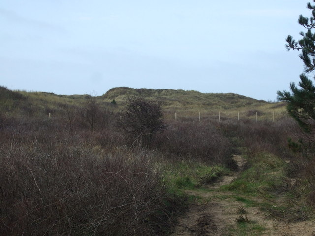
Woodvale is a small residential area located in the borough of Sefton, Lancashire, England. Situated on the northern outskirts of the town of Ainsdale, it is bordered by Victoria Park to the east and the scenic Ainsdale Sand Dunes Nature Reserve to the west. With a population of around 2,500 residents, Woodvale offers a close-knit community feel.

The area primarily consists of housing, ranging from modest terraced houses to larger detached properties. There are also a few local amenities, including a convenience store, a post office, and a small selection of shops and cafes. For further shopping options, residents can easily access Ainsdale village center, which is just a short distance away.

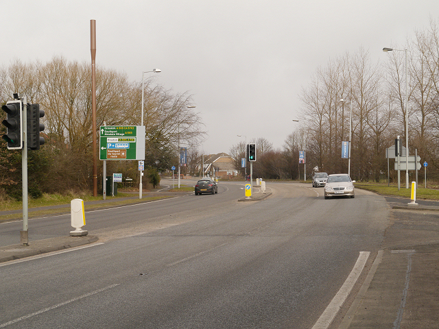
Woodvale benefits from its proximity to the picturesque Ainsdale Beach, a popular destination for locals and tourists alike. The beach stretches for miles and boasts stunning sand dunes and beautiful coastal scenery. Additionally, the nearby Ainsdale Train Station provides convenient transportation links to Liverpool and Southport, making it an ideal location for commuters.

The area is also known for its strong sense of community, with various local events and activities taking place throughout the year. Woodvale Community Centre serves as a hub for social gatherings, offering a range of classes and clubs for all ages.

Overall, Woodvale offers a peaceful and family-friendly environment, with its attractive location, access to amenities, and strong community spirit making it a desirable place to live.

If you have any feedback on the listing, please let us know in the comments section below.
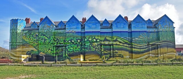
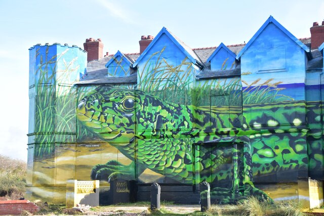
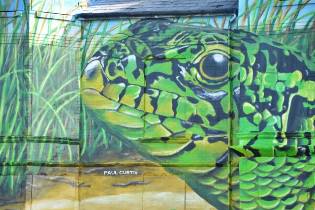
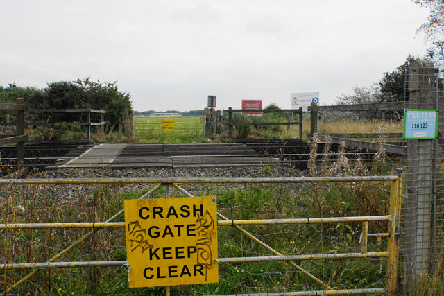
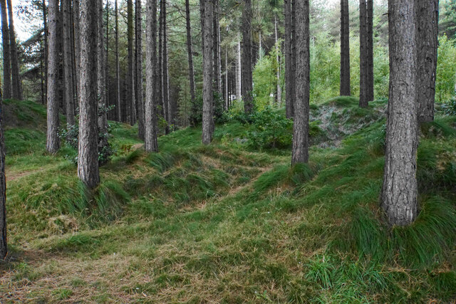
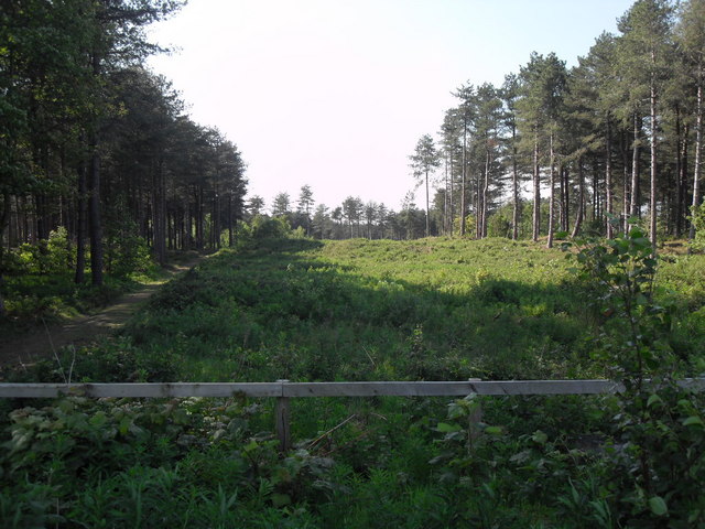
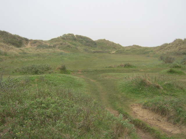
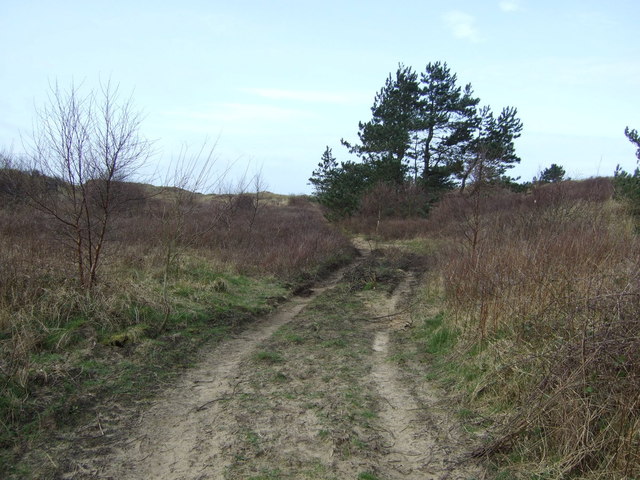
Woodvale Images

Images are sourced within 2km of 53.594282/-3.040236 or Grid Reference SD3111. Thanks to Geograph Open Source API. All images are credited.

Ex Toad Hall nightclub Sefton Council commissioned street artist Paul Curtis to create a mural featuring the local sand lizard
Ex Toad Hall nightclub
Sefton Council commissioned street artist Paul Curtis to create a mural featuring the local sand lizard
Ex Toad Hall nightclub detail Sefton Council commissioned street artist Paul Curtis to create a mural featuring the local sand lizard
Ex Toad Hall nightclub detail
Sefton Council commissioned street artist Paul Curtis to create a mural featuring the local sand lizard
Ex Toad Hall nightclub detail Sefton Council commissioned street artist Paul Curtis to create a mural featuring the local sand lizard
Ex Toad Hall nightclub detail
Sefton Council commissioned street artist Paul Curtis to create a mural featuring the local sand lizard
Crash Gate No. 5 Access in case of emergency to RAF Woodvale across the railway.
Crash Gate No. 5
Access in case of emergency to RAF Woodvale across the railway.
Pine-covered dunes Part of the Ainsdale Sand Dunes National Nature Reserve.
Pine-covered dunes
Part of the Ainsdale Sand Dunes National Nature Reserve.
Formby Hall Golf Resort and Spa Hotel reception, with guest rooms to left and catering area to right.
Formby Hall Golf Resort and Spa
Hotel reception, with guest rooms to left and catering area to right.
Formby Hall hotel, patio seating of guest rooms Some ground floor rooms have seating with views directly to the landscaped golf course which has duck ponds.
Formby Hall hotel, patio seating of guest rooms
Some ground floor rooms have seating with views directly to the landscaped golf course which has duck ponds.
Formby Hall, spa building and car park The building also has the golf shop, on the right.
Formby Hall, spa building and car park
The building also has the golf shop, on the right.
Golf buggies at Formby Hall The building on the left is the spa and golf centre.
Golf buggies at Formby Hall
The building on the left is the spa and golf centre.
Drive to Formby Hall  The golf course is on the left, the drive is off a corner in Southport Old Road.
Drive to Formby Hall
The golf course is on the left, the drive is off a corner in Southport Old Road.
Ainsdale Nature Reserve
Path in Ainsdale Hills
Woodland Path looking north
Coastal track Ainsdale Hills
Dunes, Ainsdale Hills
Woodland Path, Ainsdale The main footpath known as Woodland path, which runs parallel with the Liverpool to Southport railway line and skirts the pinewoods between Formby and Ainsdale. It is popular with joggers, walkers and cyclists.
Woodland Path, Ainsdale
The main footpath known as Woodland path, which runs parallel with the Liverpool to Southport railway line and skirts the pinewoods between Formby and Ainsdale. It is popular with joggers, walkers and cyclists.
Dune Flora and Fauna at Ainsdale Six-spot Burnet moth on (possibly) Perennial Sweet Pea (Lathyrus latifolius) in the  Ainsdale dunes
Dune Flora and Fauna at Ainsdale
Six-spot Burnet moth on (possibly) Perennial Sweet Pea (Lathyrus latifolius) in the Ainsdale dunes
Ainsdale Visitors Centre
Show me another place!

Woodvale is located at Grid Ref: SD3111 (Lat: 53.594282, Lng: -3.040236)

Unitary Authority: Sefton

Police Authority: Merseyside

What 3 Words

///elbow.unpainted.jumpy. Near Formby, Merseyside

Nearby Locations

Ainsdale Woodvale

Related Wikis

Woodvale railway station

Woodvale railway station was a railway station located in Woodvale, Merseyside, England. == History == The Southport & Cheshire Lines Extension Railway...

Woodvale, Merseyside

Woodvale is the southernmost suburb of the town of Southport, Merseyside, England. It is situated between Formby and Ainsdale, to the north of RAF Woodvale...

Ainsdale railway station

Ainsdale railway station serves the village of Ainsdale near Southport, England. The station is located on the Southport branch of the Merseyrail network...

Ainsdale (ward)

Ainsdale is a Metropolitan Borough of Sefton ward in the Southport Parliamentary constituency that covers the localities of Ainsdale and Woodvale in the...

Ainsdale

Ainsdale is an area of Southport in Merseyside, England, situated three miles south of the centre of Southport. Originally in the historic county of Lancashire...

1937 Ryder Cup

The 6th Ryder Cup Matches were held 29–30 June 1937 at the Southport and Ainsdale Golf Club in Southport, England. The United States team won the competition...

Southport and Ainsdale Golf Club

Southport and Ainsdale Golf Club is an 18-hole championship golf course in North West England, situated near the Merseyside (formerly Lancashire) towns...

1933 Ryder Cup

The 4th Ryder Cup Matches were held 26–27 June 1933 at the Southport and Ainsdale Golf Club in Southport, England. The Great Britain team won the competition...

Nearby Amenities

Located within 500m of 53.594282,-3.040236
Traffic Signals
Traffic Signals: signal
Traffic Signals Direction: backward
Lat/Long: 53.5969926/-3.0365155
Bus Stop
KENILWORTH RD/THE ARION
Bus: yes
Naptan AtcoCode: 2800S62011A
Naptan Bearing: E
Naptan CommonName: KENILWORTH RD/THE ARION
Naptan Indicator: KENILWORTH ROAD/THE ARION
Naptan Landmark: O/S 36 BETWEEN TREVOR ROAD AND FRANCEY CLOSE
Naptan NaptanCode: mergjdam
Naptan Notes: No Notes
Naptan ShortCommonName: The Arion
Naptan Street: KENILWORTH ROAD
Naptan Verified: no
Public Transport: platform
Source: naptan_import
Lat/Long: 53.5979464/-3.0409718
Bus Stop
KENILWORTH RD/THE ARION
Bus: yes
Naptan AtcoCode: 2800S62011B
Naptan Bearing: E
Naptan CommonName: KENILWORTH RD/THE ARION
Naptan Indicator: KENILWORTH ROAD/THE ARION
Naptan Landmark: O/S 55
Naptan NaptanCode: mergjdap
Naptan Notes: No Notes
Naptan ShortCommonName: The Arion
Naptan Street: KENILWORTH ROAD
Naptan Verified: no
Public Transport: platform
Source: naptan_import
Lat/Long: 53.5981363/-3.0429107
Bus Stop
GLENEAGLES DR/LONGCLIFFE DR
Bus: yes
Naptan AtcoCode: 2800S62012A
Naptan Bearing: N
Naptan CommonName: GLENEAGLES DR/LONGCLIFFE DR
Naptan Indicator: GLENEAGLES DRIVE/KENILWORTH ROAD
Naptan Landmark: O/S 2 NR LONGCLIFFE DRIVE
Naptan NaptanCode: mergjdat
Naptan Notes: No Notes
Naptan ShortCommonName: Kenilworth Rd
Naptan Street: GLENEAGLES DRIVE
Naptan Verified: no
Public Transport: platform
Source: naptan_import
Lat/Long: 53.5973284/-3.0407149
Bus Stop
GLENEAGLES DR/LONGCLIFFE DR
Bus: yes
Naptan AtcoCode: 2800S62012B
Naptan Bearing: SW
Naptan CommonName: GLENEAGLES DR/LONGCLIFFE DR
Naptan Indicator: GLENEAGLES DRIVE/KENILWORTH ROAD
Naptan Landmark: O/S 13 OPP LONGCLIFFE DRIVE
Naptan NaptanCode: mergjdaw
Naptan Notes: No Notes
Naptan ShortCommonName: Kenilworth Rd
Naptan Street: GLENEAGLES DRIVE
Naptan Verified: no
Public Transport: platform
Source: naptan_import
Lat/Long: 53.5966786/-3.0410162
Bus Stop
GLENEAGLES DR/EASEDALE DR
Bus: yes
Naptan AtcoCode: 2800S62013A
Naptan Bearing: NE
Naptan CommonName: GLENEAGLES DR/EASEDALE DR
Naptan Indicator: GLENEAGLES DRIVE
Naptan Landmark: O/S 44 BETWEEN SUNBURY DRIVE AND EASEDALE DRIV
Naptan NaptanCode: mergjdga
Naptan Notes: No Notes
Naptan ShortCommonName: Easedale Dr
Naptan Street: GLENEAGLES DRIVE
Naptan Verified: no
Public Transport: platform
Source: naptan_import
Lat/Long: 53.5949147/-3.0433149
Bus Stop
GLENEAGLES DR/PENRITH AVE
Bus: yes
Naptan AtcoCode: 2800S62013B
Naptan Bearing: SW
Naptan CommonName: GLENEAGLES DR/PENRITH AVE
Naptan Indicator: GLENEAGLES DRIVE
Naptan Landmark: O/S 65
Naptan NaptanCode: mergjdgd
Naptan Notes: No Notes
Naptan ShortCommonName: Easedale Dr
Naptan Street: GLENEAGLES DRIVE
Naptan Verified: no
Public Transport: platform
Source: naptan_import
Lat/Long: 53.594617/-3.0434436
Bus Stop
GLENEAGLES DR/PINFOLD LN
Bus: yes
Naptan AtcoCode: 2800S62014A
Naptan Bearing: N
Naptan CommonName: GLENEAGLES DR/PINFOLD LN
Naptan Indicator: GLENEAGLES DRIVE/PINFOLD LANE
Naptan Landmark: SIDE 52 PINFOLD LANE
Naptan NaptanCode: mergjdgj
Naptan Notes: No Notes
Naptan ShortCommonName: Pinfold Ln
Naptan Street: GLENEAGLES DRIVE
Naptan Verified: no
Public Transport: platform
Source: naptan_import
Lat/Long: 53.5925261/-3.0450994
Bus Stop
PINFOLD LN/GLENEAGLES DR
Bus: yes
Naptan AtcoCode: 2800S62014B
Naptan Bearing: E
Naptan CommonName: PINFOLD LN/GLENEAGLES DR
Naptan Indicator: PINFOLD LANE/GLENEAGLES DRIVE
Naptan Landmark: O/S PLAYGROUND
Naptan NaptanCode: mergjdgm
Naptan Notes: No Notes
Naptan ShortCommonName: Pinfold Ln
Naptan Street: PINFOLD LANE
Naptan Verified: no
Public Transport: platform
Source: naptan_import
Lat/Long: 53.5922242/-3.0446689
Bus Stop
PINFOLD LN/LIVERPOOL RD
Bus: yes
Naptan AtcoCode: 2800S62015A
Naptan Bearing: W
Naptan CommonName: PINFOLD LN/LIVERPOOL RD
Naptan Indicator: PINFOLD LANE/LIVERPOOL ROAD
Naptan Landmark: O/S 1
Naptan NaptanCode: mergjdgp
Naptan Notes: No Notes
Naptan ShortCommonName: Pinfold Ln/Lpool Rd
Naptan Street: PINFOLD LANE
Naptan Verified: no
Public Transport: platform
Shelter: yes
Source: naptan_import
Lat/Long: 53.5919622/-3.0396613
Bus Stop
LIVERPOOL RD/MEADOW LN
Bench: yes
Bus: yes
Covered: yes
Naptan AtcoCode: 2800S62015B
Naptan Bearing: S
Naptan CommonName: LIVERPOOL RD/MEADOW LN
Naptan Indicator: LIVERPOOL ROAD/MEADOW LANE
Naptan Landmark: O/S 791
Naptan NaptanCode: mergjdgt
Naptan Notes: No Notes
Naptan ShortCommonName: L'pool Rd/Meadow Ln
Naptan Street: LIVERPOOL ROAD
Naptan Verified: no
Public Transport: platform
Shelter: yes
Source: naptan_import
Lat/Long: 53.591558/-3.0388814
Bus Stop
LIVERPOOL RD/PINFOLD LN
Bench: yes
Bin: no
Bus: yes
Covered: yes
Lit: yes
Naptan AtcoCode: 2800S62015C
Naptan Bearing: N
Naptan CommonName: LIVERPOOL RD/PINFOLD LN
Naptan Indicator: LIVERPOOL ROAD/PINFOLD LANE
Naptan Landmark: O/S 814
Naptan NaptanCode: mergjdgw
Naptan Notes: No Notes
Naptan ShortCommonName: Pinfold Ln
Naptan Street: LIVERPOOL ROAD
Naptan Verified: no
Public Transport: platform
Shelter: yes
Source: naptan_import
Tactile Paving: no
Lat/Long: 53.5925037/-3.0391982
Bus Stop
LIVERPOOL RD/KENILWORTH RD
Bus: yes
Naptan AtcoCode: 2800S62024A
Naptan Bearing: NE
Naptan CommonName: LIVERPOOL RD/KENILWORTH RD
Naptan Indicator: LIVERPOOL ROAD/KENILWORTH ROAD
Naptan Landmark: O/S 726
Naptan NaptanCode: mergjdpa
Naptan Notes: No Notes
Naptan ShortCommonName: Kenilworth Rd
Naptan Street: LIVERPOOL ROAD
Naptan Verified: no
Public Transport: platform
Source: naptan_import
Lat/Long: 53.597433/-3.0359122
Bus Stop
ORCHARD LN/LIVERPOOL RD
Bus: yes
Naptan AtcoCode: 2800S62024B
Naptan Bearing: SE
Naptan CommonName: ORCHARD LN/LIVERPOOL RD
Naptan Indicator: ORCHARD LANE/LIVERPOOL ROAD
Naptan Landmark: ALMOST OPP 2 NR ELECTRICITY SUB STATION
Naptan NaptanCode: mergjdpd
Naptan Notes: No Notes
Naptan ShortCommonName: Orchard Ln/Lpool Rd
Naptan Street: ORCHARD LANE
Naptan Verified: no
Public Transport: platform
Source: naptan_import
Lat/Long: 53.5964782/-3.0361457
Bus Stop
KENILWORTH RD/LIVERPOOL RD
Bus: yes
Naptan AtcoCode: 2800S62024C
Naptan Bearing: NW
Naptan CommonName: KENILWORTH RD/LIVERPOOL RD
Naptan Indicator: KENILWORTH ROAD/LIVERPOOL ROAD
Naptan Landmark: ADJ 1
Naptan NaptanCode: mergjdpg
Naptan Notes: No Notes
Naptan ShortCommonName: Liverpool Rd
Naptan Street: KENILWORTH ROAD
Naptan Verified: no
Public Transport: platform
Source: naptan_import
Lat/Long: 53.5970117/-3.0368236
Bus Stop
LIVERPOOL RD/ORCHARD LN
Bench: no
Bin: no
Bus: yes
Naptan AtcoCode: 2800S62024D
Naptan Bearing: SW
Naptan CommonName: LIVERPOOL RD/ORCHARD LN
Naptan Indicator: LIVERPOOL ROAD/ORCHARD LANE
Naptan Landmark: O/S 687 NR ORCHARD LANE
Naptan NaptanCode: mergjdpj
Naptan Notes: No Notes
Naptan ShortCommonName: Orchard Ln
Naptan Street: LIVERPOOL ROAD
Naptan Verified: no
Public Transport: platform
Shelter: no
Source: naptan_import
Tactile Paving: yes
Lat/Long: 53.5960565/-3.0370873
Bus Stop
SANDBROOK RD/ORCHARD LN
Bus: yes
Naptan AtcoCode: 2800S62025A
Naptan Bearing: NE
Naptan CommonName: SANDBROOK RD/ORCHARD LN
Naptan Indicator: SANDBROOK ROAD/ORCHARD LANE
Naptan Landmark: CORNER ORCHARD LANE
Naptan NaptanCode: mergjdpm
Naptan Notes: No Notes
Naptan ShortCommonName: Orchard Ln
Naptan Street: SANDBROOK ROAD
Naptan Verified: no
Public Transport: platform
Source: naptan_import
Lat/Long: 53.5956454/-3.0347352
Bus Stop
SANDBROOK RD/ORCHARD LN
Bus: yes
Naptan AtcoCode: 2800S62025B
Naptan Bearing: SW
Naptan CommonName: SANDBROOK RD/ORCHARD LN
Naptan Indicator: SANDBROOK ROAD/ORCHARD LANE
Naptan Landmark: O/S 193 OPP SHIRDLEY CRESCENT
Naptan NaptanCode: mergjdpt
Naptan Notes: No Notes
Naptan ShortCommonName: Orchard Ln
Naptan Street: SANDBROOK ROAD
Naptan Verified: no
Public Transport: platform
Source: naptan_import
Lat/Long: 53.5953297/-3.0348634
Bus Stop
SANDBROOK RD/SANDBROOK WAY
Bus: yes
Naptan AtcoCode: 2800S62026A
Naptan Bearing: S
Naptan CommonName: SANDBROOK RD/SANDBROOK WAY
Naptan Indicator: SANDBROOK ROAD/MEADOW LANE
Naptan Landmark: NR CORNER MEADOW LANE O/S 293
Naptan NaptanCode: mergjdpw
Naptan Notes: No Notes
Naptan ShortCommonName: Sandbrook Rd
Naptan Street: SANDBROOK ROAD
Naptan Verified: no
Public Transport: platform
Source: naptan_import
Lat/Long: 53.5922448/-3.0361025
Bus Stop
Sandbrook Rd/Sandbrook Way
Bus: yes
Naptan AtcoCode: 2800S62026B
Naptan Bearing: N
Naptan CommonName: Sandbrook Rd/sandbrook Way
Naptan Indicator: Sandbrook Road/meadow Lane
Naptan Landmark: O/s 180
Naptan NaptanCode: mergjdta
Naptan Notes: No Notes
Naptan ShortCommonName: Sandbrook Rd
Naptan Street: Sandbrook Road
Naptan Verified: no
Public Transport: platform
Source: naptan_import
Lat/Long: 53.5927652/-3.0362059
Bus Stop
LIVERPOOL RD/AINSDALE CLUB
Bus: yes
Naptan AtcoCode: 2800S62032A
Naptan Bearing: NE
Naptan CommonName: LIVERPOOL RD/AINSDALE CLUB
Naptan Indicator: LIVERPOOL ROAD/THE AINSDALE CLUB
Naptan Landmark: O/S 772 NR ENTRANCE TO THE AINSDALE CLUB
Naptan NaptanCode: mergjdtj
Naptan Notes: No Notes
Naptan ShortCommonName: L'pool Rd/Club
Naptan Street: LIVERPOOL ROAD
Naptan Verified: no
Public Transport: platform
Source: naptan_import
Lat/Long: 53.5953377/-3.0380972
Bus Stop
MEADOW LN/CHERRY RD
Bus: yes
Naptan AtcoCode: 2800S62037A
Naptan Bearing: W
Naptan CommonName: MEADOW LN/CHERRY RD
Naptan Indicator: MEADOW LANE/CHERRY ROAD
Naptan Landmark: O/S 32-34 (SUNDAY ONLY)
Naptan NaptanCode: mergjdwd
Naptan Notes: No Notes
Naptan ShortCommonName: Meadow Ln/Cherry Rd
Naptan Street: MEADOW LANE
Naptan Verified: no
Public Transport: platform
Source: naptan_import
Lat/Long: 53.5916881/-3.0360285
Bus Stop
MEADOW LN/CHERRY RD
Bench: no
Bin: no
Bus: yes
Naptan AtcoCode: 2800S62037B
Naptan Bearing: E
Naptan CommonName: MEADOW LN/CHERRY RD
Naptan Indicator: MEADOW LANE/SANDBROOK ROAD
Naptan Landmark: O/S 23-25 (SUNDAY ONLY)
Naptan NaptanCode: mergjdwg
Naptan Notes: No Notes
Naptan ShortCommonName: Meadow Ln/Cherry Rd
Naptan Street: MEADOW LANE
Naptan Verified: no
Public Transport: platform
Shelter: yes
Source: naptan_import
Lat/Long: 53.5918394/-3.0372409
Bus Stop
Bench: no
Bus: yes
Covered: no
Public Transport: platform
Shelter: no
Lat/Long: 53.5935423/-3.0360799
Post Box
Ref: PR8 84
Lat/Long: 53.5920794/-3.0388863
Traffic Signals
Traffic Signals: signal
Traffic Signals Direction: backward
Lat/Long: 53.5922106/-3.0390485
Waste Basket
Lat/Long: 53.5922243/-3.0391487
One Stop
Addr City: Southport
Addr Street: Liverpool Road
Brand: One Stop
Brand Wikidata: Q65954217
Contact Website: https://www.onestop.co.uk/store?store=6199fd9f-d2db-48c3-a421-1530ccd4c73e
Shop: convenience
Lat/Long: 53.5921333/-3.0387171
Pharmacy
Woodvale Pharmacy
Addr City: Southport
Addr Housenumber: 779a
Addr Postcode: PR8 3NT
Addr Street: Liverpool Road
Healthcare: pharmacy
Phone: +44 1704 576339
Lat/Long: 53.5922065/-3.0387198
Waste Basket
Lat/Long: 53.5921202/-3.0389152
Short Stop Tyres
Addr City: Southport
Addr Housenumber: 160
Addr Postcode: PR8 3RJ
Addr Street: Sandbrook Road
Phone: +44 1704 573022
Shop: car_parts
Lat/Long: 53.5936557/-3.0361902
Fast Food
Sandbrook Chippy
Addr City: Southport
Addr Housenumber: 156
Addr Postcode: PR8 3RJ
Addr Street: Sandbrook Road
Cuisine: fish_and_chips
Phone: +44 1704 577896
Lat/Long: 53.5937307/-3.036181
Place Of Worship
Religion: christian
Lat/Long: 53.5935323/-3.0372971
Mini Market
Addr City: Southport
Addr Housenumber: 154
Addr Postcode: PR8 3RJ
Addr Street: Sandbrook Road
Phone: +44 1704 570514
Shop: convenience
Lat/Long: 53.5938075/-3.0361779
Post Box
Ref: PR8 161
Lat/Long: 53.5964685/-3.0365151
Crossing: informal
Lat/Long: 53.5934017/-3.0390007
Dentist
Healthcare: dentist
Lat/Long: 53.5966787/-3.0370805
Power: transformer
Lat/Long: 53.5922575/-3.0399518
Traffic Signals
Traffic Signals: signal
Traffic Signals Direction: backward
Lat/Long: 53.5967669/-3.0364671
Traffic Signals
Traffic Signals: signal
Traffic Signals Direction: forward
Lat/Long: 53.5970136/-3.0362329
Traffic Signals
Traffic Signals: signal
Traffic Signals Direction: forward
Lat/Long: 53.5922728/-3.0390527
Traffic Calming: cushion
Lat/Long: 53.5917755/-3.0383963
Crossing
Button Operated: yes
Crossing: traffic_signals
Crossing Island: no
Crossing Ref: pelican
Tactile Paving: yes
Lat/Long: 53.5922408/-3.0390506
The data included in this document is from www.openstreetmap.org. The data is made available under ODbL.

Have you been to Woodvale?

Leave your review of Woodvale below (or comments, questions and feedback).