The Coppice

Settlement in Staffordshire

England

The Coppice

Kineton Rise The view on the Northway Estate, Sedgley.
Kineton Rise Credit: Gordon Griffiths

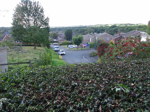
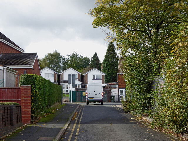
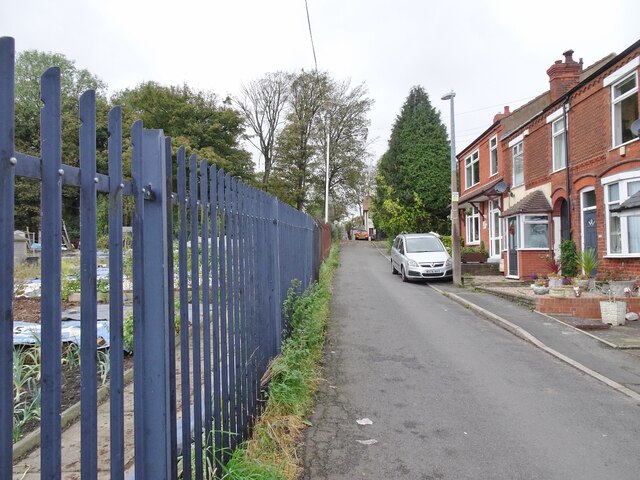
The Coppice is a charming village located in Staffordshire, England. Situated in the heart of the county, it offers a peaceful and picturesque setting for its residents and visitors alike. With a population of approximately 1,500 people, the village maintains a close-knit community atmosphere.

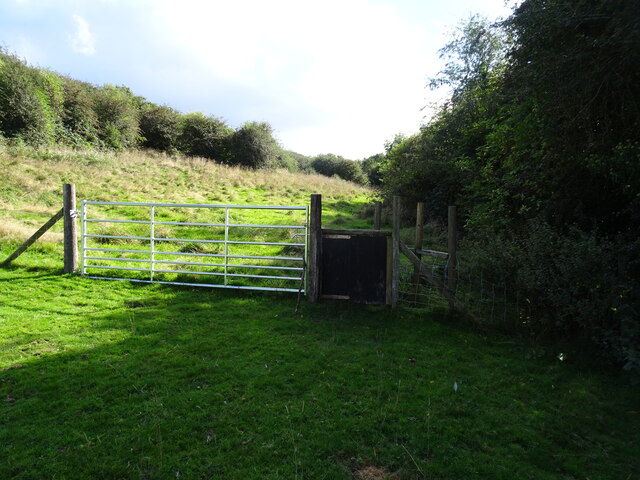
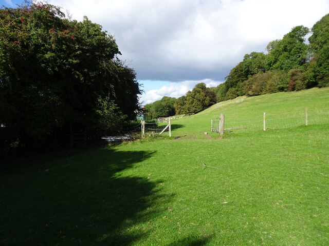
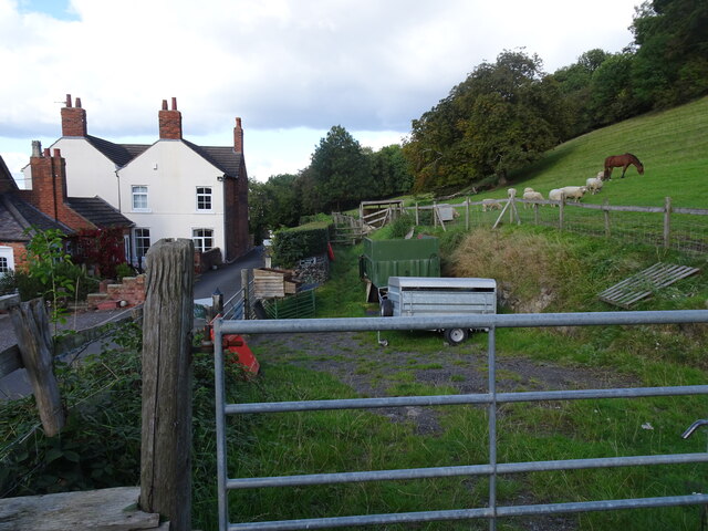
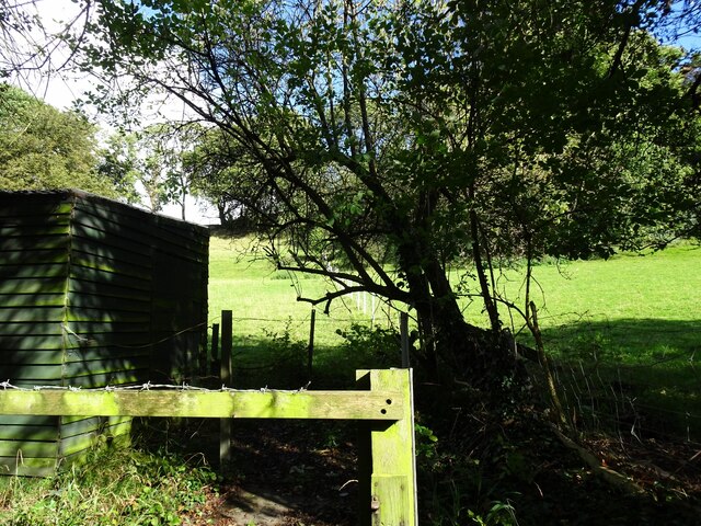
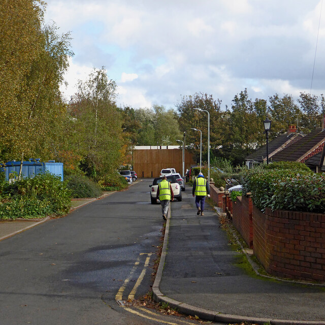
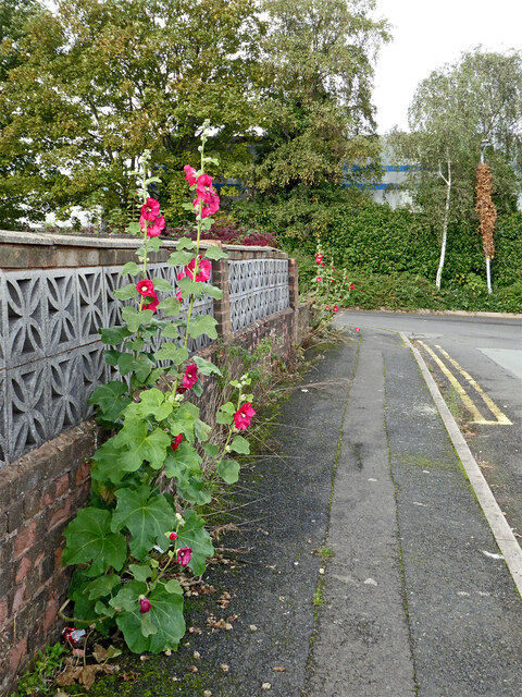
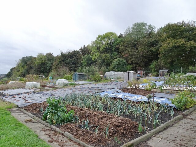
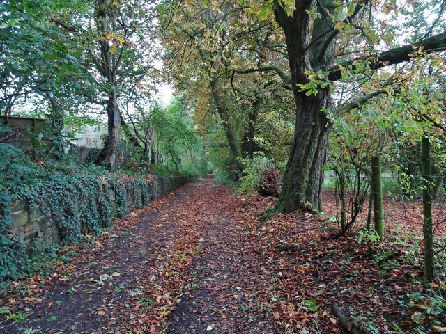
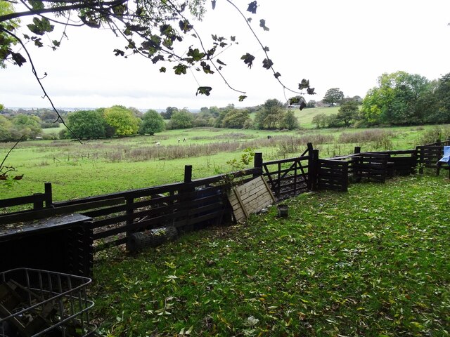
One of the notable features of The Coppice is its stunning natural surroundings. Surrounded by rolling hills and lush greenery, the village provides ample opportunities for outdoor activities and exploration. A nearby forest, also known as The Coppice, offers scenic walking trails and a haven for nature enthusiasts.

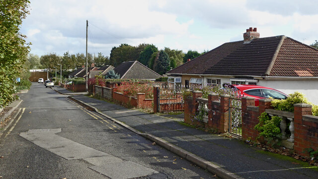
The village itself boasts a traditional English charm, with well-preserved historic buildings and quaint cottages lining its streets. The local church, St. Mary's, stands as a prominent architectural gem, dating back several centuries.

Facilities in The Coppice include a primary school, a community center, and a few local shops catering to everyday needs. While the village may lack larger commercial establishments, it benefits from its proximity to nearby towns, providing access to a wider range of amenities and services.

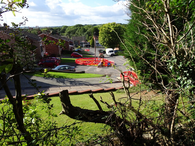
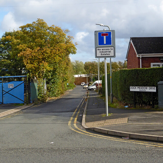
Transportation in The Coppice is primarily reliant on private vehicles, although there are regular bus services connecting the village to larger towns and cities in the region. The village is well-connected to major road networks, making it easily accessible for those commuting to nearby areas.

Overall, The Coppice offers a serene and picturesque setting, making it an ideal place for those seeking a peaceful retreat while still enjoying convenient access to amenities and nearby communities.

If you have any feedback on the listing, please let us know in the comments section below.

The Coppice Images

Images are sourced within 2km of 52.540185/-2.103179 or Grid Reference SO9393. Thanks to Geograph Open Source API. All images are credited.

Kineton Rise The view on the Northway Estate, Sedgley.
Kineton Rise
The view on the Northway Estate, Sedgley.
Edge Hill Drive  View from Sedgley Hall Farm Path, over the Northway Estate.
Edge Hill Drive
View from Sedgley Hall Farm Path, over the Northway Estate.
Kineton Rise View The view of the Close off the Northway in Sedgley.
Kineton Rise View
The view of the Close off the Northway in Sedgley.
Northway Stile The view of the path near Hickmerelands Lane, Sedgley.
Northway Stile
The view of the path near Hickmerelands Lane, Sedgley.
Northway Field The view of the path near Hickmerelands Lane, Sedgley.
Northway Field
The view of the path near Hickmerelands Lane, Sedgley.
Northway Farm The view of the Old Farm on Hickmerelands Lane Sedgley.
Northway Farm
The view of the Old Farm on Hickmerelands Lane Sedgley.
Field View The view from the Hickmerelands Lane footpath, Sedgley.
Field View
The view from the Hickmerelands Lane footpath, Sedgley.
Footpath View The view along the Hickmerelands Lane footpath, Sedgley.
Footpath View
The view along the Hickmerelands Lane footpath, Sedgley.
Northway Grazing The view on the Sedgley Hall Farm Park.
Northway Grazing
The view on the Sedgley Hall Farm Park.
Dock Meadow Drive in Lanesfield, Wolverhampton Looking east from Spring Road.
Dock Meadow Drive in Lanesfield, Wolverhampton
Looking east from Spring Road.
Dock Meadow Drive in Lanesfield, Wolverhampton Looking east from near the junction with Spring Road. There is pedestrian access to Lanesfield Drive at the far end of this unadopted cul-de-sac.
Dock Meadow Drive in Lanesfield, Wolverhampton
Looking east from near the junction with Spring Road. There is pedestrian access to Lanesfield Drive at the far end of this unadopted cul-de-sac.
Dock Meadow Drive in Lanesfield, Wolverhampton Looking west towards the A4126 Spring Road. Dock Meadow Drive is an unadopted cul-de-sac.
Dock Meadow Drive in Lanesfield, Wolverhampton
Looking west towards the A4126 Spring Road. Dock Meadow Drive is an unadopted cul-de-sac.
Dock Meadow Drive in Lanesfield, Wolverhampton Looking east from near the junction with Court Road. There is pedestrian access to Lanesfield Drive at the far end of this unadopted cul-de-sac.
Dock Meadow Drive in Lanesfield, Wolverhampton
Looking east from near the junction with Court Road. There is pedestrian access to Lanesfield Drive at the far end of this unadopted cul-de-sac.
Pretty pavement flower display in Lanesfield Hollyhocks!
This is in Court Road, looking towards Dock Mill Drive, both unadopted roads. The garden behind the wall was considerably less "attractive".
OK, it is not a pretty pavement! ;-)
Pretty pavement flower display in Lanesfield
Hollyhocks! This is in Court Road, looking towards Dock Mill Drive, both unadopted roads. The garden behind the wall was considerably less "attractive". OK, it is not a pretty pavement! ;-)
Allotment Scene The view of the allotments of the Coseley Allotment Society off Rock Road in Hurst Hill, Sedgley.
The view in October 2006 <a href="https://www.geograph.org.uk/photo/268668">SO9293 : Last blooms of autumn</a>.
Allotment Scene
The view of the allotments of the Coseley Allotment Society off Rock Road in Hurst Hill, Sedgley. The view in October 2006 SO9293 : Last blooms of autumn.
Rock Road Scene The view alongside the allotments of the Coseley Allotment Society off Rock Road in Hurst Hill, Sedgley.
Rock Road Scene
The view alongside the allotments of the Coseley Allotment Society off Rock Road in Hurst Hill, Sedgley.
Turls Hill Leafs The view of the lane in Hurst Hill, Sedgley.
Turls Hill Leafs
The view of the lane in Hurst Hill, Sedgley.
Turls Hill Grazing  The view off the lane in Hurst Hill, Sedgley.
Turls Hill Grazing
The view off the lane in Hurst Hill, Sedgley.
Show me another place!

The Coppice is located at Grid Ref: SO9393 (Lat: 52.540185, Lng: -2.103179)

Unitary Authority: Dudley

Police Authority: West Midlands

What 3 Words

///deeply.loudly.novel. Near Tipton, West Midlands

Related Wikis

Coseley Urban District

Coseley Urban District was a local government district in Staffordshire which was created in 1894.It was made up of the villages of Brierley (now Bradley...

Sarah Hughes Brewery

Sarah Hughes Brewery in Sedgley, in the Black Country of England, dates from the Victorian era. It was bought by Sarah Hughes in 1921 and brewed until...

Beacon Hill Academy, Dudley

Beacon Hill Academy, formerly known as The High Arcal School, is a secondary school in the Sedgley area of Dudley, in the English West Midlands. Originally...

Woodsetton, Dudley

Woodsetton is an area of the Dudley Metropolitan Borough in the West Midlands of England, roughly 2.0 miles (3 km) northwest of Dudley Town Centre. Formerly...

The Coseley School

The Coseley School was a mixed secondary school located in Coseley, West Midlands, England.The school closed in July 2017, in a phased closure, when the...

Woodcross

Woodcross is a residential area of Coseley, West Midlands, England. It is set within the City of Wolverhampton, though the area traditionally existed within...

Sedgley Urban District

Sedgley urban district was a local government district within Staffordshire, which was created in 1894 from the western half of the manor of Sedgley (the...

Beacon Hill, Sedgley

Beacon Hill in Sedgley, England, is one of the highest points in the West Midlands, at 237 metres (778 ft) above sea level. From the summit, Wolverhampton...

Nearby Amenities

Located within 500m of 52.540185,-2.103179
Bus Stop
Coppice Rd / Bond St
Bus: yes
Naptan AtcoCode: 43008640002
Naptan Bearing: W
Naptan BusStopType: MKD
Naptan CommonName: Bond St
Naptan Indicator: adj
Naptan NaptanCode: nwmpmpjw
Naptan PlusbusZoneRef: BHAMNWS
Naptan Status: ACT
Naptan StopType: BCT
Naptan Street: COPPICE RD
Naptan Towards: Wolverhampton
Public Transport: platform
Route Ref: 81
Shelter: no
Source: WMCA
Towards: Wolverhampton
Lat/Long: 52.5406426/-2.0984215
Bus Stop
Clifton St / Rifle St
Bus: yes
Naptan AtcoCode: 43000864201
Naptan Bearing: SE
Naptan BusStopType: MKD
Naptan CommonName: Rifle St
Naptan Indicator: adj
Naptan NaptanCode: nwmjwtgj
Naptan PlusbusZoneRef: BHAMNWS
Naptan Status: ACT
Naptan StopType: BCT
Naptan Street: CLIFTON ST
Naptan Towards: Coseley
Public Transport: platform
Route Ref: 81
Shelter: no
Source: WMCA
Lat/Long: 52.5421758/-2.1032909
Bus Stop
Clifton St / Rifle St
Bus: yes
Naptan AtcoCode: 43000864202
Naptan Bearing: NW
Naptan BusStopType: MKD
Naptan CommonName: Rifle St
Naptan Indicator: opp
Naptan NaptanCode: nwmjwtgm
Naptan PlusbusZoneRef: BHAMNWS
Naptan Status: ACT
Naptan StopType: BCT
Naptan Street: CLIFTON ST
Naptan Towards: Wolverhampton
Public Transport: platform
Route Ref: 81
Shelter: no
Source: WMCA
Towards: Wolverhampton
Lat/Long: 52.541884/-2.1031677
Bus Stop
Bond St / Caddick St
NaPTANAreaCode: 43000864301
Asset Ref: 404218
Bus: yes
Naptan AtcoCode: 43000864301
Naptan Bearing: NE
Naptan BusStopType: MKD
Naptan CommonName: Caddick St
Naptan Indicator: adj
Naptan NaptanCode: nwmjwtgp
Naptan PlusbusZoneRef: BHAMNWS
Naptan Status: ACT
Naptan StopType: BCT
Naptan Street: BOND ST
Naptan Towards: Coseley
Public Transport: platform
Route Ref: 81
Shelter: yes
Shelter Ref: 404218
Source: WMCA
Lat/Long: 52.5406133/-2.0996036
Pub
Cottage Spring
Addr Housenumber: 9
Addr Postcode: DY3 1AD
Addr Street: Brook Street
Fhrs Id: 502222
Source Addr: FHRS Open Data
Lat/Long: 52.5357047/-2.10305
Turning Circle
Lat/Long: 52.5365398/-2.1033466
Turning Circle
Lat/Long: 52.5404843/-2.1018839
Shop: funeral_directors
Lat/Long: 52.5419395/-2.1034383
Pub
The Hurst Hill
Lat/Long: 52.5411967/-2.1024741
Coseley News Wins & Food Store
Shop: convenience
Lat/Long: 52.539683/-2.1008845
Holisticly Yours ...
Note: A shop doing "Massage, Reiki, Natural Healing, Aromatherapy, ..."
Lat/Long: 52.5397613/-2.100863
Post Box
Ref: WV14 214
Lat/Long: 52.5407269/-2.0994788
Turning Circle
Source: bing
Lat/Long: 52.541683/-2.0997176
Post Box
Ref: WV14 249
Lat/Long: 52.5421491/-2.1032411
Fixme: continue
Lat/Long: 52.5435223/-2.1038164
Barrier: bollard
Bicycle: yes
Foot: yes
Lat/Long: 52.5438348/-2.1030274
Turning Circle
Source: bing
Lat/Long: 52.5398162/-2.0967441
Turning Circle
Source: bing
Lat/Long: 52.5364749/-2.1004659
Information: board
Source: survey
Tourism: information
Lat/Long: 52.5396817/-2.1088095
The data included in this document is from www.openstreetmap.org. The data is made available under ODbL.

Have you been to The Coppice?

Leave your review of The Coppice below (or comments, questions and feedback).