Bontddu

Settlement in Merionethshire

Wales

Bontddu

Ladder Stile Ladder stile over dry stone wall near to Bontddu, Gwynedd.
Ladder Stile Credit: Keith Evans

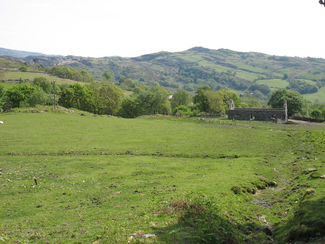
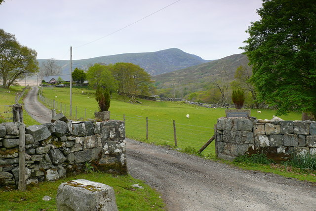
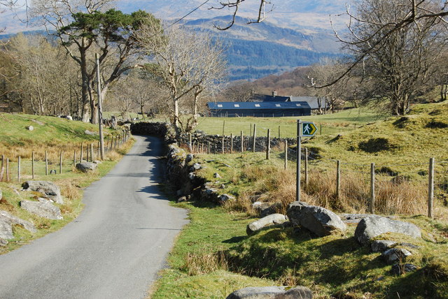
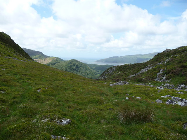
Bontddu is a small village located in the historic county of Merionethshire, Wales. Situated in the southern part of the Snowdonia National Park, Bontddu is surrounded by breathtaking natural beauty, making it an ideal destination for outdoor enthusiasts and nature lovers.

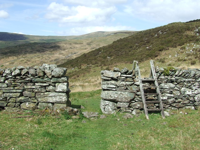
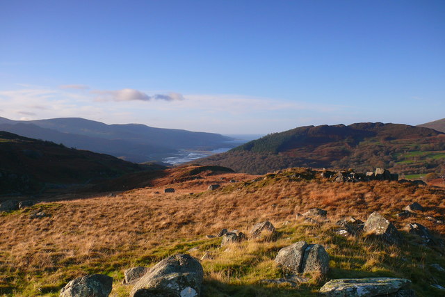
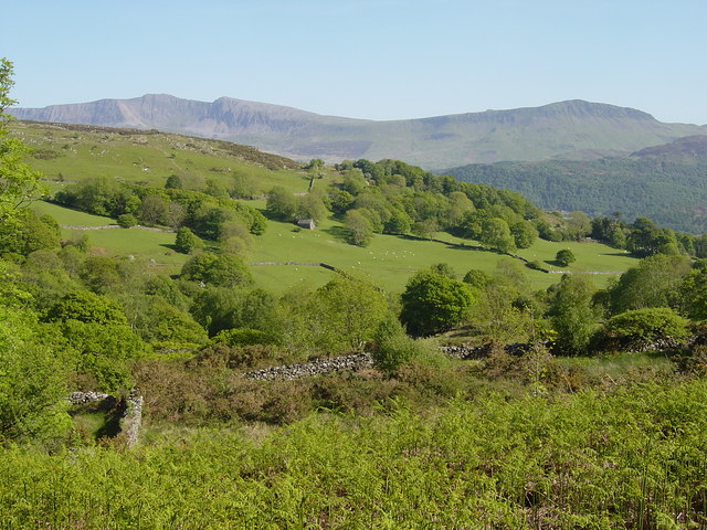
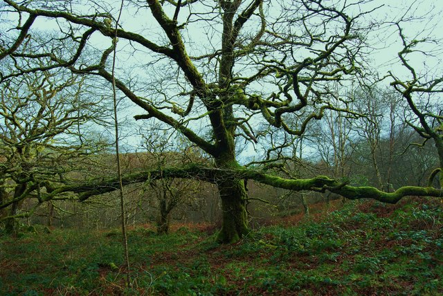
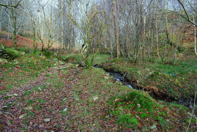
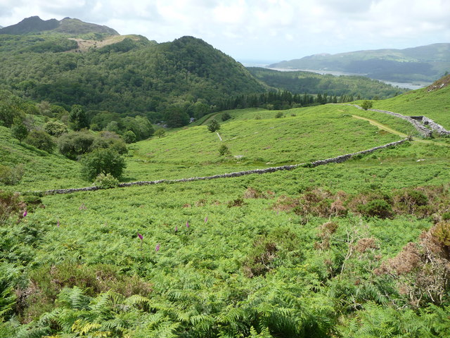
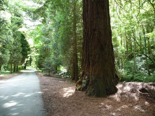
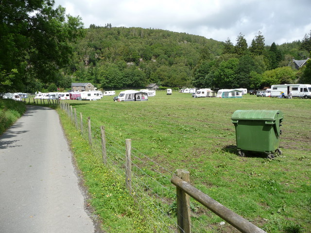
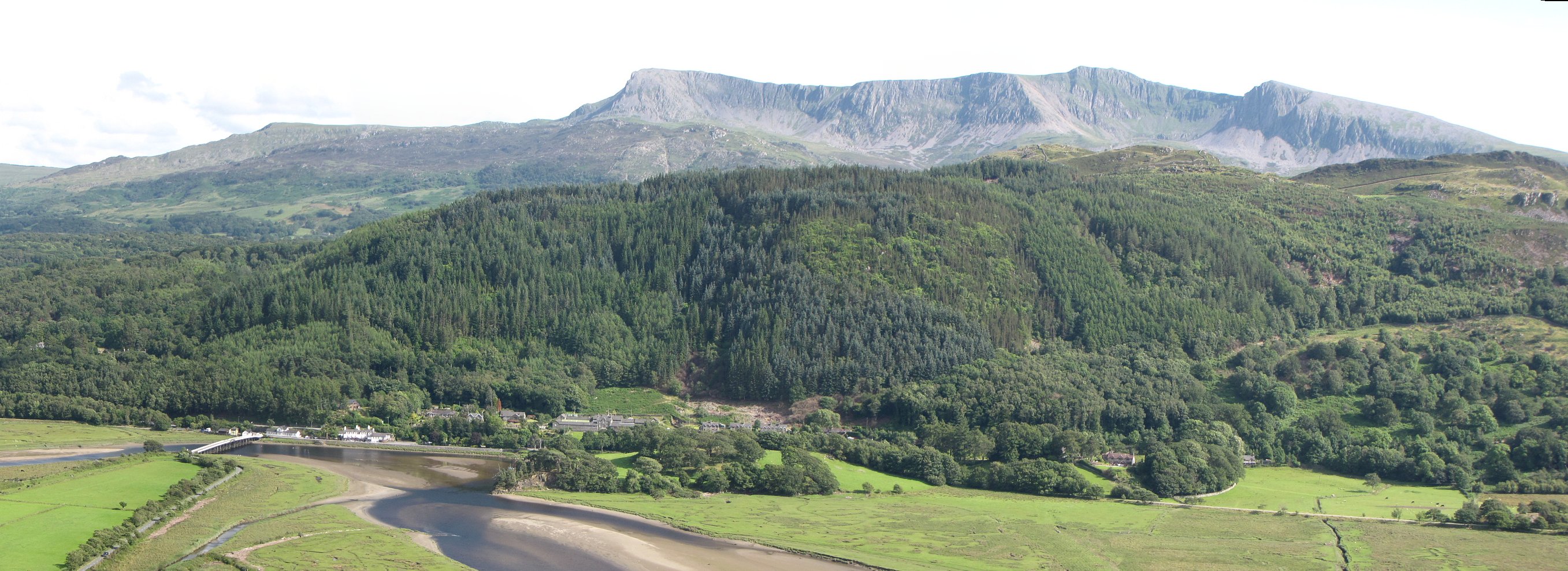
The village is nestled between the Mawddach Estuary and the foothills of the Cadair Idris mountain range, offering stunning views and a tranquil atmosphere. The area is renowned for its diverse flora and fauna, with a variety of walking trails and hiking routes available for exploration.

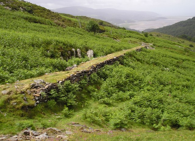
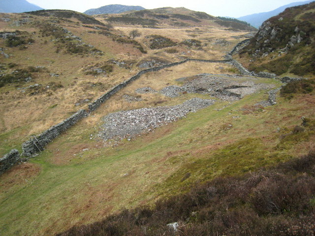
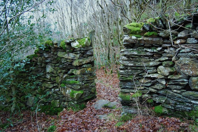
Historically, Bontddu was known for its gold mines, which were first exploited during the Roman period and continued to be active until the early 20th century. The remains of these mines can still be seen in the surrounding hills, attracting both history enthusiasts and those interested in geology.

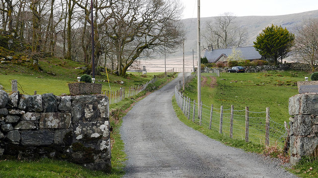
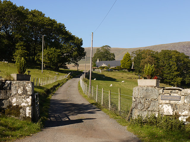
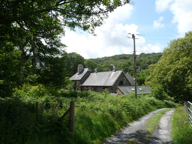
Today, Bontddu is a charming rural community with a close-knit population. It offers a peaceful retreat away from the hustle and bustle of city life. The village is dotted with traditional stone houses, some of which date back several centuries, adding to its quaint and picturesque character.

Despite its small size, Bontddu benefits from its proximity to nearby towns such as Dolgellau and Barmouth, where residents and visitors can find a range of amenities including shops, restaurants, and leisure facilities.

In summary, Bontddu is a hidden gem in Merionethshire, offering visitors a chance to experience the beauty of the Welsh countryside, explore its rich mining history, and enjoy a peaceful retreat in a charming village setting.

If you have any feedback on the listing, please let us know in the comments section below.

Bontddu Images

Images are sourced within 2km of 52.750198/-3.966805 or Grid Reference SH6718. Thanks to Geograph Open Source API. All images are credited.

Ladder Stile Ladder stile over dry stone wall near to Bontddu, Gwynedd.
Ladder Stile
Ladder stile over dry stone wall near to Bontddu, Gwynedd.
Entrance to Cae Goronwy Near the end of the metalled road from Bontddu.
Entrance to Cae Goronwy
Near the end of the metalled road from Bontddu.
Farmland above Bontddu
Tramway, Clogau Associated with the Old St David workings.
Tramway, Clogau
Associated with the Old St David workings.
Cae Goronwy Mynedfa Cae Goronwy gyda Diffwys yn y cefndir / Cae Goronwy entrance with Diffwys in the background.
Cae Goronwy
Mynedfa Cae Goronwy gyda Diffwys yn y cefndir / Cae Goronwy entrance with Diffwys in the background.
Afon Mawddach Golygfa tuag at yr Afon Mawddach / A view towards the Afon Mawddach.
Afon Mawddach
Golygfa tuag at yr Afon Mawddach / A view towards the Afon Mawddach.
Cadair Idris lords it over gentle pastures. This view is from the bridleway in the south-eastern corner of the gridsquare. Between the middleground and the bulk of Cadair Idris lies the Mawddach estuary near Bontddu.
Cadair Idris lords it over gentle pastures.
This view is from the bridleway in the south-eastern corner of the gridsquare. Between the middleground and the bulk of Cadair Idris lies the Mawddach estuary near Bontddu.
Gwaith Aur.  Gold Mine. Un o nifer o olion Gwaith y Clogau yn y rhan yma o'r sgwar.

The remains of the famous Clogau Mine are a prominent feature of this part of the square.
Gwaith Aur. Gold Mine.
Un o nifer o olion Gwaith y Clogau yn y rhan yma o'r sgwar. The remains of the famous Clogau Mine are a prominent feature of this part of the square.
Perfection of the dyke builders art This dyke is 1.8m high and stands true and square after many years. This would have had some kind of closure in the past but as it is no longer a field boundary is now just a "pop hole".
Perfection of the dyke builders art
This dyke is 1.8m high and stands true and square after many years. This would have had some kind of closure in the past but as it is no longer a field boundary is now just a "pop hole".
Wonderful old tree Great oak tree spreading to fill the space available, well decorated with lichens, mosses and fungae.
Wonderful old tree
Great oak tree spreading to fill the space available, well decorated with lichens, mosses and fungae.
Small stream through the woodland The footpath crosses the stream by a stone bridge.
Small stream through the woodland
The footpath crosses the stream by a stone bridge.
The start of the descent to Bontddu Lane lined with stone dykes and dropping fast to Afon Mawddach below. Footpath on the right heads through the trees towards Afon Dwynant. Unnamed farm on the right with a modern plastic coated steel clad building.
The start of the descent to Bontddu
Lane lined with stone dykes and dropping fast to Afon Mawddach below. Footpath on the right heads through the trees towards Afon Dwynant. Unnamed farm on the right with a modern plastic coated steel clad building.
The entrance drive to Caegoronwy
Upland valley near Dolgledr The path here passes between two rocky outcrops and offers very good views of the distant Mawddach Estuary and the sea.
Upland valley near Dolgledr
The path here passes between two rocky outcrops and offers very good views of the distant Mawddach Estuary and the sea.
Bracken and gorse on the hillside above Cae'n-y-coed In June the growth is not too thick and profuse but given a month and making progress will be harder.
Bracken and gorse on the hillside above Cae'n-y-coed
In June the growth is not too thick and profuse but given a month and making progress will be harder.
Old school building I don't know its current use but it was certainly once the local junior school.
Old school building
I don't know its current use but it was certainly once the local junior school.
Redwood trunk beside the path to Abergwynant Farm A pair of Redwood's here tower above the driveway and path, maybe in excess of 100 feet high. The Afon Gwynant tumbles by.
Redwood trunk beside the path to Abergwynant Farm
A pair of Redwood's here tower above the driveway and path, maybe in excess of 100 feet high. The Afon Gwynant tumbles by.
Touring caravan site at Abergwynant Farm A good collection of middle market caravans and a few tourers sit in the meadow here. One caravan bore the window-sticker 'Caravanners do it in comfort'. Over the years I've seen a good variety of sites (from ones as well tended as an Open golf course to rough fields with stock in) and for location this one isn't bad.
Touring caravan site at Abergwynant Farm
A good collection of middle market caravans and a few tourers sit in the meadow here. One caravan bore the window-sticker 'Caravanners do it in comfort'. Over the years I've seen a good variety of sites (from ones as well tended as an Open golf course to rough fields with stock in) and for location this one isn't bad.
Show me another place!

Bontddu is located at Grid Ref: SH6718 (Lat: 52.750198, Lng: -3.966805)

Unitary Authority: Gwynedd

Police Authority: North Wales

Also known as: Y Bontddu

What 3 Words

///intricate.dripped.alike. Near Dolgellau, Gwynedd

Related Wikis

Bontddu

Bontddu (meaning Black bridge) is a small settlement just east of Barmouth, near the town of Dolgellau in Gwynedd, Wales. It is in the community of Llanelltyd...

Mawddach Trail

The Mawddach Trail (Welsh: Llwybr Mawddach) is a cycle path route, part of Lôn Las Cymru, which runs for some 8 miles (13 km) from Dolgellau (52.7446°N...

Clogau Gold Mine

The Clogau (pronounced "clog-eye") Gold Mine (also known as Clogau St David's) is a gold mine near Bontddu in North Wales. == History == The Clogau mine...

Borthwnog

Borthwnog is a family name given to the Borthwnog estate in Gwynedd, north-west Wales. Borthwnog Hall was the Manor House of the estate which encompassed...

Penmaenpool

Penmaenpool (Welsh: Llynpenmaen) is a hamlet on the south side of the estuary of the River Mawddach in Wales, near Dolgellau. A Grade II listed toll bridge...

Penmaenpool railway station

Penmaenpool railway station at Penmaenpool in Gwynedd, North Wales, was formerly a station on the Dolgelly [sic] branch of the Aberystwith and Welsh Coast...

St Philip's Church, Caerdeon

St Philip's Church, Caerdeon, near Barmouth, in Gwynedd, North Wales, is a redundant church and a Grade I listed building. The church was built in 1862...

Tyn-y-Coed Farmhouse

Tyn-y-Coed Farmhouse is a grade II Listed Building in Caerdeon, Barmouth, Gwynedd. This Georgian farm house was built in 1756 and later extended and altered...

Nearby Amenities

Located within 500m of 52.750198,-3.966805
Source: PGS
Lat/Long: 52.74802/-3.9707008
Source: PGS
Lat/Long: 52.7480457/-3.9705426
Source: PGS
Lat/Long: 52.748673/-3.9696934
Source: PGS
Lat/Long: 52.7488997/-3.969129
Source: PGS
Lat/Long: 52.7490766/-3.9687868
Source: PGS
Lat/Long: 52.7492617/-3.9682766
Source: PGS
Lat/Long: 52.7496397/-3.9664581
Source: PGS
Lat/Long: 52.749979/-3.9648257
Source: PGS
Lat/Long: 52.7499624/-3.9645763
Source: PGS
Lat/Long: 52.750081/-3.9642469
Source: PGS
Lat/Long: 52.7502667/-3.9633628
Source: PGS
Lat/Long: 52.7506164/-3.9620394
Source: PGS
Lat/Long: 52.7507018/-3.9614681
Source: PGS
Lat/Long: 52.7507203/-3.9609692
Source: PGS
Lat/Long: 52.7505836/-3.9604237
Source: PGS
Lat/Long: 52.7504401/-3.960002
Source: PGS
Lat/Long: 52.7503316/-3.9600052
Hazard Forward: falling_rocks
Lat/Long: 52.751885/-3.9640256
Bus Stop
Bus: yes
Kerb: raised
Naptan AtcoCode: 5400AWD70013
Naptan NaptanCode: gwnatjt
Public Transport: platform
Shelter: yes
Lat/Long: 52.7495802/-3.9724715
Parking
Parking: layby
Lat/Long: 52.7516222/-3.9598773
Bus Stop
Bus: yes
Kerb: raised
Naptan AtcoCode: 5400AWD70010
Naptan NaptanCode: gwnatjw
Public Transport: platform
Shelter: no
Timetable: yes
Lat/Long: 52.7514308/-3.9671305
Bontddu
Place: village
Wikidata: Q3402560
Lat/Long: 52.7507205/-3.9682392
Bus Stop
Bus: yes
Naptan AtcoCode: 5400AWD70012
Naptan NaptanCode: gwnatjp
Public Transport: platform
Lat/Long: 52.7487115/-3.9736869
Power: pole
Lat/Long: 52.7476306/-3.9726472
Historic: memorial
Memorial: war_memorial
Lat/Long: 52.7510928/-3.9687565
Bus Stop
Bench: no
Bus: yes
Naptan AtcoCode: 5400WDB22925
Naptan NaptanCode: gwntgaw
Public Transport: platform
Shelter: no
Lat/Long: 52.7513431/-3.9673447
Post Box
Lat/Long: 52.7525035/-3.9621444
Bryn Hyfryd
Internet Access: wlan
Phone: +44 7855 804709
Tourism: apartment
Lat/Long: 52.7516503/-3.9673109
Power: pole
Lat/Long: 52.7507505/-3.9706591
Power: pole
Lat/Long: 52.7507292/-3.9708346
Power: pole
Lat/Long: 52.750679/-3.9719616
Power: pole
Lat/Long: 52.7502476/-3.9728783
Power: pole
Lat/Long: 52.7500307/-3.9731977
Power: pole
Lat/Long: 52.7507109/-3.9703377
Power: pole
Lat/Long: 52.7508399/-3.9701467
Power: pole
Lat/Long: 52.7511106/-3.9697516
Power: pole
Lat/Long: 52.7513906/-3.9693593
Power: pole
Lat/Long: 52.7504153/-3.9704717
Power: pole
Lat/Long: 52.7501563/-3.9701877
Power: pole
Lat/Long: 52.7497728/-3.9697576
Power: pole
Lat/Long: 52.7491637/-3.9697125
Power: pole
Lat/Long: 52.7487321/-3.9700111
Power: pole
Lat/Long: 52.7485023/-3.9701098
Power: pole
Lat/Long: 52.7479125/-3.9718175
Man Made: adit
Lat/Long: 52.75181/-3.9730946
Man Made: adit
Lat/Long: 52.7518413/-3.9736267
Direction: 165
Generator Method: photovoltaic
Generator Output Electricity: yes
Generator Solar Modules: 11
Generator Source: solar
Generator Type: solar_photovoltaic_panel
Location: roof
Power: generator
Lat/Long: 52.7513496/-3.9667873
Direction: 165
Generator Method: photovoltaic
Generator Output Electricity: yes
Generator Solar Modules: 10
Generator Source: solar
Generator Type: solar_photovoltaic_panel
Location: roof
Power: generator
Lat/Long: 52.7513268/-3.9669348
Direction: 165
Generator Method: photovoltaic
Generator Output Electricity: yes
Generator Solar Modules: 18
Generator Source: solar
Generator Type: solar_photovoltaic_panel
Location: roof
Power: generator
Lat/Long: 52.7516077/-3.9698155
Leisure: picnic_table
Lat/Long: 52.7521142/-3.9601495
Leisure: picnic_table
Lat/Long: 52.7520554/-3.9603339
The data included in this document is from www.openstreetmap.org. The data is made available under ODbL.

Have you been to Bontddu?

Leave your review of Bontddu below (or comments, questions and feedback).