Bontddu Wood

Wood, Forest in Merionethshire

Wales

Bontddu Wood

Old barn on Banc-y-Frân A solid but roofless stone barn sits on a small rise in the adjacent field. Diffwys can be seen in the distance.
Old barn on Banc-y-Frân Credit: Nigel Brown

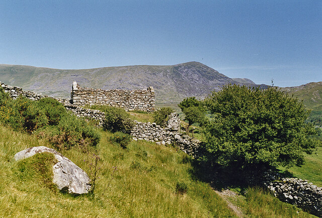
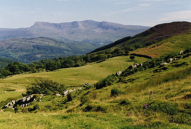
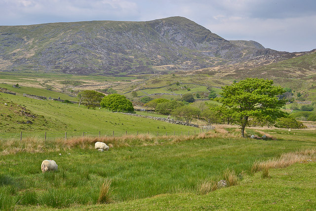
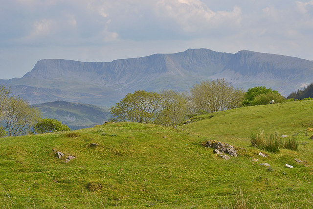
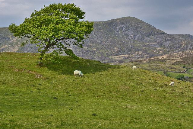
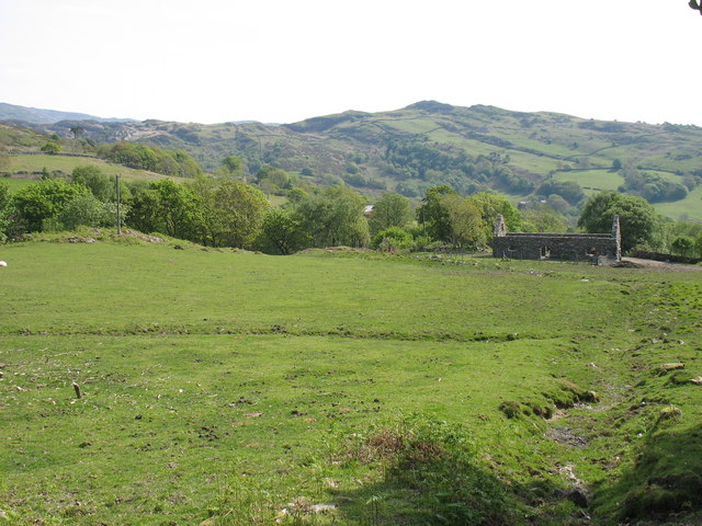
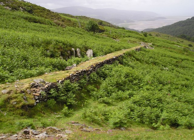
Bontddu Wood, located in the county of Merionethshire, Wales, is a picturesque forest that covers an area of approximately 250 acres. Nestled in the foothills of the Cadair Idris mountain range, this woodland is renowned for its natural beauty and diverse ecosystem.

The wood is predominantly composed of native broadleaf species, including oak, ash, birch, and rowan trees. These towering giants provide a lush canopy, creating a haven for a rich variety of flora and fauna. The forest floor is carpeted with an array of wildflowers, such as bluebells and primroses, which bloom vibrantly in the springtime.

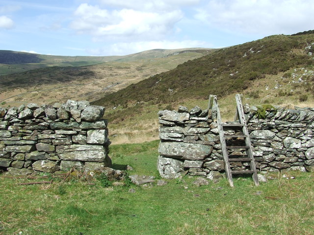
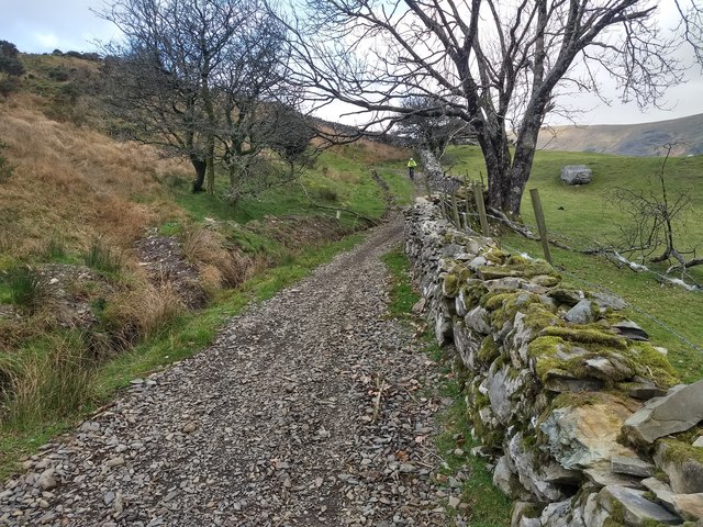
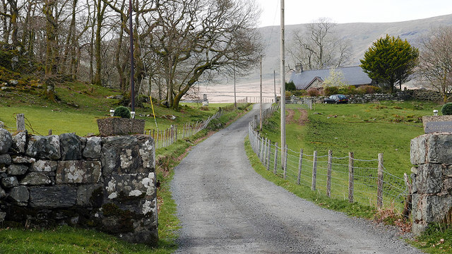
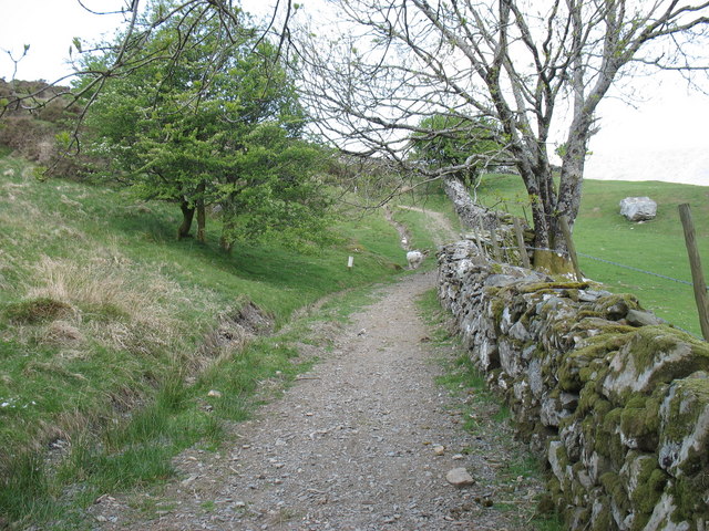
Bontddu Wood is intersected by a network of well-maintained footpaths, allowing visitors to explore its enchanting landscapes. These pathways wind through the forest, leading to peaceful streams and small waterfalls, adding to the tranquil ambiance. The wood also boasts a small lake, where visitors can enjoy picnicking or simply bask in the serene surroundings.

The diverse range of wildlife found in Bontddu Wood is truly remarkable. Visitors may catch glimpses of red squirrels, badgers, and foxes as they roam through the forest. The area is also a haven for birdwatchers, with species such as woodpeckers, owls, and various songbirds making their homes among the trees.

Bontddu Wood is a popular destination for nature enthusiasts, hikers, and photographers alike. Its idyllic setting, combined with its rich biodiversity, makes it a truly captivating location for anyone seeking a peaceful escape in the heart of nature.

If you have any feedback on the listing, please let us know in the comments section below.
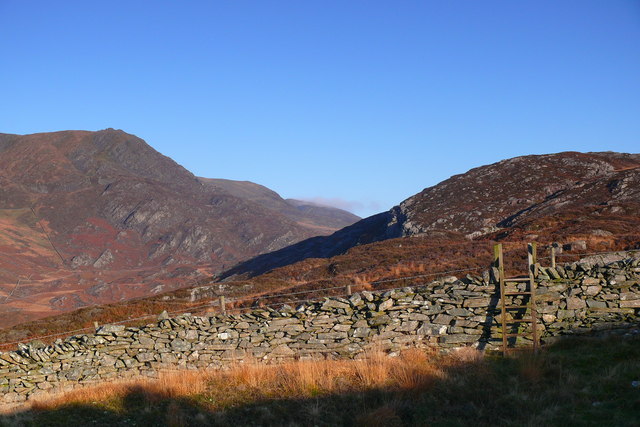
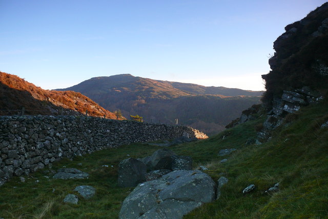
Bontddu Wood Images

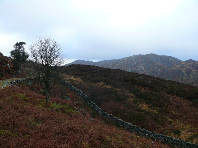
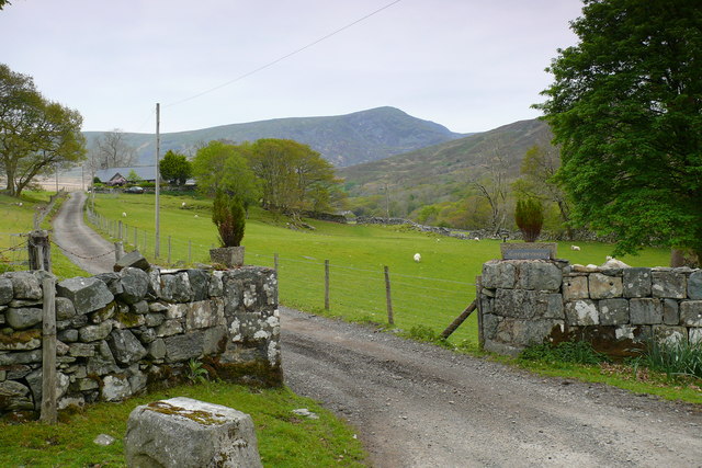
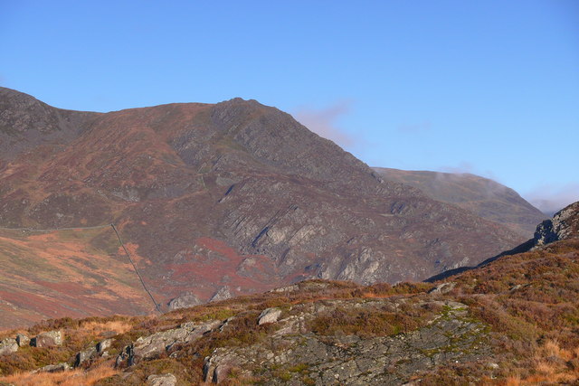
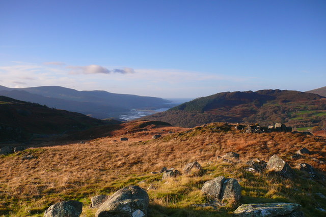
Images are sourced within 2km of 52.751447/-3.9718045 or Grid Reference SH6718. Thanks to Geograph Open Source API. All images are credited.

Old barn on Banc-y-Frân A solid but roofless stone barn sits on a small rise in the adjacent field. Diffwys can be seen in the distance.
Old barn on Banc-y-Frân
A solid but roofless stone barn sits on a small rise in the adjacent field. Diffwys can be seen in the distance.
Descending Banc-y-Frân Just north of the public road, with the hill of Uwch Mynydd on the right and Cadair Idris in the distance.
Descending Banc-y-Frân
Just north of the public road, with the hill of Uwch Mynydd on the right and Cadair Idris in the distance.
Ladder Stile Ladder stile over dry stone wall near to Bontddu, Gwynedd.
Ladder Stile
Ladder stile over dry stone wall near to Bontddu, Gwynedd.
Grazing near Cae Goronwy farm With Diffwys providing the background.
Grazing near Cae Goronwy farm
With Diffwys providing the background.
Field with a dramatic backdrop The imposing skyline of Cadair Idris never fails to impress.
Field with a dramatic backdrop
The imposing skyline of Cadair Idris never fails to impress.
Tree and field by Banc-y-Frân With Diffwys in the background.
Tree and field by Banc-y-Frân
With Diffwys in the background.
A win-win situation at Banc-y-Frân  (Crow Bank) The drainage has been cleared and the extracted material has been used to repair the track surface. Good idea!
A win-win situation at Banc-y-Frân (Crow Bank)
The drainage has been cleared and the extracted material has been used to repair the track surface. Good idea!
Old Milestone by Uwch Mynydd, north of Bontddu, Llanelltyd Parish North of the A497 from Bontddu, in parish of Llanelltyd (Gwynedd District), CAE HIR, about 1½ miles North West of village by the side of a track going over the moor to Tal-y-bont.

Inscription reads:-
(North East side) : FROM HARLECH X M :
(South West side) : V FROM TAL Y BONT iiiii M. :

Grade II Listed by Cadw.
Reference Number 16160: <span class="nowrap"><a title="https://cadwpublic-api.azurewebsites.net/reports/listedbuilding/FullReport?lang=&id=16160" rel="nofollow ugc noopener" href="https://cadwpublic-api.azurewebsites.net/reports/listedbuilding/FullReport?lang=&id=16160">Link</a><img style="margin-left:2px;" alt="External link" title="External link - shift click to open in new window" src="https://s1.geograph.org.uk/img/external.png" width="10" height="10"/></span>

Surveyed 

Milestone Society National ID: MER_HLBM10
Old Milestone by Uwch Mynydd, north of Bontddu, Llanelltyd Parish
North of the A497 from Bontddu, in parish of Llanelltyd (Gwynedd District), CAE HIR, about 1½ miles North West of village by the side of a track going over the moor to Tal-y-bont. Inscription reads:- (North East side) : FROM HARLECH X M : (South West side) : V FROM TAL Y BONT iiiii M. : Grade II Listed by Cadw. Reference Number 16160: LinkExternal link Surveyed Milestone Society National ID: MER_HLBM10
Entrance to Cae Goronwy Near the end of the metalled road from Bontddu.
Entrance to Cae Goronwy
Near the end of the metalled road from Bontddu.
Farmland above Bontddu
Start of the bridleway at Banc-y-Fran
Tramway, Clogau Associated with the Old St David workings.
Tramway, Clogau
Associated with the Old St David workings.
Cwm Llechan Trac yn arwain i fyny Cwm Llechan / Track leading up Cwm Llechan
Cwm Llechan
Trac yn arwain i fyny Cwm Llechan / Track leading up Cwm Llechan
Cae Goronwy Mynedfa Cae Goronwy gyda Diffwys yn y cefndir / Cae Goronwy entrance with Diffwys in the background.
Cae Goronwy
Mynedfa Cae Goronwy gyda Diffwys yn y cefndir / Cae Goronwy entrance with Diffwys in the background.
Llethrau Clogau / Slopes of Clogau Golygfa tuag at copa ategol Diffwys / A view over to the subsidiary summit of Diffwys.
Llethrau Clogau / Slopes of Clogau
Golygfa tuag at copa ategol Diffwys / A view over to the subsidiary summit of Diffwys.
Afon Mawddach Golygfa tuag at yr Afon Mawddach / A view towards the Afon Mawddach.
Afon Mawddach
Golygfa tuag at yr Afon Mawddach / A view towards the Afon Mawddach.
Clogau Camfa ysgol / Ladder stile.
Clogau
Camfa ysgol / Ladder stile.
Wal gerrig, Clogau / Drystone Wall, Clogau
Show me another place!

Bontddu Wood is located at Grid Ref: SH6718 (Lat: 52.751447, Lng: -3.9718045)

Unitary Authority: Gwynedd

Police Authority: North Wales

What 3 Words

///remembers.workouts.promote. Near Dolgellau, Gwynedd

Related Wikis

Bontddu

Bontddu (meaning Black bridge) is a small settlement just east of Barmouth, near the town of Dolgellau in Gwynedd, Wales. It is in the community of Llanelltyd...

Mawddach Trail

The Mawddach Trail (Welsh: Llwybr Mawddach) is a cycle path route, part of Lôn Las Cymru, which runs for some 8 miles (13 km) from Dolgellau (52.7446°N...

Clogau Gold Mine

The Clogau (pronounced "clog-eye") Gold Mine (also known as Clogau St David's) is a gold mine near Bontddu in North Wales. == History == The Clogau mine...

Borthwnog

Borthwnog is a family name given to the Borthwnog estate in Gwynedd, north-west Wales. Borthwnog Hall was the Manor House of the estate which encompassed...

Nearby Amenities

Located within 500m of 52.751447,-3.9718045
Source: PGS
Lat/Long: 52.74802/-3.9707008
Source: PGS
Lat/Long: 52.7480457/-3.9705426
Source: PGS
Lat/Long: 52.748673/-3.9696934
Source: PGS
Lat/Long: 52.7488997/-3.969129
Source: PGS
Lat/Long: 52.7490766/-3.9687868
Source: PGS
Lat/Long: 52.7492617/-3.9682766
Source: PGS
Lat/Long: 52.7496397/-3.9664581
Source: PGS
Lat/Long: 52.749979/-3.9648257
Bus Stop
Bus: yes
Kerb: raised
Naptan AtcoCode: 5400AWD70013
Naptan NaptanCode: gwnatjt
Public Transport: platform
Shelter: yes
Lat/Long: 52.7495802/-3.9724715
Bus Stop
Bus: yes
Kerb: raised
Naptan AtcoCode: 5400AWD70010
Naptan NaptanCode: gwnatjw
Public Transport: platform
Shelter: no
Timetable: yes
Lat/Long: 52.7514308/-3.9671305
Bontddu
Place: village
Wikidata: Q3402560
Lat/Long: 52.7507205/-3.9682392
Figra Bridge
Place: locality
Lat/Long: 52.7531896/-3.9748012
Bus Stop
Bus: yes
Naptan AtcoCode: 5400AWD70012
Naptan NaptanCode: gwnatjp
Public Transport: platform
Lat/Long: 52.7487115/-3.9736869
Power: pole
Lat/Long: 52.7471272/-3.9736664
Power: pole
Lat/Long: 52.7476306/-3.9726472
Historic: memorial
Memorial: war_memorial
Lat/Long: 52.7510928/-3.9687565
Bus Stop
Bench: no
Bus: yes
Naptan AtcoCode: 5400WDB22925
Naptan NaptanCode: gwntgaw
Public Transport: platform
Shelter: no
Lat/Long: 52.7513431/-3.9673447
Man Made: adit
Lat/Long: 52.7537597/-3.9737518
Designation: public_footpath
Foot: designated
Prow Ref: Llanelltyd No 47
Lat/Long: 52.7538282/-3.9747143
Bryn Hyfryd
Internet Access: wlan
Phone: +44 7855 804709
Tourism: apartment
Lat/Long: 52.7516503/-3.9673109
Man Made: adit
Lat/Long: 52.7532627/-3.9750794
Power: pole
Lat/Long: 52.7507505/-3.9706591
Power: pole
Lat/Long: 52.7507292/-3.9708346
Power: pole
Lat/Long: 52.750679/-3.9719616
Power: pole
Lat/Long: 52.7502476/-3.9728783
Power: pole
Lat/Long: 52.7500307/-3.9731977
Power: pole
Lat/Long: 52.7507109/-3.9703377
Power: pole
Lat/Long: 52.7508399/-3.9701467
Power: pole
Lat/Long: 52.7511106/-3.9697516
Power: pole
Lat/Long: 52.7513906/-3.9693593
Ford: yes
Lat/Long: 52.752784/-3.9752356
Power: pole
Lat/Long: 52.7504153/-3.9704717
Power: pole
Lat/Long: 52.7501563/-3.9701877
Power: pole
Lat/Long: 52.7497728/-3.9697576
Power: pole
Lat/Long: 52.7491637/-3.9697125
Power: pole
Lat/Long: 52.7487321/-3.9700111
Power: pole
Lat/Long: 52.7485023/-3.9701098
Power: pole
Lat/Long: 52.7479125/-3.9718175
Man Made: adit
Lat/Long: 52.75181/-3.9730946
Man Made: adit
Lat/Long: 52.7518413/-3.9736267
Man Made: adit
Lat/Long: 52.7515484/-3.9758705
Man Made: adit
Lat/Long: 52.751785/-3.9740106
Figra Gold Mine No.2 Adit
Man Made: adit
Lat/Long: 52.7528565/-3.9781326
Direction: 165
Generator Method: photovoltaic
Generator Output Electricity: yes
Generator Solar Modules: 11
Generator Source: solar
Generator Type: solar_photovoltaic_panel
Location: roof
Power: generator
Lat/Long: 52.7513496/-3.9667873
Direction: 165
Generator Method: photovoltaic
Generator Output Electricity: yes
Generator Solar Modules: 10
Generator Source: solar
Generator Type: solar_photovoltaic_panel
Location: roof
Power: generator
Lat/Long: 52.7513268/-3.9669348
Direction: 165
Generator Method: photovoltaic
Generator Output Electricity: yes
Generator Solar Modules: 18
Generator Source: solar
Generator Type: solar_photovoltaic_panel
Location: roof
Power: generator
Lat/Long: 52.7516077/-3.9698155
The data included in this document is from www.openstreetmap.org. The data is made available under ODbL.

Have you been to Bontddu Wood?

Leave your review of Bontddu Wood below (or comments, questions and feedback).