Telford

Settlement in Shropshire

England

Telford

A peek round the back of the Aldi store HGV access to the rear of the supermarket and the adjoining home improvements store (Aldi and Wickes respectively) which now occupy the land on Snedshill that was once home to the Lilleshall Company.
A peek round the back of the Aldi store Credit: Richard Law

Telford is a town located in the county of Shropshire, England. It is situated in the West Midlands region, approximately 13 miles east of Shrewsbury and 30 miles west of Birmingham. Named after civil engineer Thomas Telford, the town was established in the 1960s as a new town to alleviate population congestion in the surrounding areas.

With a population of around 170,000, Telford is now the largest town in Shropshire and serves as the administrative center for the borough of Telford and Wrekin. The town is well-connected, with excellent transport links including the M54 motorway and a railway station providing services to nearby cities.

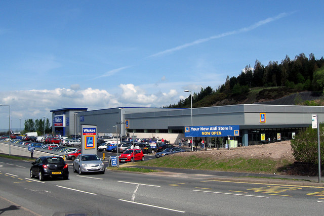
Telford is known for its diverse industrial heritage, which includes ironworks, coal mining, and the birthplace of the Industrial Revolution. Today, the town thrives on a range of industries such as manufacturing, retail, and services. Telford Shopping Centre is a popular destination for residents and visitors, offering a wide range of shops, restaurants, and entertainment facilities.

The town boasts several attractions and landmarks, including the Ironbridge Gorge World Heritage Site, which showcases the birthplace of the Industrial Revolution. The Telford Town Park is another notable feature, providing recreational spaces, beautiful gardens, and hosting various events throughout the year.

Telford is also home to several educational institutions, including the University of Wolverhampton's Telford Innovation Campus and Telford College, offering a range of academic and vocational courses.

Overall, Telford offers a blend of historical significance, modern amenities, and picturesque landscapes, making it an attractive place to live, work, and visit.

If you have any feedback on the listing, please let us know in the comments section below.
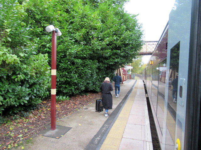
Telford Images

Images are sourced within 2km of 52.6754/-2.44875 or Grid Reference SJ6908. Thanks to Geograph Open Source API. All images are credited.

A peek round the back of the Aldi store HGV access to the rear of the supermarket and the adjoining home improvements store (Aldi and Wickes respectively) which now occupy the land on Snedshill that was once home to the Lilleshall Company.
A peek round the back of the Aldi store
HGV access to the rear of the supermarket and the adjoining home improvements store (Aldi and Wickes respectively) which now occupy the land on Snedshill that was once home to the Lilleshall Company.
Pearson Road - Office units in Central Park The area now occupied by the Central Park business estate was formerly the Snedshill steelworks, part of the Lilleshall Company's operations. By the mid '70s my recollection is that the steelworks had shut, although many of the buildings were still there, and one shed was occupied by 'The Maggot Factory' which used dead farm animals to breed maggots for angling on an industrial scale; it had a very distinctive aroma, but sold maggots by the gallon for pennies if you had the constitution to walk in and just ask.
Pearson Road - Office units in Central Park
The area now occupied by the Central Park business estate was formerly the Snedshill steelworks, part of the Lilleshall Company's operations. By the mid '70s my recollection is that the steelworks had shut, although many of the buildings were still there, and one shed was occupied by 'The Maggot Factory' which used dead farm animals to breed maggots for angling on an industrial scale; it had a very distinctive aroma, but sold maggots by the gallon for pennies if you had the constitution to walk in and just ask.
Open ground south of Holyhead Road, Snedshill The area now occupied by the Central Park business estate was formerly the Snedshill steelworks, part of the Lilleshall Company's operations, and the older maps show this land occupied by coke ovens, furnaces, chimneys and travelling cranes. All removed during the 1970s as part of the work to develop Telford as a New Town.
Open ground south of Holyhead Road, Snedshill
The area now occupied by the Central Park business estate was formerly the Snedshill steelworks, part of the Lilleshall Company's operations, and the older maps show this land occupied by coke ovens, furnaces, chimneys and travelling cranes. All removed during the 1970s as part of the work to develop Telford as a New Town.
New Aldi Supermarket and Wickes DIY stores, Snedshill, Telford The development at Holyhead Road, Snedshill, Telford is now complete and the stores are open for business.  16 April 2011.

Original Lilleshall Co. factory. <a title="https://www.geograph.org.uk/photo/2024941" href="https://www.geograph.org.uk/photo/2024941">Link</a>
Fire ravaged ruins. <a title="https://www.geograph.org.uk/photo/2028184" href="https://www.geograph.org.uk/photo/2028184">Link</a>
Cleared site. <a title="https://www.geograph.org.uk/photo/2028197" href="https://www.geograph.org.uk/photo/2028197">Link</a>
Start of development. <a title="https://www.geograph.org.uk/photo/2028204" href="https://www.geograph.org.uk/photo/2028204">Link</a>
New buildings.  <a title="https://www.geograph.org.uk/photo/2250149" href="https://www.geograph.org.uk/photo/2250149">Link</a>
New Aldi Supermarket and Wickes DIY stores, Snedshill, Telford
The development at Holyhead Road, Snedshill, Telford is now complete and the stores are open for business. 16 April 2011. Original Lilleshall Co. factory. Link Fire ravaged ruins. Link Cleared site. Link Start of development. Link New buildings. Link
OS benchmark and bolt - Snedshill, St Peter's church An OS cutmark and bolt from the 1st Primary Levelling of the country between 1840 - 1860; this mark was levelled at 561' 2" above Ordnance Datum Liverpool. It lies on the wall just to the right of the entrance to <a href="https://www.geograph.org.uk/photo/858270">SJ7010 : St Peter's Church, Priorslee</a>
OS benchmark and bolt - Snedshill, St Peter's church
An OS cutmark and bolt from the 1st Primary Levelling of the country between 1840 - 1860; this mark was levelled at 561' 2" above Ordnance Datum Liverpool. It lies on the wall just to the right of the entrance to SJ7010 : St Peter's Church, Priorslee
OS benchmark - St George's, 102 Freeston Avenue An OS cutmark in the brickwork at the side of 102 Freeston Avenue; originally levelled in 1985 at 170.31m above Ordnance Datum Newlyn.
OS benchmark - St George's, 102 Freeston Avenue
An OS cutmark in the brickwork at the side of 102 Freeston Avenue; originally levelled in 1985 at 170.31m above Ordnance Datum Newlyn.
OS benchmark - Snedshill, no 1 Furnace Lane An OS cutmark in the brickwork at the side of no 1 Furnace Lane; originally levelled in 1985 at 173.277m above Ordnance Datum Newlyn.
OS benchmark - Snedshill, no 1 Furnace Lane
An OS cutmark in the brickwork at the side of no 1 Furnace Lane; originally levelled in 1985 at 173.277m above Ordnance Datum Newlyn.
Wordsworth Way, Priorslee Ennerdale Close leads off to the right in this quiet residential part of Telford.
Wordsworth Way, Priorslee
Ennerdale Close leads off to the right in this quiet residential part of Telford.
Priorslee Flash This is the southern end of Priorslee Flash, a substantial lake surrounded by Telford's suburban development.
Priorslee Flash
This is the southern end of Priorslee Flash, a substantial lake surrounded by Telford's suburban development.
Derwent Drive, Priorslee Houses here overlook Priorslee Flash; a pleasant spot to live in the suburbs of Telford.
Derwent Drive, Priorslee
Houses here overlook Priorslee Flash; a pleasant spot to live in the suburbs of Telford.
St Peter's Church at Priorslee This rather fine, Grade II listed <span class="nowrap"><a title="https://www.britishlistedbuildings.co.uk/101033297-church-of-st-peter-st-georges-and-priorslee#.WRTNEtQrLGg" rel="nofollow ugc noopener" href="https://www.britishlistedbuildings.co.uk/101033297-church-of-st-peter-st-georges-and-priorslee#.WRTNEtQrLGg">Link</a><img style="margin-left:2px;" alt="External link" title="External link - shift click to open in new window" src="https://s1.geograph.org.uk/img/external.png" width="10" height="10"/></span> building was erected in 1836, and listed in 1983.
St Peter's Church at Priorslee
This rather fine, Grade II listed LinkExternal link building was erected in 1836, and listed in 1983.
Houses on Stafford Street, St George's, Telford
Stafford Street, St George's, Telford Looking north east.
Stafford Street, St George's, Telford
Looking north east.
Entrance to Wickes and Aldi, Holyhead Road
Elephant and Castle St Georges This pub is now closed but an extension is being added, replacing an earlier single-storey block.  It may reopen as a pub but residential use seems more likely.
Elephant and Castle St Georges
This pub is now closed but an extension is being added, replacing an earlier single-storey block. It may reopen as a pub but residential use seems more likely.
12th Century Font The 12th Century from Priorslee Chapel that now sits in the grounds of St Peter's Church in Snedshill
12th Century Font
The 12th Century from Priorslee Chapel that now sits in the grounds of St Peter's Church in Snedshill
Oakengates station
Oakengates station
Mossey Green Benchmark The OS Benchmark cut into the north facing wall adjacent to Main Road, Ketley Bank, Telford. This is a 3rd Order benchmark that was last verified by the OS in 1961. It is recorded as being 175.85-metres above the Ordnance Datum at Newlyn.
Mossey Green Benchmark
The OS Benchmark cut into the north facing wall adjacent to Main Road, Ketley Bank, Telford. This is a 3rd Order benchmark that was last verified by the OS in 1961. It is recorded as being 175.85-metres above the Ordnance Datum at Newlyn.
Show me another place!

Telford is located at Grid Ref: SJ6908 (Lat: 52.6754, Lng: -2.44875)

Unitary Authority: Telford and Wrekin

Police Authority: West Mercia

What 3 Words

///launched.velocity.community. Near Telford, Shropshire

Related Wikis

Telford

Telford ( ) is a town in Shropshire, England. It is the administrative centre of Telford and Wrekin borough, a unitary authority which covers the town...

Telford Ice Rink

Telford Ice Rink is located in the £250m Southwater Complex in Telford, Shropshire, England. The ice rink is home to National Ice Hockey League team the...

Telford (UK Parliament constituency)

Telford is a constituency represented in the House of Commons of the UK Parliament since May 2015 by Lucy Allan, a Conservative, who defeated David Wright...

South Telford Heritage Trail

The South Telford Heritage Trail is a circular, waymarked walking route that passes by forty-nine heritage sites in the English town of Telford. ��2�...

Nearby Amenities

Located within 500m of 52.6754,-2.44875
Telford
Is In: Shropshire, England, United Kingdom
Name En: Telford
Place: town
Population: 180000
Wikidata: Q576938
Wikipedia: en:Telford
Lat/Long: 52.6780419/-2.4514273
Give Way
Lat/Long: 52.6793237/-2.4516091
Traffic Signals
Traffic Signals: signal
Lat/Long: 52.6767595/-2.4552745
Traffic Signals
Traffic Signals: signal
Traffic Signals Direction: forward
Lat/Long: 52.6771576/-2.4545252
Crossing
Crossing: unmarked
Crossing Island: yes
Crossing Markings: no
Tactile Paving: yes
Lat/Long: 52.6764042/-2.4517836
Shelter: yes
Source: survey
Lat/Long: 52.678702/-2.44516
Bicycle Parking
Bicycle Parking: stands
Capacity: 8
Covered: no
Lat/Long: 52.6717466/-2.4489639
Crossing
Crossing: zebra
Lat/Long: 52.6763111/-2.4521544
Crossing
Crossing: unmarked
Crossing Island: yes
Crossing Markings: no
Tactile Paving: yes
Lat/Long: 52.6764592/-2.4517387
Bicycle Parking
Bicycle Parking: stands
Capacity: 14
Covered: no
Lat/Long: 52.677121/-2.4489489
Pub
The Thomas Botfield
Addr City: Telford
Addr Postcode: TF3 4DR
Addr Street: Grange Central
Brand: Wetherspoon
Brand Wikidata: Q6109362
Brand Wikipedia: en:Wetherspoons
Contact Website: https://www.jdwetherspoon.com/pubs/all-pubs/england/telford--wrekin/the-thomas-botfield-telford
Fhrs Id: 249687
Food: yes
Real Ale: yes
Source Addr: FHRS Open Data
Lat/Long: 52.67533/-2.445659
Crossing
Crossing: uncontrolled
Crossing Island: no
Crossing Markings: surface
Tactile Paving: yes
Lat/Long: 52.6795889/-2.4475447
Cinema
Odeon
Addr City: Telford
Addr Postcode: TF3 4NE
Addr Street: Woodhouse Central
Brand: Odeon
Brand Wikidata: Q6127470
Brand Wikipedia: en:Odeon Cinemas
Contact Website: https://www.odeon.co.uk/cinemas/telford/
Fhrs Id: 249828
Source Addr: FHRS Open Data
Lat/Long: 52.6791803/-2.4489078
Crossing
Lat/Long: 52.6775787/-2.4502664
Cafe
Costa
Brand: Costa
Brand Wikidata: Q608845
Brand Wikipedia: en:Costa Coffee
Cuisine: coffee_shop
Takeaway: yes
Lat/Long: 52.6788797/-2.4487622
Crossing
Crossing: unmarked
Crossing Island: no
Crossing Markings: no
Tactile Paving: no
Lat/Long: 52.6776825/-2.4496346
Crossing
Crossing: uncontrolled
Lat/Long: 52.6753242/-2.4475029
Turning Circle
Lat/Long: 52.6734829/-2.4489306
Crossing
Crossing: traffic_signals
Crossing Ref: toucan
Lat/Long: 52.6738778/-2.444174
Crossing
Crossing: marked
Crossing Island: no
Tactile Paving: yes
Lat/Long: 52.6772028/-2.4421071
Crossing
Crossing: marked
Crossing Island: no
Tactile Paving: yes
Lat/Long: 52.6771861/-2.4422495
Crossing
Crossing: marked
Lat/Long: 52.6784742/-2.4476089
Crossing
Crossing: marked
Lat/Long: 52.6782312/-2.4478335
Crossing
Crossing: marked
Lat/Long: 52.678727/-2.4473752
Crossing
Crossing: marked
Lat/Long: 52.6781091/-2.4479464
Crossing
Crossing: marked
Lat/Long: 52.6786019/-2.4474909
Crossing
Crossing: marked
Lat/Long: 52.6783538/-2.4477202
Crossing
Crossing: marked
Lat/Long: 52.6788481/-2.4472633
Crossing
Crossing: unmarked
Crossing Island: no
Tactile Paving: yes
Lat/Long: 52.6760886/-2.4536715
Atm
Barclays
Brand: Barclays
Brand Wikidata: Q245343
Brand Wikipedia: en:Barclays
Operator: Barclays
Operator Wikidata: Q245343
Lat/Long: 52.6756478/-2.4511276
Atm
Barclays
Brand: Barclays
Brand Wikidata: Q245343
Brand Wikipedia: en:Barclays
Operator: Barclays
Operator Wikidata: Q245343
Lat/Long: 52.6756772/-2.4511007
Charging Station
Amperage: 16
Capacity: 2
Free: yes
Layer: 0
Network: Polar Instant
Socket Type2: 2
Voltage: 250
Lat/Long: 52.6759159/-2.4512529
Charging Station
Amperage: 16
Capacity: 2
Free: yes
Layer: 0
Network: Polar Instant
Socket Type2: 2
Voltage: 250
Lat/Long: 52.6759498/-2.4513641
Crossing
Crossing: zebra
Lat/Long: 52.6725873/-2.4446361
Crossing
Crossing: zebra
Lat/Long: 52.6725612/-2.4445454
Crossing
Crossing: zebra
Lat/Long: 52.6727514/-2.4444426
Crossing
Crossing: zebra
Lat/Long: 52.6729727/-2.4452356
Crossing
Crossing: marked
Lat/Long: 52.6791713/-2.4472825
Crossing
Crossing: marked
Lat/Long: 52.6792559/-2.4472248
Bodycare
Brand: Bodycare
Brand Wikidata: Q99938329
Shop: chemist
Lat/Long: 52.6768022/-2.447007
Cafe
Cafe Britano
Addr City: Telford
Addr Housenumber: 216
Addr Postcode: TF3 4BT
Addr Street: Dean Street
Fhrs Id: 723898
Source Addr: FHRS Open Data
Lat/Long: 52.6764054/-2.4478035
Card Factory
Brand: Card Factory
Brand Wikidata: Q5038192
Brand Wikipedia: en:Card Factory
Shop: gift
Lat/Long: 52.6769854/-2.4463982
Carphone Warehouse
Brand: Carphone Warehouse
Brand Wikidata: Q118046
Brand Wikipedia: en:Carphone Warehouse
Shop: mobile_phone
Lat/Long: 52.6769208/-2.4464655
Cafe
Costa
Addr City: Telford
Addr Housenumber: 240
Addr Postcode: TF3 4BS
Addr Street: New Row
Brand: Costa
Brand Wikidata: Q608845
Brand Wikipedia: en:Costa Coffee
Cuisine: coffee_shop
Fhrs Id: 250016
Level: 0
Source Addr: FHRS Open Data
Takeaway: yes
Lat/Long: 52.6764114/-2.4485947
Diffusion
Level: 0
Lat/Long: 52.6763864/-2.4485158
Empire Accessories
Level: 0
Lat/Long: 52.6762115/-2.4479633
Bank
HSBC UK
Brand: HSBC UK
Brand Wikidata: Q64767453
Contact Website: https://www.hsbc.co.uk/branch-list/telford/
Operator: HSBC UK
Lat/Long: 52.6760435/-2.4463134
Hawkin's Bazaar
Brand: Hawkin's Bazaar
Brand Wikidata: Q16983539
Brand Wikipedia: en:Hawkin's Bazaar
Shop: toys
Lat/Long: 52.6771146/-2.4462635
Fast Food
McDonald's
Addr City: Telford
Addr Housenumber: 1
Addr Postcode: TF3 4BN
Addr Street: North Sherwood Street
Brand: McDonald's
Brand Wikidata: Q38076
Brand Wikipedia: en:McDonald's
Contact Website: https://www.mcdonalds.com/gb/en-gb/location/telford/telford/1-north-sherwood-street/8260071.html
Cuisine: burger
Drive Through: no
Fhrs Id: 1069233
Source Addr: FHRS Open Data
Takeaway: yes
Lat/Long: 52.6764674/-2.445654
Smart Ideas
Level: 0
Lat/Long: 52.6762865/-2.4482001
Superdrug
Lat/Long: 52.6762821/-2.447916
The Entertainer
Brand: The Entertainer
Brand Wikidata: Q7732289
Brand Wikipedia: en:The Entertainer (retailer)
Shop: toys
Lat/Long: 52.6768636/-2.4471948
Three.
Brand: Three
Brand Wikidata: Q407009
Brand Wikipedia: en:3 (telecommunications)
Contact Website: https://locator.three.co.uk/midlands/telford/106-the-border-telford-shopping-centre
Shop: mobile_phone
Lat/Long: 52.67705/-2.4463308
Twisted Faith
Level: 0
Lat/Long: 52.6763114/-2.448279
Vision Express
Brand: Vision Express
Brand Wikidata: Q7936150
Brand Wikipedia: en:Vision Express
Level: 0
Shop: optician
Lat/Long: 52.6763364/-2.448358
Vodafone
Brand: Vodafone
Brand Wikidata: Q122141
Brand Wikipedia: en:Vodafone
Shop: mobile_phone
Lat/Long: 52.6767288/-2.4465617
Waterstones
Brand: Waterstones
Brand Wikidata: Q151779
Brand Wikipedia: en:Waterstones
Contact Website: https://www.waterstones.com/bookshops/telford
Shop: books
Wheelchair: yes
Lat/Long: 52.6761739/-2.4478395
Entrance: yes
Lat/Long: 52.6746788/-2.447329
Entrance: yes
Lat/Long: 52.6751245/-2.4459742
Level: 0
Shop: vacant
Lat/Long: 52.6762365/-2.4480423
Level: 0
Shop: vacant
Lat/Long: 52.6762615/-2.4481212
Level: 0
Shop: vacant
Lat/Long: 52.6763614/-2.4484369
Entrance: yes
Lat/Long: 52.6765528/-2.445721
Entrance: yes
Lat/Long: 52.6772786/-2.4459156
O2
Brand: O2
Brand Wikidata: Q1759255
Brand Wikipedia: en:O2 (brand)
Shop: mobile_phone
Website: https://stores.o2.co.uk/o2-store-telford
Lat/Long: 52.6769564/-2.4460395
Addr City: Telford
Addr Housenumber: 9
Addr Postcode: TF3 4AE
Addr Street: The Border
Disused Amenity: fast_food
Old Name: McDonald's
Source Addr: FHRS Open Data
Lat/Long: 52.6771697/-2.4458491
Bank
TSB
Brand: TSB
Brand Wikidata: Q7671560
Brand Wikipedia: en:TSB Bank (United Kingdom)
Lat/Long: 52.6770986/-2.4459126
Crossing
Crossing: traffic_signals
Crossing Ref: toucan
Lat/Long: 52.6795799/-2.4514584
Crossing
Crossing: traffic_signals
Crossing Ref: toucan
Lat/Long: 52.6795576/-2.4512582
Crossing
Crossing: unmarked
Crossing Island: no
Crossing Markings: no
Tactile Paving: yes
Lat/Long: 52.6760284/-2.4502589
Noexit: yes
Lat/Long: 52.6770392/-2.4531957
Premier Inn (Telford International Centre)
Addr City: Telford
Addr Housename: Unit 8 Southwater Square
Addr Postcode: TF3 4DE
Addr Street: Southwater Way
Brand: Premier Inn
Brand Wikidata: Q2108626
Brand Wikipedia: en:Premier Inn
Contact Website: https://www.premierinn.com/gb/en/hotels/england/shropshire/telford/telford-international-centre.html
Internet Access: wlan
Internet Access Fee: customers
Internet Access Operator: Virgin Media
Internet Access Ssid: Premier Inn Free Wi-Fi
Operator: Premier Inn
Tourism: hotel
Lat/Long: 52.6736302/-2.4473297
Turning Circle
Lat/Long: 52.6728973/-2.4453619
Pub
Wrekin Giant
Addr City: Telford
Addr Postcode: TF3 4JG
Addr Street: Southwater Way
Brand: Hungry Horse
Brand Wikidata: Q5943510
Fhrs Id: 740207
Source Addr: FHRS Open Data
Lat/Long: 52.6733548/-2.4479576
Library
Southwater Library
Opening Hours: Mo-Sa 10:00-17:00; Su off
Wheelchair: yes
Lat/Long: 52.673504/-2.4480246
Restaurant
TGI Fridays
Brand: TGI Fridays
Brand Wikidata: Q1524184
Brand Wikipedia: en:TGI Fridays
Cuisine: american
Lat/Long: 52.6744981/-2.4489556
Restaurant
Nando's
Addr City: Telford
Addr Postcode: TF3 4JG
Addr Street: Southwater Way
Brand: Nando's
Brand Wikidata: Q3472954
Brand Wikipedia: en:Nando's
Cuisine: chicken;portuguese
Fhrs Id: 716033
Source Addr: FHRS Open Data
Website: https://www.nandos.co.uk/restaurants/telford
Lat/Long: 52.6737601/-2.447698
Restaurant
Bella Italia
Addr City: Telford
Addr Postcode: TF3 4JG
Addr Street: Southwater Way
Brand: Bella Italia
Brand Wikidata: Q4883362
Brand Wikipedia: en:Bella Italia
Cuisine: italian
Fhrs Id: 1275848
Source Addr: FHRS Open Data
Lat/Long: 52.6738975/-2.4476485
Cinema
Cineworld
Addr City: Telford
Addr Postcode: TF3 4JG
Addr Street: Southwater Way
Brand: Cineworld
Brand Wikidata: Q5120901
Brand Wikipedia: en:Cineworld
Fhrs Id: 716037
Source Addr: FHRS Open Data
Toilets Wheelchair: yes
Website: https://www.cineworld.co.uk/cinemas/telford/085
Wheelchair: yes
Lat/Long: 52.6736995/-2.4484983
Restaurant
Miller & Carter
Addr City: Telford
Addr Postcode: TF3 4JG
Addr Street: Southwater Way
Brand: Miller & Carter
Brand Wikidata: Q87067401
Contact Website: https://www.millerandcarter.co.uk/restaurants/east-and-west-midlands/millerandcartertelford
Cuisine: steak
Fhrs Id: 1069235
Source Addr: FHRS Open Data
Wheelchair: yes
Lat/Long: 52.6738411/-2.4483768
Restaurant
Zizzi
Addr City: Telford
Addr Postcode: TF3 4JG
Addr Street: Southwater Way
Brand: Zizzi
Brand Wikidata: Q8072944
Brand Wikipedia: en:Zizzi
Cuisine: italian
Fhrs Id: 842333
Source Addr: FHRS Open Data
Website: https://www.zizzi.co.uk/italian/restaurants/telford
Wheelchair: yes
Lat/Long: 52.6740917/-2.4481387
Restaurant
PizzaExpress
Addr City: Telford
Addr Postcode: TF3 4JG
Addr Street: Southwater Way
Brand: PizzaExpress
Brand Wikidata: Q662845
Brand Wikipedia: en:PizzaExpress
Cuisine: pizza
Fhrs Id: 716035
Source Addr Postcode: FHRS Open Data
Website: https://www.pizzaexpress.com/telford-southwater-square
Wheelchair: yes
Lat/Long: 52.6741936/-2.4480476
Bar
Liquor Lab
Addr City: Telford
Addr Postcode: TF3 4JG
Addr Street: Southwater Way
Fhrs Id: 940475
Source Addr: FHRS Open Data
Lat/Long: 52.6743439/-2.4473774
Restaurant
Coal Bar And Grill
Lat/Long: 52.673681/-2.4475246
Disused Shop: variety_store
Old Name: Wilko
Lat/Long: 52.674506/-2.4478684
Iceland
Brand: Iceland
Brand Wikidata: Q721810
Brand Wikipedia: en:Iceland (supermarket)
Contact Website: https://www.iceland.co.uk/store-finder/store?StoreID=1343&StoreName=TELFORD%202
Shop: frozen_food
Lat/Long: 52.6747673/-2.4477662
Bar
Albert's Shed
Toilets Wheelchair: no
Wheelchair: limited
Lat/Long: 52.6734817/-2.4464777
Restaurant
Wildwood
Addr City: Telford
Addr Postcode: TF3 4BF
Addr Street: Park Avenue
Branch: Kitchens
Brand: Wildwood
Brand Wikidata: Q85300869
Check Date: 2017-10-18
Cuisine: grill;pasta;pizza
Fhrs Id: 760164
Source Addr: FHRS Open Data
Lat/Long: 52.6735729/-2.4468544
Taxi
Southwater Pickup - Cineworld
Lat/Long: 52.6735492/-2.448974
Southwater
Place: quarter
Lat/Long: 52.6739021/-2.4478302
Taxi
Southwater Pickup - Ice Rink
Lat/Long: 52.6729736/-2.445488
Taxi
Southwater Pickup - TGI Fridays
Lat/Long: 52.674698/-2.4491229
Pub
Oxygen and 02 bar
Lat/Long: 52.675241/-2.4459465
Restaurant
Odyssey
Lat/Long: 52.675153/-2.4459704
Parking
Access: yes
Fee: yes
Operator: Southwater Multi Story Carpark
Parking: multi-storey
Payment Card: yes
Payment Cash: yes
Lat/Long: 52.6744271/-2.4466026
Pub
Severn Gorge
Lat/Long: 52.6765029/-2.453532
Telford 10 Pin
Leisure: bowling_alley
Opening Hours: Mo,We 10:00-23:00; Tu,Th,Fr 10:00-24:00; Sa 09:00-24:00; Su 09:00-23:00
Lat/Long: 52.6736869/-2.4469503
Capgemini sign
Historic: monument
Inscription: Capgemini, @Phoenix House
Lat/Long: 52.6759969/-2.4437342
Crossing
Crossing: unmarked
Lat/Long: 52.6757494/-2.4417887
Crossing
Crossing: unmarked
Lat/Long: 52.6758159/-2.4419975
Turning Circle
Lat/Long: 52.6760788/-2.4419055
FairShare
Office: company
Lat/Long: 52.6744466/-2.4472542
Butters John Bee
Office: estate_agent
Lat/Long: 52.6744025/-2.4473158
Post Box
Brand: Royal Mail
Brand Wikidata: Q638098
Collection Times: Mo-Fr 17:15; Sa 12:00
Operator: Royal Mail
Operator Wikidata: Q638098
Post Box Design: type_a
Post Box Type: pillar
Ref: TF3 330
Royal Cypher: EIIR
Royal Cypher Wikidata: Q33102113
Lat/Long: 52.6765736/-2.4485815
Post Box
Collection Times: Mo-Fr 16:00; Sa 11:45
Operator: Royal Mail
Operator Wikidata: Q638098
Post Box Design: indoor_pillar
Post Box Type: pillar
Ref: TF3 362
Royal Cypher: EIIR
Royal Cypher Wikidata: Q33102113
Lat/Long: 52.6755629/-2.4515757
Monsoon
Brand: Monsoon
Brand Wikidata: Q65007501
Shop: clothes
Lat/Long: 52.6766759/-2.4466338
Post Office
Telford Central Post Office
Addr City: Telford
Addr Housename: W H Smith
Addr Housenumber: 112-114
Addr Place: Telford Shopping Centre
Addr Postcode: TF3 4AF
Addr Street: The Border
Brand: Post Office
Brand Wikidata: Q1783168
Brand Wikipedia: en:Post Office Ltd
Contact Website: https://www.postoffice.co.uk/branch-finder/030641x/telford-central
Opening Hours: Mo-Sa 09:00-17:30; Su 10:30-14:30
Ref Pol Id: 126127
Source Addr: pol_branch_list_2018-02
Lat/Long: 52.6767856/-2.446788
Pharmacy
Asda
Brand: Asda
Brand Wikidata: Q297410
Brand Wikipedia: en:Asda
Contact Phone: +44 1952 741020
Contact Website: https://storelocator.asda.com/west-midlands/telford/malinsgate/pharmacy
Healthcare: pharmacy
Operator: Asda Stores Ltd
Lat/Long: 52.6753893/-2.4517062
Pharmacy
Healthcare: pharmacy
Lat/Long: 52.6762811/-2.4462622
Pharmacy
Superdrug
Addr City: Telford
Addr Housenumber: 218-220
Addr Postcode: TF3 4BT
Addr Street: Dean Street
Brand: Superdrug
Brand Wikidata: Q7643261
Brand Wikipedia: en:Superdrug
Contact Website: https://www.superdrug.com/store/telford
Fhrs Id: 249747
Healthcare: pharmacy
Source Addr: FHRS Open Data
Lat/Long: 52.6762899/-2.4479569
Asda Opticians
Brand: Asda
Brand Wikidata: Q297410
Brand Wikipedia: en:Asda
Contact Phone: +44 1952 741025
Contact Website: https://storelocator.asda.com/west-midlands/telford/malinsgate/opticians
Operator: Asda Stores Ltd
Shop: optician
Lat/Long: 52.6754375/-2.4516598
Cafe
Asda Café
Brand: Asda
Brand Wikidata: Q297410
Brand Wikipedia: en:Asda
Contact Phone: +44 1952 741020
Contact Website: https://storelocator.asda.com/west-midlands/telford/malinsgate/cafe
Cuisine: coffee_shop
Drinking Water Refill: yes
Drinking Water Refill Network: Refill
Internet Access: wlan
Internet Access Fee: no
Opening Hours Covid19: Mo-Su off
Operator: Asda Stores Ltd
Takeaway: yes
Lat/Long: 52.6758541/-2.4512955
Post Box
Collection Times: Mo-Fr 16:45; Sa 12:00
Post Box Design: wooden_indoor
Post Box Type: pillar
Lat/Long: 52.6768095/-2.4467486
Crossing
Crossing: marked
Tactile Paving: yes
Lat/Long: 52.6751308/-2.4506865
Travelodge - Telford Southwater
Addr City: Telford
Addr Postcode: TF3 4BF
Addr Street: Park Avenue
Brand: Travelodge
Brand Wikidata: Q9361374
Brand Wikipedia: en:Travelodge UK
Fhrs Authority: Telford and Wrekin Council
Fhrs Id: 1057155
Fhrs Local Authority Id: 18/00125/COMM
Internet Access: wlan
Internet Access Fee: customers
Internet Access Ssid: Travelodge WiFi
Source Addr: FHRS Open Data
Tourism: hotel
Website: https://www.travelodge.co.uk/hotels/643/Telford-hotel
Lat/Long: 52.6730884/-2.4466078
Parking
Access: yes
Fee: yes
Parking: multi-storey
Lat/Long: 52.6734737/-2.4450323
Bus Stop
Telford Bus Station
Bus: yes
Covered: yes
Departures Board: yes
Local Ref: K
Naptan AtcoCode: 3590E105900
Naptan NaptanCode: telagatj
Network: Arriva
Network Wikidata: Q680991
Network Wikipedia: en:Arriva
Operator: Arriva
Public Transport: platform
Ref: J
Shelter: yes
Lat/Long: 52.6754206/-2.4477363
Bus Stop
Telford Bus Station
Bus: yes
Covered: yes
Departures Board: yes
Local Ref: F
Naptan AtcoCode: 3590E105500
Naptan NaptanCode: telagapw
Network: Arriva
Network Wikidata: Q680991
Network Wikipedia: en:Arriva
Operator: Arriva
Public Transport: platform
Ref: F
Shelter: yes
Lat/Long: 52.6755085/-2.4479845
Bus Stop
Telford Bus Station
Bus: yes
Covered: yes
Departures Board: yes
Local Ref: L
Naptan AtcoCode: 3590E106000
Naptan NaptanCode: telagatm
Network: Arriva
Network Wikidata: Q680991
Network Wikipedia: en:Arriva
Operator: Arriva
Public Transport: platform
Ref: K
Shelter: yes
Lat/Long: 52.6754096/-2.4476906
Bus Stop
Telford Bus Station
Bus: yes
Covered: yes
Departures Board: yes
Local Ref: M
Naptan AtcoCode: 3590E106100
Naptan NaptanCode: telagatp
Network: TravelTelford
Operator: Arriva, Banga Buses, Select Bus
Public Transport: platform
Ref: L
Shelter: yes
Lat/Long: 52.6753972/-2.4476347
Bus Stop
Telford Bus Station
Bus: yes
Covered: yes
Departures Board: yes
Local Ref: J
Naptan AtcoCode: 3590E105800
Naptan NaptanCode: telagatg
Network: Arriva
Network Wikidata: Q680991
Network Wikipedia: en:Arriva
Operator: Arriva
Public Transport: platform
Ref: I
Shelter: yes
Lat/Long: 52.6754444/-2.4478027
Bus Stop
Telford Bus Station
Bench: yes
Bus: yes
Covered: yes
Departures Board: yes
Local Ref: G
Naptan AtcoCode: 3590E105600
Naptan NaptanCode: telagata
Network: Arriva
Network Wikidata: Q680991
Network Wikipedia: en:Arriva
Operator: Arriva
Public Transport: platform
Ref: G
Shelter: yes
Lat/Long: 52.6754861/-2.4479206
Bus Stop
Telford Bus Station
Bus: yes
Covered: yes
Departures Board: yes
Local Ref: D
Naptan AtcoCode: 3590E105300
Naptan NaptanCode: telagapt
Network: Arriva
Network Wikidata: Q680991
Network Wikipedia: en:Arriva
Operator: Arriva
Public Transport: platform
Ref: C
Shelter: yes
Lat/Long: 52.6755494/-2.4481183
Bus Stop
Telford Bus Station
Bus: yes
Covered: yes
Departures Board: yes
Local Ref: H
Naptan AtcoCode: 3590E105700
Naptan NaptanCode: telagatd
Network: Arriva
Network Wikidata: Q680991
Network Wikipedia: en:Arriva
Operator: Arriva
Public Transport: platform
Ref: H
Shelter: yes
Lat/Long: 52.6754675/-2.4478579
Bus Stop
Telford Bus Station
Bench: yes
Bin: yes
Bus: yes
Covered: yes
Departures Board: yes
Lit: yes
Local Ref: D
Naptan AtcoCode: 3590E105400
Naptan NaptanCode: teladpgj
Network: Arriva
Network Wikidata: Q680991
Network Wikipedia: en:Arriva
Operator: Arriva
Public Transport: platform
Ref: D
Shelter: yes
Lat/Long: 52.6755271/-2.448052
Bus Stop
Telford Bus Station
Bus: yes
Covered: yes
Departures Board: yes
Local Ref: C
Naptan AtcoCode: 3590E105200
Naptan NaptanCode: telagapm
Network: Arriva
Network Wikidata: Q680991
Network Wikipedia: en:Arriva
Operator: Arriva
Public Transport: platform
Ref: B
Shelter: yes
Lat/Long: 52.6755693/-2.4481816
Bus Stop
Telford Bus Station
Bus: yes
Covered: yes
Departures Board: yes
Local Ref: B
Naptan AtcoCode: 3590E105100
Naptan NaptanCode: telagapj
Network: Arriva
Network Wikidata: Q680991
Network Wikipedia: en:Arriva
Operator: Arriva
Public Transport: platform
Ref: A
Shelter: yes
Lat/Long: 52.6755882/-2.4482387
Bus Stop
Telford Bus Station
Bench: yes
Bus: yes
Covered: yes
Departures Board: yes
Lit: yes
Local Ref: A
Naptan AtcoCode: 3590E105000
Naptan NaptanCode: telagapg
Network: TravelTelford
Operator: Arriva, National Express
Public Transport: platform
Shelter: yes
Lat/Long: 52.675606/-2.4482977
Crossing
Crossing: unmarked
Lat/Long: 52.6788701/-2.4457934
Crossing
Crossing: unmarked
Crossing Island: yes
Crossing Markings: no
Tactile Paving: yes
Lat/Long: 52.6772644/-2.4546763
Crossing
Crossing: unmarked
Crossing Island: yes
Crossing Markings: no
Tactile Paving: yes
Lat/Long: 52.6772684/-2.4544682
Ice Cream
Creams
Brand: Creams
Brand Wikidata: Q111811895
Cuisine: ice_cream
Website: https://www.creamscafe.com/our-stores/telford/
Lat/Long: 52.6742918/-2.4482931
Crossing
Crossing: zebra
Lat/Long: 52.6747744/-2.4521947
Crossing
Crossing: zebra
Lat/Long: 52.6751301/-2.4514889
Crossing
Crossing: zebra
Lat/Long: 52.6750076/-2.4517623
Crossing
Crossing: marked
Crossing Markings: zebra
Crossing Ref: zebra
Tactile Paving: yes
Lat/Long: 52.6757491/-2.4508859
Bus Stop
Telford Town Centre Bus Station
Bus: yes
Departures Board: yes
Naptan AtcoCode: 3590E106500
Naptan NaptanCode: telamadj
Naptan Verified: no
Public Transport: platform
Shelter: yes
Source: naptan
Lat/Long: 52.6755665/-2.4479437
Bus Stop
International Centre
Bus: yes
Naptan AtcoCode: 3590E107400
Naptan NaptanCode: telamagd
Naptan Verified: no
Public Transport: platform
Source: naptan
Lat/Long: 52.6735007/-2.4428594
Bus Stop
International Centre
Bus: yes
Naptan AtcoCode: 3590E107100
Naptan NaptanCode: telamadt
Naptan Verified: no
Public Transport: platform
Source: naptan
Lat/Long: 52.6735766/-2.4427585
Barrier: lift_gate
Lat/Long: 52.675089/-2.4487017
Barrier: lift_gate
Lat/Long: 52.675105/-2.4487468
Crossing
Crossing: traffic_signals
Crossing Ref: toucan
Lat/Long: 52.6736884/-2.4440412
Crossing
Crossing: traffic_signals
Crossing Ref: toucan
Tactile Paving: yes
Lat/Long: 52.6764615/-2.4435018
Crossing
Crossing: traffic_signals
Crossing Ref: toucan
Tactile Paving: yes
Lat/Long: 52.6764929/-2.4435924
Crossing
Crossing: unmarked
Crossing Island: yes
Tactile Paving: yes
Lat/Long: 52.6759787/-2.4439259
Crossing
Crossing: unmarked
Crossing Island: yes
Tactile Paving: yes
Lat/Long: 52.6760044/-2.4440121
Barrier: cycle_barrier
Lat/Long: 52.6759331/-2.4438481
Bicycle Parking
Bicycle Parking: stands
Capacity: 12
Covered: no
Fee: no
Lat/Long: 52.6755577/-2.4485394
Bicycle Parking
Bicycle Parking: stands
Capacity: 20
Covered: yes
Fee: no
Lat/Long: 52.6757633/-2.4510397
Fast Food
Greggs
Addr City: Telford
Addr Housename: Telford Centre
Addr Postcode: TF3 4BT
Addr Street: Woodhouse Central
Brand: Greggs
Brand Wikidata: Q3403981
Brand Wikipedia: en:Greggs
Contact Website: https://www.greggs.co.uk/shop-finder?shop-code=0421
Cuisine: sandwich;bakery
Drive Through: no
Takeaway: yes
Lat/Long: 52.6764212/-2.4471984
Crossing
Crossing: marked
Lat/Long: 52.6771116/-2.4508816
Crossing
Crossing: marked
Lat/Long: 52.6771006/-2.4504409
Crossing
Crossing: unmarked
Crossing Island: no
Tactile Paving: yes
Lat/Long: 52.6767964/-2.4554561
Barrier: kerb
Kerb: flush
Tactile Paving: yes
Lat/Long: 52.6766261/-2.4554128
Crossing
Crossing: unmarked
Crossing Island: no
Tactile Paving: yes
Lat/Long: 52.6765944/-2.4554413
Barrier: kerb
Kerb: flush
Tactile Paving: yes
Lat/Long: 52.6765658/-2.4554636
Barrier: kerb
Kerb: flush
Tactile Paving: yes
Lat/Long: 52.6768294/-2.4554874
Barrier: kerb
Kerb: flush
Tactile Paving: yes
Lat/Long: 52.6767606/-2.4554179
Crossing
Crossing: unmarked
Crossing Island: yes
Crossing Markings: no
Tactile Paving: yes
Lat/Long: 52.6770501/-2.4539275
Crossing
Crossing: unmarked
Crossing Island: yes
Crossing Markings: no
Tactile Paving: yes
Lat/Long: 52.6769172/-2.4538827
Crossing
Crossing: traffic_signals
Crossing Island: no
Crossing Markings: yes
Crossing Ref: toucan
Tactile Paving: yes
Lat/Long: 52.6763983/-2.4540955
Crossing
Crossing: traffic_signals
Crossing Island: yes
Crossing Markings: yes
Crossing Ref: toucan
Tactile Paving: yes
Lat/Long: 52.6764741/-2.4539882
Crossing
Crossing: uncontrolled
Crossing Island: no
Crossing Markings: surface
Tactile Paving: yes
Lat/Long: 52.6795922/-2.4477088
ALDI
Brand: ALDI
Brand Wikidata: Q41171672
Contact Website: https://stores.aldi.co.uk/telford/unit-4-grange-central
Shop: supermarket
Lat/Long: 52.6780173/-2.4454741
B&M
Brand: B&M
Brand Wikidata: Q4836931
Shop: variety_store
Lat/Long: 52.67782/-2.4456495
Poundstretcher
Brand: Poundstretcher
Brand Wikidata: Q7235675
Shop: variety_store
Lat/Long: 52.6776568/-2.4457946
JYSK
Brand: JYSK
Brand Wikidata: Q138913
Shop: furniture
Lat/Long: 52.6775105/-2.4459247
Crossing
Crossing: marked
Crossing Island: yes
Crossing Markings: zebra
Crossing Ref: zebra
Tactile Paving: yes
Lat/Long: 52.6763093/-2.4510261
Crossing
Crossing: marked
Crossing Island: yes
Crossing Markings: zebra
Crossing Ref: zebra
Tactile Paving: yes
Lat/Long: 52.6762142/-2.4510704
Crossing
Crossing: marked
Crossing Island: no
Crossing Ref: zebra
Tactile Paving: yes
Traffic Calming: table
Lat/Long: 52.6786492/-2.448465
Crossing
Crossing: marked
Crossing Island: no
Crossing Ref: zebra
Tactile Paving: yes
Traffic Calming: table
Lat/Long: 52.6786165/-2.448383
Crossing
Lat/Long: 52.6747217/-2.4467907
Crossing
Lat/Long: 52.6744816/-2.4460879
Crossing
Crossing: marked
Crossing Island: no
Lat/Long: 52.6773087/-2.4443614
Crossing
Crossing: marked
Crossing Island: no
Lat/Long: 52.6772441/-2.444163
Crossing
Crossing: marked
Crossing Island: no
Lat/Long: 52.6773807/-2.4445761
Crossing
Crossing: unmarked
Crossing Island: no
Crossing Markings: no
Tactile Paving: yes
Lat/Long: 52.6759992/-2.450312
Crossing
Lat/Long: 52.6751571/-2.4475156
Crossing
Crossing: unmarked
Crossing Island: no
Crossing Markings: no
Tactile Paving: yes
Lat/Long: 52.6757265/-2.4491865
Crossing
Crossing: uncontrolled
Crossing Island: no
Crossing Markings: zebra
Tactile Paving: yes
Lat/Long: 52.6754877/-2.4488579
Crossing
Crossing: unmarked
Crossing Island: no
Crossing Markings: no
Tactile Paving: yes
Lat/Long: 52.6750992/-2.4492112
Crossing
Crossing: unmarked
Crossing Island: no
Crossing Markings: no
Tactile Paving: yes
Lat/Long: 52.67502/-2.4492827
Crossing
Crossing: unmarked
Crossing Island: no
Crossing Markings: no
Tactile Paving: yes
Lat/Long: 52.6748919/-2.4493983
Crossing
Crossing: marked
Tactile Paving: yes
Lat/Long: 52.67529/-2.4511812
Crossing
Crossing: uncontrolled
Crossing Island: no
Crossing Markings: zebra
Tactile Paving: yes
Lat/Long: 52.6746781/-2.4490883
Traffic Signals
Traffic Signals: signal
Lat/Long: 52.6764919/-2.4542381
Traffic Signals
Traffic Signals: signal
Lat/Long: 52.6767829/-2.4554931
Traffic Signals
Traffic Signals: signal
Traffic Signals Direction: forward
Lat/Long: 52.6773189/-2.4545065
Crossing
Button Operated: yes
Crossing: traffic_signals
Crossing Island: no
Tactile Paving: yes
Lat/Long: 52.6760043/-2.4550257
Traffic Signals
Traffic Signals: signal
Traffic Signals Direction: forward
Lat/Long: 52.6766017/-2.4436008
Traffic Signals
Traffic Signals: signal
Traffic Signals Direction: forward
Lat/Long: 52.6765878/-2.4433928
Traffic Signals
Traffic Signals: signal
Traffic Signals Direction: forward
Lat/Long: 52.676452/-2.4436316
Traffic Signals
Traffic Signals: signal
Traffic Signals Direction: forward
Lat/Long: 52.6739882/-2.4442457
Crossing
Crossing: traffic_signals
Lat/Long: 52.673965/-2.4441716
Traffic Signals
Traffic Signals: signal
Traffic Signals Direction: forward
Lat/Long: 52.6736537/-2.4440725
Traffic Signals
Traffic Signals: signal
Traffic Signals Direction: forward
Lat/Long: 52.6737293/-2.4436603
Traffic Signals
Traffic Signals: signal
Traffic Signals Direction: forward
Lat/Long: 52.6740341/-2.4439353
Traffic Signals
Traffic Signals: signal
Traffic Signals Direction: forward
Lat/Long: 52.6766408/-2.4435796
Barrier: lift_gate
Lat/Long: 52.6767887/-2.4439249
Barrier: lift_gate
Lat/Long: 52.6767386/-2.4439625
Crossing
Crossing: marked
Crossing Island: no
Lat/Long: 52.6771417/-2.4451127
Crossing
Lat/Long: 52.677433/-2.4446329
Crossing
Lat/Long: 52.6741368/-2.4440557
Vending Machine
Payment Cash: yes
Payment Coins: yes
Payment Contactless: yes
Payment Credit Cards: yes
Payment Debit Cards: yes
Payment Mastercard: yes
Payment Visa: yes
Vending: parking_tickets
Lat/Long: 52.6768747/-2.4440443
Vending Machine
Payment Cash: yes
Payment Coins: yes
Payment Contactless: yes
Payment Credit Cards: yes
Payment Debit Cards: yes
Payment Mastercard: yes
Payment Visa: yes
Vending: parking_tickets
Lat/Long: 52.67676/-2.4440926
Vending Machine
Payment Cash: yes
Payment Coins: yes
Payment Contactless: yes
Payment Credit Cards: yes
Payment Debit Cards: yes
Payment Mastercard: yes
Payment Visa: yes
Vending: parking_tickets
Lat/Long: 52.6772863/-2.4459624
Crossing
Crossing: marked
Crossing Island: no
Lat/Long: 52.6781002/-2.4471611
Crossing
Crossing: unmarked
Crossing Island: no
Crossing Markings: no
Tactile Paving: yes
Lat/Long: 52.6758845/-2.4497005
Entrance: yes
Lat/Long: 52.6777634/-2.4470338
Crossing
Crossing: marked
Lat/Long: 52.6789019/-2.4461706
Crossing
Crossing: marked
Lat/Long: 52.6788495/-2.4462177
Crossing
Crossing: unmarked
Lat/Long: 52.675705/-2.4415245
Entrance: main
Lat/Long: 52.6761182/-2.4428795
Vending Machine
Vending: parking_tickets
Lat/Long: 52.678343/-2.4471471
Entrance: yes
Lat/Long: 52.6796831/-2.4485042
Vending Machine
Vending: parking_tickets
Lat/Long: 52.6788676/-2.4492679
Access: yes
Covered: no
Leisure: picnic_table
Operator: Costa
Operator Type: private
Lat/Long: 52.6788023/-2.4488374
Access: yes
Covered: no
Leisure: picnic_table
Operator: Costa
Operator Type: private
Lat/Long: 52.6788145/-2.4488823
Access: yes
Covered: no
Leisure: picnic_table
Operator: Costa
Operator Type: private
Lat/Long: 52.6788336/-2.4488669
Access: yes
Covered: no
Leisure: picnic_table
Operator: Costa
Operator Type: private
Lat/Long: 52.6788194/-2.4488246
Barrier: lift_gate
Lat/Long: 52.6743069/-2.4506029
Fountain
Lat/Long: 52.6771302/-2.4493705
Crossing
Crossing: marked
Lat/Long: 52.6771607/-2.4498077
Crossing
Crossing: marked
Lat/Long: 52.6771353/-2.4497226
Crossing
Crossing: unmarked
Crossing Island: yes
Crossing Markings: no
Tactile Paving: yes
Lat/Long: 52.6764417/-2.4505083
Crossing
Crossing: unmarked
Crossing Island: yes
Crossing Markings: no
Tactile Paving: yes
Lat/Long: 52.6763964/-2.4503791
Crossing
Crossing: unmarked
Crossing Island: no
Crossing Markings: no
Tactile Paving: yes
Lat/Long: 52.6764645/-2.4521166
Vending Machine
Vending: parking_tickets
Lat/Long: 52.6750886/-2.448641
Crossing
Lat/Long: 52.6752721/-2.4485283
Bench
Lat/Long: 52.6729026/-2.446647
Bench
Lat/Long: 52.673053/-2.4470739
Bench
Lat/Long: 52.6731713/-2.4475251
Bench
Lat/Long: 52.6722395/-2.4470617
Bench
Lat/Long: 52.672343/-2.447391
Bench
Lat/Long: 52.6724934/-2.4476105
Bench
Lat/Long: 52.6727424/-2.4478626
Bench
Lat/Long: 52.671368/-2.4475728
Bench
Lat/Long: 52.6715279/-2.447463
Bench
Lat/Long: 52.6716856/-2.4473126
Bench
Lat/Long: 52.6715568/-2.4468649
Bench
Lat/Long: 52.6713487/-2.4467269
Bench
Lat/Long: 52.6710804/-2.4467481
Shelter
Shelter Type: picnic_shelter
Lat/Long: 52.6712033/-2.4476816
Leisure: picnic_table
Lat/Long: 52.6720514/-2.4476185
Leisure: picnic_table
Lat/Long: 52.6721229/-2.4466596
Leisure: picnic_table
Lat/Long: 52.6736474/-2.450741
Isaiah's Stone
Natural: stone
Lat/Long: 52.6729177/-2.4501953
Bench
Lat/Long: 52.6740647/-2.4524234
Bench
Lat/Long: 52.673624/-2.4516053
Crossing
Crossing: uncontrolled
Crossing Island: no
Crossing Markings: zebra
Tactile Paving: no
Lat/Long: 52.6749838/-2.4500106
Crossing
Crossing: unmarked
Crossing Island: no
Crossing Markings: no
Tactile Paving: yes
Lat/Long: 52.6757292/-2.4495471
Crossing
Crossing: unmarked
Crossing Island: no
Crossing Markings: no
Tactile Paving: yes
Lat/Long: 52.6754592/-2.4485926
Noexit: yes
Lat/Long: 52.6748242/-2.4452034
Mini Roundabout
Direction: clockwise
Lat/Long: 52.6785357/-2.450074
Traffic Signals
Traffic Signals: signal
Lat/Long: 52.6763841/-2.4540233
Traffic Signals
Traffic Signals: crossing
Lat/Long: 52.676522/-2.4540031
Give Way
Lat/Long: 52.6792022/-2.4522878
PureGym
Addr City: Telford
Addr Housename: Brodie House
Addr Postcode: TF3 4DR
Addr Street: Grange Central
Addr Substreet: Central Square
Brand: PureGym
Brand Wikidata: Q18345898
Leisure: fitness_centre
Opening Hours: 24/7
Website: https://www.puregym.com/gyms/telford/
Lat/Long: 52.6758645/-2.4446563
Bus Stop
Matheson House
Bus: yes
Public Transport: platform
Lat/Long: 52.6761333/-2.443708
Bus Stop
Matheson House
Bus: yes
Public Transport: platform
Lat/Long: 52.6759072/-2.4441332
The data included in this document is from www.openstreetmap.org. The data is made available under ODbL.

Have you been to Telford?

Leave your review of Telford below (or comments, questions and feedback).