Southwater

Lake, Pool, Pond, Freshwater Marsh in Shropshire

England

Southwater

A peek round the back of the Aldi store HGV access to the rear of the supermarket and the adjoining home improvements store (Aldi and Wickes respectively) which now occupy the land on Snedshill that was once home to the Lilleshall Company.
A peek round the back of the Aldi store Credit: Richard Law

Southwater, located in Shropshire, is a picturesque region known for its abundant freshwater resources, including a lake, pool, pond, and freshwater marsh. Nestled amidst rolling hills and verdant landscapes, this area is a haven for nature enthusiasts and wildlife aficionados.

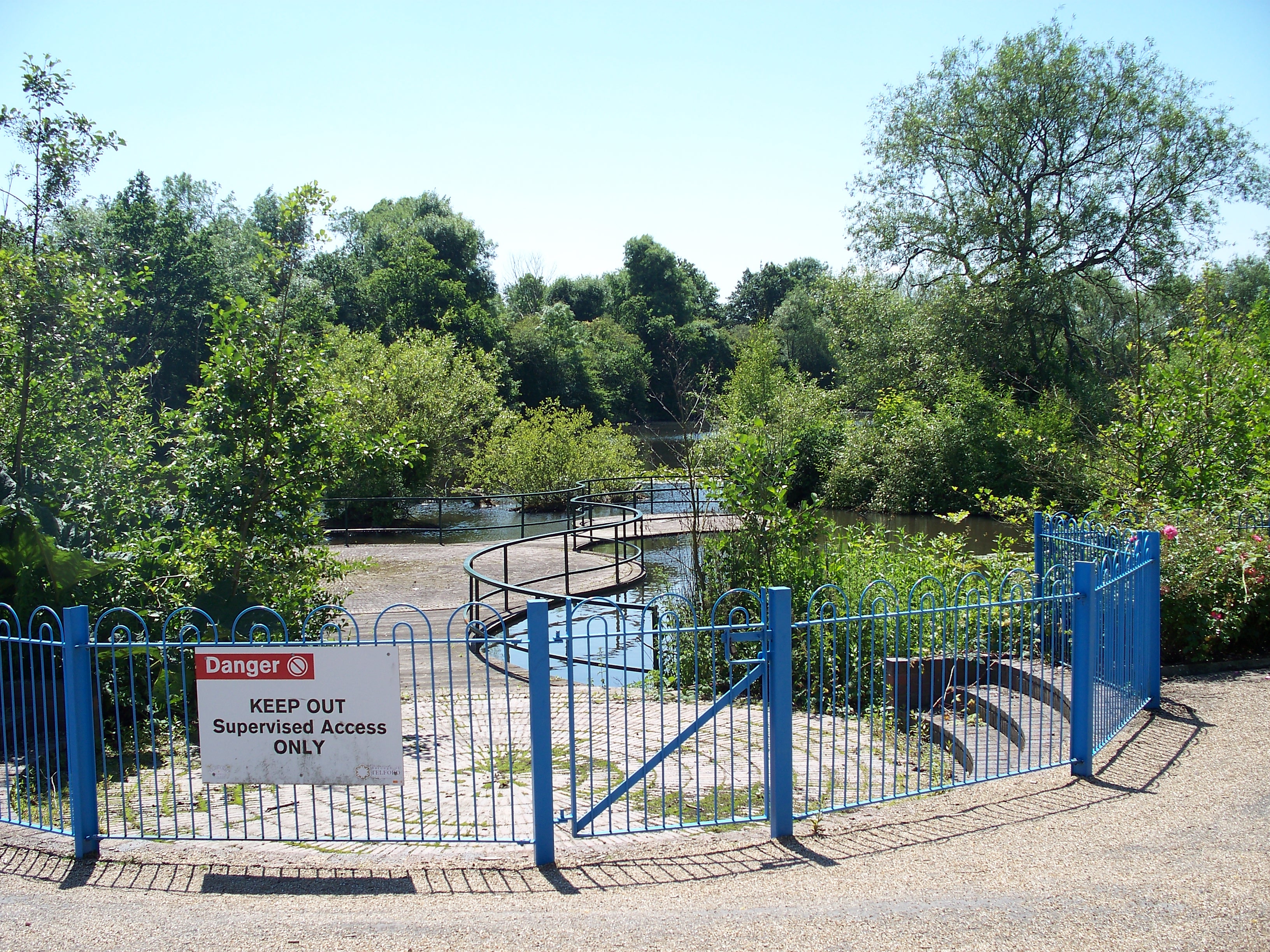
The centerpiece of Southwater is its expansive lake, which spans over a large area and provides a serene and tranquil atmosphere. The lake's crystal-clear waters are home to a diverse range of aquatic species, including various fish, waterfowl, and plants. It serves as a popular spot for recreational activities such as fishing, boating, and kayaking, attracting both locals and tourists alike.

Adjacent to the lake is a smaller pool, offering a more intimate setting for relaxation and wildlife observation. Here, visitors can witness an array of bird species, including herons, ducks, and swans, as they gracefully glide across the water's surface.

In addition to the lake and pool, Southwater boasts a charming pond that adds to the area's natural beauty. Surrounded by lush vegetation, the pond is a haven for amphibians, insects, and smaller aquatic organisms. It provides a flourishing habitat for various species, contributing to the region's rich biodiversity.

Furthermore, Southwater is also home to a freshwater marsh, which acts as a natural filtration system, purifying the surrounding water sources. The marsh is teeming with reeds, sedges, and other water-loving plants, creating an ideal habitat for marsh-dwelling creatures like frogs, dragonflies, and wading birds.

Overall, Southwater, Shropshire, with its lake, pool, pond, and freshwater marsh, is a captivating destination that offers a diverse range of natural wonders. It provides a sanctuary for wildlife and a peaceful retreat for those seeking solace amidst the beauty of nature.

If you have any feedback on the listing, please let us know in the comments section below.
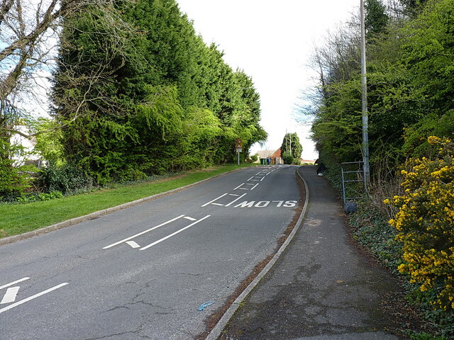
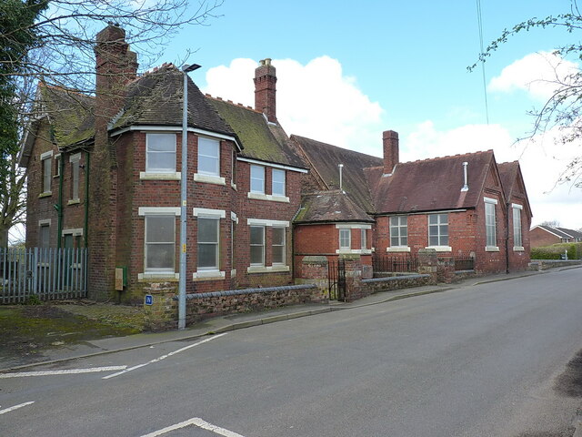
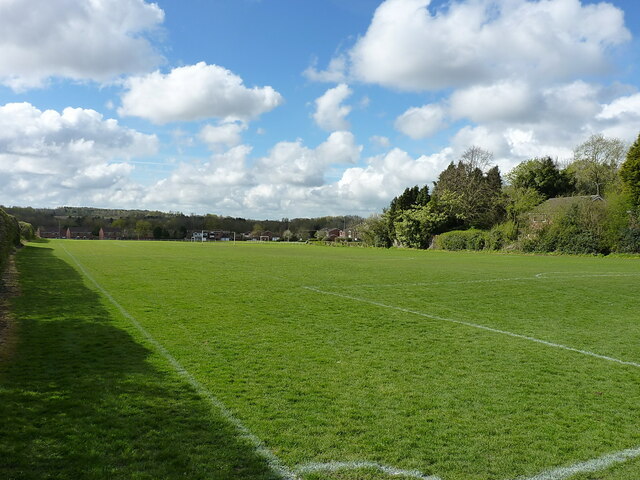
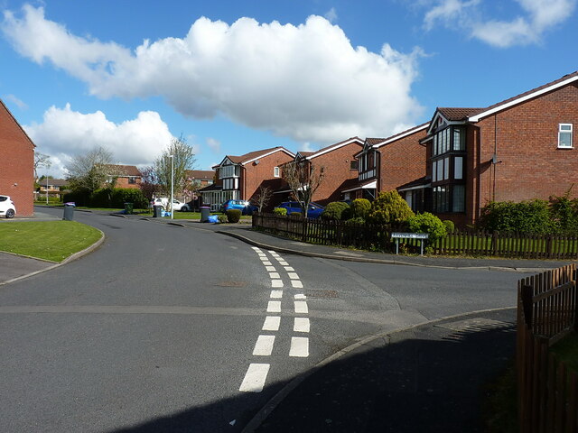
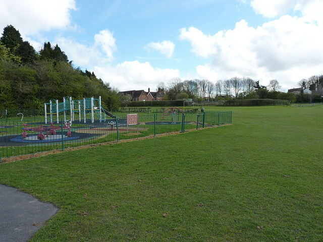
Southwater Images

Images are sourced within 2km of 52.672705/-2.4471124 or Grid Reference SJ6908. Thanks to Geograph Open Source API. All images are credited.

A peek round the back of the Aldi store HGV access to the rear of the supermarket and the adjoining home improvements store (Aldi and Wickes respectively) which now occupy the land on Snedshill that was once home to the Lilleshall Company.
A peek round the back of the Aldi store
HGV access to the rear of the supermarket and the adjoining home improvements store (Aldi and Wickes respectively) which now occupy the land on Snedshill that was once home to the Lilleshall Company.
Pearson Road - Office units in Central Park The area now occupied by the Central Park business estate was formerly the Snedshill steelworks, part of the Lilleshall Company's operations. By the mid '70s my recollection is that the steelworks had shut, although many of the buildings were still there, and one shed was occupied by 'The Maggot Factory' which used dead farm animals to breed maggots for angling on an industrial scale; it had a very distinctive aroma, but sold maggots by the gallon for pennies if you had the constitution to walk in and just ask.
Pearson Road - Office units in Central Park
The area now occupied by the Central Park business estate was formerly the Snedshill steelworks, part of the Lilleshall Company's operations. By the mid '70s my recollection is that the steelworks had shut, although many of the buildings were still there, and one shed was occupied by 'The Maggot Factory' which used dead farm animals to breed maggots for angling on an industrial scale; it had a very distinctive aroma, but sold maggots by the gallon for pennies if you had the constitution to walk in and just ask.
Open ground south of Holyhead Road, Snedshill The area now occupied by the Central Park business estate was formerly the Snedshill steelworks, part of the Lilleshall Company's operations, and the older maps show this land occupied by coke ovens, furnaces, chimneys and travelling cranes. All removed during the 1970s as part of the work to develop Telford as a New Town.
Open ground south of Holyhead Road, Snedshill
The area now occupied by the Central Park business estate was formerly the Snedshill steelworks, part of the Lilleshall Company's operations, and the older maps show this land occupied by coke ovens, furnaces, chimneys and travelling cranes. All removed during the 1970s as part of the work to develop Telford as a New Town.
New Aldi Supermarket and Wickes DIY stores, Snedshill, Telford The development at Holyhead Road, Snedshill, Telford is now complete and the stores are open for business.  16 April 2011.

Original Lilleshall Co. factory. <a title="https://www.geograph.org.uk/photo/2024941" href="https://www.geograph.org.uk/photo/2024941">Link</a>
Fire ravaged ruins. <a title="https://www.geograph.org.uk/photo/2028184" href="https://www.geograph.org.uk/photo/2028184">Link</a>
Cleared site. <a title="https://www.geograph.org.uk/photo/2028197" href="https://www.geograph.org.uk/photo/2028197">Link</a>
Start of development. <a title="https://www.geograph.org.uk/photo/2028204" href="https://www.geograph.org.uk/photo/2028204">Link</a>
New buildings.  <a title="https://www.geograph.org.uk/photo/2250149" href="https://www.geograph.org.uk/photo/2250149">Link</a>
New Aldi Supermarket and Wickes DIY stores, Snedshill, Telford
The development at Holyhead Road, Snedshill, Telford is now complete and the stores are open for business. 16 April 2011. Original Lilleshall Co. factory. Link Fire ravaged ruins. Link Cleared site. Link Start of development. Link New buildings. Link
OS benchmark and bolt - Snedshill, St Peter's church An OS cutmark and bolt from the 1st Primary Levelling of the country between 1840 - 1860; this mark was levelled at 561' 2" above Ordnance Datum Liverpool. It lies on the wall just to the right of the entrance to <a href="https://www.geograph.org.uk/photo/858270">SJ7010 : St Peter's Church, Priorslee</a>
OS benchmark and bolt - Snedshill, St Peter's church
An OS cutmark and bolt from the 1st Primary Levelling of the country between 1840 - 1860; this mark was levelled at 561' 2" above Ordnance Datum Liverpool. It lies on the wall just to the right of the entrance to SJ7010 : St Peter's Church, Priorslee
OS benchmark - Snedshill, no 1 Furnace Lane An OS cutmark in the brickwork at the side of no 1 Furnace Lane; originally levelled in 1985 at 173.277m above Ordnance Datum Newlyn.
OS benchmark - Snedshill, no 1 Furnace Lane
An OS cutmark in the brickwork at the side of no 1 Furnace Lane; originally levelled in 1985 at 173.277m above Ordnance Datum Newlyn.
St Peter's Church at Priorslee This rather fine, Grade II listed <span class="nowrap"><a title="https://www.britishlistedbuildings.co.uk/101033297-church-of-st-peter-st-georges-and-priorslee#.WRTNEtQrLGg" rel="nofollow ugc noopener" href="https://www.britishlistedbuildings.co.uk/101033297-church-of-st-peter-st-georges-and-priorslee#.WRTNEtQrLGg">Link</a><img style="margin-left:2px;" alt="External link" title="External link - shift click to open in new window" src="https://s1.geograph.org.uk/img/external.png" width="10" height="10"/></span> building was erected in 1836, and listed in 1983.
St Peter's Church at Priorslee
This rather fine, Grade II listed LinkExternal link building was erected in 1836, and listed in 1983.
Entrance to Wickes and Aldi, Holyhead Road
Elephant and Castle St Georges This pub is now closed but an extension is being added, replacing an earlier single-storey block.  It may reopen as a pub but residential use seems more likely.
Elephant and Castle St Georges
This pub is now closed but an extension is being added, replacing an earlier single-storey block. It may reopen as a pub but residential use seems more likely.
12th Century Font The 12th Century from Priorslee Chapel that now sits in the grounds of St Peter's Church in Snedshill
12th Century Font
The 12th Century from Priorslee Chapel that now sits in the grounds of St Peter's Church in Snedshill
Looking west along Fifth Avenue Probably not the one you're thinking of; this is the REALLY famous Fifth Avenue in Ketley Bank!
Looking west along Fifth Avenue
Probably not the one you're thinking of; this is the REALLY famous Fifth Avenue in Ketley Bank!
At the end of Fifth Avenue Here the Fifth Avenue joins Grange Road.
At the end of Fifth Avenue
Here the Fifth Avenue joins Grange Road.
Looking up Bank Way The main route through Ketley Bank
Looking up Bank Way
The main route through Ketley Bank
Main Road, Ketley Bank Main Road leads through the former coal-mining village of Ketley Bank. The cottage on the right looks to be one of the older properties in the area, and is Sutherland Cottage, which probably dates it to the late 18th or early 19th century.
Main Road, Ketley Bank
Main Road leads through the former coal-mining village of Ketley Bank. The cottage on the right looks to be one of the older properties in the area, and is Sutherland Cottage, which probably dates it to the late 18th or early 19th century.
The former Ketley Bank primary school Last time I passed by this way a few years ago, the old school was in use as <a href="https://www.geograph.org.uk/photo/4191695">SJ6910 : Ketley Bank Community Centre</a> but is now lying boarded up and disused. The doors had a notice saying it's no longer a polling station either.
The former Ketley Bank primary school
Last time I passed by this way a few years ago, the old school was in use as SJ6910 : Ketley Bank Community Centre but is now lying boarded up and disused. The doors had a notice saying it's no longer a polling station either.
Football pitch marked out on the playing fields of Ketley Bank The whole area was once scarred by old mines and tips; the trees on the right are growing on a former spoil heap.
Football pitch marked out on the playing fields of Ketley Bank
The whole area was once scarred by old mines and tips; the trees on the right are growing on a former spoil heap.
Ryebank Road at the junction with Ravenhill Drive New houses on the Mosseygreen estate in Ketley Bank.
Ryebank Road at the junction with Ravenhill Drive
New houses on the Mosseygreen estate in Ketley Bank.
The corner of a play area on the recreation ground Much of the open space here is marked out as football pitches, but this corner is reserved for the smaller childrens' play area.
The corner of a play area on the recreation ground
Much of the open space here is marked out as football pitches, but this corner is reserved for the smaller childrens' play area.
Show me another place!

Southwater is located at Grid Ref: SJ6908 (Lat: 52.672705, Lng: -2.4471124)

Unitary Authority: Telford and Wrekin

Police Authority: West Mercia

What 3 Words

///famous.onwards.rebounder. Near Telford, Shropshire

Related Wikis

Telford Ice Rink

Telford Ice Rink is located in the £250m Southwater Complex in Telford, Shropshire, England. The ice rink is home to National Ice Hockey League team the...

South Telford Heritage Trail

The South Telford Heritage Trail is a circular, waymarked walking route that passes by forty-nine heritage sites in the English town of Telford. ��2�...

Telford

Telford ( ) is a town in Shropshire, England. It is the administrative centre of Telford and Wrekin borough, a unitary authority which covers the town...

Malins Lee railway station

Malins Lee railway station was a station in Malinslee, Shropshire, England. The station was opened in 1862 and closed in 1952. The station site marks the...

Telford (UK Parliament constituency)

Telford is a constituency represented in the House of Commons of the UK Parliament since May 2015 by Lucy Allan, a Conservative, who defeated David Wright...

Malinslee

Malinslee is an estate in the town of Telford and Wrekin, Shropshire, England. It is near the Town Park and Telford Shopping Centre, and next to the Dawley...

Thomas Telford School

Thomas Telford School is a City Technology College in Telford, Shropshire and is sponsored by The Mercers Company and Tarmac Holdings Limited. == History... ==

Telford Town Park

Telford Town Park is a park and Local Nature Reserve in Telford in Shropshire. In 2015, it was voted "UK's Best Park" in the inaugural public competition...

Nearby Amenities

Located within 500m of 52.672705,-2.4471124
Bicycle Parking
Bicycle Parking: stands
Capacity: 8
Covered: no
Lat/Long: 52.6717466/-2.4489639
Direction: both
Traffic Calming: bump
Lat/Long: 52.6716733/-2.4541918
Pub
The Thomas Botfield
Addr City: Telford
Addr Postcode: TF3 4DR
Addr Street: Grange Central
Brand: Wetherspoon
Brand Wikidata: Q6109362
Brand Wikipedia: en:Wetherspoons
Contact Website: https://www.jdwetherspoon.com/pubs/all-pubs/england/telford--wrekin/the-thomas-botfield-telford
Fhrs Id: 249687
Food: yes
Real Ale: yes
Source Addr: FHRS Open Data
Lat/Long: 52.67533/-2.445659
Crossing
Crossing: uncontrolled
Lat/Long: 52.6753242/-2.4475029
Turning Circle
Lat/Long: 52.6734829/-2.4489306
The Bicycle Hub
Shop: bicycle
Lat/Long: 52.6708206/-2.4476448
Crossing
Crossing: traffic_signals
Crossing Ref: toucan
Lat/Long: 52.6738778/-2.444174
Atm
Barclays
Brand: Barclays
Brand Wikidata: Q245343
Brand Wikipedia: en:Barclays
Operator: Barclays
Operator Wikidata: Q245343
Lat/Long: 52.6756478/-2.4511276
Atm
Barclays
Brand: Barclays
Brand Wikidata: Q245343
Brand Wikipedia: en:Barclays
Operator: Barclays
Operator Wikidata: Q245343
Lat/Long: 52.6756772/-2.4511007
Charging Station
Amperage: 16
Capacity: 2
Free: yes
Layer: 0
Network: Polar Instant
Socket Type2: 2
Voltage: 250
Lat/Long: 52.6759159/-2.4512529
Charging Station
Amperage: 16
Capacity: 2
Free: yes
Layer: 0
Network: Polar Instant
Socket Type2: 2
Voltage: 250
Lat/Long: 52.6759498/-2.4513641
Crossing
Crossing: zebra
Lat/Long: 52.6725873/-2.4446361
Crossing
Crossing: zebra
Lat/Long: 52.6725612/-2.4445454
Crossing
Crossing: zebra
Lat/Long: 52.6727514/-2.4444426
Crossing
Crossing: zebra
Lat/Long: 52.6729727/-2.4452356
Bodycare
Brand: Bodycare
Brand Wikidata: Q99938329
Shop: chemist
Lat/Long: 52.6768022/-2.447007
Cafe
Cafe Britano
Addr City: Telford
Addr Housenumber: 216
Addr Postcode: TF3 4BT
Addr Street: Dean Street
Fhrs Id: 723898
Source Addr: FHRS Open Data
Lat/Long: 52.6764054/-2.4478035
Card Factory
Brand: Card Factory
Brand Wikidata: Q5038192
Brand Wikipedia: en:Card Factory
Shop: gift
Lat/Long: 52.6769854/-2.4463982
Carphone Warehouse
Brand: Carphone Warehouse
Brand Wikidata: Q118046
Brand Wikipedia: en:Carphone Warehouse
Shop: mobile_phone
Lat/Long: 52.6769208/-2.4464655
Cafe
Costa
Addr City: Telford
Addr Housenumber: 240
Addr Postcode: TF3 4BS
Addr Street: New Row
Brand: Costa
Brand Wikidata: Q608845
Brand Wikipedia: en:Costa Coffee
Cuisine: coffee_shop
Fhrs Id: 250016
Level: 0
Source Addr: FHRS Open Data
Takeaway: yes
Lat/Long: 52.6764114/-2.4485947
Diffusion
Level: 0
Lat/Long: 52.6763864/-2.4485158
Empire Accessories
Level: 0
Lat/Long: 52.6762115/-2.4479633
Bank
HSBC UK
Brand: HSBC UK
Brand Wikidata: Q64767453
Contact Website: https://www.hsbc.co.uk/branch-list/telford/
Operator: HSBC UK
Lat/Long: 52.6760435/-2.4463134
Hawkin's Bazaar
Brand: Hawkin's Bazaar
Brand Wikidata: Q16983539
Brand Wikipedia: en:Hawkin's Bazaar
Shop: toys
Lat/Long: 52.6771146/-2.4462635
Fast Food
McDonald's
Addr City: Telford
Addr Housenumber: 1
Addr Postcode: TF3 4BN
Addr Street: North Sherwood Street
Brand: McDonald's
Brand Wikidata: Q38076
Brand Wikipedia: en:McDonald's
Contact Website: https://www.mcdonalds.com/gb/en-gb/location/telford/telford/1-north-sherwood-street/8260071.html
Cuisine: burger
Drive Through: no
Fhrs Id: 1069233
Source Addr: FHRS Open Data
Takeaway: yes
Lat/Long: 52.6764674/-2.445654
Smart Ideas
Level: 0
Lat/Long: 52.6762865/-2.4482001
Superdrug
Lat/Long: 52.6762821/-2.447916
The Entertainer
Brand: The Entertainer
Brand Wikidata: Q7732289
Brand Wikipedia: en:The Entertainer (retailer)
Shop: toys
Lat/Long: 52.6768636/-2.4471948
Three.
Brand: Three
Brand Wikidata: Q407009
Brand Wikipedia: en:3 (telecommunications)
Contact Website: https://locator.three.co.uk/midlands/telford/106-the-border-telford-shopping-centre
Shop: mobile_phone
Lat/Long: 52.67705/-2.4463308
Twisted Faith
Level: 0
Lat/Long: 52.6763114/-2.448279
Vision Express
Brand: Vision Express
Brand Wikidata: Q7936150
Brand Wikipedia: en:Vision Express
Level: 0
Shop: optician
Lat/Long: 52.6763364/-2.448358
Vodafone
Brand: Vodafone
Brand Wikidata: Q122141
Brand Wikipedia: en:Vodafone
Shop: mobile_phone
Lat/Long: 52.6767288/-2.4465617
Waterstones
Brand: Waterstones
Brand Wikidata: Q151779
Brand Wikipedia: en:Waterstones
Contact Website: https://www.waterstones.com/bookshops/telford
Shop: books
Wheelchair: yes
Lat/Long: 52.6761739/-2.4478395
Entrance: yes
Lat/Long: 52.6746788/-2.447329
Entrance: yes
Lat/Long: 52.6751245/-2.4459742
Level: 0
Shop: vacant
Lat/Long: 52.6762365/-2.4480423
Level: 0
Shop: vacant
Lat/Long: 52.6762615/-2.4481212
Level: 0
Shop: vacant
Lat/Long: 52.6763614/-2.4484369
Entrance: yes
Lat/Long: 52.6765528/-2.445721
O2
Brand: O2
Brand Wikidata: Q1759255
Brand Wikipedia: en:O2 (brand)
Shop: mobile_phone
Website: https://stores.o2.co.uk/o2-store-telford
Lat/Long: 52.6769564/-2.4460395
Bank
TSB
Brand: TSB
Brand Wikidata: Q7671560
Brand Wikipedia: en:TSB Bank (United Kingdom)
Lat/Long: 52.6770986/-2.4459126
Crossing
Crossing: unmarked
Crossing Island: no
Crossing Markings: no
Tactile Paving: yes
Lat/Long: 52.6760284/-2.4502589
Premier Inn (Telford International Centre)
Addr City: Telford
Addr Housename: Unit 8 Southwater Square
Addr Postcode: TF3 4DE
Addr Street: Southwater Way
Brand: Premier Inn
Brand Wikidata: Q2108626
Brand Wikipedia: en:Premier Inn
Contact Website: https://www.premierinn.com/gb/en/hotels/england/shropshire/telford/telford-international-centre.html
Internet Access: wlan
Internet Access Fee: customers
Internet Access Operator: Virgin Media
Internet Access Ssid: Premier Inn Free Wi-Fi
Operator: Premier Inn
Tourism: hotel
Lat/Long: 52.6736302/-2.4473297
Turning Circle
Lat/Long: 52.6728973/-2.4453619
Pub
Wrekin Giant
Addr City: Telford
Addr Postcode: TF3 4JG
Addr Street: Southwater Way
Brand: Hungry Horse
Brand Wikidata: Q5943510
Fhrs Id: 740207
Source Addr: FHRS Open Data
Lat/Long: 52.6733548/-2.4479576
Library
Southwater Library
Opening Hours: Mo-Sa 10:00-17:00; Su off
Wheelchair: yes
Lat/Long: 52.673504/-2.4480246
Restaurant
TGI Fridays
Brand: TGI Fridays
Brand Wikidata: Q1524184
Brand Wikipedia: en:TGI Fridays
Cuisine: american
Lat/Long: 52.6744981/-2.4489556
Restaurant
Nando's
Addr City: Telford
Addr Postcode: TF3 4JG
Addr Street: Southwater Way
Brand: Nando's
Brand Wikidata: Q3472954
Brand Wikipedia: en:Nando's
Cuisine: chicken;portuguese
Fhrs Id: 716033
Source Addr: FHRS Open Data
Website: https://www.nandos.co.uk/restaurants/telford
Lat/Long: 52.6737601/-2.447698
Restaurant
Bella Italia
Addr City: Telford
Addr Postcode: TF3 4JG
Addr Street: Southwater Way
Brand: Bella Italia
Brand Wikidata: Q4883362
Brand Wikipedia: en:Bella Italia
Cuisine: italian
Fhrs Id: 1275848
Source Addr: FHRS Open Data
Lat/Long: 52.6738975/-2.4476485
Cinema
Cineworld
Addr City: Telford
Addr Postcode: TF3 4JG
Addr Street: Southwater Way
Brand: Cineworld
Brand Wikidata: Q5120901
Brand Wikipedia: en:Cineworld
Fhrs Id: 716037
Source Addr: FHRS Open Data
Toilets Wheelchair: yes
Website: https://www.cineworld.co.uk/cinemas/telford/085
Wheelchair: yes
Lat/Long: 52.6736995/-2.4484983
Restaurant
Miller & Carter
Addr City: Telford
Addr Postcode: TF3 4JG
Addr Street: Southwater Way
Brand: Miller & Carter
Brand Wikidata: Q87067401
Contact Website: https://www.millerandcarter.co.uk/restaurants/east-and-west-midlands/millerandcartertelford
Cuisine: steak
Fhrs Id: 1069235
Source Addr: FHRS Open Data
Wheelchair: yes
Lat/Long: 52.6738411/-2.4483768
Restaurant
Zizzi
Addr City: Telford
Addr Postcode: TF3 4JG
Addr Street: Southwater Way
Brand: Zizzi
Brand Wikidata: Q8072944
Brand Wikipedia: en:Zizzi
Cuisine: italian
Fhrs Id: 842333
Source Addr: FHRS Open Data
Website: https://www.zizzi.co.uk/italian/restaurants/telford
Wheelchair: yes
Lat/Long: 52.6740917/-2.4481387
Restaurant
PizzaExpress
Addr City: Telford
Addr Postcode: TF3 4JG
Addr Street: Southwater Way
Brand: PizzaExpress
Brand Wikidata: Q662845
Brand Wikipedia: en:PizzaExpress
Cuisine: pizza
Fhrs Id: 716035
Source Addr Postcode: FHRS Open Data
Website: https://www.pizzaexpress.com/telford-southwater-square
Wheelchair: yes
Lat/Long: 52.6741936/-2.4480476
Bar
Liquor Lab
Addr City: Telford
Addr Postcode: TF3 4JG
Addr Street: Southwater Way
Fhrs Id: 940475
Source Addr: FHRS Open Data
Lat/Long: 52.6743439/-2.4473774
Restaurant
Coal Bar And Grill
Lat/Long: 52.673681/-2.4475246
Disused Shop: variety_store
Old Name: Wilko
Lat/Long: 52.674506/-2.4478684
Iceland
Brand: Iceland
Brand Wikidata: Q721810
Brand Wikipedia: en:Iceland (supermarket)
Contact Website: https://www.iceland.co.uk/store-finder/store?StoreID=1343&StoreName=TELFORD%202
Shop: frozen_food
Lat/Long: 52.6747673/-2.4477662
Bar
Albert's Shed
Toilets Wheelchair: no
Wheelchair: limited
Lat/Long: 52.6734817/-2.4464777
Restaurant
Wildwood
Addr City: Telford
Addr Postcode: TF3 4BF
Addr Street: Park Avenue
Branch: Kitchens
Brand: Wildwood
Brand Wikidata: Q85300869
Check Date: 2017-10-18
Cuisine: grill;pasta;pizza
Fhrs Id: 760164
Source Addr: FHRS Open Data
Lat/Long: 52.6735729/-2.4468544
Taxi
Southwater Pickup - Cineworld
Lat/Long: 52.6735492/-2.448974
Southwater
Place: quarter
Lat/Long: 52.6739021/-2.4478302
Taxi
Southwater Pickup - Ice Rink
Lat/Long: 52.6729736/-2.445488
Taxi
Southwater Pickup - TGI Fridays
Lat/Long: 52.674698/-2.4491229
Pub
Oxygen and 02 bar
Lat/Long: 52.675241/-2.4459465
Restaurant
Odyssey
Lat/Long: 52.675153/-2.4459704
Parking
Access: yes
Fee: yes
Operator: Southwater Multi Story Carpark
Parking: multi-storey
Payment Card: yes
Payment Cash: yes
Lat/Long: 52.6744271/-2.4466026
Telford 10 Pin
Leisure: bowling_alley
Opening Hours: Mo,We 10:00-23:00; Tu,Th,Fr 10:00-24:00; Sa 09:00-24:00; Su 09:00-23:00
Lat/Long: 52.6736869/-2.4469503
Capgemini sign
Historic: monument
Inscription: Capgemini, @Phoenix House
Lat/Long: 52.6759969/-2.4437342
Crossing
Crossing: unmarked
Lat/Long: 52.6757494/-2.4417887
Crossing
Crossing: unmarked
Lat/Long: 52.6758159/-2.4419975
FairShare
Office: company
Lat/Long: 52.6744466/-2.4472542
Butters John Bee
Office: estate_agent
Lat/Long: 52.6744025/-2.4473158
Post Box
Brand: Royal Mail
Brand Wikidata: Q638098
Collection Times: Mo-Fr 17:15; Sa 12:00
Operator: Royal Mail
Operator Wikidata: Q638098
Post Box Design: type_a
Post Box Type: pillar
Ref: TF3 330
Royal Cypher: EIIR
Royal Cypher Wikidata: Q33102113
Lat/Long: 52.6765736/-2.4485815
Post Box
Collection Times: Mo-Fr 16:00; Sa 11:45
Operator: Royal Mail
Operator Wikidata: Q638098
Post Box Design: indoor_pillar
Post Box Type: pillar
Ref: TF3 362
Royal Cypher: EIIR
Royal Cypher Wikidata: Q33102113
Lat/Long: 52.6755629/-2.4515757
Monsoon
Brand: Monsoon
Brand Wikidata: Q65007501
Shop: clothes
Lat/Long: 52.6766759/-2.4466338
Post Office
Telford Central Post Office
Addr City: Telford
Addr Housename: W H Smith
Addr Housenumber: 112-114
Addr Place: Telford Shopping Centre
Addr Postcode: TF3 4AF
Addr Street: The Border
Brand: Post Office
Brand Wikidata: Q1783168
Brand Wikipedia: en:Post Office Ltd
Contact Website: https://www.postoffice.co.uk/branch-finder/030641x/telford-central
Opening Hours: Mo-Sa 09:00-17:30; Su 10:30-14:30
Ref Pol Id: 126127
Source Addr: pol_branch_list_2018-02
Lat/Long: 52.6767856/-2.446788
Pharmacy
Asda
Brand: Asda
Brand Wikidata: Q297410
Brand Wikipedia: en:Asda
Contact Phone: +44 1952 741020
Contact Website: https://storelocator.asda.com/west-midlands/telford/malinsgate/pharmacy
Healthcare: pharmacy
Operator: Asda Stores Ltd
Lat/Long: 52.6753893/-2.4517062
Pharmacy
Healthcare: pharmacy
Lat/Long: 52.6762811/-2.4462622
Pharmacy
Superdrug
Addr City: Telford
Addr Housenumber: 218-220
Addr Postcode: TF3 4BT
Addr Street: Dean Street
Brand: Superdrug
Brand Wikidata: Q7643261
Brand Wikipedia: en:Superdrug
Contact Website: https://www.superdrug.com/store/telford
Fhrs Id: 249747
Healthcare: pharmacy
Source Addr: FHRS Open Data
Lat/Long: 52.6762899/-2.4479569
Asda Opticians
Brand: Asda
Brand Wikidata: Q297410
Brand Wikipedia: en:Asda
Contact Phone: +44 1952 741025
Contact Website: https://storelocator.asda.com/west-midlands/telford/malinsgate/opticians
Operator: Asda Stores Ltd
Shop: optician
Lat/Long: 52.6754375/-2.4516598
Cafe
Asda Café
Brand: Asda
Brand Wikidata: Q297410
Brand Wikipedia: en:Asda
Contact Phone: +44 1952 741020
Contact Website: https://storelocator.asda.com/west-midlands/telford/malinsgate/cafe
Cuisine: coffee_shop
Drinking Water Refill: yes
Drinking Water Refill Network: Refill
Internet Access: wlan
Internet Access Fee: no
Opening Hours Covid19: Mo-Su off
Operator: Asda Stores Ltd
Takeaway: yes
Lat/Long: 52.6758541/-2.4512955
Post Box
Collection Times: Mo-Fr 16:45; Sa 12:00
Post Box Design: wooden_indoor
Post Box Type: pillar
Lat/Long: 52.6768095/-2.4467486
Barrier: bollard
Lat/Long: 52.6693816/-2.4430946
Restaurant
The Olive Tree Restaurant
Lat/Long: 52.6704549/-2.4428442
Crossing
Crossing: marked
Tactile Paving: yes
Lat/Long: 52.6751308/-2.4506865
Travelodge - Telford Southwater
Addr City: Telford
Addr Postcode: TF3 4BF
Addr Street: Park Avenue
Brand: Travelodge
Brand Wikidata: Q9361374
Brand Wikipedia: en:Travelodge UK
Fhrs Authority: Telford and Wrekin Council
Fhrs Id: 1057155
Fhrs Local Authority Id: 18/00125/COMM
Internet Access: wlan
Internet Access Fee: customers
Internet Access Ssid: Travelodge WiFi
Source Addr: FHRS Open Data
Tourism: hotel
Website: https://www.travelodge.co.uk/hotels/643/Telford-hotel
Lat/Long: 52.6730884/-2.4466078
Parking
Access: yes
Fee: yes
Parking: multi-storey
Lat/Long: 52.6734737/-2.4450323
Bus Stop
Telford Bus Station
Bus: yes
Covered: yes
Departures Board: yes
Local Ref: K
Naptan AtcoCode: 3590E105900
Naptan NaptanCode: telagatj
Network: Arriva
Network Wikidata: Q680991
Network Wikipedia: en:Arriva
Operator: Arriva
Public Transport: platform
Ref: J
Shelter: yes
Lat/Long: 52.6754206/-2.4477363
Bus Stop
Telford Bus Station
Bus: yes
Covered: yes
Departures Board: yes
Local Ref: F
Naptan AtcoCode: 3590E105500
Naptan NaptanCode: telagapw
Network: Arriva
Network Wikidata: Q680991
Network Wikipedia: en:Arriva
Operator: Arriva
Public Transport: platform
Ref: F
Shelter: yes
Lat/Long: 52.6755085/-2.4479845
Bus Stop
Telford Bus Station
Bus: yes
Covered: yes
Departures Board: yes
Local Ref: L
Naptan AtcoCode: 3590E106000
Naptan NaptanCode: telagatm
Network: Arriva
Network Wikidata: Q680991
Network Wikipedia: en:Arriva
Operator: Arriva
Public Transport: platform
Ref: K
Shelter: yes
Lat/Long: 52.6754096/-2.4476906
Bus Stop
Telford Bus Station
Bus: yes
Covered: yes
Departures Board: yes
Local Ref: M
Naptan AtcoCode: 3590E106100
Naptan NaptanCode: telagatp
Network: TravelTelford
Operator: Arriva, Banga Buses, Select Bus
Public Transport: platform
Ref: L
Shelter: yes
Lat/Long: 52.6753972/-2.4476347
Bus Stop
Telford Bus Station
Bus: yes
Covered: yes
Departures Board: yes
Local Ref: J
Naptan AtcoCode: 3590E105800
Naptan NaptanCode: telagatg
Network: Arriva
Network Wikidata: Q680991
Network Wikipedia: en:Arriva
Operator: Arriva
Public Transport: platform
Ref: I
Shelter: yes
Lat/Long: 52.6754444/-2.4478027
Bus Stop
Telford Bus Station
Bench: yes
Bus: yes
Covered: yes
Departures Board: yes
Local Ref: G
Naptan AtcoCode: 3590E105600
Naptan NaptanCode: telagata
Network: Arriva
Network Wikidata: Q680991
Network Wikipedia: en:Arriva
Operator: Arriva
Public Transport: platform
Ref: G
Shelter: yes
Lat/Long: 52.6754861/-2.4479206
Bus Stop
Telford Bus Station
Bus: yes
Covered: yes
Departures Board: yes
Local Ref: D
Naptan AtcoCode: 3590E105300
Naptan NaptanCode: telagapt
Network: Arriva
Network Wikidata: Q680991
Network Wikipedia: en:Arriva
Operator: Arriva
Public Transport: platform
Ref: C
Shelter: yes
Lat/Long: 52.6755494/-2.4481183
Bus Stop
Telford Bus Station
Bus: yes
Covered: yes
Departures Board: yes
Local Ref: H
Naptan AtcoCode: 3590E105700
Naptan NaptanCode: telagatd
Network: Arriva
Network Wikidata: Q680991
Network Wikipedia: en:Arriva
Operator: Arriva
Public Transport: platform
Ref: H
Shelter: yes
Lat/Long: 52.6754675/-2.4478579
Bus Stop
Telford Bus Station
Bench: yes
Bin: yes
Bus: yes
Covered: yes
Departures Board: yes
Lit: yes
Local Ref: D
Naptan AtcoCode: 3590E105400
Naptan NaptanCode: teladpgj
Network: Arriva
Network Wikidata: Q680991
Network Wikipedia: en:Arriva
Operator: Arriva
Public Transport: platform
Ref: D
Shelter: yes
Lat/Long: 52.6755271/-2.448052
Bus Stop
Telford Bus Station
Bus: yes
Covered: yes
Departures Board: yes
Local Ref: C
Naptan AtcoCode: 3590E105200
Naptan NaptanCode: telagapm
Network: Arriva
Network Wikidata: Q680991
Network Wikipedia: en:Arriva
Operator: Arriva
Public Transport: platform
Ref: B
Shelter: yes
Lat/Long: 52.6755693/-2.4481816
Bus Stop
Telford Bus Station
Bus: yes
Covered: yes
Departures Board: yes
Local Ref: B
Naptan AtcoCode: 3590E105100
Naptan NaptanCode: telagapj
Network: Arriva
Network Wikidata: Q680991
Network Wikipedia: en:Arriva
Operator: Arriva
Public Transport: platform
Ref: A
Shelter: yes
Lat/Long: 52.6755882/-2.4482387
Bus Stop
Telford Bus Station
Bench: yes
Bus: yes
Covered: yes
Departures Board: yes
Lit: yes
Local Ref: A
Naptan AtcoCode: 3590E105000
Naptan NaptanCode: telagapg
Network: TravelTelford
Operator: Arriva, National Express
Public Transport: platform
Shelter: yes
Lat/Long: 52.675606/-2.4482977
Ice Cream
Creams
Brand: Creams
Brand Wikidata: Q111811895
Cuisine: ice_cream
Website: https://www.creamscafe.com/our-stores/telford/
Lat/Long: 52.6742918/-2.4482931
Crossing
Crossing: zebra
Lat/Long: 52.6747744/-2.4521947
Crossing
Crossing: zebra
Lat/Long: 52.6751301/-2.4514889
Crossing
Crossing: zebra
Lat/Long: 52.6750076/-2.4517623
Crossing
Crossing: marked
Crossing Markings: zebra
Crossing Ref: zebra
Tactile Paving: yes
Lat/Long: 52.6757491/-2.4508859
Bus Stop
Telford Town Centre Bus Station
Bus: yes
Departures Board: yes
Naptan AtcoCode: 3590E106500
Naptan NaptanCode: telamadj
Naptan Verified: no
Public Transport: platform
Shelter: yes
Source: naptan
Lat/Long: 52.6755665/-2.4479437
Bus Stop
International Centre
Bus: yes
Naptan AtcoCode: 3590E107400
Naptan NaptanCode: telamagd
Naptan Verified: no
Public Transport: platform
Source: naptan
Lat/Long: 52.6735007/-2.4428594
Bus Stop
International Centre
Bus: yes
Naptan AtcoCode: 3590E107100
Naptan NaptanCode: telamadt
Naptan Verified: no
Public Transport: platform
Source: naptan
Lat/Long: 52.6735766/-2.4427585
Barrier: lift_gate
Lat/Long: 52.675089/-2.4487017
Barrier: lift_gate
Lat/Long: 52.675105/-2.4487468
Crossing
Crossing: traffic_signals
Crossing Ref: toucan
Lat/Long: 52.6736884/-2.4440412
Crossing
Crossing: traffic_signals
Crossing Ref: toucan
Tactile Paving: yes
Lat/Long: 52.6764615/-2.4435018
Crossing
Crossing: traffic_signals
Crossing Ref: toucan
Tactile Paving: yes
Lat/Long: 52.6764929/-2.4435924
Crossing
Crossing: unmarked
Crossing Island: yes
Tactile Paving: yes
Lat/Long: 52.6759787/-2.4439259
Crossing
Crossing: unmarked
Crossing Island: yes
Tactile Paving: yes
Lat/Long: 52.6760044/-2.4440121
Barrier: cycle_barrier
Lat/Long: 52.6759331/-2.4438481
Bicycle Parking
Bicycle Parking: stands
Capacity: 12
Covered: no
Fee: no
Lat/Long: 52.6755577/-2.4485394
Bicycle Parking
Bicycle Parking: stands
Capacity: 20
Covered: yes
Fee: no
Lat/Long: 52.6757633/-2.4510397
Fast Food
Greggs
Addr City: Telford
Addr Housename: Telford Centre
Addr Postcode: TF3 4BT
Addr Street: Woodhouse Central
Brand: Greggs
Brand Wikidata: Q3403981
Brand Wikipedia: en:Greggs
Contact Website: https://www.greggs.co.uk/shop-finder?shop-code=0421
Cuisine: sandwich;bakery
Drive Through: no
Takeaway: yes
Lat/Long: 52.6764212/-2.4471984
Crossing
Crossing: marked
Crossing Island: yes
Crossing Markings: zebra
Crossing Ref: zebra
Tactile Paving: yes
Lat/Long: 52.6763093/-2.4510261
Crossing
Crossing: marked
Crossing Island: yes
Crossing Markings: zebra
Crossing Ref: zebra
Tactile Paving: yes
Lat/Long: 52.6762142/-2.4510704
Crossing
Lat/Long: 52.6747217/-2.4467907
Crossing
Lat/Long: 52.6744816/-2.4460879
Events Venue
QE11 Arena
Note: Outdoor arena/concert arena with capacity of 10000 people.
Lat/Long: 52.6710469/-2.4447445
Crossing
Crossing: unmarked
Crossing Island: no
Crossing Markings: no
Tactile Paving: yes
Lat/Long: 52.6759992/-2.450312
Crossing
Lat/Long: 52.6751571/-2.4475156
Crossing
Crossing: unmarked
Crossing Island: no
Crossing Markings: no
Tactile Paving: yes
Lat/Long: 52.6757265/-2.4491865
Crossing
Crossing: uncontrolled
Crossing Island: no
Crossing Markings: zebra
Tactile Paving: yes
Lat/Long: 52.6754877/-2.4488579
Crossing
Crossing: unmarked
Crossing Island: no
Crossing Markings: no
Tactile Paving: yes
Lat/Long: 52.6750992/-2.4492112
Crossing
Crossing: unmarked
Crossing Island: no
Crossing Markings: no
Tactile Paving: yes
Lat/Long: 52.67502/-2.4492827
Crossing
Crossing: unmarked
Crossing Island: no
Crossing Markings: no
Tactile Paving: yes
Lat/Long: 52.6748919/-2.4493983
Crossing
Crossing: marked
Tactile Paving: yes
Lat/Long: 52.67529/-2.4511812
Crossing
Crossing: uncontrolled
Crossing Island: no
Crossing Markings: zebra
Tactile Paving: yes
Lat/Long: 52.6746781/-2.4490883
Traffic Signals
Traffic Signals: signal
Traffic Signals Direction: forward
Lat/Long: 52.6766017/-2.4436008
Traffic Signals
Traffic Signals: signal
Traffic Signals Direction: forward
Lat/Long: 52.6765878/-2.4433928
Traffic Signals
Traffic Signals: signal
Traffic Signals Direction: forward
Lat/Long: 52.676452/-2.4436316
Traffic Signals
Traffic Signals: signal
Traffic Signals Direction: forward
Lat/Long: 52.6739882/-2.4442457
Crossing
Crossing: traffic_signals
Lat/Long: 52.673965/-2.4441716
Traffic Signals
Traffic Signals: signal
Traffic Signals Direction: forward
Lat/Long: 52.6736537/-2.4440725
Traffic Signals
Traffic Signals: signal
Traffic Signals Direction: forward
Lat/Long: 52.6737293/-2.4436603
Traffic Signals
Traffic Signals: signal
Traffic Signals Direction: forward
Lat/Long: 52.6740341/-2.4439353
Traffic Signals
Traffic Signals: signal
Traffic Signals Direction: forward
Lat/Long: 52.6766408/-2.4435796
Barrier: lift_gate
Lat/Long: 52.6767386/-2.4439625
Crossing
Lat/Long: 52.6741368/-2.4440557
Vending Machine
Payment Cash: yes
Payment Coins: yes
Payment Contactless: yes
Payment Credit Cards: yes
Payment Debit Cards: yes
Payment Mastercard: yes
Payment Visa: yes
Vending: parking_tickets
Lat/Long: 52.67676/-2.4440926
Crossing
Crossing: unmarked
Crossing Island: no
Crossing Markings: no
Tactile Paving: yes
Lat/Long: 52.6758845/-2.4497005
Entrance: main
Lat/Long: 52.6761182/-2.4428795
Barrier: lift_gate
Lat/Long: 52.6743069/-2.4506029
Crossing
Crossing: unmarked
Crossing Island: yes
Crossing Markings: no
Tactile Paving: yes
Lat/Long: 52.6764417/-2.4505083
Crossing
Crossing: unmarked
Crossing Island: yes
Crossing Markings: no
Tactile Paving: yes
Lat/Long: 52.6763964/-2.4503791
Vending Machine
Vending: parking_tickets
Lat/Long: 52.6750886/-2.448641
Crossing
Lat/Long: 52.6752721/-2.4485283
Tourism: viewpoint
Lat/Long: 52.6692656/-2.4500417
Bench
Lat/Long: 52.6729026/-2.446647
Bench
Lat/Long: 52.673053/-2.4470739
Bench
Lat/Long: 52.6731713/-2.4475251
Bench
Lat/Long: 52.6722395/-2.4470617
Bench
Lat/Long: 52.672343/-2.447391
Bench
Lat/Long: 52.6724934/-2.4476105
Bench
Lat/Long: 52.6727424/-2.4478626
Bench
Lat/Long: 52.671368/-2.4475728
Bench
Lat/Long: 52.6715279/-2.447463
Bench
Lat/Long: 52.6716856/-2.4473126
Bench
Lat/Long: 52.6715568/-2.4468649
Bench
Lat/Long: 52.6713487/-2.4467269
Bench
Lat/Long: 52.6710804/-2.4467481
Shelter
Shelter Type: picnic_shelter
Lat/Long: 52.6712033/-2.4476816
Leisure: picnic_table
Lat/Long: 52.6720514/-2.4476185
Leisure: picnic_table
Lat/Long: 52.6721229/-2.4466596
Leisure: picnic_table
Lat/Long: 52.6736474/-2.450741
Isaiah's Stone
Natural: stone
Lat/Long: 52.6729177/-2.4501953
Bench
Lat/Long: 52.6740647/-2.4524234
Bench
Lat/Long: 52.673624/-2.4516053
Crossing
Crossing: uncontrolled
Crossing Island: no
Crossing Markings: zebra
Tactile Paving: no
Lat/Long: 52.6749838/-2.4500106
Crossing
Crossing: unmarked
Crossing Island: no
Crossing Markings: no
Tactile Paving: yes
Lat/Long: 52.6757292/-2.4495471
Crossing
Crossing: unmarked
Crossing Island: no
Crossing Markings: no
Tactile Paving: yes
Lat/Long: 52.6754592/-2.4485926
Noexit: yes
Lat/Long: 52.6748242/-2.4452034
Direction: both
Traffic Calming: bump
Lat/Long: 52.6722378/-2.4544678
PureGym
Addr City: Telford
Addr Housename: Brodie House
Addr Postcode: TF3 4DR
Addr Street: Grange Central
Addr Substreet: Central Square
Brand: PureGym
Brand Wikidata: Q18345898
Leisure: fitness_centre
Opening Hours: 24/7
Website: https://www.puregym.com/gyms/telford/
Lat/Long: 52.6758645/-2.4446563
Bus Stop
Matheson House
Bus: yes
Public Transport: platform
Lat/Long: 52.6761333/-2.443708
Bus Stop
Matheson House
Bus: yes
Public Transport: platform
Lat/Long: 52.6759072/-2.4441332
Playground: slide
Lat/Long: 52.6713973/-2.4478953
Playground: slide
Lat/Long: 52.6715162/-2.4478282
Playground: excavator
Lat/Long: 52.6716161/-2.4475466
Playground: excavator
Lat/Long: 52.6716237/-2.4476029
Playground: excavator
Lat/Long: 52.6716012/-2.4475553
Playground: excavator
Lat/Long: 52.6716087/-2.4476116
Leisure: picnic_table
Lat/Long: 52.6710159/-2.4483734
Leisure: picnic_table
Lat/Long: 52.6710358/-2.4484196
Leisure: picnic_table
Lat/Long: 52.6709951/-2.4484625
Leisure: picnic_table
Lat/Long: 52.6709785/-2.4484196
Leisure: picnic_table
Lat/Long: 52.6709581/-2.4483821
Leisure: picnic_table
Lat/Long: 52.6706324/-2.4480005
Leisure: picnic_table
Lat/Long: 52.6706141/-2.4480321
The data included in this document is from www.openstreetmap.org. The data is made available under ODbL.

Have you been to Southwater?

Leave your review of Southwater below (or comments, questions and feedback).