Bonnybridge

Settlement in Stirlingshire

Scotland

Bonnybridge

Cowden Hill Trig Point at Bonnybridge
Cowden Hill Trig Point at Bonnybridge Credit: Colin Park

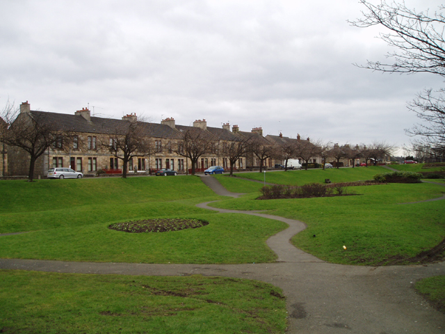
Bonnybridge is a small town located in Stirlingshire, Scotland. Situated approximately 6 miles east of Falkirk, it lies on the banks of the Forth and Clyde Canal. With a population of around 6,000 residents, Bonnybridge is a relatively close-knit community.

The town has a rich history, dating back to Roman times when it served as a strategic location for the Antonine Wall. Today, remnants of this ancient wall can still be seen in the surrounding countryside. During the Industrial Revolution, Bonnybridge became an important center for coal mining and ironworks, which contributed to its growth and development.

One of the notable landmarks in Bonnybridge is the Bonnybridge UFO trail, which attracts visitors interested in extraterrestrial phenomena. The area has gained a reputation for being a hotspot for UFO sightings, with numerous reported incidents over the years. As a result, it has become a popular destination for enthusiasts and researchers.

In terms of amenities, Bonnybridge offers a range of local shops, schools, and community facilities. The town is well-connected to surrounding areas through road and rail links, making it easily accessible for commuters. Additionally, the nearby Falkirk Wheel and the Kelpies, iconic horse-head sculptures, are popular tourist attractions that are easily reachable from Bonnybridge.

Overall, Bonnybridge is a historic town with a charming community spirit. Its blend of natural landscapes, industrial heritage, and the allure of UFO sightings make it a unique destination within Stirlingshire.

If you have any feedback on the listing, please let us know in the comments section below.
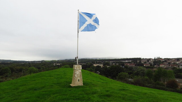
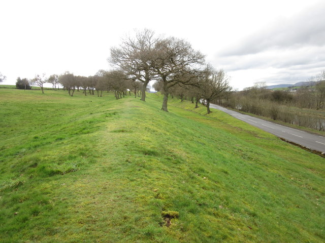
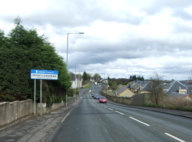
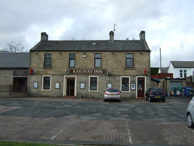
Bonnybridge Images

Images are sourced within 2km of 56.001946/-3.890794 or Grid Reference NS8280. Thanks to Geograph Open Source API. All images are credited.

Cowden Hill Trig Point at Bonnybridge
Bridge Street, Bonnybridge
Canalbank Workshops and Offices Appears to be sole remains of former foundry
Canalbank Workshops and Offices
Appears to be sole remains of former foundry
New apartment block on Falkirk Road On site of Bonnybridge Social Club
New apartment block on Falkirk Road
On site of Bonnybridge Social Club
Bonnyside Road A mixture of older cottages and new build houses
Bonnyside Road
A mixture of older cottages and new build houses
Forth & Clyde Canal: Bonnybridge Looking to the lifting bridge
Forth & Clyde Canal: Bonnybridge
Looking to the lifting bridge
Field of Wheat Stretching from canal to A803
Field of Wheat
Stretching from canal to A803
Canal with railway line beyond Train heading east
Canal with railway line beyond
Train heading east
Marshy wedge Lower area left uncultivated
Marshy wedge
Lower area left uncultivated
Canal outflow Feeds into Rowan Tree Burn
Canal outflow
Feeds into Rowan Tree Burn
Modern milestone The last of the Millennium milestones, distance markers, travelling eastwards on the Forth Clyde canal before reaching the Falkirk Wheel.  It is near the lifting bridge taking the road over the canal.  All the plates on the stones on the main Forth Clyde route have distances in kilometres.    A couple of plaques on the Port Dundas branch into Glasgow have the distances in miles.  All the plaques are set onto large uneven rectangular blocks of stone.
Modern milestone
The last of the Millennium milestones, distance markers, travelling eastwards on the Forth Clyde canal before reaching the Falkirk Wheel. It is near the lifting bridge taking the road over the canal. All the plates on the stones on the main Forth Clyde route have distances in kilometres. A couple of plaques on the Port Dundas branch into Glasgow have the distances in miles. All the plaques are set onto large uneven rectangular blocks of stone.
Signage - M80 southbound
View from a Glasgow-Stirling train - High Bonnybridge View north at the village and in the distance, the newly erected gantries on the Edinburgh-Glasgow main line. They also mark the site (far left of picture) of the former Bonnybridge High railway station.
View from a Glasgow-Stirling train - High Bonnybridge
View north at the village and in the distance, the newly erected gantries on the Edinburgh-Glasgow main line. They also mark the site (far left of picture) of the former Bonnybridge High railway station.
St Helen's Loch Viewed from a Glasgow bound train.
St Helen's Loch
Viewed from a Glasgow bound train.
Antonine Wall, Seabegs Wood One of the best preserved sections of the Antonine Wall, the ditch and rampart remains clearly defined.
Antonine Wall, Seabegs Wood
One of the best preserved sections of the Antonine Wall, the ditch and rampart remains clearly defined.
Entering Dennyloanhead On Glasgow Road (A803).
Entering Dennyloanhead
On Glasgow Road (A803).
The Railway Inn, Dennyloanhead On Glasgow Road (A803).
The Railway Inn, Dennyloanhead
On Glasgow Road (A803).
Houses on the B816, Bonnybridge
Show me another place!

Bonnybridge is located at Grid Ref: NS8280 (Lat: 56.001946, Lng: -3.890794)

Unitary Authority: Falkirk

Police Authority: Forth Valley

What 3 Words

///reverses.apprehend.admiringly. Near Bonnybridge, Falkirk

Related Wikis

Bonnybridge Central railway station

Bonnybridge Central railway station served the village of Bonnybridge, Falkirk, Scotland from 1888 to 1935 on the Kilsyth and Bonnybridge Railway. ��2...

Bonnybridge

Bonnybridge (Scottish Gaelic: Drochaid Bhunaich; Scots: Bonniebrig) is a village in the Falkirk council area of Scotland. It is 4.0 miles (6.4 km) west...

Bonnybridge railway station

Bonnybridge railway station was a railway station serving the village of Bonnybridge in central Scotland. The station was located on a short branch off...

Greenhill, Falkirk

Greenhill is a village which lies in the Falkirk council area of Scotland. The village is located on the outskirts of Bonnybridge, 4.3 miles (6.9 km) west...

Nearby Amenities

Located within 500m of 56.001946,-3.890794
Bonnybridge
Name En: Bonnybridge
Name Gd: Drochaid Bhuinne
Name Sco: Bonnybrig
Place: town
Wikidata: Q1014515
Wikipedia: en:Bonnybridge
Lat/Long: 56.0014357/-3.8876642
Mini Roundabout
Direction: clockwise
Lat/Long: 56.0012495/-3.8865576
Crossing
Crossing: uncontrolled
Crossing Markings: zebra
Crossing Ref: zebra
Tactile Paving: yes
Lat/Long: 56.001372/-3.8875236
Mini Roundabout
Direction: clockwise
Lat/Long: 56.0019922/-3.8948099
Access: yes
Barrier: lift_gate
Horse: no
Lift Gate Type: double
Lat/Long: 55.9992011/-3.8869077
Mini Roundabout
Direction: clockwise
Lat/Long: 56.0030952/-3.893593
Mini Roundabout
Direction: clockwise
Lat/Long: 56.0026369/-3.8949451
Post Office
Bonnybridge Post Office
Addr Postcode: FK4 1BX
Brand: Post Office
Brand Wikidata: Q1783168
Operator: Scotmid
Ref Pol Id: 3187
Source: OS OpenData StreetView
Wheelchair: limited
Lat/Long: 56.001068/-3.8881662
Give Way
Direction: forward
Lat/Long: 56.0022376/-3.896512
Noexit: yes
Lat/Long: 56.0029034/-3.8960806
Turning Circle
Source: Bing
Lat/Long: 55.9999213/-3.8944534
Turning Circle
Lat/Long: 56.0004977/-3.8926033
Noexit: yes
Lat/Long: 56.0009522/-3.8935646
Noexit: yes
Lat/Long: 56.0008442/-3.892481
Noexit: yes
Lat/Long: 56.0046311/-3.896464
Noexit: yes
Lat/Long: 56.0041632/-3.8957909
Turning Circle
Lat/Long: 56.0036726/-3.8876894
Noexit: yes
Lat/Long: 55.9987601/-3.8858905
Entrance: yes
Lat/Long: 56.0037942/-3.887629
Noexit: yes
Lat/Long: 56.0015688/-3.8920724
Social Facility
Roots Helping Hands Foodshare
Addr City: Bonnybridge
Addr Housename: Bonnybridge Community Centre
Addr Postcode: FK4 1AA
Addr Street: Bridge Street
Contact Facebook: https://www.facebook.com/groups/358729521373824/
Description: No referral required
Phone: +44 7808054211
Social Facility: food_bank
Lat/Long: 56.0005171/-3.8886105
Noexit: yes
Lat/Long: 56.001287/-3.8878822
Addr City: Bonnybridge
Addr Postcode: FK4 1AA
Addr Street: Bridge Street
Lat/Long: 56.000265/-3.8880835
Noexit: yes
Lat/Long: 56.0036686/-3.8891396
Waste Basket
Colour: brown
Material: metal
Survey Date: 2020-10-10
Waste: trash
Lat/Long: 56.0010289/-3.8857434
Bench
Backrest: yes
Colour: brown
Material: wood
Seats: 3
Survey Date: 2020-10-10
Lat/Long: 56.0011984/-3.8856635
Bench
Backrest: yes
Colour: brown
Material: wood
Seats: 3
Survey Date: 2020-10-10
Lat/Long: 56.0015599/-3.8854141
Noexit: yes
Lat/Long: 56.0022359/-3.8915603
Bonnybridge Central
Historic Railway: station
Railway: site
Wikidata: Q79802671
Wikipedia: en:Bonnybridge Central railway station
Lat/Long: 56.0024066/-3.8896676
Bench
Lat/Long: 56.0015495/-3.8864557
Bench
Lat/Long: 56.0015593/-3.8865536
Bench
Lat/Long: 56.0014768/-3.8864584
Historic: memorial
Lat/Long: 56.001548/-3.886103
Historic: memorial
Lat/Long: 56.0015233/-3.8864879
Historic: memorial
Lat/Long: 56.0014835/-3.886913
Access: yes
Barrier: lift_gate
Horse: no
Lift Gate Type: double
Lat/Long: 55.9993028/-3.8871473
Generator Method: photovoltaic
Generator Output Electricity: yes
Generator Source: solar
Generator Type: solar_photovoltaic_panel
Power: generator
Lat/Long: 56.0042209/-3.8855092
Generator Method: photovoltaic
Generator Output Electricity: yes
Generator Source: solar
Generator Type: solar_photovoltaic_panel
Power: generator
Lat/Long: 56.0039694/-3.8963514
Generator Method: photovoltaic
Generator Output Electricity: yes
Generator Source: solar
Generator Type: solar_photovoltaic_panel
Power: generator
Lat/Long: 56.0040831/-3.8974082
Post Box
Collection Times: Mo-Fr 09:00; Sa 07:00
Operator: Royal Mail
Post Box Type: wall
Ref: FK4 83D
Royal Cypher: scottish_crown
Lat/Long: 56.001942/-3.8923171
Atm
Fee: no
Opening Hours: 24/7
Wheelchair: yes
Lat/Long: 56.0012597/-3.8882938
Post Box
Collection Times: Mo-Fr 16:45; Sa 11:00
Operator: Royal Mail
Post Box Type: pillar
Ref: FK4 123
Royal Cypher: scottish_crown
Lat/Long: 56.0012813/-3.8883749
1 Stop Laundry Shop
Laundry Service: yes
Shop: laundry
Lat/Long: 55.9990304/-3.8850389
Atm
Brand: Tesco
Opening Hours: 24/7
Operator: Tesco
Lat/Long: 56.00084/-3.8875207
Noexit: yes
Lat/Long: 56.0014662/-3.8905871
Bus Stop
Bench: no
Naptan AtcoCode: 66903300026
Naptan NaptanCode: 32525829
Shelter: no
Lat/Long: 56.0016402/-3.888609
Dickson Middleton
Office: accountant
Lat/Long: 56.0008978/-3.8867596
Zassica
Shop: beauty
Lat/Long: 56.0010253/-3.8865584
Peach Hair
Shop: hairdresser
Lat/Long: 56.0011025/-3.8864458
Auto Doctor
Shop: car_repair
Lat/Long: 56.0002768/-3.8871217
Bus Stop
Bench: yes
Layby: yes
Naptan AtcoCode: 66903300029
Naptan NaptanCode: 32525923
Shelter: yes
Lat/Long: 56.0006083/-3.8870855
Noexit: yes
Lat/Long: 56.0001446/-3.8877364
Give Way
Direction: forward
Lat/Long: 56.00335/-3.8954983
Noexit: yes
Lat/Long: 56.0039138/-3.8963002
Give Way
Direction: backward
Lat/Long: 56.0036865/-3.895506
Generator Method: photovoltaic
Generator Output Electricity: yes
Generator Source: solar
Generator Type: solar_photovoltaic_panel
Power: generator
Lat/Long: 56.002212/-3.8847934
Generator Method: photovoltaic
Generator Output Electricity: yes
Generator Source: solar
Generator Type: solar_photovoltaic_panel
Power: generator
Lat/Long: 56.0020771/-3.8846674
The data included in this document is from www.openstreetmap.org. The data is made available under ODbL.

Have you been to Bonnybridge?

Leave your review of Bonnybridge below (or comments, questions and feedback).