Swalecliffe

Settlement in Kent Canterbury

England

Swalecliffe

Coastguard Lookout
Coastguard Lookout Credit: Alex McGregor

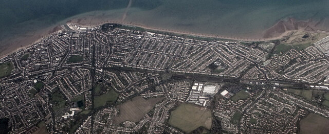
Swalecliffe is a small coastal village located in the county of Kent, England. Situated on the north coast of Kent, it lies approximately 3 miles west of the popular seaside town of Herne Bay. The village is bordered by the Swalecliffe Brook to the east and the Whitstable and Herne Bay Golf Club to the west.

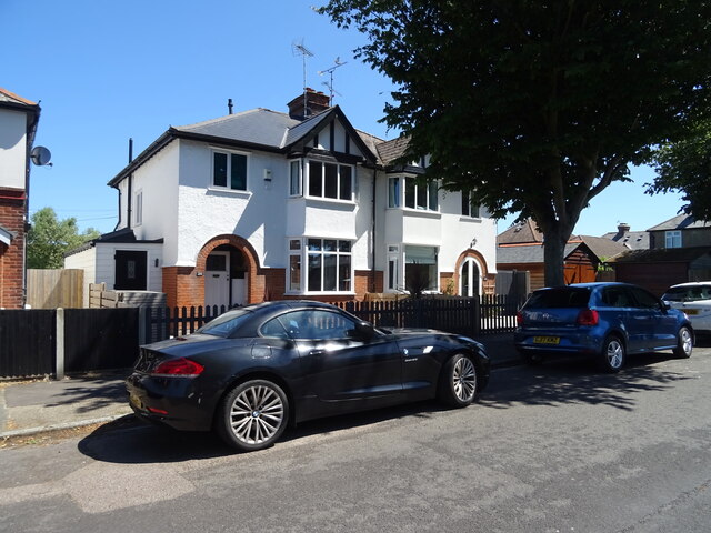
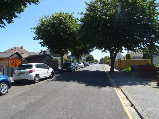
Swalecliffe is primarily a residential area with a population of around 6,000 people. It offers a peaceful and picturesque setting, surrounded by beautiful countryside and stunning coastal landscapes. The village has a strong community spirit and benefits from a range of local amenities including a primary school, a post office, a convenience store, and a selection of small shops and businesses.

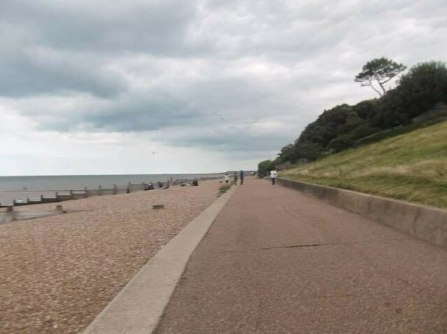
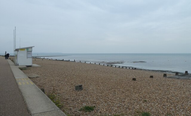
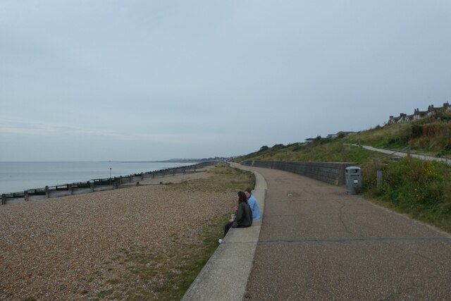
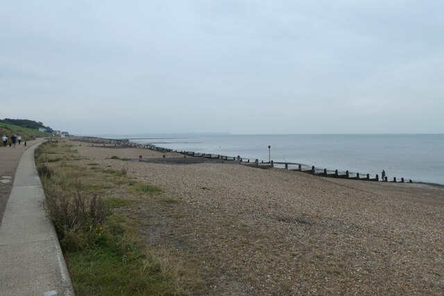
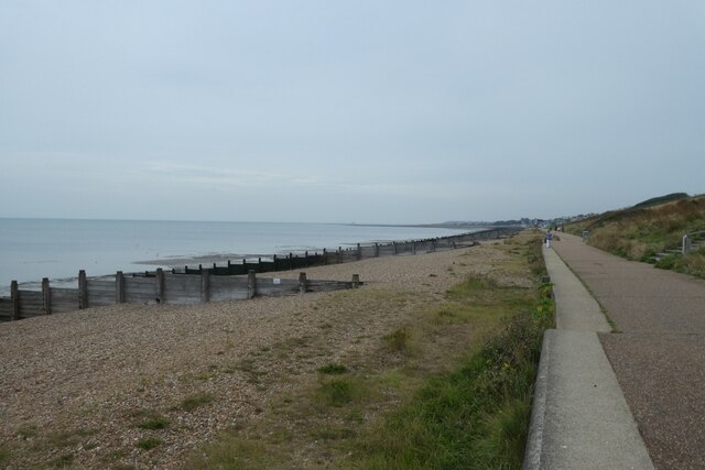
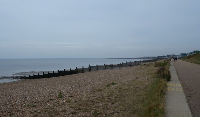
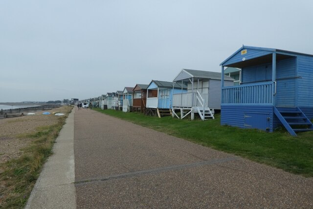
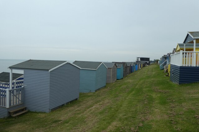
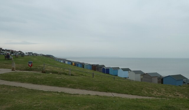
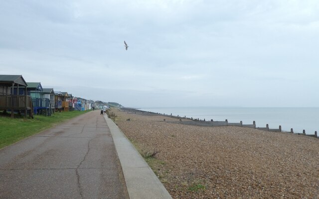
One of the main attractions of Swalecliffe is its close proximity to the beach. The village boasts a long stretch of sandy shoreline, perfect for relaxing walks, picnics, and enjoying the panoramic views of the North Sea. The beach is a popular spot for water sports enthusiasts, with opportunities for windsurfing, sailing, and jet skiing.

Swalecliffe is well-connected to other parts of Kent and beyond. The nearby Herne Bay railway station provides regular train services to London and Canterbury, making it a convenient location for commuters. Additionally, the village is served by several bus routes, linking it to the surrounding towns and villages.

Overall, Swalecliffe offers a tranquil and scenic place to live, with its beautiful coastline, community spirit, and convenient transport links making it an appealing destination for both residents and visitors.

If you have any feedback on the listing, please let us know in the comments section below.
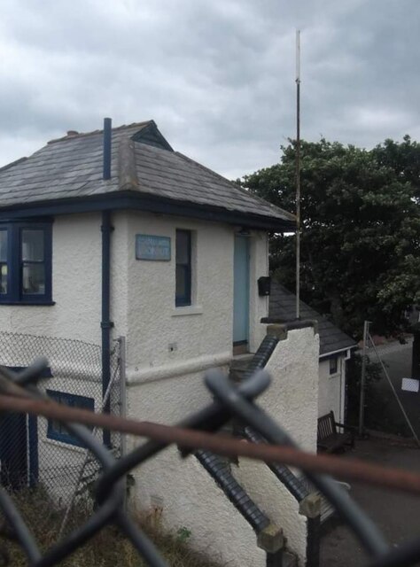
Swalecliffe Images

Images are sourced within 2km of 51.36628/1.068602 or Grid Reference TR1367. Thanks to Geograph Open Source API. All images are credited.

Coastguard Lookout
Coastguard Lookout
Saxon Shore Way
Saxon Shore Way
Lifeguard lookout Looking across part of Tankerton Beach.
Lifeguard lookout
Looking across part of Tankerton Beach.
Cycle path beside Tankerton Beach Looking along the cycle path on the sea front.
Cycle path beside Tankerton Beach
Looking along the cycle path on the sea front.
Tankerton Beach Looking across part of the shingle beach.
Tankerton Beach
Looking across part of the shingle beach.
Path along the sea wall Looking across part of Tankerton Beach.
Path along the sea wall
Looking across part of Tankerton Beach.
Shingle on Tankerton Beach Looking east along the beach.
Shingle on Tankerton Beach
Looking east along the beach.
Beach huts and cycle path Looking along the path beside Tankerton Beach.
Beach huts and cycle path
Looking along the path beside Tankerton Beach.
Rows of beach huts Looking along lines of beach huts beside Tankerton Beach.
Rows of beach huts
Looking along lines of beach huts beside Tankerton Beach.
Above Tankerton Beach Looking down towards Tankerton Beach from a little cafe.
Above Tankerton Beach
Looking down towards Tankerton Beach from a little cafe.
West along the beach Looking along Tankerton Beach towards Whitstable.
West along the beach
Looking along Tankerton Beach towards Whitstable.
Whitstable from the air Tankerton and its beach are prominent in this view which was taken from a Gatwick bound flight from Prague.

See also <a href="https://www.geograph.org.uk/photo/7091170">TR1265 : Whitstable from the air</a>.
Whitstable from the air
Tankerton and its beach are prominent in this view which was taken from a Gatwick bound flight from Prague. See also TR1265 : Whitstable from the air.
8, St Anne's Road This view shows the former house that occupied <a href="https://www.geograph.org.uk/photo/6389889">TR1167 : 8, St Anne’s Road</a>.
8, St Anne's Road
This view shows the former house that occupied TR1167 : 8, St Anne’s Road.
1-3, St Anne’s Road Planning permission has been granted by Canterbury City Council under application number CA/22/00815 for the “erection of a mixed use commercial and residential development providing a retail unit, restaurant and 8 residential apartments including associated external works following demolition of existing building”.
1-3, St Anne’s Road
Planning permission has been granted by Canterbury City Council under application number CA/22/00815 for the “erection of a mixed use commercial and residential development providing a retail unit, restaurant and 8 residential apartments including associated external works following demolition of existing building”.
83, Tankerton Road This view shows <a href="https://www.geograph.org.uk/photo/6389246">TR1167 : 83, Tankerton Road</a> during its construction. It is partly occupied, on the ground floor, by Retreat Whitstable, a beauty salon.
83, Tankerton Road
This view shows TR1167 : 83, Tankerton Road during its construction. It is partly occupied, on the ground floor, by Retreat Whitstable, a beauty salon.
Tankerton Circus The name given for the roundabout; the white building beyond is an apartment block with a small portion of the ground floor for retail sales.
Tankerton Circus
The name given for the roundabout; the white building beyond is an apartment block with a small portion of the ground floor for retail sales.
Houses on Graystone Road, Whitstable
Graystone Road, Whitstable
Show me another place!

Swalecliffe is located at Grid Ref: TR1367 (Lat: 51.36628, Lng: 1.068602)

Administrative County: Kent

District: Canterbury

Police Authority: Kent

What 3 Words

///bumps.paused.agenda. Near Tankerton, Kent

Nearby Locations

Long Rock Swalecliffe

Related Wikis

Swalecliffe

Swalecliffe is a part of the ribbon development of the north Kent coast between Whitstable and Herne Bay in Southeast England. It forms Swalecliffe ward...

Chestfield & Swalecliffe railway station

Chestfield and Swalecliffe railway station is on the Ramsgate branch of the Chatham Main Line in England, serving the villages of Chestfield, Swalecliffe...

Heart Kent

Heart Kent (previously Invicta FM) was an Independent Local Radio station owned and operated by Global Radio as part of the Heart network. It broadcast...

Chestfield

Chestfield is a village (and civil parish and with Swalecliffe a district council ward) in the Canterbury District of Kent, England. The parish is centred...

Tankerton

Tankerton (formerly Tankerton-on-Sea) is a suburb of Whitstable in Kent in south-east England. It was designed in the late 19th century as the train network...

Hampton-on-Sea

Hampton-on-Sea is a drowned and abandoned village in what is now the Hampton area of Herne Bay, Kent. It grew from a tiny fishing hamlet in 1864 at the...

Hampton, Herne Bay

Hampton is the coastal west end of Herne Bay, Kent, England. Formerly the site of the village of Hampton-on-Sea, the settlement is underwater due to massive...

All Saints Church, Whitstable

All Saints Church is a Church of England church in Whitstable, Kent. It is one of five Church of England churches in the Whitstable Team Ministry. There...

Related Videos

Park Holidays Camping Pods Tour

Park Holidays Camping Pods Tour We stayed at Park Holidays Seaview in Kent in one of their new camping pods and in this ...

Tankerton, Whitstable, a Walking History Tour Guide Using Postcards Kent UK

Tankerton, Whitstable, Kent, UK, A walking history tour guide of Tankerton using old postcards. Would really appreciate it if you ...

#whitstable Morning Walk along Tankerton Beach

Tankerton Beach, Whitstable #whitstable #移民英國#beach #kent.

Nearby Amenities

Located within 500m of 51.36628,1.068602
Post Box
Brand: Royal Mail
Brand Wikidata: Q638098
Collection Times: Mo-Fr 09:00; Sa 07:00
Operator: Royal Mail
Operator Wikidata: Q638098
Post Box Mounting: brick_pillar
Post Box Type: wall
Postal Code: CT5
Ref: CT5 299
Royal Cypher: GVIR
Royal Cypher Wikidata: Q33102169
Source: survey
Lat/Long: 51.3638922/1.0713342
Swalecliffe
Is In: Kent, England, UK
Place: village
Source: NPE maps
Wikidata: Q3506407
Lat/Long: 51.3660446/1.0681869
Post Box
Postal Code: CT5
Ref: CT5 90
Source: survey
Lat/Long: 51.3631967/1.0666617
Barrier: bollard
Lat/Long: 51.3619938/1.0669268
Bus Stop
The Plough
Naptan AtcoCode: 2400A048780A
Naptan Bearing: SW
Naptan CommonName: The Plough
Naptan Indicator: adj
Naptan Landmark: The Plough PH
Naptan NaptanCode: kntgajgm
Naptan PlusbusZoneRef: HRNEBAY
Naptan Street: St Johns Road
Naptan Verified: no
Source: naptan_import
Lat/Long: 51.3637127/1.0710171
Bus Stop
The Plough
Naptan AtcoCode: 2400A048790A
Naptan Bearing: NE
Naptan CommonName: The Plough
Naptan Indicator: opp
Naptan Landmark: The Plough PH
Naptan NaptanCode: kntgajgp
Naptan PlusbusZoneRef: HRNEBAY
Naptan Street: St Johns Road
Naptan Verified: no
Source: naptan_import
Lat/Long: 51.3643042/1.0719968
Barrier: cycle_barrier
Lat/Long: 51.3639431/1.0714204
Generator Method: photovoltaic
Generator Output Electricity: yes
Generator Solar Modules: 10
Generator Source: solar
Generator Type: solar_photovoltaic_panel
Location: roof
Power: generator
Lat/Long: 51.3653171/1.0725986
Generator Method: photovoltaic
Generator Output Electricity: yes
Generator Source: solar
Generator Type: solar_photovoltaic_panel
Location: roof
Power: generator
Lat/Long: 51.3655148/1.072252
Generator Output Electricity: yes
Generator Solar Modules: 16
Generator Source: solar
Generator Type: solar_photovoltaic_panel
Location: roof
Power: generator
Lat/Long: 51.3646034/1.0734207
Generator Method: photovoltaic
Generator Output Electricity: yes
Generator Source: solar
Generator Type: solar_photovoltaic_panel
Location: roof
Power: generator
Lat/Long: 51.3649868/1.0617122
Generator Method: photovoltaic
Generator Output Electricity: yes
Generator Source: solar
Generator Type: solar_photovoltaic_panel
Location: roof
Power: generator
Lat/Long: 51.3649617/1.0618383
Generator Method: photovoltaic
Generator Output Electricity: yes
Generator Source: solar
Generator Type: solar_photovoltaic_panel
Location: roof
Power: generator
Lat/Long: 51.3649114/1.0620072
Generator Method: photovoltaic
Generator Output Electricity: yes
Generator Solar Modules: 6
Generator Source: solar
Generator Type: solar_photovoltaic_panel
Location: roof
Power: generator
Lat/Long: 51.3628239/1.0664155
Generator Method: photovoltaic
Generator Output Electricity: yes
Generator Solar Modules: 10
Generator Source: solar
Generator Type: solar_photovoltaic_panel
Location: roof
Power: generator
Lat/Long: 51.3631848/1.0673878
Generator Method: photovoltaic
Generator Output Electricity: yes
Generator Solar Modules: 10
Generator Source: solar
Generator Type: solar_photovoltaic_panel
Location: roof
Power: generator
Lat/Long: 51.3630743/1.0662022
Generator Method: photovoltaic
Generator Output Electricity: yes
Generator Source: solar
Generator Type: solar_photovoltaic_panel
Location: roof
Power: generator
Lat/Long: 51.3630927/1.0702765
Generator Method: photovoltaic
Generator Output Electricity: yes
Generator Source: solar
Generator Type: solar_photovoltaic_panel
Location: roof
Power: generator
Lat/Long: 51.3630944/1.0703462
Drinking Water
Lat/Long: 51.3659581/1.0625625
Waste Basket
Lat/Long: 51.3659455/1.0624914
The data included in this document is from www.openstreetmap.org. The data is made available under ODbL.

Have you been to Swalecliffe?

Leave your review of Swalecliffe below (or comments, questions and feedback).