Bolney

Settlement in Sussex Mid Sussex

England

Bolney

Barn at Rout Farm
Barn at Rout Farm Credit: Ian Cunliffe

Bolney is a small village located in the Mid Sussex district of West Sussex, England. Situated approximately 12 miles north of Brighton and 30 miles south of London, it is nestled in the picturesque countryside of the High Weald Area of Outstanding Natural Beauty.

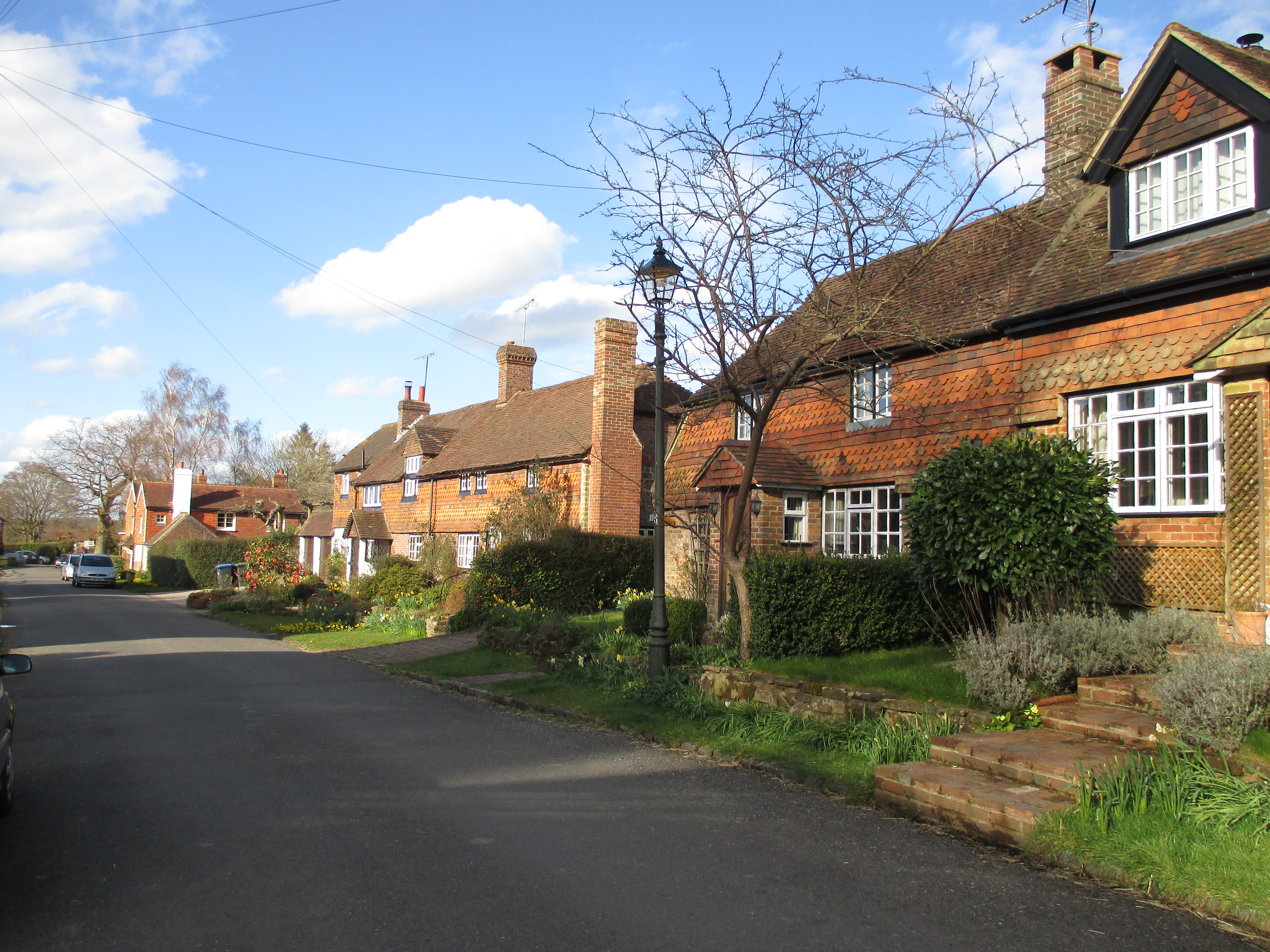
The village is characterized by its rural charm and quintessential English feel. It is surrounded by rolling hills, woodlands, and fields, offering breathtaking views and ample opportunities for outdoor activities such as hiking and cycling. Bolney is also known for its vineyards and wineries, with Bolney Wine Estate being one of the most prominent producers in the region.

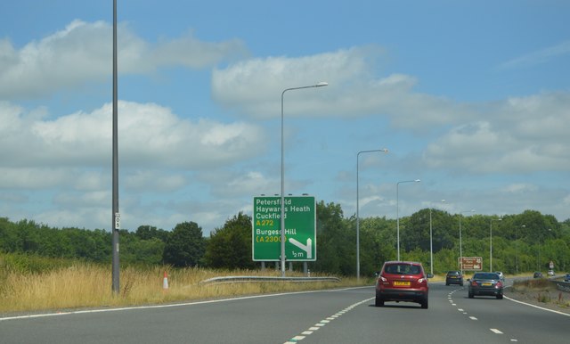
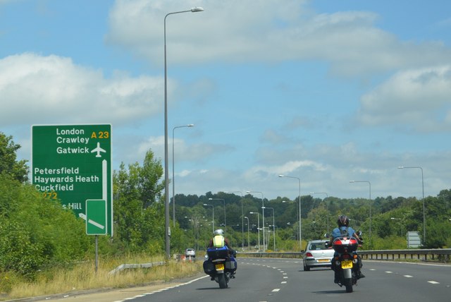
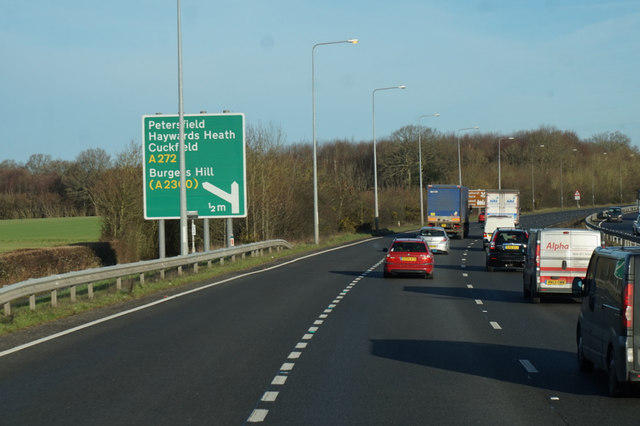
In terms of amenities, Bolney offers a range of local shops and services, including a village pub, a primary school, a post office, and a village hall. The community is tight-knit and vibrant, with various local events and activities taking place throughout the year. The village also has good transport links, with easy access to the A23 and A272 roads, connecting it to nearby towns and cities.

Historically, Bolney has roots dating back to the Roman period, and traces of its past can still be seen today. St. Mary Magdalene Church, a Grade I listed building, stands as a testament to the village's ancient heritage. Bolney is also proud of its agricultural heritage, with farming playing a significant role in shaping the local economy and culture.

Overall, Bolney offers a peaceful and picturesque setting for those seeking a rural retreat while still being within commuting distance of larger urban centers.

If you have any feedback on the listing, please let us know in the comments section below.

Bolney Images

Images are sourced within 2km of 50.995924/-0.203134 or Grid Reference TQ2623. Thanks to Geograph Open Source API. All images are credited.

Barn at Rout Farm
Barn at Rout Farm
A23, northbound The A23 is a 53 mile long road between London and Brighton.
Wikipedia: <span class="nowrap"><a title="http://en.wikipedia.org/wiki/A23_road" rel="nofollow ugc noopener" href="http://en.wikipedia.org/wiki/A23_road">Link</a><img style="margin-left:2px;" alt="External link" title="External link - shift click to open in new window" src="https://s1.geograph.org.uk/img/external.png" width="10" height="10"/></span>
A23, northbound
The A23 is a 53 mile long road between London and Brighton. Wikipedia: LinkExternal link
Broxmead Lane over the A23 The A23 is a 53 mile long road between London and Brighton.
Wikipedia: <span class="nowrap"><a title="http://en.wikipedia.org/wiki/A23_road" rel="nofollow ugc noopener" href="http://en.wikipedia.org/wiki/A23_road">Link</a><img style="margin-left:2px;" alt="External link" title="External link - shift click to open in new window" src="https://s1.geograph.org.uk/img/external.png" width="10" height="10"/></span>
Broxmead Lane over the A23
The A23 is a 53 mile long road between London and Brighton. Wikipedia: LinkExternal link
A23, northbound The A23 is a 53 mile long road between London and Brighton.
Wikipedia: <span class="nowrap"><a title="http://en.wikipedia.org/wiki/A23_road" rel="nofollow ugc noopener" href="http://en.wikipedia.org/wiki/A23_road">Link</a><img style="margin-left:2px;" alt="External link" title="External link - shift click to open in new window" src="https://s1.geograph.org.uk/img/external.png" width="10" height="10"/></span>
A23, northbound
The A23 is a 53 mile long road between London and Brighton. Wikipedia: LinkExternal link
The Stone Floor The remains of Bolney water mill, with a pair of stones still in place. The site has now been cleared.
The Stone Floor
The remains of Bolney water mill, with a pair of stones still in place. The site has now been cleared.
All That Was Left The remains of Bolney water mill, now cleared away.
All That Was Left
The remains of Bolney water mill, now cleared away.
Discarded Casing That once surrounded the stones in the adjacent derelict water mill.
Discarded Casing
That once surrounded the stones in the adjacent derelict water mill.
The Mill Pond The southern tip of the lower mill pond viewed from the dam.
The Mill Pond
The southern tip of the lower mill pond viewed from the dam.
A23 northbound near Bolney
Junction of Cowfold Road and The Street at Bolney A different view is at <a title="https://www.geograph.org.uk/photo/3238031" href="https://www.geograph.org.uk/photo/3238031">Link</a>.
Junction of Cowfold Road and The Street at Bolney
A different view is at Link.
Cowfold Road at Bolney with footpath junction
Footpath goes south from Cowfold Road
Footpath heading south towards Pond Wood
Footpath goes south from south eastern corner of Pond Wood The South Downs are on the horizon.
Footpath goes south from south eastern corner of Pond Wood
The South Downs are on the horizon.
The southern edge of Pond Wood
Looking east across field to woodland The view is across a mill pond which is not visible here.  It can be seen at <a title="https://www.geograph.org.uk/photo/4765652" href="https://www.geograph.org.uk/photo/4765652">Link</a> from 1965.
Looking east across field to woodland
The view is across a mill pond which is not visible here. It can be seen at Link from 1965.
Footpath turns east at field corner
Show me another place!

Bolney is located at Grid Ref: TQ2623 (Lat: 50.995924, Lng: -0.203134)

Administrative County: West Sussex

District: Mid Sussex

Police Authority: Sussex

What 3 Words

///curly.large.spellings. Near Cuckfield, West Sussex

Related Wikis

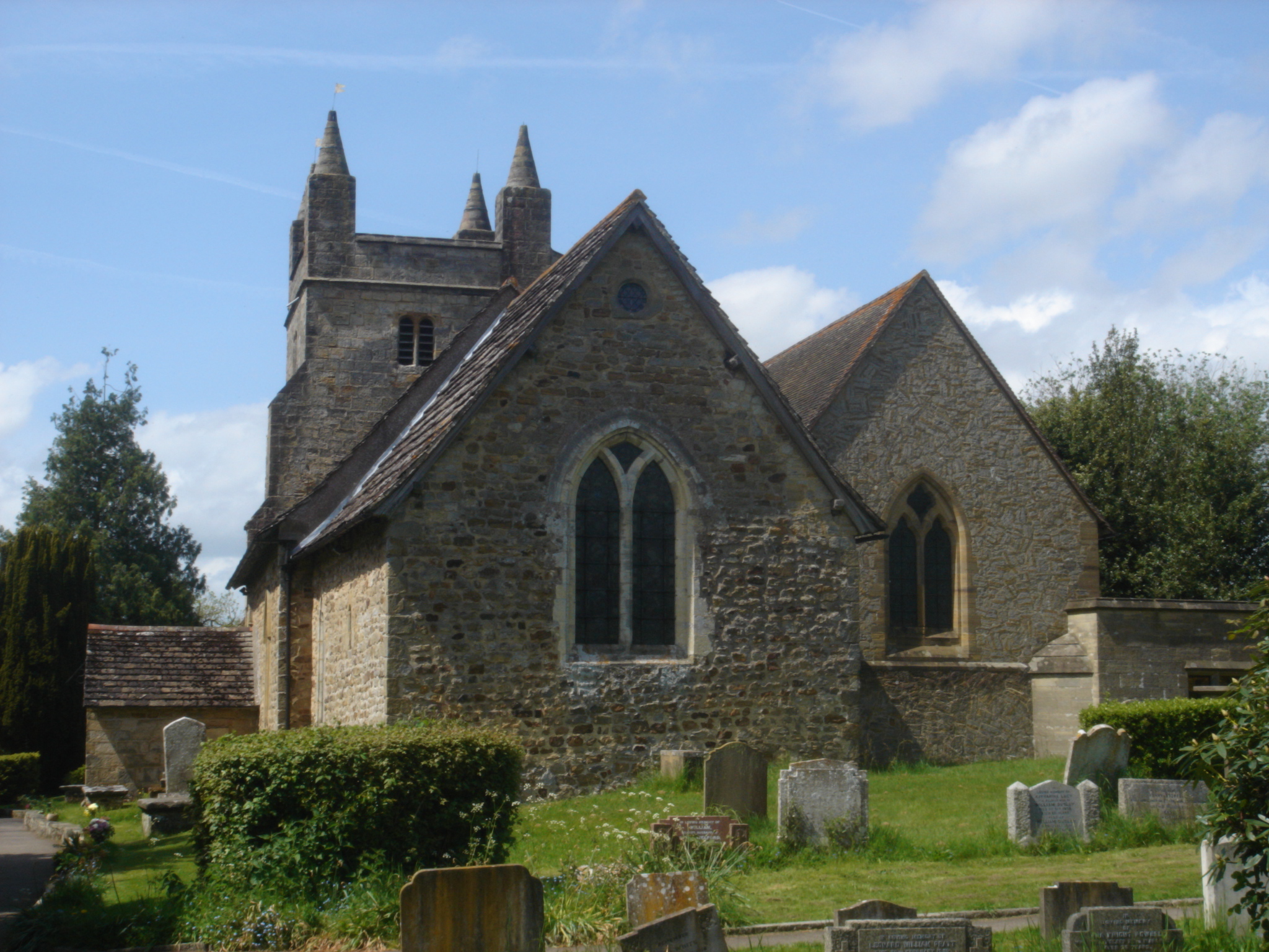
St Mary Magdalene's Church, Bolney

St Mary Magdalene's Church is an Anglican church in the village of Bolney in Mid Sussex, one of seven local government districts in the English county...

Bolney

Bolney is a village and civil parish in the Mid Sussex district of West Sussex, England. It lies 36 miles (58 km) south of London, 11 miles (18 km) north...

Wykehurst Place

Wykehurst Place (or Park) is a Gothic Revival mansion in Bolney, West Sussex, England, resembling more the châteaux of the Loire than an English manor...

Ansty and Staplefield

Ansty and Staplefield, previously Cuckfield Rural, is a civil parish in the Mid Sussex District of West Sussex, England, covering an area from the north...

Colwood, West Sussex

Colwood is a village near Warninglid in West Sussex, England. It is the site of Colwood Manor. == References == The geographic coordinates are from the...

Ansty, West Sussex

Ansty is a village in the Mid Sussex district of West Sussex, England. It lies on the A272 road 1.4 miles (2.2 km) southwest of Cuckfield. It is in the...

Warninglid

Warninglid (historically known as Warninglyth and Warningeld) is a small village in the Mid Sussex District of West Sussex, England. It lies on the B2115...

St Peter's Church, Twineham

St Peter's Church is the Church of England parish church of Twineham, a village in the Mid Sussex District of West Sussex, England. The church, with St...

Nearby Amenities

Located within 500m of 50.995924,-0.203134
Bolney
Place: village
Wikidata: Q2459953
Lat/Long: 50.9954021/-0.2026184
Bus Stop
Ryecroft Road
Bus: yes
Naptan AtcoCode: 4400HR0530
Naptan Bearing: S
Naptan CommonName: Ryecroft Road
Naptan Indicator: Opp
Naptan Landmark: Ryecroft Road
Naptan NaptanCode: wsxawpgd
Naptan ShortCommonName: Bolney Ryecroft Road
Naptan Street: The old A23
Naptan Verified: no
Public Transport: platform
Source: naptan_import
Lat/Long: 50.995381/-0.198308
Bus Stop
Ryecroft Road
Bus: yes
Naptan AtcoCode: 4400HR0531
Naptan Bearing: N
Naptan BusStopType: CUS
Naptan CommonName: Ryecroft Road
Naptan Indicator: adj
Naptan Landmark: Ryecroft Road
Naptan NaptanCode: wsxawpgj
Naptan ShortCommonName: Bolney Ryecroft Road
Naptan Street: The old A23
Naptan Verified: no
Public Transport: platform
Source: naptan_import
Lat/Long: 50.9955168/-0.1984952
Bus Stop
Paynesfield
Bus: yes
Naptan AtcoCode: 4400HR0533
Naptan Bearing: S
Naptan CommonName: Paynesfield
Naptan Indicator: adj Paynesfield
Naptan Landmark: Paynesfield
Naptan NaptanCode: wsxawpgp
Naptan Street: The Street
Naptan Verified: no
Public Transport: platform
Source: naptan_import
Lat/Long: 50.9929673/-0.203737
Bus Stop
Paynesfield
Bus: yes
Naptan AtcoCode: 4400HR0534
Naptan Bearing: N
Naptan CommonName: Paynesfield
Naptan Indicator: opp Paynesfield
Naptan Landmark: Paynesfield
Naptan NaptanCode: wsxawpgt
Naptan Street: The Street
Naptan Verified: no
Public Transport: platform
Source: naptan_import
Lat/Long: 50.9931314/-0.2038874
Barrier: stile
Bicycle: private
Foot: yes
Horse: no
Motor Vehicle: no
Lat/Long: 50.9957786/-0.196128
Barrier: kissing_gate
Lat/Long: 50.9968239/-0.2092857
Post Box
Brand: Royal Mail
Brand Wikidata: Q638098
Brand Wikipedia: en:Royal Mail
Operator: Royal Mail
Operator Wikidata: Q638098
Post Box Type: wall
Ref: RH17 13
Royal Cypher: GR
Royal Cypher Wikidata: Q33102273
Lat/Long: 50.9952206/-0.2030624
Addr City: Haywards Heath
Addr Housename: Hillcrest Cottages
Addr Postcode: RH17 5PY
Addr Street: London Road
Addr Village: Bolney
Lat/Long: 50.9978298/-0.1992197
Addr City: Haywards Heath
Addr Housename: The Nurseries
Addr Postcode: RH17 5PP
Addr Street: Top Street
Addr Village: Bolney
Lat/Long: 50.9973377/-0.1999868
Addr City: Haywards Heath
Addr Housename: Scarps Meadow Cottages
Addr Postcode: RH17 5PJ
Addr Street: The Street
Addr Village: Bolney
Lat/Long: 50.997986/-0.2022895
Addr City: Haywards Heath
Addr Housename: Springfield Cottages
Addr Postcode: RH17 5PN
Addr Street: Top Street
Addr Village: Bolney
Lat/Long: 50.9974947/-0.2024478
Addr City: Haywards Heath
Addr Housename: Queens Mews
Addr Postcode: RH17 5PY
Addr Street: London Road
Addr Village: Bolney
Lat/Long: 50.9955239/-0.1982474
Addr City: Haywards Heath
Addr Housename: Gatehouse
Addr Postcode: RH17 5PF
Addr Street: The Street
Addr Village: Bolney
Lat/Long: 50.9947887/-0.2030352
Addr City: Haywards Heath
Addr Housename: Bolney Lodge Mews
Addr Postcode: RH17 5RT
Addr Street: Foxhole Lane
Addr Village: Bolney
Lat/Long: 50.9965427/-0.2089682
Addr City: Haywards Heath
Addr Housename: Bolney Cottage
Addr Postcode: RH17 5RT
Addr Street: Foxhole Lane
Addr Village: Bolney
Lat/Long: 50.9963789/-0.2095395
Power: pole
Lat/Long: 50.9936898/-0.2066334
Power: pole
Lat/Long: 50.9938873/-0.2076017
Power: pole
Lat/Long: 50.9938183/-0.2088854
Power: pole
Lat/Long: 50.9937867/-0.2053716
Leisure: picnic_table
Lat/Long: 50.9944864/-0.2027997
Leisure: picnic_table
Lat/Long: 50.99446/-0.202767
Leisure: picnic_table
Lat/Long: 50.9944395/-0.2028132
Bench
Lat/Long: 50.9946045/-0.2026007
Charlie's Pedal Shed
Addr City: Bolney
Addr Housename: Millfield
Addr Postcode: RH17 5PP
Addr Street: Top Street
Opening Hours: Mo-Fr 18:00-20:00
Phone: +44 1444 881835; +44 7483854794
Service Bicycle Bicycle Sales And Service: yes
Service Bicycle Parts: yes
Service Bicycle Repair: yes
Shop: bicycle
Lat/Long: 50.9967895/-0.1996162
Bench
Lat/Long: 50.9939541/-0.2018156
Ford: yes
Lat/Long: 50.9939492/-0.2017337
Ford: yes
Lat/Long: 50.9937967/-0.201753
The data included in this document is from www.openstreetmap.org. The data is made available under ODbL.

Have you been to Bolney?

Leave your review of Bolney below (or comments, questions and feedback).