Stanton

Settlement in Northumberland

England

Stanton

Longshaws Farmhouse
Longshaws Farmhouse Credit: Les Hull

Stanton is a small village located in the county of Northumberland, in the northeast of England. Situated in the picturesque Tyne Valley, it is about 15 miles west of the historic city of Newcastle upon Tyne. With a population of around 500 residents, Stanton is a close-knit community with a strong sense of community spirit.

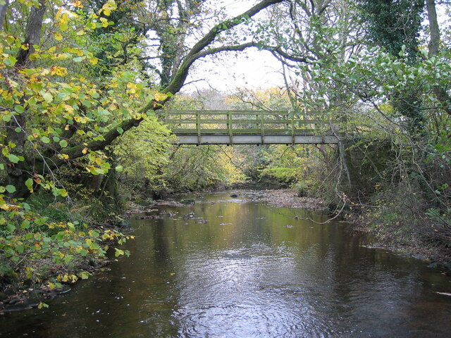
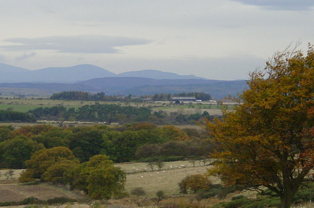
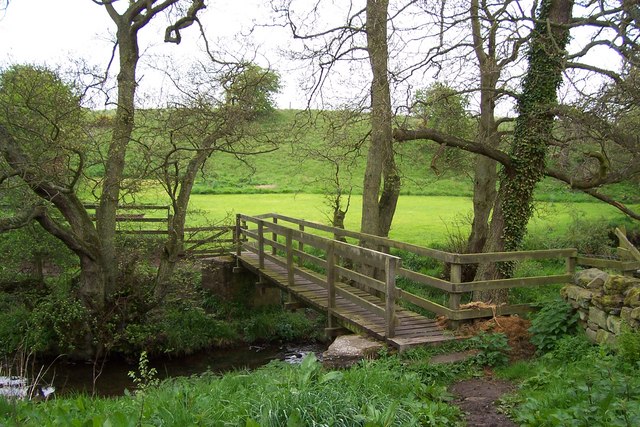
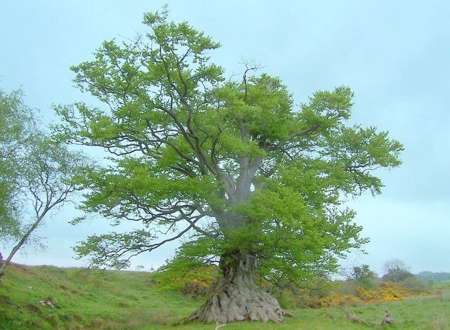
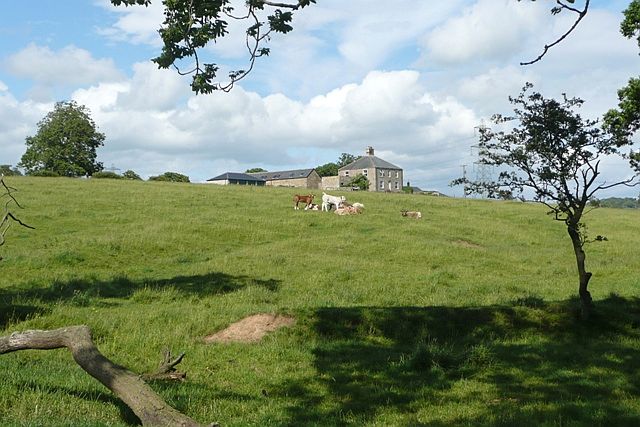
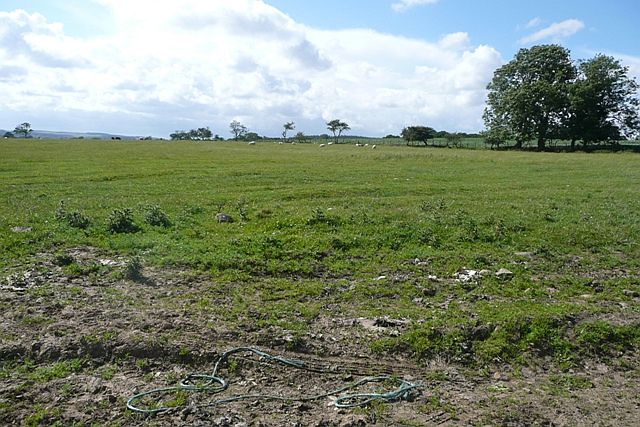
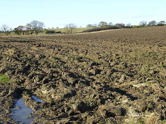
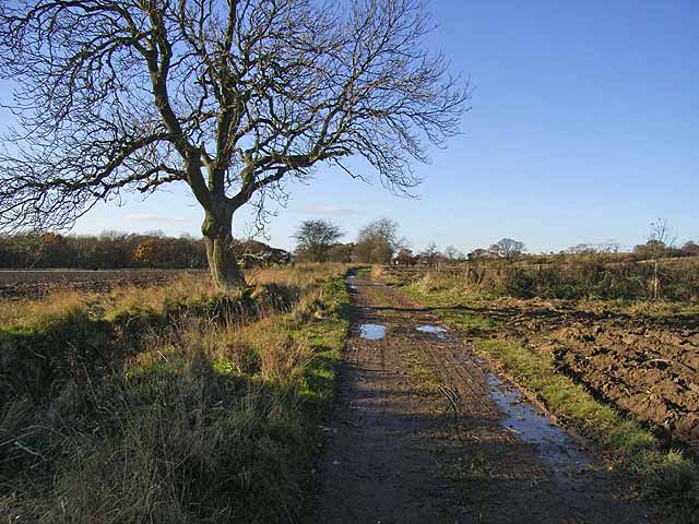
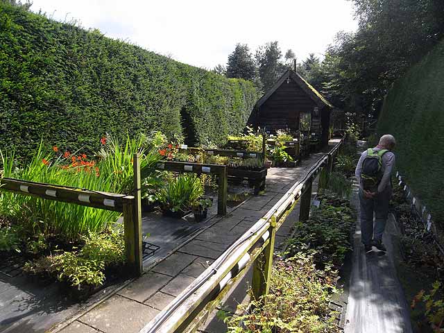
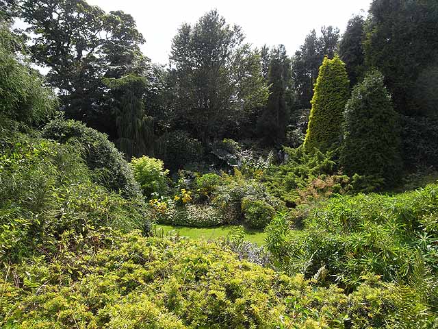
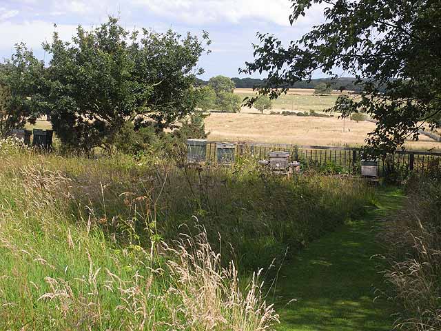
The village is known for its idyllic rural setting, surrounded by rolling hills and scenic countryside. It is particularly popular among nature enthusiasts and outdoor lovers, as it offers ample opportunities for hiking, cycling, and exploring the surrounding natural beauty. The nearby Tyne River is also a popular spot for fishing and boating.

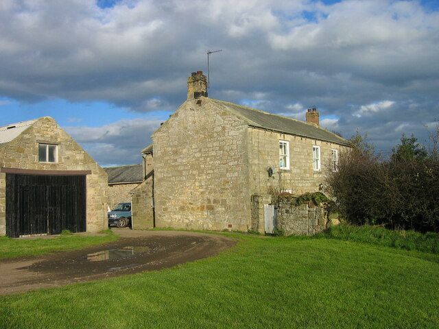
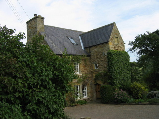
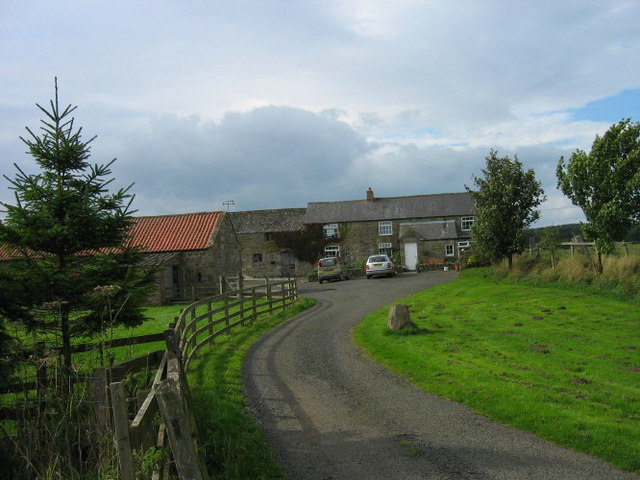
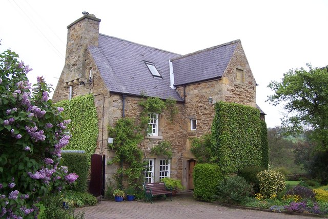
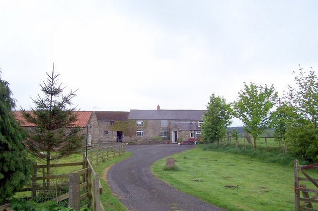
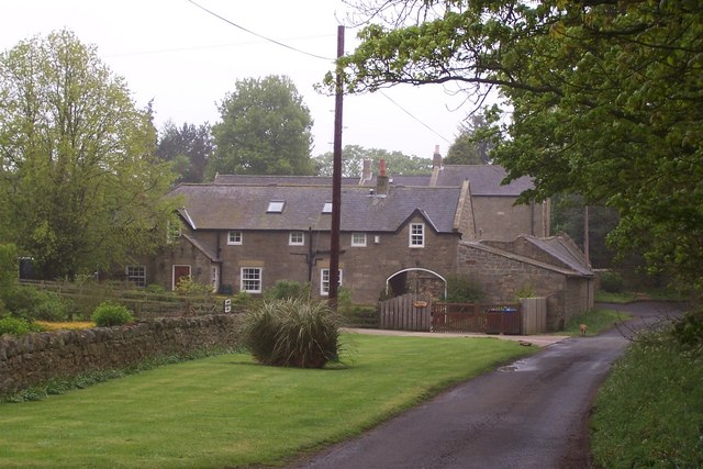
Stanton boasts a rich history, with its origins dating back to medieval times. The village is home to several historic buildings, including a 12th-century church that stands as a testament to its long-standing heritage. Additionally, there are a number of traditional stone houses that add to the charming character of the village.

Despite its small size, Stanton offers a range of amenities for its residents. These include a village hall, a local pub, and a primary school, providing a strong sense of community and convenience. However, for more extensive services and shopping options, residents can easily access nearby towns and cities, including Hexham and Newcastle upon Tyne.

Overall, Stanton is a tranquil and welcoming village that offers a peaceful and picturesque lifestyle for its residents, while also providing easy access to larger urban centers and a range of outdoor activities.

If you have any feedback on the listing, please let us know in the comments section below.

Stanton Images

Images are sourced within 2km of 55.201863/-1.794144 or Grid Reference NZ1389. Thanks to Geograph Open Source API. All images are credited.

Longshaws Farmhouse
Longshaws Farmhouse
Footbridge over the River Font
Looking towards the Cheviots from Stanton.
Witton Shields Tower The Gatehouse Web Site: King writes this is a C17 domestic building, not a fortified tower. Dodds writes it is a late strong house. PastScape report it as "A bastle or fortified house, probably built in the early C17. A stone inscribed with the date 1608 and the initials N T (Nigel Thornton) is set above the door. The rear extensions were added in 1680 and the building was reduced in height by a storey circa 1914. One of the upper rooms of the house was used as a Roman Catholic chapel in the early C17. The house stands in pastureland, overlooking the dene of the Cowclose Burn on the north side, and the valley of the River Font to the south. It is a strongly constructed building of two storeys with a central stair turret and walls 1 metre thick. The rectangular building is built of stone rubble, with a slate roof." Recorded in survey of 1715 as "a large old building bellonging to Jon. Thornton, esq." SMR report that it is possible there was once a small watchtower on the western side of the roof.
Witton Shields Tower
The Gatehouse Web Site: King writes this is a C17 domestic building, not a fortified tower. Dodds writes it is a late strong house. PastScape report it as "A bastle or fortified house, probably built in the early C17. A stone inscribed with the date 1608 and the initials N T (Nigel Thornton) is set above the door. The rear extensions were added in 1680 and the building was reduced in height by a storey circa 1914. One of the upper rooms of the house was used as a Roman Catholic chapel in the early C17. The house stands in pastureland, overlooking the dene of the Cowclose Burn on the north side, and the valley of the River Font to the south. It is a strongly constructed building of two storeys with a central stair turret and walls 1 metre thick. The rectangular building is built of stone rubble, with a slate roof." Recorded in survey of 1715 as "a large old building bellonging to Jon. Thornton, esq." SMR report that it is possible there was once a small watchtower on the western side of the roof.
High Trewitley
High Trewitley
Witton Shields Tower King writes this is a C17 domestic building, not a fortified tower. Dodds writes it is a late strong house. PastScape report it as "A bastle or fortified house, probably built in the early C17. A stone inscribed with the date 1608 and the initials N T (Nigel Thornton) is set above the door. The rear extensions were added in 1680 and the building was reduced in height by a storey circa 1914. One of the upper rooms of the house was used as a Roman Catholic chapel in the early C17. The house stands in pastureland, overlooking the dene of the Cowclose Burn on the north side, and the valley of the River Font to the south. It is a strongly constructed building of two storeys with a central stair turret and walls 1 metre thick. The rectangular building is built of stone rubble, with a slate roof." Recorded in survey of 1715 as "a large old building bellonging to Jon. Thornton, esq." SMR report that it is possible there was once a small watchtower on the western side of the roof.
Witton Shields Tower
King writes this is a C17 domestic building, not a fortified tower. Dodds writes it is a late strong house. PastScape report it as "A bastle or fortified house, probably built in the early C17. A stone inscribed with the date 1608 and the initials N T (Nigel Thornton) is set above the door. The rear extensions were added in 1680 and the building was reduced in height by a storey circa 1914. One of the upper rooms of the house was used as a Roman Catholic chapel in the early C17. The house stands in pastureland, overlooking the dene of the Cowclose Burn on the north side, and the valley of the River Font to the south. It is a strongly constructed building of two storeys with a central stair turret and walls 1 metre thick. The rectangular building is built of stone rubble, with a slate roof." Recorded in survey of 1715 as "a large old building bellonging to Jon. Thornton, esq." SMR report that it is possible there was once a small watchtower on the western side of the roof.
Footbridge over the Cow Close Burn at Witton Shields
Huge Beech with 20ft Bole
High Trewitley farm
High Trewitley farm
Townhead Farm, Stanton
Gallowshaw A cattle grazing area in front of the property of Gallowshaw, which is for sale if you are interested.
Gallowshaw
A cattle grazing area in front of the property of Gallowshaw, which is for sale if you are interested.
West of Gallowshaw From the drive to Gallowshaw.  The square is mainly flat sheep grazing land.
West of Gallowshaw
From the drive to Gallowshaw. The square is mainly flat sheep grazing land.
Ploughed field at Abshield Recently ploughed field in autumn.
Ploughed field at Abshield
Recently ploughed field in autumn.
Farm road from Abshields to Berryhill Although just a farm road, carries the status of a public road, theoretically open to all traffic.
Farm road from Abshields to Berryhill
Although just a farm road, carries the status of a public road, theoretically open to all traffic.
Entrance to Bide-a-Wee Cottage Gardens The entrance and plant sales area of Bide-a-Wee Cottage Gardens <span class="nowrap"><a title="http://www.bideawee.co.uk/" rel="nofollow ugc noopener" href="http://www.bideawee.co.uk/">Link</a><img style="margin-left:2px;" alt="External link" title="External link - shift click to open in new window" src="https://s1.geograph.org.uk/img/external.png" width="10" height="10"/></span> , an impressive and immaculately kept garden open to the public two afternoons a week.
Entrance to Bide-a-Wee Cottage Gardens
The entrance and plant sales area of Bide-a-Wee Cottage Gardens LinkExternal link , an impressive and immaculately kept garden open to the public two afternoons a week.
Bide-a-Wee Cottage Gardens Bide-a-Wee Cottage Gardens <span class="nowrap"><a title="http://www.bideawee.co.uk/" rel="nofollow ugc noopener" href="http://www.bideawee.co.uk/">Link</a><img style="margin-left:2px;" alt="External link" title="External link - shift click to open in new window" src="https://s1.geograph.org.uk/img/external.png" width="10" height="10"/></span> , an impressive and immaculately kept garden open to the public two afternoons a week. The gardens have been developed on the site of a former quarry over the course of the last twenty five years.
Bide-a-Wee Cottage Gardens
Bide-a-Wee Cottage Gardens LinkExternal link , an impressive and immaculately kept garden open to the public two afternoons a week. The gardens have been developed on the site of a former quarry over the course of the last twenty five years.
Beehives at Bide-a-Wee Cottage Gardens Tucked away beyond the visitor area of Bide-a-Wee Cottage Gardens, these beehives overlook open farmland.
Beehives at Bide-a-Wee Cottage Gardens
Tucked away beyond the visitor area of Bide-a-Wee Cottage Gardens, these beehives overlook open farmland.
Old piece of agricultural equipment A disused cattle Crush
Old piece of agricultural equipment
A disused cattle Crush
Show me another place!

Stanton is located at Grid Ref: NZ1389 (Lat: 55.201863, Lng: -1.794144)

Unitary Authority: Northumberland

Police Authority: Northumbria

What 3 Words

///chilled.defensive.cherry. Near Longhorsley, Northumberland

Nearby Locations

Stanton Hall Stanton

Related Wikis

Stanton, Northumberland

Stanton is a small hamlet and former civil parish, now in the parish of Netherwitton, in Northumberland, England, which is located 7 miles (11 km) north...

Pigdon

Pigdon is a hamlet and former civil parish 3 miles (4.8 km) from Morpeth, now in the parish of Meldon, in the county of Northumberland, England. In 1951...

Netherwitton

Netherwitton is a village in Northumberland, England about 8 miles (13 km) west north west of Morpeth. A former cotton-mill now converted into residential...

Netherwitton Hall

Netherwitton Hall is a mansion house, and a Grade I listed building at Netherwitton, near Morpeth, Northumberland, England.The estate was owned by the...

Longhorsley

Longhorsley is a village in Northumberland, England about 7 miles (11 km) northwest of Morpeth, and about 14 miles (23 km) south of Alnwick. The A697 road...

Meldon Park

Meldon Park is a privately owned country mansion situated at Meldon, Northumberland. It is a Grade II* listed building. == Present building == In 1832...

Hart Burn

Hart Burn is a river that flows through Northumberland, England. It is a tributary of the River Wansbeck, is 24 km long and has a catchment area of 45...

Mitford Hall

Mitford Hall is a Georgian mansion house and Grade II* listed building standing in its own 85-acre (34 ha) park overlooking the River Wansbeck at Mitford...

Nearby Amenities

Located within 500m of 55.201863,-1.794144
Stanton
Place: hamlet
Wikidata: Q7600219
Lat/Long: 55.203545/-1.7932842
Power: pole
Lat/Long: 55.1979717/-1.7905988
Power: pole
Lat/Long: 55.1989952/-1.7903258
Power: pole
Lat/Long: 55.2000892/-1.7900339
Power: pole
Lat/Long: 55.2010826/-1.7897689
Power: pole
Lat/Long: 55.2020818/-1.7895023
Power: pole
Lat/Long: 55.2030788/-1.7892363
Power: pole
Lat/Long: 55.2038807/-1.7984043
Power: pole
Lat/Long: 55.2042162/-1.7997481
Power: pole
Lat/Long: 55.2045563/-1.7938748
Power: pole
Lat/Long: 55.2043099/-1.7956612
Power: pole
Lat/Long: 55.2039918/-1.7973458
Selby House Farm Airstrip
Addr City: Stanton
Addr County: Northumberland
Aeroway: airstrip
Lat/Long: 55.2032286/-1.8005
Power: pole
Lat/Long: 55.2041086/-1.7889261
The data included in this document is from www.openstreetmap.org. The data is made available under ODbL.

Have you been to Stanton?

Leave your review of Stanton below (or comments, questions and feedback).