Stansty

Settlement in Denbighshire

Wales

Stansty

Wrexham General station platforms and offices
Wrexham General station platforms and offices Credit: Roy Hughes

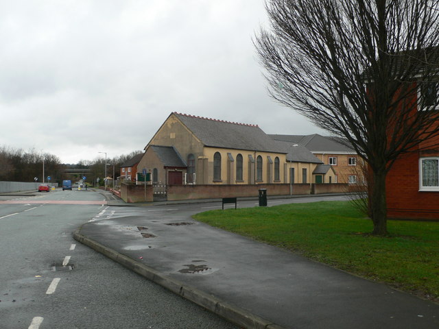
Stansty is a small village located in the county of Denbighshire, in the northeastern part of Wales. It is situated approximately one mile south of Wrexham, the largest town in North Wales, and falls within the community of Offa.

The village is primarily residential, with a mix of housing types ranging from detached houses to small terraced properties. It is known for its peaceful and quiet atmosphere, making it an attractive place to live for families and individuals seeking a tranquil environment.

Stansty is surrounded by picturesque countryside, offering residents the opportunity to enjoy beautiful walks and outdoor activities. The nearby Clywedog Valley Trail is a popular route for walkers and cyclists, providing scenic views of the surrounding landscape.

In terms of amenities, the village has a local convenience store, offering daily essentials to residents. For more extensive shopping needs, the town of Wrexham is easily accessible and provides a wider range of retail options, including supermarkets, boutiques, and shopping centers.

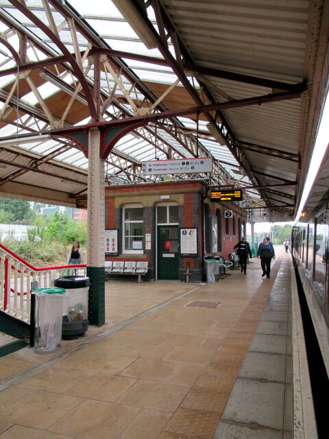
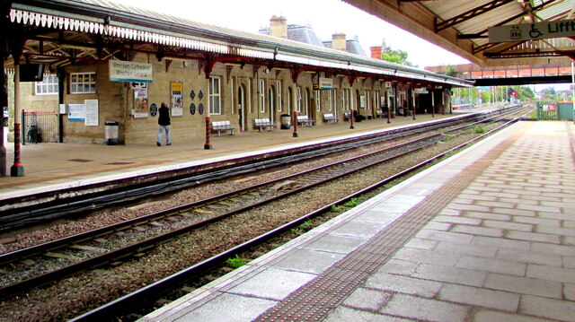
The village benefits from excellent transport links, with the A483 road passing close by, connecting it to the wider region. Wrexham General train station is also conveniently located nearby, providing regular services to destinations across Wales and England.

Overall, Stansty is a charming village with a peaceful ambiance, offering residents a quiet retreat while still being within easy reach of the amenities and services of nearby Wrexham.

If you have any feedback on the listing, please let us know in the comments section below.
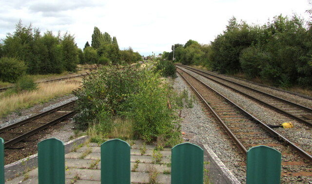
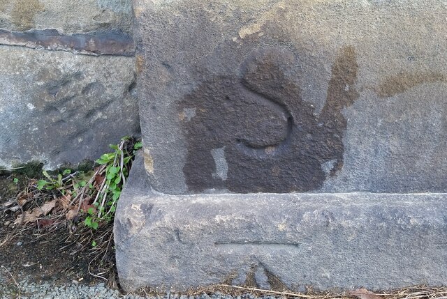
Stansty Images

Images are sourced within 2km of 53.058634/-3.006099 or Grid Reference SJ3251. Thanks to Geograph Open Source API. All images are credited.

Wrexham General station platforms and offices
Wrexham General station and footbridge
Wrexham bus station – 1969 A feature of the bus station was the hand-painted destination boards on the shelters.

Bay 6 is occupied by a venerable Bristol LL5G of Crosville Motor Services (No.SLG191) on one of the routes to Moss. Built in 1950, at the age of 19 it was well beyond the average life of a bus in those days.

This is one of a series of views featuring buses in the 60s, 70s, and 80s. <a title="https://www.geograph.org.uk/search.php?i=137652761" href="https://www.geograph.org.uk/search.php?i=137652761">Link</a>
Wrexham bus station – 1969
A feature of the bus station was the hand-painted destination boards on the shelters. Bay 6 is occupied by a venerable Bristol LL5G of Crosville Motor Services (No.SLG191) on one of the routes to Moss. Built in 1950, at the age of 19 it was well beyond the average life of a bus in those days. This is one of a series of views featuring buses in the 60s, 70s, and 80s. Link
Wrexham General platform 1 This platform is normally used by southbound trains.
Wrexham General platform 1
This platform is normally used by southbound trains.
From 2 to 1 at Wrexham General station Looking south along platform 1 from platform 2.
From 2 to 1 at Wrexham General station
Looking south along platform 1 from platform 2.
Triangular signs at the northern end of Platform 4, Wrexham General station Showing SIGNAL AHEAD CN 945 and CHECK AWS in September 2016.
Triangular signs at the northern end of Platform 4, Wrexham General station
Showing SIGNAL AHEAD CN 945 and CHECK AWS in September 2016.
Railway lines north of Wrexham General station Viewed from the fence here. <a title="https://www.geograph.org.uk/photo/6963517" href="https://www.geograph.org.uk/photo/6963517">Link</a>
Railway lines north of Wrexham General station
Viewed from the fence here. Link
Ordnance Survey Cut Mark This OS cut mark can be found on the post at the end of a wall which is part of the Acton Park Entrance on Chester Road. It marks a point 100.313m above mean sea level.
Ordnance Survey Cut Mark
This OS cut mark can be found on the post at the end of a wall which is part of the Acton Park Entrance on Chester Road. It marks a point 100.313m above mean sea level.
Ordnance Survey Cut Mark This OS cut mark can be found on the wall south side of Prices Lane. It marks a point 84.597m above mean sea level.
Ordnance Survey Cut Mark
This OS cut mark can be found on the wall south side of Prices Lane. It marks a point 84.597m above mean sea level.
Ordnance Survey Cut Mark This OS cut mark can be found on the garage at the rear of No29 Chester Road. It marks a point 84.981m above mean sea level.
Ordnance Survey Cut Mark
This OS cut mark can be found on the garage at the rear of No29 Chester Road. It marks a point 84.981m above mean sea level.
Ordnance Survey Cut Mark This OS cut mark can be found on No36 The Beeches. It marks a point 82.208m above mean sea level.
Ordnance Survey Cut Mark
This OS cut mark can be found on No36 The Beeches. It marks a point 82.208m above mean sea level.
Ordnance Survey Cut Mark This OS cut mark can be found on No19 Park Avenue. It marks a point 82.543m above mean sea level.
Ordnance Survey Cut Mark
This OS cut mark can be found on No19 Park Avenue. It marks a point 82.543m above mean sea level.
Ordnance Survey Cut Mark This very worn OS cut mark can be found on the west side of Chester Road. It marks a point 85.106m above mean sea level.
Ordnance Survey Cut Mark
This very worn OS cut mark can be found on the west side of Chester Road. It marks a point 85.106m above mean sea level.
Ordnance Survey Rivet This OS rivet can be found on the wallof No7 Grove Road. It marks a point 85.335m above mean sea level.
Ordnance Survey Rivet
This OS rivet can be found on the wallof No7 Grove Road. It marks a point 85.335m above mean sea level.
Ordnance Survey Cut Mark This OS cut mark can be found on the wall of No13 Grove Road. It marks a point 85.167m above mean sea level.
Ordnance Survey Cut Mark
This OS cut mark can be found on the wall of No13 Grove Road. It marks a point 85.167m above mean sea level.
Ordnance Survey Cut Mark This very worn OS cut mark can be found at the junction of Grove Road & Chester Road.
Ordnance Survey Cut Mark
This very worn OS cut mark can be found at the junction of Grove Road & Chester Road.
Ordnance Survey Cut Mark This OS cut mark can be found on the wall post west side of Chester Road. It marks a point 85.250m above mean sea level.
Ordnance Survey Cut Mark
This OS cut mark can be found on the wall post west side of Chester Road. It marks a point 85.250m above mean sea level.
Ordnance Survey Cut Mark This OS cut mark can be found on the north face of the Wynnstay Arms Hotel. It marks a point 80.330m above mean sea level.
Ordnance Survey Cut Mark
This OS cut mark can be found on the north face of the Wynnstay Arms Hotel. It marks a point 80.330m above mean sea level.
Show me another place!

Stansty is located at Grid Ref: SJ3251 (Lat: 53.058634, Lng: -3.006099)

Unitary Authority: Wrexham

Police Authority: North Wales

What 3 Words

///happen.diner.fears. Near Wrexham

Nearby Locations

Plas Coch Stansty

Related Wikis

Stansty

Stansty () is an area and electoral ward in Wrexham County Borough, Wales, lying to the immediate north-west of the city of Wrexham. It is a former civil...

Rhosddu Halt railway station

Rhosddu Halt railway station was a station in Rhosddu, Wrexham, Wales. The station was opened in July 1906 and closed on 1 March 1917. Used by workmen...
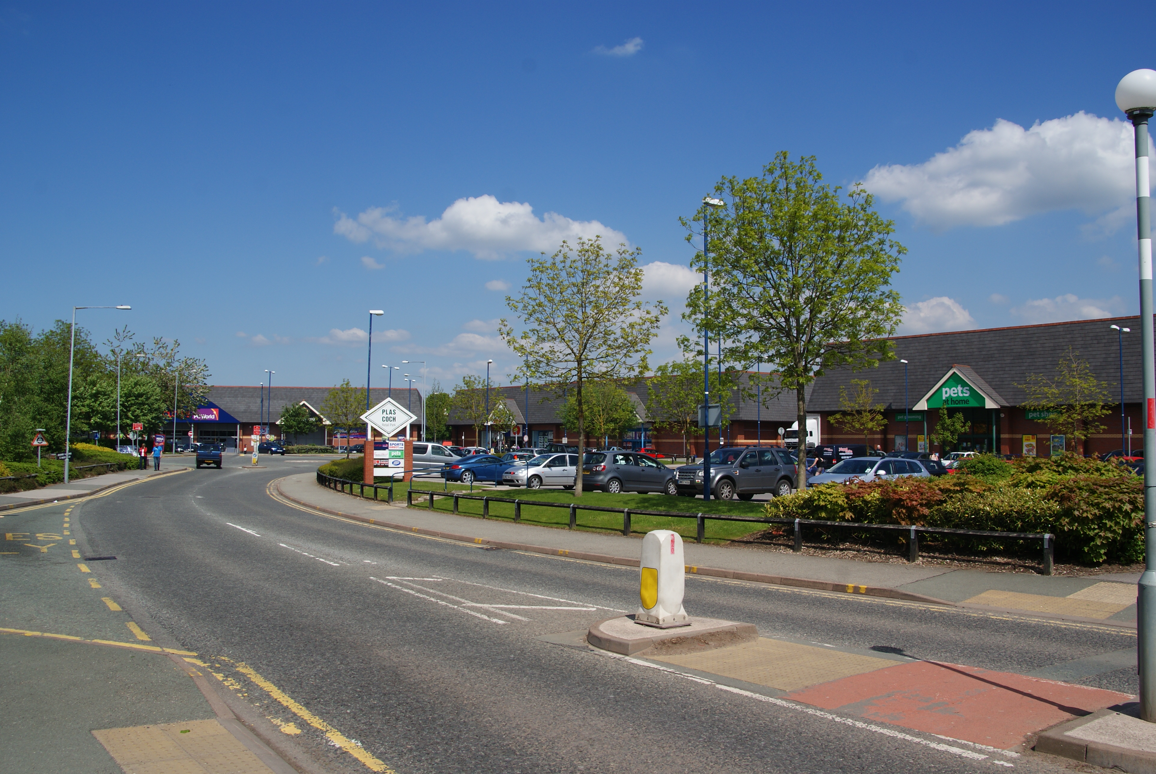
Plas Coch

Plas Coch (Welsh: Plas-coch) is an area of the community of Rhosddu, in the city of Wrexham, Wales. A major retail and educational area of Wrexham, it...

Wrexham Built-up area

The Wrexham Built-up area (also known as the Wrexham Urban Area) is an area of land defined by the United Kingdom Office for National Statistics (ONS)...

Nearby Amenities

Located within 500m of 53.058634,-3.006099
Turning Circle
Turning Circle: square
Lat/Long: 53.0573755/-2.9991666
Pub
The Railway
Wikidata: Q80581864
Lat/Long: 53.0587069/-3.0017115
Turning Circle
Lat/Long: 53.0611901/-3.0045888
Turning Circle
Lat/Long: 53.0599489/-3.0057676
Turning Circle
Lat/Long: 53.0607377/-3.0048352
Turning Circle
Lat/Long: 53.0577992/-3.003894
Turning Circle
Lat/Long: 53.0606603/-3.0034889
Crossing
Crossing: zebra
Lat/Long: 53.0547822/-3.0078397
Recycling
Recycling Cans: yes
Recycling Clothes: yes
Recycling Glass: yes
Recycling Paper: yes
Lat/Long: 53.0560129/-3.0096982
Motorway Junction
Mold Road
Name Cy: Ffordd yr Wyddgrug
Name En: Mold Road
Ref: 5
Source Ref: survey
Lat/Long: 53.0588582/-3.0081446
Crossing
Crossing: zebra
Lat/Long: 53.0567061/-3.0074476
Crossing
Traffic Calming: table
Lat/Long: 53.0544575/-3.005593
Crossing
Crossing: zebra
Lat/Long: 53.0554517/-3.0084782
Barrier: cycle_barrier
Lat/Long: 53.0556642/-3.0010117
Crossing
Crossing: zebra
Lat/Long: 53.0570696/-3.0063468
Crossing
Crossing: zebra
Lat/Long: 53.0567793/-3.0083741
Crossing
Crossing: zebra
Lat/Long: 53.056366/-3.0085332
Crossing
Crossing: zebra
Lat/Long: 53.055946/-3.0086975
Addr City: Wrexham
Addr Housenumber: 71
Addr Street: Crispin Lane
Lat/Long: 53.0554021/-3.0010579
Addr City: Wrexham
Addr Housenumber: 73
Addr Street: Crispin Lane
Lat/Long: 53.0554824/-3.0010499
Addr City: Wrexham
Addr Housenumber: 75
Addr Street: Crispin Lane
Lat/Long: 53.0555213/-3.001089
Addr City: Wrexham
Addr Housenumber: 69
Addr Street: Crispin Lane
Lat/Long: 53.0553728/-3.0010992
Addr City: Wrexham
Addr Housenumber: 93
Addr Street: Crispin Lane
Lat/Long: 53.0557613/-3.0011155
Addr City: Wrexham
Addr Housenumber: 99
Addr Street: Crispin Lane
Lat/Long: 53.0559688/-3.001192
Addr City: Wrexham
Addr Housenumber: 95
Addr Street: Crispin Lane
Lat/Long: 53.0558308/-3.0011432
Addr City: Wrexham
Addr Housenumber: 97
Addr Street: Crispin Lane
Lat/Long: 53.0558993/-3.0011644
Addr City: Wrexham
Addr Housenumber: 101
Addr Street: Crispin Lane
Lat/Long: 53.0560853/-3.0012653
Addr City: Wrexham
Addr Housenumber: 103
Addr Street: Crispin Lane
Lat/Long: 53.0561323/-3.0013093
Addr City: Wrexham
Addr Housenumber: 105
Addr Street: Crispin Lane
Lat/Long: 53.0561851/-3.001363
Addr City: Wrexham
Addr Housenumber: 107
Addr Street: Crispin Lane
Lat/Long: 53.0562624/-3.00142
Addr City: Wrexham
Addr Housenumber: 109
Addr Street: Crispin Lane
Lat/Long: 53.0563632/-3.0015519
Addr City: Wrexham
Addr Housenumber: 111
Addr Street: Crispin Lane
Lat/Long: 53.0564337/-3.0016333
Addr City: Wrexham
Addr Housenumber: 1
Addr Street: Stansty Road
Lat/Long: 53.0565619/-3.0017815
Addr City: Wrexham
Addr Housenumber: 3
Addr Street: Stansty Road
Lat/Long: 53.0566353/-3.0018515
Addr City: Wrexham
Addr Housenumber: 5
Addr Street: Stansty Road
Lat/Long: 53.0567214/-3.0019053
Addr City: Wrexham
Addr Housenumber: 11
Addr Street: Stansty Road
Lat/Long: 53.0569064/-3.0020746
Addr City: Wrexham
Addr Housenumber: 13
Addr Street: Stansty Road
Lat/Long: 53.057015/-3.0021739
Addr City: Wrexham
Addr Housenumber: 7
Addr Street: Stansty Road
Lat/Long: 53.0567753/-3.0019557
Addr City: Wrexham
Addr Housenumber: 9
Addr Street: Stansty Road
Lat/Long: 53.0568379/-3.0020079
Crossing
Crossing: zebra
Lat/Long: 53.05475/-3.0080976
Crossing
Crossing: zebra
Lat/Long: 53.0547851/-3.0085952
Crossing
Crossing: zebra
Lat/Long: 53.0546564/-3.0081668
Crossing
Crossing: zebra
Lat/Long: 53.0545389/-3.0081709
Power: substation
Lat/Long: 53.058349/-3.001399
Power: substation
Lat/Long: 53.0557/-3.001344
Power: substation
Lat/Long: 53.058374/-3.000179
Railway: switch
Lat/Long: 53.0599867/-3.0018875
Direction: 190
Generator Method: photovoltaic
Generator Output Electricity: yes
Generator Solar Modules: 7
Generator Source: solar
Generator Type: solar_photovoltaic_panel
Location: roof
Power: generator
Lat/Long: 53.0597238/-3.0045213
Direction: 190
Generator Method: photovoltaic
Generator Output Electricity: yes
Generator Solar Modules: 7
Generator Source: solar
Generator Type: solar_photovoltaic_panel
Location: roof
Power: generator
Lat/Long: 53.0597041/-3.0043757
Direction: 190
Generator Method: photovoltaic
Generator Output Electricity: yes
Generator Solar Modules: 7
Generator Source: solar
Generator Type: solar_photovoltaic_panel
Location: roof
Power: generator
Lat/Long: 53.0596747/-3.0041581
Direction: 190
Generator Method: photovoltaic
Generator Output Electricity: yes
Generator Solar Modules: 7
Generator Source: solar
Generator Type: solar_photovoltaic_panel
Location: roof
Power: generator
Lat/Long: 53.0596665/-3.0040978
Direction: 195
Generator Method: photovoltaic
Generator Output Electricity: yes
Generator Solar Modules: 7
Generator Source: solar
Generator Type: solar_photovoltaic_panel
Location: roof
Power: generator
Lat/Long: 53.0602316/-3.0052938
Direction: 195
Generator Method: photovoltaic
Generator Output Electricity: yes
Generator Solar Modules: 7
Generator Source: solar
Generator Type: solar_photovoltaic_panel
Location: roof
Power: generator
Lat/Long: 53.0602482/-3.0054188
Direction: 195
Generator Method: photovoltaic
Generator Output Electricity: yes
Generator Solar Modules: 7
Generator Source: solar
Generator Type: solar_photovoltaic_panel
Location: roof
Power: generator
Lat/Long: 53.0602626/-3.005527
Direction: 195
Generator Method: photovoltaic
Generator Output Electricity: yes
Generator Solar Modules: 7
Generator Source: solar
Generator Type: solar_photovoltaic_panel
Location: roof
Power: generator
Lat/Long: 53.0602764/-3.0056313
Direction: 195
Generator Method: photovoltaic
Generator Output Electricity: yes
Generator Solar Modules: 7
Generator Source: solar
Generator Type: solar_photovoltaic_panel
Location: roof
Power: generator
Lat/Long: 53.0602896/-3.005731
Direction: 195
Generator Method: photovoltaic
Generator Output Electricity: yes
Generator Solar Modules: 7
Generator Source: solar
Generator Type: solar_photovoltaic_panel
Location: roof
Power: generator
Lat/Long: 53.0608357/-3.0039755
Direction: 195
Generator Method: photovoltaic
Generator Output Electricity: yes
Generator Solar Modules: 7
Generator Source: solar
Generator Type: solar_photovoltaic_panel
Location: roof
Power: generator
Lat/Long: 53.06082/-3.0038313
Direction: 235
Generator Method: photovoltaic
Generator Output Electricity: yes
Generator Solar Modules: 7
Generator Source: solar
Generator Type: solar_photovoltaic_panel
Location: roof
Power: generator
Lat/Long: 53.0563851/-3.0015878
Direction: S
Generator Method: photovoltaic
Generator Output Electricity: yes
Generator Solar Modules: 7
Generator Source: solar
Generator Type: solar_photovoltaic_panel
Location: roof
Power: generator
Lat/Long: 53.0554207/-3.0017078
Direction: S
Generator Method: photovoltaic
Generator Output Electricity: yes
Generator Solar Modules: 7
Generator Source: solar
Generator Type: solar_photovoltaic_panel
Location: roof
Power: generator
Lat/Long: 53.0554159/-3.0016206
Direction: S
Generator Method: photovoltaic
Generator Output Electricity: yes
Generator Solar Modules: 7
Generator Source: solar
Generator Type: solar_photovoltaic_panel
Location: roof
Power: generator
Lat/Long: 53.0551414/-3.0018426
Direction: S
Generator Method: photovoltaic
Generator Output Electricity: yes
Generator Solar Modules: 7
Generator Source: solar
Generator Type: solar_photovoltaic_panel
Location: roof
Power: generator
Lat/Long: 53.0551458/-3.0015402
Stansty
Name Cy: Stansty
Name En: Stansty
Place: village
Wikidata: Q7600202
Wikipedia: en:Stansty
Lat/Long: 53.0615088/-3.0058519
Plas Coch
Alt Name: Plas-coch;Red Hall
Alt Name Cy: Plas Coch
Alt Name En: Plas-coch;Red Hall
Name Cy: Plas-coch
Name En: Plas Coch
Old Name En: Lower Stansty
Place: quarter
Wikidata: Q7201708
Wikipedia: en:Plas Coch
Lat/Long: 53.0549538/-3.0061492
Atm
Sainsbury's ATM
Lat/Long: 53.0569869/-3.0088613
Traffic Signals
Traffic Signals: signal
Lat/Long: 53.055276/-3.010412
Traffic Signals
Traffic Signals: signal
Lat/Long: 53.0552146/-3.0106098
Direction: 170
Generator Method: photovoltaic
Generator Output Electricity: yes
Generator Solar Modules: 4
Generator Source: solar
Generator Type: solar_photovoltaic_panel
Location: roof
Power: generator
Lat/Long: 53.0569755/-2.9992662
Card Factory
Brand: Card Factory
Brand Wikidata: Q5038192
Shop: gift
Lat/Long: 53.0585923/-3.0077976
The data included in this document is from www.openstreetmap.org. The data is made available under ODbL.

Have you been to Stansty?

Leave your review of Stansty below (or comments, questions and feedback).