Boddam

Settlement in Shetland

Scotland

Boddam

Loch of Mails from the air
Loch of Mails from the air Credit: Mike Pennington

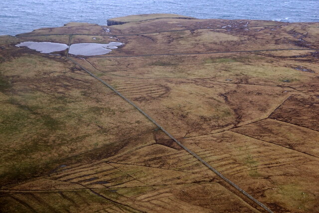
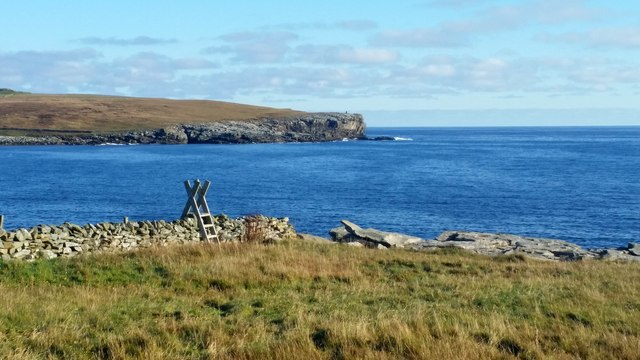
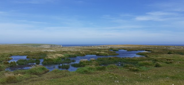
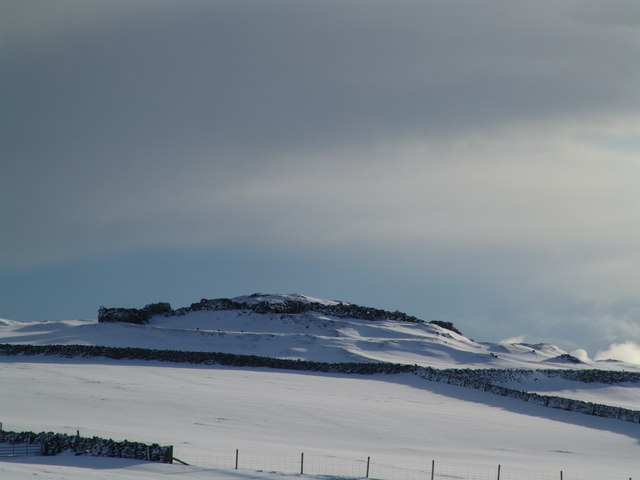
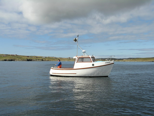
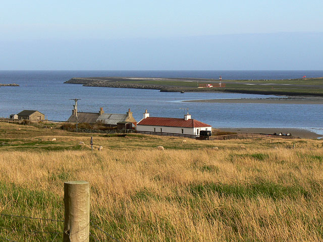
Boddam is a small village located on the eastern coast of the Shetland Islands in Scotland. Situated on the mainland, it lies approximately 14 miles south of the capital, Lerwick. The village is nestled between the rugged cliffs and the North Sea, offering breathtaking views of the surrounding natural beauty.

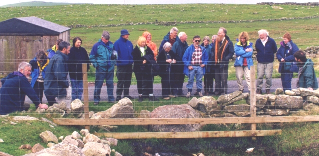
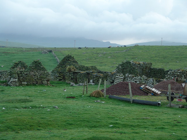
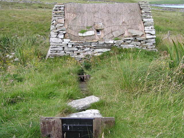
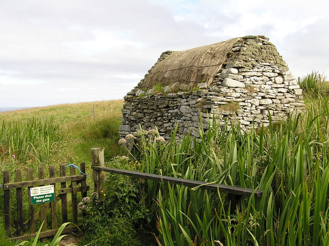
With a population of around 300 residents, Boddam is known for its peaceful and close-knit community. Residents often engage in traditional activities such as fishing, crofting, and agriculture, which have been the backbone of the local economy for generations. The village has a strong connection to its cultural heritage, with the locals actively preserving their traditional way of life.

Boddam is also home to several notable landmarks. The Boddam Lighthouse, built in 1855, stands as a prominent feature on the cliffs, guiding ships safely through the treacherous waters. The lighthouse is a popular spot for visitors, providing an opportunity to learn about the maritime history of the area.

Additionally, Boddam has a picturesque sandy beach known as Sandsayre. This beautiful stretch of coastline attracts locals and tourists alike, offering a peaceful retreat and a chance to enjoy the tranquility of the North Sea.

While Boddam may be a small village, its natural beauty, rich history, and tight-knit community make it a charming destination for those seeking an authentic Shetland experience.

If you have any feedback on the listing, please let us know in the comments section below.
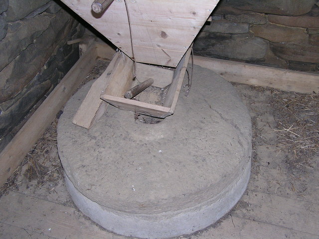
Boddam Images

Images are sourced within 2km of 59.919441/-1.2995901 or Grid Reference HU3915. Thanks to Geograph Open Source API. All images are credited.

Loch of Mails from the air
Coastal path at Bu Taing, Boddam Looking across to Dalsetter.
Coastal path at Bu Taing, Boddam
Looking across to Dalsetter.
Arctic Skua (Stercorarius parastiticus), Dalsetter, Boddam
Long-tailed Skua (Stercorarius longicauda), Dalsetter, Boddam Normally a high Arctic breeder, but this bird has been here for a month.
Long-tailed Skua (Stercorarius longicauda), Dalsetter, Boddam
Normally a high Arctic breeder, but this bird has been here for a month.
Small pool at Dalsetter
The Dalsetter Erratic This party of geologists is admiring the large boulder in the centre, which is of such a distinctive rock that it has been possible to pinpoint exactly where it came from before the glaciers of the Ice Age dumped it in Shetland - from Tonsberg, near Larvik in Norway!

For a closer view of the erratic itself see <a href="https://www.geograph.org.uk/photo/2619886">HU4016 : Dalsetter erratic</a>.
The Dalsetter Erratic
This party of geologists is admiring the large boulder in the centre, which is of such a distinctive rock that it has been possible to pinpoint exactly where it came from before the glaciers of the Ice Age dumped it in Shetland - from Tonsberg, near Larvik in Norway! For a closer view of the erratic itself see HU4016 : Dalsetter erratic.
Broch of Dalsetter Remains of the Broch at Dalsetter
Broch of Dalsetter
Remains of the Broch at Dalsetter
The old croft Old croft buildings at Dalsetter
The old croft
Old croft buildings at Dalsetter
Voe Dunrossness Looking west into Voe, from a fishing mark known as 'Da Kirk on Da Brakes'
Voe Dunrossness
Looking west into Voe, from a fishing mark known as 'Da Kirk on Da Brakes'
Tirl under the mill at Sout Voe Dunrossness The Tirl which drives the grinding stone. Crofthouse Museum.
Tirl under the mill at Sout Voe Dunrossness
The Tirl which drives the grinding stone. Crofthouse Museum.
Millstone At the mill, Crofthouse Museum, Dunrossness
Millstone
At the mill, Crofthouse Museum, Dunrossness
Mill at Crofthouse Museum Waterway into mill.
Mill at Crofthouse Museum
Waterway into mill.
Interior of mill at Crofthouse Museum
Mill at Crofthouse Museum
Spectacular ridge Dot coming off the spur of Lambhoga Head
Dalsetter Wynd in the background - nearly 2 kms away
Spectacular ridge
Dot coming off the spur of Lambhoga Head Dalsetter Wynd in the background - nearly 2 kms away
Loch of Mails The wall that bisects the Loch of Mails.
In the foreground is a disused sheep-pen and dip.
Loch of Mails
The wall that bisects the Loch of Mails. In the foreground is a disused sheep-pen and dip.
Loch of Mails Like all similar lochs, it seems to be diminishing in size
Loch of Mails
Like all similar lochs, it seems to be diminishing in size
Strong Feature Hardly discernable on the map but clear on the ground.
Maybe an ancient stock control feature - just maybe!
Strong Feature
Hardly discernable on the map but clear on the ground. Maybe an ancient stock control feature - just maybe!
Show me another place!

Boddam is located at Grid Ref: HU3915 (Lat: 59.919441, Lng: -1.2995901)

Unitary Authority: Shetland Islands

Police Authority: Highlands and Islands

What 3 Words

///train.appraised.deduced. Near Sumburgh, Shetland Islands

Related Wikis

Boddam, Shetland

Boddam is a village on the island of Mainland, in Shetland, Scotland. Boddam is an area of Dunrossness in the South Mainland of Shetland. Although Boddam...

Dunrossness

Dunrossness, (Old Norse: Dynrastarnes meaning "headland of the loud tide-race", referring to the noise of Sumburgh Roost) is the southernmost parish of...

Lochs of Spiggie and Brow

The Lochs of Spiggie and Brow are located west of Boddam in the parish of Dunrossness, in the South Mainland of Shetland, Scotland, about 6 km north of...

Scousburgh

Scousburgh is a small community in the parish of Dunrossness, in the South Mainland of Shetland, Scotland, overlooking the picturesque Scousburgh Sand...

Exnaboe

Exnaboe, locally referred to as 'bö', is a settlement in the Virkie area of the parish of Dunrossness, South Mainland, Shetland, Scotland, overlooking...

Clumlie Broch

Clumlie Broch is an Iron Age broch located on Mainland, Shetland, in Scotland (grid reference HU40451811). == Location == Clumlie Broch is located in Dunrossness...

Toab, Shetland

Toab is the southernmost village on Mainland, Shetland, Scotland. It is part of Virkie and overlooks Sumburgh Airport. Toab is within the parish of Dunrossness...

Pool of Virkie

The Pool of Virkie is a tidal lagoon in the parish of Dunrossness, south Mainland, Shetland. == History == The Pool of Virkie, during the late 15th and...

Nearby Amenities

Located within 500m of 59.919441,-1.2995901
Mainlands
Addr City: Shetland
Addr Postcode: ZE2 9JB
Fhrs Id: 978367
Shop: convenience
Source Addr Postcode: FHRS Open Data
Lat/Long: 59.9189463/-1.3007772
Police
Lat/Long: 59.9219468/-1.2979885
Dunrossness
Place: village
Lat/Long: 59.9211499/-1.2960738
Post Box
Operator: Royal Mail
Ref: ZE2 29
Lat/Long: 59.9189976/-1.3005434
Fuel
Lat/Long: 59.9190714/-1.3011688
Post Office
Dunrossness Post Office
Addr City: Shetland
Addr Postcode: ZE2 9JB
Brand: Post Office
Brand Wikidata: Q1783168
Opening Hours: Mo,Th 09:00-17:00; Tu 09:30-17:00; We,Sa 09:00-13:00; Fr 09:00-16:00
Ref Pol Id: 2349
Website: https://www.postoffice.co.uk/branch-finder/1338498/dunrossness
Lat/Long: 59.9189611/-1.3006458
Shop: hairdresser
Lat/Long: 59.9189047/-1.3006753
Shop: convenience
Lat/Long: 59.9187111/-1.3012707
Shop: doityourself
Lat/Long: 59.918695/-1.3001523
Barrier: cattle_grid
Lat/Long: 59.9236452/-1.2984856
Power: pole
Lat/Long: 59.9183238/-1.3005093
Power: pole
Lat/Long: 59.9176677/-1.3029206
Power: pole
Lat/Long: 59.9181759/-1.3017002
Power: pole
Lat/Long: 59.9178317/-1.3045219
Power: pole
Lat/Long: 59.9179716/-1.3033122
Power: pole
Lat/Long: 59.9180334/-1.3028616
Power: pole
Lat/Long: 59.9182391/-1.2995196
Power: pole
Lat/Long: 59.9176798/-1.3057396
Power: pole
Lat/Long: 59.917536/-1.3069466
Power: pole
Lat/Long: 59.9174674/-1.293785
Power: pole
Lat/Long: 59.9176045/-1.2928033
Power: pole
Lat/Long: 59.9171528/-1.2930796
Power: pole
Lat/Long: 59.9180899/-1.2978271
Power: pole
Lat/Long: 59.9179877/-1.2967033
Power: pole
Lat/Long: 59.9181934/-1.2990851
Power: pole
Lat/Long: 59.9178828/-1.2956545
Power: pole
Lat/Long: 59.9179312/-1.2925592
Power: pole
Lat/Long: 59.9177914/-1.2945736
Power: pole
Lat/Long: 59.9209358/-1.2996763
Power: pole
Lat/Long: 59.9188332/-1.2972623
Power: pole
Lat/Long: 59.9174687/-1.2983513
Power: pole
Lat/Long: 59.9210958/-1.2998292
Power: pole
Lat/Long: 59.9207556/-1.3009263
Power: pole
Lat/Long: 59.9168461/-1.2987778
Power: pole
Lat/Long: 59.9204841/-1.2992123
Power: pole
Lat/Long: 59.9162008/-1.2990434
Power: pole
Lat/Long: 59.9204357/-1.2991479
Power: pole
Lat/Long: 59.9199276/-1.2985766
Power: pole
Lat/Long: 59.9193414/-1.2978953
Power: pole
Lat/Long: 59.9202999/-1.3011865
Power: pole
Lat/Long: 59.9184367/-1.2975762
Bus Stop
Naptan AtcoCode: 6030156
Naptan NaptanCode: 45823985
Lat/Long: 59.9217933/-1.2921827
Bus Stop
Bus: yes
Naptan AtcoCode: 6030120
Naptan NaptanCode: 45823935
Public Transport: platform
Shelter: yes
Lat/Long: 59.9226706/-1.2986599
Power: pole
Lat/Long: 59.9216445/-1.3001955
Power: pole
Lat/Long: 59.9221661/-1.3007131
Power: pole
Lat/Long: 59.9227052/-1.3012281
Power: pole
Lat/Long: 59.923216/-1.301735
Power: pole
Lat/Long: 59.9236999/-1.3022178
Power: pole
Lat/Long: 59.9230587/-1.3027489
Power: pole
Lat/Long: 59.9222979/-1.3031298
Power: pole
Lat/Long: 59.9215921/-1.3034865
Power: pole
Lat/Long: 59.9209038/-1.3038272
Power: pole
Lat/Long: 59.9203217/-1.3041249
Power: pole
Lat/Long: 59.9200946/-1.3040149
Power: pole
Lat/Long: 59.9196671/-1.3038459
Power: pole
Lat/Long: 59.9191938/-1.3036206
Power: pole
Lat/Long: 59.9184222/-1.3032639
Power: pole
Lat/Long: 59.9168976/-1.302596
Power: pole
Lat/Long: 59.9162307/-1.3028589
Power: pole
Lat/Long: 59.9154428/-1.3031942
Street Lamp
Lat/Long: 59.9218514/-1.2987974
Street Lamp
Lat/Long: 59.922047/-1.2987142
Street Lamp
Lat/Long: 59.9222728/-1.2986056
Street Lamp
Lat/Long: 59.9225672/-1.2984916
Street Lamp
Lat/Long: 59.9226781/-1.298206
Street Lamp
Lat/Long: 59.9234033/-1.2981456
Street Lamp
Lat/Long: 59.923617/-1.2980544
Power: pole
Lat/Long: 59.9185486/-1.3080221
Power: pole
Lat/Long: 59.9155254/-1.2993562
Power: pole
Lat/Long: 59.9183413/-1.2925279
Power: pole
Lat/Long: 59.9186632/-1.2919181
Power: pole
Lat/Long: 59.9208648/-1.2942466
Power: pole
Lat/Long: 59.9213446/-1.2938943
Power: pole
Lat/Long: 59.9214095/-1.2929033
Power: pole
Lat/Long: 59.9219223/-1.2935316
Power: pole
Lat/Long: 59.9227837/-1.2939901
Power: pole
Lat/Long: 59.9239205/-1.2996473
Power: pole
Lat/Long: 59.9235871/-1.3006128
The data included in this document is from www.openstreetmap.org. The data is made available under ODbL.

Have you been to Boddam?

Leave your review of Boddam below (or comments, questions and feedback).