Inskip

Coastal Marsh, Saltings in Shetland

Scotland

Inskip

Lambhoga Head and Loch of Mails from the air
Lambhoga Head and Loch of Mails from the air Credit: Mike Pennington

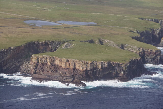
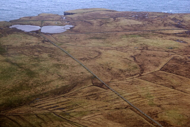
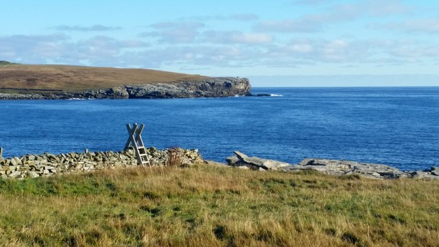
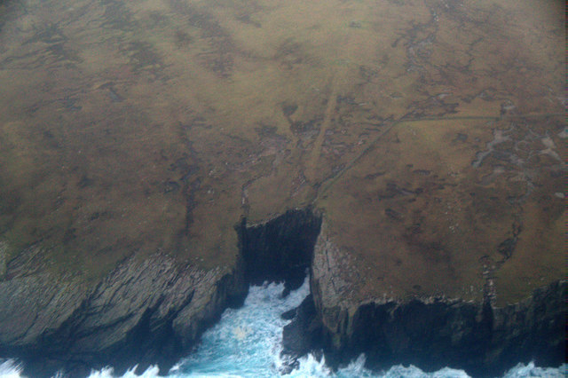
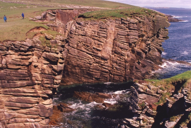
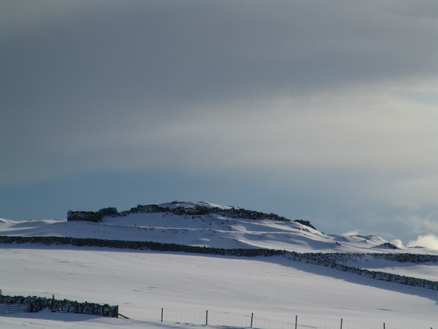
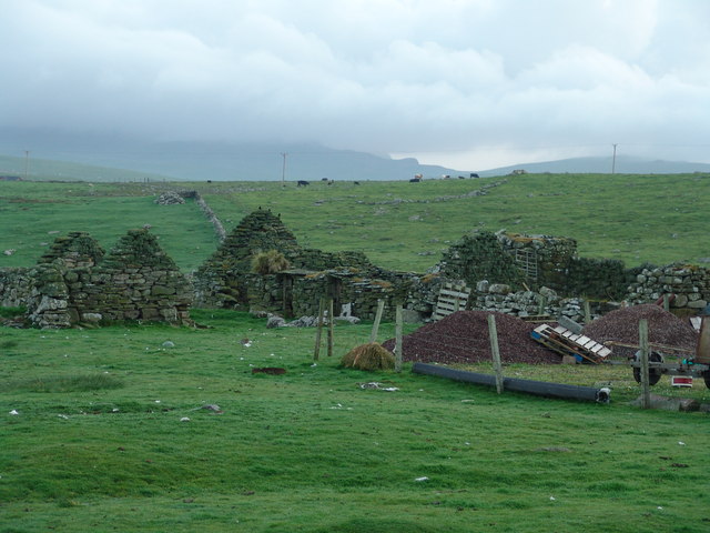
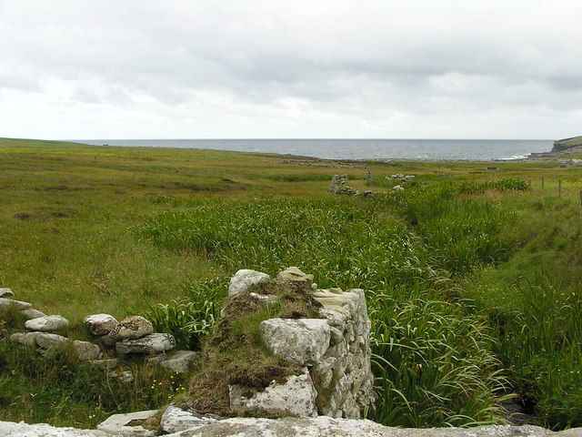
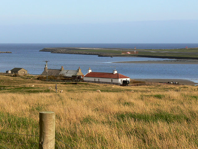
Inskip, Shetland is a coastal marsh and saltings located on the northernmost tip of the Shetland Islands, Scotland. It is situated on the west coast of Shetland’s Mainland, the largest island in the archipelago. Inskip is a part of the Yell Sound Special Protection Area, designated for its important bird habitat.

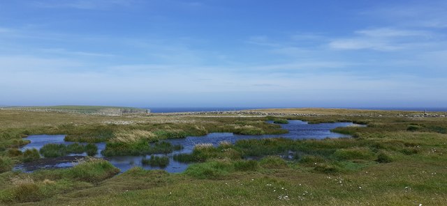
This coastal area consists of a vast expanse of marshland and salt marshes, characterized by its unique flora and fauna. The marshes are home to a variety of plant species, including sea pink, sea aster, sea lavender, and various grasses that thrive in the brackish water environment. The salt marshes are formed by the deposition of sediments carried by the tides, creating a diverse and fragile ecosystem.

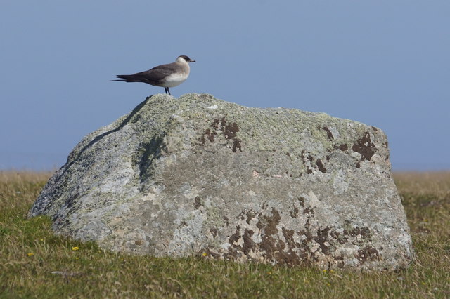
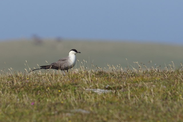
Inskip is known for its rich birdlife, attracting numerous species throughout the year. It serves as an important breeding site and feeding ground for various waterfowl, waders, and seabirds. Common sightings include lapwings, oystercatchers, curlews, redshanks, and snipe. The area also serves as a vital stopover for migratory birds, such as sandpipers, dunlins, and golden plovers.

The coastal marsh and saltings of Inskip are highly valued for their ecological significance and are protected under various conservation designations. They provide a habitat for a wide range of wildlife and contribute to the overall biodiversity of the region. The area is also popular among nature enthusiasts, who visit to observe and appreciate the diverse birdlife and natural beauty of this coastal marshland.

If you have any feedback on the listing, please let us know in the comments section below.

Inskip Images

Images are sourced within 2km of 59.921008/-1.2902565 or Grid Reference HU3915. Thanks to Geograph Open Source API. All images are credited.

Lambhoga Head and Loch of Mails from the air
Loch of Mails from the air
Coastal path at Bu Taing, Boddam Looking across to Dalsetter.
Coastal path at Bu Taing, Boddam
Looking across to Dalsetter.
Teisti Geo, south of Boddam
Arctic Skua (Stercorarius parastiticus), Dalsetter, Boddam
Long-tailed Skua (Stercorarius longicauda), Dalsetter, Boddam Normally a high Arctic breeder, but this bird has been here for a month.
Long-tailed Skua (Stercorarius longicauda), Dalsetter, Boddam
Normally a high Arctic breeder, but this bird has been here for a month.
Small pool at Dalsetter
The Dalsetter Erratic This party of geologists is admiring the large boulder in the centre, which is of such a distinctive rock that it has been possible to pinpoint exactly where it came from before the glaciers of the Ice Age dumped it in Shetland - from Tonsberg, near Larvik in Norway!

For a closer view of the erratic itself see <a href="https://www.geograph.org.uk/photo/2619886">HU4016 : Dalsetter erratic</a>.
The Dalsetter Erratic
This party of geologists is admiring the large boulder in the centre, which is of such a distinctive rock that it has been possible to pinpoint exactly where it came from before the glaciers of the Ice Age dumped it in Shetland - from Tonsberg, near Larvik in Norway! For a closer view of the erratic itself see HU4016 : Dalsetter erratic.
Broken Brough Spectacular dune cross-bedding in Devonian desert sandstones.
Broken Brough
Spectacular dune cross-bedding in Devonian desert sandstones.
Broch of Dalsetter Remains of the Broch at Dalsetter
Broch of Dalsetter
Remains of the Broch at Dalsetter
The old croft Old croft buildings at Dalsetter
The old croft
Old croft buildings at Dalsetter
Voe Dunrossness Looking west into Voe, from a fishing mark known as 'Da Kirk on Da Brakes'
Voe Dunrossness
Looking west into Voe, from a fishing mark known as 'Da Kirk on Da Brakes'
Burn at Troswick The ruins of old mills can be seen along the burn. Further down the burn one of the mills has been restored to working order.
Burn at Troswick
The ruins of old mills can be seen along the burn. Further down the burn one of the mills has been restored to working order.
Tirl under the mill at Sout Voe Dunrossness The Tirl which drives the grinding stone. Crofthouse Museum.
Tirl under the mill at Sout Voe Dunrossness
The Tirl which drives the grinding stone. Crofthouse Museum.
Millstone At the mill, Crofthouse Museum, Dunrossness
Millstone
At the mill, Crofthouse Museum, Dunrossness
Mill at Crofthouse Museum Waterway into mill.
Mill at Crofthouse Museum
Waterway into mill.
Interior of mill at Crofthouse Museum
Mill at Crofthouse Museum
Show me another place!

Inskip is located at Grid Ref: HU3915 (Lat: 59.921008, Lng: -1.2902565)

Unitary Authority: Shetland Islands

Police Authority: Highlands and Islands

What 3 Words

///forgiving.artichoke.nightcap. Near Sumburgh, Shetland Islands

Related Wikis

Boddam, Shetland

Boddam is a village on the island of Mainland, in Shetland, Scotland. Boddam is an area of Dunrossness in the South Mainland of Shetland. Although Boddam...

Dunrossness

Dunrossness, (Old Norse: Dynrastarnes meaning "headland of the loud tide-race", referring to the noise of Sumburgh Roost) is the southernmost parish of...

Clumlie Broch

Clumlie Broch is an Iron Age broch located on Mainland, Shetland, in Scotland (grid reference HU40451811). == Location == Clumlie Broch is located in Dunrossness...

Lochs of Spiggie and Brow

The Lochs of Spiggie and Brow are located west of Boddam in the parish of Dunrossness, in the South Mainland of Shetland, Scotland, about 6 km north of...

Scousburgh

Scousburgh is a small community in the parish of Dunrossness, in the South Mainland of Shetland, Scotland, overlooking the picturesque Scousburgh Sand...

Exnaboe

Exnaboe, locally referred to as 'bö', is a settlement in the Virkie area of the parish of Dunrossness, South Mainland, Shetland, Scotland, overlooking...

Toab, Shetland

Toab is the southernmost village on Mainland, Shetland, Scotland. It is part of Virkie and overlooks Sumburgh Airport. Toab is within the parish of Dunrossness...

Pool of Virkie

The Pool of Virkie is a tidal lagoon in the parish of Dunrossness, south Mainland, Shetland. == History == The Pool of Virkie, during the late 15th and...

Nearby Amenities

Located within 500m of 59.921008,-1.2902565
Police
Lat/Long: 59.9219468/-1.2979885
Dunrossness
Place: village
Lat/Long: 59.9211499/-1.2960738
Boddam
Place: hamlet
Lat/Long: 59.9246744/-1.290636
Power: pole
Lat/Long: 59.9174674/-1.293785
Power: pole
Lat/Long: 59.9176045/-1.2928033
Power: pole
Lat/Long: 59.9167064/-1.2919745
Power: pole
Lat/Long: 59.9171528/-1.2930796
Power: pole
Lat/Long: 59.9179877/-1.2967033
Power: pole
Lat/Long: 59.9178828/-1.2956545
Power: pole
Lat/Long: 59.9179312/-1.2925592
Power: pole
Lat/Long: 59.9177914/-1.2945736
Power: pole
Lat/Long: 59.9188332/-1.2972623
Power: pole
Lat/Long: 59.9204357/-1.2991479
Power: pole
Lat/Long: 59.9199276/-1.2985766
Power: pole
Lat/Long: 59.9193414/-1.2978953
Power: pole
Lat/Long: 59.9184367/-1.2975762
Bus Stop
Naptan AtcoCode: 6030156
Naptan NaptanCode: 45823985
Lat/Long: 59.9217933/-1.2921827
Street Lamp
Lat/Long: 59.9218514/-1.2987974
Street Lamp
Lat/Long: 59.922047/-1.2987142
Street Lamp
Lat/Long: 59.9222728/-1.2986056
Street Lamp
Lat/Long: 59.9225672/-1.2984916
Street Lamp
Lat/Long: 59.9226781/-1.298206
Power: pole
Lat/Long: 59.9183413/-1.2925279
Power: pole
Lat/Long: 59.9186632/-1.2919181
Power: pole
Lat/Long: 59.9168419/-1.2880466
Power: pole
Lat/Long: 59.9169357/-1.2888574
Power: pole
Lat/Long: 59.917033/-1.2897028
Power: pole
Lat/Long: 59.9171267/-1.2904975
Power: pole
Lat/Long: 59.9171383/-1.2906569
Power: pole
Lat/Long: 59.9170214/-1.2913498
Power: pole
Lat/Long: 59.9208648/-1.2942466
Power: pole
Lat/Long: 59.9213446/-1.2938943
Power: pole
Lat/Long: 59.9214095/-1.2929033
Power: pole
Lat/Long: 59.9219223/-1.2935316
Power: pole
Lat/Long: 59.9232213/-1.2835167
Power: pole
Lat/Long: 59.9230129/-1.2849004
Power: pole
Lat/Long: 59.9227675/-1.2864377
Power: pole
Lat/Long: 59.9230511/-1.2874795
Power: pole
Lat/Long: 59.9232965/-1.2882787
Power: pole
Lat/Long: 59.9234933/-1.2889902
Power: pole
Lat/Long: 59.9238082/-1.2901094
Power: pole
Lat/Long: 59.9240606/-1.2891265
Power: pole
Lat/Long: 59.9246533/-1.2888608
Power: pole
Lat/Long: 59.925268/-1.2885467
Power: pole
Lat/Long: 59.9235871/-1.2910033
Power: pole
Lat/Long: 59.9233347/-1.2920059
Power: pole
Lat/Long: 59.9230523/-1.2930685
Power: pole
Lat/Long: 59.9227837/-1.2939901
Power: pole
Lat/Long: 59.9236461/-1.2929021
Power: pole
Lat/Long: 59.9242238/-1.2927635
Power: pole
Lat/Long: 59.9249624/-1.2925811
Power: pole
Lat/Long: 59.9251128/-1.2935051
The data included in this document is from www.openstreetmap.org. The data is made available under ODbL.

Have you been to Inskip?

Leave your review of Inskip below (or comments, questions and feedback).