The Houb

Coastal Marsh, Saltings in Shetland

Scotland

The Houb

Lambhoga Head and Loch of Mails from the air
Lambhoga Head and Loch of Mails from the air Credit: Mike Pennington

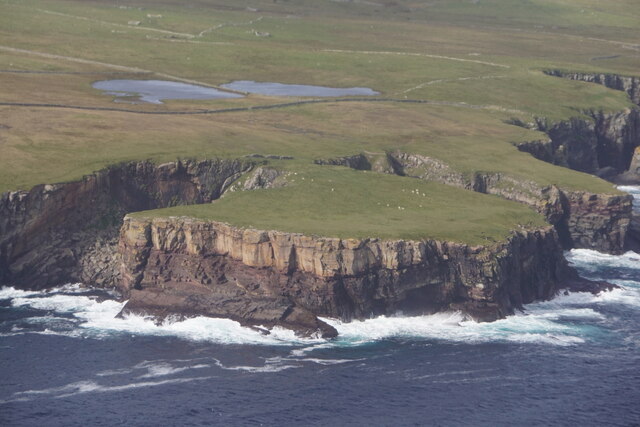
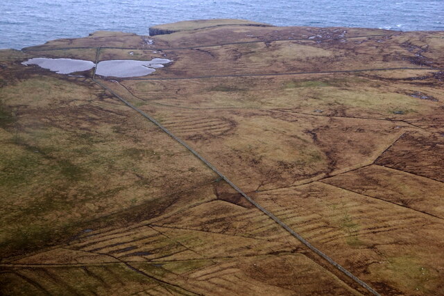
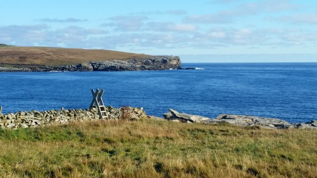
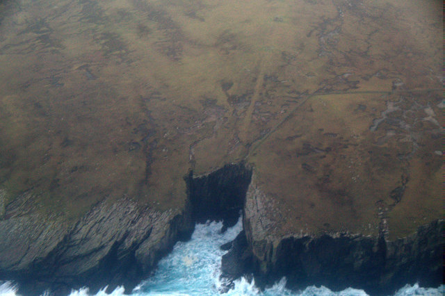
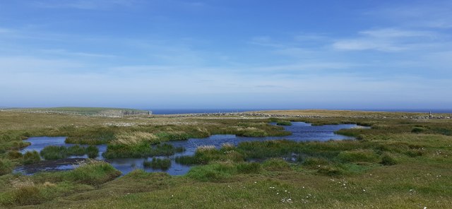
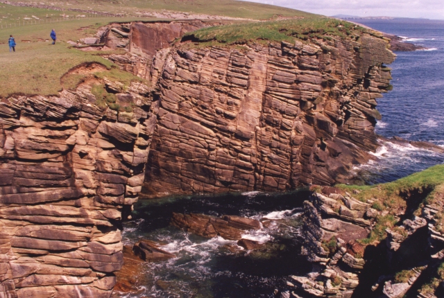
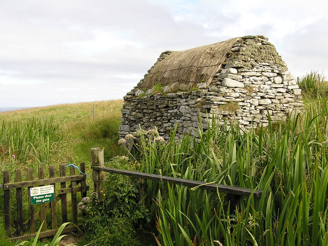
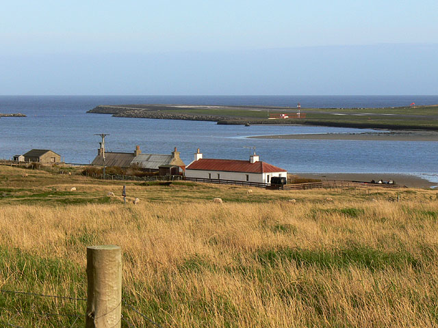
The Houb, located in Shetland, is a coastal marsh and saltings area that offers a unique and diverse natural environment. Stretching across a vast expanse, this site is situated on the eastern coast of the Shetland mainland, near the town of Lerwick. The Houb is a designated Site of Special Scientific Interest (SSSI) due to its ecological significance.

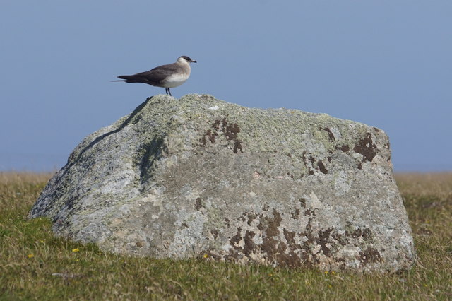
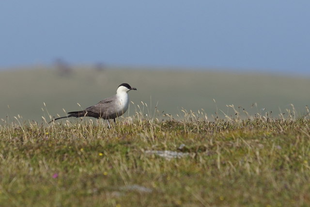
The marshland at The Houb is characterized by its dynamic salt marshes and mudflats. These habitats are influenced by the ebb and flow of the tide, creating a rich and fertile environment for a variety of plant and animal species. The area is particularly renowned for its diverse bird population, making it a popular spot for birdwatching enthusiasts. Species such as redshanks, oystercatchers, and lapwings can be observed nesting and foraging along the shores.

The Houb is also home to a plethora of plant species, including saltmarsh grasses, sea aster, and sea lavender. These plants have adapted to the saltwater environment and play a vital role in stabilizing the marshland and providing habitat for insects and other invertebrates.

Visitors to The Houb can enjoy the tranquil beauty of the marshland while taking in breathtaking views of the surrounding coastline. The area is accessible via footpaths and offers opportunities for walking, wildlife observation, and photography. It is important for visitors to respect the fragile nature of this ecosystem and follow any guidelines or restrictions in place to ensure the continued preservation of The Houb's unique environment.

If you have any feedback on the listing, please let us know in the comments section below.

The Houb Images

Images are sourced within 2km of 59.918552/-1.2876978 or Grid Reference HU3915. Thanks to Geograph Open Source API. All images are credited.

Lambhoga Head and Loch of Mails from the air
Loch of Mails from the air
Clevigarth from the air
Coastal path at Bu Taing, Boddam Looking across to Dalsetter.
Coastal path at Bu Taing, Boddam
Looking across to Dalsetter.
Teisti Geo, south of Boddam
Arctic Skua (Stercorarius parastiticus), Dalsetter, Boddam
Long-tailed Skua (Stercorarius longicauda), Dalsetter, Boddam Normally a high Arctic breeder, but this bird has been here for a month.
Long-tailed Skua (Stercorarius longicauda), Dalsetter, Boddam
Normally a high Arctic breeder, but this bird has been here for a month.
Small pool at Dalsetter
The Dalsetter Erratic This party of geologists is admiring the large boulder in the centre, which is of such a distinctive rock that it has been possible to pinpoint exactly where it came from before the glaciers of the Ice Age dumped it in Shetland - from Tonsberg, near Larvik in Norway!

For a closer view of the erratic itself see <a href="https://www.geograph.org.uk/photo/2619886">HU4016 : Dalsetter erratic</a>.
The Dalsetter Erratic
This party of geologists is admiring the large boulder in the centre, which is of such a distinctive rock that it has been possible to pinpoint exactly where it came from before the glaciers of the Ice Age dumped it in Shetland - from Tonsberg, near Larvik in Norway! For a closer view of the erratic itself see HU4016 : Dalsetter erratic.
Broken Brough Spectacular dune cross-bedding in Devonian desert sandstones.
Broken Brough
Spectacular dune cross-bedding in Devonian desert sandstones.
Broch of Dalsetter Remains of the Broch at Dalsetter
Broch of Dalsetter
Remains of the Broch at Dalsetter
The old croft Old croft buildings at Dalsetter
The old croft
Old croft buildings at Dalsetter
Voe Dunrossness Looking west into Voe, from a fishing mark known as 'Da Kirk on Da Brakes'
Voe Dunrossness
Looking west into Voe, from a fishing mark known as 'Da Kirk on Da Brakes'
Tirl under the mill at Sout Voe Dunrossness The Tirl which drives the grinding stone. Crofthouse Museum.
Tirl under the mill at Sout Voe Dunrossness
The Tirl which drives the grinding stone. Crofthouse Museum.
Millstone At the mill, Crofthouse Museum, Dunrossness
Millstone
At the mill, Crofthouse Museum, Dunrossness
Mill at Crofthouse Museum Waterway into mill.
Mill at Crofthouse Museum
Waterway into mill.
Interior of mill at Crofthouse Museum
Mill at Crofthouse Museum
Show me another place!

The Houb is located at Grid Ref: HU3915 (Lat: 59.918552, Lng: -1.2876978)

Unitary Authority: Shetland Islands

Police Authority: Highlands and Islands

What 3 Words

///dice.mermaids.prongs. Near Sumburgh, Shetland Islands

Related Wikis

Boddam, Shetland

Boddam is a village on the island of Mainland, in Shetland, Scotland. Boddam is an area of Dunrossness in the South Mainland of Shetland. Although Boddam...

Dunrossness

Dunrossness, (Old Norse: Dynrastarnes meaning "headland of the loud tide-race", referring to the noise of Sumburgh Roost) is the southernmost parish of...

Exnaboe

Exnaboe, locally referred to as 'bö', is a settlement in the Virkie area of the parish of Dunrossness, South Mainland, Shetland, Scotland, overlooking...

Clumlie Broch

Clumlie Broch is an Iron Age broch located on Mainland, Shetland, in Scotland (grid reference HU40451811). == Location == Clumlie Broch is located in Dunrossness...

Lochs of Spiggie and Brow

The Lochs of Spiggie and Brow are located west of Boddam in the parish of Dunrossness, in the South Mainland of Shetland, Scotland, about 6 km north of...

Toab, Shetland

Toab is the southernmost village on Mainland, Shetland, Scotland. It is part of Virkie and overlooks Sumburgh Airport. Toab is within the parish of Dunrossness...

Scousburgh

Scousburgh is a small community in the parish of Dunrossness, in the South Mainland of Shetland, Scotland, overlooking the picturesque Scousburgh Sand...

Pool of Virkie

The Pool of Virkie is a tidal lagoon in the parish of Dunrossness, south Mainland, Shetland. == History == The Pool of Virkie, during the late 15th and...

Nearby Amenities

Located within 500m of 59.918552,-1.2876978
Power: pole
Lat/Long: 59.9174674/-1.293785
Power: pole
Lat/Long: 59.9176045/-1.2928033
Power: pole
Lat/Long: 59.9167064/-1.2919745
Power: pole
Lat/Long: 59.9157662/-1.2908417
Power: pole
Lat/Long: 59.9171528/-1.2930796
Power: pole
Lat/Long: 59.9162931/-1.2909733
Power: pole
Lat/Long: 59.9178828/-1.2956545
Power: pole
Lat/Long: 59.9179312/-1.2925592
Power: pole
Lat/Long: 59.9177914/-1.2945736
Power: pole
Lat/Long: 59.9153702/-1.2906846
Bus Stop
Naptan AtcoCode: 6030156
Naptan NaptanCode: 45823985
Lat/Long: 59.9217933/-1.2921827
Power: pole
Lat/Long: 59.9158392/-1.2912944
Power: pole
Lat/Long: 59.9154188/-1.2916109
Power: pole
Lat/Long: 59.9152289/-1.291761
Power: pole
Lat/Long: 59.9147055/-1.2919735
Power: pole
Lat/Long: 59.9183413/-1.2925279
Power: pole
Lat/Long: 59.9186632/-1.2919181
Power: pole
Lat/Long: 59.9151896/-1.2899615
Power: pole
Lat/Long: 59.9168419/-1.2880466
Power: pole
Lat/Long: 59.9169357/-1.2888574
Power: pole
Lat/Long: 59.917033/-1.2897028
Power: pole
Lat/Long: 59.9171267/-1.2904975
Power: pole
Lat/Long: 59.9171383/-1.2906569
Power: pole
Lat/Long: 59.9170214/-1.2913498
Power: pole
Lat/Long: 59.9208648/-1.2942466
Power: pole
Lat/Long: 59.9213446/-1.2938943
Power: pole
Lat/Long: 59.9214095/-1.2929033
Power: pole
Lat/Long: 59.9219223/-1.2935316
Power: pole
Lat/Long: 59.9227675/-1.2864377
The data included in this document is from www.openstreetmap.org. The data is made available under ODbL.

Have you been to The Houb?

Leave your review of The Houb below (or comments, questions and feedback).