Boddam
Settlement in Aberdeenshire
Scotland
Boddam
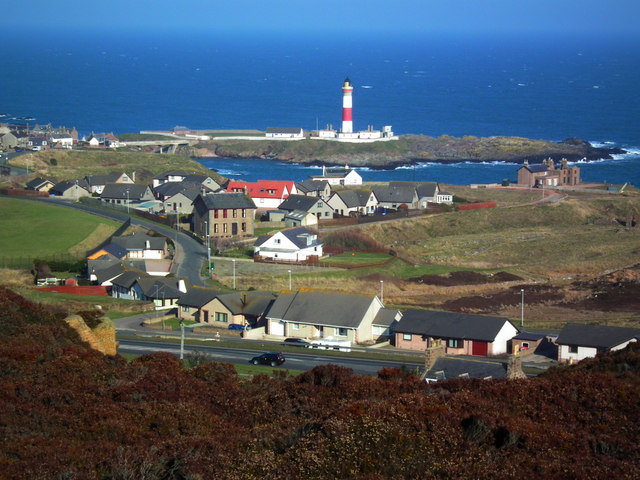
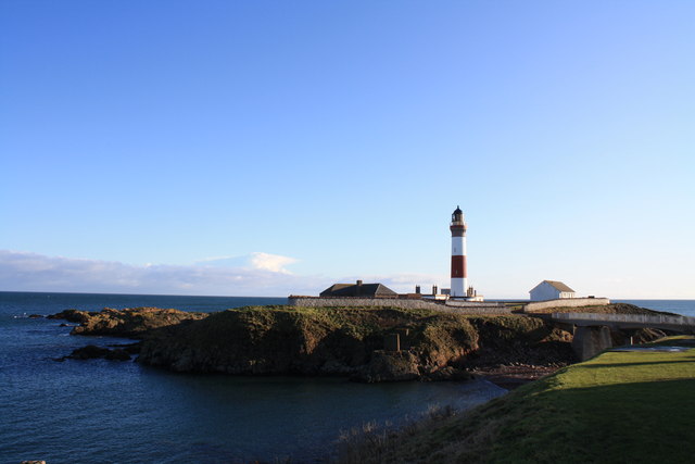
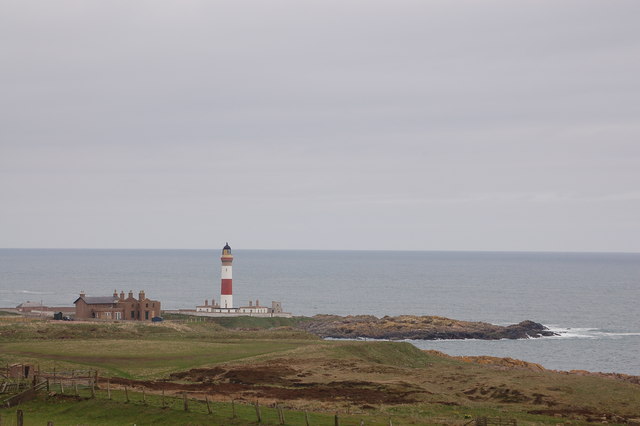
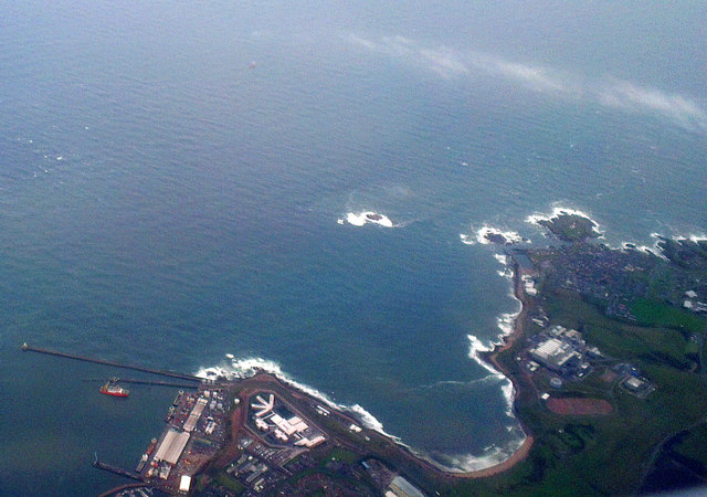
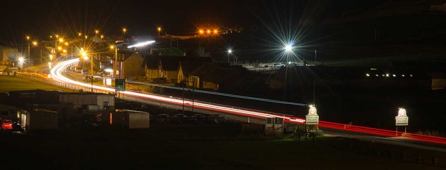
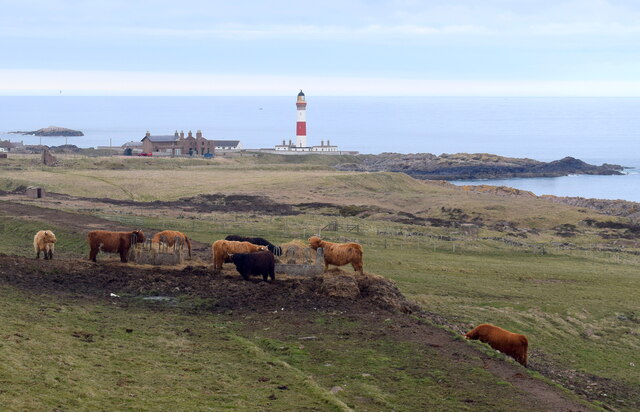
Boddam is a small coastal village located in Aberdeenshire, Scotland. Situated on the northeastern coast of the country, it is approximately 26 miles north of Aberdeen. Boddam is positioned on a peninsula, bordered by the North Sea on three sides, providing beautiful panoramic views of the ocean.
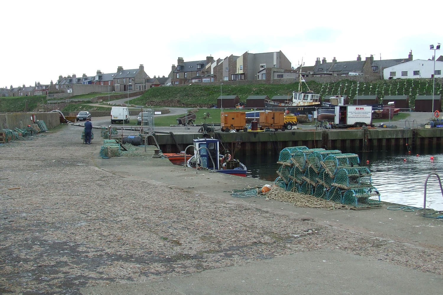
The village has a rich history, dating back to the 18th century when it was primarily a fishing community. Boddam became an important fishing port, known for its herring industry. Today, remnants of this history can still be seen in the village, including the old herring station and fisherman's cottages.
Despite its small size, Boddam offers several amenities to its residents and visitors. The village has a primary school, a community hall, a pub, and a convenience store, providing essential services to the local community. Additionally, Boddam is well-connected to nearby towns and cities via road and public transportation.
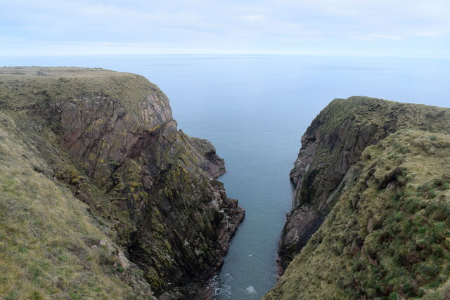
One of the main attractions in Boddam is the Bullers of Buchan, a stunning natural feature located just a short distance from the village. This geological formation consists of collapsed sea caves that have formed an impressive chasm. It is a popular spot for birdwatching, as various seabirds, including puffins and fulmars, nest in the cliffs surrounding the Bullers of Buchan.
Boddam offers a peaceful and picturesque setting, making it an ideal destination for those seeking a tranquil coastal retreat or outdoor activities such as walking, fishing, or birdwatching.
If you have any feedback on the listing, please let us know in the comments section below.
Boddam Images
Images are sourced within 2km of 57.472579/-1.783161 or Grid Reference NK1342. Thanks to Geograph Open Source API. All images are credited.


Boddam is located at Grid Ref: NK1342 (Lat: 57.472579, Lng: -1.783161)
Unitary Authority: Aberdeenshire
Police Authority: North East
What 3 Words
///seeing.chaos.vanish. Near Boddam, Aberdeenshire
Nearby Locations
Related Wikis

Brethren Meeting House
Brethren Meeting House is a Category C listed building at 26 Gordon Street in Boddam, Aberdeenshire, Scotland. It was formerly a late-Victorian-era Wesleyan...
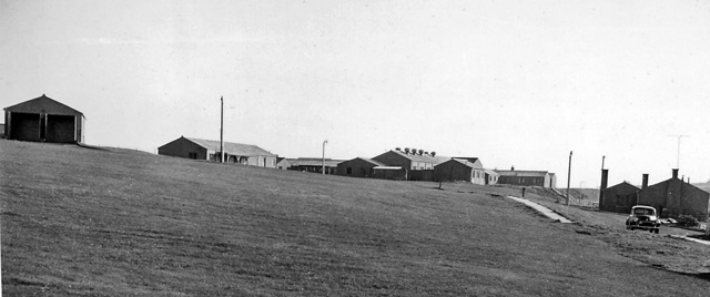
Boddam railway station
Boddam railway station was a railway station in Boddam, Aberdeenshire that served as the terminus of a now closed line from Ellon. == History == The station...

Boddam Masonic Hall
Boddam Masonic Hall is an historic building in Boddam, Aberdeenshire, Scotland. It is a Category B listed structure, located a few hundred yards west of...

Stirling Village
Stirling Village is a settlement in the Buchan area of Aberdeenshire, Scotland, located on the A90 road immediately to the west of Boddam and 3 miles...
Boddam, Aberdeenshire
Boddam is a coastal village in Aberdeenshire, Scotland. It is 29 miles (47 km) north of Aberdeen and 3 miles (4.8 km) south of Peterhead. The settlement...
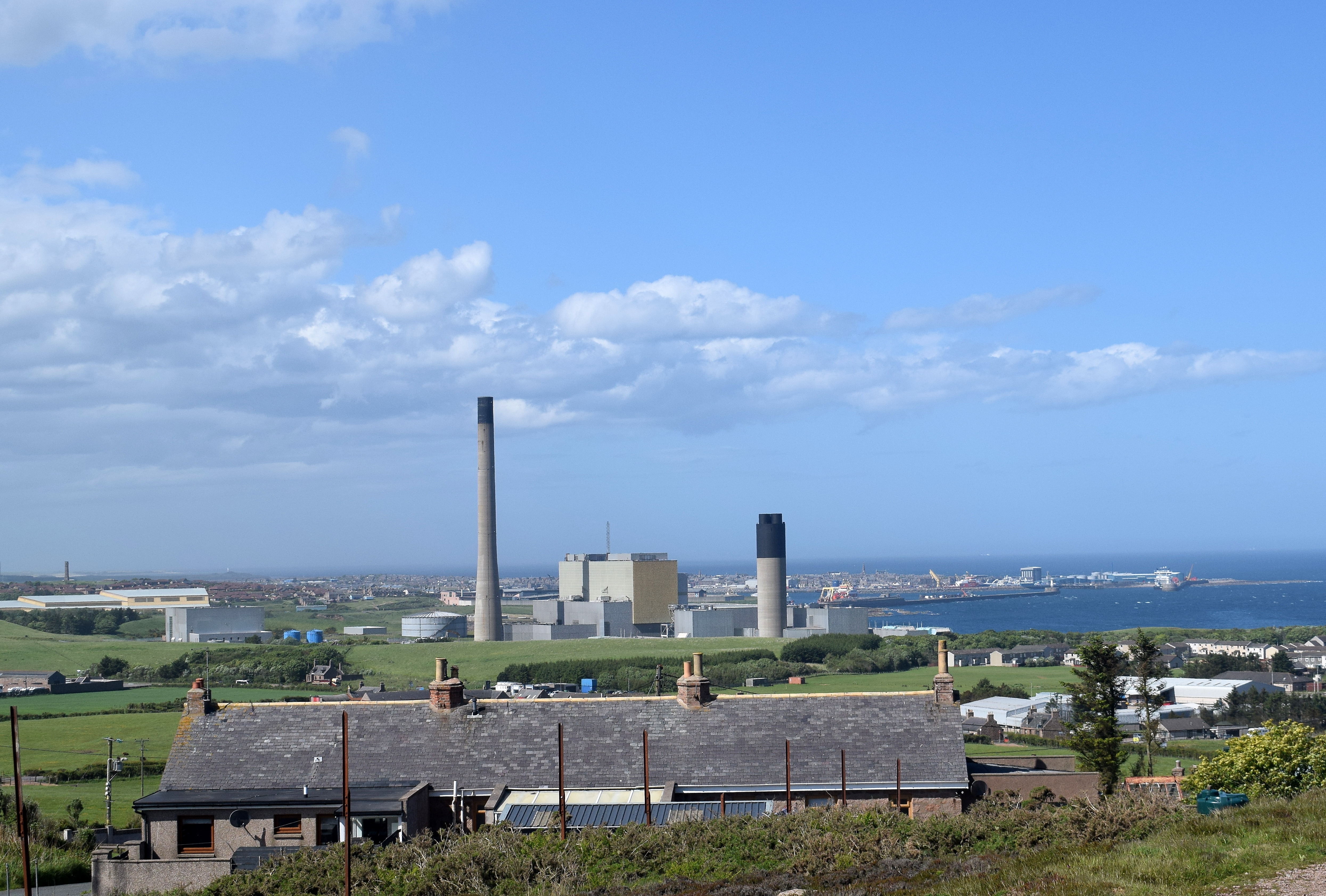
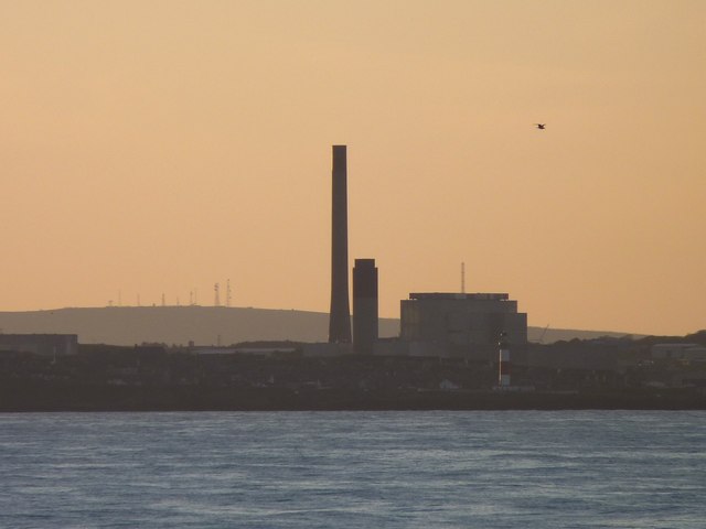
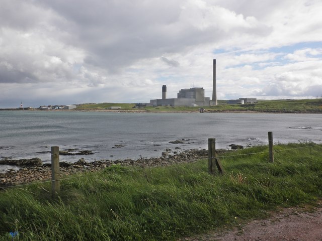
Peterhead Power Station
Peterhead Power Station is a multi-unit station owned and operated by SSE plc, with a capacity of 2,177 MW (1,550 MW transmissible). It is located near...

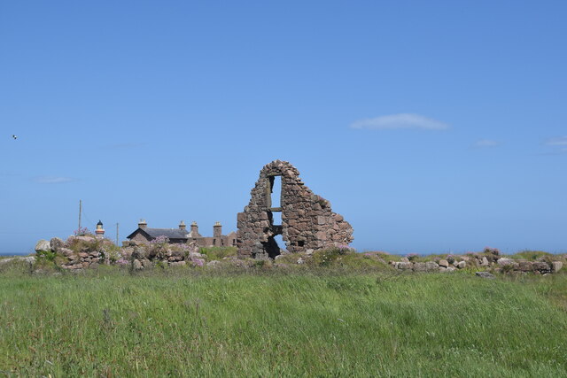
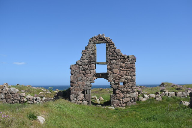
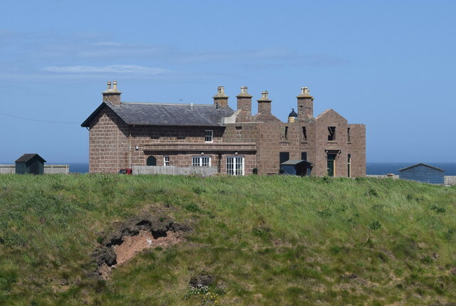
Boddam Castle
Boddam Castle is a ruined castle in Boddam, Aberdeenshire, Scotland. It was thought to have been built in the early 16th century as a seat for the Keiths...

Sandford Lodge
Sandford Lodge is a Category B listed building in Peterhead, Aberdeenshire, Scotland. A former farmhouse, described by Charles McKean as a "miniature...
Related Videos

😎 Cool cottage on holiday!!!
Summer holiday at Boddan Village, @sea front cottage. Having fun with my family.

Boddam Village Walk, Scotland Countryside 4K
Boddam Village Walk, Scotland Countryside 4K. Boddam village lies a few miles from Peterhead and has a population of about ...

around peterhead & Peterhead prison museum Christmas experience
last wednesday we took a trip to peterhead and visited Peterhead prison museum Christmas experience for a look around.

Peterhead Prison Museum
Todays video takes us to one of Scotland's Toughest Prisons . HMP Peterhead is now a museum and well worth a visit so come ...
Nearby Amenities
Located within 500m of 57.472579,-1.783161Have you been to Boddam?
Leave your review of Boddam below (or comments, questions and feedback).