Blyth Bridge

Settlement in Peeblesshire

Scotland

Blyth Bridge

Fields, Mountain Cross View from the Henderland Hill hillfort.
Fields, Mountain Cross Credit: Richard Webb

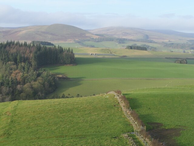
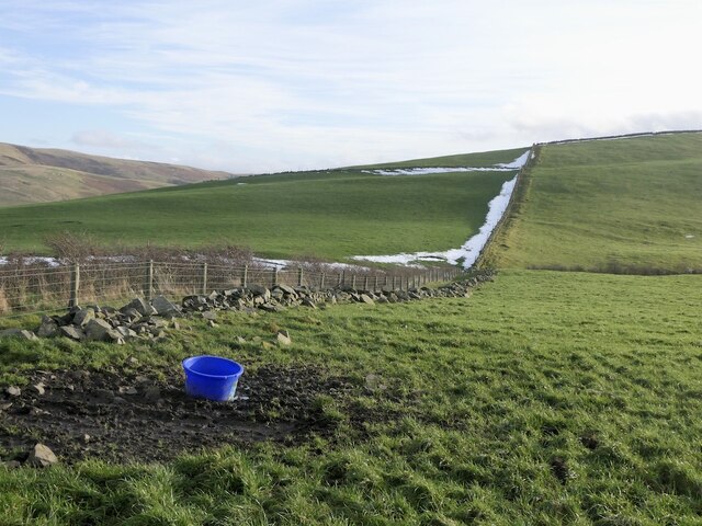
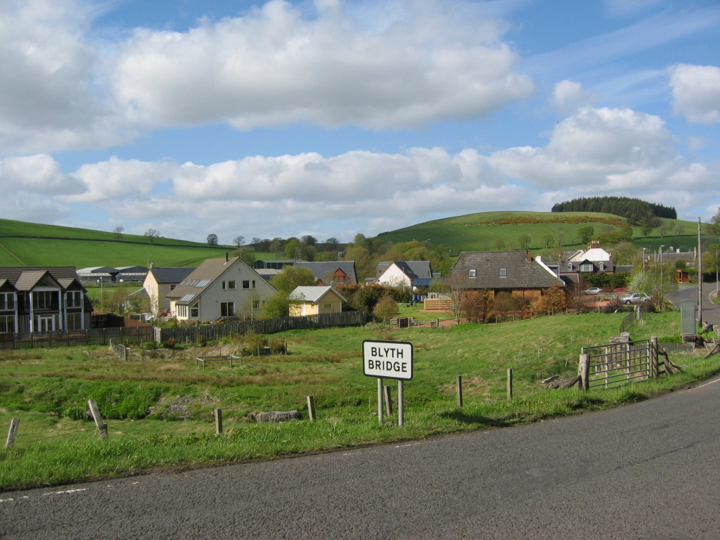
Blyth Bridge is a small village located in Peeblesshire, Scotland. Situated on the A721 road, it lies approximately 20 miles south of Edinburgh and 5 miles northwest of Peebles. The village is nestled in the picturesque Tweed Valley, surrounded by lush green fields and rolling hills.

Blyth Bridge is known for its tranquil and rural setting, providing residents and visitors with a peaceful escape from the bustling city life. The village is home to a close-knit community, with a population of around 300 people. The residents enjoy a friendly and welcoming atmosphere, making it an ideal place to settle down or visit.

Despite its small size, Blyth Bridge offers several amenities to cater to the needs of its community. These include a village hall, a primary school, and a local pub, providing a central hub for social gatherings and community events. The village also benefits from easy access to Peebles, where residents can find a wider range of services, shops, and recreational facilities.

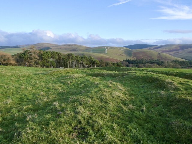
Blyth Bridge's location in the Tweed Valley offers ample opportunities for outdoor activities and exploration. The surrounding area is renowned for its stunning natural beauty, with picturesque walking trails, cycling routes, and fishing spots along the River Tweed. The nearby Glentress Forest also attracts outdoor enthusiasts, offering mountain biking trails and scenic woodland walks.

Overall, Blyth Bridge is a charming and peaceful village that provides a close-knit community, picturesque surroundings, and easy access to outdoor adventures.

If you have any feedback on the listing, please let us know in the comments section below.
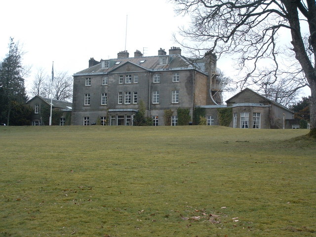
Blyth Bridge Images

Images are sourced within 2km of 55.695899/-3.3819037 or Grid Reference NT1345. Thanks to Geograph Open Source API. All images are credited.

Fields, Mountain Cross View from the Henderland Hill hillfort.
Fields, Mountain Cross
View from the Henderland Hill hillfort.
Parkneuk View from the Henderland Hill hillfort.
Parkneuk
View from the Henderland Hill hillfort.
Blythbank View from the Henderland Hill hillfort.
Blythbank
View from the Henderland Hill hillfort.
Stripwood, Blythbank View towards Black Mount.
Stripwood, Blythbank
View towards Black Mount.
Hillfort, Henderland Hill The fort here is more elaborate than a lot of the forts in Peeblesshire with two sets of ramparts.
Hillfort, Henderland Hill
The fort here is more elaborate than a lot of the forts in Peeblesshire with two sets of ramparts.
Henderland Hill hillfort The fort here is more elaborate than a lot of the forts in Peeblesshire with two sets of ramparts.
Henderland Hill hillfort
The fort here is more elaborate than a lot of the forts in Peeblesshire with two sets of ramparts.
Henderland Hill hill fort The fort here is more elaborate than a lot of the forts in Peeblesshire with two sets of ramparts.
Henderland Hill hill fort
The fort here is more elaborate than a lot of the forts in Peeblesshire with two sets of ramparts.
A young hedge, Henderland Hill
A new hedge on Henderland Hill
Lone tree, Henderland Hill
On Henderland Hill
On Henderland Hill
Gate on Henderland Hill With a view towards Wether Law.
Gate on Henderland Hill
With a view towards Wether Law.
Pines, Henderland Hill A deep reentrant above Callands
Pines, Henderland Hill
A deep reentrant above Callands
Scattered trees, Scotstown Bank
Hill above Callands A higher summit, south of Henderland Hill.
Hill above Callands
A higher summit, south of Henderland Hill.
Hill fort, Henderland Hill
Blyth Farm Road Blyth Bridge end of the Old Coach Road.
Blyth Farm Road
Blyth Bridge end of the Old Coach Road.
Road end, Blyth Bridge Junction on the A701.
Road end, Blyth Bridge
Junction on the A701.
Show me another place!

Blyth Bridge is located at Grid Ref: NT1345 (Lat: 55.695899, Lng: -3.3819037)

Unitary Authority: The Scottish Borders

Police Authority: The Lothians and Scottish Borders

What 3 Words

///durations.hiker.cosmetic. Near West Linton, Scottish Borders

Related Wikis

Blyth Bridge

Blyth Bridge is a small hamlet in the Scottish Borders area of Scotland, near to West Linton. It is located in a bend on the A701 which goes from Moffat...

Castle Craig Hospital

Castle Craig Hospital is a private residential drug and alcohol rehabilitation clinic. It is located in Peeblesshire, Scotland. Castle Craig is an 18th...

Kirkurd

Kirkurd is a parish in Peeblesshire in the Scottish Borders situated 3 miles south-east of Dolphinton and 6 miles north-east of Broughton. Tarth Water...

Bordlands

Bordlands is a village in the Parish of Newlands in the Scottish Borders area of Scotland. The former name of Bordlands was Boreland. == See also == List...

Nearby Amenities

Located within 500m of 55.695899,-3.3819037
Blyth Bridge
Name Uk: Блайт-Брідж
Place: village
Population: 107
Wikidata: Q4930849
Wikipedia: en:Blyth Bridge
Lat/Long: 55.6939422/-3.3818375
Bus Stop
Old Mill Inn
Bus: yes
Local Ref: AT
Naptan AtcoCode: 69001315
Naptan Bearing: S
Naptan CommonName: Old Mill Inn
Naptan Indicator: at
Naptan Landmark: Old Mill Inn
Naptan NaptanCode: 72726962
Naptan Street: A701
Operator: Scottish Borders Council
Public Transport: platform
Ref: 69001315
Source: NaPTAN
Lat/Long: 55.6932977/-3.382132
Bus Stop
Old Mill
Bench: yes
Bus: yes
Naptan AtcoCode: 6900166
Naptan Bearing: N
Naptan CommonName: Old Mill
Naptan Indicator: opp
Naptan Landmark: Old Mill Inn
Naptan NaptanCode: 72724765
Naptan Street: A701
Operator: Scottish Borders Council
Public Transport: platform
Ref: 6900166
Shelter: yes
Source: NaPTAN
Lat/Long: 55.6933871/-3.3823741
Noexit: yes
Lat/Long: 55.6925122/-3.3847859
Noexit: yes
Lat/Long: 55.6950574/-3.3808388
Post Box
Collection Times: Mo-Fr 09:30; Sa 08:30
Operator: Royal Mail
Post Box Type: lamp
Ref: EH46 27
Royal Cypher: scottish_crown
Source: survey
Lat/Long: 55.6934258/-3.3823911
Telephone
Defibrillator
Access: yes
Booth: K6
Covered: booth
Defibrillator Location: inside old red phone box, Blyth Bridge
Emergency: defibrillator
Man Made: telephone_box
Ref GB The Circuit: 66B048CE-4AD9-4F05-83EF-AFAA0147BF2A
Source: survey
Lat/Long: 55.6934198/-3.3823513
Blyth
Place: hamlet
Lat/Long: 55.6976718/-3.3825303
Scotstonrig
Place: isolated_dwelling
Lat/Long: 55.6959338/-3.3753164
Noexit: yes
Lat/Long: 55.6960204/-3.3754399
Noexit: yes
Lat/Long: 55.6959594/-3.3755134
Generator Method: photovoltaic
Generator Output Electricity: yes
Generator Source: solar
Generator Type: solar_photovoltaic_panel
Power: generator
Lat/Long: 55.6964809/-3.3842636
Generator Method: photovoltaic
Generator Output Electricity: yes
Generator Source: solar
Generator Type: solar_photovoltaic_panel
Power: generator
Lat/Long: 55.6928472/-3.383899
Generator Method: photovoltaic
Generator Output Electricity: yes
Generator Source: solar
Generator Type: solar_photovoltaic_panel
Power: generator
Lat/Long: 55.6931072/-3.3839661
Generator Method: photovoltaic
Generator Output Electricity: yes
Generator Source: solar
Generator Type: solar_photovoltaic_panel
Power: generator
Lat/Long: 55.6939742/-3.3826706
Noexit: yes
Lat/Long: 55.6925766/-3.3845025
Give Way
Direction: forward
Lat/Long: 55.6943367/-3.381643
Power: pole
Lat/Long: 55.6935861/-3.3752014
Power: pole
Lat/Long: 55.6955756/-3.3747872
Power: pole
Lat/Long: 55.6953007/-3.3759267
Power: pole
Lat/Long: 55.6950116/-3.3770389
Power: pole
Lat/Long: 55.6947213/-3.378151
Power: pole
Lat/Long: 55.6944594/-3.3791602
Power: pole
Lat/Long: 55.6942165/-3.3801336
Power: pole
Lat/Long: 55.6940009/-3.3808379
Power: pole
Lat/Long: 55.6937983/-3.381519
Power: pole
Lat/Long: 55.6946478/-3.3745076
Power: pole
Lat/Long: 55.694181/-3.3750101
The data included in this document is from www.openstreetmap.org. The data is made available under ODbL.

Have you been to Blyth Bridge?

Leave your review of Blyth Bridge below (or comments, questions and feedback).