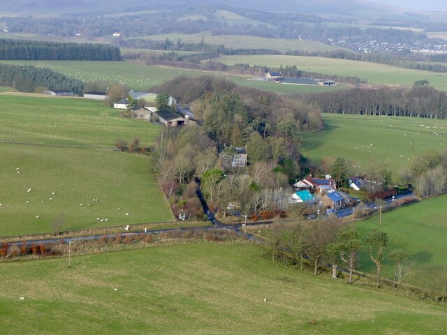
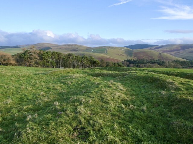
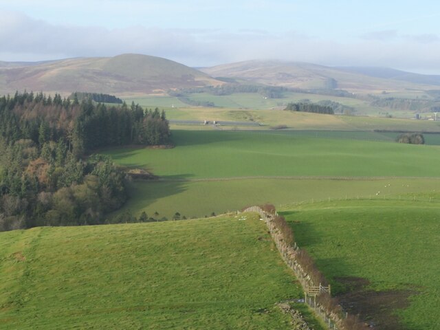
Blyth Dene
Valley in Peeblesshire
Scotland
Blyth Dene

Blyth Dene, Peeblesshire is a picturesque valley located in the Scottish Borders region of Scotland. It is nestled between the scenic hills and lush greenery of the Tweed Valley, offering visitors a tranquil and idyllic retreat.
The valley of Blyth Dene is renowned for its outstanding natural beauty, with its rolling hills, meandering streams, and dense woodlands. The area is a haven for nature lovers, hikers, and outdoor enthusiasts who can explore the numerous walking trails and paths that crisscross the valley.
One of the main attractions of Blyth Dene is the Blyth Water, a crystal-clear river that flows through the valley. The river is home to a diverse range of wildlife, including otters, brown trout, and various species of birds, making it a popular spot for birdwatching and fishing.
The valley is also dotted with charming villages and hamlets that offer a glimpse into the region's rich history and heritage. Peebles, a historic market town, is located nearby and provides visitors with a range of amenities, including shops, restaurants, and accommodation options.
For those seeking a peaceful and rejuvenating escape, Blyth Dene offers a serene environment away from the hustle and bustle of city life. Whether it's exploring the breathtaking landscapes, engaging in outdoor activities, or simply enjoying the tranquility of the surroundings, Blyth Dene is a destination that promises a memorable experience for all who visit.
If you have any feedback on the listing, please let us know in the comments section below.
Blyth Dene Images
Images are sourced within 2km of 55.699535/-3.3838142 or Grid Reference NT1345. Thanks to Geograph Open Source API. All images are credited.


Blyth Dene is located at Grid Ref: NT1345 (Lat: 55.699535, Lng: -3.3838142)
Unitary Authority: The Scottish Borders
Police Authority: The Lothians and Scottish Borders
What 3 Words
///messy.national.cautious. Near West Linton, Scottish Borders
Nearby Locations
Related Wikis
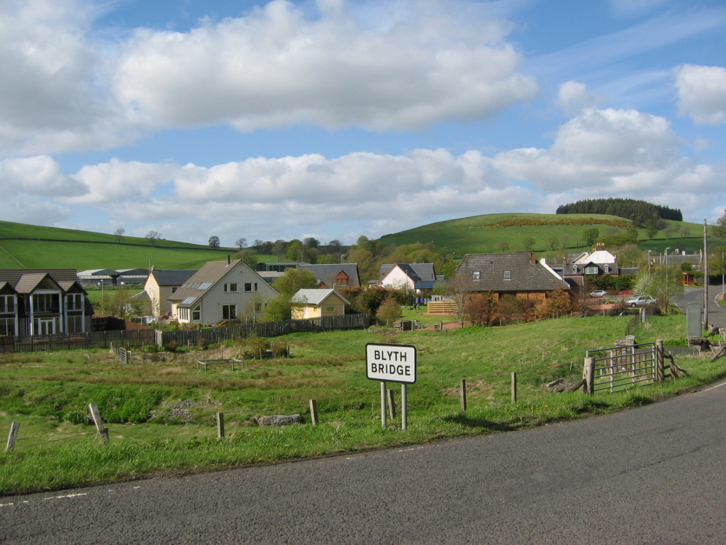
Blyth Bridge
Blyth Bridge is a small hamlet in the Scottish Borders area of Scotland, near to West Linton. It is located in a bend on the A701 which goes from Moffat...

Kirkurd
Kirkurd is a parish in Peeblesshire in the Scottish Borders situated 3 miles south-east of Dolphinton and 6 miles north-east of Broughton. Tarth Water...
Castle Craig Hospital
Castle Craig Hospital is a private residential drug and alcohol rehabilitation clinic. It is located in Peeblesshire, Scotland. Castle Craig is an 18th...

Bordlands
Bordlands is a village in the Parish of Newlands in the Scottish Borders area of Scotland. The former name of Bordlands was Boreland. == See also == List...
Nearby Amenities
Located within 500m of 55.699535,-3.3838142Have you been to Blyth Dene?
Leave your review of Blyth Dene below (or comments, questions and feedback).