Blyth
Settlement in Peeblesshire
Scotland
Blyth

Blyth is a small village located in the Peeblesshire region of Scotland. Situated in the Scottish Borders, it lies approximately 5 miles southeast of Biggar and 27 miles south of Edinburgh. The village is nestled amidst rolling hills and picturesque countryside, offering a tranquil and scenic setting for its residents.
Blyth has a rich history, dating back many centuries. The village is known for its ancient Blyth Kirk, a historic church that stands as a testament to its heritage. The surrounding area is dotted with remnants of prehistoric settlements, such as the Blyth Cairn, which adds to the village's historical significance.
The village itself is small but charming, with a close-knit community. It offers a range of amenities for its residents, including a primary school, a community hall, and a local shop. Blyth is also well-connected to the nearby towns and cities, making it a convenient place to live.
The surrounding countryside provides ample opportunities for outdoor activities and exploration. There are several walking and cycling trails in the area, allowing residents and visitors to enjoy the natural beauty of the Scottish Borders. Additionally, Blyth is within close proximity to the Pentland Hills Regional Park, offering further recreational opportunities.
Overall, Blyth is a peaceful and scenic village that offers a tranquil lifestyle amidst the beautiful Scottish Borders. With its rich history, friendly community, and natural surroundings, it is an idyllic place to call home.
If you have any feedback on the listing, please let us know in the comments section below.
Blyth Images
Images are sourced within 2km of 55.690638/-3.3854884 or Grid Reference NT1345. Thanks to Geograph Open Source API. All images are credited.


Blyth is located at Grid Ref: NT1345 (Lat: 55.690638, Lng: -3.3854884)
Unitary Authority: The Scottish Borders
Police Authority: The Lothians and Scottish Borders
What 3 Words
///sleepless.prom.grasp. Near West Linton, Scottish Borders
Nearby Locations
Related Wikis

Kirkurd
Kirkurd is a parish in Peeblesshire in the Scottish Borders situated 3 miles south-east of Dolphinton and 6 miles north-east of Broughton. Tarth Water...
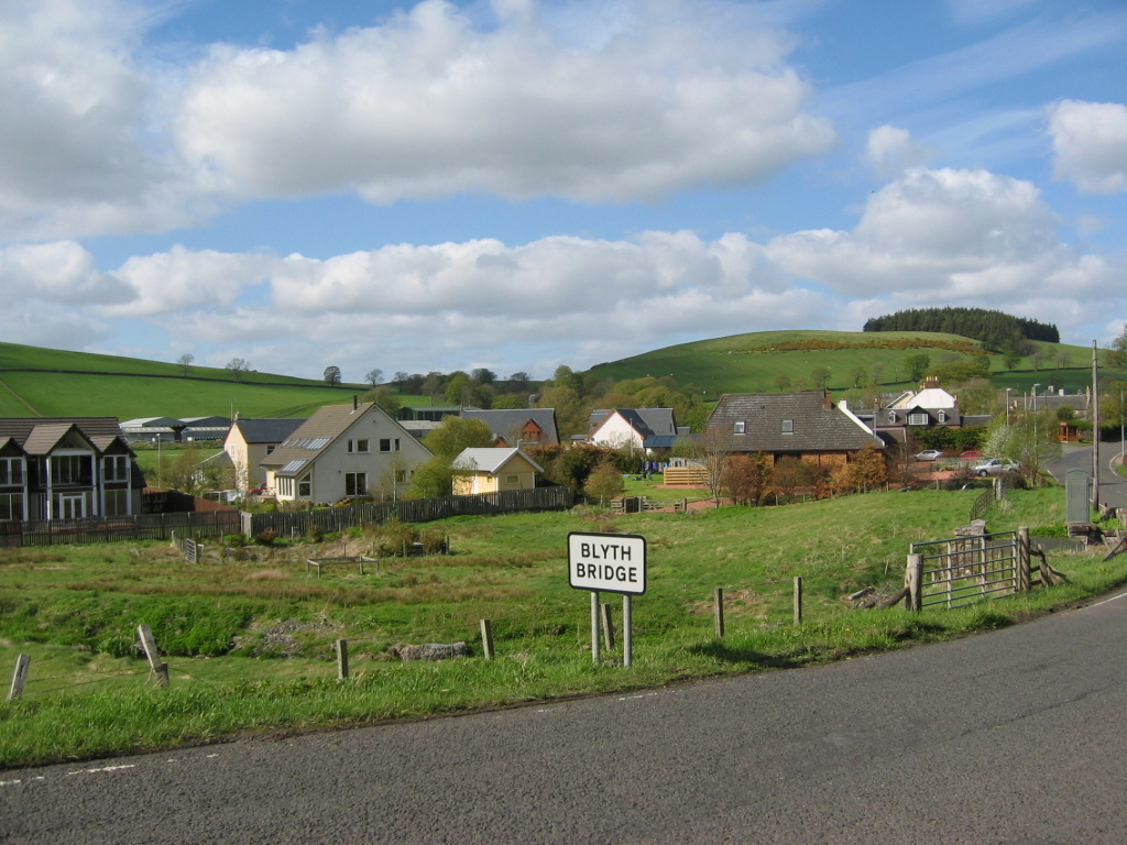
Blyth Bridge
Blyth Bridge is a small hamlet in the Scottish Borders area of Scotland, near to West Linton. It is located in a bend on the A701 which goes from Moffat...
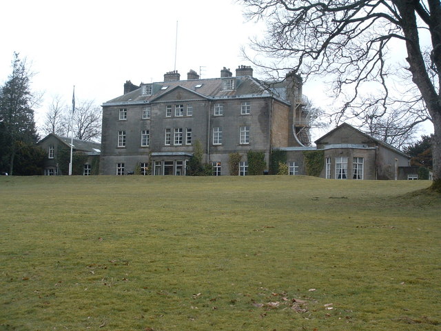
Castle Craig Hospital
Castle Craig Hospital is a private residential drug and alcohol rehabilitation clinic. It is located in Peeblesshire, Scotland. Castle Craig is an 18th...

Bordlands
Bordlands is a village in the Parish of Newlands in the Scottish Borders area of Scotland. The former name of Bordlands was Boreland. == See also == List...
Nearby Amenities
Located within 500m of 55.690638,-3.3854884Have you been to Blyth?
Leave your review of Blyth below (or comments, questions and feedback).