Bluntisham

Settlement in Huntingdonshire Huntingdonshire

England

Bluntisham

St Mary, Bluntisham: late September 2021
St Mary, Bluntisham: late September 2021 Credit: Basher Eyre

Bluntisham is a village located in the district of Huntingdonshire in Cambridgeshire, England. Situated on the eastern bank of the Great Ouse River, it is approximately 10 miles northwest of the city of Cambridge. The village has a population of around 2,000 residents.

Bluntisham is a picturesque village with a rich history that dates back to the Roman times. Evidence of Roman settlements has been discovered in the area, including pottery and coins. The village's name is believed to have originated from the Old English words "blunt" and "ham," which mean "blunt" and "homestead" respectively.

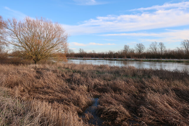
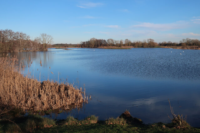
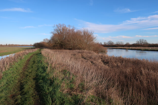
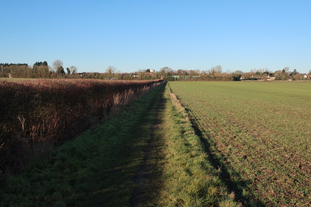
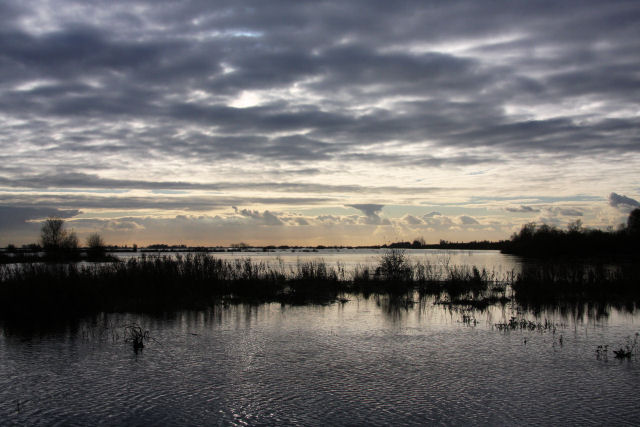
The village is known for its beautiful natural surroundings, with the Great Ouse River running alongside it. The river provides opportunities for boating, fishing, and leisurely walks along its banks. Bluntisham is also surrounded by lush countryside, offering scenic views and peaceful walks for nature enthusiasts.

Bluntisham has a strong sense of community and offers a range of amenities to its residents. These include a primary school, a village hall, a local shop, and a pub. The village is well-connected to surrounding areas through a network of roads, making it easily accessible for commuters.

Overall, Bluntisham is a charming village in Huntingdonshire that offers a peaceful and scenic lifestyle for its residents. Its rich history, natural beauty, and community spirit make it an attractive place to live and visit.

If you have any feedback on the listing, please let us know in the comments section below.

Bluntisham Images

Images are sourced within 2km of 52.353902/0.006847 or Grid Reference TL3674. Thanks to Geograph Open Source API. All images are credited.
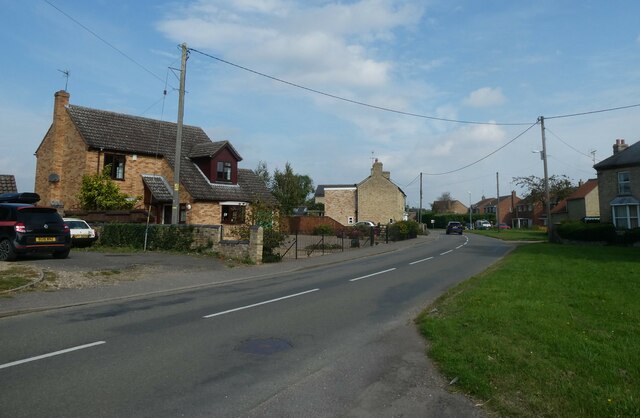
St Mary, Bluntisham: late September 2021
Approaching the junction of the A1123 with Holliday's Road
Village sign, Colne
Village sign, Colne
St Helen, Colne: late September 2021
Looking north-east along the High Street
Crane's Fen (Cell 8), Ouse Fen RSPB Former sand and gravel quarry, and arable land before that.
Crane's Fen (Cell 8), Ouse Fen RSPB
Former sand and gravel quarry, and arable land before that.
Path at Ouse Fen One of the reserve paths from the car park at the north end.
Path at Ouse Fen
One of the reserve paths from the car park at the north end.
Houses at Bluntisham A semi-detached pair at the junction of Holliday's Road with Rectory Road [A1123]. The RH one looks as if it has nest boxes for swifts, or other birds, under the eaves?
Houses at Bluntisham
A semi-detached pair at the junction of Holliday's Road with Rectory Road [A1123]. The RH one looks as if it has nest boxes for swifts, or other birds, under the eaves?
The Colne Road [B1050] at Earith The brick building is a gas governor.
The Colne Road [B1050] at Earith
The brick building is a gas governor.
Cook's Drove, Earith At its junction with Colne Road [B1050].
Cook's Drove, Earith
At its junction with Colne Road [B1050].
Little Fen Floodplain by the Great Ouse.
Little Fen
Floodplain by the Great Ouse.
River Great Ouse
River Great Ouse
Bluntisham House
Bluntisham House
Path to Bluntisham
Path to Bluntisham
Horse paddocks by Bluntisham
Barleycroft Lake Former gravel pit, now part of the RSPB Ouse Fen reserve, which also covers Needingworth Lakes, Berry Fen and the new reedbeds east of the Ouse, which is the area generally referred to as Ouse Fen.
Barleycroft Lake
Former gravel pit, now part of the RSPB Ouse Fen reserve, which also covers Needingworth Lakes, Berry Fen and the new reedbeds east of the Ouse, which is the area generally referred to as Ouse Fen.
Ouse Valley Way
Ouse Valley Way
Footpath to Bluntisham
Show me another place!

Bluntisham is located at Grid Ref: TL3674 (Lat: 52.353902, Lng: 0.006847)

Administrative County: Cambridgeshire

District: Huntingdonshire

Police Authority: Cambridgeshire

What 3 Words

///mammal.pedicure.reunion. Near Bluntisham, Cambridgeshire

Related Wikis

Bluntisham railway station

Bluntisham railway station was a station in Bluntisham, Cambridgeshire on the Ely and St Ives Railway. The station closed for regular passenger services...

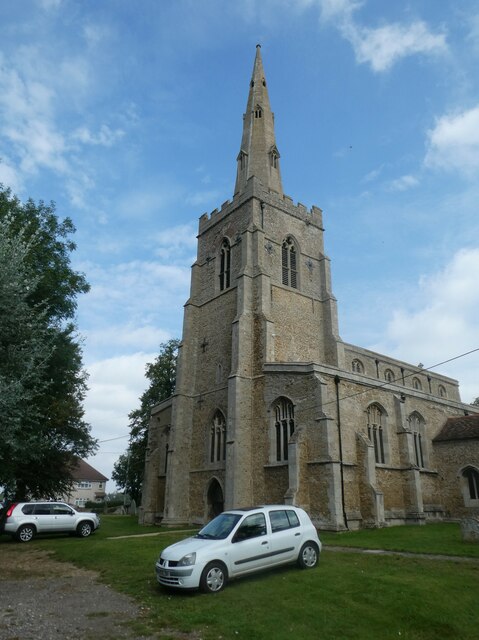
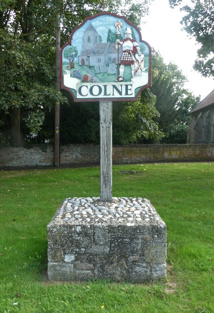
Colne, Cambridgeshire

Colne is a village and civil parish in Cambridgeshire, England. Colne lies about 9 miles (14 km) east of Huntingdon; the villages of Bluntisham, Woodhurst...

Bluntisham

Bluntisham is a village and civil parish in Cambridgeshire, England. The population of the civil parish at the 2011 census was 2,003. Bluntisham lies approximately...

Earith

Earith is a village and civil parish in Cambridgeshire, England. Lying approximately 10 miles (16 km) east of Huntingdon, Earith is situated within Huntingdonshire...

Berry Fen

Berry Fen is a 15.3-hectare (38-acre) biological Site of Special Scientific Interest on the western outskirts of Earith in Cambridgeshire.This neutral...

Cambridgeshire

Cambridgeshire (abbreviated Cambs.) is a ceremonial county in the East of England and East Anglia. It is bordered by Lincolnshire to the north, Norfolk...

List of Sites of Special Scientific Interest in Cambridgeshire

Cambridgeshire is a county in eastern England, with an area of 339,746 hectares (1,312 sq mi) and a population as of mid-2015 of 841,218. It is crossed...

List of local nature reserves in Cambridgeshire

Cambridgeshire is a county in eastern England, with an area of 1,308 square miles (3,390 km2) and a population as of 2011 of 708,719. It is crossed by...

Related Videos

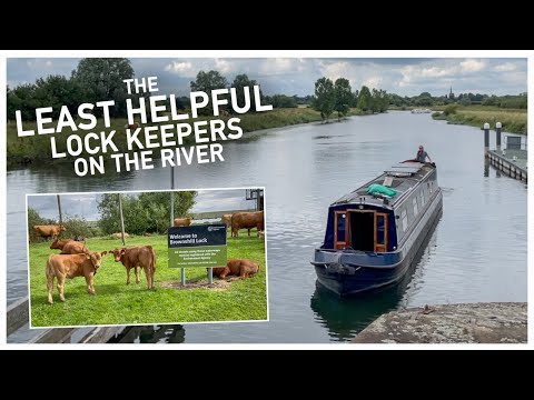
409 - The Least Helpful Lock Keepers on the River!

We have a very long cruising day as we travel from Ely to Earith and beyond on the River Great Ouse. The route took us down the ...

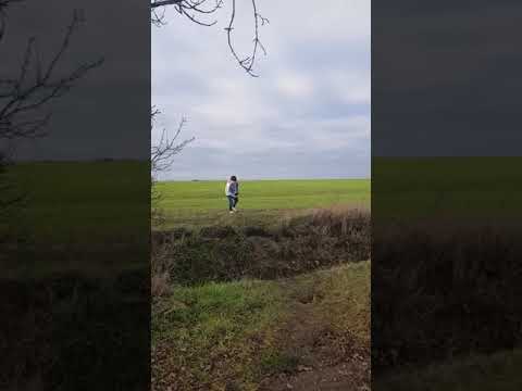
Funny dog fail video - cute puppy - dog jumping Actual footage of me making decisions

Out for a nice walk, geocaching in the british winter when we came across a nice ditch to jump. The dog joined in too, with some ...

Voodoo Haze - Tush (ZZ Top cover)

Follow us https://www.facebook.com/voodoohaze Voodoo Haze are a four-piece band from Peterborough UK that specialise in ...

Nearby Amenities

Located within 500m of 52.353902,0.006847
Bluntisham
Place: village
Lat/Long: 52.353456/0.0088242
Bus Stop
Presses Close
Bus: yes
Naptan AtcoCode: 0500HBLUN003
Naptan Bearing: N
Naptan BusStopType: CUS
Naptan CommonName: Presses Close
Naptan Indicator: adj
Naptan Landmark: Presses Close
Naptan NaptanCode: cmbdmptw
Naptan ShortCommonName: Presses Close
Naptan Street: Colne Road
Naptan Verified: no
Public Transport: platform
Source: naptan_import
Lat/Long: 52.3558666/0.0089162
Bus Stop
Rectory Road
Bus: yes
Naptan AtcoCode: 0500HBLUN004
Naptan Bearing: N
Naptan CommonName: Rectory Road
Naptan Indicator: opp
Naptan Landmark: Station Road
Naptan NaptanCode: cmbdmpwa
Naptan ShortCommonName: Rectory Road
Naptan Street: High Street
Naptan Verified: no
Public Transport: platform
Source: naptan_import
Lat/Long: 52.3511445/0.0063526
Bus Stop
Rectory Road
Bus: yes
Naptan AtcoCode: 0500HBLUN005
Naptan Bearing: SW
Naptan CommonName: Rectory Road
Naptan Indicator: near
Naptan Landmark: High Street
Naptan NaptanCode: cmbdmpwd
Naptan ShortCommonName: Station Road
Naptan Street: Station Road
Naptan Verified: no
Public Transport: platform
Shelter: yes
Source: naptan_import
Lat/Long: 52.3505497/0.0058998
Bus Stop
St Mary's Close
Bus: yes
Naptan AtcoCode: 0500HBLUN006
Naptan Bearing: S
Naptan CommonName: St Mary's Close
Naptan Indicator: opp
Naptan Landmark: St Mary's Close
Naptan NaptanCode: cmbdmpwg
Naptan ShortCommonName: St Mary's Close
Naptan Street: Hollidays Road
Naptan Verified: no
Public Transport: platform
Source: naptan_import
Lat/Long: 52.3524168/0.0124308
Bus Stop
St Mary's Close
Bus: yes
Naptan AtcoCode: 0500HBLUN007
Naptan Bearing: N
Naptan CommonName: St Mary's Close
Naptan Indicator: near
Naptan Landmark: St Mary's Close
Naptan NaptanCode: cmbdmpwj
Naptan ShortCommonName: St Mary's Close
Naptan Street: Hollidays Road
Naptan Verified: no
Public Transport: platform
Source: naptan_import
Lat/Long: 52.3522486/0.0122763
Bus Stop
Presses Close
Bus: yes
Naptan AtcoCode: 0500HBLUN008
Naptan Bearing: S
Naptan CommonName: Presses Close
Naptan Indicator: opp
Naptan Landmark: Presses Close
Naptan NaptanCode: cmbdmpwm
Naptan ShortCommonName: Presses Close
Naptan Street: Colne Road
Naptan Verified: no
Public Transport: platform
Source: naptan_import
Lat/Long: 52.3558459/0.0090768
Bus Stop
St Mary's Road
Bus: yes
Naptan AtcoCode: 0500HBLUN010
Naptan Bearing: E
Naptan CommonName: St Mary's Road
Naptan Indicator: opp
Naptan Landmark: St Mary's Road
Naptan NaptanCode: cmbdmpwt
Naptan ShortCommonName: St Mary's Road
Naptan Street: East Street
Naptan Verified: no
Public Transport: platform
Source: naptan_import
Lat/Long: 52.3547482/0.0096437
Bus Stop
High Street
Bus: yes
Naptan AtcoCode: 0500HBLUN011
Naptan Bearing: S
Naptan CommonName: High Street
Naptan Indicator: o/s 23
Naptan Landmark: Sayers Court
Naptan NaptanCode: CMBDMTAD
Naptan ShortCommonName: Sayers Court
Naptan Street: High Street
Naptan Verified: no
Public Transport: platform
Source: naptan_import
Lat/Long: 52.3540099/0.0070551
Bus Stop
St Mary's Road
Bus: yes
Naptan AtcoCode: 0500HBLUN012
Naptan Bearing: W
Naptan CommonName: St Mary's Road
Naptan Indicator: near
Naptan Landmark: St Mary's Road
Naptan NaptanCode: cmbdmtag
Naptan ShortCommonName: St Mary's Road
Naptan Street: East Street
Naptan Verified: no
Public Transport: platform
Source: naptan_import
Lat/Long: 52.3546733/0.0098166
Post Box
Ref: PE28 53
Lat/Long: 52.3565667/0.0020089
Post Box
Ref: PE28 255
Lat/Long: 52.357106/0.008062
Bicycle Parking
Lat/Long: 52.356063/0.0124824
Bramble Corner
Tourism: guest_house
Lat/Long: 52.3510086/0.0097369
Post Box
Ref: PE28 123
Lat/Long: 52.3513096/0.0101218
War Memorial
Historic: memorial
Wikidata: Q66478083
Lat/Long: 52.3514912/0.0124286
Barrier: cycle_barrier
Lat/Long: 52.3521912/0.0069797
Pub
The White Swan
Lat/Long: 52.3539301/0.0067096
Fast Food
May Garden
Cuisine: chinese
Lat/Long: 52.3539328/0.0064218
Barrier: cycle_barrier
Lat/Long: 52.3539628/0.0069737
Post Box
Ref: PE28 98
Lat/Long: 52.3542618/0.0065113
Barrier: cycle_barrier
Lat/Long: 52.3552515/0.0067707
Barrier: cycle_barrier
Lat/Long: 52.3547212/0.0083444
Power: pole
Lat/Long: 52.3500619/0.0040206
Power: pole
Lat/Long: 52.3521068/0.0035047
Power: pole
Lat/Long: 52.3535603/0.0047634
Power: pole
Lat/Long: 52.3534391/0.0010674
Power: pole
Lat/Long: 52.3539093/6.7E-5
Power: pole
Lat/Long: 52.3543043/0.0022261
Power: pole
Lat/Long: 52.355107/0.0022636
Power: pole
Lat/Long: 52.3534655/0.0021402
Power: pole
Lat/Long: 52.351467/0.0036429
Power: pole
Lat/Long: 52.3534457/0.0031219
Power: pole
Lat/Long: 52.3528374/0.0033433
Bench
Lat/Long: 52.3547892/0.0130042
Bench
Lat/Long: 52.355901/0.012854
Bench
Lat/Long: 52.3548002/0.0126179
Bench
Lat/Long: 52.3559087/0.0126801
Public Bookcase
Used Book Exchange
Booth: K6
Disused Amenity: telephone
Listed Status: Grade II
Man Made: telephone_box
Public Bookcase Type: phone_box
Wikidata: Q26615418
Lat/Long: 52.354924/0.0084777
Bus Stop
High Street
Bus: yes
Lit: yes
Naptan AtcoCode: 0500HBLUN009
Naptan Bearing: N
Naptan BusStopType: CUS
Naptan CommonName: High Street
Naptan Indicator: o/s 26a
Naptan NaptanCode: CMBDMPWP
Naptan Street: High Street
Naptan Verified: no
Public Transport: platform
Surface: asphalt
Lat/Long: 52.3535826/0.0067905
Turning Circle
Lat/Long: 52.3519326/0.0089344
Power: pole
Lat/Long: 52.3510269/0.0037438
Bluntisham
Man Made: village_sign
Source: survey
Tourism: artwork
Lat/Long: 52.3514125/0.0123006
The data included in this document is from www.openstreetmap.org. The data is made available under ODbL.

Have you been to Bluntisham?

Leave your review of Bluntisham below (or comments, questions and feedback).