Smythe's Green

Settlement in Essex Colchester

England

Smythe's Green

Birch: Very boggy field and practically full drainage channel
Birch: Very boggy field and practically full drainage channel Credit: Michael Garlick

Smythe's Green is a charming village located in the county of Essex, England. Situated amidst picturesque countryside, this tranquil settlement offers a peaceful retreat away from the hustle and bustle of city life. With a population of around 500 residents, Smythe's Green exudes a close-knit community atmosphere that is warmly welcoming to both locals and visitors.

The village is known for its idyllic surroundings, characterized by rolling green fields, quaint cottages with thatched roofs, and a beautiful village green at its heart. This well-preserved village green serves as a focal point for social gatherings and community events throughout the year, such as summer fetes and Christmas markets.

Smythe's Green is not only visually appealing but also boasts a rich historical heritage. The village is home to several listed buildings, including the St. Mary's Church, a magnificent structure dating back to the 12th century. The church's stunning architecture and serene atmosphere make it a popular spot for weddings and other religious ceremonies.

Despite its rural charm, Smythe's Green is conveniently located just a short drive from nearby towns and cities. This accessibility allows residents to easily access a range of amenities, including schools, shops, and healthcare facilities. The village also benefits from excellent transport links, with regular bus services connecting it to the surrounding areas.

In summary, Smythe's Green offers a quintessential English countryside experience. Its breathtaking scenery, strong community spirit, and historical significance make it an attractive destination for those seeking a peaceful and picturesque place to call home.

If you have any feedback on the listing, please let us know in the comments section below.

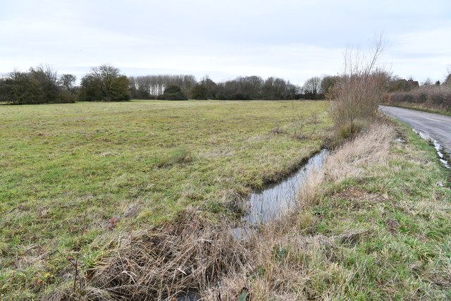
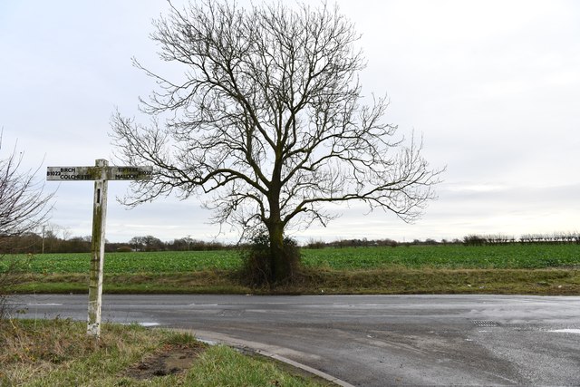
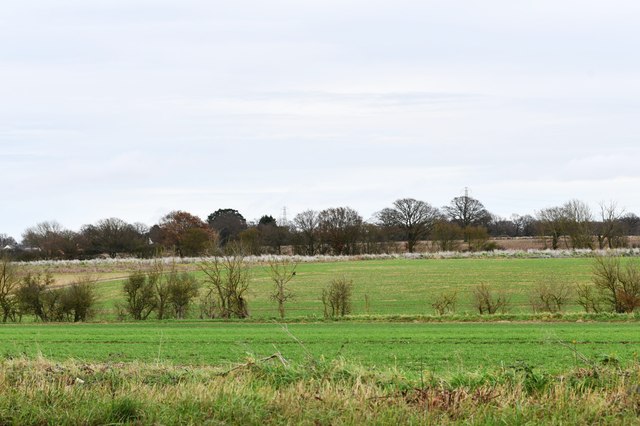
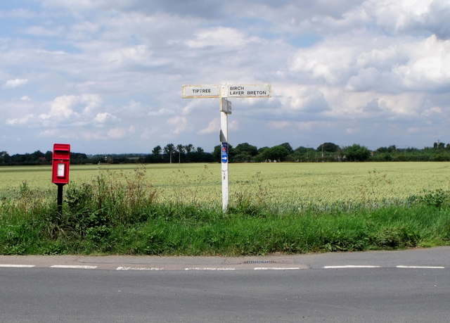
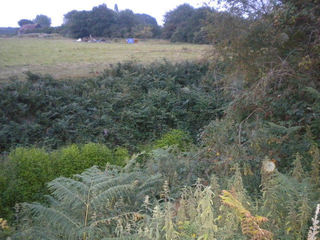
Smythe's Green Images

Images are sourced within 2km of 51.829952/0.785537 or Grid Reference TL9218. Thanks to Geograph Open Source API. All images are credited.

Birch: Very boggy field and practically full drainage channel
Birch: B1022 junction
Birch: Fields
Birch: Fields
Layer Marney Tower.  Essex The magnificent Tudor gatehouse of this renowned Essex Mansion, built by Henry, the first Lord Marney, who never lived to see its completion.
Layer Marney Tower. Essex
The magnificent Tudor gatehouse of this renowned Essex Mansion, built by Henry, the first Lord Marney, who never lived to see its completion.
Giant Sequoioa One of four on the track going down Pods Wood.
Giant Sequoioa
One of four on the track going down Pods Wood.
Horse and cattle grid, Layer Marney
Layer Marney Tower, Essex
Black sheep, Layer Marney
Postbox and signpost, Layer Marney
A very overgrown rampart The rampart is a deep ditch dug by the Romans. It was used to defend the Romans from another army.
A very overgrown rampart
The rampart is a deep ditch dug by the Romans. It was used to defend the Romans from another army.
Wheat field near Layer Lakes In winter this is just grass.
Wheat field near Layer Lakes
In winter this is just grass.
Pathway looking towards the Rampart The rampart is a defensive ditch <a href="https://www.geograph.org.uk/photo/2801512">TL9017 : A very overgrown rampart</a>
Pathway looking towards the Rampart
The rampart is a defensive ditch TL9017 : A very overgrown rampart
Shooting tower
Shooting tower
Interior of the function hall, Layer Marney Tower
The Gatehouse, Layer Marney Tower My second visit in 33 years.  The only difference I can see from my 1979 picture <a href="https://www.geograph.org.uk/photo/2368828">TL9217 : Layer Marney Tower.  Essex</a> is the dense evergreen hedging either side of the path has either been re-planted or heavily cut back.
The Gatehouse, Layer Marney Tower
My second visit in 33 years. The only difference I can see from my 1979 picture TL9217 : Layer Marney Tower. Essex is the dense evergreen hedging either side of the path has either been re-planted or heavily cut back.
Layer Marney Tower,  Essex Taken from the steps in front of the gatehouse,looking the reverse way from <a href="https://www.geograph.org.uk/photo/3086012">TL9217 : The Gatehouse, Layer Marney Tower</a>. The view is now down the path, beyond the wrought iron gates to the buildings of Hall Farm, and on further into the lush Essex countryside.
Layer Marney Tower, Essex
Taken from the steps in front of the gatehouse,looking the reverse way from TL9217 : The Gatehouse, Layer Marney Tower. The view is now down the path, beyond the wrought iron gates to the buildings of Hall Farm, and on further into the lush Essex countryside.
The Gatehouse, Layer Marney Tower Built of the very finest Tudor bricks, this magnificent gatehouse is the tallest gatehouse in England. As was the custom of those that had wealth, it was meant to impress. To show just how much your status was above that of your contemporaries.
The Gatehouse, Layer Marney Tower
Built of the very finest Tudor bricks, this magnificent gatehouse is the tallest gatehouse in England. As was the custom of those that had wealth, it was meant to impress. To show just how much your status was above that of your contemporaries.
Spiral staircase at Layer Marney Tower The way down from the roof
Spiral staircase at Layer Marney Tower
The way down from the roof
Show me another place!

Smythe's Green is located at Grid Ref: TL9218 (Lat: 51.829952, Lng: 0.785537)

Administrative County: Essex

District: Colchester

Police Authority: Essex

What 3 Words

///irritable.hopping.adopt. Near Tiptree, Essex

Related Wikis

Smythe's Green

Smythe's Green is a hamlet on the B1022 road, in the Colchester district, in the county of Essex, England. It is located in between the villages of Tiptree...
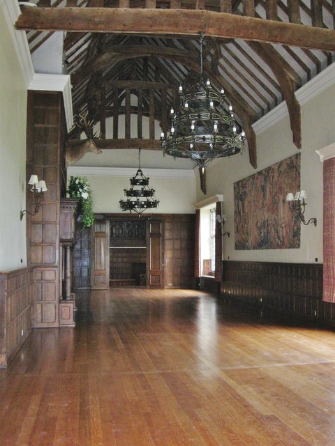
Layer Marney Tower

Layer Marney Tower is an incomplete early Tudor country house, with gardens and parkland, dating from about 1523, in Layer Marney, Essex, England, between...

RAF Birch

Royal Air Force Birch or more simply RAF Birch is a former Royal Air Force station in Essex, England. The airfield is located 2 mi (3.2 km) northeast...

Layer Marney

Layer Marney is a village and civil parish in the City of Colchester district of Essex, England, near Tiptree. Layer Marney has a Tudor palace called Layer...

Nearby Amenities

Located within 500m of 51.829952,0.785537
Bus Stop
Smyths Green
Naptan AtcoCode: 1500IM1272
Naptan Bearing: SW
Naptan CommonName: Smyths Green
Naptan Indicator: Adj
Naptan Landmark: Smyths Green
Naptan NaptanCode: esxdajam
Naptan Street: Maldon Road
Public Transport: platform
Source: naptan_import;bing
Lat/Long: 51.8337194/0.7870167
Bus Stop
Smyths Green
Naptan AtcoCode: 1500IM1272AA
Naptan Bearing: NE
Naptan BusStopType: CUS
Naptan CommonName: Smyths Green
Naptan Indicator: Opp
Naptan Landmark: Smyths Green
Naptan NaptanCode: esxjajgd
Naptan Street: Maldon Road
Naptan Verified: no
Public Transport: platform
Source: naptan_import
Lat/Long: 51.8337945/0.7869853
Smythe's Green
Place: hamlet
Wikidata: Q7546771
Lat/Long: 51.8329978/0.7878123
Power: pole
Source: bing
Lat/Long: 51.8294367/0.7893095
Power: pole
Source: bing
Lat/Long: 51.8301353/0.7886769
Power: pole
Source: bing
Lat/Long: 51.830351/0.7874115
Power: pole
Source: bing
Lat/Long: 51.8305788/0.7860209
Power: pole
Source: bing
Lat/Long: 51.8309022/0.7891619
Power: pole
Source: bing
Lat/Long: 51.8316442/0.789657
Power: pole
Source: bing
Lat/Long: 51.8323863/0.7901353
Power: pole
Source: bing
Lat/Long: 51.8330932/0.7905835
Power: pole
Lat/Long: 51.8272909/0.7910478
Power: pole
Lat/Long: 51.8280128/0.790455
Power: pole
Lat/Long: 51.8287381/0.7898784
Power: pole
Lat/Long: 51.8314897/0.7923058
Power: pole
Lat/Long: 51.8309012/0.7913348
Power: pole
Lat/Long: 51.8302631/0.7902727
Power: pole
Lat/Long: 51.8294823/0.7889771
Power: pole
Lat/Long: 51.8280021/0.7884246
Power: pole
Lat/Long: 51.82716/0.7864237
Power: pole
Lat/Long: 51.8270953/0.7850316
Power: pole
Lat/Long: 51.826419/0.7838917
Power: pole
Lat/Long: 51.8259133/0.7834384
Power: pole
Lat/Long: 51.8265433/0.7844764
Power: pole
Lat/Long: 51.8268268/0.7855734
Power: pole
Lat/Long: 51.8271682/0.7870594
Power: pole
Lat/Long: 51.82746/0.7882905
Power: pole
Lat/Long: 51.8284397/0.7890469
Power: pole
Lat/Long: 51.8295072/0.7894948
Power: pole
Lat/Long: 51.8300973/0.7904685
Power: pole
Lat/Long: 51.8307537/0.7915467
Description: temporary
Marker: yes
Utility: gas
Lat/Long: 51.8329598/0.7846974
Description: temporary
Marker: yes
Utility: gas
Lat/Long: 51.832972/0.7846172
Colour: yellow
Marker: post
Material: plastic
Utility: gas
Lat/Long: 51.8325942/0.7865332
Colour: red and white
Description: temporary
Marker: aerial
Material: plastic
Utility: gas
Lat/Long: 51.8328194/0.7831701
Colour: red and white
Description: temporary
Marker: aerial
Material: plastic
Utility: gas
Lat/Long: 51.8327914/0.7810627
The data included in this document is from www.openstreetmap.org. The data is made available under ODbL.

Have you been to Smythe's Green?

Leave your review of Smythe's Green below (or comments, questions and feedback).