Small Dole

Settlement in Sussex Horsham

England

Small Dole

Sheep north of Eastout
Sheep north of Eastout Credit: Ian Cunliffe

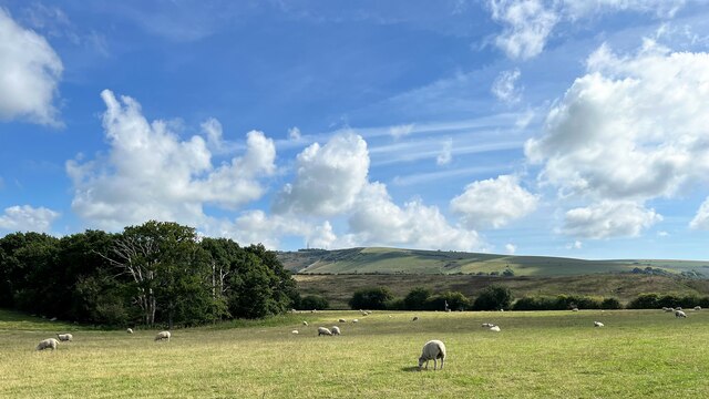
Small Dole is a small village located in the Horsham District of West Sussex, England. Situated approximately 10 miles north of the coastal city of Brighton and Hove, Small Dole is nestled amidst the picturesque South Downs National Park. With a population of around 500 residents, it exudes a quaint charm and a close-knit community atmosphere.

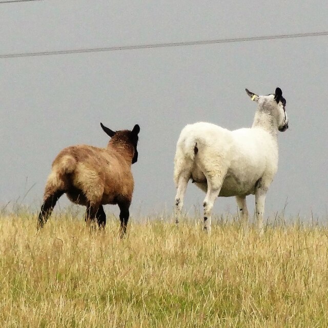
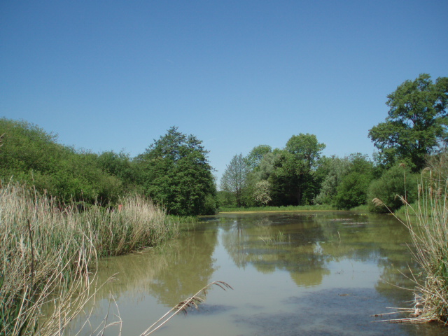
The village is surrounded by rolling hills, meadows, and woodlands, offering residents and visitors ample opportunities for outdoor activities such as hiking, cycling, and horse riding. It is also home to the popular Downs Link, a long-distance footpath and bridleway that connects the North Downs Way and the South Downs Way, attracting nature enthusiasts and adventurers alike.

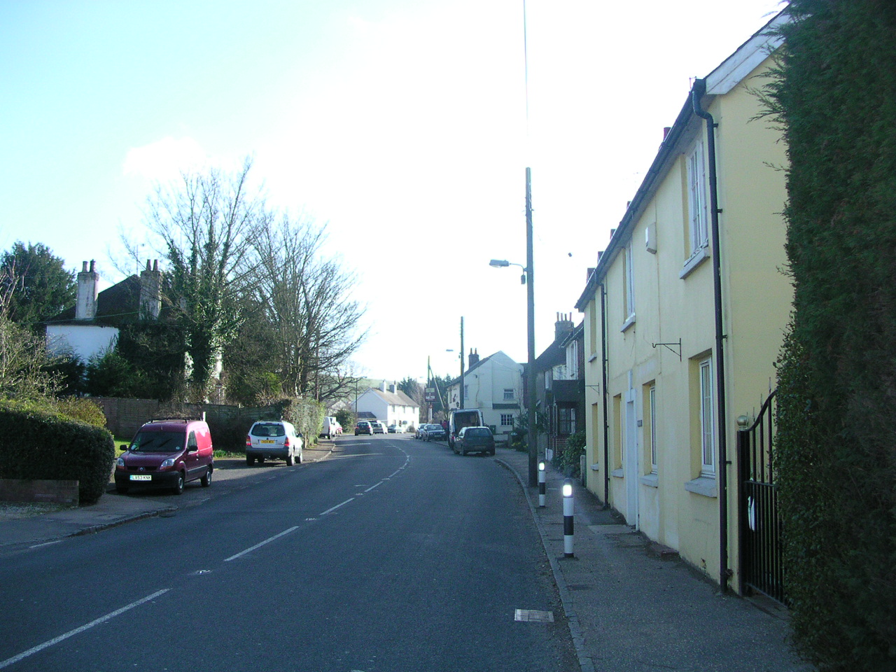
Small Dole boasts a rich history, with evidence of human settlement dating back to the Iron Age. Today, it retains a historic character with several traditional cottages and buildings dotting its landscape. The village is served by a local pub, The Fox, which offers a cozy atmosphere and traditional British cuisine.

For amenities, residents have access to a village hall, a primary school, and a small convenience store. Nearby towns such as Henfield and Steyning provide additional services and amenities including shops, supermarkets, and secondary schools. Small Dole benefits from good transport links, with regular bus services connecting it to the surrounding areas, and the nearby A283 road providing convenient access to larger towns and cities.

Overall, Small Dole is a tranquil and idyllic village that offers residents a peaceful countryside lifestyle, while still providing access to essential amenities and the beauty of the South Downs National Park.

If you have any feedback on the listing, please let us know in the comments section below.
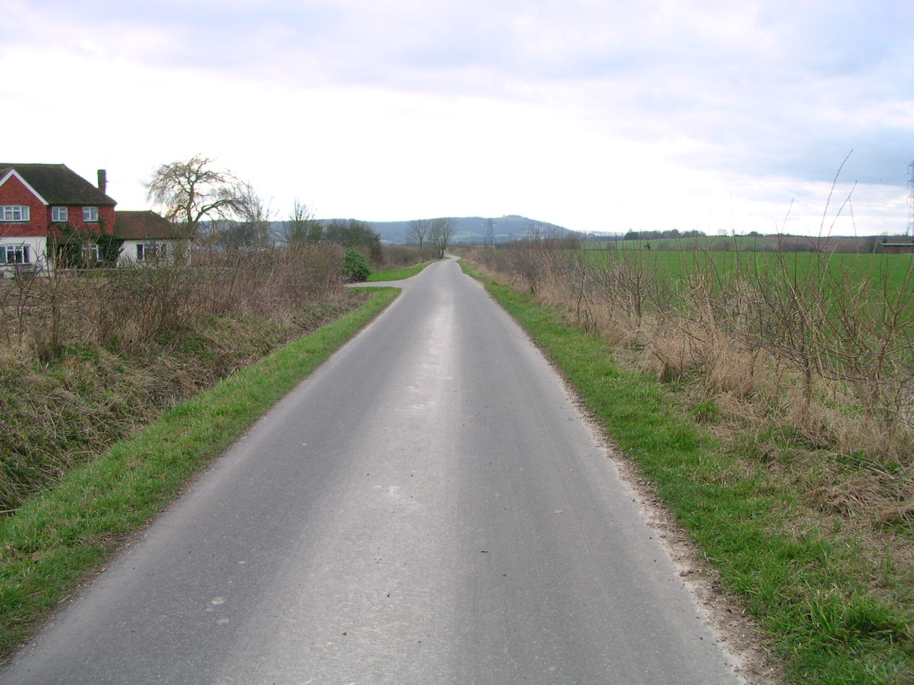
Small Dole Images

Images are sourced within 2km of 50.904385/-0.269542 or Grid Reference TQ2113. Thanks to Geograph Open Source API. All images are credited.

Sheep north of Eastout
Gate latch by the Downs Link footpath
Fungi growing on horse manure
View SE towards Truleigh Hill Horton Wood is on the left.
View SE towards Truleigh Hill
Horton Wood is on the left.
Outbuilding at New Hall
Flood water on the east side of the disused railway track
Pylon in a field of buttercups
Nettle leaf
Nettle leaf
Cows by the public footpath These cows were gathered near the stile. They are usually further along the footpath - to the east.
Cows by the public footpath
These cows were gathered near the stile. They are usually further along the footpath - to the east.
Banks of the River Adur Banks of the River Adur with BT Mast at Truleigh Hill (ht 216m) in the distance
Banks of the River Adur
Banks of the River Adur with BT Mast at Truleigh Hill (ht 216m) in the distance
River Adur Taken from the footpath on the northern bank of the river looking into the early morning sun whilst trying to capture the mist rising off the river. There are herds of cows on both banks.
River Adur
Taken from the footpath on the northern bank of the river looking into the early morning sun whilst trying to capture the mist rising off the river. There are herds of cows on both banks.
Frost Covered Field, Adur Flood Plain The footpath that connects the River Adur with Wyckham Farm runs somewhere through it.
Frost Covered Field, Adur Flood Plain
The footpath that connects the River Adur with Wyckham Farm runs somewhere through it.
Old and New Footbridges The one in the field, lacking a right hand barrier is awaiting collection having been replaced with a new one. The latter carries the footpath from the River Adur to Wyckham Farm.
Old and New Footbridges
The one in the field, lacking a right hand barrier is awaiting collection having been replaced with a new one. The latter carries the footpath from the River Adur to Wyckham Farm.
Do You Think He Wants To Go This Way? The northern side of the footbridge is blocked by a herd of inquisitive bullocks. The next ten minutes will require much shooing and being followed. On the footpath from the River Adur to Wyckham Farm.
Do You Think He Wants To Go This Way?
The northern side of the footbridge is blocked by a herd of inquisitive bullocks. The next ten minutes will require much shooing and being followed. On the footpath from the River Adur to Wyckham Farm.
Quick Lads, There's A Bloke With A Camera In Our Field Let's Follow Him This was fun crossing this field, having negotiated a herd of inquisitive bullocks blocking the footbridge I turned the corner and discovered another herd in the next field who were soon joined by a couple who had followed me from the footbridge. The walk across here involved a couple of minutes walking away from them followed by a few more walking towards them to shoo them away. This continued until they got bored and wandered back to the rest of the herd. The footpath itself links the River Adur with Wyckham Farm.
Quick Lads, There's A Bloke With A Camera In Our Field Let's Follow Him
This was fun crossing this field, having negotiated a herd of inquisitive bullocks blocking the footbridge I turned the corner and discovered another herd in the next field who were soon joined by a couple who had followed me from the footbridge. The walk across here involved a couple of minutes walking away from them followed by a few more walking towards them to shoo them away. This continued until they got bored and wandered back to the rest of the herd. The footpath itself links the River Adur with Wyckham Farm.
River Adur - view towards Truleigh Hill
River Adur - and plaque giving historical information about Stretham Manor
Downs Link bridge over River Adur Formerly a railway bridge. Curiously, this is one of two bridges near Henfield which straddle the '20th parallel' where the route crosses the Adur. Careful positioning is needed to get in the same square as the bulk of the bridge.
Downs Link bridge over River Adur
Formerly a railway bridge. Curiously, this is one of two bridges near Henfield which straddle the '20th parallel' where the route crosses the Adur. Careful positioning is needed to get in the same square as the bulk of the bridge.
Show me another place!

Small Dole is located at Grid Ref: TQ2113 (Lat: 50.904385, Lng: -0.269542)

Administrative County: West Sussex

District: Horsham

Police Authority: Sussex

What 3 Words

///became.desk.tripling. Near Henfield, West Sussex

Related Wikis

Small Dole

Small Dole is a village in the Horsham District of West Sussex, in England. It lies on the A2037 road two miles (3.2 km) south of Henfield. In the late...
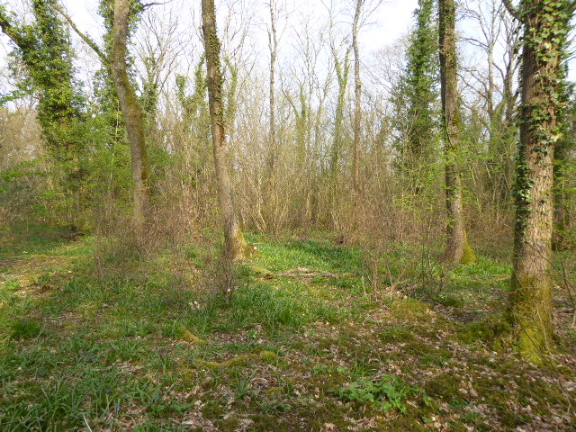
Tottington Wood

Tottington Wood is a 5.1-hectare (13-acre) Local Nature Reserve in Small Dole in West Sussex. It is owned by Hopegar Properties and managed by The Tottington...

Woods Mill

Woods Mill is a 19-hectare (47-acre) nature reserve south of Henfield in West Sussex. It is managed by the Sussex Wildlife Trust.This is the headquarters...

Horton Clay Pit

Horton Clay Pit is a 0.4-hectare (0.99-acre) geological Site of Special Scientific Interest in Small Dole in West Sussex. It is a Geological Conservation...

Sussex Greensand Way

The Sussex Greensand Way is a Roman road that runs east-west linking the London to Lewes Way at Barcombe Mills to Stane Street at Hardham. The road, which...

Edburton

Edburton is a small village and former civil parish, now in the parish of Upper Beeding, in the Horsham district, in the county of West Sussex, England...

Woodmancote, Horsham District

Woodmancote is a village and civil parish in the Horsham District of West Sussex, England. The village is 1 mile (1.5 km) southeast of Henfield on the...

Edburton Castle Ring

Edburton Castle Ring (or Castle Rings) is an archaeological site in West Sussex, England, on the peak of Edburton Hill on the South Downs, near the villages...

Nearby Amenities

Located within 500m of 50.904385,-0.269542
Bus Stop
Post Office
Naptan AtcoCode: 4400HR0348
Naptan Bearing: N
Naptan CommonName: Post Office
Naptan Indicator: o/s Post Office
Naptan Landmark: Sands Lane
Naptan NaptanCode: wsxawdpg
Naptan Street: Shoreham Road
Naptan Verified: no
Source: naptan_import
Lat/Long: 50.9025483/-0.2747776
Bus Stop
Post Office
Naptan AtcoCode: 4400HR0349
Naptan Bearing: S
Naptan CommonName: Post Office
Naptan Indicator: adj Sands Lane
Naptan Landmark: Sands Lane
Naptan NaptanCode: wsxawdpj
Naptan Street: Shoreham Road
Naptan Verified: no
Source: naptan_import
Lat/Long: 50.9031498/-0.2741011
Bus Stop
Hoewood
Naptan AtcoCode: 4400HR1123
Naptan Bearing: S
Naptan CommonName: Hoewood
Naptan Indicator: Hoewood
Naptan Landmark: New Hall Lane
Naptan Street: Shoreham Road
Naptan Verified: no
Source: naptan_import
Lat/Long: 50.9068861/-0.2737638
Bus Stop
Hoewood
Naptan AtcoCode: 4400HR1124
Naptan Bearing: N
Naptan CommonName: Hoewood
Naptan Indicator: Hoewood
Naptan Landmark: New Hall Lane
Naptan Street: Shoreham Road
Naptan Verified: no
Source: naptan_import
Lat/Long: 50.9063583/-0.273954
Post Office
Small Dole Post Office
Addr City: Henfield
Addr Country: GB
Addr Postcode: BN5 9XT
Addr Street: Henfield Road
Addr Village: Small Dole
Brand: Post Office
Brand Wikidata: Q1783168
Fhrs Id: 427135
Opening Hours: Mo-Sa 06:00-20:00; Su 06:00-13:30
Ref Pol Id: 1025
Source: OS_OpenData_StreetView
Website: https://www.postoffice.co.uk/branch-finder/0909084/small-dole
Lat/Long: 50.9025156/-0.274838
Small Dole
Place: village
Wikidata: Q9338599
Lat/Long: 50.9031241/-0.2733922
Barrier: kissing_gate
Lat/Long: 50.9025574/-0.2634067
Mapillary: 749133469053958
Removed Amenity: telephone
Survey Date: 2020-11-04
Lat/Long: 50.90313/-0.2741047
Barrier: kissing_gate
Lat/Long: 50.9034936/-0.2743057
Addr Housename: Farmhouse Caravans and Camping
Phone: +44 1273 493157
Tourism: caravan_site
Website: http://www.farmhousecampsite.co.uk/
Lat/Long: 50.9033162/-0.2697669
Traffic Signals
Crossing: traffic_signals
Lat/Long: 50.9028084/-0.27451
Addr City: Henfield
Addr Housename: The Oaks
Addr Locality: Small Dole
Addr Postcode: BN5 9XU
Addr Street: Henfield Road
Lat/Long: 50.9025365/-0.274473
Addr City: Henfield
Addr Housename: Flint Cottages
Addr Locality: Small Dole
Addr Postcode: BN5 9YG
Addr Street: Shoreham Road
Lat/Long: 50.9060366/-0.2741924
Addr Place: Hill View
Addr Postcode: BN5 9XX
Addr Street: Hill View
Lat/Long: 50.9035799/-0.2718495
The data included in this document is from www.openstreetmap.org. The data is made available under ODbL.

Have you been to Small Dole?

Leave your review of Small Dole below (or comments, questions and feedback).