Saltcotes

Settlement in Lancashire Fylde

England

Saltcotes

Lytham windmill and museum
Lytham windmill and museum Credit: Steve Daniels

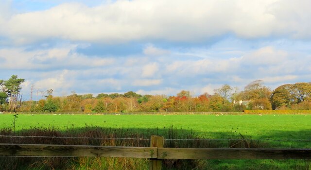
Saltcotes is a small village located in the county of Lancashire, in the northwest of England. Situated near the coastal town of Lytham St Annes, Saltcotes is known for its picturesque setting and tranquil atmosphere. The village is surrounded by open fields and farmland, contributing to its rural charm.

The history of Saltcotes dates back centuries, with evidence of settlement in the area from as early as the 12th century. In the past, the village was primarily associated with agriculture, and remnants of its farming heritage can still be seen in the form of old farmhouses and barns.

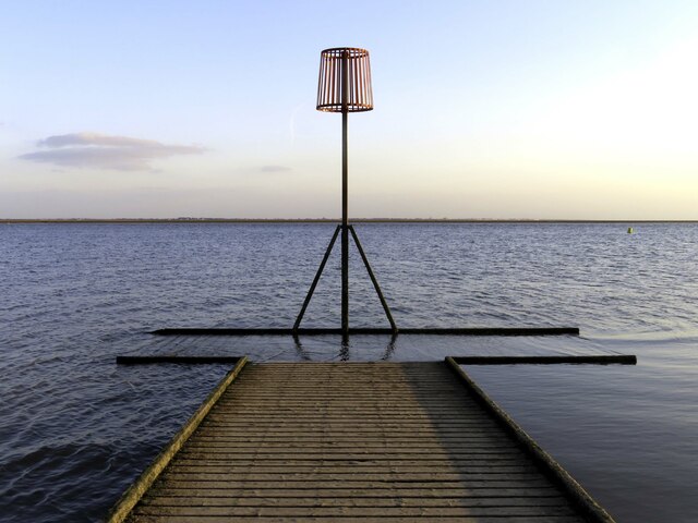
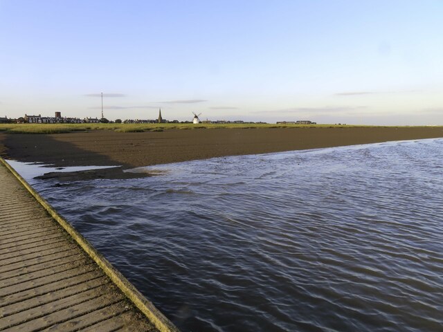
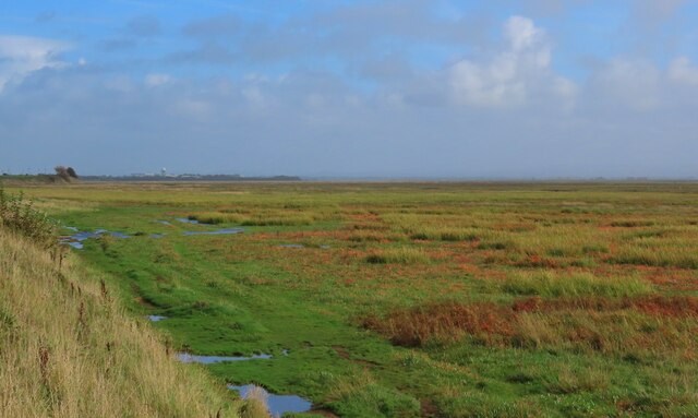
One of the prominent features of Saltcotes is its proximity to the Ribble Estuary, a large tidal river that flows into the Irish Sea. This coastal location makes Saltcotes a popular destination for birdwatching enthusiasts, as it serves as a habitat for a wide variety of bird species, including waders and wildfowl.

Despite its small size, Saltcotes benefits from convenient transportation links, with the nearby M55 motorway providing easy access to the rest of Lancashire and beyond. The village also has a local bus service, ensuring residents have access to nearby towns and amenities.

In terms of amenities, Saltcotes is relatively limited, with few shops or services within the village itself. However, the nearby towns of Lytham St Annes and Preston offer a range of shops, restaurants, and leisure facilities, catering to the needs of Saltcotes' residents.

Overall, Saltcotes offers a peaceful and idyllic living environment, with its rural location and close proximity to nature making it an attractive place to reside for those seeking a quieter lifestyle away from the hustle and bustle of larger towns and cities.

If you have any feedback on the listing, please let us know in the comments section below.
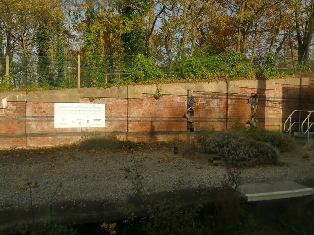
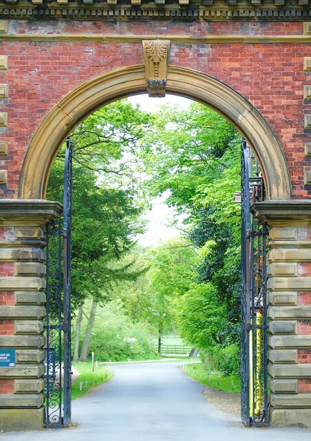
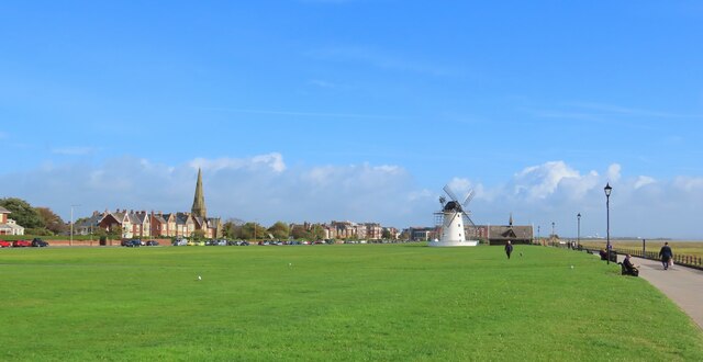
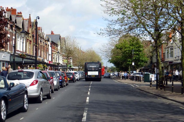
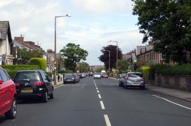
Saltcotes Images

Images are sourced within 2km of 53.746456/-2.94315 or Grid Reference SD3728. Thanks to Geograph Open Source API. All images are credited.

Lytham windmill and museum
Boardwalk to the jetty by Lytham RNLI Station
The end of the jetty by the Lytham RNLI Station
The foreshore at Lytham
The boardwalk to the Lytham RNLI Station
Lytham Windmill Lytham Windmill.
Lytham Windmill
Lytham Windmill.
Lytham station, disused platform In the heyday of holiday trains to the seaside, Lytham had two platforms, of which only one is now in use.  The white notice on the wall explains that the planters, of which one is shown here, are to encourage biodiversity.  See <a href="https://www.geograph.org.uk/photo/4751426">SD3627 : A train leaving Lytham Station</a> for context.
Lytham station, disused platform
In the heyday of holiday trains to the seaside, Lytham had two platforms, of which only one is now in use. The white notice on the wall explains that the planters, of which one is shown here, are to encourage biodiversity. See SD3627 : A train leaving Lytham Station for context.
Windmill and Old Lifeboat House On Lytham Green with the former lifeboat house now having very large shelters each side
Windmill and Old Lifeboat House
On Lytham Green with the former lifeboat house now having very large shelters each side
Lytham Hall gatehouse This structure is the gatehouses (one on either side of the entrance way) marking the entrance on Ballam Road to Lytham Hall and its park. Lytham St Anne's, Lancashire.
Lytham Hall gatehouse
This structure is the gatehouses (one on either side of the entrance way) marking the entrance on Ballam Road to Lytham Hall and its park. Lytham St Anne's, Lancashire.
Windmill on the Green Lytham Windmill, Lytham Green, Lytham St Anne's, Lancashire
Windmill on the Green
Lytham Windmill, Lytham Green, Lytham St Anne's, Lancashire
To Warton Bank Taken on Lytham Green, Lytham St Anne's, Lancashire, I am looking eastwards up the Ribble Estuary to Warton Bank and Warton Aerodrome and the BAE Systems manufacturing and assembly facility located at the aerodrome.
To Warton Bank
Taken on Lytham Green, Lytham St Anne's, Lancashire, I am looking eastwards up the Ribble Estuary to Warton Bank and Warton Aerodrome and the BAE Systems manufacturing and assembly facility located at the aerodrome.
Lodges and entrance gate, Lytham Hall These are the Grade II listed lodges and entrance gate to Lytham Hall, Lytham St Anne's, Lancashire.
Lodges and entrance gate, Lytham Hall
These are the Grade II listed lodges and entrance gate to Lytham Hall, Lytham St Anne's, Lancashire.
Watch Wood This was taken from the main driveway leading from the Lytham end of Ballam Road to Lytham Hall. The woodland is Watch Wood and Ballam Road continues on towards Ballam beyond. Lytham St Anne's, Lancashire.
Watch Wood
This was taken from the main driveway leading from the Lytham end of Ballam Road to Lytham Hall. The woodland is Watch Wood and Ballam Road continues on towards Ballam beyond. Lytham St Anne's, Lancashire.
Lytham Windmill
Lytham Windmill
Windmill, Lytham St Anne's A Grade II Listed heavily restored tower windmill of c1805. The building to its left is a former lifeboat house that is now a museum.
Windmill, Lytham St Anne's
A Grade II Listed heavily restored tower windmill of c1805. The building to its left is a former lifeboat house that is now a museum.
Museum, Lytham St Anne's A former lifeboat station that is now a museum and is Listed Grade II. There is a preserved windmill right behind it.
Museum, Lytham St Anne's
A former lifeboat station that is now a museum and is Listed Grade II. There is a preserved windmill right behind it.
Clifton Street in Lytham
Warton Street in Lytham
Show me another place!

Saltcotes is located at Grid Ref: SD3728 (Lat: 53.746456, Lng: -2.94315)

Administrative County: Lancashire

District: Fylde

Police Authority: Lancashire

What 3 Words

///ticket.pass.handrail. Near Warton, Lancashire

Related Wikis

St Bede's Catholic High School, Lytham St Annes

St Bede's Catholic High School is a coeducational secondary school located in the Lytham area of Lytham St Annes in the English county of Lancashire.Established...
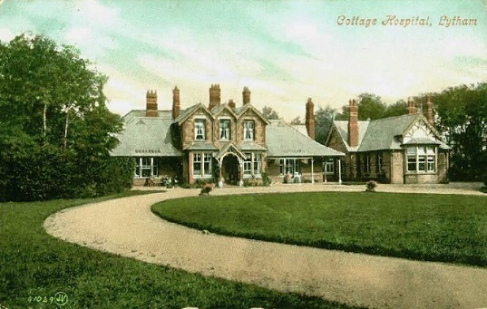
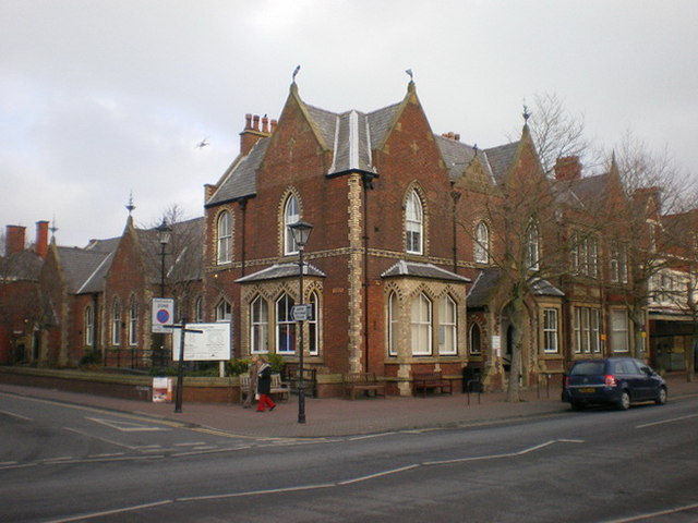
Lytham Hospital

Lytham Hospital is a health facility in Lytham St Annes, Lancashire. It is managed by Lancashire Care NHS Foundation Trust. == History == === Cottage... ===

Lytham (Station Road) railway station

The original Lytham railway station was the Lytham terminus of a branch of the Preston and Wyre Joint Railway from Kirkham in Lancashire, England. It opened...
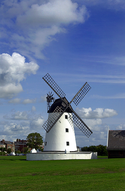
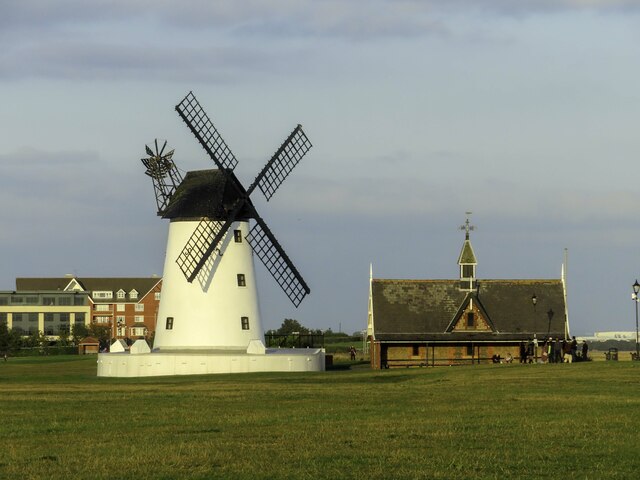
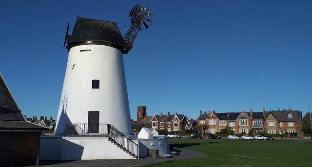
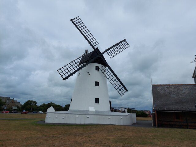
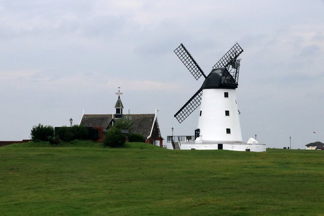
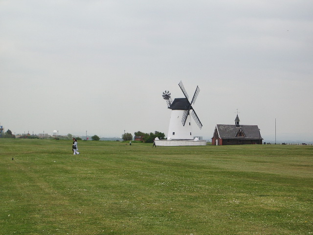
Lytham Windmill

Lytham Windmill is situated on Lytham Green in the coastal town of Lytham St Annes, Lancashire, England. It is of the type known as a tower mill and was...

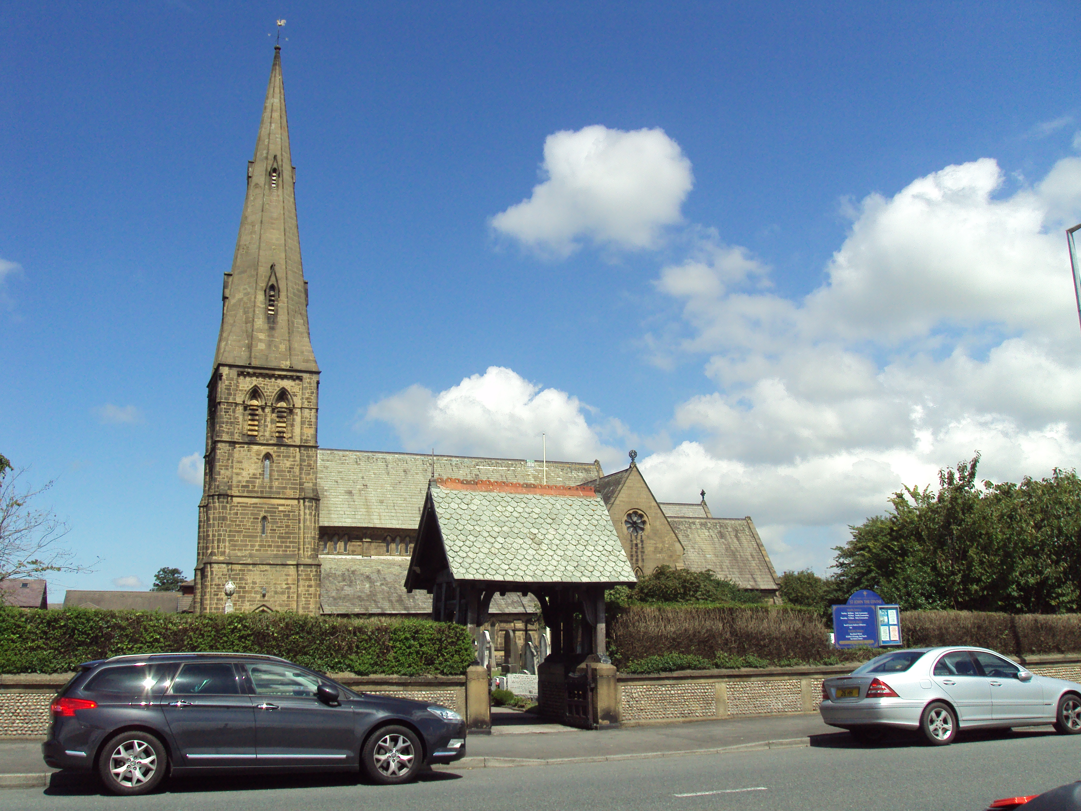
St John's Church, Lytham

St John's Church is in East Beach, Lytham St Annes, Lancashire, England. It is an active Anglican parish church in the deanery of Kirkham, the archdeaconry...

Lytham Library

Lytham library was built originally as a Mechanics Institute. It included a small library of books and a reading room and opened on 30 August 1878. The...

Lytham Festival

The Lytham Festival (formerly and colloquially Lytham Proms) is an annual five-day music festival held in Lytham St Annes, Lancashire. The festival takes...

Lytham railway station

Lytham railway station serves the Lytham area within Lytham St Annes, Lancashire, England, on the Blackpool South to Preston railway line. == Services... ==

Nearby Amenities

Located within 500m of 53.746456,-2.94315
Saltcotes
Place: neighbourhood
Source: npe
Lat/Long: 53.7463564/-2.9457514
Mini Roundabout
Direction: clockwise
Lat/Long: 53.7444876/-2.9458541
Turning Circle
Lat/Long: 53.7425178/-2.9428467
Turning Circle
Lat/Long: 53.7427667/-2.9420088
Fast Food
McDonald's
Addr City: Lytham St Annes
Addr Postcode: FY8 5HU
Addr Suburb: Lytham
Brand: McDonald's
Brand Wikidata: Q38076
Brand Wikipedia: en:McDonald's
Contact Website: https://www.mcdonalds.com/gb/en-gb/location/lytham/lytham/lidun-park-industrial-estate/8261159.html
Cuisine: burger
Drive Through: yes
Fhrs Id: 124072
Takeaway: yes
Lat/Long: 53.7454562/-2.9372576
Mini Roundabout
Direction: clockwise
Lat/Long: 53.742884/-2.9435404
Turning Circle
Lat/Long: 53.7466561/-2.9423626
Turning Circle
Lat/Long: 53.7471259/-2.9442425
Turning Circle
Lat/Long: 53.7475875/-2.9395763
Turning Circle
Lat/Long: 53.7447595/-2.9424706
Turning Circle
Lat/Long: 53.7472734/-2.9433326
Turning Circle
Lat/Long: 53.7474563/-2.9412879
Bridge Court Stores
Addr City: Lytham St Annes
Addr Postcode: FY8 4HN
Addr Suburb: Lytham
Fhrs Id: 135717
Shop: convenience
Lat/Long: 53.7439776/-2.9453475
Post Box
Brand: Royal Mail
Brand Wikidata: Q638098
Brand Wikipedia: en:Royal Mail
Collection Plate: CP1D
Collection Times: Mo-Fr 09:00; Sa 07:00; Su off
Drive Through: no
Operator: Royal Mail
Operator Wikidata: Q638098
Post Box Design: type_b
Post Box Mounting: building
Post Box Type: wall
Ref: FY8 126D
Royal Cypher: EIIR
Royal Cypher Wikidata: Q33102113
Source: survey;streetlevel imagery;aerial imagery
Lat/Long: 53.7433695/-2.944479
Post Box
Brand: Royal Mail
Brand Wikidata: Q638098
Brand Wikipedia: en:Royal Mail
Collection Times: Mo-Fr 09:00; Sa 07:00; Su off
Drive Through: no
Operator: Royal Mail
Operator Wikidata: Q638098
Post Box Mounting: pier
Post Box Type: lamp
Ref: FY8 239D
Royal Cypher: EIIR
Royal Cypher Wikidata: Q33102113
Source: survey;streetlevel imagery;aerial imagery
Lat/Long: 53.7463125/-2.9435656
Turning Circle
Lat/Long: 53.7472437/-2.9442335
Turning Circle
Lat/Long: 53.7454932/-2.9415295
Noexit: yes
Lat/Long: 53.7448875/-2.9407434
Lytham Salcotes Road
Bus: yes
Public Transport: stop_position
Lat/Long: 53.7436912/-2.9446689
The data included in this document is from www.openstreetmap.org. The data is made available under ODbL.

Have you been to Saltcotes?

Leave your review of Saltcotes below (or comments, questions and feedback).