Salt End

Settlement in Yorkshire

England

Salt End

The  Limes  from  Staithes  Road
The Limes from Staithes Road Credit: Martin Dawes

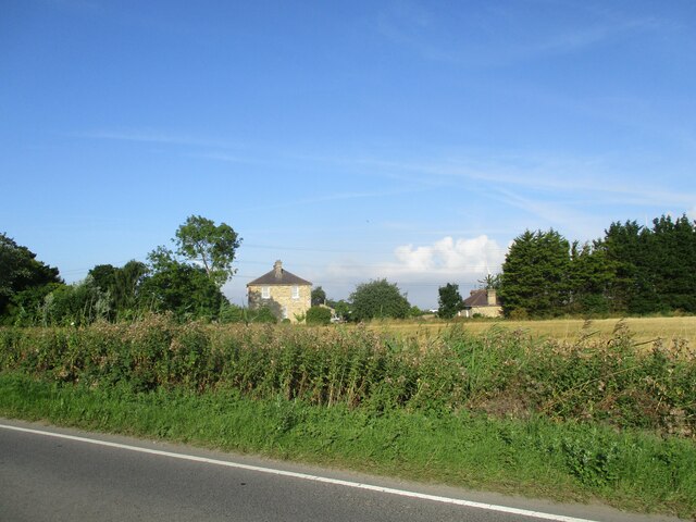
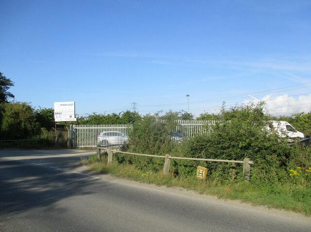
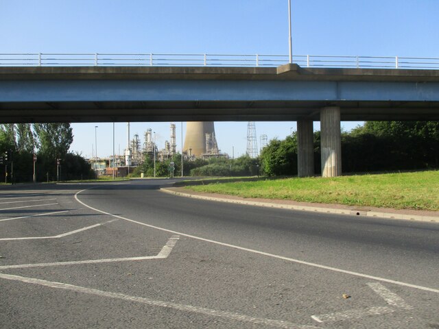
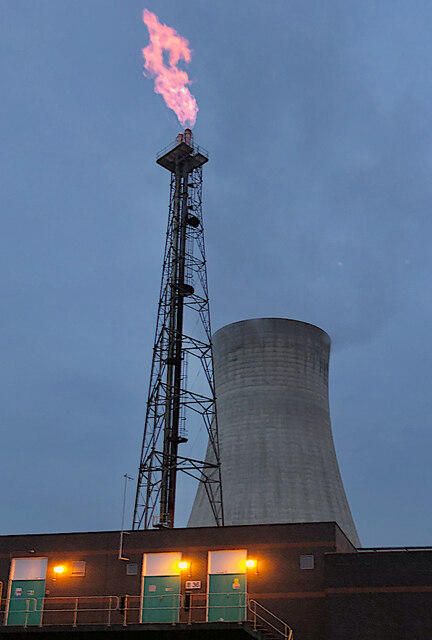
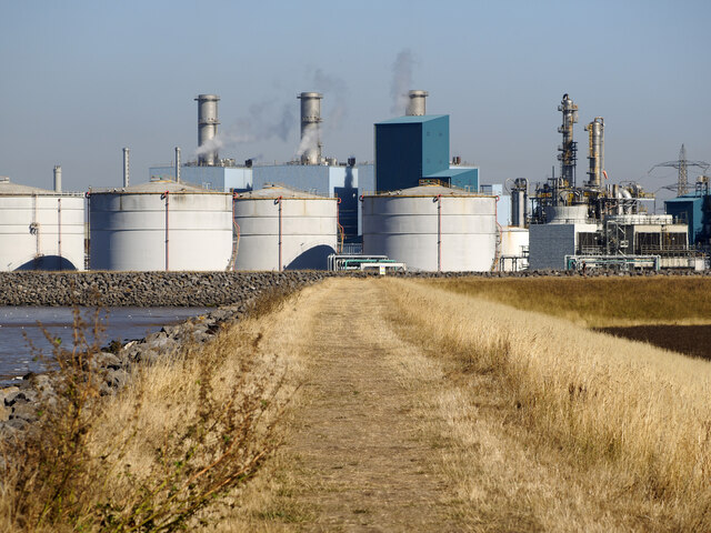
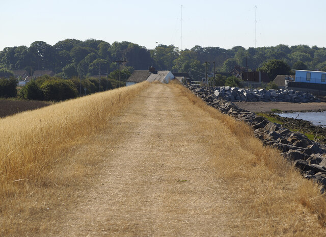
Salt End is a small village located in the East Riding of Yorkshire, England. Situated on the northern banks of the Humber Estuary, it is part of the civil parish of Hedon. The village is primarily known for its industrial complex, which houses a number of chemical plants and refineries.

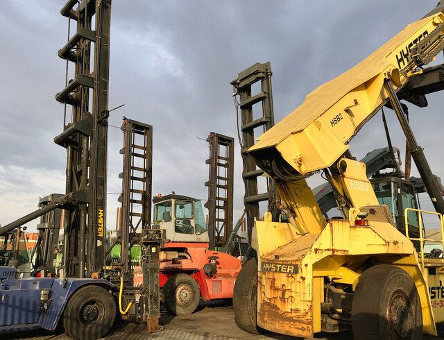
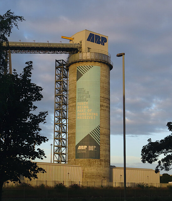
The area around Salt End has a long history of industrial activity, dating back to the early 20th century. The village itself developed as a result of the expansion of the nearby BP Saltend Chemicals Park, one of the largest petrochemical sites in the UK. This complex plays a significant role in the local economy, providing employment opportunities for many residents in the region.

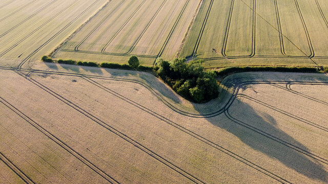
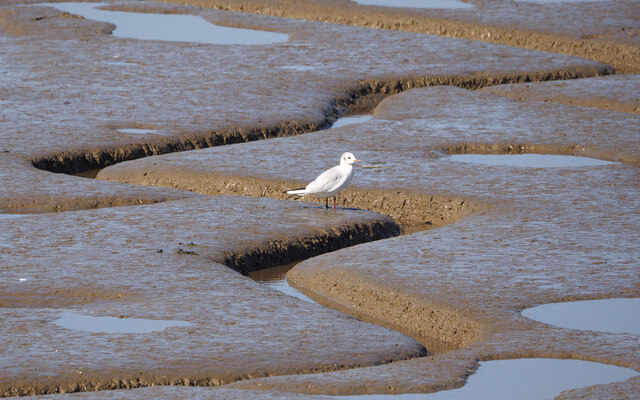
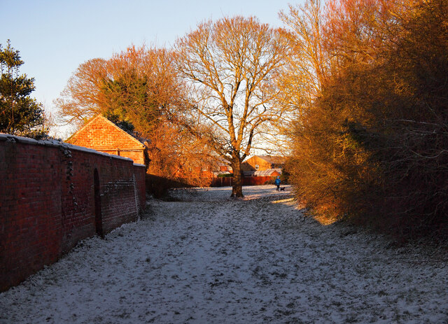
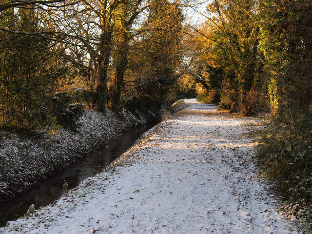
Despite its industrial nature, Salt End also boasts some natural beauty. The village is surrounded by picturesque countryside, offering stunning views of the estuary and the Humber Bridge in the distance. The area attracts birdwatchers and nature enthusiasts who appreciate the diverse wildlife found in the estuary.

While Salt End may not be a tourist hotspot, it serves as an important hub for the petrochemical industry in the region. The village offers a close-knit community for its residents, with amenities such as schools, shops, and other essential services. Its strategic location, proximity to major transport links, and industrial significance make Salt End an integral part of the local economy and a notable area in Yorkshire.

If you have any feedback on the listing, please let us know in the comments section below.

Salt End Images

Images are sourced within 2km of 53.740376/-0.232983 or Grid Reference TA1628. Thanks to Geograph Open Source API. All images are credited.

The  Limes  from  Staithes  Road
The Limes from Staithes Road
Access  to  Industrial  Units  Staithes  Road
Access to Industrial Units Staithes Road
Looking  under  the  A1033  at  Salt  End  roundabout
Looking under the A1033 at Salt End roundabout
Flare stack, Salt End, near Hedon Gas flare and cooling tower on the chemical works site, seen from Paull Road.
Flare stack, Salt End, near Hedon
Gas flare and cooling tower on the chemical works site, seen from Paull Road.
Autumnal Tree at the beginning of Ivy Lane
Three Fields of Cereals The photo was taken, in the low evening sun, from roughly 100m up.  I've no idea why the copse has been planted here, but it's been here for many years.  The diagonal line across the field is the Hedon to Staithes Road, Preston footpath.  The conscientious farmer always cuts a footpath across his field every year whether it be wheat, barley, rapeseed or potatoes - the usual crops in this part of East Yorkshire.
Three Fields of Cereals
The photo was taken, in the low evening sun, from roughly 100m up. I've no idea why the copse has been planted here, but it's been here for many years. The diagonal line across the field is the Hedon to Staithes Road, Preston footpath. The conscientious farmer always cuts a footpath across his field every year whether it be wheat, barley, rapeseed or potatoes - the usual crops in this part of East Yorkshire.
Forklifts near Preston (E Yorks) Seen from Staithes Road, some of the machinery at Wide Range Services <span class="nowrap"><a title="https://www.wrshulluk.com/" rel="nofollow ugc noopener" href="https://www.wrshulluk.com/">Link</a><img style="margin-left:2px;" alt="External link" title="External link - shift click to open in new window" src="https://s1.geograph.org.uk/img/external.png" width="10" height="10"/></span> a company selling, maintaining and repairing lifting and handling equipment.
Forklifts near Preston (E Yorks)
Seen from Staithes Road, some of the machinery at Wide Range Services LinkExternal link a company selling, maintaining and repairing lifting and handling equipment.
Bird on the Mudflats
Parched Land In the decades I've been visiting this spot, like everywhere currently in the south east of England, I've never seen the grass here in such a bad state.

The Saltend industrial site forms the backdrop here.
Parched Land
In the decades I've been visiting this spot, like everywhere currently in the south east of England, I've never seen the grass here in such a bad state. The Saltend industrial site forms the backdrop here.
Parched Path to Paull Like everywhere currently in the south east of England, green grass seems to be a rarity. This path to Paull is no exception.
Parched Path to Paull
Like everywhere currently in the south east of England, green grass seems to be a rarity. This path to Paull is no exception.
Salt End sunrise The early morning sun about to break through a bank of cloud over Hedon, seen from the A1033 flyover.
Salt End sunrise
The early morning sun about to break through a bank of cloud over Hedon, seen from the A1033 flyover.
Cally in the Snow Cally is a green lane in Hedon and is designated a "Permissive Bridleway".  Up until a week ago, the track was very muddy and difficult to use - the spell of recent of cold weather has frozen all of that!
Cally in the Snow
Cally is a green lane in Hedon and is designated a "Permissive Bridleway". Up until a week ago, the track was very muddy and difficult to use - the spell of recent of cold weather has frozen all of that!
Frozen Bridleway Up until a few days ago, this very muddy bridleway was very difficult to walk on - the frozen ground makes things a lot easier.
Frozen Bridleway
Up until a few days ago, this very muddy bridleway was very difficult to walk on - the frozen ground makes things a lot easier.
Ladybird Cluster Although not in this instance, most of the ladybirds in this area were resting on stinging nettle leaves.  How can they be there without getting badly stung?
Ladybird Cluster
Although not in this instance, most of the ladybirds in this area were resting on stinging nettle leaves. How can they be there without getting badly stung?
Hedon Road, Kingston upon Hull Nineteen new ‘buzz shelters’ have been installed in the city, all with green roofs designed to provide food and shelter for bees and other pollinating insects at risk from habitat loss. Kingston upon Hull City Council has installed the ecological shelters at bus stops on Hall Road and Hedon Road, replacing shelters that were in poor condition. Further information in Hull News: <span class="nowrap"><a title="https://www.hullccnews.co.uk/06/06/2023/bee-friendly-bus-shelters-have-landed-in-hull/" rel="nofollow ugc noopener" href="https://www.hullccnews.co.uk/06/06/2023/bee-friendly-bus-shelters-have-landed-in-hull/">Link</a><img style="margin-left:2px;" alt="External link" title="External link - shift click to open in new window" src="https://s1.geograph.org.uk/img/external.png" width="10" height="10"/></span>

Depicted is the shelter at the bus stop on Hedon Road outside the business of Struthers and Carter of Valletta Street.  The design features Amy Johnson (1903 to 1941), aviator, with a moth, alluding to her de Havilland DH.60 Gipsy Moth G-AAAH. Wikipedia: <span class="nowrap"><a title="https://en.wikipedia.org/wiki/Amy_Johnson" rel="nofollow ugc noopener" href="https://en.wikipedia.org/wiki/Amy_Johnson">Link</a><img style="margin-left:2px;" alt="External link" title="External link - shift click to open in new window" src="https://s1.geograph.org.uk/img/external.png" width="10" height="10"/></span>  The artist is Mike Sprout; read about him in The Hull Daily Mail: <span class="nowrap"><a title="https://www.hulldailymail.co.uk/whats-on/whats-on-news/gallery/meet-artist-behind-hull-bus-8491886" rel="nofollow ugc noopener" href="https://www.hulldailymail.co.uk/whats-on/whats-on-news/gallery/meet-artist-behind-hull-bus-8491886">Link</a><img style="margin-left:2px;" alt="External link" title="External link - shift click to open in new window" src="https://s1.geograph.org.uk/img/external.png" width="10" height="10"/></span>
Hedon Road, Kingston upon Hull
Nineteen new ‘buzz shelters’ have been installed in the city, all with green roofs designed to provide food and shelter for bees and other pollinating insects at risk from habitat loss. Kingston upon Hull City Council has installed the ecological shelters at bus stops on Hall Road and Hedon Road, replacing shelters that were in poor condition. Further information in Hull News: LinkExternal link Depicted is the shelter at the bus stop on Hedon Road outside the business of Struthers and Carter of Valletta Street. The design features Amy Johnson (1903 to 1941), aviator, with a moth, alluding to her de Havilland DH.60 Gipsy Moth G-AAAH. Wikipedia: LinkExternal link The artist is Mike Sprout; read about him in The Hull Daily Mail: LinkExternal link
Old Milepost by the B1362, Hull Road, Preston parish Cast iron post by the B1362, in parish of PRESTON (KINGSTON UPON HULL District), Hull Road, Preston (South), opposite Nos. 16/18, by the road, on South side of road. Hedon casting, erected by the Hull & Hedon turnpike trust in the 19th century. An earlier photograph can be found here <a title="https://www.geograph.org.uk/photo/6056148" href="https://www.geograph.org.uk/photo/6056148">Link</a>.

Inscription reads:-
: HEDON / ¼ / MILE : : PATRINGTON / 10¼ / MILES : : HULL / 5 / MILES :

Milestone Society National ID: YE_HLPA05.
Old Milepost by the B1362, Hull Road, Preston parish
Cast iron post by the B1362, in parish of PRESTON (KINGSTON UPON HULL District), Hull Road, Preston (South), opposite Nos. 16/18, by the road, on South side of road. Hedon casting, erected by the Hull & Hedon turnpike trust in the 19th century. An earlier photograph can be found here Link. Inscription reads:- : HEDON / ¼ / MILE : : PATRINGTON / 10¼ / MILES : : HULL / 5 / MILES : Milestone Society National ID: YE_HLPA05.
Biomass storage silo, Hull Seen from Hedon Road, the 49m-high biomass storage silo enables trains to Drax Power Station to be loaded with wood pellets imported from North America and Europe into the port of Hull. Built in 2013, it still carries a 29m-high banner dating from 2016, promoting Hull's 2017 stint as UK City of Culture.
Biomass storage silo, Hull
Seen from Hedon Road, the 49m-high biomass storage silo enables trains to Drax Power Station to be loaded with wood pellets imported from North America and Europe into the port of Hull. Built in 2013, it still carries a 29m-high banner dating from 2016, promoting Hull's 2017 stint as UK City of Culture.
Show me another place!

Salt End is located at Grid Ref: TA1628 (Lat: 53.740376, Lng: -0.232983)

Division: East Riding

Unitary Authority: East Riding of Yorkshire

Police Authority: Humberside

What 3 Words

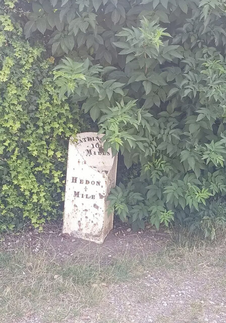
///hood.gosh.stuck. Near Paull, East Yorkshire

Related Wikis

Salt End

Salt End or Saltend is a hamlet in the East Riding of Yorkshire, England, in an area known as Holderness. It is situated on the north bank of the Humber...

Hedon Aerodrome

Hedon Aerodrome (also known as Royal Air Force Hedon and Royal Air Force Hull), was an airfield located 6 miles (9.7 km) east of Kingston upon Hull in...

Pensana Salt End

Pensana Saltend is a future processing facility for rare earth metals at Salt End, near Hull in the East Riding of Yorkshire, England. When operating at...

Hedon Stadium

Hedon Stadium was a motorcycle speedway venue between Hedon and Hull, England. The location of the stadium was south of the Hedon Racecourse railway station...

Nearby Amenities

Located within 500m of 53.740376,-0.232983
Hedon Hull Road
Naptan AtcoCode: 2200YEA00315
Naptan Bearing: E
Naptan CommonName: Hedon Hull Road
Naptan Landmark: Near Salt End Roundabout
Naptan Street: Hull Road
Physically Present: no
Source: naptan + survey
Lat/Long: 53.743186/-0.2341257
Bus Stop
Salt End Hull Road
Kerb: raised
Naptan AtcoCode: 2200YEA00316
Naptan Bearing: W
Naptan CommonName: Salt End Hull Road
Naptan Landmark: Near Salt End Roundabout
Naptan Street: Hull Road
Note: no code on sign;moved S to slip road
Shelter: yes
Source: naptan + survey
Lat/Long: 53.7427894/-0.2350871
Bus Stop
Hedon Hull Road
Naptan AtcoCode: 2200YEA00317
Naptan Bearing: E
Naptan CommonName: Hedon Hull Road
Naptan Landmark: Glencoe Villas
Naptan Street: A1033 Hull Road
Note: no code on sign
Shelter: no
Source: naptan + survey
Lat/Long: 53.7423035/-0.227432
Bus Stop
Hedon Hull Road
Layby: yes
Naptan AtcoCode: 2200YEA00318
Naptan Bearing: W
Naptan CommonName: Hedon Hull Road
Naptan Landmark: Opp Glencoe Villas
Naptan Street: A1033 Hull Road
Note: no code on sign
Shelter: yes
Source: naptan + survey
Lat/Long: 53.7419044/-0.2265844
Salt End Hull Road
Naptan AtcoCode: 2200YEA01211
Naptan Bearing: W
Naptan CommonName: Salt End Hull Road
Naptan Landmark: Waste Water Treatment Works
Naptan Street: Hull Road
Physically Present: no
Source: naptan + survey
Lat/Long: 53.7434974/-0.2382852
Bus Stop
Salt End Hull Road
Naptan AtcoCode: 2200YEA01212
Naptan Bearing: E
Naptan CommonName: Salt End Hull Road
Naptan Landmark: Waste Water Treatment Works
Naptan Street: Hull Road
Note: no code on sign;moved E
Shelter: yes
Source: naptan + survey
Lat/Long: 53.7435781/-0.2369463
Landuse: industrial
Military: checkpoint
Lat/Long: 53.7390213/-0.2372639
Landuse: industrial
Military: checkpoint
Lat/Long: 53.7391141/-0.2374958
Power: tower
Lat/Long: 53.7416294/-0.2392656
Power: tower
Lat/Long: 53.7419385/-0.2375889
Power: tower
Lat/Long: 53.7439813/-0.23591
Barrier: yes
Lat/Long: 53.7402439/-0.2311218
Crossing
Lat/Long: 53.7380509/-0.2362385
Traffic Signals
Traffic Signals: crossing
Lat/Long: 53.7425201/-0.2322984
Traffic Signals
Traffic Signals: crossing
Lat/Long: 53.7428692/-0.2322999
Crossing
Crossing: unmarked
Lat/Long: 53.7433097/-0.2328789
Crossing
Crossing: unmarked
Lat/Long: 53.7433659/-0.2330471
The data included in this document is from www.openstreetmap.org. The data is made available under ODbL.

Have you been to Salt End?

Leave your review of Salt End below (or comments, questions and feedback).