Salt Cotes

Settlement in Cumberland Allerdale

England

Salt Cotes

Course of disused railway near Raby Cote Looking south west on the former line to Silloth.
Course of disused railway near Raby Cote Credit: Clive Nicholson

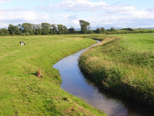
Salt Cotes is a hamlet located in the county of Cumberland, England. Situated on the northern coast of the country, it is part of the larger parish of St. Bees. Salt Cotes is nestled between the towns of Whitehaven and St. Bees, offering breathtaking views of the Irish Sea.

The history of Salt Cotes dates back centuries, with records of its existence dating as far back as the 12th century. It was originally a fishing village, known for its thriving salt industry. The name "Salt Cotes" itself refers to the large salt pans that were used to extract salt from the sea water.

Today, Salt Cotes has transformed into a peaceful residential area, attracting both locals and tourists alike. The hamlet is characterized by quaint cottages, many of which have been converted into holiday accommodations, providing visitors with a chance to experience the charm of a traditional English village.

The surrounding natural beauty is one of the main attractions of Salt Cotes. The hamlet is situated within close proximity to the Lake District National Park, offering easy access to stunning landscapes, hiking trails, and picturesque lakes. Additionally, the nearby St. Bees Head, a designated Site of Special Scientific Interest, provides opportunities for birdwatching and coastal walks.

Although small in size, Salt Cotes offers a tranquil escape from the hustle and bustle of city life, allowing visitors to immerse themselves in the beauty of the English countryside and the rich history of the area.

If you have any feedback on the listing, please let us know in the comments section below.

Salt Cotes Images

Images are sourced within 2km of 54.869678/-3.266824 or Grid Reference NY1853. Thanks to Geograph Open Source API. All images are credited.

Course of disused railway near Raby Cote Looking south west on the former line to Silloth.
Course of disused railway near Raby Cote
Looking south west on the former line to Silloth.
Red Barn at Moss Side Farm Across a field from the B5307 road, a corrugated sheet barn
Red Barn at Moss Side Farm
Across a field from the B5307 road, a corrugated sheet barn
Route of former railway This view from the B5307 road bridge near Sleightholme is towards Abbeytown
Route of former railway
This view from the B5307 road bridge near Sleightholme is towards Abbeytown
Direction Sign – Signpost on the B5307 near Raby Grange Located beside the parapet of Grange Bridge on the west side of the junction on the B5307 near Raby Grange. Holme East Waver parish. 3 arms and broken annulus finial.

Milestone Society National ID: CU_NY1852
Direction Sign – Signpost on the B5307 near Raby Grange
Located beside the parapet of Grange Bridge on the west side of the junction on the B5307 near Raby Grange. Holme East Waver parish. 3 arms and broken annulus finial. Milestone Society National ID: CU_NY1852
Direction Sign – Signpost at Moss Side Located on the northwest side of the junction on the B5307 at Moss Side. Holme East Waver parish. 3 arms and pawn finial.

Milestone Society National ID: CU_NY1952
Direction Sign – Signpost at Moss Side
Located on the northwest side of the junction on the B5307 at Moss Side. Holme East Waver parish. 3 arms and pawn finial. Milestone Society National ID: CU_NY1952
North West Entrance to Wedholme Flow. A nature reserve.
North West Entrance to Wedholme Flow.
A nature reserve.
West End Farm, Newton Arlosh
Maryholme
Maryholme
Beech Tree Farm
Beech Tree Farm
The pond at Salt Coats
The road to Raby Cote
The bridge over the disused rail line
The former rail line
Buildings at Knowehill
Road Bridge at Sleighthome over Dismantled Railway Looking south-eastward.
Road Bridge at Sleighthome over Dismantled Railway
Looking south-eastward.
Ordnance Survey Flush Bracket 10980 This can be found on the parapet of Sleightholme Railway Bridge over the dismantled railway line.
For more detail see : <span class="nowrap"><a title="http://www.bench-marks.org.uk/bm21679" rel="nofollow ugc noopener" href="http://www.bench-marks.org.uk/bm21679">Link</a><img style="margin-left:2px;" alt="External link" title="External link - shift click to open in new window" src="https://s1.geograph.org.uk/img/external.png" width="10" height="10"/></span>
Ordnance Survey Flush Bracket 10980
This can be found on the parapet of Sleightholme Railway Bridge over the dismantled railway line. For more detail see : LinkExternal link
Newton Arlosh Church St John Baptist's Church was licensed in 1304, soon after the village was founded as a 'new town' by Holme Cultram Abbey.  The W tower was intended to be defensible and has no outer doorway and only small arrow-slit windows.
Newton Arlosh Church
St John Baptist's Church was licensed in 1304, soon after the village was founded as a 'new town' by Holme Cultram Abbey. The W tower was intended to be defensible and has no outer doorway and only small arrow-slit windows.
Salt Marsh used for grazing sheep
Salt Marsh
used for grazing sheep
Show me another place!

Salt Cotes is located at Grid Ref: NY1853 (Lat: 54.869678, Lng: -3.266824)

Administrative County: Cumbria

District: Allerdale

Police Authority: Cumbria

What 3 Words

///umbrellas.doted.scooters. Near Silloth, Cumbria

Nearby Locations

Salt Coates Salt Cotes

Related Wikis

Sleightholme railway station

Sleightholme was an early, short lived railway station near Newton Arlosh, Cumbria on the Carlisle & Silloth Bay Railway & Dock Company's branch from Carlisle...

River Waver

The River Waver is a river in Cumbria, England. The river rises at Wavergillhead (as Townthwaite Beck). It is fed by the northwards flowing Thornthwaite...

Moss Side, Cumbria

Moss Side is a hamlet on the B5307 road, in the civil parish of Holme East Waver in Cumbria, United Kingdom. Nearby settlements include the villages of...

Holme East Waver

Holme East Waver is a civil parish in Cumbria, United Kingdom. It is bordered to the north by the civil parish of Bowness-on-Solway, to the east by the...

Raby, Cumbria

Raby is a small hamlet in the civil parish of Holme East Waver in Cumbria, United Kingdom. == See also == Listed buildings in Holme East Waver == References... ==

St John the Evangelist's Church, Newton Arlosh

St John the Evangelist's Church is in the village of Newton Arlosh, Cumbria, England. It is an active Anglican parish church in the deanery of Carlisle...

Abbey Junction railway station

Abbey Junction railway station was the railway junction where the branch line to Silloth on the Solway Firth divided from the Solway Junction Railway...

Newton Arlosh

Newton Arlosh is a village in the civil parish of Holme East Waver in Cumbria, United Kingdom. == Landmarks == St. John the Evangelist's Church is one...

Nearby Amenities

Located within 500m of 54.869678,-3.266824
Generator Output Electricity: yes
Generator Source: solar
Generator Type: solar_photovoltaic_panel
Location: roof
Power: generator
Lat/Long: 54.8700353/-3.2692105
Power: pole
Lat/Long: 54.8736486/-3.2683931
Power: pole
Lat/Long: 54.8739656/-3.2671936
Power: pole
Lat/Long: 54.865893/-3.2636365
Power: pole
Lat/Long: 54.86652/-3.2645505
Power: pole
Lat/Long: 54.867363/-3.2657934
Power: pole
Lat/Long: 54.8683279/-3.2673651
Power: pole
Lat/Long: 54.8686826/-3.2678846
The data included in this document is from www.openstreetmap.org. The data is made available under ODbL.

Have you been to Salt Cotes?

Leave your review of Salt Cotes below (or comments, questions and feedback).