Salt Hill

Settlement in Buckinghamshire

England

Salt Hill

Old Milestone by the A4 in Slough Carved stone post by the A4, in parish of Slough (Slough District), Bath Road; outside Offices, No. 7, on pavement beside low brick wall, just South East of corner, on South side of road. Bath Road limestone diamond, erected by the Colnbrook, Datchet & Slough turnpike trust in the 18th century. 

Inscription reads:-
: MAIDENHEAD / 5 : : LONDON / 21 : : SLOUGH / ½ :

Grade II listed.
List Entry Number: 1321975 <span class="nowrap"><a title="https://historicengland.org.uk/listing/the-list/list-entry/1321975" rel="nofollow ugc noopener" href="https://historicengland.org.uk/listing/the-list/list-entry/1321975">Link</a><img style="margin-left:2px;" alt="External link" title="External link - shift click to open in new window" src="https://s1.geograph.org.uk/img/external.png" width="10" height="10"/></span>

Milestone Society National ID: BU_LB21
Old Milestone by the A4 in Slough Credit: Bryn Kemp

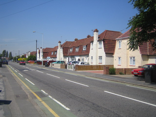
Salt Hill is a suburban area located in the county of Buckinghamshire, England. Situated just to the south of Slough, it forms part of the wider Slough Urban Area. The area is primarily residential, offering a mix of housing options including detached houses, semi-detached houses, and apartments.

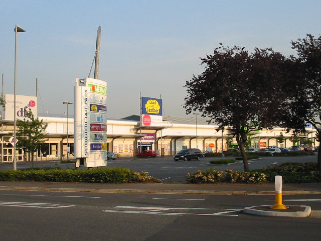
Salt Hill benefits from its close proximity to Slough town center, which is just a short distance away. This provides residents with easy access to a wide range of amenities, including shops, supermarkets, restaurants, and leisure facilities. The area is also well-served by public transportation, with several bus routes connecting Salt Hill to neighboring towns and villages.

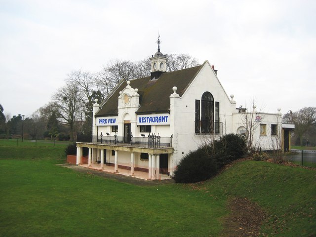
One of the notable features of Salt Hill is its green spaces. The area is home to several parks and recreational areas, providing residents with opportunities for outdoor activities and leisurely walks. Salt Hill Park, in particular, is a popular spot for locals and visitors alike. This well-maintained park features beautiful landscaped gardens, a children's play area, and a lake, making it an ideal place for picnics and family outings.

Salt Hill offers a peaceful and family-friendly environment, attracting residents who seek a suburban lifestyle with convenient access to urban amenities. The area benefits from its proximity to major road networks, including the M4 motorway, which provides easy access to London and the wider region. With its range of housing options, green spaces, and proximity to essential amenities, Salt Hill presents an attractive choice for those looking to settle in Buckinghamshire.

If you have any feedback on the listing, please let us know in the comments section below.
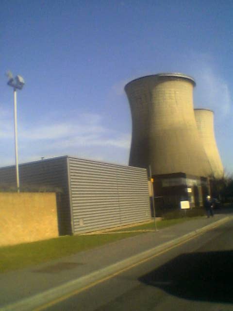
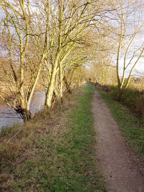
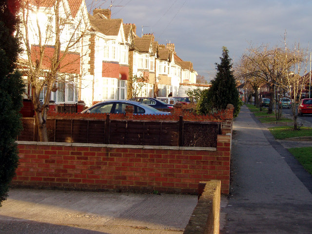
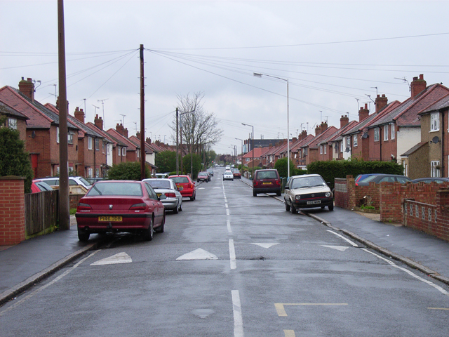
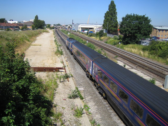
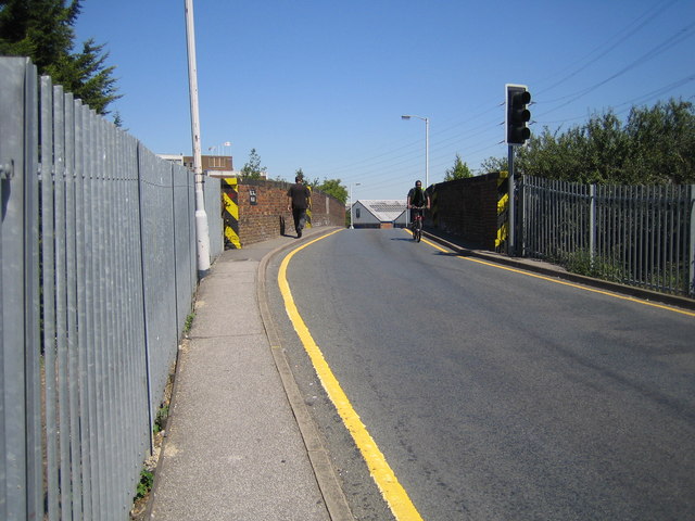
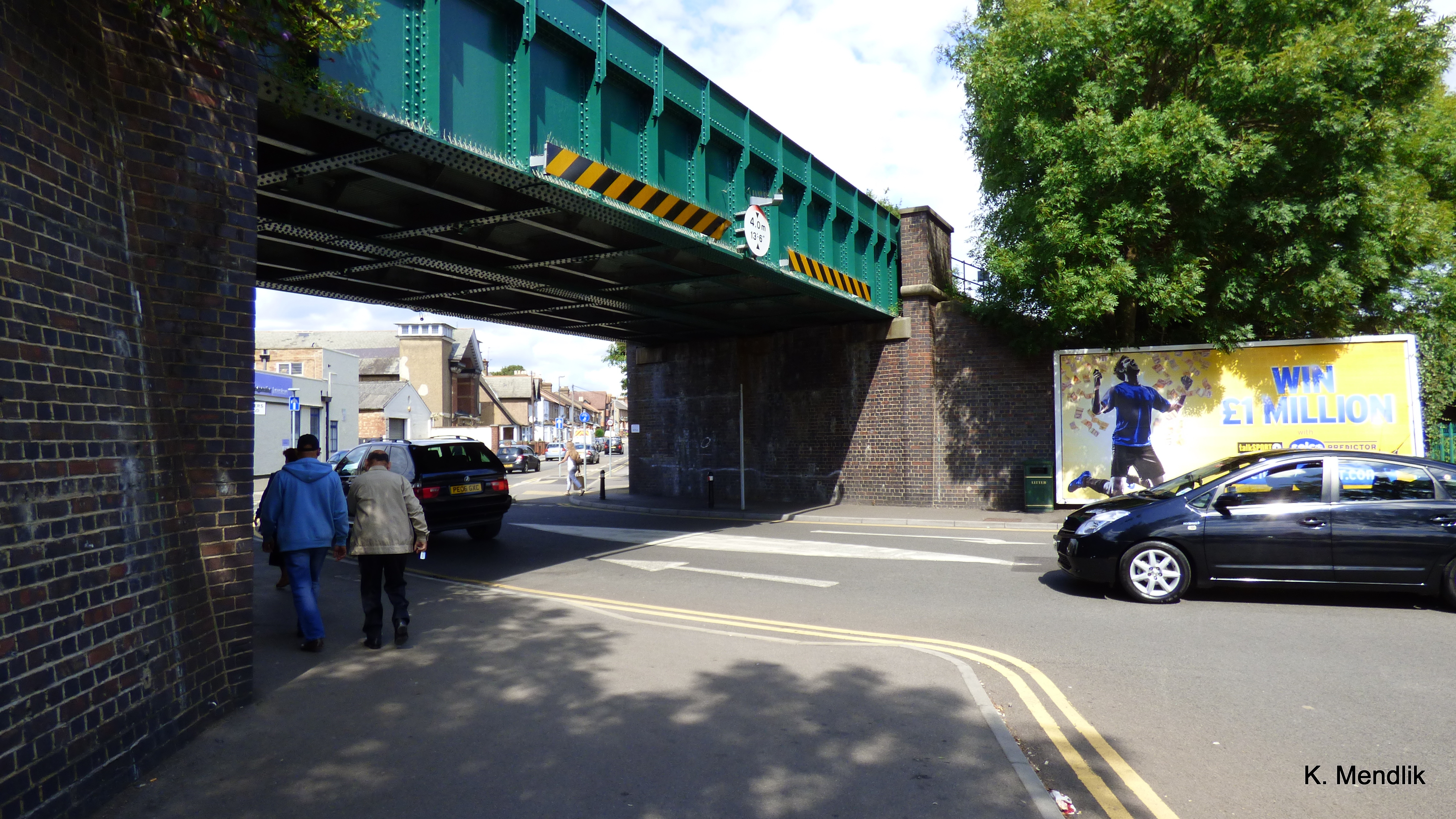
Salt Hill Images

Images are sourced within 2km of 51.512677/-0.607744 or Grid Reference SU9680. Thanks to Geograph Open Source API. All images are credited.

Old Milestone by the A4 in Slough Carved stone post by the A4, in parish of Slough (Slough District), Bath Road; outside Offices, No. 7, on pavement beside low brick wall, just South East of corner, on South side of road. Bath Road limestone diamond, erected by the Colnbrook, Datchet & Slough turnpike trust in the 18th century. 

Inscription reads:-
: MAIDENHEAD / 5 : : LONDON / 21 : : SLOUGH / ½ :

Grade II listed.
List Entry Number: 1321975 <span class="nowrap"><a title="https://historicengland.org.uk/listing/the-list/list-entry/1321975" rel="nofollow ugc noopener" href="https://historicengland.org.uk/listing/the-list/list-entry/1321975">Link</a><img style="margin-left:2px;" alt="External link" title="External link - shift click to open in new window" src="https://s1.geograph.org.uk/img/external.png" width="10" height="10"/></span>

Milestone Society National ID: BU_LB21
Old Milestone by the A4 in Slough
Carved stone post by the A4, in parish of Slough (Slough District), Bath Road; outside Offices, No. 7, on pavement beside low brick wall, just South East of corner, on South side of road. Bath Road limestone diamond, erected by the Colnbrook, Datchet & Slough turnpike trust in the 18th century. Inscription reads:- : MAIDENHEAD / 5 : : LONDON / 21 : : SLOUGH / ½ : Grade II listed. List Entry Number: 1321975 LinkExternal link Milestone Society National ID: BU_LB21
Slough Station
Slough Station
Slough Retail Park, Twinches Lane Just off the A4 Bath Road which runs through the middle of the square, this photo is looking south.
Slough Retail Park, Twinches Lane
Just off the A4 Bath Road which runs through the middle of the square, this photo is looking south.
The Three Tuns The busy junction between the A4 Bath Road, and the A355 which joins the M4 at Junction 6. It is known as "The Three Tuns" after the pub shown here.
The Three Tuns
The busy junction between the A4 Bath Road, and the A355 which joins the M4 at Junction 6. It is known as "The Three Tuns" after the pub shown here.
"The Office", Slough Trading Estate This building, otherwise known as Crossbow House, 40 Liverpool Road, is situated at the heart of Slough Trading Estate (which incidentally is the largest trading estate in single ownership in Europe). This building is famous for featuring in the opening sequences and some of the filming for popular BBC comedy "The Office".
"The Office", Slough Trading Estate
This building, otherwise known as Crossbow House, 40 Liverpool Road, is situated at the heart of Slough Trading Estate (which incidentally is the largest trading estate in single ownership in Europe). This building is famous for featuring in the opening sequences and some of the filming for popular BBC comedy "The Office".
Slough Power Station These large cooling chimneys, situated in Slough Trading Estate, are visible for miles around.
Slough Power Station
These large cooling chimneys, situated in Slough Trading Estate, are visible for miles around.
Slough CHP Cooling towers Slough was the first privately owned power station and an early innovator in CHP (Combined Heat and Power) supplying steam to heat factories all over the industrial estate.

It now has gas fluidized bed reactors and can use waste paper and plastic collected on the estate as a fuel.
Slough CHP Cooling towers
Slough was the first privately owned power station and an early innovator in CHP (Combined Heat and Power) supplying steam to heat factories all over the industrial estate. It now has gas fluidized bed reactors and can use waste paper and plastic collected on the estate as a fuel.
Grand Union Canal: Slough branch Unlikely scene in the middle of Slough. Taken on a winter evening, looking east.
Grand Union Canal: Slough branch
Unlikely scene in the middle of Slough. Taken on a winter evening, looking east.
Stoke Poges Lane Once a rural lane, now a very busy road.
Stoke Poges Lane
Once a rural lane, now a very busy road.
Essex Avenue, Slough From the crossroads with Canterbury Avenue.
Essex Avenue, Slough
From the crossroads with Canterbury Avenue.
Corfe Gardens Residential estate off Cippenham Lane.
Corfe Gardens
Residential estate off Cippenham Lane.
Slough: Main line railway Viewed looking towards Slough railway station from the Wexham Road bridge with a westbound First Great Western express train.
Slough: Main line railway
Viewed looking towards Slough railway station from the Wexham Road bridge with a westbound First Great Western express train.
Slough: The Horlicks factory One of Slough's iconic images, the Horlicks factory on Stoke Poges Lane was completed in 1908 at a cost of £28,000. The brand name and the site now belong to GlaxoSmithKline. Everything you ever wanted to know about Horlicks (for example that India is by far the largest market for the product) is contained in the Wikipedia article <span class="nowrap"><a title="http://en.wikipedia.org/wiki/Horlicks" rel="nofollow ugc noopener" href="http://en.wikipedia.org/wiki/Horlicks">Link</a><img style="margin-left:2px;" alt="External link" title="External link - shift click to open in new window" src="https://s1.geograph.org.uk/img/external.png" width="10" height="10"/></span> , and, for a free plug which should ensure I get a lifetime supply of the stuff, here's Horlick's own website <span class="nowrap"><a title="http://www.horlicks.co.uk/" rel="nofollow ugc noopener" href="http://www.horlicks.co.uk/">Link</a><img style="margin-left:2px;" alt="External link" title="External link - shift click to open in new window" src="https://s1.geograph.org.uk/img/external.png" width="10" height="10"/></span>
Slough: The Horlicks factory
One of Slough's iconic images, the Horlicks factory on Stoke Poges Lane was completed in 1908 at a cost of £28,000. The brand name and the site now belong to GlaxoSmithKline. Everything you ever wanted to know about Horlicks (for example that India is by far the largest market for the product) is contained in the Wikipedia article LinkExternal link , and, for a free plug which should ensure I get a lifetime supply of the stuff, here's Horlick's own website LinkExternal link
Slough: Main line railway Viewed looking away from Slough from the A355 Farnham Road bridge.
Slough: Main line railway
Viewed looking away from Slough from the A355 Farnham Road bridge.
Slough: Leigh Road bridge This narrow road bridge provides a road link over the railway between two industrial estates, but it is controlled by lights, and can be a traffic bottleneck. There is little room for pedestrians to cross safely either.
Slough: Leigh Road bridge
This narrow road bridge provides a road link over the railway between two industrial estates, but it is controlled by lights, and can be a traffic bottleneck. There is little room for pedestrians to cross safely either.
Slough Power Station The two cooling towers on the north side of Edinburgh Avenue, with just a wisp of steam coming from the left one.
Slough Power Station
The two cooling towers on the north side of Edinburgh Avenue, with just a wisp of steam coming from the left one.
Slough Power Station On the south side of Edinburgh Avenue.
Slough Power Station
On the south side of Edinburgh Avenue.
Slough: Elliman Avenue Home of a housing estate with unusual houses built with their chimneys at the front, Elliman Avenue is named after one of Slough's municipal benefactors, James Elliman (yes, he of Elliman's Embrocation fame). Some houses along the road, such as the salmon-coloured one on the right side of the photo, have had their chimneys removed.
Slough: Elliman Avenue
Home of a housing estate with unusual houses built with their chimneys at the front, Elliman Avenue is named after one of Slough's municipal benefactors, James Elliman (yes, he of Elliman's Embrocation fame). Some houses along the road, such as the salmon-coloured one on the right side of the photo, have had their chimneys removed.
Show me another place!

Salt Hill is located at Grid Ref: SU9680 (Lat: 51.512677, Lng: -0.607744)

Unitary Authority: Slough

Police Authority: Thames Valley

What 3 Words

///gossip.minute.famous. Near Slough, Berkshire

Nearby Locations

Salt Hill Baylis Pond

Related Wikis

Salt Hill

Salt Hill is a district within the unitary authority of Slough in Berkshire in the south of England, close to London. Before 1974, Salt Hill was part of...
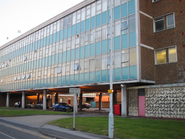
Slough Town Hall

Slough Town Hall is a former municipal building in Bath Road, Slough, Berkshire, England. The town hall was the headquarters of Slough Borough Council...

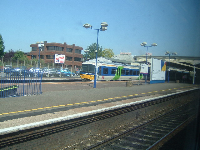
Chalvey Halt railway station

Chalvey Halt was a short-lived railway station on the Great Western Railway branch from Slough to Windsor & Eton. It was situated just to the north of...

Baylis House

Baylis House is a Grade I listed building currently operating as a hotel and business centre in Slough, Berkshire, England. It is representative of the...

Nearby Amenities

Located within 500m of 51.512677,-0.607744
Turning Circle
Lat/Long: 51.5164279/-0.6039941
Traffic Signals
Lat/Long: 51.5115603/-0.6083299
Crossing
Crossing: uncontrolled
Crossing Ref: zebra
Lat/Long: 51.5088388/-0.6041478
Turning Circle
Lat/Long: 51.5141735/-0.6105067
Turning Circle
Lat/Long: 51.5129912/-0.6107385
Turning Circle
Lat/Long: 51.5110849/-0.6138595
Place Of Worship
Ledgers Road Methodist
Denomination: methodist
Religion: christian
Lat/Long: 51.5098164/-0.6031652
Salt Hill Park
Information: map
Map Size: site
Tourism: information
Lat/Long: 51.5146945/-0.606191
Bench
Colour: black
Lat/Long: 51.5140715/-0.6034265
Waste Basket
Lat/Long: 51.5140399/-0.6033205
Bench
Colour: black
Lat/Long: 51.5140453/-0.6033387
Bench
Colour: black
Lat/Long: 51.5140626/-0.6033967
Bench
Colour: black
Lat/Long: 51.5140524/-0.6033625
Waste Basket
Lat/Long: 51.5140571/-0.6033782
Bench
Lat/Long: 51.5161737/-0.6056397
Barrier: bollard
Bicycle: yes
Foot: yes
Lat/Long: 51.5157116/-0.6052739
Waste Basket
Lat/Long: 51.5162705/-0.6048633
Milestone
Lat/Long: 51.5111009/-0.6025336
Railway: switch
Lat/Long: 51.5149787/-0.6062448
Railway: switch
Lat/Long: 51.514067/-0.6025358
Railway: switch
Lat/Long: 51.5140988/-0.6020255
Railway: switch
Lat/Long: 51.5139564/-0.6011776
Railway: switch
Lat/Long: 51.5143091/-0.6031966
Railway: switch
Lat/Long: 51.5144374/-0.6040487
Railway: switch
Lat/Long: 51.514571/-0.6046394
Railway: buffer_stop
Lat/Long: 51.5144183/-0.6031783
Railway: switch
Lat/Long: 51.5157197/-0.6095093
Railway: switch
Lat/Long: 51.5154172/-0.6079643
Railway: switch
Lat/Long: 51.5158101/-0.6098698
Railway: switch
Lat/Long: 51.5161835/-0.6115339
Crossing
Crossing: traffic_signals
Designation: toucan
Lat/Long: 51.509491/-0.6125203
Crossing
Crossing: traffic_signals
Designation: toucan
Lat/Long: 51.5094943/-0.6123448
Railway: switch
Lat/Long: 51.5150994/-0.6067647
Railway: switch
Lat/Long: 51.5153752/-0.6079275
Absolutely Ice
Disused: yes
Leisure: ice_rink
Lat/Long: 51.5109267/-0.6091431
Traffic Signals
Lat/Long: 51.5116432/-0.608179
Traffic Signals
Lat/Long: 51.5115399/-0.6081345
Traffic Signals
Lat/Long: 51.5115082/-0.608376
Traffic Signals
Lat/Long: 51.5116074/-0.6088687
Barrier: bollard
Lat/Long: 51.5102573/-0.605219
Traffic Signals
Surface: asphalt
Traffic Signals: pedestrian_crossing
Lat/Long: 51.512435/-0.6127265
SOPs Healthcare Ltd
Addr City: Slough
Addr Housenumber: 147
Addr Postcode: SL1 3UX
Addr Street: Bath Road
Healthcare: optometrist
Website: https://www.cqc.org.uk/location/1-6648272543
Lat/Long: 51.5126006/-0.614903
Bus Stop
Ellis Avenue
Bus: yes
Public Transport: platform
Shelter: no
Lat/Long: 51.5105932/-0.6032719
Bus Stop
Windmill Road
Bus: yes
Naptan AtcoCode: 03700381
Naptan NaptanCode: slgawpt
Public Transport: platform
Shelter: yes
Lat/Long: 51.5118862/-0.6089459
Bus Stop
Windmill Road
Bus: yes
Naptan AtcoCode: 03700431
Naptan NaptanCode: slgdamw
Public Transport: platform
Shelter: yes
Lat/Long: 51.511779/-0.6094613
Bus Stop
Salt Hill Park
Bus: yes
Public Transport: platform
Shelter: yes
Lat/Long: 51.5114888/-0.6044862
Bus Stop
Salt Hill Park
Bus: yes
Public Transport: platform
Shelter: yes
Lat/Long: 51.5112968/-0.6045068
Bus Stop
Salt Hill Three Tuns
Bus: yes
Public Transport: platform
Shelter: yes
Lat/Long: 51.5135609/-0.6127124
Bus Stop
Salt Hill Three Tuns
Bus: yes
Public Transport: platform
Shelter: yes
Lat/Long: 51.5135526/-0.6123999
Fast Food
Pizza GoGo
Brand: Pizza GoGo
Brand Wikidata: Q118121277
Cuisine: pizza
Takeaway: yes
Lat/Long: 51.5118715/-0.6085808
Pharmacy
Campbell pharmacy
Dispensing: yes
Drive Through: no
Healthcare: pharmacy
Phone: +44 1753521968
Lat/Long: 51.5125079/-0.613602
SD wines
Shop: convenience
Lat/Long: 51.5124938/-0.6135166
Fireworks factory
Shop: pyrotechnics
Lat/Long: 51.5124828/-0.6134464
Aptus
Office: estate_agent
Lat/Long: 51.5124739/-0.6133746
Gents hairdresser
Shop: hairdresser
Lat/Long: 51.512463/-0.6133003
Aruna tanning
Beauty: tanning
Shop: beauty
Lat/Long: 51.5124494/-0.6132267
Fast Food
Pizza Hut Delivery
Brand: Pizza Hut Delivery
Brand Wikidata: Q107293079
Brand Wikipedia: en:Pizza Hut
Cuisine: pizza
Delivery: yes
Takeaway: yes
Lat/Long: 51.5124331/-0.6131395
Fast Food
Peri Chick 'n' Grill
Cuisine: chicken
Lat/Long: 51.5124193/-0.6130505
Paragon Dry Cleaners
Shop: dry_cleaning
Lat/Long: 51.512399/-0.6129888
Fast Food
Domino's
Addr Country: GB
Brand: Domino's
Brand Wikidata: Q839466
Brand Wikipedia: en:Domino's Pizza
Contact Website: https://www.dominos.co.uk/pizza-near-me/slough/115-bath-road
Cuisine: pizza
Takeaway: yes
Lat/Long: 51.5123259/-0.6128674
Fast Food
Slough Kebab & Grill
Cuisine: kebab
Lat/Long: 51.5122682/-0.6128291
Cafe
Three Tuns Cafe
Lat/Long: 51.5121842/-0.6128404
Owen white solicitors
Office: lawyer
Lat/Long: 51.5117775/-0.6083728
pro edge salon
Shop: hairdresser
Lat/Long: 51.5131099/-0.6142213
BSG ladies only salon
Shop: hairdresser
Lat/Long: 51.5130633/-0.6142437
AGA hairdressers
Shop: hairdresser
Lat/Long: 51.5130281/-0.614262
Crossing
Bicycle: yes
Crossing: traffic_signals
Crossing Ref: toucan
Lat/Long: 51.5119376/-0.6098241
Traffic Signals
Lat/Long: 51.5119286/-0.609779
Crossing
Bicycle: yes
Crossing: unmarked
Lat/Long: 51.5118691/-0.6097966
Traffic Signals
Lat/Long: 51.5120546/-0.6099004
Crossing
Bicycle: yes
Crossing: traffic_signals
Crossing Ref: toucan
Lat/Long: 51.5120446/-0.6098488
Lego Co Ltd.
Office: company
Lat/Long: 51.5112798/-0.6065361
Fire Station
Slough Fire Station
Lat/Long: 51.5115668/-0.6116371
Direction: 195
Generator Method: photovoltaic
Generator Output Electricity: yes
Generator Solar Modules: 40
Generator Source: solar
Generator Type: solar_photovoltaic_panel
Location: roof
Power: generator
Lat/Long: 51.5124912/-0.6140585
Crossing
Lat/Long: 51.5148216/-0.6123865
Crossing
Lat/Long: 51.51471/-0.6126119
Crossing
Crossing: marked
Crossing Island: no
Tactile Paving: yes
Lat/Long: 51.5145723/-0.6125325
Direction: 180
Generator Method: photovoltaic
Generator Output Electricity: yes
Generator Solar Modules: 16
Generator Source: solar
Generator Type: solar_photovoltaic_panel
Location: roof
Power: generator
Lat/Long: 51.5145193/-0.6137467
Traffic Calming: hump
Lat/Long: 51.5116414/-0.6138838
Direction: 190
Generator Method: photovoltaic
Generator Output Electricity: yes
Generator Solar Modules: 8
Generator Source: solar
Generator Type: solar_photovoltaic_panel
Location: roof
Power: generator
Lat/Long: 51.5148552/-0.6091296
Generator Method: photovoltaic
Generator Output Electricity: yes
Generator Solar Modules: 8
Generator Source: solar
Generator Type: solar_photovoltaic_panel
Location: roof
Power: generator
Tilted: no
Lat/Long: 51.514828/-0.6091397
Crossing
Crossing: unmarked
Lat/Long: 51.5097825/-0.6056253
Crossing
Crossing: unmarked
Lat/Long: 51.5095276/-0.605404
Crossing
Crossing: unmarked
Lat/Long: 51.5090635/-0.6046578
Parking Entrance
Access: private
Lat/Long: 51.5108523/-0.6026195
Direction: 285
Generator Method: photovoltaic
Generator Output Electricity: yes
Generator Solar Modules: 22
Generator Source: solar
Generator Type: solar_photovoltaic_panel
Location: roof
Power: generator
Lat/Long: 51.5107316/-0.6020624
Direction: 105
Generator Method: photovoltaic
Generator Output Electricity: yes
Generator Solar Modules: 22
Generator Source: solar
Generator Type: solar_photovoltaic_panel
Location: roof
Power: generator
Lat/Long: 51.5107274/-0.6020358
Direction: 285
Generator Method: photovoltaic
Generator Output Electricity: yes
Generator Solar Modules: 26
Generator Source: solar
Generator Type: solar_photovoltaic_panel
Location: roof
Power: generator
Lat/Long: 51.5113665/-0.6013487
Direction: 105
Generator Method: photovoltaic
Generator Output Electricity: yes
Generator Solar Modules: 64
Generator Source: solar
Generator Type: solar_photovoltaic_panel
Location: roof
Power: generator
Lat/Long: 51.5112824/-0.6012556
Traffic Calming: hump
Lat/Long: 51.5156446/-0.602397
Traffic Calming: hump
Lat/Long: 51.5156416/-0.6033305
Traffic Calming: hump
Lat/Long: 51.515638/-0.6042649
Traffic Calming: island
Lat/Long: 51.5156799/-0.6054715
Traffic Calming: hump
Lat/Long: 51.5158582/-0.6058325
Traffic Calming: hump
Lat/Long: 51.5165138/-0.6066227
Traffic Calming: table
Lat/Long: 51.5167394/-0.6069936
Traffic Calming: hump
Lat/Long: 51.5171228/-0.6069694
Parking
Lat/Long: 51.5096376/-0.6072269
NHS Covid19 Mass Vaccination Centre
Healthcare: vaccination_centre
Note: precise location in building required
Start Date: 18/01/2021
Vaccination: covid19
Lat/Long: 51.5122831/-0.6074721
Barrier: bollard
Lat/Long: 51.5146959/-0.6136934
Traffic Signals
Traffic Signals: pedestrian_crossing
Lat/Long: 51.5112346/-0.6029348
Traffic Signals
Traffic Signals: pedestrian_crossing
Lat/Long: 51.5113464/-0.603107
Traffic Signals
Traffic Signals: pedestrian_crossing
Lat/Long: 51.5113748/-0.6029777
Traffic Signals
Traffic Signals: pedestrian_crossing
Lat/Long: 51.5112044/-0.6030587
Traffic Signals
Traffic Signals: pedestrian_crossing
Lat/Long: 51.512409/-0.6125513
Traffic Signals
Traffic Signals: pedestrian_crossing
Lat/Long: 51.5126451/-0.6130011
Traffic Signals
Traffic Signals: pedestrian_crossing
Lat/Long: 51.5126042/-0.6123758
Traffic Signals
Traffic Signals: pedestrian_crossing
Lat/Long: 51.5125166/-0.6119185
Traffic Signals
Traffic Signals: pedestrian_crossing
Lat/Long: 51.5124067/-0.6122105
Bicycle Parking
Lat/Long: 51.5106867/-0.6087758
Entrance: main
Lat/Long: 51.5105382/-0.6089287
Bus Stop
Salt Hill Three Tuns
Bus: yes
Public Transport: platform
Shelter: yes
Lat/Long: 51.5128474/-0.6138696
Bus Stop
Salt Hill Three Tuns
Bus: yes
Public Transport: platform
Shelter: yes
Lat/Long: 51.5127036/-0.6140708
Direction: 95
Generator Method: photovoltaic
Generator Output Electricity: yes
Generator Solar Modules: 40
Generator Source: solar
Generator Type: solar_photovoltaic_panel
Location: roof
Power: generator
Lat/Long: 51.5107791/-0.6054495
Direction: 275
Generator Method: photovoltaic
Generator Output Electricity: yes
Generator Solar Modules: 40
Generator Source: solar
Generator Type: solar_photovoltaic_panel
Location: roof
Power: generator
Lat/Long: 51.5107805/-0.6054675
The data included in this document is from www.openstreetmap.org. The data is made available under ODbL.

Have you been to Salt Hill?

Leave your review of Salt Hill below (or comments, questions and feedback).