Baylis Pond

Lake, Pool, Pond, Freshwater Marsh in Buckinghamshire

England

Baylis Pond

Slough Station
Slough Station Credit: Claire Ward

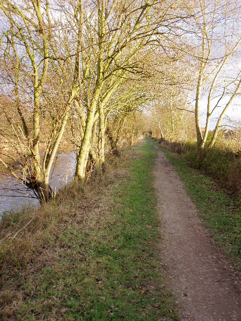
Baylis Pond is a freshwater pond located in Buckinghamshire, England. It is a small body of water covering an area of approximately 2.5 acres. The pond is situated in a tranquil and picturesque setting, surrounded by lush greenery and trees.

Baylis Pond is known for its diverse ecosystem, supporting a wide range of plant and animal species. The clear and calm waters are home to various aquatic plants such as water lilies, reeds, and rushes, which provide shelter and food for numerous aquatic creatures.

The pond attracts a variety of bird species, making it a popular spot for birdwatchers. Visitors can often spot species such as ducks, swans, herons, and kingfishers, among others. The surrounding vegetation and trees also provide nesting sites for these birds.

Apart from its ecological importance, Baylis Pond is also a recreational area for locals and tourists. It offers opportunities for fishing, with common species including perch, roach, and carp. The tranquil ambiance and scenic views make it a perfect spot for picnics and leisurely walks.

The conservation of Baylis Pond is a priority, with efforts made to maintain its natural beauty and preserve its wildlife habitat. The pond is regularly monitored and managed by local authorities to ensure the health and sustainability of the ecosystem.

Overall, Baylis Pond in Buckinghamshire is a charming freshwater pond, offering both ecological significance and recreational opportunities for visitors. Its tranquil atmosphere, diverse wildlife, and scenic surroundings make it a cherished natural gem in the area.

If you have any feedback on the listing, please let us know in the comments section below.
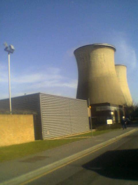
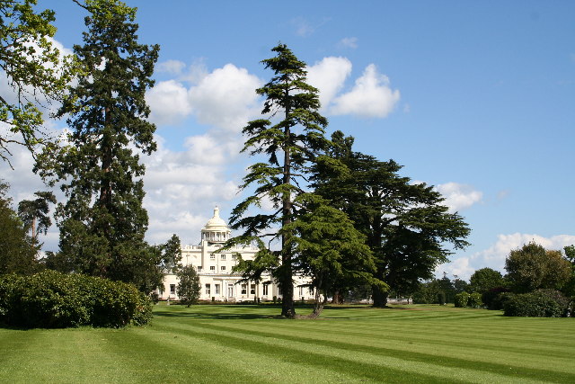
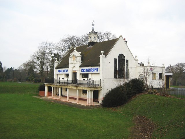
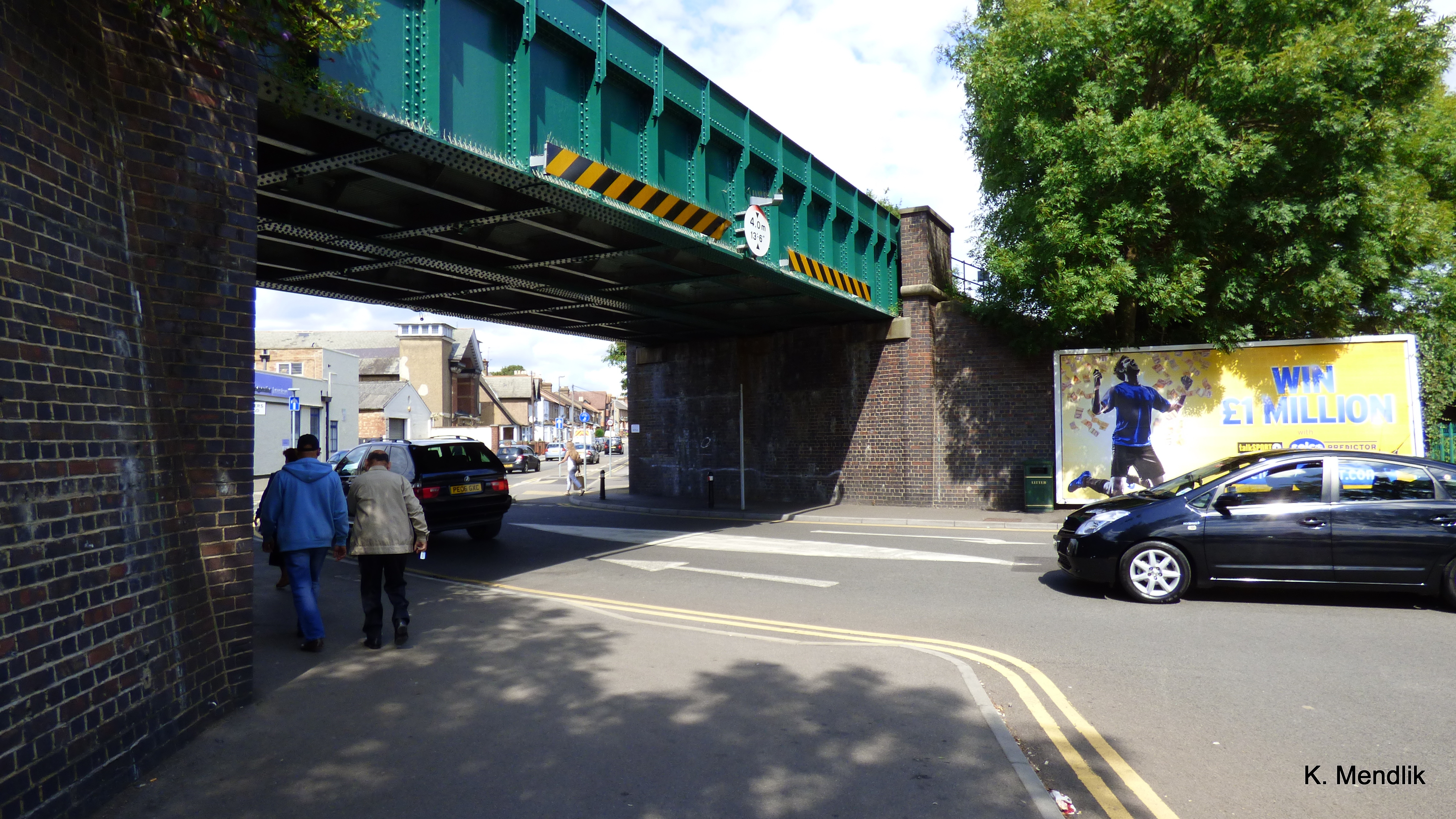
Baylis Pond Images

Images are sourced within 2km of 51.516287/-0.60523905 or Grid Reference SU9680. Thanks to Geograph Open Source API. All images are credited.

Slough Station
Slough Station
Slough Retail Park, Twinches Lane Just off the A4 Bath Road which runs through the middle of the square, this photo is looking south.
Slough Retail Park, Twinches Lane
Just off the A4 Bath Road which runs through the middle of the square, this photo is looking south.
The Three Tuns The busy junction between the A4 Bath Road, and the A355 which joins the M4 at Junction 6. It is known as "The Three Tuns" after the pub shown here.
The Three Tuns
The busy junction between the A4 Bath Road, and the A355 which joins the M4 at Junction 6. It is known as "The Three Tuns" after the pub shown here.
"The Office", Slough Trading Estate This building, otherwise known as Crossbow House, 40 Liverpool Road, is situated at the heart of Slough Trading Estate (which incidentally is the largest trading estate in single ownership in Europe). This building is famous for featuring in the opening sequences and some of the filming for popular BBC comedy "The Office".
"The Office", Slough Trading Estate
This building, otherwise known as Crossbow House, 40 Liverpool Road, is situated at the heart of Slough Trading Estate (which incidentally is the largest trading estate in single ownership in Europe). This building is famous for featuring in the opening sequences and some of the filming for popular BBC comedy "The Office".
Slough Power Station These large cooling chimneys, situated in Slough Trading Estate, are visible for miles around.
Slough Power Station
These large cooling chimneys, situated in Slough Trading Estate, are visible for miles around.
Slough CHP Cooling towers Slough was the first privately owned power station and an early innovator in CHP (Combined Heat and Power) supplying steam to heat factories all over the industrial estate.

It now has gas fluidized bed reactors and can use waste paper and plastic collected on the estate as a fuel.
Slough CHP Cooling towers
Slough was the first privately owned power station and an early innovator in CHP (Combined Heat and Power) supplying steam to heat factories all over the industrial estate. It now has gas fluidized bed reactors and can use waste paper and plastic collected on the estate as a fuel.
Stoke Park Club, Stoke Poges
Grand Union Canal: Slough branch Unlikely scene in the middle of Slough. Taken on a winter evening, looking east.
Grand Union Canal: Slough branch
Unlikely scene in the middle of Slough. Taken on a winter evening, looking east.
Stoke Poges Lane Once a rural lane, now a very busy road.
Stoke Poges Lane
Once a rural lane, now a very busy road.
St. Mary, Farnham Royal
Essex Avenue, Slough From the crossroads with Canterbury Avenue.
Essex Avenue, Slough
From the crossroads with Canterbury Avenue.
Corfe Gardens Residential estate off Cippenham Lane.
Corfe Gardens
Residential estate off Cippenham Lane.
Slough: Main line railway Viewed looking towards Slough railway station from the Wexham Road bridge with a westbound First Great Western express train.
Slough: Main line railway
Viewed looking towards Slough railway station from the Wexham Road bridge with a westbound First Great Western express train.
Slough: The Horlicks factory One of Slough's iconic images, the Horlicks factory on Stoke Poges Lane was completed in 1908 at a cost of £28,000. The brand name and the site now belong to GlaxoSmithKline. Everything you ever wanted to know about Horlicks (for example that India is by far the largest market for the product) is contained in the Wikipedia article <span class="nowrap"><a title="http://en.wikipedia.org/wiki/Horlicks" rel="nofollow ugc noopener" href="http://en.wikipedia.org/wiki/Horlicks">Link</a><img style="margin-left:2px;" alt="External link" title="External link - shift click to open in new window" src="https://s1.geograph.org.uk/img/external.png" width="10" height="10"/></span> , and, for a free plug which should ensure I get a lifetime supply of the stuff, here's Horlick's own website <span class="nowrap"><a title="http://www.horlicks.co.uk/" rel="nofollow ugc noopener" href="http://www.horlicks.co.uk/">Link</a><img style="margin-left:2px;" alt="External link" title="External link - shift click to open in new window" src="https://s1.geograph.org.uk/img/external.png" width="10" height="10"/></span>
Slough: The Horlicks factory
One of Slough's iconic images, the Horlicks factory on Stoke Poges Lane was completed in 1908 at a cost of £28,000. The brand name and the site now belong to GlaxoSmithKline. Everything you ever wanted to know about Horlicks (for example that India is by far the largest market for the product) is contained in the Wikipedia article LinkExternal link , and, for a free plug which should ensure I get a lifetime supply of the stuff, here's Horlick's own website LinkExternal link
Slough: Main line railway Viewed looking away from Slough from the A355 Farnham Road bridge.
Slough: Main line railway
Viewed looking away from Slough from the A355 Farnham Road bridge.
Slough: Leigh Road bridge This narrow road bridge provides a road link over the railway between two industrial estates, but it is controlled by lights, and can be a traffic bottleneck. There is little room for pedestrians to cross safely either.
Slough: Leigh Road bridge
This narrow road bridge provides a road link over the railway between two industrial estates, but it is controlled by lights, and can be a traffic bottleneck. There is little room for pedestrians to cross safely either.
Slough Power Station The two cooling towers on the north side of Edinburgh Avenue, with just a wisp of steam coming from the left one.
Slough Power Station
The two cooling towers on the north side of Edinburgh Avenue, with just a wisp of steam coming from the left one.
Slough Power Station On the south side of Edinburgh Avenue.
Slough Power Station
On the south side of Edinburgh Avenue.
Show me another place!

Baylis Pond is located at Grid Ref: SU9680 (Lat: 51.516287, Lng: -0.60523905)

Unitary Authority: Slough

Police Authority: Thames Valley

What 3 Words

///broad.cute.suffer. Near Slough, Berkshire

Nearby Locations

Baylis Pond Salt Hill

Related Wikis

Baylis House

Baylis House is a Grade I listed building currently operating as a hotel and business centre in Slough, Berkshire, England. It is representative of the...

Salt Hill

Salt Hill is a district within the unitary authority of Slough in Berkshire in the south of England, close to London. Before 1974, Salt Hill was part of...

Herschel Grammar School

Herschel Grammar School is a co-educational grammar school with academy status, located in Slough, Berkshire, England. The headteacher is Mrs Joanne Rockall...

Slough Town Hall

Slough Town Hall is a former municipal building in Bath Road, Slough, Berkshire, England. The town hall was the headquarters of Slough Borough Council...

Slough rail accident

The Slough rail accident happened on 16 June 1900 at Slough railway station on the Great Western Main Line when an express train from London Paddington...

Heart of Slough

The Heart of Slough project is a £400 million plan to redevelop the town centre in Slough, Berkshire. Begun in 2009, it aims to create a "cultural quarter...

Chalvey Halt railway station

Chalvey Halt was a short-lived railway station on the Great Western Railway branch from Slough to Windsor & Eton. It was situated just to the north of...

Slough bus station

Slough bus station is a bus station in Slough, United Kingdom. The bus station is situated adjacent to Slough railway station. == History == Partial demolition...

Nearby Amenities

Located within 500m of 51.516287,-0.60523905
Mini Roundabout
Direction: clockwise
Lat/Long: 51.5167385/-0.5997328
Turning Circle
Lat/Long: 51.5164279/-0.6039941
Power: tower
Lat/Long: 51.519151/-0.6020227
Power: tower
Lat/Long: 51.5193155/-0.6043352
Power: tower
Lat/Long: 51.518648/-0.6064307
Power: tower
Lat/Long: 51.5192475/-0.6097818
Turning Circle
Lat/Long: 51.5141735/-0.6105067
Barrier: cycle_barrier
Lat/Long: 51.5188575/-0.6052308
Turning Circle
Lat/Long: 51.5193669/-0.6026592
Turning Circle
Lat/Long: 51.5195076/-0.6016055
Salt Hill Park
Information: map
Map Size: site
Tourism: information
Lat/Long: 51.5146945/-0.606191
Bench
Colour: black
Lat/Long: 51.5140715/-0.6034265
Waste Basket
Lat/Long: 51.5140399/-0.6033205
Bench
Colour: black
Lat/Long: 51.5140453/-0.6033387
Bench
Colour: black
Lat/Long: 51.5140626/-0.6033967
Bench
Colour: black
Lat/Long: 51.5140524/-0.6033625
Waste Basket
Lat/Long: 51.5140571/-0.6033782
Bench
Lat/Long: 51.5161737/-0.6056397
Barrier: bollard
Bicycle: yes
Foot: yes
Lat/Long: 51.5157116/-0.6052739
Waste Basket
Lat/Long: 51.5162705/-0.6048633
Barrier: bollard
Bicycle: yes
Foot: yes
Lat/Long: 51.5195646/-0.6078446
Waste Basket
Lat/Long: 51.5177023/-0.6053215
Bench
Backrest: no
Colour: green
Lat/Long: 51.5174296/-0.6035947
Bench
Backrest: no
Colour: green
Lat/Long: 51.5175066/-0.6032849
Bench
Backrest: no
Colour: green
Lat/Long: 51.5176387/-0.6036779
Bench
Backrest: no
Colour: green
Lat/Long: 51.5175881/-0.6039276
Bench
Backrest: no
Colour: green
Lat/Long: 51.5177045/-0.6033347
Baylis House
Tourism: hotel
Wikidata: Q4874584
Wikipedia: en:Baylis House
Lat/Long: 51.5185366/-0.6041776
Doctors
Shreeji Day Surgery Unit
Healthcare: doctor
Lat/Long: 51.5184429/-0.6071401
Dentist
Shreeji Dental Clinic
Healthcare: dentist
Lat/Long: 51.5184253/-0.6071389
Barrier: cycle_barrier
Lat/Long: 51.5190579/-0.6045905
Waste Basket
Lat/Long: 51.5184228/-0.6030897
Place Of Worship
Slough Spiritual Church
Religion: christian
Lat/Long: 51.5192605/-0.6035015
Godolphin Recreation Ground
Information: map
Map Size: site
Tourism: information
Lat/Long: 51.5188535/-0.6053921
Dentist
Acorn Dental Care
Healthcare: dentist
Phone: +44 1753 776 757
Lat/Long: 51.5155341/-0.6004587
Post Office
Stoke Poges Lane Post Office
Addr City: Slough
Addr Housenumber: 30
Addr Postcode: SL1 3PG
Addr Street: Stoke Poges Lane
Branch: Stoke Poges Lane
Brand: Post Office
Brand Wikidata: Q1783168
Check Date: 2020-02-20
Contact Website: https://www.postoffice.co.uk/branch-finder/0799467/stoke-poges-lane
Opening Hours: Mo-Fr 07:00-23:00
Ref Pol Id: 768
Toilets Wheelchair: no
Wheelchair: limited
Lat/Long: 51.5166508/-0.5999155
Barrier: cycle_barrier
Bicycle: yes
Foot: yes
Lat/Long: 51.515284/-0.5989007
Barrier: cycle_barrier
Bicycle: yes
Foot: yes
Lat/Long: 51.5156026/-0.5986739
Telephone
Booth: KX100
Covered: booth
Lat/Long: 51.5173829/-0.5998046
Post Box
Operator: Royal Mail
Operator Wikidata: Q638098
Lat/Long: 51.5182678/-0.6075122
Railway: switch
Lat/Long: 51.5149787/-0.6062448
Railway: switch
Lat/Long: 51.514067/-0.6025358
Railway: switch
Lat/Long: 51.5140988/-0.6020255
Railway: switch
Lat/Long: 51.5139564/-0.6011776
Railway: switch
Lat/Long: 51.5143091/-0.6031966
Railway: switch
Lat/Long: 51.5144374/-0.6040487
Railway: switch
Lat/Long: 51.514571/-0.6046394
Railway: buffer_stop
Lat/Long: 51.5144183/-0.6031783
Railway: switch
Lat/Long: 51.5157197/-0.6095093
Railway: switch
Lat/Long: 51.5154172/-0.6079643
Railway: switch
Lat/Long: 51.5158101/-0.6098698
Railway: switch
Lat/Long: 51.5161835/-0.6115339
Traffic Calming: hump
Lat/Long: 51.5185434/-0.6103836
Railway: switch
Lat/Long: 51.5150994/-0.6067647
Railway: switch
Lat/Long: 51.5153752/-0.6079275
Baylis Park East Enterance
Barrier: entrance
Bicycle: yes
Foot: yes
Lat/Long: 51.517189/-0.6025418
Place Of Worship
Stoke Poges Mosque
Religion: muslim
Lat/Long: 51.5186315/-0.5994859
Belgrave Stores
Shop: yes
Lat/Long: 51.5166661/-0.5999968
Crossing
Button Operated: yes
Crossing: traffic_signals
Crossing Island: no
Tactile Paving: yes
Traffic Signals Sound: yes
Lat/Long: 51.5169805/-0.5997198
Fast Food
Lat/Long: 51.5167483/-0.5998938
Fast Food
Sky Fries
Lat/Long: 51.5168773/-0.5998871
Stoke Poges Food & Wine
Shop: convenience
Lat/Long: 51.5166968/-0.5999416
Crossing
Crossing: unmarked
Crossing Island: no
Crossing Markings: no
Tactile Paving: yes
Lat/Long: 51.5165745/-0.5999251
Give Way
Direction: forward
Lat/Long: 51.5182731/-0.6071503
Give Way
Direction: backward
Lat/Long: 51.5183131/-0.607223
Railway: switch
Lat/Long: 51.5136735/-0.5998256
Direction: 160
Generator Method: photovoltaic
Generator Output Electricity: yes
Generator Solar Modules: 7
Generator Source: solar
Generator Type: solar_photovoltaic_panel
Location: roof
Power: generator
Lat/Long: 51.5191835/-0.6028053
Direction: 210
Generator Method: photovoltaic
Generator Output Electricity: yes
Generator Solar Modules: 8
Generator Source: solar
Generator Type: solar_photovoltaic_panel
Location: roof
Power: generator
Lat/Long: 51.5192325/-0.6049571
Direction: 120
Generator Method: photovoltaic
Generator Output Electricity: yes
Generator Solar Modules: 4
Generator Source: solar
Generator Type: solar_photovoltaic_panel
Location: roof
Power: generator
Lat/Long: 51.5191926/-0.6048839
Generator Method: photovoltaic
Generator Output Electricity: yes
Generator Solar Modules: 6
Generator Source: solar
Generator Type: solar_photovoltaic_panel
Location: roof
Power: generator
Tilted: no
Lat/Long: 51.5194712/-0.6038541
Direction: 210
Generator Method: photovoltaic
Generator Output Electricity: yes
Generator Solar Modules: 4
Generator Source: solar
Generator Type: solar_photovoltaic_panel
Location: roof
Power: generator
Lat/Long: 51.5195049/-0.6037692
Direction: 120
Generator Method: photovoltaic
Generator Output Electricity: yes
Generator Solar Modules: 6
Generator Source: solar
Generator Type: solar_photovoltaic_panel
Location: roof
Power: generator
Lat/Long: 51.5195238/-0.6037452
Direction: 190
Generator Method: photovoltaic
Generator Output Electricity: yes
Generator Solar Modules: 8
Generator Source: solar
Generator Type: solar_photovoltaic_panel
Location: roof
Power: generator
Lat/Long: 51.5148552/-0.6091296
Generator Method: photovoltaic
Generator Output Electricity: yes
Generator Solar Modules: 8
Generator Source: solar
Generator Type: solar_photovoltaic_panel
Location: roof
Power: generator
Tilted: no
Lat/Long: 51.514828/-0.6091397
Crossing
Crossing: unmarked
Crossing Markings: no
Lat/Long: 51.5167318/-0.5995385
Traffic Calming: hump
Lat/Long: 51.5167168/-0.5991083
Traffic Calming: island
Lat/Long: 51.5164752/-0.5997901
Traffic Calming: hump
Lat/Long: 51.5156485/-0.6005699
Traffic Calming: hump
Lat/Long: 51.5156446/-0.602397
Traffic Calming: hump
Lat/Long: 51.5156416/-0.6033305
Traffic Calming: hump
Lat/Long: 51.515638/-0.6042649
Traffic Calming: island
Lat/Long: 51.5156799/-0.6054715
Traffic Calming: hump
Lat/Long: 51.5158582/-0.6058325
Traffic Calming: hump
Lat/Long: 51.5165138/-0.6066227
Traffic Calming: table
Lat/Long: 51.5167394/-0.6069936
Traffic Calming: hump
Lat/Long: 51.5171228/-0.6069694
Traffic Calming: table
Lat/Long: 51.5175196/-0.607166
Traffic Calming: hump
Lat/Long: 51.5178641/-0.6071168
Traffic Calming: hump
Lat/Long: 51.5183412/-0.6078378
Direction: 190
Generator Method: photovoltaic
Generator Output Electricity: yes
Generator Solar Modules: 13
Generator Source: solar
Generator Type: solar_photovoltaic_panel
Location: roof
Power: generator
Lat/Long: 51.5182403/-0.6082445
Traffic Calming: hump
Lat/Long: 51.518489/-0.6093703
Traffic Calming: island
Lat/Long: 51.5146201/-0.6008305
Crossing
Crossing: unmarked
Crossing Markings: no
Lat/Long: 51.514384/-0.6007927
NHS Covid19 Mass Vaccination Centre
Healthcare: vaccination_centre
Note: precise location in building required
Start Date: 18/01/2021
Vaccination: covid19
Lat/Long: 51.5122831/-0.6074721
Artwork Type: statue
Tourism: artwork
Lat/Long: 51.5145441/-0.5999715
Bench
Lat/Long: 51.5149015/-0.5986761
Waste Basket
Lat/Long: 51.5149637/-0.5987104
The data included in this document is from www.openstreetmap.org. The data is made available under ODbL.

Have you been to Baylis Pond?

Leave your review of Baylis Pond below (or comments, questions and feedback).