Salem

Settlement in Caernarfonshire

Wales

Salem

Looking S from near the summit of Moel Eilio The summits of Snowdon and Y Garn on the skyline.
Looking S from near the summit of Moel Eilio Credit: SK53

Salem is a small village located in the county of Caernarfonshire, Wales. Situated amidst the stunning Snowdonia National Park, this picturesque village offers a tranquil and scenic setting for residents and visitors alike. With a population of around 500 people, Salem is known for its close-knit community and friendly atmosphere.

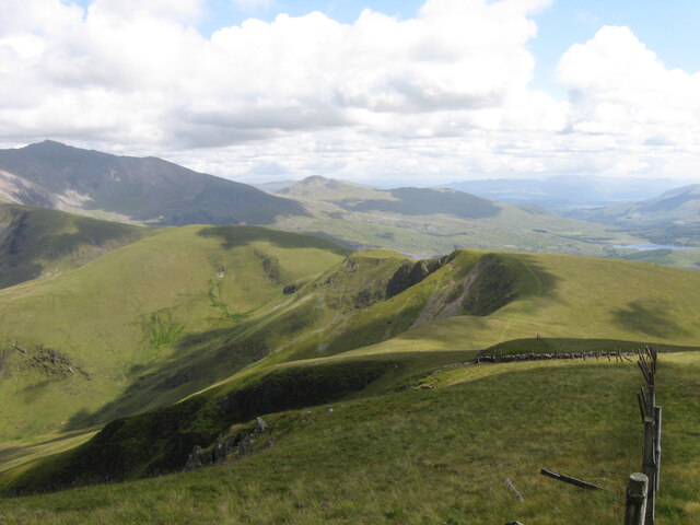
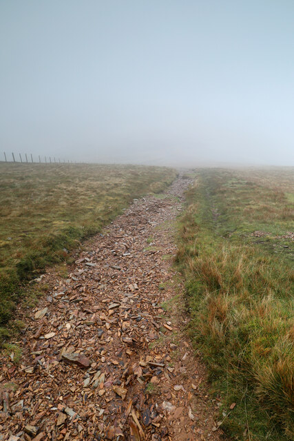
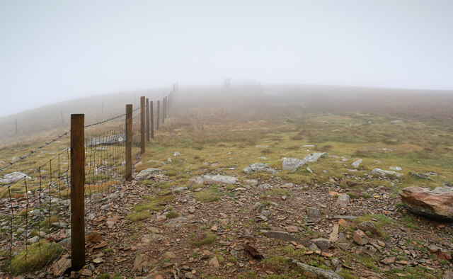
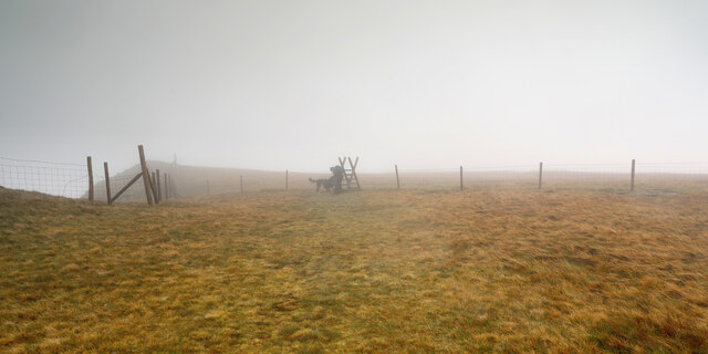
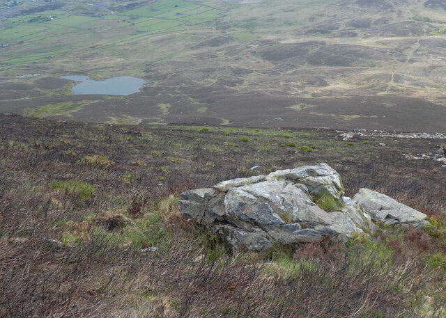
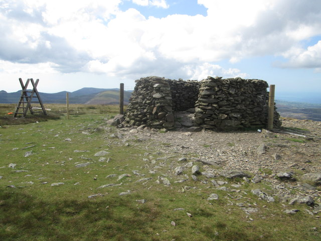
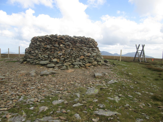
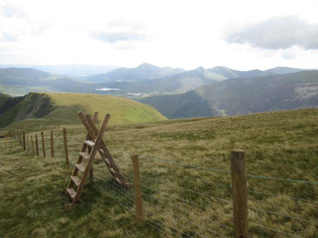
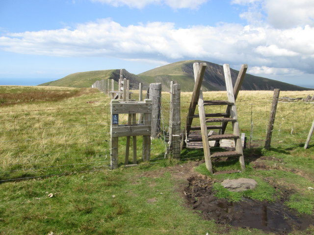
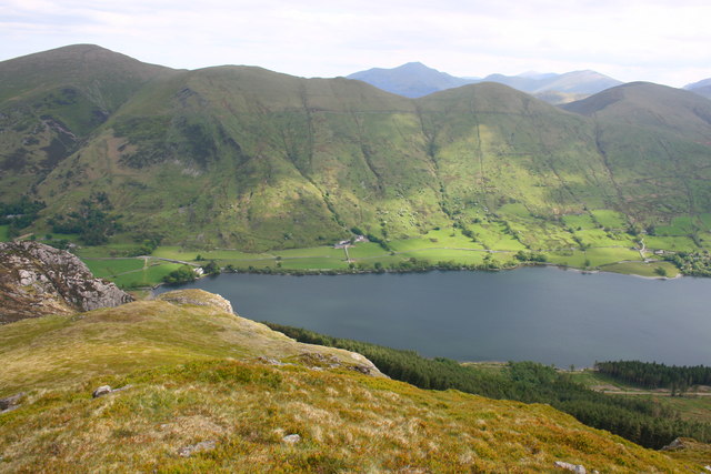
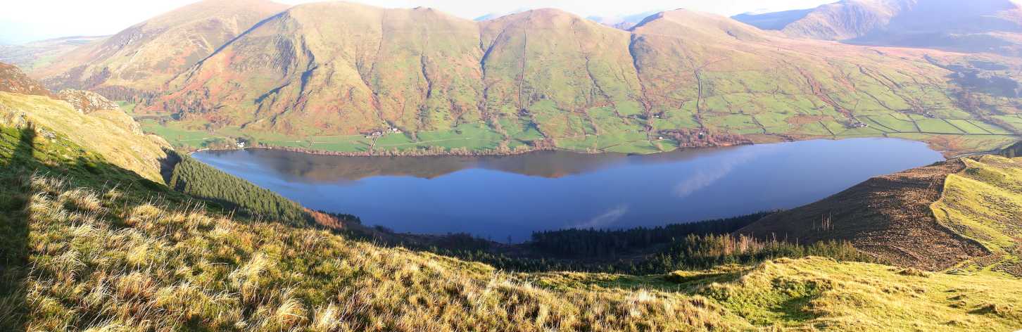
The village is surrounded by breathtaking natural beauty, with rolling hills, lush green valleys, and picturesque lakes. Outdoor enthusiasts are drawn to Salem for its excellent walking and hiking trails, providing opportunities to explore the stunning landscapes and take in the fresh mountain air.

Despite its small size, Salem boasts a few amenities to cater to the needs of its residents. These include a local convenience store, a village hall that hosts community events and gatherings, and a charming pub where locals and visitors can relax and socialize.

Salem is also home to a primary school, providing education for children in the village and the surrounding areas. The school serves as a hub for the community, fostering a sense of unity and providing educational opportunities for the younger generation.

While Salem may not be a bustling hub of activity, its charm lies in its tranquility and natural beauty. Visitors often come to escape the hustle and bustle of city life and immerse themselves in the peaceful surroundings. With its idyllic setting and welcoming community, Salem is truly a gem in the heart of Caernarfonshire.

If you have any feedback on the listing, please let us know in the comments section below.
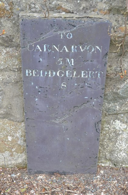
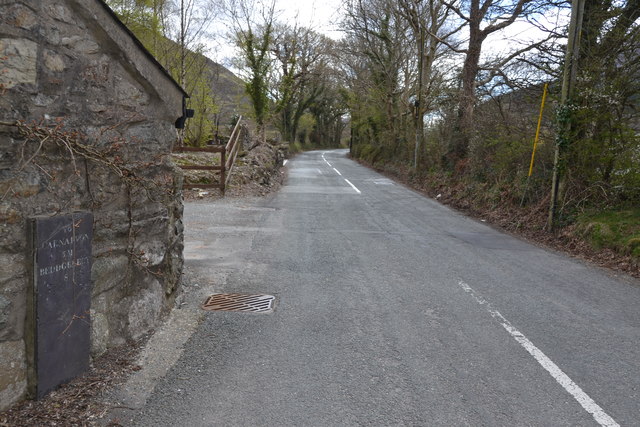
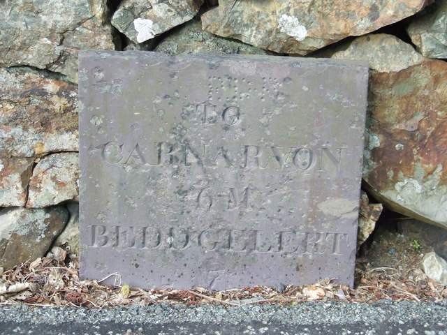
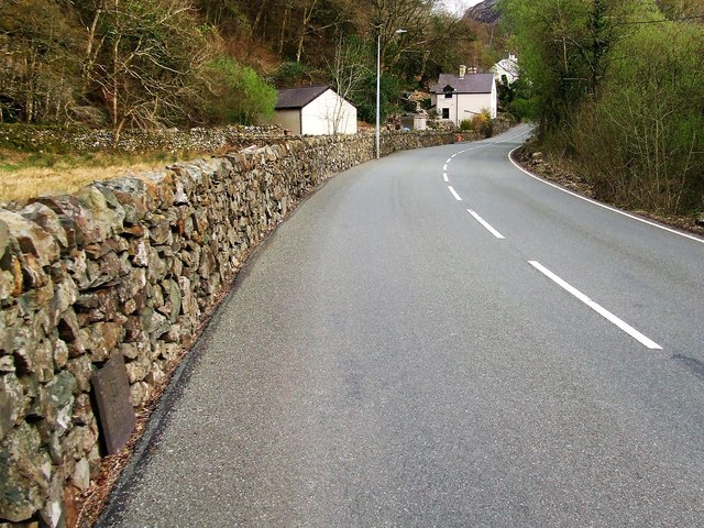
Salem Images

Images are sourced within 2km of 53.088338/-4.173944 or Grid Reference SH5456. Thanks to Geograph Open Source API. All images are credited.

Looking S from near the summit of Moel Eilio The summits of Snowdon and Y Garn on the skyline.
Looking S from near the summit of Moel Eilio
The summits of Snowdon and Y Garn on the skyline.
Welsh Highland Railway train near Betws Garmon Welsh Highland Railway Garratt locomotive No.K1 about to pass under the A4085 in Nant-y-Betws with a train from Caernarfon to Rhyd-Ddu, which was the terminus of the line at the time.
Welsh Highland Railway train near Betws Garmon
Welsh Highland Railway Garratt locomotive No.K1 about to pass under the A4085 in Nant-y-Betws with a train from Caernarfon to Rhyd-Ddu, which was the terminus of the line at the time.
Geology and botany of Moel Eilio The views of Snowdon and its environs from an ascent of Moel Eilio are reputed to be magnificent, but if you have the misfortune to choose a day like this for the ascent, I recommend an interest in the botany of the peat moorland (mostly sedges) or the underlying geology as revealed by the wear and tear on the footpath, as these are all that you will see. It took some research even to work out whether the view was looking up to the heavens or back down the way we'd come (the latter proved the case), but facing away from the wind-driven rain was the best direction to get any kind of unblurred photo. The rocks down there (almost beyond the range of my vision, having removed rain-spattered spectacles) are silt- and mudstones of the Ordovician Nant Ffrancon formation. The formation spans the late Arenig, the Llanvirn, Llandeilo and probably the early part of the Caradoc stages with no clear distinctions between them having been mapped. That suggests an absence of recognisable fossil evidence (Ordovician zones are usually based on graptolites, which somehow fail to excite most people, and are not an easy diagnostic). There are certainly no faunal zones depicted on the stratigraphic columns in the relevant BGS sheet (106, Bangor).
Geology and botany of Moel Eilio
The views of Snowdon and its environs from an ascent of Moel Eilio are reputed to be magnificent, but if you have the misfortune to choose a day like this for the ascent, I recommend an interest in the botany of the peat moorland (mostly sedges) or the underlying geology as revealed by the wear and tear on the footpath, as these are all that you will see. It took some research even to work out whether the view was looking up to the heavens or back down the way we'd come (the latter proved the case), but facing away from the wind-driven rain was the best direction to get any kind of unblurred photo. The rocks down there (almost beyond the range of my vision, having removed rain-spattered spectacles) are silt- and mudstones of the Ordovician Nant Ffrancon formation. The formation spans the late Arenig, the Llanvirn, Llandeilo and probably the early part of the Caradoc stages with no clear distinctions between them having been mapped. That suggests an absence of recognisable fossil evidence (Ordovician zones are usually based on graptolites, which somehow fail to excite most people, and are not an easy diagnostic). There are certainly no faunal zones depicted on the stratigraphic columns in the relevant BGS sheet (106, Bangor).
A small part of Moel Eilio I would have hoped to categorise this as "Summit view", but that would leave me open to the charge of blatant dishonesty. The good thing about geograph is being able to browse all these other images of what we ought to have been able to see on this November ascent in most of a gale and wind-driven rain. Snowdon, for example. I was lucky to be able to see my feet most of the time, with or without my glasses... The "view" is taken from just in the lee of the summit wind shelter, which was occupied by four people who had just beaten us to the top. Covid precautions would have kept us out anyway, but as they had sandwiches, it seemed unlikely that they would welcome the company of a manic Flat-coated Retriever (30 kg of hunger) and a totally bonkers Collie, so our pause here was very brief.
A small part of Moel Eilio
I would have hoped to categorise this as "Summit view", but that would leave me open to the charge of blatant dishonesty. The good thing about geograph is being able to browse all these other images of what we ought to have been able to see on this November ascent in most of a gale and wind-driven rain. Snowdon, for example. I was lucky to be able to see my feet most of the time, with or without my glasses... The "view" is taken from just in the lee of the summit wind shelter, which was occupied by four people who had just beaten us to the top. Covid precautions would have kept us out anyway, but as they had sandwiches, it seemed unlikely that they would welcome the company of a manic Flat-coated Retriever (30 kg of hunger) and a totally bonkers Collie, so our pause here was very brief.
Dog stopper on Foel Gron Thirty kilograms is a good weight for a flat-coated retriever (courtesy of my daughter, who had gone mountain biking elsewhere) if you don't want it to blow off the mountain in a gale, but is less convenient when there are umpteen stiles along the way and you are trying to stay one fence away from a big drop off into a deep cwm in poor visibility. The collie (our own) is less than half that weight and more likely to become airborne. The lack of view ahead and the path becoming increasingly vague once we were south of Moel Eilio also contributed to crossing more stiles like this one than were strictly necessary. I'd recommend this walk on a day when the reputed stunning views across to Snowdon are actually realisable and standing upright more readily achievable.
Dog stopper on Foel Gron
Thirty kilograms is a good weight for a flat-coated retriever (courtesy of my daughter, who had gone mountain biking elsewhere) if you don't want it to blow off the mountain in a gale, but is less convenient when there are umpteen stiles along the way and you are trying to stay one fence away from a big drop off into a deep cwm in poor visibility. The collie (our own) is less than half that weight and more likely to become airborne. The lack of view ahead and the path becoming increasingly vague once we were south of Moel Eilio also contributed to crossing more stiles like this one than were strictly necessary. I'd recommend this walk on a day when the reputed stunning views across to Snowdon are actually realisable and standing upright more readily achievable.
Maen ar Fynydd Mawr / A boulder on The Elephant
Caeaugwinion Farm Situated above Llyn Cwellyn.
Caeaugwinion Farm
Situated above Llyn Cwellyn.
Moel Eilio summit (2,382 ft) A summit in Snowdonia that sees few visitors compared with the crowds who head up Snowdon just a few miles away.
Moel Eilio summit (2,382 ft)
A summit in Snowdonia that sees few visitors compared with the crowds who head up Snowdon just a few miles away.
“Beehive” on Moel Eilio summit
Descent towards Bwlch Gwyn The south-east ridge of Moel Eilio.
Descent towards Bwlch Gwyn
The south-east ridge of Moel Eilio.
Wild ponies on Moel Eilio
Two ponies at Bwlch Gwyn
Cloud above Moel Eilio
Wooden stile over a fence on Foel Goch
Old Milestone Old milestone on the A4085 near to Betws Garmon, Gwynedd. For overall view see <a title="https://www.geograph.org.uk/photo/5070518" href="https://www.geograph.org.uk/photo/5070518">Link</a>
Old Milestone
Old milestone on the A4085 near to Betws Garmon, Gwynedd. For overall view see Link
Beddgelert 8 Old milestone on the A4085 near to Betws Garmon, Gwynedd. For close up view see <a title="https://www.geograph.org.uk/photo/5070512" href="https://www.geograph.org.uk/photo/5070512">Link</a>
Beddgelert 8
Old milestone on the A4085 near to Betws Garmon, Gwynedd. For close up view see Link
Old Milestone Old milestone on the A4085 near to Betws Garmon, Gwynedd. For overall view see <a title="https://www.geograph.org.uk/photo/5073617" href="https://www.geograph.org.uk/photo/5073617">Link</a>
Old Milestone
Old milestone on the A4085 near to Betws Garmon, Gwynedd. For overall view see Link
Beddgelert 7 Old milestone on the A4085 near to Betws Garmon, Gwynedd. For close up view see <a title="https://www.geograph.org.uk/photo/5073614" href="https://www.geograph.org.uk/photo/5073614">Link</a>
Beddgelert 7
Old milestone on the A4085 near to Betws Garmon, Gwynedd. For close up view see Link
Show me another place!

Salem is located at Grid Ref: SH5456 (Lat: 53.088338, Lng: -4.173944)

Unitary Authority: Gwynedd

Police Authority: North Wales

What 3 Words

///parkland.elbow.broached. Near Llanberis, Gwynedd

Related Wikis

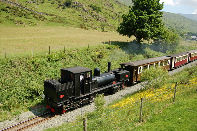
Plas-y-Nant railway station

Plas-y-Nant is an unstaffed halt on the narrow gauge Welsh Highland Railway. == History == A halt at Plas-y-Nant was first used in the 1920s but closed...

Betws Garmon

Betws Garmon is a community and small hamlet outside Waunfawr and near Beddgelert in Gwynedd, Wales. It has a population of 249.The summit of Snowdon...

Moel Eilio

Moel Eilio is a mountain in Snowdonia, North Wales, that is situated approximately 3 miles north-west of Snowdon itself. It has two subsidiary tops, Foel...

Foel Gron

Foel Gron is a peak on the Moel Eilio ridge of hills/mountains in Snowdonia, North Wales. This ridge is used as a hiker's route from Llanberis to the summit...

Mynydd Mawr

Mynydd Mawr (Welsh for big mountain) is a mountain in Snowdonia, North Wales, approximately 7 km (4.3 mi) west of Snowdon itself, overlooking Llyn Cwellyn...

Llyn Cwellyn

Llyn Cwellyn (Llyn Quellyn in some antiquated texts) is a reservoir in North Wales which supplies drinking water to parts of Gwynedd and Anglesey. It lies...

Alexandra quarry

Alexandra quarry was a slate quarry in North Wales, on the slopes of Moel Tryfan in north Gwynedd. It was part of one of the major slate quarrying regions...

Snowdon Ranger railway station

Snowdon Ranger is a station on the narrow gauge Welsh Highland Railway, which was built in 1878 as the North Wales Narrow Gauge Railways Moel Tryfan Undertaking...

Nearby Amenities

Located within 500m of 53.088338,-4.173944
Railway: crossing
Ref: LC32.63
Lat/Long: 53.089169/-4.181178
Salem
Railway: crossing
Ref: LC33.07
Lat/Long: 53.0870869/-4.1761968
Railway: crossing
Ref: LC33.45
Lat/Long: 53.0846461/-4.1723297
Railway: crossing
Ref: LC33.25
Lat/Long: 53.0860952/-4.1742895
Railway: crossing
Ref: LC32.90
Lat/Long: 53.0876329/-4.1785958
Railway: crossing
Ref: LC32.85
Lat/Long: 53.0878738/-4.179071
Post Box
Brand: Royal Mail
Brand Wikidata: Q638098
Operator: Royal Mail
Operator Wikidata: Q638098
Post Box Type: lamp
Lat/Long: 53.0878406/-4.1746262
Salem
Place: hamlet
Lat/Long: 53.0879612/-4.1751706
Power: pole
Lat/Long: 53.0868747/-4.1749568
Power: pole
Lat/Long: 53.0876598/-4.1741054
Power: pole
Lat/Long: 53.0878113/-4.173597
Power: pole
Lat/Long: 53.0865247/-4.1753402
Pont Cerrig-y-rhyd
Place: locality
Lat/Long: 53.0845338/-4.1716299
Telephone
Booth: K6
Covered: booth
Listed Status: Grade II
Operator: BT
Operator Wikidata: Q593786
Phone: +44 1286 650315
Lat/Long: 53.0878241/-4.1743568
Barrier: kissing_gate
Lat/Long: 53.0877355/-4.1757948
Direction: SSW
Generator Method: photovoltaic
Generator Output Electricity: yes
Generator Solar Modules: 14
Generator Source: solar
Generator Type: solar_photovoltaic_panel
Location: roof
Power: generator
Lat/Long: 53.088025/-4.1741852
Direction: SW
Generator Method: photovoltaic
Generator Output Electricity: yes
Generator Solar Modules: 12
Generator Source: solar
Generator Type: solar_photovoltaic_panel
Location: roof
Power: generator
Lat/Long: 53.0879381/-4.1760868
Direction: 175
Generator Method: photovoltaic
Generator Output Electricity: yes
Generator Solar Modules: 6
Generator Source: solar
Generator Type: solar_photovoltaic_panel
Location: roof
Power: generator
Lat/Long: 53.0880648/-4.1749999
Direction: 175
Generator Method: photovoltaic
Generator Output Electricity: yes
Generator Solar Modules: 16
Generator Source: solar
Generator Type: solar_photovoltaic_panel
Location: roof
Power: generator
Lat/Long: 53.0880697/-4.1751124
The data included in this document is from www.openstreetmap.org. The data is made available under ODbL.

Have you been to Salem?

Leave your review of Salem below (or comments, questions and feedback).